Memorial Day 2021 Flash Flood
←
→
Page content transcription
If your browser does not render page correctly, please read the page content below
Memorial Day 2021 Flash Flood
    The holiday weekend over the Midland/Odessa area was fairly active with numerous severe
    thunderstorms near the NWS Midland population centers, but a majority of the higher impact
    storms remained away from the city limits. On the morning of May 31st, 2021, an outflow
    boundary stemming from a cluster of thunderstorms that occurred the previous day over
    Southern Lea County in New Mexico to Andrews County, slipped southward toward the I-20
    corridor, bisecting the Midland/Odessa area around 930 AM CDT. To the north, a cold front over
    Southwest Oklahoma continued to slide south into what would be a favorable environment for
    rapidly developing thunderstorms along and just ahead of the front. In addition to the potential
    for severe weather, there was some concern for areas of localized flooding/flash flooding due to
    the very moist environment out ahead of the cold front 1. In fact, the precipitable water value
    (measure of moisture in the atmosphere above) from the morning KMAF weather balloon
    sounding was above the 90th percentile looking back at climatological data for the time period
    (One of the highest values recorded for that time frame; See Figure 1).

                      May 31, 2021 12z Sounding PWAT
                            Measurement (1.47”)

  Figure 1: NWS Midland/Odessa forecast sounding climatology for all precipitable water values (PWAT) measured for all
observed weather balloon soundings. Black star indicates the observed sounding for 5-31-21 12z. The location is within 0.02”
             of the observed record for the date, which is well-above normal for the day (Average in red box)

    1
     Mesoscale Precipitation Discussion issued by the Weather Prediction Center on the morning of May
    31st: https://www.wpc.ncep.noaa.gov/metwatch/metwatch_mpd_multi.php?md=0255&yr=2021
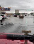
By 1030 AM CDT, showers and thunderstorms were already developing along I-20 with rapid growth, including a few severe thunderstorms that would drop quarter sized hail on the east side of Odessa. Very heavy rainfall was reported by local gauges and observing stations within the span of 15-20 minutes. A lot of this development was due to the convergence of the two boundaries mentioned above; the outflow boundary that was stationary over I-20 and the cold front. The rapid development of thunderstorms coupled with the perfect environment in place for very heavy rainfall resulting in the potential for flash flooding issues within a more urbanized corridor (areas with lots of concrete structures where runoff is more likely to occur). As such, by 11 AM CDT, the entire stretch from West Odessa to Central Midland was being inundated with copious amounts of rainfall, and would shortly lead to numerous areas flash flooding across the area. Initial reports received included rapid flooding of some of the busier roads/streets and intersections in the city of Odessa due to the prolific rainfall that was occurring. Radar estimates of two to four inches of rain per hour were actually a common occurrence over a large chunk of Odessa as the strongest thunderstorm slowly moved between the section from US 385 on the north side of town down to the I-20 corridor, and over to the southeast limits of Odessa (Figure 2). This is where some of the worst areas of flooding occurred with areas like Dixie Blvd, 42nd Ave, and encompassing areas becoming submerged under at least a foot of water. Pictures provided via social media platforms shed even more light on the localized impact with some of the side street areas off the main thoroughfares indicating water creeping up to the front of resident door steps and cars/trucks stranded in very high water (Figures 3&4). In Figure 2: Radar image of 10:56 AM CDT for the Midland/Odessa area on 5-31-21. Odessa at addition, the Odessa this hour was experiencing very heavy rainfall rates with localized flooding reported by the Fire Department public and local Emergency Managers. reported that approximately 27 high water rescues occurred during this evening. The heavy rain was impacting portions of Midland as well with the areas on the west side of town receiving up to two inches of rainfall in 30 minutes (between 11 AM and Noon CDT), creating some significant flash flooding issues (Figure 5). By 1230-1 PM CDT, the heaviest rainfall moved
farther to the south and east, away from the urban corridors, into the southern half of the Permian
Basin.

                                        Figures 3&4: Pictures of
                                        flooding in two areas of
                                        Odessa.

                                        Right Photo: A dumpster
                                        floating in the middle of the
                                        intersection of 8th St and
                                        Muskingum
                                        Photo Credit: Jessica Florence

                                        Left Photo: Flooding up to the
                                        sides of parked vehicles on
                                        Walnut St.
                                        Photo Credit: Kristi Wilson

    Figure 5: Total estimated precipitation for 5-31-21 by 18z (1 PM CDT). The area outlined in black is the
  documented area of heaviest rainfall. The dark orange and pinkish-red shadings are between 1-3” of rainfall.
This setup was a perfect example of how the Midland/Odessa area can see some of its worst flooding events with numerous thunderstorms moving over the region in a moisture rich environment. This event ended up lasting just long enough to create a major flooding concern for the area, however if it had lasted one to two hours longer, it would have been considerably worse. We appreciate all the pictures, videos, and information we received from the public, first responders, and Emergency Managers during the event. Another very active day within a very active three-week period of weather for West Texas and Southeast New Mexico.
You can also read


