Glasshouse - Pumicestone - Description
←
→
Page content transcription
If your browser does not render page correctly, please read the page content below
Glasshouse – Pumicestone
Description Draft vision statement
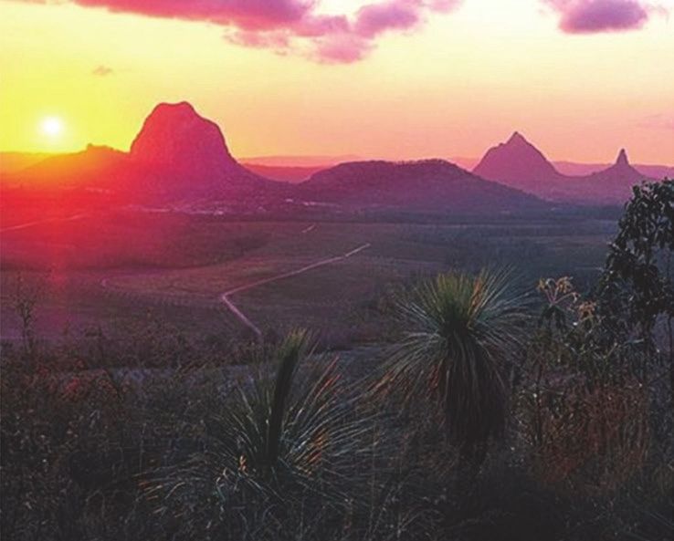
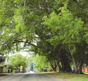
The proposed Glasshouse – Pumicestone Local Plan Area (LPA) is The Glasshouse – Pumicestone LPA continues to be the green
located in the southern part of the Sunshine Coast, stretching from the gateway to the Sunshine Coast, a mosaic of conservation areas,
coast to the hinterland. The local plan area includes the localities of forestry and farmland punctuated by small rural towns and the iconic
Glass House Mountains, Beerburrum, Coochin Creek, Bribie Island peaks of the Glass House Mountains, and framed by the Ramsar
North, and southern parts of Peachester and Beerwah. The Bruce protected wetlands of the Pumicestone Passage and northern Bribie
Highway and North Coast Rail Line run north south through the local Island.
plan area. The area comprises predominantly productive agricultural The significant landscape, scenic, ecological, cultural, recreational and
land and forestry, interspersed with the scenic peaks of the Glass rural production values of this large expanse of greenspace (known as
House Mountains and framed by the Peachester Range and the the Regional Inter-Urban Break) are protected and enhanced, and no
Pumicestone Passage. The Regional Inter-Urban Break is included new urban or rural residential expansion has occurred in this area. The
within this local plan area. The proposed boundary of the Glasshouse - area continues to mark an important transition from the greater
Pumicestone LPA is identified on the attached map. Brisbane area.
There are limited opportunities for growth due to the need to protect The township of Glass House Mountains remains a small, relaxed rural
the Regional Inter-Urban Break which includes productive agricultural town, with a village feel and strong heritage character. It offers a range
land, forestry resources, major habitats, biodiversity and conservation of services to locals and visitors. Urban areas of the township are
areas. Other constraints include bushfire and the need to maintain characterised by traditional low density, low-rise residential
water quality in the Pumicestone Passage and Somerset Dam water development on larger urban lots. Some streets close to the town
supply catchment. centre and railway station have redeveloped over time to offer a
greater range of housing types including well designed, low rise
townhouses and duplexes.
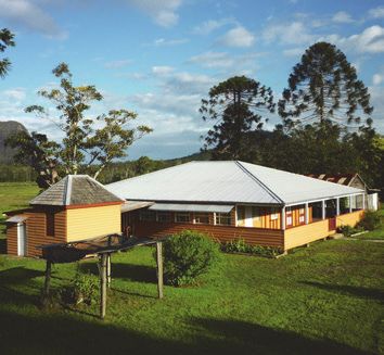
The township of Beerburrum remains a small village with an intimate
rural character and identity, serving the basic needs of locals and
visitors. Residents of the village enjoy a quiet, semi-rural lifestyle on
large blocks.
Role in the Sunshine Coast region Outside the townships, rural residential communities have experienced
In a region-wide context, the Glasshouse – Pumicestone LPA little change. Residents in these areas enjoy a quiet, semi-rural
provides: lifestyle on large blocks.
Regional landscape (Major greenspace – Regional Inter- Rural areas continue to thrive, accommodating important and
urban Break productive rural activities including cropping, grazing and forestry, as
well as significant expanses of bushland habitat.
Rural production
With a diverse array of natural assets, the area is an increasingly
Hinterland living, rural and rural residential living sought-after visitor destination. This has allowed the townships and the
local rural economy to increasingly benefit from the visitor and day trip
Recreation focus market, offering a range of small scale and low impact nature and rural
based tourism opportunities, as well as cultural tourism opportunities
Tourism focus (nature and rural-based) for First Nations people.
Major habitat and biodiversity
*the area may also provide other functions at a local level.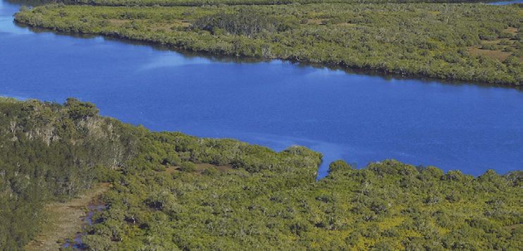
Glasshouse – Pumicestone
Proposed Planning Directions Level of change proposed
The following are proposed planning directions for Glasshouse –
Pumicestone Local Plan Area for the new planning scheme:
No or minimal change in maximum allowable building heights
No or minimal change to growth management boundaries
Retain large urban and rural residential minimum lot sizes
Maintain controls on signage, especially in rural areas and along
scenic routes
Retain compact centres and strong provisions to discourage out- From existing Planning Scheme From current on-ground situation
of-centre development
Investigate opportunities for additional low-medium density
development such as dual occupancies and townhouses close to
the Glass House Mountains town centre
Investigate opportunities for specific designation of land for
retirement/aged care at Glass House Mountains township
Protect water quality in the Pumicestone Passage and Somerset
Dam water supply catchment
Maintain Halls Creek area within the rural zone and outside the
urban growth management boundary. Continue to emphasise the
environmental/landscape importance of this area (Map Ref. 1)
Maintain current limits on subdivision in rural areas to preserve
rural production and landscape values
Retain strong inter-urban breaks to retain the separate identity of
the towns
Include specific provisions for development in the Regional Inter-
urban Break which protect the area and leverage opportunities for
appropriate nature and rural-based tourism and recreation
Protect forestry operations (Map Ref.2)
The attached map identifies a location reference for some of the
proposed planning directions. Not all proposed planning directions are
mapped.
Tell us what you think
Do you agree with the proposed vision and proposed planning
directions for your local area?
Do you think the proposed boundaries of the local plan area are
right?
Is there anything in your local area that you particularly value and
want to see protected or enhanced in the planning scheme?
What types of development would you like to see
encouraged or supported in your local area?
To have your say scan the QR code or go to
haveyoursay.sunshinecoast.qld.gov.au
New Sunshine Coast Planning Scheme Project LOCAL PLAN AREA Page 2 of 2
SUNSHINE COAST GLASSHOUSE – PUMICESTONE LOCAL PLAN AREA
NEW
PLANNING SCHEME PROJECT Glasshouse - Pumicestone Local Plan Area
220030A 02/22.
A - Glass House Mountains Township B - Beerburrum Village
! Park
Corbould Shelly
BLACKALL RANGE MOOLOOLAH !
- MALENY LOCAL VALLEY LOCAL !
Caloundra Beach
PLAN AREA PLAN AREA
Caloundra
!
West ! Kings
Crohamhurst Beach
Landsborough
!
Baringa
Mount Mellum !
Nirimba CALOUNDRA AND
SURROUNDS LOCAL ! Golden Beach
PLAN AREA
Bells !Creek
BEERWAH - !
Banya
LANDSBOROUGH
LOCAL PLAN AREA
Beerburrum ! Pelican
Glass House ! !
Waters
Mountains
!
Gagalba
Peachester MORETON BAY
REGIONAL
COUNCIL Sunshine Coast Regional Council
Beerwah !
Sunshine Coast Regional Council
1!(
1
! Creek
Coochin
Refer inset A
Glass House !
Mountains
2!(
1
Bribie
!
Island
North
Refer inset B
Glasshouse - Pumicestone Local Plan Area
Path: C:\Users\cl003\AppData\Local\Temp\ArcGISProTemp12840\1ece391a-b255-4c9a-a996-d6ec50c4ebd9\Untitled.aprx
Proposed Local Plan Area Boundary
Beerburrum !
MORETON BAY 1
REGIONAL
!
( Map reference for proposed planning direction (Note 1)
COUNCIL Existing Centre
Major Development Area (Beerwah East)
Approx Scale @ A0 1:28,098
°
0 50100 200 300 400 500
m
Sunshine Coast
While every Regional
care is taken to ensure theCouncil
accuracy of this product, neither the Sunshine Coast
Council nor the State of Queensland makes any representations or warranties about its accuracy,
reliability, completeness or suitability for any particular purpose and disclaims all responsibility
and all liability (including without limitation, liability in negligence) for all expenses, losses,
damages (including indirect or consequential damage) and costs that may occur as a result
of the product being inaccurate or incomplete in any way or for any reason.
Crown & Council Copyright Reserved.
Note 1 - Not all proposed planning directions are mapped.
Date: Tuesday, 18 January 2022 DRAFT Sunshine Coast Planning Scheme 2024

You can also read


