Chapter 5. Cultural Resources - Mountain Watershed ...
←
→
Page content transcription
If your browser does not render page correctly, please read the page content below
Indian Creek River Conservation Plan: The Sequel                     Chapter 5. Cultural Resources

                   Chapter 5. Cultural Resources

As a part of the Laurel Highlands Region the Indian Creek watershed is located in an area that is
widely known for its vast wilderness, recreational opportunities, and deep history. This region is
often referred to as Pittsburgh’s playground since it is within an hour’s drive from Pittsburgh proper
due to easy access via the Pennsylvania Turnpike. The Indian Creek watershed is a major corridor
to popular destinations like Ohiopyle State Park and Fallingwater, but it also has its own ecological
attractions which seem to be more eclectic.

RECREATIONAL RESOURCES

    Trails
    Trails are greenways between our communities providing a vital connection from one small
    town to the next. These pathways are an asset to the Indian Creek watershed community that
    not only provide users with recreational opportunities, but can be used as transportation
    passageways. As a region that experiences low income levels and higher quantity of families
    living in poverty the trail is a legitimate transportation corridor.

       Indian Creek Valley Trail
       The Indian Creek Valley Trail was initially opened in 1989 when Saltlick Township obtained
       the railroad right-of-way and opened up the Indian Creek Hike-Bike Trail that spanned six
       miles along the original Indian Creek Valley Railroad corridor from Champion to Indian
       Head. While Saltlick Township saw the value
       in utilizing the abandoned railroad corridor
       for the trail development the neighboring
       townships of Donegal and Springfield were
       not interested at that time.

       The corridor in the Donegal Township section
       was acquired by the Western Pennsylvania
       Conservancy who later conveyed the corridor
       to Mountain Watershed Association (Indian
       Creek Valley Hike Bike Trail Feasibility Study,
       2009). In 2009, an additional 1.5 miles of trail   Alonzo Kalp was a former board member and
       known as the Alonzo Kalp Jr section was            huge advocate and spearhead for expanding the
       added, but it wasn’t until 2014 when               Indian Creek Valley Trail, sadly Alonzo passed
       Mountain Watershed Association constructed         in 2018.
       a pedestrian bridge crossing Indian Creek
       that the trail was able to reach Route 31 and
       the current northern terminus of the trail.

                                                                                            Page 5-1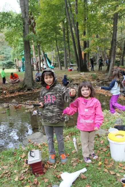
Indian Creek River Conservation Plan: The Sequel                   Chapter 5. Cultural Resources

        The corridor in Springfield Township reverted back to the adjacent landowners because
        there was no entity interested in preserving the corridor at the time of abandonment.
        However, the Municipal Authority of Westmoreland County owns a significant portion of
        that corridor and has entered into a lease with Mountain Watershed Association so that the
        Indian Creek Valley Trail can continue along the original Indian Creek Valley Railroad
        corridor to the Youghiogheny River. In 2019, Mountain Watershed Association completed a
        major drainage and resurfacing project along 4.3 miles of one of the most pristine sections
        of the trail-- the Indian Creek Gorge.

        In addition to the Municipal Authority there are several individual landowners who own
        portions of the trail. Some of them have signed easements allowing the trail to continue
        and some have not, leaving gaps in the trail. While we continue to communicate with those
        landowners to establish easements we are moving forward with the next major phase of
        the trail development. That is crossing the Youghiogheny River and linking the Indian
        Creek Valley Trail with the Great Allegheny Passage at Camp Carmel.

        Mountain Streams Trail System
        The Mountain Streams Trail System is located in the Forbes state forest and the
        headwaters of the Indian Creek watershed. Several old railroad grades including the Indian
        Creek Valley Railroad and Blair Brothers Railroad are contained within this hardwood forest
        with old farm fields reverting to forest. There are five maintained trails open for hiking,
        cross-country skiing, mountain biking, snowshoeing, and equestrian use. Several township
        roads also traverse this area and are open to hiking, biking, and equestrian use with some
        roadways open to snowmobiling use in the winter.

                          TABLE 5-1. MOUNTAIN STREAMS TRAIL SYSTEM

            Trail              Miles                         Information about the trail
Mountain Streams            7.7       This trail stretches from Tunnel Road to Camp Run Road
Trail                                 following parts of the old Blair Brothers Railroad grade.
Pike Run Trail              1.5       This trail stretches from Route 31 to Camp Run Road
(Jeff Barr Memorial)                  following and old spur of the Indian Creek Valley Railroad
                                      grade.
Dan Carns Trail             0.5       This is a connector between the Mountain Streams trail and
                                      the Blair Brothers Trail.
Blair Brothers Trail        1.4       This section extends along the Blair Brothers railroad grade
                                      from Route 381 to Hunter Lane.
Hunter Lane                 1.4       Hunter Lane is a township road that connects Tabernacle
                                      Road with Route 381.
                                  (Source: Pennsylvania Bureau of Forestry)

        A connection from the Blair Brothers Trail to the Indian Creek Valley Trail is possible by
        crossing Route 31; however a formal connection has not been finalized. Connecting the two

                                                                                         Page 5-2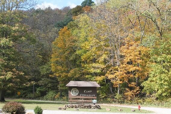
Indian Creek River Conservation Plan: The Sequel                     Chapter 5. Cultural Resources

      trails requires cooperation from the Pennsylvania Department of Transportation since
      Route 31 is a state highway. The speed limit where the crossing would take place has
      already been reduced, but for safety signs alerting users to the trail crossing will be
      needed. Completing this connection would increase opportunities for recreational users of
      both trail systems.

      Roaring Run Natural Area
      Located within the watershed is the Roaring Run Natural Area which hosts eight trails over
      3,593 acres of second and third growth forests and features a mountain stream, Roaring
      Run. Trails in the Natural Area are limited to foot traffic such as hiking, cross-country skiing
      and snowshoeing. These trails are highlighted in Table 5-2.

                    TABLE 5-2. HIKING TRAILS IN THE ROARING RUN NATURAL AREA
            Trail          Miles                          Information about the trail
     North Loop             4.5       This trail is located on the remains of old logging railroad
                                      grades and old skid trails.
     Painter Rock Trail     1.8       Points of interest along this trail include abandon fields
                                      reverting to forest and a prominent rock break offering
                                      numerous vistas of the Roaring Run Valley.
     Roaring Run Trail      3.3       Located in the heart of the Natural Area this trail follows
                                      Roaring Run for most of its length. The main portion of this
                                      trail is located on an old logging railroad grade.
     South Loop Trail       1.9       Most of this trail is located on old logging roads and skid
                                      trails
     Birch Rock Trail       0.7       This trail provides access to Birch Rocks and during periods of
                                      leaf-off the ski slopes at Seven Springs Resort are visible.
     McKenna Trail          2.8       This trail connects the Route 31 parking lot to the heart of
                                      the Natural Area.
     Hillside Trail         1.3       This trail connects Firetower Road to Painter Rock Road.
     Tower Road Trail       1.4
                                  (Source: Pennsylvania Bureau of Forestry)

      The Indian Creek Valley ATV Club is a private membership club that started in 2000 as a
      family oriented organization that promotes outdoor safety and respect for the environment.
      The club currently has 40 miles of trail over 750 acres miles of trail available. The club
      requires all vehicles to be registered and insured; users to wear helmets and display club
      membership decal. Camping, littering, night driving and campfires are prohibited.

      The club is actively adding and enhancing trail ways for users and has recently completed a
      master site plan. This plan is guiding the development of the trails to ensure they are safe,
      environmentally responsible, and enjoyable for members.

                                                                                           Page 5-3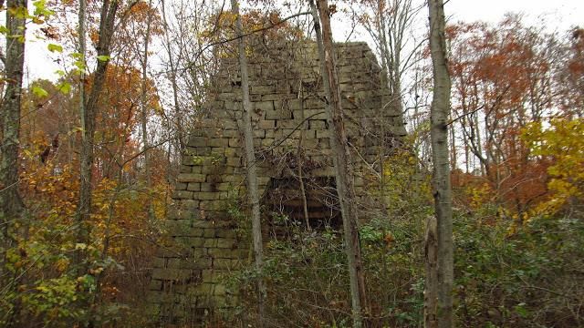
Indian Creek River Conservation Plan: The Sequel                     Chapter 5. Cultural Resources

    Parks
    Parks are areas of land set aside for public use maintained for enjoyment and the recreational
    use of people (Landes, 2004). Parks can vary from small neighborhood parks to large state or
    federal parks. They can be publicly owned with no cost to utilize the parks resources or
    sometimes they are privately owned and visitors may be charged an entrance or activity fee.
    Within the Indian Creek watershed there are two community parks, Mill Run Athletic Fields
    and Resh Park, a neighborhood park in Melcroft, two school playgrounds, a closed school
    playground, and ballfields in Davistown and Normalville. A portion of the Laurel Ridge State
    Park is within the watershed; however, none of the parks amenities are located here. In
    addition, there are two pay to play parks--Living Treasures Animal Park and Caddy Shak-- that
    charge visitors for use of their services.

       Mill Run Athletic Fields
       The Mill Run Athletic Fields is a county owned park that is managed by Springfield
       Township. This park features two baseball fields, of which one is multifunctional and can
       be converted to a football field. The fields play host to a variety of sectional and divisional
       baseball tournaments attracting many visitors to the region. Other amenities at the park
       include, a basketball court that in the winter can be converted into an ice skating rink, a
       playground and Mill Run, a high quality stream supporting wild trout. The park does have
       restrooms and a picnic pavilion that are highly utilized especially when the athletic fields
       host a variety of sectional and divisional baseball tournaments.

       A few needs have been identified to enhance visitors’ experiences at the park including
       upgrading the facilities to be compliant with the American Disability Act (ADA), establishing
       a spur from the Indian Creek Valley Trail to the park, and improving the playground. The
       playground needs proper drainage, safety surface, and upgraded equipment including a
       handicapped accessible swing.

       C.W. Resh Memorial Park
                                                 C.W. Resh Memorial Park is located in Indian Head
                                                 at the confluence of Back Creek and Indian Creek.
                                                 The park is owned and maintained by Saltlick
                                                 Township. Features at the park include the
                                                 playground, three picnic pavilions that can be
                                                 rented, a basketball court, a volleyball court,
                                                 baseball fields, access to the Indian Creek Valley
                                                 Trail and a children’s only fishing area. During the
                                                 summer months portable toilets and a
                                                 handwashing station are also available.

                                                 The park does have handicapped parking available
         Playground with safety surface          at the pavilion closest to the main playground;
               at C.W. Resh Park                 however, adding a handicapped swing would be a
                                                 benefit to the park.
                                                                                            Page 5-4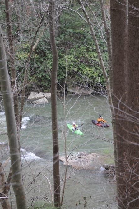
Indian Creek River Conservation Plan: The Sequel                    Chapter 5. Cultural Resources

      Melcroft Park
      Melcroft Park is a smaller neighborhood park located along Melcroft Road, just before
      Route 711. The park has a war memorial, a picnic table, swings, a basketball court and a
      baseball field directly across the road. Enhancements at this park including ADA
      accessibility and some upgraded equipment including a small playground. The actual name
      of this park is unknown.

      The playground at the old Clifford Pritts Elementary school status is unknown due to the
      sale of the school.

      Living Treasures Wild Animal Park
      Living Treasures is a zoo in the Laurel Highlands Region. The nine acre parcel opened in
      1998 and now has 300 animals, 50 different species that permit visitor interaction. Living
      Treasures prides itself with providing visitors with a unique interactive experience that
      allows visitors to get close to the animals. There is an admission charge associated with
      visiting this park.

      Caddie Shak
      Caddie Shak is a 50 acre pay to play park with action packed attractions for fun and
      excitement. The park features three Go-Kart tracks, two miniature golf courses, bumper
      boats, batting cages, golf driving range, paintball shooting gallery, kiddie rides, arcade,
      playground, picnic pavilion, snack shak, and more.

     Camping
     Camping is a major recreational activity that
     provides an economic boost to our region.
     Many of the local businesses cater to this
     seasonal industry by expanding their hours
     of service from Memorial Day to Labor Day
     each year.

     Camping is permitted in Forbes State Forest;
     except within the Roaring Run Natural Area.
     Camping in Forbes State Forest is restricted
     to back-pack type camping except for several                Low impact camping
     motorized sites. Camping out of vehicles or
     campers is not allowed. Camping longer than one night requires a permit; however, all
     campers are encouraged to obtain a permit so they can be reached in emergency situations.
     Please visit Forbes State Forest website for more information and restrictions about where to
     camp.

     There are seven campgrounds in the Indian Creek watershed. Services available vary from
     primitive to private resorts. These are all pay to play services.
                                                                                           Page 5-5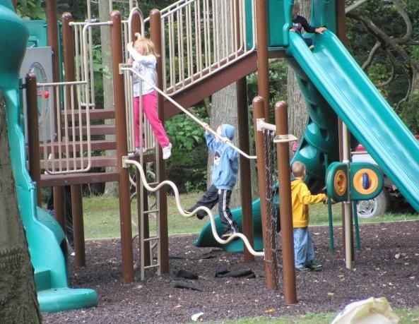
Indian Creek River Conservation Plan: The Sequel                   Chapter 5. Cultural Resources

      Indian Creek Camplands
      Indian Creek Camplands is the most primitive and private campground in the watershed
      and unlike most campgrounds is open year-round. Sites vary in size from single tents to
      acres accommodating large groups. The sites are so private that you will not see other
      campers unless you choose to. There are no RV Hookups or shower houses and the sites are
      rustic meaning they are not mowed down. What this campground does offer is plenty of
      deep and steep woods, huge rocks, ancient trails, and cool springs along with Rasler Run
      and Indian Creek.

      Hideaway Campground
      Hideaway Campground is a small family-oriented campground with 24 sites available with
      hookups, seven tent sites and six primitive sites. The campground is nestled along a
      beautiful section of Stoney Creek. Features include a fishing pond, pavilion, playground,
      rest room, and shower house. Hideaway is ADA compliant providing handicap access and
      also welcomes pets.

      Donegal Campground
      Donegal Campground is a family owned and operated campground that has been in
      operation since 1969. Campsites vary to include full hook ups of electric, water, cable and
      sewage to tent sites. Each site has a picnic table, fire ring, and shade. Other features
      include an in-ground swimming pool that is open seasonally and a recreation hall featuring
      ping pong, pool and arcade games. Wireless internet is available free of charge throughout
      the campground.

      Yogi Bear’s Jellystone Park
      Yogi Bear’s Jellystone Park in Mill Run provides a variety of opportunities for family fun in
      addition to the camping. A variety of campsites are available to rent along with cabins and
      RVs. Amenities at the site include free wireless internet, cable, campground store and gift
      shop, game room, restaurant, laundry facilities, restrooms, showers, miniature golf,
      paintball, mining sluice, playgrounds, and a variety of rides including train, carousel,
      wagon, fire truck, 4x4 adventure, and the Picnic Basket Express. Yogi Bear’s wetlands
      features swimming pool, water slides, and a splash park to keep guest cool. They also offer
      themed weekends and a variety of other activities including bingo and adult crafts.

      Roaring Run Resort
      Roaring Run Resort is a private membership campground that is open year-round to its
      members. Recreational opportunities at the resort include an Olympic sized swimming
      pool, children’s wading pool, playground, adult lounge, activities lodge, country store,
      miniature golf course with lights for nighttime golfing, bocce ball, horseshoes,
      shuffleboard, volleyball, tennis, basketball and a sport’s field. Sites are available with
      water, electric, and cable hookups. There is free wireless internet service and 24 hour
      security. Some of the activities include bingo, hay wagon rides, movies, and a family fire pit.
      In addition, to the reserve only campsites the resort has cabins available for rent.
                                                                                          Page 5-6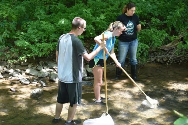
Indian Creek River Conservation Plan: The Sequel                     Chapter 5. Cultural Resources

      Mountain Pines Campground
      Mountain Pines Campground provides a variety of resources to its weekend guests and
      seasonal campers. Different types of campsites with partial and full hookups are available
      in addition to primitive and deluxe cabins and a lodge that can be rented. The typical
      shower house and restrooms are provided along with laundry facilities, recreation center,
      club house, store, snack bar, and pavilion. Recreational amenities include miniature golf,
      shuffle board, jump pad, dog park, tennis court, basketball court, playground, volleyball
      court, a field and both indoor and outdoor swimming pools. Fishing is available in
      neighboring Indian Creek and the campground also has access to the Indian Creek Valley
      Trail.

      Laurel Highlands Camplands
      Laurel Highlands Camplands is another year-round facility that has a manufactured housing
      community of over 100 homes in addition to the permanent and nightly sites available
      from RVs, fifth wheelers, and campers, to regular and rustic tents. The Camplands hosts a
      variety of events including bingo, movie nights, horseshoe and cornhole tournaments,
      bands, DJs, and karaoke. Facilities at the site include two stocked fishing lakes, playground,
      pavilion, club house, snack bar, indoor and outdoor swimming pools, golf cart trails,
      basketball, tennis and volleyball courts, and horseshoes.

                                                  Camp Christian
                                                  “Camp Christian provides a place and opportunity
                                                  where Christians of all ages can be still and know
                                                  who God is.” It was established in 1941 when the
                                                  Baltimore and Ohio Railroad sold the property to
                                                  the Christian Churches of Somerset for use as a
                                                  summer camp. The site continues to be used as a
                                                  summer camp providing a variety of experiences
                                                  based on age and interest.

      Amenities at the site include dormitories, cabins, dining hall, chapel, conference rooms,
      picnic pavilions, swimming pool, a basketball court, volleyball, shuffle board, horse shoe,
      swings, ropes course, ping pong, carpet ball, gaga ball, campfire area, and 9-square in the
      air.

      The site is used for more than just summer camping, a variety of events/retreats are held
      throughout the year. In addition, the facilities are available to rent for private functions. For
      more information about services, activities, and history check out the camp’s website at
      http://camp-christian.org/.

                                                                                            Page 5-7
Indian Creek River Conservation Plan: The Sequel                        Chapter 5. Cultural Resources

    Boating
    Boating within the Indian Creek watershed is very limited
    due to inconsistent variable water depth and public access.
    Boating activities can only be done during periods of
    adequate flow. With the close proximity of Ohiopyle, only
    the more experienced boaters view Indian Creek as a viable
    location. From time to time when conditions are right you
    will see kayakers below the Indian Creek reservoir in the
    Gorge. Development of a formal water trail and the
    installation of canoe and kayak launches are needed.

    Fishing
    Fishing is once again a viable activity in the Indian Creek
    watershed. Years of restoration projects have improved the
    quality of Indian Creek so that it presently supports the
    aquatic life needed to sustain healthy fish populations.                Kayakers in the Indian
    Fishing is a popular recreational activity that attracts visitors           Creek Gorge
    to our region.

    Fishing in the Commonwealth of Pennsylvania is regulated by the Pennsylvania Fish and Boat
    Commission (PFBC) as they work to protect, conserve, and enhance the Commonwealth’s
    aquatic resources and provide fishing and boating opportunities. In an effort to achieve their
    goal they handle area streams differently through various management designations and
    stream stocking.

    Indian Creek is stocked from Route 381 Bridge in Jones Mills to the Indian Creek Reservoir
    near Mill Run. In addition, sections of the main stems of Back Creek and Mill Run are also
    stocked. Back Creek is stocked in the children’s fishing area located in Resh Park several times
    a year for various kids fishing derbies through out the spring, and then again in the fall for the
    Indian Creek Watershed Festival. Sections of Indian Creek are also stocked by B&G Bait Shop
    in Normalville. They hold fundraisers in order to raise money to purchase trout to stock.

       Wilderness Trout Stream
       “Wilderness Trout Stream management is based upon the provision of a wild trout fishing
       experience in a remote, natural, and unspoiled environment where man’s disruptive
       activities are minimized” (PFBC). The purpose of this designation is to protect and promote
       native brook trout fisheries and the ecological requirements necessary for natural trout
       reproduction. Roaring Run is the only stream in the Indian Creek watershed with this
       designation, laying within the boundaries of Forbes State Forest and more specifically the
       Roaring Run Natural Area.

       Special Regulation Areas
       Only one Special Regulation Area exists within the Indian Creek watershed. It is located on
       the mainstem of Indian Creek between Route 381 parking lot and Hunter Lane. This 1.64
                                                                                             Page 5-8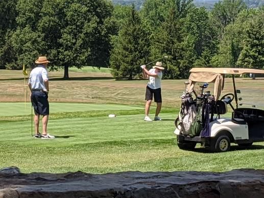
Indian Creek River Conservation Plan: The Sequel                     Chapter 5. Cultural Resources

                                    mile section of stream is designated as a delayed harvest
                                    artificial lures only area meaning this stretch is open to fishing
                                    year-round; however, anglers may only keep their catch if the
                                    trout is nine inches or greater and it is caught between June 15
                                    and Labor Day. During that timeframe the creel limit is three
                                    trout regardless of species. From Sunset on Labor Day to an
                                    hour before dawn on June 15 anglers must practice catch and
                                    release. Other restrictions in this section of stream require
                                    anglers to use artificial lures constructed of metal, plastic,
                                    rubber, and/or wood, or flies and streamers constructed of
                                    natural and synthetic materials. The type of gear, fly-rod or
                                    spinning rod is not restricted.

                                    Class A Wild Trout Waters
                                    Class A Wild Trout Waters are streams that support populations
                                    of naturally producing trout of sufficient size and abundance to
     Youth anglers displaying
                                    support a long-term reward fishery. Streams that are designated
     their catch at the Indian      as Wild Trout streams are not eligible for stocking. Nine
     Creek Watershed Festival       tributaries with 35.81 miles of stream in the Indian Creek
                                    watershed are designated as Class A Wild Trout Waters, they are
       identified in Table 5-3.

       Wild Trout Waters
       Wild Trout Waters are capable of supporting natural reproduction of trout. This designation,
       unlike that of the Class A Waters has no limitations for management and is eligible to be
       stocked with hatchery trout. There are 83.1 miles of stream in the Indian Creek watershed
       that support natural trout reproduction, see Table 5-4.

                                  TABLE 5-3. CLASS A WILD TROUT WATERS
                                                                                                 % Public
        Stream             Fishery       Length             Section Description                 Ownership
       Buck Run          Brook Trout      2.88     Headwaters to 2300m upstream of mouth           11%
      Camp Run           Brook Trout      4.26             Headwaters to mouth                     81%
      Fulton Run            Brook         3.65             Headwaters to mouth                      0%
     Indian Creek        Brown Trout       6.2       Headwaters to Township 916 Bridge             57%
     Middle Fork
                         Brook Trout       3.51              Headwaters to mouth                    0%
      Laurel Run
       Neals Run         Brook Trout     2.77               Headwaters to mouth                     3%
       Pike Run             Brook        5.19               Headwaters to mouth                    17%
                       Brook/Rainbow
      Rasler Run                         5.15               Headwaters to mouth                     0%
                            Trout
     Roaring Run         Brook Trout      2.2      Forbes State Forest Boundary to mouth            5%
                             (Source: Pennsylvania Fish and Boat Commission)
                                                                                            Page 5-9
Indian Creek River Conservation Plan: The Sequel Chapter 5. Cultural Resources
TABLE 5-4. NATURALLY REPRODUCING TROUT STREAM
Stream Wild Trout Limits Miles
Back Creek Headwaters downstream to mouth 3.6
Buck Run Headwaters downstream to 2.3 kilometers upstream of mouth 1.7
Camp Run Headwaters downstream to mouth 4.1
Clay Run Headwaters downstream to mouth 3.12
Fulton Run Headwaters downstream to mouth 3.66
Indian Creek Headwaters to Indian Head Bridge 15.36
Laurel Run Headwaters downstream to mouth 4.75
Little Run Headwaters downstream to mouth 2.1
Middle Fork Laurel Run Headwaters downstream to mouth 3.5
Mill Run Headwaters downstream to mouth 6.61
Neals Run Headwaters downstream to mouth 2.4
Pike Run Headwaters downstream to mouth 4.6
Poplar Run Headwaters downstream to confluence Newmyer Run 1.68
Rasler Run Headwaters downstream to mouth 3.31
Roaring Run Headwaters downstream to mouth 5.12
Stony Run Headwaters downstream to mouth 2.94
Tates Run Headwaters to mouth 2.65
Trout Run Headwaters downstream to mouth 3.5
UNT Indian Creek
Headwaters to mouth 1.16
(RM 0.49)
UNT Indian Creek
Headwaters to mouth 2.31
(RM 25.55)
UNT Poplar Run (RM 3.12) Headwaters to mouth 1.41
UNT Rasler Run (RM 1.99) Headwaters downstream to mouth 2.19
UNT Rasler Run (RM 3.04) Headwaters downstream to mouth 1.33
Source: Pennsylvania Fish and Boat Commission)
Hunting
Public hunting within the watershed is limited to tracts in Forbes State Forest and
Pennsylvania State Game Lands unless permission is secured from private landowners. Before
hunting on any private lands interested hunters should contact individual landowners for
permission to hunt.
Forbes State Forest has a dominant presence in the headwaters of the Indian Creek watershed.
It is administered by Pennsylvania Bureau of Forestry within the Pennsylvania Department of
Conservation and Natural Resources. The forest is managed for long-term health and
productivity while conserving native wild plants.
Page 5-10Indian Creek River Conservation Plan: The Sequel Chapter 5. Cultural Resources
Pennsylvania State Game Lands 51, located in the Indian Creek Gorge below Tates Run to the
confluence with the Youghiogheny River on river right is open to hunting. State Game Lands
are managed by the Pennsylvania Game Commission to provide habitat for wildlife increasing
opportunities for lawful hunting and trapping.
Golfing
Locations for golfing in the Indian Creek watershed are
very limited; the only golf course in the watershed is a
9-hole, par 32 private course located in the Pike Run
Country Club. The course is a well-manicured scenic
course that is family friendly, welcoming children. This
course is also unique in that there are no scheduled tee
times. However, you must be a member of the club, or a
guest of a member of the club to use the facilities.
Golfers at Pike Run
Country Club
In addition to golfing the Pike Run Country Club also
offers its members a state of the art shooting facility that offers trap, skeet, five-stand, and sub
trap shooting. They hold monthly competitive shooting events for all levels including inter-
club events for the more competitive shooters. They also have a variety of safety and
instructional clinics for all levels of shooters. The Club has a private trout stream, swimming
pool, two tennis courts, a bowling green, cozy lodging, and gourmet dining.
ENVIORNMENTAL EDUCATION
Educating citizens to be environmentally responsible is an ongoing venture than spans many
generations. Often when most people think about environmental education they quickly think
about youth; however, environmental education is needed for everyone. Everyday decisions that
we make can have a profound impact on our surrounding environment. For example, where does
the water go at the end of the swimming season when we drain our swimming pools? Most often it
is discharged into stormwater drains leading directly into one of our streams containing all the
chemicals that we use to keep the pool clean. The aquatic organisms, including fish, living in our
streams do not tolerate these chemical well. Did you know that the same stream that these
chemicals are discharge in is also our community’s drinking water supply?
It’s the little decisions we make without a thought that can harm our watershed. Through
educating landowners about the effects of their actions we hope to encourage a modification of
behavior and by demonstrating a benefit to them whether it be financial, health, or copasetic we
hope to encourage sound, healthy stewardship. By educating the youth we hope to exhort the next
generation to be compassionate about the environment in which they must live.
Environmental education was first deployed in the agricultural community through the
implementation of conservation practices. These conservation practices not only helped the
environment, but were beneficial to the landowner. Educating the public about important
environmental challenges and developing knowledgeable citizens who actively participate in
Page 5-11Indian Creek River Conservation Plan: The Sequel Chapter 5. Cultural Resources
addressing the environmental challenges that we face today is critical to sustaining the balance
between environmental and human activities, maintaining community quality of life, ensuring the
health and welfare of our watershed, protecting human health, advancing quality education,
expanding employment opportunities, promoting sustainable development and protecting our
natural heritage (Pennsylvania Department of Education, 2000).
A variety of organizations provide environmental education opportunities to landowners, students,
and visitors in and around the Indian Creek watershed. Mountain Watershed Association (MWA) is
one of these groups. Did you know that you can request a program from MWA and they will tailor a
presentation specifically to your needs? Over the years’ our local watershed group has conducted
educational programs for our schools, camps, and civic groups among others. MWA also hosts the
annual Indian Creek Watershed Festival which features a free children’s fishing day, a rubber duck
race, car show, vendors, and hands on environmental education activities.
Other organizations offer trainings and programs to
help you become better stewards of your community.
The Penn State extension has master gardener, master
watershed, and master well steward programs. County
Conservation Districts host events and are also willing
to conduct environmental educational programs in
addition to sponsoring county Envirothon competitions.
Environmental education programs are also offered at
our neighboring state parks, and Forbes State Forest.
Environmental education program
These programs are geared towards providing hands-
on, in-field learning experiences and getting people teaching young adults about
outside away from the electronic devices that control macroinvertebrate sampling
our lives.
HISTORY
Prior to European settlement of Southwestern Pennsylvania, the Indian Creek Valley was most
likely inhabited by the Monongahela culture of Native Americans who were widespread within and
around the Monongahela River Valley in the modern-day states of Pennsylvania, West Virginia, and
Ohio. Though that specific group of native peoples disappeared around 1635, the vacuum left by
them was filled by either newcomers or descendants as a few conflicts between settlers and Native
Americans in the area are cited in History of Fayette County by Franklin Ellis well into the 1700s
(Pennsylvania Heritage Foundation, 2019 and Ellis, 1882). Originally known by frontiersman as
Great Salt Lick Creek in the first half of the 18th century from the numerous salt deposits that
cropped out along its banks, it eventually took on the name Indian Creek in the latter half. This
name supposedly originated in 1758 when a group of British Army soldiers under the command of
a “Captain Harris” moved a herd of cattle upstream from a natural meadow near the mouth of Mill
Run where they were camped. While moving along Indian Creek they came across a Native
American village—empty at that time—that showed signs that the valley was highly trafficked for
Page 5-12Indian Creek River Conservation Plan: The Sequel Chapter 5. Cultural Resources
hunting and fishing. Henceforth they referred to it as Indians’ Creek, which spread and evolved into
the modern name of Indian Creek (Ellis, 1882).
Permanent European settlements began to crop up in the Indian Creek watershed following the
end of the Revolutionary War, and with them came saw mills and grist mills. These provided
lumber and flour respectively to the area, taking advantage of readily available moving water
provided by Indian Creek and its numerous tributaries to turn water wheels powering the mill
gearing. Small communities began to form around the nucleus of these mills, as is the origin story
of many small hamlets on the rural frontier (Ellis, 1882).
It was not long before residents and entrepreneurs sought to take advantage of the rich natural
resources in the watershed: iron ore, limestone, timber, and surface deposits of quality coal
sometimes six feet thick. As early as 1807, iron ore was being collected and processed at the St.
John Furnace near the mouth of Indian Creek. At the other end of the watershed in Forbes State
Forest the Fountain Furnace was built and in blast by 1812 at the latest. There was at least one
more furnace known as the Fayette Furnace operated along the streambank of Buck Run. Stone
ruins of these three furnaces are still there, with the Fayette Furnace being the most structurally
intact (Ellis, 1882; Coke Oven Mike, 2016, & Coke Oven Mike, 2017).
Quarried limestone was used in the form of lime
as flux in the iron furnaces or as a treatment for
farm fields to increase crop productivity. Trees
from early clearing of the vast ancient
woodlands provided lumber locally and plenty of
tannin from bark. Tannin is used in the hide
tanning process, so tanneries were also set up
within the watershed to provide leather goods.
Blacksmiths were the first to capitalize on easily
accessible coal deposits around 1835, and
Fayette Furnace along Buck Run several small mines were established by the
Photo: taken by Coke Oven Mike from latter half of the 19th century to supply
coalandcoke.blogspot.com businesses and households throughout the valley
and nearby surrounding area. Since the
mountainous area is isolated and Indian Creek isn’t a large enough waterway for commercial
transport, the resources of the watershed stayed within the watershed for the most part unless it
was produced near the mouth at the larger and floatable Youghiogheny River (Ellis, 1882).
Underground coal mining began in the Indian Creek valley in the mid to late 19th century and
continued until the late 1960s. These mines were developed on the Middle Kittanning coal seam—
known locally as the Miller B Coal—adjacent to the Indian Creek and Champion Creek valleys. With
few exceptions, underground mines were developed up-dip to facilitate drainage, a practice that
resulted in mines discharging into the local waterways.
Page 5-13Indian Creek River Conservation Plan: The Sequel Chapter 5. Cultural Resources
In the beginning of relatively modern transportation into and out of the area occurred around 1871
when the Baltimore and Ohio Railroad built a train station at the mouth of Indian Creek. Into the
1880s and 1890s, the Southeastern portion of the watershed near the boundary of Fayette and
Somerset County became well known for illicit distilling of whiskey by moonshiners like the
infamous Bill Pritts; they did it hidden away in this rural area to avoid the taxation that went along
with distilling and selling whiskey (Bruner, 2016). Mass resource extraction did not come until
1906 when the Indian Creek Valley Railroad (ICVRR) was established, following the path of Indian
Creek hauling timber and coal out of the watershed to connect with the Baltimore and Ohio
Railroad at the Youghiogheny. This opened the gate for huge coal companies to come in and build
entire mining towns, like Melcroft, to sustain the miners, their families, and all the accompanying
infrastructure.
Abandoned mine drainage (AMD) problems were prevalent early on during mine development and
have continued through the present. As early as 1924, Melcroft Coal Company and other mining
companies were enjoined and restrained from allowing AMD discharges into the upper Indian
Creek watershed by the Fayette County Court of Common Pleas. The order resulted from a lawsuit
brought against the various coal companies by the Pennsylvania Railroad and several private water
companies. The lawsuit claimed that the mines were causing pollution downstream of the Mill Run
Reservoir. In order to comply with the court ruling, the mining companies constructed a mine
drainage “flume” to collect and convey mine drainage to a point downstream of the reservoir. The
system was over seven miles in length and utilized piping to provide connections to existing mine
workings. The flume system discharged below the reservoir into Charles Run, a tributary of Indian
Creek, near Normalville.
During the mid-1970s the flume system began to malfunction as a result of deterioration,
plugging, and lack of any significant maintenance. AMD from these abandoned mines began to
enter the main channel of Indian Creek at the down-dip mine entries or as coal crop line
discharges. The majority of
the discharges enter
between the villages of
Melcroft and Indian Head,
where the axis of the
Ohiopyle-Ligonier Syncline
crosses the Indian Creek
valley. Flow rates and
corresponding pollution
loads vary. In addition to
abandoned underground
mining AMD sources,
several forfeited abandoned
surface mine sites also
contribute significant
pollution loads to Indian
Creek and its tributaries.
Page 5-14Indian Creek River Conservation Plan: The Sequel Chapter 5. Cultural Resources
The ICVRR ran until 1969 when it was officially abandoned and truck transportation took over for
hauling resources (Mountain Watershed).
A very small number of historic structures in the Indian Creek watershed survive today; they’ve
been lost to time through fire, development, sale, or just plain neglect. There are at least a few
houses still standing built prior to 1800 in the Fayette County portion according to online property
records (Fayette County Department of Assessments). There are undoubtedly more in the
Westmoreland portion, but those property records are not nearly as accessible. The last known
water-powered mill standing in the watershed—the Mathews grist mill in Jones Mills—was
disassembled and moved out of the area over 20 years ago. Other historic artifacts dot the
landscape such as the above-mentioned iron furnaces, damp spring houses, crumbling foundations,
a lonely stone chimney standing proudly in the woods, or an overgrown family graveyard. Historic
resources such as these give cultural meaning and context to the area, and it’s a shame that the
vast majority have vanished over the past almost 250 years. Documentation and preservation
efforts are important moving into the future for those still around. None of these sites are currently
recognized on the National Register of Historic Places
HISTORICAL SITES
The National Register of Historic Places was established by the National Historical Preservation Act
of 1966. The National Parks Service maintains the list nationally, but here in Pennsylvania it is
administered by the Pennsylvania State Historic Preservation Office within the Pennsylvania
Historic Museum Commission.
For consideration, or placement on the National Register a landowner applies to the State Historic
Preservation Office. The first step is the completion of a Historic Resource Survey. This provides a
historical description of the buildings, sites, structure, object, or district that the landowner would
like placed on the National Register. The state office reviews the forms and if needed reaches out
to the landowner for additional information to determine if it meets eligibility guidelines. If not,
the landowner is provided appeal information. If a property does meet the initial eligibility, it is
then nominated to the State Historic Preservation Board. If the Board approves the nomination, it
recommends placement to the National Parks Service. Again, if it is denied by the Historic
Preservation Board the landowner is given information about how to appeal.
Currently there are no sites on the National Register within the Indian Creek watershed.
Page 5-15You can also read