Welcome to the 2022 RA-IV (Virtual) Workshop on Hurricane Forecasting and Warning
←
→
Page content transcription
If your browser does not render page correctly, please read the page content below
Welcome to the 2022 RA-IV (Virtual) Workshop on
      Hurricane Forecasting and Warning

                             Ken Graham, Director
                           National Hurricane Center
   Richard J. Pasch & Daniel P. Brown   Anne-Claire Fontan, Scientific Officer
      Senior Hurricane Specialists        WMO Tropical Cyclone Program
       National Hurricane Center
                              February 28, 2022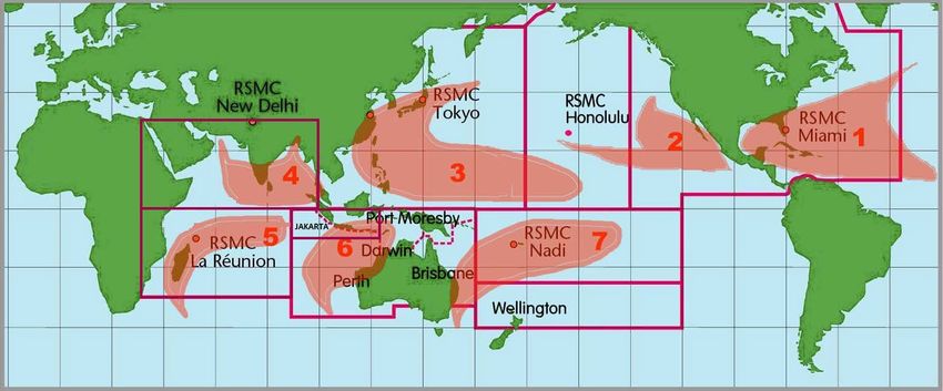
Workshop Reminders
•   Please log in a few minutes before the start of each
    session to minimize distractions

•   Please come back from breaks on time

•   Please turn on camera during discussion and questions
    and answer period

•   Schedule:
    •   Session from 1400-1700 UTC and 1800-2100 UTC
    •   Lunch break from 1700-1800 UTC
    •   Ends at 1700 UTC on Friday

•   Technical issues please email: Richard.j.pasch@noaa.gov
    or Daniel.p.brown@noaa.gov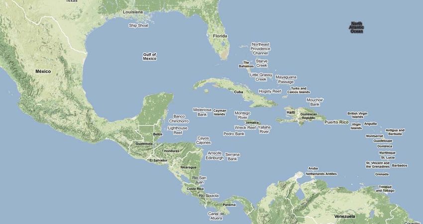
Google Meet Crash Course
 • You can change your view by selecting the
 options icon. These changes will not take effect
  until you rejoin the session. Please wait until a
break to leave and return to the session to do this.

                                        Click additional options icon (3 dots)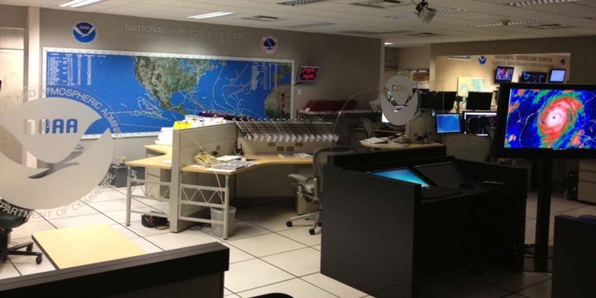
Google Meet Crash Course
 • You can change your view by selecting the
 options icon. These changes will not take effect
  until you rejoin the session. Please wait until a
break to leave and return to the session to do this.

                                    Click “change layout”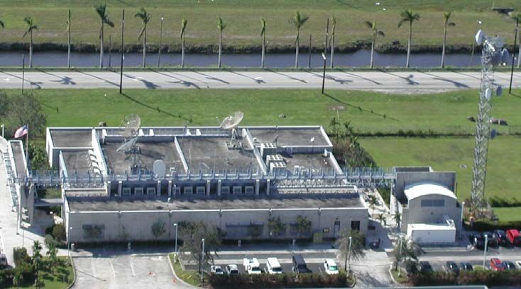
Google Meet Crash Course
 • You can change your view by selecting the
 options icon. These changes will not take effect
  until you rejoin the session. Please wait until a
break to leave and return to the session to do this.

                         To maximize the presentation size, use spotlight or sidebar.
                         Sidebar allows you to see the speaker.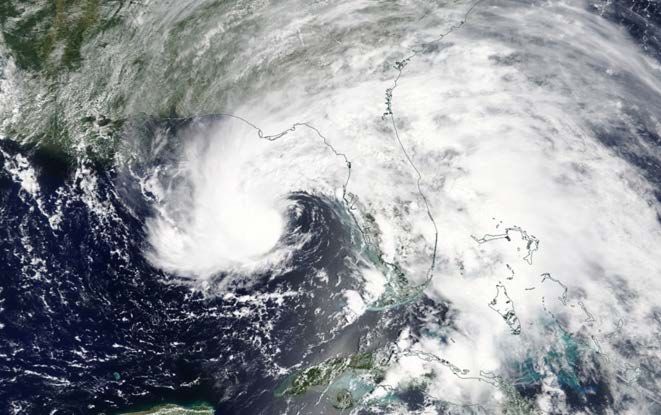
Google Meet Crash Course
 • We highly encourage interaction during the
webinar. This can be done in a few different ways: Click chat icon
Google Meet Crash Course
 • We highly encourage interaction during the
webinar. This can be done in a few different ways: Click here

                                                        Then enter
                                                        message here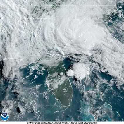
Google Meet Crash Course
• When these opportunities arise, we will prompt the
  group to have individuals to “raise their hand”. Note,
      attendees can ask question throughout the
        presentations through the chat window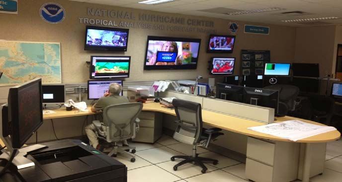
Google Meet Crash Course
• There will be several opportunities for poll questions
  throughout the workshop. We will let you know to look
     for the indicator for poll questions when they are
                         being asked.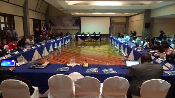
A couple of quick rules
• Please mute yourself at all times unless we unmute
   you to speak. You are more than welcome to keep
  your camera on so we can see the audience and you
                can see others as well.

• Please do not share your screen unless you are a
       presenter. You will know who you are

• Please have fun and interact with us in order to get
           the most out of this experience!
Workshop Agenda
Workshop Agenda
National Hurricane Center
                                       Organizational Structure
      Hurricane
      Hurricane                                    Tropical                         Technology
      Specialist                                Analysis and                        and Science
     Specialists
           Unit                                Forecast Branch                        Branch
           Unit
  Develop, coordinate
Develop, coordinate                         Marine/ocean and satellite          Computer systems support
   (domestically
(domestically      and
                 and     abroad),
                      abroad), and          analyses, forecasts and warnings    24x7
   and  issue  tropical  cyclone
issue tropical cyclone warnings,
   warnings,   forecasts,                   in text and graphical formats,
forecasts,  and   outlooksand
                            in text         24x7, (~100 products/day)           Applications development
   outlooks  in  text and  graphical
and graphical formats, mostly                                                   and technology infusion
onformats   (~700
    a six-hour      full advisory
                 cycle;                     Conduct tropical cyclone (Dvorak)
   packages/yr)
                                            analyses for the hurricane          Storm surge guidance (real
• “Off-season” outreach;                    specialists                         time; community planning;
   “Off-season”
Applied         outreach
         research        and
                  and public                                                    preparedness)
   public awareness
awareness   programs.programs
                                            Augments operational support
                                            staffing                            Emergency operational
  Applied research
                                                                                support staffing
Facts About the NHC Facility • Opened in 1995 • 25,000 square ft • Design team included Herb Saffir • Rest five feet above flood plain • 10-inch thick walls made from 3000 cubic yards of concrete, reinforced with 45 miles of steel reinforcing rods • More than 50 miles of electrical and communications wiring • Also houses the NWS Miami Weather Forecast Office
Tour of Primary Operations Areas

NHC Operations                              TAFB Operations

FEMA HLT Operations                       CARCAH Operations
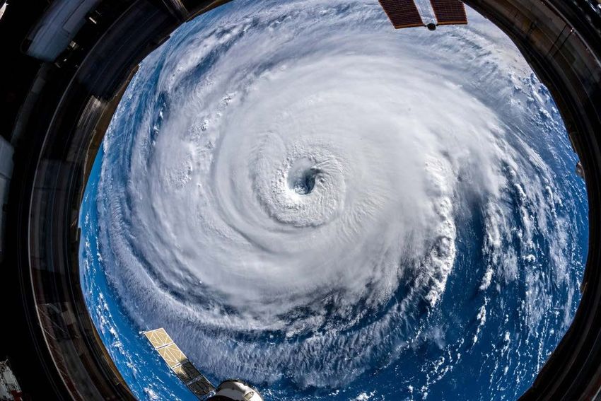
World Meteorological Organization
   Regional Specialized Meteorological Centers (RSMC)

• NHC is one of 7 RSMCs that produce and coordinate tropical cyclone
  forecasts for various ocean basins.
• NHC is responsible for both the Atlantic & eastern North Pacific Ocean basins.
International Collaboration Highlights
•   Open exchange of meteorological data among
    countries
•   NHC provides forecasts and guidance on watches
    and warnings to 28 WMO member nations
•   NHC hosts and teaches two-week workshop on
    tropical cyclones for international government
    meteorologists
•   NHC Director serves as Chairman of the WMO RA-
    IV Hurricane Committee. Annual meeting updates
    the Region’s “Hurricane Operational Plan”
•   U.S. conducts annual Caribbean Hurricane
    Awareness Tour
•   Storm surge projects
Hurricane Awareness Tour
• 2020 and 2021 – Canceled due to the
pandemic
• Limited Return in 2022 - U.S. Territories
• Full Return in 2023– Hopefully!
• Opportunity to increase hurricane
awareness by meeting with emergency
managers, media, and general public
• Tour of hurricane hunter aircraftNHC’s International Coordination
World MET. ORGANIZATION - Regional Association IV Coordination
RSMC= Regional Specialized Meteorological Center
RA-IV countries include Caribbean area, Central America,
Mexico, Canada, and Bermuda.Coordination of International
Watches & Warnings
• Each country is responsible for issuing
watches/warnings for their respective
country or jurisdiction
– NHC issues watches/warnings for Haiti
• NHC will recommend the placement of
watches/warnings
• Coordinated with Met. Offices throughout the
region
• Potential Tropical Cyclone advisories allow for
the issuance of watches and warnings prior to
the formation of a tropical depressionReminder of a 2021 Change - May 15 Start of NHC
Atlantic Tropical Weather Outlooks
• In 2021, NHC begin issuing the
Tropical Weather Outlooks on May 15
• No change to the official start of
hurricane season
• Provides information on possible
development prior to June 1
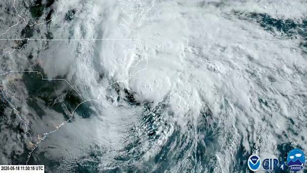
Alberto- May 2018
• 7 straight years with at least one
Bertha- May 2020 named storm prior to June 1st
• In 2020, 36 special TWOs issued prior to
June 1!
• 5 of the recent pre-season storms
Arthur- May 2020 have impacted the United StatesReminder of a 2021 Change –
World Meteorological Organization
Tropical Cyclone Naming Update
• Overflow name list no longer includes
the Greek Alphabet
• Supplemental name lists for Atlantic
and Eastern Pacific basinsQuestions?
You can also read