Water Resources Availability Portfolio Update - ICWP AND WSWC SPRING ROUNDTABLE APRIL 15, 2021 - Western States Water Council
←
→
Page content transcription
If your browser does not render page correctly, please read the page content below
Water Resources
Availability Portfolio
Update
ICWP AND WSWC SPRING ROUNDTABLE
APRIL 15, 2021
Strategic Priorities

In 2018 the National Academies of Science, Engineering and Medicine
recommended that to prepare for the next generation of water resources
challenges the Nation will face, we should focus now on the following science
priorities:

 Six Cross-Cutting Water Challenges
 1. Understanding the role of water in the Earth system
 2. Quantifying the water cycle
 3. Developing integrated modeling and prediction
 4. Quantifying change in the socio-hydrological system
 5. Securing reliable and sustainable water supplies
 6. Understanding and predicting water-related hazards
                              +                                                 National Academies of Sciences, Engineering, and
                                                                                Medicine 2018. Future Water Priorities for the Nation:
 7. Leverage emerging technologies                                              Directions for the U.S. Geological Survey Water Mission
                                                                                Area. Washington, DC: The National Academies Press.       2
                                                                                https://doi.org/10.17226/25134.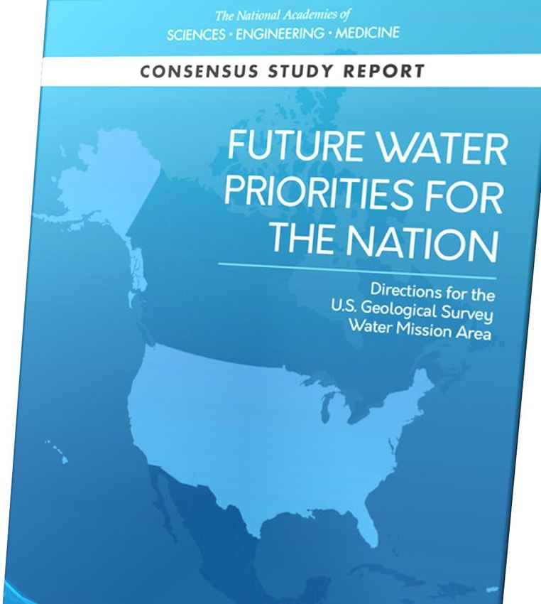
Water Availability Forecasting

                                  Improve Water Availability Information Delivery
      Working with regional and National stakeholders, deliver the data, tools, and
      information they need to make management decisions. Improve capacity to
      understand daily availability and provide forecasts at weekly, monthly,
      seasonal, and decadal time steps. What is the most effective and impactful
      way to deliver this information so it becomes critical data.
                         Hydrologic Drought and Human Behavior
How do socioeconomics impact availability, especially when
supplies do not meet demand? How are resource allocations
made? Can we improve hydrologic drought understanding so that
we can forecast onset and predict severity? What impact does
drought have on water quality and habitat? What about flash
droughts and economic impacts?
                                                                                       Incorporate Water Quantity and Quality
                    Improve Water Use Reporting                                       Develop national indicators of water quality
By 2022, USGS will report daily water use                                             impacts on availability, for both human and
estimates for 90% of the total water use in the                                       ecological needs. Develop models that
Nation, goal is to report 100% through models.                                        forecast water budgets on daily basis. How
Five-year reporting will focus on water availability                                  are seasonal changes in water budget
and trends in factors that impact availability,                                       components impacting reservoir
such as water use.                                                                    management? Evaluate trends in water
                                                                                      availability. Impacts of hazards?
                                                                                                                                     3
USGS Integrated Water Resources Initiatives
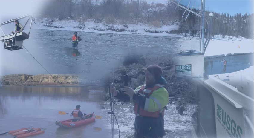
Next Generation Water Observing System (NGWOS)
NGWOS collects real-time data on water quantity and quality in more affordable, rapid,
and intensive ways than has previously been possible. The flexible monitoring approach
enables USGS networks to evolve with new technology and emerging threats.
Integrated Water Availability Assessments (IWAA)
IWAAs examine the supply, use, and availability of the nation’s water. These regional and
national assessments evaluate water quantity and quality in both surface and groundwater,
as related to human and ecosystem needs and as affected by human and natural influences.
Integrated Water Prediction (IWP)
IWP builds a powerful set of modeling tools to predict the amount and quality of surface
and groundwater, now and into the future. These models use the best available science
to provide information for more rivers and aquifers than can be directly monitored.
National Water Information System (NWIS) Modernization
NWIS data systems that house USGS water information are being modernized to maximize data
integrity, simplify data delivery to the general public, automate early warning to enable faster
response times during water emergencies, and support the new National 4
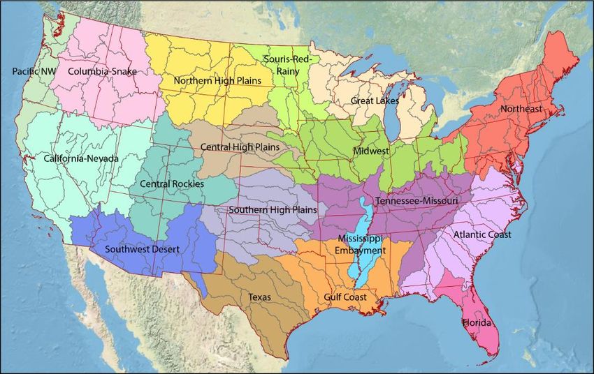
Water Dashboard. 4Integrated Water Resources Basins
Goal: 10 river basins (10,000-20,000 mi2) in 10
Milwaukee
years, representative of larger water-
resource regions to drive the future of
integrated water resources science Chicago
Regional focus areas for intensive observation,
assessments, modeling, prediction, and validation
#3: Illinois #1: Delaware
River Basin River Basin
Develop a deep, integrated under-standing that can
be extended to the broader region #2: Upper Colorado (DRB)
Peoria (ILRB)
River Basin
Basin selection process includes quantitative (UCOL)
metrics and extensive stakeholder
Springfield
engagement
Basin #4 selection by end of FY21
5WRAP Planned Accomplishments
FY2021-FY2024
Finalize infrastructure and engineering strategy and begin testing, evaluation, and development
of community-based integrated water prediction platform
Develop water use withdrawal models, including consumptive use, that account for 90% of water
use nationally
Develop tools to evaluate groundwater vulnerability and plan for developing capability to assess
groundwater vulnerability nationally
Deliver a web-based, integrated National Water Census representing water availability in over
100,000 small watersheds
Pilot predictive modeling capabilities for ecological flow needs in UCOL IWS
Develop eDNA sampling network to inform analytical system of ecological health
Develop machine learning techniques to guide drought prediction, including onset and duration
and deliver prototype prediction capability in IWS Basin
Develop science-based decision tools and models that assist with delivery of HABs early event
warning system
6Contact Information
Mindi Dalton
Program Coordinator
Water Resources Mission Area
Email: msdalton@usgs.gov
Phone: 770-283-9728
7You can also read


