Traffic Impact Study Convenience Store and Gas Station 306 Boston Post Road (US Route 1) Darien, CT - Town of Darien
←
→
Page content transcription
If your browser does not render page correctly, please read the page content below
Traffic Impact Study
              Convenience Store and Gas Station
                                  306 Boston Post Road (US Route 1)

                                                         Darien, CT

Prepared by                                                       Prepared for
McMahon Associates, Inc.                                   Bohler Engineering
94 North Elm Street, Suite 301F
Westfield, MA 01085                                                  July 2020
413‐875‐8855

Transportation Solutions Building Better Communities   mcmahonassociates.com
TABLE OF CONTENTS

INTRODUCTION ............................................................................................................................... 1
   PROJECT DESCRIPTION ....................................................................................................................... 1
   STUDY METHODOLOGY ...................................................................................................................... 4
   STUDY AREA INTERSECTIONS ............................................................................................................ 4
EXISTING CONDITIONS ................................................................................................................. 5
   ROADWAY NETWORK AND INTERSECTIONS ..................................................................................... 5
   SIGNALIZED INTERSECTIONS ............................................................................................................. 6
   UNSIGNALIZED INTERSECTIONS ........................................................................................................ 6
   PUBLIC TRANSPORTATION ................................................................................................................. 7
   FIELD REVIEW ..................................................................................................................................... 7
   EXISTING TRAFFIC VOLUMES ............................................................................................................. 7
   CRASH SUMMARY ............................................................................................................................. 11
FUTURE CONDITIONS .................................................................................................................. 13
   FUTURE ROADWAY IMPROVEMENTS ............................................................................................... 13
   BACKGROUND TRAFFIC GROWTH ................................................................................................... 13
   2022 BACKGROUND TRAFFIC VOLUMES ......................................................................................... 14
   SITE‐GENERATED TRAFFIC ............................................................................................................... 17
   PROJECT SITE DISTRIBUTION AND ASSIGNMENT ............................................................................ 18
   2022 COMBINED TRAFFIC VOLUMES ............................................................................................... 18
TRAFFIC OPERATIONS ANALYSIS ........................................................................................... 24
   LEVEL‐OF‐SERVICE CRITERIA ........................................................................................................... 24
   CAPACITY ANALYSIS RESULTS......................................................................................................... 24
   SIGHT ACCESS/CIRCULATION .......................................................................................................... 27
   SIGHT DISTANCE............................................................................................................................... 28
CONCLUSIONS ................................................................................................................................ 29

                                                                          ii
LIST OF TABLES

TABLE 1: CONVENIENCE STORE/GAS STATION VEHICULAR TRIP GENERATION ............................. 17
TABLE 2: INTERSECTION CAPACITY ANALYSIS RESULTS ................................................................... 25
TABLE 3: SIGHT DISTANCE REQUIREMENTS........................................................................................ 28

                                                     LIST OF FIGURES

FIGURE 1: SITE LOCATION MAP ............................................................................................................. 3
FIGURE 2: 2020 EXISTING WEEKDAY MORNING PEAK HOUR TRAFFIC VOLUMES ............................. 9
FIGURE 3: 2020 EXISTING WEEKDAY AFTERNOON PEAK HOUR TRAFFIC VOLUMES....................... 10
FIGURE 4: CRASH TYPES AT US ROUTE 1 AND I‐95 SOUTHBOUND ON‐RAMP ................................. 11
FIGURE 5: CRASH TYPES AT US ROUTE 1 AND I‐95 SOUTHBOUND OFF‐RAMP (EXIT 13) ................ 12
FIGURE 6: 2022 BACKGROUND WEEKDAY MORNING PEAK HOUR TRAFFIC VOLUMES .................. 15
FIGURE 7: 2022 BACKGROUND WEEKDAY AFTERNOON PEAK HOUR TRAFFIC VOLUMES .............. 16
FIGURE 8: DIRECTIONS OF ARRIVAL AND DEPARTURE ...................................................................... 19
FIGURE 9: 2022 COMBINED WEEKDAY MORNING PEAK HOUR NEW PROJECT TRIPS ..................... 20
FIGURE 10: 2022 COMBINED WEEKDAY AFTERNOON PEAK HOUR NEW PROJECT TRIPS ............... 21
FIGURE 11: 2022 COMBINED WEEKDAY MORNING PEAK HOUR TRAFFIC VOLUMES ...................... 22
FIGURE 12: 2022 COMBINED WEEKDAY AFTERNOON PEAK HOUR TRAFFIC VOLUMES.................. 23

                                                 LIST OF APPENDICES

APPENDIX A: TRAFFIC COUNT DATA
APPENDIX B: SEASONAL ADJUSTMENT DATA
APPENDIX C: CRASH SUMMARY
APPENDIX D: TRAFFIC PROJECTION MODEL
APPENDIX E: HIGHWAY CAPACITY MANUAL METHODOLOGIES
APPENDIX F: 2020 EXISTING CAPACITY/LEVEL‐OF‐SERVICE ANALYSIS
APPENDIX G: 2022 BACKGROUND CAPACITY/LEVEL‐OF‐SERVICE ANALYSIS
APPENDIX H: 2022 COMBINED CAPACITY/LEVEL‐OF‐SERVICE ANALYSIS
APPENDIX I: CAPACITY/LEVEL‐OF‐SERVICE ANALYSIS SUMMARY

                                                                    iii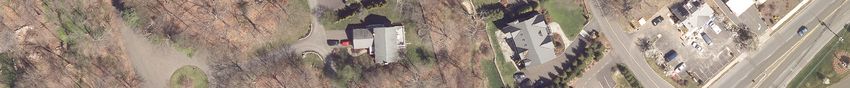
Traffic Impact Study
Convenience Store and Gas Station
Darien, Connecticut
INTRODUCTION
McMahon Associates (McMahon) has completed a review of the existing traffic operations
and potential traffic impacts associated with the proposed Convenience Store and Gas
Station (hereafter referred to as “The Project”) to be located at 306 Boston Post Road (US
Route 1) in the Town of Darien, Connecticut. The purpose of this traffic impact study is to
evaluate existing and projected traffic operations and safety conditions associated with the
Project within the study area.
The assessment documented in this traffic impact study is based on a review of existing
traffic volumes, recent crash data, and the anticipated traffic generating characteristics of the
Project. The study examines existing and projected traffic operations (both with and without
the Project) at key intersections in the vicinity of the project site. The study area was selected
based on a review of the surrounding roadway network and expected trip generating
characteristics of the proposed project. This study provides a detailed analysis of traffic
operations during the weekday morning and weekday afternoon peak hours, when the
combination of adjacent roadway volumes and project trips would be expected to be
greatest.
Based on the analysis presented in this study, McMahon concludes that the projected traffic
increases associated with the general background growth and the traffic associated with the
Project can be reasonably accommodated by the study area roadways and intersections. The
findings of our analysis, as well as recommendations to ensure efficient operations, are
documented in this report.
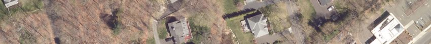
Project Description
The Project would be constructed at 306 Boston Post Road (hereafter referred to as US Route 1)
in the Town of Darien, Connecticut, as shown in Figure 1. The proposed site is currently
occupied by a fully‐operational fast‐food restaurant and drive‐through, and is bounded by US
Route 1 and dense tree cover to the north, a professional office complex to the south, Interstate
95 (I‐95) to the east, and US Route 1 to the west. A fitness studio and driveway are located on
the west side of US Route 1 directly across from the proposed site. Access to the existing site is
currently provided by a single full‐access driveway on the east side of US Route 1. Opposing
travel directions on the driveway are separated by an approximately seven‐foot painted yellow
median, and vehicles exiting the site are accommodated by a single shared‐use lane.
1
Traffic Impact Study
                                                             Convenience Store and Gas Station
                                                                          Darien, Connecticut

The Project would include the demolition of the existing fast‐food restaurant and the
construction of an approximately 4,050 square‐foot convenience store which would include a
foodservice counter and a gas station with 12 vehicle fueling positions. Limited indoor
seating would be provided for the foodservice portion of the convenience store. The Project
would also provide a self‐service vacuum and air station in the northeast corner of the site.
Project access would continue to be provided by the existing full‐access driveway on US
Route 1. Two driveway configurations were considered as part of this project: a single
shared‐use lane for all egress movements, and separated left/through and right‐turn egress
lanes.

                                              2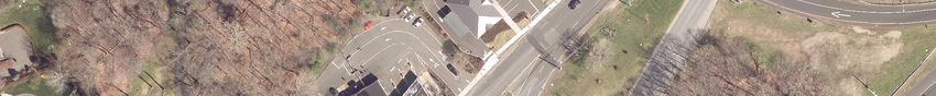
[                                                                                            e
                                                                                                       1)

                                                            Ri
                                                                                                Rt

                                                              ch
                                                                                               (
                                                                                           d

                                                              m
                                                                                        tR

                                                               on
                                                                                     s
                                                                                   Po

                                                                   d
                                                                   Dr
                                                                             ton
                                                                         Bos

                                                              1)
                                                             te
                                                            (R
                                                        Rd
                                                       st
                                                       Po
                                                   on
                                                  st
                                                  Bo
  Bi
       rc

                                           SITE
        h
              Rd

                   1)
                  te
               (R
              Rd
        st
       Po
   n
  to
   s
Bo

                                                            LEGEND

  0    37.5   75      150   225   300                              Study Area Intersection
                                    Feet

                                                                                    Figure 1
                                                                          Site Location Map
                                                   Proposed Convenience Store & Gas Station
                                                                        Darien, Connecticut
Traffic Impact Study
Convenience Store and Gas Station
Darien, Connecticut
Study Methodology
This traffic impact study evaluates existing and projected traffic operations within the study
area for the weekday morning and weekday afternoon peak hour traffic conditions when the
combination of the adjacent roadway volumes and projected project trips would be expected to
be greatest.
The study was conducted in three steps. The first step consisted of an inventory of existing
traffic conditions within the project study area. As part of this inventory, historic automatic
traffic recorder counts (ATRs) and manual turning movement counts (TMCs) were obtained
from the Connecticut Department of Transportation (CTDOT) at key intersections in the study
area for the weekday morning and weekday afternoon peak hours. These count data were
expanded to the existing year 2020 equivalent based on observed traffic growth in the vicinity of
the Project. A field visit was also completed to document intersection and roadway geometries,
posted speed limits, and available sight distance at the site driveway. Crash data for the study
area intersections were obtained from the CTDOT to determine if the study area has any
existing traffic safety deficiencies.
The second step of the study builds upon the data collected in the first step to establish the basis
for evaluating potential transportation impacts associated with the projected future conditions.
During this second step, the projected traffic demands associated with any planned future
developments that could influence traffic volumes at the study area intersections were assessed.
The 2020 Existing traffic volumes were forecasted to the future year 2022 to determine 2022
Background (without project) conditions and 2022 Combined (with project) conditions.
The third step of this study determined if measures were necessary to improve existing or
future traffic operations and safety, minimize potential traffic impacts, and provide safe and
efficient access to the proposed project site. An evaluation of site access, circulation and egress
for fuel delivery trucks was conducted in the third step.
Study Area Intersections
Based on a review of the anticipated traffic generating characteristics of the Project and a review
of the adjacent roadways serving the project site, the following study area intersections were
selected for detailed analysis:
US Route 1 at I‐95 Southbound Off‐Ramp (Exit 13);
US Route 1 at I‐95 Southbound On‐Ramp;
US Route 1 at Proposed Site Driveway.
The traffic impact study presented in this report documents existing and future traffic
conditions for the study area intersections noted above.
4
Traffic Impact Study
                                                                Convenience Store and Gas Station
                                                                             Darien, Connecticut

EXISTING CONDITIONS

An accurate assessment of the potential traffic impacts associated with the Project requires a
comprehensive understanding of the existing traffic conditions within the study area. The
existing conditions assessment included in this study consists of an inventory of intersection
and roadway geometries, an inventory of traffic control devices, the collection of historic
traffic volume data in the study area, and a review of recent crash data. The existing
conditions in the vicinity of the project site are summarized below.

Roadway Network and Intersections

The project site benefits from excellent access via the local and regional roadway system. A brief
description of the principal roadways providing access to the project site is presented below.

Boston Post Road (US Route 1)
US Route 1 generally runs in the north/south direction through the study area, and is
classified as an urban principal arterial under CTDOT jurisdiction. Land uses along US Route
1 in the vicinity of the proposed site are almost exclusively commercial/service related, and
the posted speed limit is 35 mph in the northbound direction through the study area. There
is no posted speed limit in the southbound direction through the study area. Based on the
characteristics of the US Route 1 corridor the southbound speed limit is considered to be 35
mph.

North of the proposed site, US Route 1 generally provides two travel lanes in each direction
measuring between approximately 11 and 12 feet in width in the vicinity of the study area.
Marked shoulders are provided on this section of US Route 1, and measure between three
and seven feet in width. Concrete sidewalks measuring approximately 4.5 feet in width are
provided on the west side of the roadway. Curb ramps are generally provided on the
sidewalks at intersections along the US Route 1 corridor, and there are no controlled or
uncontrolled pedestrian crossings within the study area.

South of the proposed site, US Route 1 provides one travel lane in each direction, each
measuring approximately 16 feet in width. Marked shoulders are also provided on this section
of US Route 1, and measure between 7.5 feet and 8.5 feet in width. Concrete sidewalks
measuring between four and five feet in width are provided on both sides of the roadway.

                                                5
Traffic Impact Study
                                                              Convenience Store and Gas Station
                                                                           Darien, Connecticut

Signalized Intersections

US Route 1 at I‐95 Southbound On‐Ramp
The intersection of US Route 1 and the I‐95 Southbound On‐Ramp is a two‐way signalized
intersection under CTDOT jurisdiction located approximately 300 feet north of the site
driveway. At the intersection, US Route 1 is oriented in the eastbound direction, whereas the
I‐195 Southbound On‐Ramp has a southbound orientation. The eastbound US Route 1
approach consists of two through lanes and a channelized right‐turn lane under yield
control. The southbound approach consists of an exclusive through lane and a shared
through/right‐turn lane.

The signal is pre‐timed and operates with two phases for vehicular traffic, including a phase
for eastbound movements on US Route 1 and a phase for southbound movements onto the I‐
95 Southbound On‐Ramp. Pedestrian accommodations are not present at the intersection.

The traffic signal equipment at the intersection of US Route 1 and the I‐95 Southbound On‐
Ramp is currently undergoing modification as part of a larger corridor‐wide optimization
project being conducted by CTDOT. Based on a signal plan of the proposed improvements,
provided by CTDOT and dated April 11, 2018, the existing loop detection at the intersection
is being converted to 360‐degree video detection, and the signal timings will be optimized as
part of a closed‐loop system containing nine other intersections. According to the plan, signal
coordination parameters would be determined by the closed‐loop coordination unit,
meaning that these parameters would change automatically based on intersection volumes.
Based on correspondence with CTDOT regarding these improvements, the modifications to
the signal are expected to be completed in the 2020 construction season. As such, these
modifications were included in the 2020 Existing conditions model, as well as the future
conditions models.

Unsignalized Intersections

US Route 1 at I‐95 Southbound Off‐Ramp (Exit 13)
The intersection of US Route 1 at the I‐95 Southbound Off‐Ramp (Exit 13) is four‐way
unsignalized intersection located approximately 750 feet north of the site driveway. The
westbound I‐95 Southbound Off‐Ramp approach consists of a shared through/right‐turn lane
under stop control. The US Route 1 northbound approach consists of an exclusive through
lane and a shared through/left‐turn lane without any traffic control. The US Route 1
southbound approach consists of two through lanes: the right lane continues south on US
Route 1, and the left lane continues south towards the signalized intersection at the I‐95
Southbound On‐Ramp. The eastbound approach to the intersection is formed by the existing
gas station driveway onto US Route 1 Southbound.

                                              6
Traffic Impact Study
                                                              Convenience Store and Gas Station
                                                                           Darien, Connecticut

Opposing travel directions on US Route 1 at this intersection are separated by a large grass
median. Westbound left‐turning vehicles leaving the Off‐Ramp must stop for northbound
traffic on US Route 1 before proceeding forward to access an additional stop‐controlled
intersection, where they must stop again for southbound traffic on US Route 1. The paved
median provides approximately 40 feet of storage for left‐turning vehicles.

Public Transportation

The Project is served by Connecticut Transit (CT Transit) Bus Route 341, which provides
weekday and weekend service between the Stamford Transit Center and the Norwalk Mall
via US Route 1. Weekday service is provided between 5:00 AM and 12:00 AM, and Saturday
service is provided between 5:45 AM and 9:00 PM. Limited service is provided on Sundays
between 7:30 AM and 7:00 PM. CT Transit stops are located on US Route 1 directly adjacent
to the Project site in the northbound and southbound directions, and sidewalk connections
between the site and the bus stops are available.

Field Review

A field review of the existing study area was conducted on Wednesday, May 27, 2020. This
review included the documentation of lane widths and traffic control devices, sight distance
from the existing full‐access driveway, posted speed limits and general traffic operations.
Traffic signal timings at the I‐95 Southbound On‐Ramp were obtained manually using a
stopwatch.

Existing Traffic Volumes

Existing Peak Hour Traffic Volumes
Current traffic volumes in the study area are below average due to travel restrictions
imposed by the ongoing COVID‐19 pandemic. As such, turning movement count (TMC)
data could not be obtained, and historic data was provided by CTDOT for use in this study.
To assess peak hour traffic conditions, historic TMC data at the study area intersections were
obtained from CTDOT for the weekday morning peak period (7:00 AM to 9:00 AM) and the
weekday afternoon peak period (4:00 PM to 6:00 PM). The data at the I‐95 Southbound On‐
Ramp were collected on Wednesday, June 29, 2016. TMC data at the I‐95 Southbound Off‐
Ramp were collected on Thursday, October 27, 2016. An annual growth rate of 0.6 per year,
compounded annually, was established in conjunction with CTDOT to equate the 2016
counted volumes to the 2020 Existing traffic volumes. This growth rate was provided by
CTDOT, and is based on historic traffic count data obtained in the vicinity of the Project.

                                              7
Traffic Impact Study
Convenience Store and Gas Station
Darien, Connecticut
The results of the turning movement counts are tabulated by 15‐minute periods and are
provided in Appendix A of this report. The four highest consecutive 15‐minute intervals
during each of these count periods constitute the peak hours that are the basis of the traffic
analysis provided in this report. According to the peak period traffic data, the weekday
morning peak hour occurs between 8:00 AM and 9:00 AM, and the weekday afternoon peak
hour occurs between 5:00 PM and 6:00 PM.
As mentioned previously, the proposed site is currently occupied by a fully‐operational fast‐
food restaurant, and a fitness studio is located on the west side of US Route 1 directly across
from the site. Historic traffic count data was not available at the driveways of these existing
businesses. Therefore, traffic volumes entering and exiting these sites under existing
conditions were estimated using vehicle trip generation data from the Institute of
Transportation Engineers’ (ITE) publication, Trip Generation Manual, 10th Edition. This
methodology is discussed further in subsequent sections of this report.
Seasonal Variation
In order to account for seasonal variation in traffic volumes, seasonal adjustment factors
were obtained from CTDOT for the study area. The seasonal factors are multiplicative factors
that are calculated based on CTDOT traffic data, and are categorized as interstate, urban,
rural, or recreational. Urban factors were reviewed for the purposes of this study, and are
provided in Appendix B of this report.
Based on the seasonal adjustment trends of the data, traffic counts collected in the vicinity of
the study area during the months of June are approximately 11.0 percent higher than those
collected in the average month. Similarly, traffic counts collected in October are
approximately 7.0 percent higher than those collected in the average month. Therefore, to
provide a conservative analysis, the existing peak hour TMCs were not seasonally adjusted.
The peak hourly traffic flows for the 2020 Existing conditions are depicted in Figures 2 and 3
for the weekday morning and weekday afternoon peak hours, respectively.
8[
B
)N
E1
31
(RT
14 1)
Ri
3 te
RD
I-1
95
(R
ch
SB
T
OF
OS
Rd
m
F-R
AM
P
on
P
t
ON
s
Po
d
ST
22
4
BO
Dr
on
26
t
24
90
os
13
B
SB
1)
18
TE
0
(R
I-1 14
95 7
RD
O
FF SB
ST
-R
PO AM
P
N
O
ST
BO
56 0
1
77
1)
te
DR
IV
(R
EW 29
1)
AY
TE
0
Rd
(R
1 54
0
RD
SI
st
TE
1
ST
Po
DR
IV
PO
EW
on
AY
ON
ST
st
1
BO
5
Bo
40
30
Bi
rc
h
Rd
1)
te
705
(R
5
Rd
BOSTON PO
ST RD
st
(RTE 1)
Po
281
ON-RAMP
I-195 SB
154
on
st
Bo
0 37.5 75 150 225 300
Feet
Figure 2
2020 Existing Weekday Morning Peak Hour Traffic Volumes
Proposed Convenience Store & Gas Station
Darien, Connecticut[
B
)N
E1
20
(RT
1)
6
17
Ri
5
te
RD
I-1
95
(R
ch
SB
T
OF
OS
Rd
m
F-R
AM
P
on
P
t
ON
s
Po
d
ST
25
6
BO
Dr
on
75
t
20
33
os
10
B
SB
1)
23
TE
0
(R
I-1 17
95 7
RD
O
FF SB
ST
-R
PO AM
P
N
O
ST
BO
30 3
6
61
1)
te
DR
IV
(R
EW 38
1)
AY
TE
0
Rd
(R
7 28
0
RD
SI
st
TE
5
ST
Po
DR
IV
PO
EW
on
AY
ON
ST
st
9
BO
3
Bo
81
41
Bi
rc
h
Rd
1)
549
te
14
(R
Rd
BOSTON PO
ST RD
st
(RTE 1)
Po
767
ON-RAMP
I-195 SB
on
91
st
Bo
0 37.5 75 150 225 300
Feet
Figure 3
2020 Existing Weekday Afternoon Peak Hour Traffic Volumes
Proposed Convenience Store & Gas Station
Darien, ConnecticutTraffic Impact Study
Convenience Store and Gas Station
Darien, Connecticut
Crash Summary
Crash data for the study area intersections were obtained from the Connecticut Crash Data
Repository, which is comprised of data from CTDOT and the Department of Public Safety
(DPS). Data were collected for the most recent three‐year period available, which includes
yearly crash summaries for 2017 through 2019. A summary of the crash data is presented in
Appendix C.
The crash rates at the study area intersections were calculated to determine whether the crash
frequencies at the study area intersection were unusually high given the travel demand. The
intersection crash rate is expressed in crashes per million entering vehicles (MEV).
The signalized intersection of US Route 1 and the I‐95 Southbound On‐Ramp experienced a
total of four reported crashes over the three‐year period analyzed, resulting in a crash rate of
0.12 crashes per MEV. Two reported crashes were single‐vehicle collisions, one was a rear‐end
collision, and one was a sideswipe collision. Two crashes resulted in personal injury, and two
resulted in property damage only. No fatal crashes were reported at the intersection. One of the
single‐vehicle collisions at the intersection was given an “A” rating on the KABCO scale,
indicating that a serious or incapacitating injury was suspected at the time of reporting. Limited
details on this collision were provided by the Crash Data Repository, which indicated that the
crash involved a collision with a utility pole under dark, lighted conditions and did not occur
directly at the intersection. As such, it is anticipated that this crash is the result of driver
behavior, and is not related to the inherent geometric properties of the intersection. The
proportion of crash types at the intersection relative to the total is shown in Figure 4 below.
Based on the low observed crash rate, there are no immediate safety concerns at the signalized
intersection.
Figure 4: Crash Types at US Route 1 and I‐95 Southbound On‐Ramp
25%
50%
25%
Rear‐end Sideswipe Single‐Vehicle
11Traffic Impact Study
Convenience Store and Gas Station
Darien, Connecticut
The unsignalized intersection of US Route 1 and the I‐95 Southbound Off‐Ramp (Exit 13) had a
total of 12 reported crashes over the three‐year period analyzed, resulting in a crash rate of 0.20
crashes per MEV. A total of five crashes were angle collisions, five were rear‐end collisions, and
two were sideswipe collisions. Two crashes resulted in personal injury, with the remaining 10
crashes resulting in property damage only. No fatal crashes were reported at the intersection.
The proportion of crash types at the intersection relative to the total is shown in Figure 5 below.
Similar to the previous intersection, the low observed crash rate indicated that there are no
immediate safety concerns at the unsignalized intersection.
Figure 5: Crash Types at US Route 1 and I‐95 Southbound Off‐Ramp (Exit 13)
17%
41%
42%
Angle Rear‐end Sideswipe
The unsignalized intersection of US Route 1 and the site driveway had a total of three reported
crashes over the three‐year period analyzed, resulting in a crash rate of 0.09 crashes per MEV.
This intersection experienced one of each of the following collision types: angle, rear‐end and
sideswipe. All three crashes resulted in property damage only, and there were no injuries or
fatal crashes were reported at the intersection. The overall results of the crash analysis indicate
that there are no immediate safety concerns at the site driveway.
12Traffic Impact Study
Convenience Store and Gas Station
Darien, Connecticut
FUTURE CONDITIONS
To determine future traffic demands on the study area roadways and intersections, the 2020
Existing traffic volumes were projected to the future year 2022. Traffic volumes on the study
area roadways in 2022 are assumed to include all existing traffic, as well as new traffic resulting
from general growth in the study area and from other planned development projects,
independent of the proposed project. The potential background traffic growth, unrelated to the
proposed project, was considered in the development of the 2022 Background (without project)
peak hour traffic volumes. The estimated traffic increases associated with the proposed project
were then added to the 2022 Background volumes to reflect the 2022 Combined (with project)
traffic conditions. A more detailed description of the development of the 2022 Background and
2022 Combined traffic volume networks is presented below.
Future Roadway Improvements
Planned roadway improvement projects can impact travel patterns and future traffic
operations. The CTDOT Bureau of Policy and Planning was consulted to develop an
understanding of future area roadway improvement projects. According to CTDOT, there
are no planned roadway improvement projects in the study area that would impact traffic
operations.
Background Traffic Growth
Traffic growth is generally a function of changes in motor vehicle use and expected land
development within the area. In order to predict the rate at which traffic on the study area
roadways can be expected to grow during the two‐year forecast period (2020 to 2022), both
planned area developments and historic traffic growth were reviewed.
Historic Traffic Growth
To project the 2020 Existing traffic volumes into the future year 2022, an annual background
traffic growth rate was established in conjunction with CTDOT and the Town of Darien. The
Town of Darien Planning Department was consulted regarding the annual growth rate.
During a conversation on June 2, 2020, the Town noted that the existing Darien Crossing
professional office complex, located adjacent to the Project at 320/330 US Route 1, is currently
undergoing renovations. It is anticipated that many of the vacant offices in these buildings
will be leased in the near future. Additionally, the existing commercial space at 364 US Route
1, approximately 550 feet south of the Project, is currently undergoing redevelopment. The
exact scope of these redevelopment projects is unknown at this time, but the Town noted
that both projects may result in traffic increases on US Route 1. As such, the Town
recommended a more conservative growth rate of 1.0 percent per year. This background
growth rate of 1.0 percent per year, compounded annually, was selected to forecast increases
in traffic volumes on the study area roadways and intersections for the analysis of future
conditions.
13Traffic Impact Study
Convenience Store and Gas Station
Darien, Connecticut
Site‐Specific Growth
In addition to the aforementioned background traffic growth rate, the traffic volumes
associated with other proposed developments in the area were considered. As mentioned
previously, a background traffic growth rate of 1.0 percent per year was selected to account
for potential traffic increases associated with the Darien Crossing and 364 US Route 1
developments. According to the Town of Darien, there are no other proposed projects that
would impact traffic volumes in the study area.
The Norwalk city line is located approximately 0.5 miles to the north of the Project. As such,
proposed developments in the City of Norwalk were also considered as part of this study.
The City of Norwalk publishes a list of ongoing development projects on their website. This
list includes developments with pending applications, approved developments, and
developments that are currently under construction. For this study, the most recent project
list, dated May 1, 2020, was reviewed. All of the ongoing Norwalk projects in the list are
located outside of the study area, and are not expected to have a significant impact on traffic
operations in the vicinity of the Project. In addition, the Norwalk City Planner confirmed that
there are no developments along US Route 1 during a phone conversation on June 17, 2020.
2022 Background Traffic Volumes
The 2020 Existing peak hour traffic volumes were grown by 1.0 percent per year
(compounded annually) over the two‐year study horizon (2020 to 2022) to establish the 2022
Background traffic volumes, which are illustrated in Figures 6 and 7 for the weekday
morning and weekday afternoon peak hours, respectively, and are documented in the traffic
projection model presented in Appendix D of this report.
14[
B
)N
E1
32
(RT
14 1)
Ri
6
te
RD
I-1
95
(R
ch
SB
T
OF
OS
Rd
m
F-R
AM
P
on
P
t
ON
s
Po
d
ST
22
0
BO
Dr
on
27
t
24
19
os
14
B
SB
1)
18
TE
0
(R
I-1 15
95 0
RD
O
FF SB
ST
-R
PO AM
P
N
O
ST
BO
56 6
1
78
1)
te
DR
IV
(R
EW 29
1)
AY
TE
0
Rd
(R
1 54
0
RD
SI
st
TE
1
ST
Po
DR
IV
PO
EW
on
AY
ON
ST
st
1
BO
4
Bo
41
30
Bi
rc
h
Rd
1)
721
te
(R
5
Rd
BOSTON PO
ST RD
st
(RTE 1)
Po
287
ON-RAMP
I-195 SB
157
on
st
Bo
0 37.5 75 150 225 300
Feet
Figure 6
2022 Background Weekday Morning Peak Hour Traffic Volumes
Proposed Convenience Store & Gas Station
Darien, Connecticut[
B
)N
E1
21
(RT
17
0
1)
Ri
9 te
RD
I-1
95
(R
ch
SB
T
OF
OS
Rd
m
F-R
AM
P
on
P
t
ON
s
Po
d
ST
25
2
BO
Dr
on
77
t
20
56
os
10
B
SB
1)
23
TE
0
(R
I-1 18
95 1
RD
O
FF SB
ST
-R
PO AM
P
N
O
ST
BO
30 6
6
62
1)
te
DR
IV
(R
EW 38
1)
AY
TE
0
Rd
(R
7 28
0
RD
SI
st
TE
5
ST
Po
DR
IV
PO
EW
on
AY
ON
ST
st
9
BO
1
Bo
83
41
Bi
rc
h
Rd
1)
te
561
14
(R
Rd
BOSTON PO
ST RD
st
(RTE 1)
Po
783
ON-RAMP
I-195 SB
on
93
st
Bo
0 37.5 75 150 225 300
Feet
Figure 7
2022 Background Weekday Afternoon Peak Hour Traffic Volumes
Proposed Convenience Store & Gas Station
Darien, ConnecticutTraffic Impact Study
Convenience Store and Gas Station
Darien, Connecticut
Site‐Generated Traffic
In order to estimate the number of vehicle trips associated with the Project, the ITE publication,
Trip Generation Manual, 10th Edition, was referenced. ITE is a national research organization of
transportation professionals, and Trip Generation Manual, 10th Edition provides traffic generation
information for various land uses compiled from studies conducted by members nationwide.
Based on the most recent floor plan for the project, prepared by the Dimension Group and
dated July 8, 2020, the total footprint of the proposed convenience store and gas station is
approximately 4,050 square feet. Included in the total building footprint is a 365 square‐foot
foodservice counter. Vehicle trip estimates for the convenience store portion of the Project were
developed using ITE Land Use Codes (LUC) 960 (Super Convenience Market/Gas Station).
Vehicle trip estimates for the foodservice portion of the Project were developed using LUC 933
(Fast‐Food Restaurant without Drive‐Through). ITE data establishes vehicle trip rates based on
actual traffic counts conducted at similar existing land uses across the United States.
As mentioned previously, the existing fast‐food restaurant and drive‐through on the
proposed site are fully operational under existing conditions, and credit was taken for the
existing fast‐food restaurant on the site. Existing trips were subtracted from the existing site
and roadway network prior to adding in new trips for the proposed site. Historic TMCs were
not available at the existing fast‐food or fitness studio driveways. As such, the volumes
associated with the existing developments were approximated using ITE LUC 934 (Fast‐Food
Restaurant with Drive‐Through Window) and LUC 492 (Health/Fitness Club).
The vehicle trips expected to be generated by the Project during the weekday morning and
weekday afternoon peak hours are shown in Table 1 below.
Table 1: Convenience Store/Gas Station Vehicular Trip Generation
Weekday AM Weekday PM
Peak Hour Peak Hour
Description In Out Total In Out Total
Fast‐Food Restaurant (No Drive‐Through)1 6 4 10 5 5 10
Proposed Gas Station/Convenience Market2 168 168 336 138 138 276
3
Existing Fast Food Restaurant ‐86 ‐83 ‐169 ‐71 ‐66 ‐137
New Trip Subtotal 88 89 177 72 77 149
4
Pa ss‐by Trips ‐17 ‐17 ‐34 ‐15 ‐15 ‐30
New Trip Total 71 72 143 57 62 119
(1) ITE Land Use Code 933 (Fast‐Food Restaurant without Drive‐Through Window ), based on 365 s.f. gross floor area.
(2) ITE Land Use Code 960 (Super Convenience Market/Gas Station), based on 12 vehicle fueling positions.
(3) ITE Land Use Code 930 (Fast‐Food Restaurant with Drive‐Through Window), based on 4,204 s.f. gross floor area.
(4) Based on CTDOT standards, 20 percent of peak hour trips are attributed to ʺpass‐byʺ trips.
17Traffic Impact Study
Convenience Store and Gas Station
Darien, Connecticut
As shown in Table 1, the proposed Convenience Store/Gas Station is estimated to generate
approximately 143 new vehicle trips (71 entering vehicles and 72 exiting vehicles) during the
weekday morning peak hour and approximately 119 new vehicle trips (57 entering vehicles
and 62 exiting vehicles) during the weekday afternoon peak hour.
Not all trips to convenience markets with gasoline pumps are “new” trips. In fact, a
significant portion of the total trips attracted to such retail uses are “pass‐by” trips. Since
pass‐by traffic is already on the adjacent roadways, this portion of the total development
traffic is reflected in the existing, base traffic volumes, and does not represent additional
traffic on the roadway network. Therefore, the total traffic volume associated with the Project
is reduced by the pass‐by volume to estimate the “new” traffic generated by the proposed
development. According to the ITE Trip Generation Handbook, 3rd Edition, a pass‐by rate of 76
percent is recommended for LUC 960. However, CTDOT Traffic Impact Assessment
guidelines permit up to a 20‐percent pass‐by reduction of new project trips for sites whose
access or egress is located on a state roadway. US Route 1 is under CTDOT jurisdiction, so
the 20‐percent reduction was applied to the New Trip Subtotal in Table 1 to approximate the
net total new trips for the Project.
Project Site Distribution and Assignment
The traffic projected to be generated by the Project was distributed onto the study area
roadways and intersections based on the existing travel patterns of the adjacent roadways
and logical routes for site patrons. The resulting arrival and departure patterns are presented
in Figure 8 and are documented in the traffic projection model found in Appendix D.
The project‐related traffic was assigned to the surrounding roadway network based on the
project trip distribution patterns presented in Figure 8. The resulting distributed project trips
are shown in 9 and 10 for the weekday morning and weekday afternoon peak hours,
respectively.
2022 Combined Traffic Volumes
To establish the 2022 Combined peak hour traffic volumes, the distributed project trips were
added to the 2022 Background peak hour traffic volumes. The resulting 2022 Combined
weekday morning and weekday afternoon peak hour traffic volumes are presented in Figure
11 and 12, respectively, and are documented in the traffic projection model presented in
Appendix D of this report.
18[ Rt
e
1)
Ri
(
ch
d
tR
m
s
on
Po
d
on
Dr
t
Bos
50%
30%
1)
te
(R
Rd
st
Po
on
st
Bo
30%
Bi
20%
rc
SITE
h
Rd
1)
te
(R
d
tR
s
Po
on
st
Bo
LEGEND
0 37.5 75 150 225 300 Study Area Intersection
Feet
Figure 8
Directions of Arrival and Departure
Proposed Convenience Store & Gas Station
Darien, Connecticut[
B
)N
E1
(RT
42 1)
Ri
(0) te
RD
I-1
95
(R
ch
SB
T
OF
OS
Rd
m
F-R
AM
P
on
P
t
ON
s
Po
)
d
ST
69
BO
Dr
0(
on
)
(0 t
70
B os
SB
1)
TE
(R
I-1 42
95 (0
RD
O
FF SB )
ST
-R
PO AM
P
N
O
ST
BO
)
(0
1)
2
11
te
DR
IV
(R
EW
1)
AY
TE
0(
Rd
(R
1
0 ( 10)
RD
SI 28
st
TE
)
ST
Po
DR
IV
PO
EW
on
AY
ON
)
(0
ST
st
BO
28
Bo
Bi
rc
h
Rd
1)
te
(R
BOSTON PO
ST RD (RTE 1)
Rd
0 (69)
ON-RAMP
I-195 SB
st
0 (41)
Po
on
st
Bo
LEGEND
0 37.5 75 150 225 300
Feet Enter (Exit)
Figure 9
2022 Combined Weekday Morning Peak Hour New Project Trips
Proposed Convenience Store & Gas Station
Darien, Connecticut[
B
)N
E1
1)
(RT
35
Ri
(0) e
Rt
RD
I-1
95
ch
SB
(
T
OF
d
OS
m
F-R
tR
AM
P
on
P
ON
s
)
Po
57
d
ST
BO
0(
Dr
t on
)
(0
os
57
B
SB
1)
TE
(R
I-1 35
95 (0
RD
O
FF SB )
ST
-R
PO AM
P
N
O
ST
BO
(0)
1)
92
te
DR
IV
(R
EW
1)
AY
TE
0(
Rd
(R
0 ( 92)
RD
SI 23
st
TE
)
ST
Po
DR
IV
PO
EW
on
AY
ON
)
(0
ST
st
BO
23
Bo
Bi
rc
h
Rd
1)
te
(R
d
tR
BOSTON PO
ST RD
s
(RTE 1)
Po
0 (57)
ON-RAMP
I-195 SB
on
0 (35)
st
Bo
0 37.5 75 150 225 300
Feet
Figure 10
2022 Combined Weekday Afternoon Peak Hour New Project Trips
Proposed Convenience Store & Gas Station
Darien, Connecticut[
B
)N
E1
32
1)
(RT
18
e
Ri
8
Rt
RD
I-1
95
ch
SB
(
T
OF
Rd
OS
m
F-R
AM
P
t
on
P
ON
s
Po
d
ST
22
0
BO
Dr
on
32
t
24
33
os
14
B
SB
1)
18
TE
0
(R
I-1 19
95 2
RD
O
FF SB
ST
-R
PO AM
P
N
O
ST
BO
13 7
1
76
9
1)
te
DR
IV 12
(R
EW
1)
AY 5
TE
0
Rd
(R
1 47
0
RD
SI
st
TE
1
ST
Po
DR
IV
PO
EW
on
AY
ON
ST
st
1
BO
7
Bo
40
35
Bi
rc
h
Rd
1)
te
713
(R
5
Rd
BOSTON PO
st
ST RD (RTE 1)
Po
337
ON-RAMP
I-195 SB
on
196
st
Bo
0 37.5 75 150 225 300
Feet
Figure 11
2022 Combined Weekday Morning Peak Hour Traffic Volumes
Proposed Convenience Store & Gas Station
Darien, Connecticut[
B
)N
E1
21
(RT
21
0
1)
Ri
4
te
RD
I-1
95
(R
ch
SB
T
OF
OS
Rd
m
F-R
AM
P
on
P
t
ON
s
Po
d
ST
25
5
BO
Dr
on
79
t
20
83
os
10
B
SB
1)
23
TE
0
(R
I-1 21
95 6
RD
O
FF SB
ST
-R
PO AM
P
N
O
ST
BO
11 0
6
61
4
1)
te
DR
IV
(R
EW 10
1)
AY 4
TE
0
Rd
(R
7 39
0
RD
SI
st
TE
5
ST
Po
DR
IV
PO
EW
on
AY
ON
ST
st
9
BO
5
Bo
82
29
Bi
rc
h
Rd
1)
555
te
14
(R
Rd
BOSTON PO
ST RD
st
(RTE 1)
Po
806
ON-RAMP
I-195 SB
130
on
st
Bo
0 37.5 75 150 225 300
Feet
Figure 12
2022 Combined Weekday Afternoon Peak Hour Traffic Volumes
Proposed Convenience Store & Gas Station
Darien, ConnecticutTraffic Impact Study
Convenience Store and Gas Station
Darien, Connecticut
TRAFFIC OPERATIONS ANALYSIS
In previous sections of this report, the quantity of traffic at the study area intersections has been
discussed. This section describes the overall quality of the traffic flow at the study area
intersections during the weekday morning and weekday afternoon peak hours. As a basis for
this assessment, intersection capacity analyses were conducted using the Synchro capacity
analysis software at the study area intersections under the 2020 Existing, 2022 Background and
2022 Combined peak hour traffic conditions. The analysis is based on Synchro capacity analysis
methodologies and procedures contained in the Highway Capacity Manual, 6th Edition (HCM),
which is summarized in Appendix E. A discussion of the evaluation criteria and a summary of
the results of the capacity analyses are presented below.
Level‐of‐Service Criteria
Average total vehicle delay is reported as level‐of‐service (LOS) on a scale of A to F. LOS A
represents delays of 10 seconds or less and LOS F represents delays in excess of 50 seconds and
80 seconds for unsignalized and signalized movements, respectively. A more detailed
description of the LOS criteria is provided in Appendix E.
Capacity Analysis Results
Intersection capacity analyses were conducted using Synchro capacity analysis software for the
study area intersections to evaluate the 2020 Existing, 2022 Background and 2022 Combined
traffic conditions. As mentioned previously, the peak hour traffic volumes utilized as part of
this analysis are provided in the traffic projection model, attached in Appendix D of this report.
The Synchro capacity analysis results for the 2020 Existing, 2022 Background and 2022
Combined traffic conditions are presented in Appendix F, Appendix G, and Appendix H,
respectively. For this study, two site driveway configurations were analyzed: a shared
left‐turn/right‐turn lane, and separate left‐turn and right‐turn lanes. The overall results of the
intersection capacity analysis for the study area intersections are presented in Table 3 below. A
more detailed summary of the capacity analysis for each study area intersection is provided in
Appendix I. The results of the specific capacity analysis at the study area intersections are
discussed below.
24Traffic Impact Study
Convenience Store and Gas Station
Darien, Connecticut
Table 2: Intersection Capacity Analysis Results
Existing 2020 Background 2022 Combined 2022
Weekday AM Weekday PM Weekday AM Weekday PM Weekday AM Weekday PM
Intersection Movement LOS1 Delay2 V/C3 LOS Delay V/C LOS Delay V/C LOS Delay V/C LOS Delay V/C LOS Delay V/C
Boston Post Road (US Route 1) at EB LTR D 29.5 0.02 F 50.5 0.14 D 30.7 0.02 E 49.0 0.13 F 51.3 0.03 F 104.3 0.26
Site Driveway (Shared Lane) WB LTR F 66.5 0.64 F 64.1 0.56 F 73.6 0.67 F 64.1 0.56 F 124.8 1.02 F 226.8 1.24
NB LTR A 0.0 0.00 A 0.1 0.01 A 0.0 0.00 A 0.1 0.01 A 0.0 0.00 A 0.1 0.01
SB LTR A 0.6 0.06 A 0.5 0.05 A 0.6 0.06 A 0.5 0.04 A 1.4 0.14 B 1.7 0.16
Boston Post Road (US Route 1) at EB LTR n/a n/a n/a n/a n/a n/a n/a n/a n/a n/a n/a n/a F 51.3 0.03 F 104.3 0.26
Site Driveway (Separate Lanes) WB LT n/a n/a n/a n/a n/a n/a n/a n/a n/a n/a n/a n/a F 160.2 0.79 F 237.2 0.90
R n/a n/a n/a n/a n/a n/a n/a n/a n/a n/a n/a n/a B 13.3 0.24 C 21.2 0.34
NB LTR n/a n/a n/a n/a n/a n/a n/a n/a n/a n/a n/a n/a A 0.0 0.00 A 0.1 0.01
SB LTR n/a n/a n/a n/a n/a n/a n/a n/a n/a n/a n/a n/a A 1.4 0.14 A 1.7 0.16
Boston Post Road at EB T A 8.6 0.22 A 9.1 0.51 A 8.8 0.23 A 8.6 0.49 A 9.0 0.27 A 8.7 0.50
I‐95 SB Entrance Ramp R A 0.1 0.10 A 0.1 0.05 A 0.1 0.11 A 0.1 0.05 A 0.2 0.13 A 0.1 0.07
SB LT B 15.8 0.71 B 12.9 0.55 B 15.3 0.70 B 14.3 0.62 B 15.3 0.70 B 14.2 0.61
Overall B 11.8 0.43 B 10.1 0.45 B 11.6 0.43 B 10.3 0.46 B 11.2 0.43 B 10.1 0.46
Boston Post Road (US Route 1) NB at WB TR B 10.5 0.23 C 23.4 0.70 B 10.6 0.24 D 25.0 0.72 B 11.0 0.31 D 31.1 0.80
I‐95 SB Exit Ramp NB LT A 0.0 0.00 A 0.0 0.00 A 0.0 0.00 A 0.0 0.00 A 0.0 0.00 A 0.0 0.00
Boston Post Road (US Route 1) SB at EB R n/a n/a n/a n/a n/a n/a n/a n/a n/a n/a n/a n/a n/a n/a n/a n/a n/a n/a
I‐95 SB Exit Ramp WB LT E 45.8 0.71 E 35.2 0.69 F 50.3 0.74 E 38.0 0.72 F 77.6 0.92 F 53.9 0.85
SB TR A 0.0 0.00 A 0.0 0.00 A 0.0 0.00 A 0.0 0.00 A 0.0 0.00 A 0.0 0.00
1 Le ve l‐of‐Se rvice
2 Ave rage ve hicle de lay in se conds
3 Volume to capacity ratio
n/a Not Applicable
25Traffic Impact Study
Convenience Store and Gas Station
Darien, Connecticut
US Route 1 at Site Driveway
Under Existing conditions, the site driveway operates at LOS F during the weekday morning and
weekday afternoon peak hours. The adjacent fitness studio driveway operates at LOS D during the
weekday morning peak hour and LOS F during the weekday afternoon peak hour. The
northbound and southbound US Route 1 approaches operate at LOS A during both peak hours
analyzed. Operations are expected to be similar under 2022 Background conditions. The site
driveway is expected to continue operating at LOS F during both peak hours, and the fitness
studio driveway is expected to operate at LOS D and LOS E during the weekday morning and
weekday afternoon peak hours, respectively.
Two configurations were analyzed for the site driveway under 2022 Combined conditions: a
shared‐use lane for all egress movements, and separated through/left and right‐turn egress lanes.
With the single shared‐use lane configuration that exists at the site today, the site driveway is
expected to continue operating at LOS F under 2022 Combined conditions, with calculated delays
and queueing being significantly higher than existing conditions. Additionally, the site driveway is
expected to operate over capacity during both peak hours with the shared‐lane configuration.
Operations at the fitness studio driveway are expected to worsen under 2022 Combined
conditions; the driveway is expected to operate at LOS F during the weekday morning and
weekday afternoon peak hours. Northbound and southbound through movements on US Route 1
are expected to continue operating at LOS A under 2022 Combined conditions.
With the separated‐lane configuration, left‐turning/through movements from the site driveway are
expected to operate at LOS F during the weekday morning and weekday afternoon peak hours.
Right‐turning movements are expected to operate at LOS B during the weekday morning peak
hour and LOS C during the weekday afternoon peak hour. Because left turns, right turns and
through movements are not confined to a single lane with this configuration, the 95th percentile
queue lengths for vehicles exiting the site would be lower than those with the single lane
configuration, allowing for improved site circulation and reduced delay for right‐turning vehicles.
Northbound and southbound through movements on US Route 1 are expected to continue
operating at LOS A during both peak hours analyzed.
Although the site driveway is expected to operate at LOS F under 2022 Combined conditions, it
would also operate below capacity during both peak hours analyzed with the separated
through/left and right‐turn lanes. The 95th percentile queue length for left turns out of the site
driveway is not expected to exceed 3.7 vehicles, for which there is sufficient storage on the site. The
vehicle delay and queueing at the site driveway would be internal to the site, and would therefore
not affect traffic operations on US Route 1. Furthermore, exiting drivers who would normally
make a left turn out of the site would have the option of turning right and utilizing the turnaround
at Exit 13 to continue southbound on US Route 1.
26Traffic Impact Study
Convenience Store and Gas Station
Darien, Connecticut
US Route 1 at the I‐95 Southbound On‐Ramp
The signalized intersection of US Route 1 and US Route 1 currently operates at overall LOS B
during the weekday morning and weekday afternoon peak hours. The intersection is expected to
continue operating at overall LOS B during both peak hours under 2022 Background and 2022
Combined conditions, experiencing negligible changes in overall average vehicle delay. The
intersection currently operates below capacity, and is expected to continue operating below
capacity during both peak hours and under all conditions analyzed.
As mentioned previously, the intersection of US Route 1 and the I‐95 Southbound On‐Ramp is
planned to be modified during the 2020 construction season, and the planned improvements are
reflected under existing conditions. These modifications include the installation of 360‐degree
video detection and implementation of corridor‐wide signal timing and coordination
optimizations. The US Route 1/I‐95 Southbound On‐Ramp intersection would be part of a closed‐
loop adaptive signal system, meaning that coordination parameters would be automatically
determined based on traffic volumes at the intersection and elsewhere along the corridor. To reflect
these automatic adjustments, signal timings at the intersection were optimized for the 2020
Existing, 2022 Background and 2022 Combined capacity analysis models.
US Route 1 at the I‐95 Southbound Off‐Ramp (Exit 13)
Under Existing conditions, westbound movements from the unsignalized intersection of US Route
1 Northbound at the I‐95 Southbound Off‐Ramp operate at LOS B and LOS C during the weekday
morning and weekday afternoon peak hours, respectively. Under 2022 Background conditions,
these movements are expected to operate at LOS B and LOS D during the weekday morning and
weekday afternoon peak hours, respectively, and would be expected to continue operating as such
under 2022 Combined conditions. The critical westbound movement would only experience minor
increases in delay between 2022 Background and 2022 Combined conditions.
Critical westbound movements at the unsignalized intersection of US Route 1 Southbound at the I‐
95 Southbound Off‐Ramp currently operate at LOS E during the weekday morning and weekday
afternoon peak hours. Under 2022 Background conditions, these critical movements are expected
to operate at LOS F and LOS E during the weekday morning and weekday afternoon peak hours,
respectively, and would be expected to continue operating as such under 2022 Combined
conditions. The increases in delay experienced by westbound movements between 2022
Background and 2022 Combined are minor overall, and the addition of Project traffic onto the
roadway network does not appear to have a significant effect on these intersections.
Sight Access/Circulation
Access to the proposed site would continue to be provided by the existing site driveway on US
Route 1. The site proposes a total of six gasoline pumps (12 fueling positions) aligned parallel to
US Route 1, which is expected to allow for safe, efficient circulation around the site.
27Traffic Impact Study
Convenience Store and Gas Station
Darien, Connecticut
The site geometry was evaluated using a fuel delivery truck design vehicle. The truck is almost
identical in size to an WB‐50, as defined by the American Association of State Highway and
Transportation Officials (AASHTO). Based on this wheel path analysis, the proposed site and
driveway can reasonably accommodate fuel delivery trucks without any encroachment on
parking spaces within the site. Due to the geometry of the site driveway, some encroachment on
opposing driveway travel lanes is expected, although fuel deliveries would occur infrequently,
thereby minimizing conflicts with other entering and exiting vehicles.
Sight Distance
A field review of the available sight distance was conducted at the location of the full‐access site
driveway on US Route 1. The AASHTO publication, A Policy on Geometric Design, 2011 Edition,
defines minimum and desirable sight distances at intersections. According to CTDOT
standards, the minimum sight distance is based on the recommended intersection sight distance
(ISD) for vehicles traveling along the main road. The ISD allows vehicles to enter the main street
traffic flow without requiring the mainline traffic to slow to less than 70 percent of their speed.
In addition, CTDOT standards state that sight lines for drivers may not cross over adjacent
properties or parking areas.
Table 3 summarizes these sight distance standards for the approximate 85th percentile speeds
and the available sight distance at the site driveway on US Route 1. The approximated 85th
percentile speed on US Route 1 used for the calculations is 40 mph, and was determined by
adding five mph to the posted speed limit of 35 mph. At the time of the field review, the ISD
was measured assuming that the driveway would utilize a single shared‐use egress lane.
However, it is not expected that sight lines from the driveway would change significantly with
implementation of the separated lanes.
Table 3: Sight Distance Requirements
85th %
Site Driveway Speed ISD1 Sight Distance
Location Looking (mph) Recommended (ft) Measured (ft) Meets ISD?
Boston Post Road (US
Left (South) 40 445 470 Yes
Route 1)
Right (North) 40 445 >700 Yes
(1) Inte rse ction sight distance (se e AASHTO e quations 9‐1 and 9‐2) for the de sign spe e d or 85th pe rce ntile
spe e d.
28Traffic Impact Study
Convenience Store and Gas Station
Darien, Connecticut
As shown in Table 3, the available sight distance exiting the full‐access site driveway exceeds
the CTDOT requirements for ISD based on the approximate 85th percentile speeds in both
directions. Based on the field review conducted on May 27, 2020, the sight lines for drivers
leaving the site driveway do not cross over the parking area of the site, nor do they cross over
any adjacent properties.
CONCLUSIONS
The Project involves the construction of a convenience store and gas station with a foodservice
counter on Boston Post Road (US Route 1) in the Town of Darien, Connecticut. The proposed site is
currently occupied by a fast‐food restaurant with a drive‐through window, and access to the site
would be provided via an unsignalized full‐access driveway. The total footprint of the proposed
building is approximately 4,050 square feet, and includes 365 square‐feet of restaurant space for the
foodservice counter and 12 vehicle fueling positions. Limited indoor seating would be provided.
The study area included three intersections: US Route 1 at the I‐95 Southbound On‐Ramp, US
Route 1 at the I‐95 Southbound Off‐Ramp, and US Route 1 at the site driveway. A crash data
review was conducted for the most recent five‐year period at the study area intersections. This data
indicates that there was a total of 19 crashes in the entire study area. Four of the crashes resulted in
personal injury, while the remainder resulted in property damage only. Crash frequencies within
the study area do not appear to be unusually high, and no fatal crashes were reported at any of the
intersections. Therefore, there do not appear to be any immediate safety concerns at the study
intersections.
Due to travel restriction imposed due to the ongoing COVID‐19 pandemic, vehicle volumes in the
study area are expected to be considerably below average. Therefore, TMC data could not be
obtained under existing conditions. To approximate vehicle volumes in the area, historic TMC data
were obtained at the study area intersections from CTDOT during the weekday morning and
weekday afternoon peak hours. These volumes were expanded to 2020 Existing volumes using a
growth rate of 0.6 percent per year, as recommended by CTDOT. Based on seasonal adjustment
factor data from CTDOT, these volumes were found to be collected in above‐average months, and
were not seasonally adjusted to provide a conservative analysis.
Based on a conversation with the Town of Darien Planner, the office complex and plaza adjacent to
the site are undergoing renovations and are expected to be occupied under future conditions,
although the specific scope of these projects is unknown at this time. As such, the Town of Darien
recommended a conservative growth rate of 1.0 percent to project 2020 Existing volumes to the
2022 Background and 2022 Combined conditions in order to account for these additional
developments.
29You can also read