The Deep Roots of Geology: Tectonic History of Australia and its Margins expressed as Mantle Anisotropy
←
→
Page content transcription
If your browser does not render page correctly, please read the page content below
Geological Society of Australia
Victoria Division
Topic: GSA Vic Division Evening Presentation
Time: Sep 30, 2021 06:00 PM Canberra, Melbourne, Sydney
Register here: https://zoom.us/meeting/register/tJMtfuGhpzMqEtz0InmPV7mADxyDZ56dV_N7

         The Deep Roots of Geology: Tectonic History of
          Australia and its Margins expressed as Mantle
                            Anisotropy

                                  Dr Caroline Eakin
                         ANU Research School of Earth Science
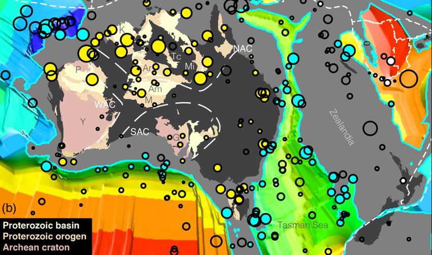
Australia is an old stable continent with a rich geological history. Limitations in sub-surface seismic
imaging below the Moho, however, mean that is unclear to what extent, and to what depth, this rich
geological history is expressed in the mantle. Studies of seismic anisotropy, which reflect
past/present mantle deformation, can offer potential insights. One commonly employed technique is
shear wave splitting, in which the wave polarisation is measured. New such results from the BILBY
array, a linear transect of seismic stations that crossed the Australian continent from north to south,
reveals a pattern of anisotropy that is consistent with past deformation of the Australian lithosphere
that has been preserved for over 300 million years. Another informative technique is to use scattered
surface waves, called Quasi-Love waves, that can detect lateral gradients in seismic anisotropy. The
first such study for the region finds that scatterers are preferentially located near (1) the passive
continental margins, and (2) the boundaries of major geological provinces within Australia. Such
lateral anisotropic gradients within the continental interior imply pervasive fossilized lithospheric
anisotropy, on a scale that mirrors the crustal geology at the surface. Beneath the continental
margins, lateral anisotropic gradients may indicate small-scale dynamic processes in the
asthenosphere, such as edge-drive convection, that are tied to the margins.
Speaker bio...
Caroline Eakin is an observational seismologist
at the Australian National University, in the
Research School of Earth Sciences, and is
currently an ARC DECRA Fellow. She joined
RSES as a Research Fellow in 2016 and was
promoted to Fellow at the end of last year. She
has a PhD in seismology from Yale University,
and did her undergrad in geophysics from
Imperial College London. Before arriving in
Australia she held a postdoctoral fellowship at
the University of Southampton. Much of her
research involves fieldwork deploying
seismometers in remote places, including
current projects surrounding Lake Eyre in
central Australia, and deploying ocean-bottom
seismometers along the Macquarie Ridge in the
Southern Ocean.

                                  Meet the Committee
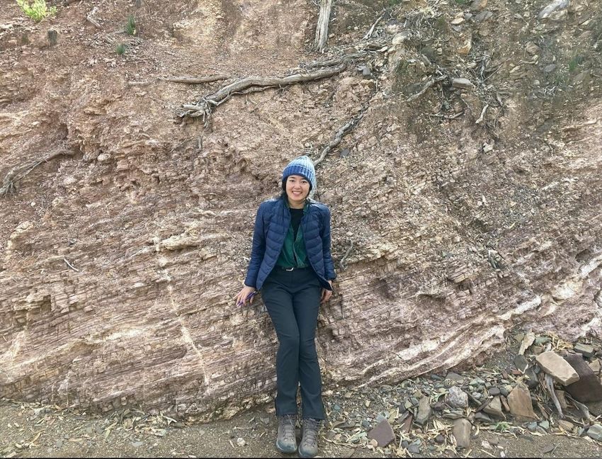
Our Monash University Student Representative

This is Fatemeh, and I am from Iran. I was born and raised in a copper mining district in Kerman
province. It is hard to live on one volcanic belt and not fall in love with the geology and amazing
landscape around you. Also, I have always been a math and physics enthusiast. I did mining
engineering in my undergrad and Masters, although mainly focused on mineral exploration. My main
passion is learning new tools and techniques and how to implement them to answer unsolved
questions in exploration. I am doing my PhD at Monash University. My PhD is multidisciplinary
research between geophysics, geology, and mineral exploration. In my research, I utilise potential
field geophysics, seismic interpretation, and structural geology to create an accurate image of
lithospheric and crustal-scale structures that control Australia's base metal mineral systems. Also, I
am a proactive person and enjoy organising events and meeting people. I have always been
involved in social activities and love bringing people together. Now excited to be a part of the GSA
Victoria committee and represent the students in the society.

Fatemeh Amirpoorsaeed
Monash University PhD Candidate
Structural Geophysics Group
School of Earth, Atmosphere, and Environment
@saeed_fatemeh

                                  Meet the Committee

             Our Melbourne University Student Representative

Hi, I’m Mana - the GSAV student rep for the University of Melbourne. I’m a third year undergrad,
majoring in Geology. I grew up in Sydney and lived in the UK for a few years before moving back to
Australia to start my BSc. I’ve always been interested in the natural world, and I’ve been lucky
enough to travel and see some spectacular landforms, like the Rocky Mountains in Canada. My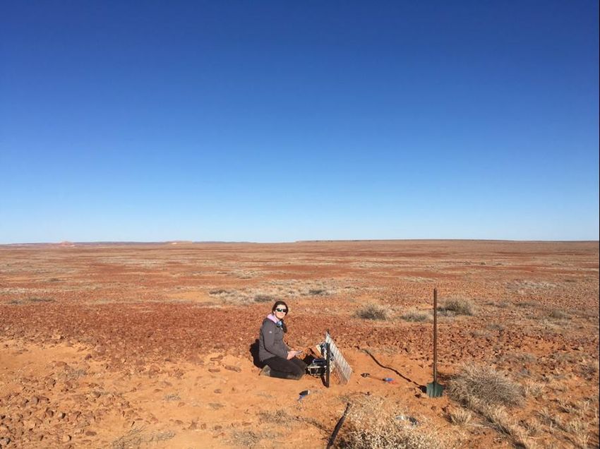
interest in minerals grew whilst working as a jewellery maker, when I often worked with different
gemstones. But I really developed these interests into a passion whilst taking Geology courses
during my first year at Uni. I had some amazing lecturers who showed me that geology is a
spectacular way to learn about the Earth and the processes that shape it. My favourite aspect of
geology is looking at look at beautifully preserved structures in rocks and thinking in extremely long
timescales. I also love that geology is such a broad and often multidisciplinary field.

Mana Ryuba
Melbourne University
School of Geography, Earth and Atmospheric Sciences
@RyubaMana

    A new mineral discovered by Monash University PhD
                         student

Owen Missen and team have discovered a new tellurate, Wildcatite (IMA2020–019), associated with
gold. It is a calcium–iron(III) tellurate that was discovered at the small gold prospect Wildcat in Utah.
Wildcatite has been discovered to take on a variety of appearances, ranging from transparent
orange to brown coatings or masses to earthy, white polycrystalline coatings filling jasperoid fracture
surfaces.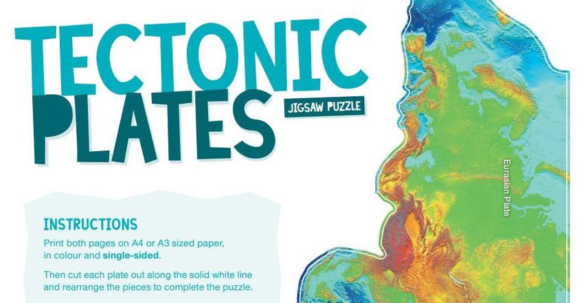
Owen describes more on this excellent Twitter thread
https://twitter.com/scimissionowen/status/1438339730031054854?s=20
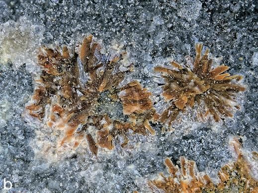
Figure 1 Oblique aerial of The Potholes, from the south looking north. The heavily timbered Wyatts
Reserve is on the left and the dolines there are obscured by the tress but the circular dolines are
very clear on the cleared and grazed areas. Many of the cave entrances are too small to see at this
scale. Photo courtesy Neville Rosengren.

         The Potholes and Wyatt’s Reserve,
                    Murrindal.

                        Dr Susan White OAM
                     Consultant Geomorphologist
                         Wakelin Associates
The Buchan area of East Gippsland, ~380 km east of Melbourne, is a
densely cavernous impounded karst in Palaeozoic limestones, extending
20+ km north-south and covering an ~75 km2 with over 700 caves and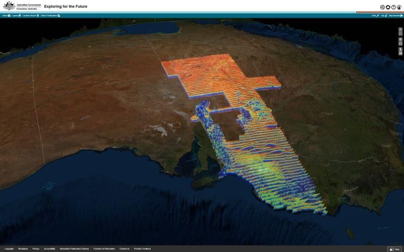
karst related features. This I-Spy is a description of the most spectacular
karst feature in the Buchan area.

First gazetted in 1887 as a camping and stock reserve, the small Wyatt’s
Reserve at Murrindal, was extended to include the Allotment 22A after a
concerted campaign by the Victorian Speleological Association (1970s and
1980s) against a quarry development the The Potholes area. Further
acquisitions have occurred to the north, which has enhanced its integrity.
The highly fossiliferous Rocky Camp and McLarty members of the
Murrindal Limestone outcrop in this area.

General Geology

The predominantly marine Devonian Buchan Group limestones are
downfaulted into the underlying Lower Devonian Snowy River Volcanics
and consists of three main formations: the Buchan Caves Limestone, the
Taravale Marlstone, and the Murrindal Limestone (Teichert and Talent
1958, Vandenberg, 2003, Orth et al, 1995). The lenticular Murrindal
Limestone is restricted to the northern part of the Murrindal Synclinorium
comprises two members; the lower McLarty Member and the upper paler
Rocky Camp Member. The carbonates were folded into the large south-
plunging Murrindal Synclinorium but the period between the Middle
Devonian and the Tertiary is assumed to be a long period of erosion. In the
late Eocene valley-filling basalt flows were deposited north and west of
Buchan. Subsequent deposition was limited to stream alluvium and
colluvial deposits.

Surface stream drainage dominates over subsurface drainage except in
local areas, and the karst includes dolines, dry or blind valleys, stream
sinks, springs and caves. The caves tend to be of two main types: vertical
shafts and fissures, and horizontal “stream” caves.
The Potholes Doline field

Figure 2: Annotated panorama of Potholes area from the east looking west. The 18 Acre Reserve is
the timbered Wyatt’s Reserve. The Murrindal River valley is in the foreground and also has several
associated dolines and caves. A recent dye trace has linked caves e.g. Baby Berger at The Potholes
with the springs in the Murrindal River. C= cave. Photo courtesy Rudy Frank.

The most spectacular feature in the karst is The Potholes doline field at the
southern end of the Murrindal Limestone ~14 km north of Buchan, where
100+ closely spaced conical dolines and associated caves occur.

The conical shape of the dolines cave entrances combined with the
presence of rockfall upper cave passages implies that the dolines are the
result of both solution and collapse. The limestones are strongly jointed
along three planes striking at 60º and most caves are vertical shafts e.g.
Jam Pot (3M-48). Several complex joint controlled three-dimensional
mazes of interconnecting fissures with high ceilings, contain calcite
speleothems e.g. Honeycomb Cave (3M-41) have developed along
previous water tables. The depth of the caves in the Potholes area
(typically 50-60 m) is governed by the thickness of the Murrindal
Limestone, which is underlain by the relatively insoluble interbedded
limestones and shales of the Taravale Formation.

The cave entrances are relatively high in the landscape, up to ~200 m
above the adjacent river valley floors. Uranium series dating of the
speleothems indicates that these higher caves are considerably older than
the lower altitude stream caves. A sample from Honeycomb (3M-41) dated
at 2.94 Ma (Engel et al 2020) indicates that the karst landscape of The
Potholes was formed over ~3Ma ago.

The area contains the best example of doline karst topography and
associated cave forms in south-eastern Australia. Other significant and
interesting aspects of the karst are accessible to visitors in the Buchan
area, but The Potholes and Wyatt’s reserves are definitely worth a visit. It is
documented by the GSA (V) as being of National significance for its
geological features.

References for further reading

These are not generally cited in the above text but give interested readers
more detail.

Engel, J., Woodhead, J., Hellstrom, J., White, S., White, N. and Green, H., 2020. Using speleothems
to constrain late Cenozoic uplift rates in karst terranes. Geology, 48, 755–760.

Gray, D.R. and Gregory, R.T., 2003. Fault geometry as evidence for inversion of a former rift basin
in the Eastern Lachlan Orogen. Australian Journal of Earth Sciences, 50, 513–523.

Joyce, E.B., Webb, J.A. and others (2003). Chapter 18 – Geomorphology. In W. Birch (Ed.) Geology
of Victoria (pp. 533–561). Sydney NSW: Geological Society of Australia, Special Publication 23.

Orth, K., Vandenberg, A.H.M., Nott, R.J., and Simons, B.A., 1995: Murrindal 1:100,000 Map
Geological Report. Geological Survey of Victoria Report, 100.

Teichert C. and Talent J.A. 1958. Geology of the Buchan area, East Gippsland. Geological Survey
of Victoria, Memoir 21, 1-56.

VandenBerg A.H.M., 2003. Chapter 5 - Silurian to Early Devonian. In Birch, W. (ed.), Geology of
Victoria. Geological Society of Australia Special Publication 23, 117-155.

Webb, J. A., Finlayson, B. L., Fabel, F. G., & Ellaway, M. (1991). The geomorphology of the Buchan
karst: implications for landscape history of the Southeastern Highlands of Australia. In M. A. J.
Williams, P. DeDekker & A. P. Kershaw (Eds.) The Cenozoic of the Australian region – a reappraisal
of the evidence (pp. 210–234). Sydney NSW: Geological Society of Australia, Special Publication
18.

                                Membership renewals for 2022
For those who haven't renewed their GSA membership yet for 2022 you can pay your dues by:
• Paying via credit card over the phone to the GSA Business Office on
02 9290 2194
• Mailing a cheque or a renewal form to the GSA Business Office
(a self-addressed envelope and renewal form were enclosed with
renewal notices)
• Paying via Electronic Funds Transfers
Account Name: Geological Society of Australia Inc.
(BSB: 082067 Account Number: 52-507-4491)
• Signing in and accessing your profile page on the GSA website
(www.gsa.org.au).
Please see the following HELP videos if you encounter any difficulties:
• How to re-set a password
• How to sign-in and pay online
• How to print a receipt/invoice
If you need assistance, please contact the GSA office: membership@gsa.org.au
Want to know more about GSA membership? Contact us!
Exploring the Future
Geoscience Australia
An unprecedented snapshot of the geology of south-eastern Australia has been
released after the recent AusAEM airborne electromagnetic survey was
conducted across more than 600,000 square kilometres of south-eastern
Australia. More information: https://www.ga.gov.au/news-events/news/latest-
news/first-major-release-from-expanded-exploring-for-the-future-programGSA Instagram
The Geological Society of Australia Instagram page
https://www.instagram.com/geologicalsocietyofaustralia/ now has over 32,500 followers!
Geologists from all over Australia have been submitting amazing images with a small text to describe it.
You will see lava tubes, caves, folds, mines, building stones and much more. If you want to take part
submit your image and text to Tim at our federal office tim.holland@gsa.org.au
Earth Day 2022 - Earth Futures Festival
Macquarie University Associate Professor and GSA Governing Councillor, Heather Handley, has joined
forces with TV Executive Producer, Simon John Heath to raise awareness of the crucial role Earth Scienceplays in leading the path to a more sustainable future. Together they have established The Earth Futures
Festival with the support of the UNESCO International Geosciences Program.
Astronaut Eugene Andrew Cernan photographs the terrain in Boulder City, Nevada, during geology training for his upcoming
spaceflight, 24-25th January 1972. He has been chosen as the Commander of NASA's Apollo 17 lunar landing mission in
December 1972. (Photo by Space Frontiers/Getty Images)
More information on the festival can be found here:
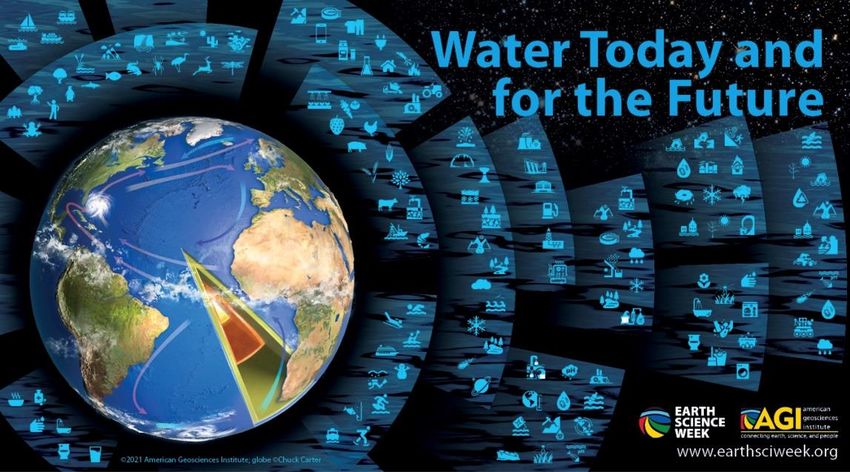
https://inspiringnsw.org.au/2021/09/16/earth-futures-festival/Earth Science Week Earth Science Week 2021 (Week October 10-16th) will engage young people and others in exploring the importance of water — and water science — for living things, Earth systems, and the many activities that people undertake. Watch out for events around Victoria. Our Twitter account @GSAVictoria will post local highlights.
GSA Earth Science Week Event - GSA Neo
                           12 and 13 October 2021

GSA Neo is a two day online event during Earth Science Week for Early Career Geoscientists
(ECGs), consisting of online workshops, presentations and panel discussions designed to give
ECGs the competitive edge, increase confidence and strengthen networks.

Workshop Day 1: Geochemical data evaluation and interpretation.

Workshop Day 2: To D2, or not to D2 Structural geology interpretation and discussion.

Speakers: Scott Halley, Brett Davis, Richard Blewett, Sarah Jones, Gerard Tripp, Ivan Zibra and
Quentin Masurel (and more)

Registrations will be available on the national Events page
soon:https://www.gsa.org.au/Public/Events/SharedContent/Events/Event_Add.aspx?hkey=889f77e6-
1393-4526-b3c6-76024f7ddf69

Program: http://gsa.junctionworld.com/geoz/geoz239/BigDayOut.pdf
Help for school online from Geoscience Australia
Geoscience Australia produces teaching resources for primary and secondary levels.
Resources include background information, student activities, full-colour cut-out 3D
models and posters.
For more information contact education@ga.gov.au or explore the classroom
resources and other helpful material here:
http://www.ga.gov.au/education/classroom-resources
Forthcoming events
Unless otherwise noted, all 2021 talks will be via Zoom meeting.
October 28th: A Global Tour of Mud Volcanoes, Dr Mark Tingay, Adjunct Associate Professor in
geomechanics and drilling engineering at the University of Adelaide.November 25th: TBC Student Scholarships The GSAV are pleased to offer scholarships for honours and postgraduate students in geological sciences for assistance with travel costs associated with attending conferences (fieldwork excluded). The number and value of the scholarships awarded each year is made at the discretion of the GSA Victoria committee. Up to $500 for travel within Australia and between Australia and New Zealand and $700 for travel elsewhere is available, paid half before and half after the conference. More information, including the eligibility criteria and application form, is available at http://www.gsavic.org/scholarship.html. Contributions to The Victorian Geologist If there are any events, happenings, news, or views that would be of interest to the membership, please send your details and information to the secretary at gsavictoria@gmail.com. Newsletter deadline: First Friday of the month, except for December and January. Contribute to TAG It is member contributions which make TAG (The Australian Geologist) a member magazine – please keep the contributions coming and assist with informing all of the membership (not just your Division) about your activities. Please send your news to: tag@gsa.org.au About the GSA Victoria Division
General information about the Geological Society of Australia and GSA Victoria Division can be found
at www.gsa.org.au and www.gsavic.org.
Contact details for the GSAV Committee can be found at www.gsavic.org/committee.html.

                                       Copyright © 2018 GSA Victoria, All rights reserved.
         You are receiving this email because you are a member of the Geological Society of Australia (Victoria division).

                                                     Our mailing address is:
                                                           GSA Victoria
                                                         GPO Box 2355
                                                       Melbourne, VIC 3001
                                                             Australia

                                                   Add us to your address book

                                           Want to change how you receive these emails?
                                  You can update your preferences or unsubscribe from this list

                                 Twitter           YouTube               GSAV website         Instagram
You can also read