Leica Geosystems TruStory Building a Precise Monitoring Network
←
→
Page content transcription
If your browser does not render page correctly, please read the page content below
Leica Geosystems TruStory
Building a Precise
Monitoring Network
The structures that accompany evolution of any structure to make fast GeoSHM Deformation Analyst that is
our everyday seem static and informed decisions. developed by the consortium.
unalterable to our eyes. Weather
conditions, aging, human activity, Led by UbiPOS UK as the prime contractor, Leica Geosystems GNSS monitoring
geological changes and other consortium members including academics systems provide the complete picture by
factors alter these structures and from the University of Nottingham’s producing 3D real-time displacements
pose a challenge for engineers that Geospatial Institute and industrial and tilt of the bridge. GeoSHM converts
strive to maintain the health of the partners from Leica Geosystems, GVL, data into useful information to end
constructions that our economies Amey, Transport Scotland and China users and delivers it through a web-
and daily lives depend on. Railway, are developing GeoSHM (GNSS based interface that provides precise
and observation for Structural Health deformation information that allows
Structural behaviours are not always Monitoring), a system to provide users bridgemasters to understand the loading
predicable by design and simulations. with an integrated solution to monitor and response effect of the bridge under
An unexpected bridge failure cannot and assess in real time the operational normal loading conditions.
just prevent you from arriving to conditions of different types of assets.
work or getting back home. A lack of Aware of the challenges to maintain the Bridgemasters can measure the
proper monitoring and maintenance structural safety and operation of long performance of structural design
can also result in the total isolation span bridges, the European Space Agency models against the current conditions
of cities and even in the loss of lives. (ESA), has supported the grant through to identify unusual deformations under
Engineers, therefore, need to detect in the Integrated Application Promotion (IAP) extreme weather conditions and detect
an accurately and timely manner any Programme. movement at millimetre level. When
structural movements under all natural deformations surpass designated
physical conditions. The complete picture parameters, the GeoSHM Deformation
It is of critical importance to have the Analyst issues an early and emergency
To gain knowledge of the integrity and ability to monitor remotely and in real time warning. In this way, GeoSHM provides a
changes of any structure, engineers any asset. GeoSHM uses real-time data service that offers 24/7 monitoring, and
today have Structural Health Monitoring gathered with Leica Geosystems GNSS facilitates a targeted maintenance by
(SHM) tools to obtain a clear picture receivers and software to analyse the identifying structural failures promptly
of the current state, degradation and operational conditions of bridges with the and assessing the bridge after an event.
“We selected Leica Geosystems products for
their high positioning precision and reliability.
The GRlO, the GM30 receivers and the Leica
GNSS Spider software are stable, easy to
use, and provided excellent results,” said Dr.
Xiaolin Meng, GeoSHM project leader from
Nottingham Geospatial Institute. “Integrating
Leica Geosystems GNSS technology allowed
us to simplify our process, save time, and
remotely control and monitor the status of
the project.”
The test platform
The Forth Road Bridge, a long span
suspension bridge in east central Scotland,
was the test bed for GeoSHM. The bridge
was inaugurated in 1964, the longest steel
suspension bridge in Europe at that time.
When the bridge was designed in the 1950s, expanded by the consortium. The Leica GNSS A proven solution
engineers could not predict the increasing Spider software provides the professional Using Leica Geosystems monitoring
traffic this crucial corridor between south- solution for controlling and operating the technologies, together with other sensors, the
east and north-east Scotland would need to installed GNSS reference stations and GeoSHM project aims to establish a state-of
support. Initially designed to sustain a traffic networks. The GNSS receivers collect and the-art system that can address the challenges
of 30,000 vehicles per day, the bridge can stream out data through Leica Spide via in structural deformation monitoring of long
normally be exposed to support twice the internet processing in real time, providing the bridges, and other critical infrastructure, with
traffic it was originally designed for. positioning to analyse the bridge health status a model that combines reference monitoring
with the GeoSHM Deformation Analyst. systems with the engagement of multiple
The Forth Road Bridge, like many other stakeholders. As a next stage of development,
span suspension bridges, must defy the One Leica GRlO reference station was set GeoSHM will be expanded on a selection of
most challenging conditions, such as on top of the bridge and three Leica GM30 bridges in China.
unexpected deformation, unusual traffic monitoring receivers where set throughout
loading, temperature changes, high winds the bridge to acquire the data from the GNSS Using Leica Geosystems GNSS solutions that
and extreme tides. Bridgemasters and satellites and sent via optic fibre network to are empowered with the GeoSHM Deformation
infrastructure managers, therefore, have a local hub. GNSS data is sent for processing Analyst engine, GeoSHM has demonstrated that
an urgency to understand the behaviour through secure internet connection to the having a deep understanding and monitoring of
to develop a maintenance programme that Central Processing Centre at the University this critical transport infrastructure can extend
allows access to a rapid, targeted, and of Nottingham where it is integrated with and safeguard the lifetime of aging bridges.
automated assessment of the bridge’s health the data collected from the bridge sensors Leica GNSS Monitoring Solutions provide vital
to assure cost efficient maintenance and to generate changes in deformation and information to reduce the maintenance costs
management. displacement information with millimetre with a targeted approach of inspections and
A sensor network you can trust accuracy and high resolution. At the Control timely identification of potential structural
Currently the GeoSHM service collects the Centre, the further processed GNSS data as damage.
Forth Road Bridge data from four permanent deformation information is combined with
Leica Geosystems GNSS receivers and two lnSAR, a radar technique used in remote
anemometres to measure the speed of the sensing, to measure long-term structural
wind, but the programme will be further trends and local environmental effects.
Leica Geosystems AG
leica-geosystems.com
©2019 Hexagon AB and/or its subsidiaries and affiliates.
Leica Geosystems is part of Hexagon. All rights reserved.
Leica Geosystems TruStory
                                                        Connecting through
                                                        monitoring

Once a major infrastructure project          the joint venture was tasked with this        Although often thought of as static,
is completed, engineers need                 important monitoring project:                 engineering structures are continually in
to monitor for movement. This                • John Holland, leading contractor and        a state of motion. Consider the several
is to ensure that movement or                  service operator for Australia, New         elements that stress a structure on a
settlement occurs within expected              Zealand and South East Asia                 daily basis:
tolerance levels, ensuring the safety        • LEED Civil & Engineering, specialists of    • John Holland, leading contractor and
of motorists and others.                       complex infrastructures projects               service operator for Australia, New
                                                                                              Zealand and South East Asia
For the South Road Superway project          Some facts about the South Road               • LEED Civil & Engineering, specialists of
it was particularly important to analyse     Superway project:                                complex infrastructures projects
differential settlements, or deformation     • 4.8 kilometre major road corridor
occurring at a faster or slower pace         • Non-stop connection between the             Some facts about the South Road
on the infrastructure. These positional        northern and southern parts of              Superway project:
changes if unchecked could eventually          the South Australian capital city of        • Expansion and contraction caused by
lead to a step in the road. Any                Adelaide.                                     temperature change
deformation of the road surface can          • Project cost $812 million AUD               • Differential heating effects caused by
lead to rapid deterioration of the asset,    • Now known as part of the North South          the movement of the sun across a
which in turn means costly repairs and         Motorway                                      structure
required resurfacing. This puts additional   • Included 2.8 km of elevated roadway         • Wind loading
pressure on the project’s budget and           over the original South Road, which         • Ocean loading and earth tides caused
can impair its profitability.                  is the longest and largest single             by daily tidal movements
                                               investment in South Australia’s history     • Vehicular traffic loading
When the South Road Superway                 • Supports up to 6 lanes of traffic for the
in South Australia was completed,              1.3 million residents of the capital city
All of this combines to produce constant                Real-time monitoring for safety The                  Levels on either side of the joints are monitored
movement in a structure. Such movements                 Leica GeoMos automated monitoring system             with particular care because if settlement
are typically small and occur slowly over               continues to monitor structural movements            happens at different rates, a step in the
the cause of a day. It is critical, therefore,          24/7 delivering the data required to analyse the     roadway can occur. If any positioning data
to understanding the structures’ behaviour              structures behaviour and ensuring the safety of      collected by GeoMoS should exceed the set
that monitoring is conducted automatically              road users.                                          tolerance levels, the software will send out an
and frequently so that these changes can be                                                                  alert in real time to the project management,
tracked.                                                “We recommended Leica GeoMos and total               alerting them that limits have been reached.
                                                        stations because we’ve used them in many             This level of information allows action to be
The striking design of the South Road                   other projects around the country with               taken avoiding any costly repairs or long term
Superway, with its unusual curved piers,                excellent results,” Richard Ingham, C.R.             damage to the structure.
complex geometry, and size presented some               Kennedy Survey Division New South Wales
challenging measurement tasks.                          state manager. “With the real-time ability           GeoMos is able to use ‘virtual sensors’
                                                        to alert engineers to any changes and the            (calculations) to derive key performance
C. R. Kennedy, the largest surveying solutions          high-precision data collected by the Leica           indicators on the project, such as pier rotations
supplier in Australia, was able to supply and           Geosystems total stations, this was a perfect        needle beams deflections and separations.
consult the combined venture as to the                  fit for the super highway project.”                  These ‘derived’ “Using Leica GeoMoS, we’re
best solution for this long-term monitoring                                                                  seamlessly processing and managing the data
project. C.R. Kennedy recommended Leica                 Monitoring is to be conducted for a minimum          collected by the total stations. The software is
GeoMoS monitoring software and hardware:                period of 7 years to ensure that the structure       automatically delivering us information on the
• GeoMos Monitor                                        ‘settles down’ and any movement remains              roadway piers, around-the-clock,” said Stephen
• GeoMos Option 1 (Computations)                        within expected levels.                              Singline from John Holland. “We receive reports
• GeoMos Option 2 (Limit checks &                                                                            that are easily understandable, and we can
   Messaging)                                           GeoMoS software manages the data                     even customise the graphs and visuals for what
• GeoMos Analyser                                       collected by the total stations of the bridge’s      we need. This informs our decision making
• 230x GeoMos Sensor Licences                           dramatically curved piers. These piers support       processes with the most current and reliable
•   5x TM50 Total Stations                              the bridge deck, or road, and have finger joints     data available.
•   2x TS15 Total Stations                              built into the expansion joints of the articulated
•   7x Instrument environmental housings                deck. These joints enable the needed expansion       Long-term analysis reports can also be used to
•   2x Vaisala weather stations                         of the bridge in order to accommodate the            improve design of infrastructure in the future
•   7x Modems                                           forces and stresses caused by the usage and          and also help improve construction practices.
•   7x Power supply/UPS systems                         environmental factors.
•   290x Prisms

                       Leica Geosystems AG
                       leica-geosystems.com

                       ©2019 Hexagon AB and/or its subsidiaries and affiliates.
                       Leica Geosystems is part of Hexagon. All rights reserved.
Leica Geosystems TruStory
Designing a dam
monitoring system
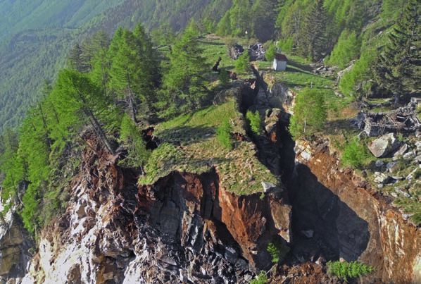
In early 2017, winter storms filled an infrastructure owner’s tool belt for choice here, because other vendors don’t
and then overfilled reservoirs monitoring the condition and performance really have a good option for monitoring
in California, USA, leading to of critical facilities. in this environment.”
the evacuation of hundreds of
thousands of citizens near Lake Designing for better data Three of the GNSS reference station
Oroville, California’s second largest Consulting with Sensemetrics, a firm receivers are solar powered and one
manmade lake. specialising in networked sensor is powered by a 120v AC feed. All are
applications based in San Diego, U.S.A., securely fastened inside enclosures
About 160 kilometres away, the Pardee EBMUD designed and proposed a installed near the Leica AR20 antennas,
and Camanche reservoirs also filled sophisticated monitoring system based on: which are mounted on concrete
from the 2017 storms, reaching 103 per • 31 Leica GMX901+ GPS sensors pedestals. The network is largely
cent of capacity in March, but the dams • Four Leica GM10 GNSS reference autonomous, needing only occasional
were not overtopped, and releases were stations attention. Data flow is through 900 MHz
sustainable within the waterways. • A radio network consisting of 900 MHz and 2.4 GHz spread spectrum radios into
Thanks to the installation of one of mesh radios an existing microwave telemetry link to
the nation’s most advanced automated • 2.4 GHz repeaters and two radio towers EBMUD’s business intranet at its Oakland
GNSS-based dam monitoring systems • Leica GNSS Spider and GeoMoS headquarters, where a server runs the
at these two facilities, along with software solutions Spider and GeoMos software necessary
other instrumentation improvements, to process the GNSS data and results.
East Bay Municipal Utility District The use of Geosystems receivers is The results are then presented through
(EBMUD) had the technology in place important, according to Cory Baldwin, software customised by Sensemetrics.
to monitor crest elevations at these president of Sensemetrics: “The GMX901+s
dams and dikes remotely with improved are purpose-built for remote monitoring Five of the GMX901+ sensors as well as
temporal resolution. Having this type applications, with non-exposed, built-in four seismographs are installed on the
of data available is one more tool in antennas,” he says. “They were my first Pardee Dam connected via fiberoptic
cable directly to the microwave business                Camanche sites are several hours away from          Automated dam monitoring in action
intranet. These instruments continuously                main offices, and the semi-annual surveys           A recent example of the benefits of automating
monitor dam movement and report remotely.               [conducted previously] took over a week to          a survey monitoring scheme comes from
Two of the GM10 reference stations were                 complete. This new system provides more             another EBMUD automated dam monitoring
installed near and on either side of Pardee             accurate data, more or less constantly, and, of     project on San Pablo Dam in California, USA. In
Dam and are connected to the fiberoptic line            course, reduces the time survey crews spend         2008 and 2009, the dam underwent a seismic
by 2.4 GHz radio connections.                           on this task. It’s a big improvement, and it is     improvement to buttress the toe of the dam
                                                        performing beyond expectations.”                    to bedrock using a cement deep soil mixing
Downstream from Pardee Dam, the Camanche                Baldwin says one important design goal was          process. Increased monitoring requirements from
Reservoir site consists of one large earth-             interconnectivity with existing and future          the DSOD, while working on an active dam, were
filled dam and six dikes. The Camanche                  monitoring systems. The potential to automate       met via an Automated Motorised Total Station
Reservoir is primarily used to control releases         and improve emergency responses to seismic          System (AMTS), which has been running several
to downstream agencies and maintain flows               events is a major advantage of monitoring           times a day since that project was completed
for the salmon. Twenty-six GMX901+ sensors              networks.                                           in 2009. EBMUD also has a program to visually
are installed around the reservoir, and these                                                               inspect dams and reservoirs immediately after an
also monitor and report continuously.                   EBMUD now has more survey information               earthquake to check for cracking or other visible
                                                        immediately at its fingertips regarding structure   damage as a quick ground truth
A complete picture of infrastructure                    performance than at any previous moment in
performance                                             the district’s history. By being proactive and      After a 4.4 magnitude earthquake in January
The State of California Division of Safety of           automating monitoring systems, EBMUD has            2018 on the Hayward fault centred in Berkeley,
Dams (DSOD) requires semi-annual monitoring             greatly improved dam safety monitoring.             less than 8 km from the San Pablo dam site,
surveys. The new system provides accurate                                                                   EBMUD geotechnical engineers were able to
information more rapidly, reduces staff time             “The GPS system at Pardee Dam now                  log in to the AMTS automated monitoring
spent on monitoring, and is capable of being            gives us a complete picture of the seasonal         system to review whether there had been any
tied into state-wide emergency and seismic              deformations due to thermal expansion and           actual movement or slumping on the dam, and
monitoring systems as they emerge. After                contraction of the concrete structure,” says        they confirmed that there was no significant
almost two years of service, DSOD monitoring            Steven J. Martin, survey supervisor for EBMUD.      movement. This ability to have information
requirements have been met with a more                  “With the Camanche Reservoir portion of the         immediately and at their fingertips has proven
complete picture of overall performance.                GPS monitoring system, we are able to meet          to be a huge asset in managing dam safety at
                                                        DSOD monitoring requirements without long           EBMUD.
“EBMUD’s infrastructure is spread out over              trips out of town by the survey crew and to
a vast area and covers multiple counties,”              check for any possible deformations remotely
says Baldwin. “In particular, the Pardee and            in near real time.”

                       Leica Geosystems AG
                       leica-geosystems.com

                       ©2019 Hexagon AB and/or its subsidiaries and affiliates.
                       Leica Geosystems is part of Hexagon. All rights reserved.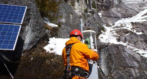
Leica Geosystems TruStory
                                                        Ensuring Smooth Flow

Germany’s busy Kiel Canal has been           businesses. Closing the Kiel Canal during      The WSA Brunsbüttel has numerous
used as an international shipping            this seven-year construction project would     water sensors that continuously
lane for more than 100 years.                be unthinkable since the canal is the          collect water level data to foresee
Linking the North Sea to the Baltic,         lifeline and gate that connects German         any possible water-related difficulties
the canal enables ships not only             ports to the Baltic Sea. Therefore, a fifth    for the locks’ infrastructure and the
to save a distance of roughly 280            sluice chamber needed to be added to the       canal’s surrounding area, supplying vast
nautical miles but also to avoid the         existing infrastructure. With an expected      amounts of historic analysis. A geodetic
potentially dangerous storm ridden           completion in 2020, this fifth chamber will    monitoring system is also onsite and
conditions of Denmark’s northern             handle the shipping traffic while the older    continuously collects massive amounts
Jutland Peninsula - the coastal gale         locks’ renovation is being carried out.        of data. Further review of the data
winds and increasingly difficult tidal                                                      dictated the need for a programme
changes of the Skagervak between             Analysing the rise and fall of the tide        that could read and combine sensor
Denmark and Norway.                          The Kiel Canal not only functions as a         information into the data processing
                                             shipping lane but also neutralises the         software.
After a century of heavy traffic, German’s   effects of the North Sea’s tide fluctuations
Ministry of Transport, Building and Urban    and the water level of the locks that          Before beginning construction, the
Development decided to modernise and         continuously fluctuates, rising and sinking    stability of this enormous project had
carry out safety improvements on the         roughly 3 metres over the course of six        to be assessed. The new infrastructure
locks of the Waterways and Shipping          hours as the tides change. The Brunsbüttel     presented demanding technical and
Authority (WSA Brunsbüttel). The Kiel        lock system also provides important            logistical challenges, which needed to be
Canal is one of the most travelled           coastal protection from the Baltic Sea’s       taken into consideration. The fifth sluice
artificial waterways in the world and        notorious water level differences that         chamber, when completed will measure
many countries rely heavily on the canal     occur due to gale winds and storm flooding     roughly 350 m in length, 45 m in width,
for the economy of their industries and      from the sea.                                  with an underwater extending cill on the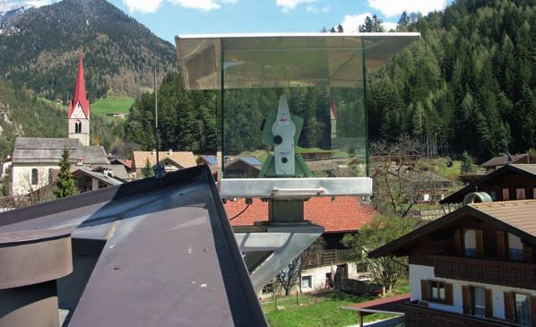
lock gate at 14m below sea level.                       building site will be continuously monitored       configuration parameters, such as time format,
The chamber will be built into the sluice               three times per hour for any standard              identifier, observation, unit and location. With
island between the large and small locks                deviations (2 mm) and for any deformation          this information, any CSV file could be
and requires the removal of roughly 1.6                 activity of more than 15 mm from the position      processed in pre-defined time intervals. In this
million m³ of mostly clay soil. Three months            and height of each measured point                  case, the raw data of the water levels were
of monitoring the existing lock system                  being monitored.                                   combined with the coordinates of the geodetic
at Brunsbüttel was necessary in order to                                                                   monitoring system.
analyse the stability of the structure before           The data collected for existing chambers gates
starting with construction. Once the project            and walls used four Leica Nova TM50 total          With the virtual sensor editor, the system could
began, the seven-year construction site will            stations set up on pillars throughout the lock     process the deformations corrected by the tide
be monitored until its completion.                      infrastructure and also used Leica Geosystems      influence to become a complete monitoring
                                                        monitoring prisms.                                 analysis.
Monitoring movements during
construction                                            Installations were completed by ALLSAT,            With this new file formatting editor, the
Kirchner Engineering Consultants GmbH was               who used Leica GeoMoS software for data            monitoring software became highly flexible
contracted to monitor the movements of                  processing and visualisations. Communication       and able to read any software interface.
the structure during construction. A key                boxes with GPRS data modems were also              Sensor data available via the Internet could
requirement for WSA was to incorporate                  installed on top of the measuring pillars using    be quickly integrated for real-time analyses.
data collected from existing water sensors              mobile service providers to transfer data. Total   All changes to the canal’s water levels can be
scattered throughout the lock structure at              stations were also secured by weather              taken into account when analysing the geodetic
Brunsbüttel and to easily integrate                     element protectors.                                measurements for deformation tolerance
this information into the automatic, real time                                                             levels. The software also processed this data
geodetic monitoring analysis.                           Necessity is the mother of all invention           into easily understood visualisations that can
                                                        Due to the special demands required by WSA,        be customised to the level and needs of those
ALLSAT GmbH, a company specialising in                  Leica Geosystems added a new format editor         responsible receiving the information.
geomonitoring using high-precision total                to its GeoMoS software. This new editor
stations and has been collecting geodetic               can automatically process data from one or         Should any of the data measurements exceed
data from the Brunsbüttel for some time,                multiple sources, such as sensors,                 the set maximal deformation limits, a second
was contracted by Kirchner. The project                 data loggers, files or databases. With this        measurement is made immediately after the
requires the best possible deviation                    editor addition, Intelligent Open Interface        completion of that measuring cycle. If this
measurements and Leica GeoMoS                           was enabled, allowing the integration of any       second data measurement still exceeded the
Monitor software used by ALLSAT delivers                Comma Separated Value (CSV) file. After a          maximal allowed limits, the people responsible
the highest accuracy of +/- 2 mm.                       one-time content configuration, the GeoMos         at Kirchner were immediately informed by an
                                                        CSV-module canautomatically process any            email message automatically sent so they could
After collecting and analysing new and                  new raw data content from the water sensors        take the necessary actions. A version of this
previous data for three months, the                     on the tidal range water levels surrounding        story first appeared in GeoConnexion at http://
building of the chamber could start. During             the locks.Each data field, separated by a          www.geoconnexion.com.
construction, the chamber walls next to the             semicolon within the CSV file, received certain

                       Leica Geosystems AG
                       leica-geosystems.com

                       ©2019 Hexagon AB and/or its subsidiaries and affiliates.
                       Leica Geosystems is part of Hexagon. All rights reserved.
Leica Geosystems TruStory
                                              GNSS Monitoring for Safety
                                              on the Brenner

When it is complete in thirteen      and executing the monitoring work,            be about 200 m (656 ft) wide, with
years the 55 km (34 mi) Brenner      based on a sophisticated multi-               adjacent overstressed rock stretching for
Base Tunnel will be only 2 km (1.2   stage continuous (GNSS) monitoring            a kilometer.
mi) shorter than the Gotthard        network.
Base Tunnel, which celebrated its                                                  The challenge posed by the Periadriatic
breakthrough almost two years        Several sections of the exploratory tunnel    Seam is well known to the project
ago. Leica Geosystems instruments    for the Brenner Base Tunnel (BBT) are         company – the European public limited
ensured the centimeter accuracy of   currently under construction. The six-meter   company BBT SE, a cooperative venture
the Gotthard miners’ work and the    in diameter exploratory tunnel will be        between Austria and Italy. This section
engineers in charge at the Brenner   centered directly below the two singletrack   of the works was therefore undertaken
Base Tunnel have also opted to       main tunnel tubes and will serve as an        with greatest caution. It is being carried
use Leica Geosystems instruments     escape and service tunnel after the BBT       out as a separate contract and the
and equipment for a wide range of    is open. The 1.5 km (0.9 mi) “Periadriatic    underground measurements required
tasks, among them the monitoring     Seam” section of the tunnel, running under    during tunnel driving are particularly
of a geologically unstable zone      the village of Mauls (Community of            complex. In addition, the Schwaz-based
on the South Tyrol side of the       Freienfeld) in South Tyrol, is particularly   Tyrolean firm of consulting engineers
Brenner Pass. Consulting engineers   precarious. Here the tunnel passes through    Trigonos was commissioned to develop
Trigonos and the European public     the Periadriatic Seam – a geologic fault      an aboveground monitoring concept:
limited company BBT SE (Brenner      separating the Southern Limestone             “In close cooperation with surveying
Base Tunnel Societas Europaea)       Alps from the Austrian Central Eastern        engineers of BBT SE, we designed a
are responsible for developing       Alps. The main fault zone is estimated to     GNSS monitoring concept and proved its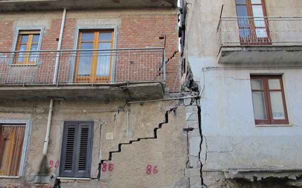
Gries
                                                                        Brenner Basistunnel
                                                 am Brenner

                                   STPOS
                                   Sterzing
                                                        FISH
                                      Sterzing

                                                                                                                                           STPOS
                                                                                                                                           Bruneck

                                                                                                                                          Bruneck

                                                                                    Brixen

                 Sarntal

                                                              Klausen
                                                                                                           FISH
                                                                                                           Fischerhof
                                                                                                                        STFL     Stoffl
                                        Ritten
                                                                                              KRST
                                                                          MAUL
                                                                                        Krustner   Lines
                     STPOS                                                                                                                                     PFIT
                     Bozen                                                                                                                                         Rizzolo

                                                                        Mauls                                                                       Pfitscherhof
                   Bozen
                                                                                                           Brenner Basistunnel

suitability in practice during the baseline             short as possible to maintain the highest                           masts for the antenna communications
measurement and the initial follow-                     possible accuracy. However, this also means                         equipment. Four stations have a 230
up survey,” explains Lienhart Troyer,                   the reference station itself is positioned in a                     V power supply. The Stoffl station
Managing Director of Trigonos, who is                   potential deformation zone. Any settlement                          was powered by battery for the
also involved in several other projects                 or movement of the reference station                                baseline measurement and initial
for the Brenner Base Tunnel.                            would influence the results of the other                            follow-up survey but will subsequently
                                                        four stations. This is why the reference                            be operating continuously with a
Multistage Monitoring Network with                      station is additionally monitored using data                        photovoltaic supply of energy. Backup
5 + 3 Stations                                          from three stations forming part of the GPS                         batteries with a capacity of 48 hours
The above-ground survey has one                         reference service STPOS in the Bozen/South                          will ensure the stations’ uninterrupted
primary question to answer: is surface                  Tyrol province,” explains Lienhart Troyer.                          operation.
settlement occuring during tunneling?                   The lengths of the baselines between the
The system must run fully automatically,                Fischerhof reference station and the three                          The necessary software was installed
and – should tolerances be exceeded –                   STPOS stations at Sterzing, Bozen, and                              in the office and included Leica GNSS
send text and e-mail notifications to the               Bruneck range from 10 km to more than                               Spider to operate the network and
client and the site supervisory staff.                  43 km (6 mi to more than 27 mi). “This                              the individual stations. “The baseline
                                                        hierarchical monitoring network can reliably                        measurement took place in July over a
“We decided to set up a local GNSS                      detect movements of the Fischerhof station,                         period of 48 hours. We went through the
network consisting of five points near                  while being able to provide precise local                           entire GPS constellation several times,”
the village of Mauls, which was then                    information about possible deformations in                          says Lienhart Troyer. A Leica GMX902
embedded in a higher-order network,”                    the area being monitored.”                                          GG dual-frequency monitoring receiver
explains Lienhart Troyer. The monitored                                                                                     was used at the reference station, and
zone covers an area of about two square                 Installation and First Measurements                                 Leica GMX901 monitoring SmartAntennas
kilometers, so only a GNSS solution                     Trigonos’ contract included                                         were installed at the other four stations.
would be able to achieve the required                   implementation of their concept, including                          Data transfer was wireless over GPRS/
accuracy. The centrally positioned                      baseline measurement and the initial                                UMTS in real time, with Leica SpiderQC
station in Fischerhof (FISH) is used as a               follow-up survey. After several visits with                         continuously checking data quality. A first
reference station for the calculation of                staff from BBT SE, the exact locations                              follow-up survey, also lasting 48 hours,
the baselines to the other stations in                  of the five stations were chosen. BBT                               was performed in August to confirm the
Mauls (MAUL), Krustner (KRST), Stoffl                   SE conducted the negotiations with the                              baseline measurement data.
(STFL), and Pfitscherhof (PFIT).                        landowners, followed by a construction
“We wanted to keep the baselines as                     company erecting the foundations and
Specialists from Leica Geosystems,
Heerbrugg were involved with the data BBT SE The Brenner Base Tunnel
analysis, the results of which were The Brenner Base Tunnel is the key
incorporated into the BBT frame network. Headquarters: section of the 2,200 km (1,367 mi)
“Because of the length of the base lines Bolzano, Italy and Innsbruck, Austria long Berlin-Munich-Verona-Bologna-
and the high accuracy requirements, we Employees: > 90 Palermo high-speed railway axis. This flat
relied on Cross-Check, the coordinate Established: trajectory, rail-only tunnel with a length
calculation service provided by Leica 2004 as a European public limited company of 55 km (34 mi) will be primarily used
Geosystems, for the calculation of the Executive Board: for the transport of goods. It consists
higherorder network. This meant we Raffaele Zurlo, Konrad Bergmeister of two single-track main tubes with an
avoided purchasing special software for Responsibles Surveying: exploratory tunnel running below them.
this project and saved a great deal of Pierluigi Sibilla, Claudio Floretta, Gregor The main tubes will be driven 70 m (230
additional training time. Our expectations Windischer ft) apart and linked every 333 m (1,092
of accuracy were completely fulfilled,” ft) by connecting side tunnels. Including
says Lienhart Troyer, expressing Trigonos’ For more information, please visit: the existing 7.7 km (4.8 mi) underground
satisfaction with the outcome. www.bbt-se.com freight train bypass around Innsbruck, the
62.7 km (39 mi) base tunnel will be the
Europe-wide Tender longest railway tunnel in the world. The
In January 2012 Trigonos was awarded tunnel is designed for a maximum speed
the Europewide tender for the of 250 km/h (155 mph). In addition to
continuous operation of the monitoring the Innsbruck freight bypass, the line will
system issued by BBT SE. This phase tie-in to the existing infrastructure of the
of the project will start simultaneously Innsbruck and Fortezza train stations.
with the tunnel driving in the area of the Multi-function stations in the tunnel will
Periadriatic Seam in April 2012 and will be located at Innsbruck, St. Jodok, and
be maintained for at least three years. Trens. (Source: BBT SE)
In addition to the GNSS monitoring, a
terrestrial monitoring system, using a
Leica Viva TS15 imaging total station and
prisms, was installed in Mauls to obtain
reliable and immediate information
about ground surface movements,
particularly in the densely built center of
the 2000-strong community of Mauls.
Leica Geosystems AG
leica-geosystems.com
©2019 Hexagon AB and/or its subsidiaries and affiliates.
Leica Geosystems is part of Hexagon. All rights reserved.Leica Geosystems
Innovative System Ensures Vertical
Alignment of Gerald Desmond Bridge
Since 1968, the Gerald Desmond So the Gerald Desmond Bridge is being Wilmington Oil Field since the 1930s,
Bridge has been an important part of replaced with California’s first long span, and the region has been a hotbed of
regional and national infrastructure. cable-stayed bridge, with an additional 50 progressive monitoring techniques for
The bridge connects Long Beach with feet of clearance, making it one of the about 70 years.
the major Port of Long Beach and tallest cable-stayed bridges in the United
Port of Los Angeles shipping facilities States. The cables will be anchored on two, Clearing out old wells and rerouting
built up on Terminal Island—15% of 515-foot tall support towers. The new major utilities has been lengthy,
the nation’s waterborne imports are bridge will also be wider, providing room challenging, tedious, and mostly invisible
trucked across the Gerald Desmond for additional traffic lanes, emergency to commuters. But with that work done,
Bridge. But the bridge’s 155-foot access lanes, and a bicycle/pedestrian Shimmick/FCC/Impregilo (SFI)—the joint
clearance—considered generous in path. When it is complete, the old bridge venture team that won the project’s
1968—is now too limiting for some of will be demolished. design/build contract—is now turning its
the largest container ships in use. In attention to construction that is more
2012, for example, the MSC Fabiola Bridge construction began in 2012, but iconic and spectacular; building the
could not pass under the Gerald Long Beach citizens could be pardoned bridge support towers and keeping them
Desmond Bridge and was forced to if they have been underwhelmed by vertically aligned.
dock at another terminal. Even more visible progress to date; the project
problematic is the Gerald Desmond’s is complicated by the presence of the Given the “sinking feeling” that the
condition; pieces of the deck are Wilmington Oil Field, one of California’s oil field is known for, maintaining
literally falling off, and a “diaper” largest oil fields, which lies directly vertical alignment during construction
of wire netting has been strung to beneath the bridge site. Subsidence is a serious concern. In a cable-stayed
protect those passing under. has been an issue in and around the design like this one, achieving andmaintaining excellent vertical alignment of
the bridge support towers is one of the most
critical construction tasks. For the Gerald
Desmond Bridge Replacement project, a
vertical alignment system developed by Leica
Geosystems and proven on supertall building
projects like the Burj Khalifa and New York’s
432 Park Avenue residential building (which
is on track to be one of North America’s
tallest towers), was selected as the tool
that project surveyors will use for this
important job.
Monitoring in Long Beach
Subsidence of the Wilmington Oil Field has
been startling at times; in the 1940s and
1950s, subsidence of as much as 29 feet
was recorded in some areas. The problem
has been mitigated since the 1950s with
water injection into oil reservoirs; this
grew into one of the world’s largest water
flooding programs, and 600 injection wells sophisticated spirit level network that along with ground-based control, is used as
currently pump about one million barrels per ultimately included 350 benchmarks in the City a reference. The system is able to compare
day into the field. of Long Beach and 540 benchmarks in the real-time tower position with design position
port. It was a good method—very precise—but and can be used to compensate for several
Subsidence in Long Beach, and the effect of it was also time consuming with no real-time factors, including crane weight, wind load, and
waterflooding (the use of water injection to component. So, since 2001, the city has relied even the thermal expansion caused by unequal
increase the production from oil reservoirs), on twice annual GPS surveys, and a network of solar loads. Contractors and project surveyors
have been the subject of intense monitoring twelve continuously operating receivers placed use this high quality information to guide
for decades, occasionally by exotic means: strategically around the city and port. concrete formwork and positioning of new steel
“Precision casing collar surveys” measured members.
change in well casing collars, compaction It’s fitting, then, that the new bridge support
recorders were used to measure subsidence towers also rely on an innovative use of Taking GNSS to New Heights
in shallow aquifers, and tidal gauge recorders GNSS receivers to maintain plumb during This is an innovative system, developed by
were used to compare tide heights to construction. The Leica Geosystems Vertical Leica Geosystems for use on supertall buildings
shoreline features. There was even a Alignment System used in this project is built such as New York City’s 1 World Trade Center.
program that shot radioactive bullets into around a Leica TS15i total station and up Previously, the alignment of tall structures
production wells, and later attempted to to six Leica GM10 GNSS receivers, several depended on the painstaking extension of
track the bullet location with a gamma rovers and radios, and specialized software. ground control networks. “In the past, when
ray survey. GNSS and optical data are monitored and you wanted to work on a tower or a bridge
processed continuously in real-time by a support, you’d establish a ground reference,
But for many decades, the mainstay of custom implementation of Leica’s GNSS Spider and then have a prism up on the actual
the monitoring program was a large and Software. Leica’s SmartNet RTK network, formwork,” explains Leica Geosystems’ Directorof Structural Monitoring David Rutledge. “On previous projects, we’ve shown that our
“As the structure began to climb in height, system can maintain tight tolerances,” Rutledge
maintaining line of sight to the prism would says, “…well within the couple of inches specified
become increasingly difficult. The Leica on the Gerald Desmond Bridge.”
solution is to gracefully switch over to the
GNSS system for primary alignment control. It’s interesting to consider the importance of
This is a proven methodology that has been GNSS monitoring to this part of the world. From
used on the world’s largest buildings.” precise monitoring of deformation caused by
oil production, to precise vertical alignment of a
After construction is complete, the receivers tower 515 feet above the ground surface, the
can be left in place to provide ongoing Port and City of Long Beach rely on the skillful use
monitoring. (Incidentally, Rutledge was of GNSS receivers to keep things level and plumb
also instrumental in setting up the GPS … and to avoid that sinking feeling.
subsidence monitoring system in Long
Beach.)
Leica Geosystems AG
leica-geosystems.com
©2019 Hexagon AB and/or its subsidiaries and affiliates.
Leica Geosystems is part of Hexagon. All rights reserved.Leica Geosystems
Innovative Vertical Alignment
System Keeps 432 Park Ave. Plumb
‘Skyscrapers’ is such an ‘80s tower in the United States (depending differing expansion rates of sunlit
term—1880s that is. In the 21st on how one defines One World Trade and shaded sides of a building), wind
century, as high-rise buildings have Center’s crowning pinnacle) and easily the pressure (remember, each side of the
reached previously unimaginable Western hemisphere’s tallest residential completed building will be like a giant,
new heights, architects and city building… and it will rise straight up from 131,000 sq. foot sail), and crane loading
planners have been forced to find a perfectly square (“The purest geometric and movement during construction.
new terms, eventually settling on the form,” according to architect Rafael Viñoly) More subtle factors include slight
fairly literal ‘supertall’ for buildings footprint measuring just 28.5 meters variations in concrete settling, and even
over 300 meters (984 feet) and the (93.5 feet) per side. That’s about 814 sq. the variations, within tolerance, of steel
clunky-but-evocative ‘megatall’ for meters (8,760 sq. feet)—for comparison, work. So Adam M. Cronin, lead surveyor
buildings over 600 meters (1968 the Burj Khalifa’s footprint is about 8,000 for Roger and Sons Concrete on 432
feet)—only three buildings currently sq. meters. Park Avenue, really needs to know— in
qualify, including Dubai’s 829.8 realtime if possible—where the building
meter (2,722 feet) Burj Khalifa. A building this tall and this skinny is very is, compared to design, and how it’s
nearly in a class by itself, and calls for responding to various loads.
But there are lots of supertalls, so advanced construction techniques. One
many that subcategories are beginning task in particular is simple in conception, For conventional urban construction,
to emerge, and the sexiest so far is but extremely challenging in practice: even skyscrapers, this task is relatively
‘superslim’ a term being applied to a keeping the building plumb. simple. Ground level control is
new crop of supertall buildings with very transferred to permanent marks on
small footprints. New York City’s 432 Working With Gravity surrounding buildings, and those marks
Park Avenue building is perhaps the best Many confounding factors affect supertall are used as references for formwork
example now under construction; when verticality and most are dynamic, changing positioning, steel assembly, and other
completed in 2015 it will, at 426 meters from hour to hour. Some of the most layout tasks. Sometimes, buildings are
(1,398 feet), be the 2nd or 3rd tallest important include thermal load (the kept plumb with sightings through slabpenetrations. But these methods won’t work displacement to +/-0.2” of arc, are installed how the various construction and weather loads
on a supertall. For one thing, they don’t in the building’s basement, and at regular affect verticality from day to day. If needed,
scale well—the need for vertical alignment intervals of about 10-12 floors. “They make a he can make adjustments to form positioning
information is so critical and urgent that big difference. Along with the GNSS, they’re to make corrections. It’s a surprisingly speedy
optical measurements are simply not fast or helping us to make great strides in vertical process; “We’re completing a lift every three
accurate enough. It can take several hours, alignment control, especially when predicting days,” Cronin says. “And that’s fast for this
in typical ground reference systems, to the effects of the day to day construction type of construction.”
take all needed measurements and perform and wind loads,” Cronin says, referring to
calculations for a high altitude positional fix. movement due to the weather, crane loads, In sum, the Vertical Alignment System frees
More obviously, 432 Park Avenue will quickly concrete placement, cocoon jumping and so supertall construction surveyors from the
rise well above nearby buildings, making on. The system’s inclinometers are sometimes need to tie to ground references. Building
nearby optical references useless. “We’re left in place after construction to provide control is independent of ground control, and
literally in the clouds up here,” Cronin points continuous monitoring. surveyors can generate precise coordinates as
out. “Some days, we can’t see the street or • As construction progresses, a weather needed, compare these to design coordinates,
even other buildings.” station will be added; “We’re working with and correct the building’s vertical alignment
Leica Geosystems to tie in realtime wind and incrementally to keep walls plumb.
So on this project, Cronin is using the most temperature information,” Cronin explains. “To
recent iteration of the Vertical Alignment tie that in with the GNSS/RTK observations “The Vertical Alignment System consists of
System first developed by Leica Geosystems and tiltmeter data would be very helpful.” consultation, training, installation and on-going
Engineered Solutions for use on the Burj management of the data,” explained Leica
Khalifa, and proven several times since, All this data is combined and processed Geosystems’ Vice-President of Engineered
most notably on One World Trade Center. In in a customized implementation of Leica’s Solutions Gerard Manley. “It’s a modular
essence, the system combines realtime data advanced Spider network RTK solution. Among system, and the components can be acquired
streams from several sources: other tasks, Spider is able to automatically based on the user’s needs. We are seeing a
• GNSS positional data from four Leica apply the complex transformation between definite trend in supertall construction, where
receivers, posted near the corners of 432 ‘ellipsoid normal’ (vertical relative to the BIM, realtime monitoring, and construction are
Park Avenue’s outer formwork platform WGS84 ellipsoid) and ‘gravity vertical’ (vertical all tightly integrated. As this trend develops, we
(also known as the “cocoon”). The receivers on the job site, better known as ‘plumb’). In are continuing to refine the Vertical Alignment
monitor GPS and GLONASS, and the Brooklyn most construction applications, the difference System to be even more effective.”
Pier and Holland Tunnel CORS stations. between the two is immaterial, but at nearly
• Continuously monitored optical data, 1,400 feet it could be inches… which would An Easy Transition
derived from total station shots on 360º be potentially disastrous. “Fortunately, thanks 432 Park Avenue is Cronin’s first opportunity to
prisms mounted just beneath the GNSS to Spider, I don’t have to think about that too use a GNSS-based system on a major building
receivers. This data gives feedback on the much,” Cronin says. construction, and he admits he was a little
building’s frame and shape, and the prisms uncomfortable at first. “I didn’t want to “flip
are also used as resection points when doing All results can be accessed continuously, and the switch” too soon,” he says. “Coming from
layout and form positioning work. The prisms a ‘solid solution’ is provided each hour. So, on a more traditional surveying background, it was
are ‘active’ control points; moving upward as an hourly basis, Cronin can check the figures important to me to test the system against
construction progresses. and be confident he knows exactly how the ground references.”
• Leica Nivel200 Series dual-axis building is placed within two hundredths of a
inclinometers, which can measure foot and, over time, he can develop a sense ofFortunately, he was able to do just that for afternoon, and found that the differences were
several months. Cronin essentially doubled negligible, which surprised me. And even during
up on verticality control during construction the recent polar vortex weather, which was super
of the first 20 floors. That is, he started with cold, we always had good signal and good results.
ground control, and a network of prisms on It’s been a very reliable system.”
nearby buildings, while also installing and
using the Vertical Alignment System. “We Leica Geosystems has developed the current
compared results every floor,” he explains. state of the art in high-rise construction control,
“And by the 20th floor, as I lost the ability and the Vertical Alignment System has proven its
to use references I was used to, I was worth on the world’s tallest buildings, including
already super confident—the GNSS system the Burj Khalifa, the tallest of all. For the first
always checked out.” In fact, as the building time, construction surveyors are no longer
rises multipath issues are eliminated, and dependent on the ever receding ground for
GNSS coordinates should become even positional fixes; instead, continuously updating
more reliable. GNSS and inclinometer data, and optical readings
give precise moment-to-moment coordinates on
Cronin has established some good routines active control points, and help to keep the world’s
for working with the Vertical Alignment burgeoning class of supertalls and superslims
System. For instance, he’s learned to use standing tall, and perfectly straight.
overnight results as the basis for layout
work; thermal loads are balanced then, So what’s it like when your ‘office’ is a semi-
and cranes aren’t shifting a lot of weight exposed platform more than a 1,000 feet above
around. He also prefers to do precise layout the ground? “There’s nothing better!” says Cronin.
work in the quieter twilight hours, when the “We can see from Tappan Zee Bridge all the way
site is calmer and there is less movement downtown, and we have a bird’s eye view of
in the structure. Still, he finds that he can Central Park. It’s not for everyone, but I surelike
get consistent results at any time of day; it.” And with the security provided by excellent,
“As an exercise, we’ve performed the same realtime positional information, he likes it even
positioning work at twilight and in the more.
Leica Geosystems AG
leica-geosystems.com
©2019 Hexagon AB and/or its subsidiaries and affiliates.
Leica Geosystems is part of Hexagon. All rights reserved.Leica Geosystems TruStory
Keeping a vigilant eye
Newmont’s Ahafo South Mine lies responsible and safe. observations of the mine pit walls
within the Sefwi Volcanic Belt, one In business since 1921, Newmont in real time. Any fast movements
of Ghana’s largest volcanic belts. operates mines in seven countries occurring on the walls will be
These active regions contain a across seven conti-nents. They acquired immediately detected and used to
wealth of mineral deposits, such as two mining properties in Ghana in the predict and prevent wall failures. This in
gold, but are also cause for a great mid-1970s, Akyem and Ahafo, which turn saves the loss of equipment and,
deal of concern amongst mining quickly became major new gold mines most importantly, protects the lives
corporations and employees. A for Newmont. With the Newmont Ghana of Newmont employees on location in
gold mine’s steep walls are very mines, the company generated more than the pit.
fragile and in constant motion. $464 million in economic value for its
Continuous, extensive monitoring stakeholders in 2015 alone. 10 years – a world of difference
by geotechnical engineers must Commercial mining began at Ahafo back
be done in order to keep open pit The Ahafo Mine has been a challenge for in 2006. Monitoring the stability of this
miners safe from falling rocks or Newmont over the few past years. The 2100 x 450 x 120 metre pit was carried
collapsing walls. western part of the mine is characterised out manually by surveyors. Back then,
by a weaker rock material called graphite, they would periodically measure sets
One of the world’s leading gold which can cause sta-bility issues when of prism targets installed on the mine’s
producers, Newport Mining coupled with volcanic belt movement. slopes, using manual Leica Geosys-tems
Corporation, selected Leica GeoMoS Falling rock accidents were occurring and total stations, such as the Leica TS11,
monitoring solution due to the stability was becoming an issue. and a software program located back in
software’s proven track record. the office.
The Ahafo mine is equipped with In January 2016, a team of experts
this industry-leading software to were employed to implement the Deformation movement is determined
provide monitoring professionals GeoMos monitoring solu-tion at the by comparing sets of measurements.
with real-time, actionable Ahafo mine. This new solution makes Ten years ago, data was collected
information and keep mining necessary round-the-clock measurement manually once a day then broughtto geotechnical engineers to analyse delivered in these 3D point clouds, with Worth its weight in gold
based on comparisons with subsequent each of the thousands of points within Newmont uses the industry-leading
measurement sets. The entire process them being a highly precise measurement. GeoMoS monitoring solution at various
was very time consuming. Surveyors other mine sites worldwide. Within the
could also only take measurements “The Leica MS60 not only recorded company, the software performance
during the day, dividing them in shifts. displacements in GeoMoS by collecting record is considered exceptional by
With too few skilled personnel and 3D scans, it also proved very helpful monitoring professionals across the
not enough data, the incidents at the by scanning the volume of materials globe.
mine continued to occur. The company moved from the pit,” says Michael Muri,
decided to increase the monitoring geotechnical engineer at the Newmont GeoMoS connects to the MS60, via a
of the steep slopes to five times a Ahafo Mine. router, to collect data. It then stores and
day. This brought about the upgrade streams this data using a SQL database.
from manual to automated monitoring After considering several monitoring The Meteo sensor, installed close to
equipment, such as Leica Geosystems programs, the GeoMoS software was the monitoring station, measures
robotic total stations TS15, TCRP 1201 selected. It was the first automated any environmental changes, such as
and TCRA 1203 that automatically monitoring system installed for a customer temperature and pressure, to correct the
monitored the 30 prisms installed in Ghana by PDSA and Nana was part of measured slope distances taken by the
throughout the mine. the team who implemented it. MultiStation.
The streamlined solution tracks the
“All of these instruments live up to their The solution consists of the Nova MS60 many movements of the gold mines. The
reputation for being extremely robust MultiStation, a digital terrain model (DTM) MS60 is able to scan critical, inaccessible
and precise instruments. Newmont is Meteo sen-sor for measuring atmospheric sections of the mine safely, without
convinced there’s no better accuracy variations in temperature and air pressure, placing people or expensive equipment
or durability on the geodetic market,” and a Netmodule Industrial WLAN Router at risk. Using the reflectorless mode of
says Nana Yaw Quayson from technical for communicating between equipment the electronic distance meter (EDM), the
services and support at PDSA Ltd, and sending collected data. All of this MultiStation is able to measure with the
author-ised service partner of Leica is powered by a 12V solar panel power highest accuracy possible, locking onto
Geosystems. supply. natural targets to detect deformation
movements in areas of the mine’s
Investing in the best for maximum Leica GeoMoS Monitor and Leica Ge-oMoS surfaces where prisms have not yet been
return Analyser software is used to monitor the installed.
Newmont opted for the new Leica MS60 mines.
MultiStation, which could scan critical Simpler workflows enable faster,
slope surfaces in 3D point clouds and more informed decisions
is capable of collecting data without All of this was set up in a shed close to All of this information is taken and
having to access targeted loca-tions the mine pit built specifically to protect the processed by Leica Monitor, which
to install prisms. Such inaccessible equipment, Once the instruments were provides monitoring professionals with
or dangerous monitoring points are configured, Nana and the team went back understandable information instantly.
scattered throughout the pit and to the office, quickly installed GeoMoS and Rapid movement below the earth’s
are now easily monitored. Maximum monitoring could begin. surface can create instable walls and
deformation volume results are dangerous developments immediately.You can also read