LA VETA PARKS, OPEN SPACES & TRAILS MASTER PLAN - AUGUST 7, 2020 - Town of La Veta
←
→
Page content transcription
If your browser does not render page correctly, please read the page content below
LA VETA PARKS,
OPEN SPACES &
TRAILS MASTER PLAN
AUGUST 7, 2020
TABLE OF CONTENTS
Acknowledgments										 3
Executive Summary										 4
Section 1: Project Introduction								 7
Section 2: Stakeholder and Public Input Process				                       9
Section 3: Existing Conditions Report						                               12
Section 4: Alternative Development							 16
Section 5: Master Plan Recommendations					                               17
Section 6: Implementation									 32
Citation													 37

2              LA VETA TRAILS PARKS, OPEN SPACES AND TRAILS MASTER PLAN
ACKNOWLEDGMENTS
This project began in September of 2019 and the Master Plan document was completed in August of
2020. Below is a list of those individuals who contributed to the Master Planning Process. The Town
of La Veta would like to thank all the community members who attended and participated in multiple
public workshops and provided valuable input to the Master Planning Process.

Town of La Veta
Doug Brgoch, Mayor
Connie Grimm, Trustee
Jack Grimm, Trustee
Tim Tady, Trustee
Derek Sokoloski, Trustee
Kenny Arnold, Trustee
Mickey Schmidt, Trustee

La Veta Trails
Marilyn Russell, President
                                                                         We wish to thank the
Cindy Campbell, Board Member                                             funders who made this
                                                                         master plan possible:
Consultant Team
Kevin Shanks, THK Principal
Lucas Buscher, THK Landscape Designer
Randall Navarro, THK Business Development Director

La Veta Public Schools
Bree Lessar, Superintendent
Gaye Davis, Grant Manager (New School Building)

Active Living Class
Sam Montalbano, Student Intern
Tim Gripka, Teacher
Eleanor Masinton, Student
                                Special thanks to Huerfano County & La Veta Public Library.
                                           ACKNOWLEDGMENTS                                            3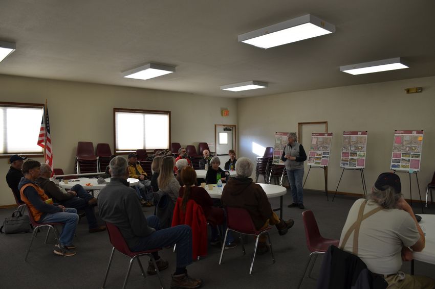
EXECUTIVE SUMMARY
Project Introduction
La Veta is a town of approximately 800 people located in Huerfano County in Southern Colorado. Both
the Cucharas River and Highway 12 run through La Veta. With a majority of the residents being over the
age of 50, it is a priority for the Town of La Veta to create outdoor recreation that meets the needs of its
residents with a multi-generational design and connectivity through its parks, open spaces and trails.

Vision Statement
The purpose and vision of this master plan is to create an interconnected community-based system
of parks, open spaces and trails for people of all ages and abilities and to connect to the regional trail
system. With the help of strategic partners, community members and visitors will be able to enjoy and
see all La Veta has to offer. The local history, arts and people are what makes La Veta unique.

4                            LA VETA TRAILS PARKS, OPEN SPACES AND TRAILS MASTER PLAN
Goals
1. Develop a trail system that connects key city facilities with recreational amenities and the future
   school. Use directional and informational sigange

2. Upgrade parks, open spaces and trails to meet current community needs and desires, including
   year-round and multi-generational uses.

3. Provide additional recreational access to the Cucharas River.

4. Connect La Veta’s trail system to the Front Range Trail and regional recreational amenities.

5. Develop potential future programming options for a La Veta Trails environmental education center in
   the former school annex building.

6. Recognize the economic benefits of parks, open spaces and trails to the local community.

7. Utilize traditional and creative mechanisms for funding the design, planning, construction and
   maintenance of existing and new recreational amenities.

Stakeholder Public Input Process
The first meeting was held in September 2019 at the beginning of the project with the Town of La Veta,
La Veta Trails and La Veta School District to identify goals of the Master Plan. Then, a public opinion
survey was conducted to gather community input on the current usage of La Veta’s recreational
amenities. This public survey remained open until after the first public meeting was completed. At the
first public meeting held, the Master Plan team introduced the project and gathered more information
on what trail routes were used by the residents. Students from the Active Living Class also presented
a summary of their findings from the Rural Active Living Assessment study. Prior to the second public
meeting, the Master Plan team also met with the Town Board to approve concepts being presented
and how to present the final master plan concepts digitally to the community during the COVID-19
Pandemic. During the second public meeting, the Master Plan team presented concepts for trail
connections, the Community Center, the Town Park and other identified Town of La Veta owned property.
This process included receiving feedback from attendees about design elements that they preferred. To
present the final Master Plan, a third public meeting was anticipated but due to the COVID-19 Pandemic
and in the best interest of health and safety, it was cancelled. Instead, the draft plan will be made
available to the community via an online link.

Alternative Development
By utilizing the existing conditions report, stakeholder and community input and Town of La Veta
input, eight concepts for parks and open spaces were created and several different trail routes were
considered during the alternative development process. Based on the public feedback, a preferred
concept was created. The preferred concept emphasized making connections between the La Veta’s
parks, open spaces and trails and included multi-generational activities that can be enjoyed by various
age groups.

                                             EXECUTIVE SUMMARY                                            5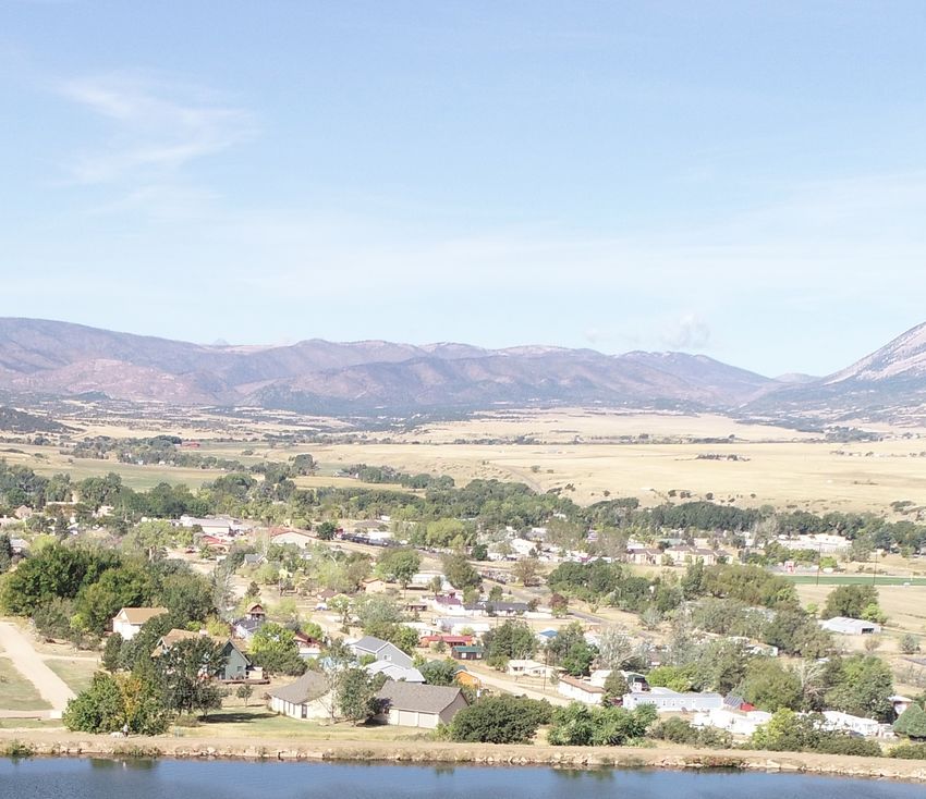
Master Plan Recommendations
Connectivity is a key element to La Veta Parks, Open Spaces and Trails Master Plan. Walking is the
number one form of recreational activity in La Veta. Walking is a main form of exercise for an older
demographic and people of all age groups. Having connectivity will address one of the major
comments heard from survey reponsdents and attenedees of the public meetings.

Planned multi-generational activities at the Community Center will utilize the limited foot print of
the community center and provide for multi-use courts that include programming for both older and
younger members of the population. By proposing more trails and benches in the North West park
system, this Master Plan provides opportunities for all residents of La Veta and visitors. Additionally, a
playground and fitness stations in Town Park will help La Veta stay active.

Providing access to the Cucharas River has been a long-term goal of the people of La Veta and La Veta
Trails, and the Town Board. This plan recommends a riverfront access and a trail that runs parallel for a
portion of the Cucharas River, while still preserving the river’s unique character.

Implementation
This Master Plan provides the structure for La Veta to create a connected system of parks, open spaces
and trails. While the recommendations give the Town a guide to develop the proposed projects,
continued partnership with La Veta Trails will be crucial to engage the community by educating,
organizing volunteers and helping to organize recreational programming.

This Master plan has four phases of programming to help develop proposed projects:

•   Phase 1: Building Momentum

•   Phase 2: Design/Build

•   Phase 3: Site Development

•   Phase 4: Sustainable Programming

Each has programming opportunities the Town or La Veta Trails can direct.

This Master Plan document proposes a logical sequence of phasing for development based on the
Town’s finances and projects that will help engage the community to build momentum. The design and
implementation of a trail along Ryus Ave, Aspen St and Garland St, trail signage and a new playground
at the Town Park are identified as top priorities.

A high-level cost estimate has been provided in the 6.4 Implementation Costs in this Master Plan, a
specific unit cost estimate for each area has been provided in the La Veta Parks, Open Spaces and Trails
Master Plan Appendix document. The overall Cost Estimate for implementing the entire Master Plan is
approximately 5.8 million (based on 2019/2020 costs of goods and services).

The La Veta Parks, Open Spaces and Trails Master Plan identifies implementable projects that could be
funded through various funding sources such as Great Outdoors Colorado (GOCO), Colorado Parks and
Wildlife (CPW), Colorado Health Foundation (CHF), Colorado Department of Agriculture Noxious Weed
Fund and The Next 50 Initiative.

Building on successful existing partnerships, the Town can create programming opportunities that can
help offset maintenance and management costs, while creating a parks, open spaces and trails system
that better serves residents of La Veta.

6                            LA VETA TRAILS PARKS, OPEN SPACES AND TRAILS MASTER PLAN
1. PROJECT INTRODUCTION
1.1 Introduction
Background
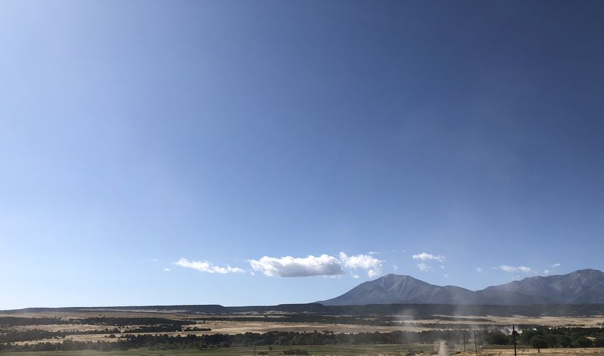
The town of La Veta was established in 1876 and is located in Huerfano County in southern Colorado.
Approximately 800 residents live here year-round, with a majority of the population being over the age
of 50. La Veta is located along the Cucharas River at the base of the Spanish Peaks and is surrounded
by open grasslands and agricultural operations. State Highway 12, which is designated as a scenic
byway known as the Highway of Legends, passes through La Veta and is the main road in town. La Veta
is home to an active and diverse business district that includes many artist and creatives whose crafts
include pottery, glass, jewelry and more.
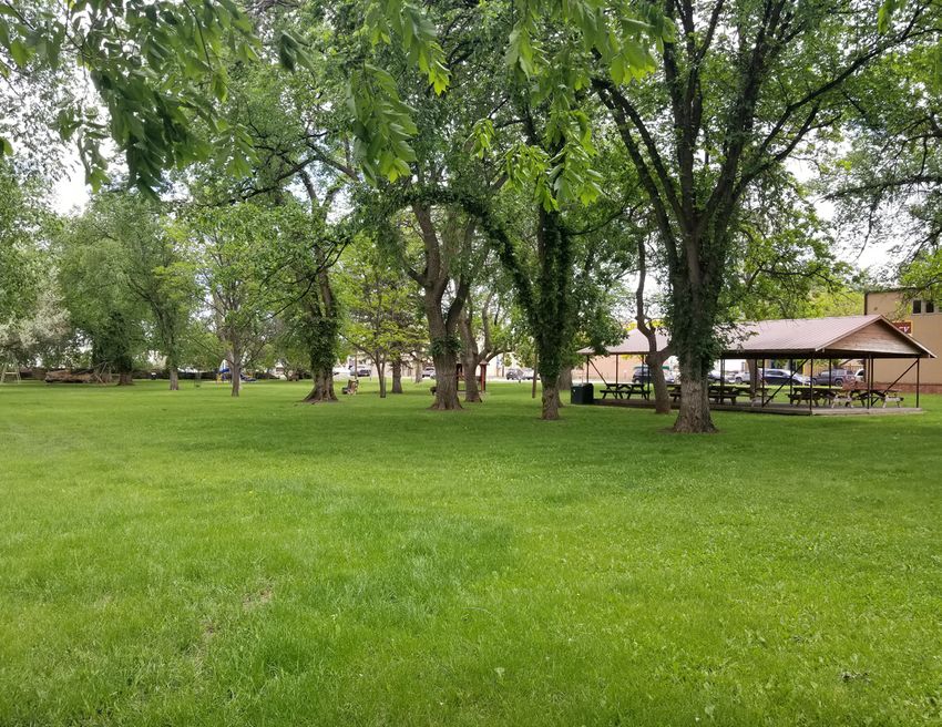
La Veta’s major park is Town Park and is located between Park St. and W. Ryus Ave. The Town Park is
an active and often used site for recreation and for holding events. The School Nature Trail located on
a 3-acre parcel of land owned by the Town is a second major park where people can walk the quarter-
mile interpretative trail and learn about local plants. The Community Center located on E. Ryus Ave.
serves as multi-use building for community gatherings and events. There are several other undeveloped
parcels located around the town that are owned by the Town of La Veta. At the time of writing this
master plan, many of the La Veta’s roads are unpaved and often do not have sidewalks for residents to
use.
PROJECT INTRODUCTION 7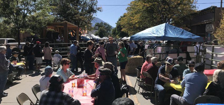
1.2 Visions & Goals
Vision Statement
The vision of this Master Plan is to create an interconnected community-based system of parks, open
spaces and trails for people of all ages and abilities and connect to the regional system. With the help
of strategic partners, community members and visitors will be able to enjoy and see all La Veta has to
offer. The local history, arts and people are what makes La Veta unique.

Goals
1. Develop a trail system with directional and informational signage. This trail system must connect
   key city facilities with recreational amenities and the future school.

2. Upgrade parks, open spaces and trails to meet current community needs and desires, including
   year-round and multi-generational uses.

3. Provide additional recreational access to the Cucharas River.

4. Connect La Veta’s trail system to the Front Range Trail and regional recreational amenities.

5. Based on the transfer of ownership of the school annex building, develop potential future
   programming options for a La Veta Trails environmental education center.

6. Recognize the economic benefits of parks, open spaces and trails to the local community.

7. Utilize traditional and creative mechanisms for funding the design, planning, construction and
   maintenance of existing and new recreational amenities.

Existing School Nature Trail in La Veta

8                                     LA VETA TRAILS PARKS, OPEN SPACES AND TRAILS MASTER PLAN
2. STAKEHOLDER AND
PUBLIC INPUT PROCESS
2.1 The Team
La Veta is a special place to its community members and proof of this is can be found in the partnership
between the Town of La Veta, La Veta Trails and the La Veta School District. La Veta Trails has led the effort
in crafting a vision, getting local community members involved and generating energy around parks,
open spaces and trails.

2.2 Public Outreach & Communication Strategy
An objective of the La Veta Parks, Open Spaces and Trails Master Plan is to create a community-driven
plan through a comprehensive and collaborative public outreach process. To enable the Master Plan
to be fully inclusive and far reaching, the aim of this process was to leverage the local knowledge and
experience of the community. Nobody knows the existing conditions and the future opportunities of
the area better than those who use it every day.

Stakeholder & Town Board Meetings
At the beginning of the planning process, the THK team met with representatives from the Town of La
Veta, La Veta Trails and La Veta Public Schools to identify the vision and goals of the project. Prior to the
second public meeting, THK also met with the Town Board to get approval of the proposed concepts
before showing them to the public.

                                     STAKEHOLDER AND PUBLIC INPUT PROCESS                                       9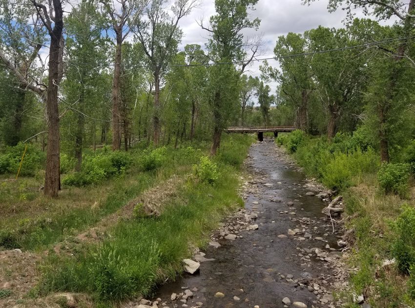
Community Survey
Early in the master planning process, a survey was created to better understand the residents and
visitors use of existing sites and facilities, what activities are preferred and to gauge what improvements
would be desired. Findings from this survey helped to inform the master plan process and to directly
influence the concepts the Master Plan team presented at the second public meeting. A copy of the
survey results can be found in the appendix document. Some key findings of the survey are:

•    Of the 121 people who responded to
     the survey a total of 65% were over
     the age of 50.
•    Walking was rated as the number
     one activity that respondents like to
     do in the parks and trail system both
     in the winter months (October –
     May) at 80% and during the summer
     months (June – September) at 88%
•    Four of the most used facilities are
     Town Park (79%), Wahatoya Lake Trail
     (69%), Daigre Reservoir Trail (55%)
                                                              88%
                                                          of respondents walk
                                                                                                80%
                                                                                              of respondents walk
     and School Nature Trail (52%).
                                                          during the Summer                   during the Winter
These results emphasized the importance of connecting the Town properties to provide more walking
opportunities for residents and that more natural trail systems were preferred.

Oktoberfest
In October of 2019, the Oktoberfest Committee hosted its annual Oktoberfest, which draws thousands of
visitors every year. It was identified early on by the Master Planning Team that this event would provide
a great opportunity to get the word out about the Master Plan and an opportunity to get the community
and visitors to start taking the survey. A booth was set up with paper copies of the survey, instructions
on how to take the survey online and the booth was staffed by two people to help explain the project
and answer any questions. As a result the survey and information about this Master Plan was able to
reach a wider audience who might not otherwise be aware of it.

2019 Oktoberfest that the master planning team attended

10                                 LA VETA TRAILS PARKS, OPEN SPACES AND TRAILS MASTER PLAN
First Public Meeting
The first public meeting was held on November 21, 2019 at the La Veta Community Center. This meeting
consisted of a presentation to introduce the project, a presentation by students from the Active Living
Class to summarize the findings from the Rural Active Living Assessment and an open discussion that
included local and regional maps. These maps
were used to discuss and identify existing trail
routes being used by residents and visitors to
to La Veta. The meeting provided an opportunity
for community members to voice their opinions
and mark up maps about what was currently
working well in La Veta and what was not
working. Major outcomes from this meeting
included understanding what trails in La Veta
and what regional trail connections were
important to attendees. The map comments
were digitized and included in the geodatabase
used for analysis and graphic production. Sam Montalbano and Eleanor Masinton from the Active Living Class
present findings from the Rural Active Living Assessment at the First
Public Meeting
Second Public Meeting
At the second public meeting, held on February 27, 2020, the Master Plan team presented 9 boards that
showed concepts for parks, open spaces and trails in La Veta. Each concept was briefly summarized
before allowing attendees to provide feedback verbally or with sticky notes. Participants were not asked
to choose between alternatives, but rather
to choose individual features they liked
from each plan that was then organized in
a final preferred design alternative. A major
outcome from this meeting included getting
feedback on what design elements should
go into the final preferred concept for the
parks, open spaces and trails.
Focus Groups
After the second public meeting, two
focus groups were held by La Veta Trails Attendees reviewing concepts at the Second Public Meeting
that focused on residents over the age
of 55. These focus groups specifically provided older residents an opportunity to talk about their
needs. Originally, this had been planned as a face-to-face but had to change due to COVID-19. These
focus groups findings covered general demographics about participants, recreational priorities,
recommendations for amenities and improvements and obstacles faced by older residents. A complete
copy of the focus group findings can be found in the appendix documment. A major finding of the
focus groups includes a desire for a river trail that allows for biking and walking and this amenity being
prioritized as the number one priority. Restrooms, safe sidewalks and benches for resting were also
highly prioritized amenities. Participants of the focus groups are walking and exercising outside more
due to the impacts of COVID-19.
STAKEHOLDER AND PUBLIC INPUT PROCESS 113. EXISTING CONDITIONS REPORT 3.1 Methodology Analysis of the existing conditions was completed utilizing the information compiled from site visits, background research, data collection, mapping exercises using existing GIS data, Rural Active Living Assessment data and from data compiled by the students from La Veta. 3.2 Existing Data Collection The following is a list of the existing data and documents that were collected, reviewed and analyzed to complete the Existing Conditions Report. All GIS data was compiled into a geodatabase and existing planning documents were reviewed to identify opportunities and constraints for development options for La Veta’s parks, open spaces and trails. Existing GIS Data and Documents: Town of La Veta GIS Data The Town of La Veta provided GIS aerial photography from 2019. This information was used to help develop base map information and graphics. Huerfano County GIS Data Huerfano County provided GIS data for parcels, state and federal public lands, roads, streams and municipal boundaries. This information was used to help develop base map information and graphics. 12 LA VETA TRAILS PARKS, OPEN SPACES AND TRAILS MASTER PLAN
Design Guidance Accommodating Bicycle and Pedestrian Travel in La Veta
Colorado (2002)
The Design Guidance Accommodating Bicycle and Pedestrian Travel in La Veta Colorado document was
completed in 2002. The document states policy language for La Veta regarding competing interests
between motorized and non-motorized users and provides guidelines and polices for the Town
concerning bicycle safety. This document helped to provide context from previous efforts related to
trails. The document also described trail types desired by the community.

Town of La Veta Comprehensive Plan for Parks and Open Space and Trails (2003)
The Town of La Veta Comprehensive Plan for Parks and Open Space and Trails was a planning document
completed in March of 2003. It establishes goals, objectives, recommendations and implementation
strategies for planning and development of new parks, recreation facilities, trails and open spaces in
La Veta. This document provided previous considerations for many of the areas included in the master
plan. The Comprehensive Plan gave background information and physical descriptions of these spaces.
Additionally, recommendations such as connecting Town Park with other nearby Town owned parcels
was identified and recommended.

2011 La Veta Community Survey
In 2011, a survey was conducted that covered a broad range of topics for residents of La Veta and
visitors. Topics covered in the survey included household make up, economics, social activities and
identified priority projects for the Town, including the improvement of existing sidewalks. The 2011
La Vea Community Survey reinforced the findings of the survey that was done for this master plan.
The 2011 La Veta Community Survey emphasized the importance of improving existing sidewalks.
Improving existing sidewalks was ranked second highest as preferred priority only behind improving
the conditions of existing town roads and storm drainage.

2017 Bike-Walk Huerfano County Survey
A survey that focused on bike and walking recreational uses and needs of Huerfano County residents
was conducted in 2017. Information gathered included preferred walking and biking experiences,
frequency of recreation activities related to the survey, municipalities where respondents recreate and
what reasons respondents did not recreate more frequently. This survey captured preferred areas where
bikers liked to ride and helped to inform different trail alignment options for the bike trail along Hwy 12.

Rural Active Living Assessment (2019)
The Rural Active Living Assessment was a collaborative effort formed between La Veta Trails and the
La Veta Public School District for the NextFifty Initiative to assess conditions in La Veta that promote
or inhibit active living. The La Veta Parks, Open Spaces and Trails Master Plan is a deliverable for the
NextFifty Initiative funding received by La Veta. La Veta School District formed a class of interested
students who collected data and analyzed it to form recommendations for the Town. The findings
included recommendations for immediate, short-term and long-term issues related to the Town’s
programs and policies. The Rural Active Living Assessment findings reinforced the need for La Veta to
create a wayfinding system for its trails.

                                             EXISTING CONDITIONS                                           13
3.3 Site Analysis
Using existing GIS data, field visits, site photos and discussions with locals, a comprehensive picture
was made of La Veta’s existing parks, open spaces and trails. At the beginning of the project, an initial
site visit was conducted to view major park areas such as Town Park, the Community Center, available
Town parcels and the reservoirs, as well as to explore potential regional trail connections. A photo
inventory can be found in the appendix document. This information was used to get a sense of the
parks and their character and what elements would need to be replaced. A map was created to identify
the major public areas and amenities in La Veta and other public areas of interest. See the map below.
Through discussions with La Veta Trails and Town residents, existing trail routes were identified both
in Town and at a regional level. These trails were digitized into GIS and added to the geodatabase for
the project. The geodatabase was used to create maps and graphics included in this master plan. This
information provided a bulk of the recommendation for where new trails are recommended in La Veta
and where street crossing improvements are needed. The existing parcel data provided by Huerfano
County was used to help identify town owned parcels. These parcels were then analyzed and studied
for recreational opportunities and inclusion in the master plan.
NEW SCHOOL SITE
SAN LUIS & RIO
GRANDE RAILROAD
OPEN SPACE AREA
*
FOOTBALL FIELD FAIR GROUNDS
DAIGRE LAKE
TOWN PARK
*
WAHATOYA LAKE
PRACTICE FIELD
CUCHARAS RIVER
*
NATURE AREA
CEMETERY
SCIENCE BUILDING
LEGEND
CHARLES PARK
HIGHWAYS
EXISTING TRAIL
RAIL ROAD
HWY 12
TOWN PROPERTY
SCHOOL PROPERTY
September 17, 2019
GRADNOTE PEAK
GOLF CLUB
0’ 10,000’
N 5,000’ 20,000’
Map that was created to identify public areas and trails to be considered in the Master Plan
14 LA VETA TRAILS PARKS, OPEN SPACES AND TRAILS MASTER PLAN3.4 Student Contributions
To provide support and to gather information, the Active Living Class from La Veta Public Schools
participated throughout the master planning process. This class included a student intern who helped
coordinate data collection and relay updates from the class on progress and information to the Master
Plan team. Products produced by the Active Living Class included a sidewalk inventory model that
details existing sidewalks, structures, stairs and green spaces. Representatives from the class helped to
provide feedback throughout the planning process. Students also created a presentation of the Rural
Active Living Assessment document at the first public meeting. This feedback and site information was
used to decide placement for new sidewalks for trails and emphasized the importance of creating a
signage plan for the Town.
Students from the Active Living Class presenting findings from the Rural Active Living Assessment at the first Public Meeting.
EXISTING CONDITIONS 154. ALTERNATIVE DEVELOPMENT 4.1 Survey & Community Mapping A survey was created to get feedback from residents of La Veta as well as visitors related to recreation in the town. Questions included preferred recreational activities, preferred parks in La Veta, and seasonal interest in outdoor activities. Refer to section 2.2 - Community Survey for a detailed description of questions and summary of responses. In order to understand the community’s needs and desires for trail connections, maps of La Veta’s existing conditions and surrounding connections were created for the first public meeting. This was also an opportunity for the master plan team to get an understanding of what trails were already being used, what elements of existing parks were being utilized and what amenities could use improvements. Trails identified were digitized and added to a GIS database to create an existing trails map that identified trails currently being used by residents. 4.2 Alternative Development Using the existing site conditions, community input from the first public meeting, input from the survey, input from the Active Living students and input from the Town of La Veta, a total of 8 bubble diagrams and 2 trail maps were made. Each diagram depicted different layout options and a variety of elements for the various park sites located around La Veta. The trail maps showed routes in La Veta and at a larger regional scale. These diagrams, maps and explanations of each concept can be found in the appendix document. 16 LA VETA TRAILS PARKS, OPEN SPACES AND TRAILS MASTER PLAN
5. MASTER PLAN
RECOMMENDATIONS
5.1 La Veta Parks, Open Spaces and
Trails Master Plan
The La Veta Parks, Open Spaces and Trails Master Plan recommendations are intended to respond to
the needs of the community. The goals developed earlier in the process were balanced with the existing
site conditions and public input to help organize the site and develop appropriate programming
opportunities.

GOALS:
1. Develop a trail system with directional and informational signage. This trail system must connect
   key city facilities with recreational amenities and the future school.

2. Upgrade parks, open spaces and trails to meet current community needs and desires, including
   year-round and multi-generational uses.

3. Provide additional recreational access to the Cucharas River.

4. Connect La Veta’s trail system to the Front Range Trail and regional recreational amenities.

5. Based on the transfer of ownership of the school annex building, develop potential future
   programming options for a La Veta Trails environmental education center.

6. Recognize the economic benefits of parks, open spaces and trails to the local community.

7. Utilize traditional and creative mechanisms for funding the design, planning, construction and
   maintenance of existing and new recreational amenities.

                                       MASTER PLAN RECOMMENDATION                                      17
5.2 Preferred Alternative
The following section discusses the proposed concepts selected by residents of La Veta after the second
public meeting. Proposed elements are numbered and refer to site plans found on page 21 for the
Community Center and page 25 for the Northwest Park System.
Trails:
This Master Plan represents a long-time goal of the residents of La Veta for an accessible and connected
system of parks, open spaces and trails. By providing a more connected system that is accessible,
this plan addresses one of the major findings that was reiterated in previous documents, the public
meetings and the surveys: residents of La Veta—and specifically older residents—enjoy walking. More
trails that connect to more destinations in town and regionally provides a better walking experience
while also providing a safe and accessible mode of travel to in-town recreation spaces without having
to use a vehicle.
The Highway 12 Planning and Environmental Linkages (PEL) Study conducted by Colorado Department
of Transportation (CDOT) and South Central Council of Governments (SCCOG) is looking at the
Southern Mountain Loop that is part of the Front Range Trail. The Southern Mountain Loop/Hwy 12
passes through and forms La Veta’s main street. As part of the Southern Mountain Loop plan, it was
decided that maintaining the trail adjacent to Hwy 12 will be the most beneficial option, as it allows
for CDOT to provide funding for improvements. Hwy 12 improvements include roadway markings to
allow bikes to share the road through the entire length of La Veta. Update all curbs at intersections to
be ADA compliant. Currently, a vast majority are not ADA compliant in La Veta. The trail map on the
following page identifies areas along Hwy 12 that need improved pedestrian crossings and signage. The
improvements to pedestrian crossings will also help to slow down traffic, improve safety and address
the concerns of residents.
Existing trails and social paths are already being used by many of the Town’s residents and visitors.
However, there are issues regarding safety, accessibility and directional signage that the community
has identified. The figure to the right shows the location of new and existing trails and proposed sign
locations. The signs will include trail network information signage and trail markers at .25 mile intervals.
Currently existing trails have users walking on gravel roads and alleyways. It is proposed to install 6’
concrete trails adjacent to the gravel roads and not the alley ways. The new concrete trails will allow
residents to get off the road, provide better walking for a wider range of mobility and lower mainte-
nance. The proposed trail network helps to connect the Town’s green spaces and provides access to the
new proposed parks and improvements. Benches will also be placed strategically for trail users.
The most common type of
physical activity among older
adults, regardless of age and
other sociodemographic
attributes, is walking for
exercise or transportation
purposes.
(Loukaitou-Sideris, Levy-Storms,
Brozen, 2014)
Existing sidewalks and trails in La Veta
18 LA VETA TRAILS PARKS, OPEN SPACES AND TRAILS MASTER PLAN0
SH 160
451
Middle Creek
LA VETA - TRAILS
430
TRAIL TO NATIONAL FOREST
CO-12
TRAIL TO GREAT SAND
Cucharas
River DUNES NATIONAL PARK
ASPEN ST
RYUS AV
*
CHERRY ST
S
CHERRY ST *
OAK ST S
*
* *
1ST ST
OAK ST
2ND ST
HIGH ST
YASO
C T
MAIN ST
*
*
*
*
FIELD ST
BIRCH ST S
GRAND ST
GRAND
BIRCH ST
FRANCISCO ST
MOORE AV
WALNUT ST
NFOR
GRAND AV
POPLAR ST
FIELD ST
AIR
AIRP
PINE ST
PO
ORT
RT
SPRUCE ST
R
TRAIL TO WILDERNESS AREA
LN
D
ELM ST
ARROWHEAD DR
VA
L
CO-12 ALIGNMENTT
LE
Y
RO
AD
36
5
LEGEND
LA VETA ECL
CDOT Highway and Roads
Rivers & Streams
3651
Existing Trails
Wa
Proposed Trails ha toya
Cre 35
ek
Proposed Front Range 7
TRAIL TO LATHROP STATE PARK
Trail Alignment
Town Boundaries
359
3501
Public Land
Pedestrain Crossing
*
Improvement
S Trail System Sign Locations
N 0’ 600’ 1,200’ 1,800’
MASTER PLAN RECOMMENDATION 19Community Center & Expanded Parking (1-6):
The intent of the Community Center and expanded parking is to create an in-town recreational hub.
Currently, the site has an existing basketball court that is used, lawn space and four outdoor tables.
The Community Center building is utilized for a wide range of activities including Town meetings,
organizational meetings, private events and funeral services. Programmed elements, such as pickleball,
are proposed with an aging demographic in mind; while the volleyball/basketball court cater to La Veta’s
youth and existing school volleyball program. The proximity to the new school will increase the visibility
of amenities at the community center.
The preferred alternative includes a dual basketball and volleyball court (1), an overhead shade
structure with seating (2) and a dual tennis court and pickleball court (3). Both the basketball court or
the tennis court areas can be used for a non-permanent ice skating rink during the winter. An open lawn
(4) has been left to the south of the tennis/pickleball court for informal gatherings and for lawn games
such as bocce ball and horseshoes. To help screen the street and provide wind blocks, trees have been
added throughout the site. Concrete paths will allow for circulation throughout the site and connect to
adjacent parking and streets.
Parking has been formalized (5) in front of the community center to accommodate anticipated increase
of use and visitors to the site. This expansion keeps the two existing accessible parking spaces and adds
an additional 15 standard parking spaces. Additional parking (6) has been added at the adjacent Town
owned property, as well as relocating the existing recycling center. The additional parking will add two
accessible parking spaces and 16 standard spaces.
Basketball/Volleyball Court Non-Permanent Ice Skating Rink
Senior citizens, especially
when they’ve experienced
health setbacks, are often at a
higher risk for depression and
anxiety than other age groups.
Organized recreational activities
can help reduce this risk in more
than one way.
(United Way, 2017)
Tennis/Pickleball Court
20 LA VETA TRAILS PARKS, OPEN SPACES AND TRAILS MASTER PLANBIRCH ST
1
2
5
MOORE
AVE
4
3
VEHICULAR ACCESS
E RYUS AVE
POST OFFICE
6
RECYCLING BINS VEHICULAR ACCESS
N
Plan view of proposed Community Center improvements
MASTER PLAN RECOMMENDATION 21Baseball Field (7):
At the time of this master plan writing, the Town of La Veta was in discussion with the Two Peaks Fitness
Youth Sports League for the renovation of the existing baseball field (7) on site. Reorienting the field
and moving existing structures will allow for a Babe Ruth League standard field. Additional parking has
been added including two accessible parking spaces and 21 standard spaces.
Town Park (8-9):
Town Park is one of the most utilized spaces in La Veta and during the planning process, was often
mentioned by community members. An emphasis was made by the community to leave the character
of the Town Park as an open space. This site functions and serves the community well, so intervention
was minimal. Two reoccurring themes were brought up in discussions related to the park: the existing
play structures on the site that need to be replaced and an event space where local community
members could gather and perform was desired.
A stage (8) is been proposed behind the former Town Hall building. Removal of the existing play
structures will allow a larger lawn area for events, concerts and outdoor classes for education and
recreation.
The proposed playground addresses feedback provided by the community in the survey and through
the public meeting: develop a multi-generational approach. The new playground (9) will be built at the
west end of Town Park near the existing shelter. This new playground will include nature play elements
for structures, boulders, a rock-climbing feature and a swing set. Additionally, outdoor exercise
equipment that is appropriate for an older demographic have been included. A walkway with seating
surrounds the perimeter of the playground. This design encourages intergenerational play that can
occur together or alongside one another.
A perimeter walkway around Town Park helps to provide accessibility and give more opportunities for
walking without interfering with the open feel of the park. Parking has been formalized and added near
the bathroom, which includes two accessible parking spaces and 12 standard parking spaces. A bicycle
rack that accommodates 7 bicycles will be located near the existing bathroom.
A senior citizen playground emphasizes core
muscle strength and focuses on activities such
as walking, building strength, and increasing
flexibility.
(AAA State of Play)
Senior-Focused Outdoor Exercise Equipment
Nature Play Area
22 LA VETA TRAILS PARKS, OPEN SPACES AND TRAILS MASTER PLANSTAGE
8
W RYUS AVE
BATHROOM
BIKE RACK
PARKING
PARK ST
SHELTER
PLAYGROUND
OUTDOOR EXCERCISE
EQUIPMENT
9
SWING SET
CLIMBING FEATURE
& BOULDERS
N
S OAK ST
The Town Park
MASTER PLAN RECOMMENDATION 23Cucharas Riverfront (10-11):
A long-term goal of the Town of La Veta’s Board has been to provide access to the Cucharas River.
The interest in access to the Cucharas River has been compounded by the recent flooding events that
have impacted the town and required clean-up. This clean-up event provided community members
the opportunity to see the river up close and reignited the community’s interest in accessing the river.
The proposed riverfront and associated improvements will provide a place for residents and visitors to
interact and to appreciate the natural resources in La Veta.
Additional parking is proposed on South Oak St and includes one accessible parking space and 7
standard spaces. A bicycle rack that accommodates 5 bikes is located next to the parking and pedestrian
crossing. An overhead shade structure with benches will utilize the current skate park footprint along
the trail. A river access (10) with stone steps and ramp allows for accessible access to the Cucharas
River. A pedestrian crossing will span the east to west bank and will provide a connection to a wildlife
viewing spot. A crusher fines trail (11) will lead to a pedestrian crossing to the Arboretum.
Arboretum (12):
The arboretum provides a scenic overlook to the surrounding land north of La Veta and will also provide
an educational opportunity to learn about vegetation found in Colorado, by using native tree species in
landscaping. A crusher fines path loops around the arboretum, with seating located at strategically to
allow for rest. A bicycle rack that accommodates 3 bicycles will be located near the entrance off of West
Ryus Ave.
River access
View from Arboretum existing site
Parks can reduce the prevalence of
social isolation, provide opportunities
for intergenerational interaction, and
create a sense of place and attachment.
(Loukaitou-Sideris, Levy-Storms, Brozen, 2014)
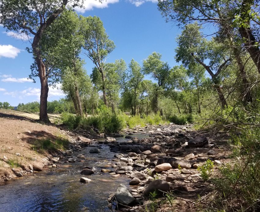
Cucharas River in La Veta
24 LA VETA TRAILS PARKS, OPEN SPACES AND TRAILS MASTER PLANMAIN ST
W RYUS AVE
8
7
PARK ST
9
W 1ST AVE
S OAK ST
16
10
WILDLIFE
VIEWING
RIVER
ARAS
15 CUCH
11
WILDLIFE
VIEWING
14
ARBORETUM
CROSSING
0
45
Y
HW
13
12
N
North-West park system
MASTER PLAN RECOMMENDATION 25Pump Track & Sky Garden (13-14):
Mountain biking is a recreational activity that has been growing in popularity over recent years.
Surrounding La Veta there are multiple opportunities for mountain biking including at Lathrop State
Park, Bear Lake Trail and Blue Camp Trail. Currently, there is not a good location for new comers to the
sport to learn these mountain biking skills. The proposed pump track provides this opportunity for a safe
and low risk area to learn these skills.
An approximately quarter mile paved pump track (13) with native grasses is proposed on the western
and southern portions of the site. Parking with two accessible spaces and 10 regular spaces will
be located at the entrance. To provide a gathering space, a 20’x20’ shelter and a bicycle rack that
accommodates 7 bicycles will be located at the entrance to the pump track.
Additionally, by designing and building the pump track to USA Pump Track Championship standards, La
Veta could host national events. The USA Pump Track Championships is an “all age category grass roots
pump track race focused on national talent.” (Carruth, 2020). Hosting these events will bring in visitors
and revenue for La Veta.
The Sky Garden provides a space for residents to view the night sky. Community members and
residents who attended the public meetings or answered the survey mentioned the importance of
maintaining the view of the dark night sky. A crusher fines path will lead to the sky garden (14) that
features numerous lawn mounds buffered by trees that will allow for day and night viewing of the
sky in La Veta. These landforms also provide opportunities for sledding or practicing skiing during the
winter months.
Sky Garden
Pump Track
26 LA VETA TRAILS PARKS, OPEN SPACES AND TRAILS MASTER PLANCucharas River Walk (15):
Similarly, to the Cucharas Riverfront (10), a trail along the Cucharas River provides visitors and
residents a way to appreciate the Town’s natural resources. A crusher fines trail with several wildlife
viewing areas will provide connectivity to the sky garden (14), dog park (16) and Cucharas riverfront
(10).
Dog Park (16):
The Town of La Veta confirmed that they will be purchasing a former brownfield site that is adjacent
to the Cucharas River. This proposed site allows for a dog park that is approximately an acre in size.
La Veta Trails organized local community members that are interested in having a dog park to provide
feedback on what amenities are desired. Based on input from community members, the elements in the
dog park include a small dog area, large dog area, shelter, dog bag stations, benches, waste disposal
and a watering area. Parking at this site includes one accessible space and 10 standard spaces. A bicycle
rack that accommodates 3 bicycles will be located near the dog park entrance. Native grasses, tree
plantings and crusher fines paths will connect to the nearby baseball field (7), sky garden (14), Cucharas
river trail (15) and will surround the dog park.
Wildlife viewing
Open spaces provide settings
for both passive and active
recreation. Older adults need
to remain active as they
age and require spaces that
accommodate their limitations
in mobility and strength.
(Loukaitou-Sideris, Levy-Storms, Brozen, 2014)
Dog Park concept made by local community members for the former skate
park site off of S Oak St, prior to plans to purchase the now proposed dog
park site
MASTER PLAN RECOMMENDATION 27VEHICULAR ACCESS
PARKING
16
LARGE DOG AREA
BIKE RACK SHELTER
NATIVE GRASSES
SMALL DOG
AREA
RAILROAD
CROSSING
W 1ST AVE
RIVER WALK
WILDLIFE
VIEWING PEDESTRIAN
BRIDGE WILDLIFE 15
VIEWING
CUCHARAS RIVER
PARKING
LAWN
SKY GARDEN
14
BIKE RACK
13
PUMP TRACK
SHELTER
NATIVE GRASSES
N
Pump Track, Sky Garden, Cucharas River Walk and Dog Park
28 LA VETA TRAILS PARKS, OPEN SPACES AND TRAILS MASTER PLAN5.3 Additional
Recommendations
Wahatoya Lake and
Daigre Reservoir:
Outside of the La Veta town limits, Wahatoya Lake
and Daigre Reservoir are located immediately
adjacent to the Town. Wahatoya Lake and Daigre
Reservoir have existing trails around their
perimeter that are frequently used by Town
members. Wahatoya Lake can be accessed via
Hwy 358 or by accessing the trail located off of
Elm Street. Daigre Reservoir can only be accessed
by vehicle via Hwy 358. Based on public feedback
View of Daigre Reservoir’s existing trail two improvements are proposed to the lake
trail system. Creating an accessible fishing dock
and trail at Wahatoya Lake. Creating a trail connection between Wahatoya Lake and Daigre Reservoir.
The creation of an accessible trail and fishing dock would provide more recreational opportunities for
a wider range of mobilities. The connection between the lakes provides a safer route to access Daigre
Reservoir.
Opportunities near the new school:
At the time of this master planning, the La Veta School District was in the process of finalizing their
plans for a new school. Depending on the final design, there is a potential opportunity for several
parcels, located off Pinkerton Rd, to be utilized for trail development to provide connection to the
school. These areas could also serve as a pocket park, informal gathering space or outdoor exercise
equipment location.
Site plan for La Veta’s new school
MASTER PLAN RECOMMENDATION 295.4 Additional Considerations Economic Impacts of Trail Systems to the La Veta Region’s Economy: The anticipated La Veta Trail System will have significant economic impacts to the regional economy. Not only will the trail system provide improved and positive visual enhancements and create additional opportunities for health and wellness activities, there will be economic impacts to La Veta and Huerfano County. The trail system can be expected to attract additional visitors to the area that will generate additional economic activity and expenditures. According to American Trails, “Parks tend to increase the value and sale price of homes and property located nearby. In addition, the amount of local tax dollars required to operate and service recreation areas may be less than for other types of land use, such as residential developments, further increasing the fiscal impacts they have on municipal governments.” Additionally, “studies indicate that proximity to a park increases home value by two to 22 percent”, as well as “tourists to notable parks generate additional income for nearby businesses and the local government”. (Citiesspeak, 2016) Property Values – A May 2020 article by the National Recreation and Park Association indicates that a majority of homeowners believe that convenient access to a trail system increase the value of their home. Specific percentages of the amount of increase were not reported. THK Associates, Inc. has appraisal services in house. Our experience tells us that homes within easy access and exposure to a trail system will have a 5% higher value due to the trail. If the average home in the La Veta area near the trail system has a value of $450,000 there would be an increased value of $20,000. At a 7.14% assessment rate, the increased assessed value would be $1,430. La Veta has a mill levy of 4.990 and Huerfano County has a mill levy of 20.986. Therefore, for every home in La Veta and Huerfano County that is located near the trail system there would be additional annual property taxes to La Veta and Huerfano County of $37.00 per year. Sales Taxes - According to the Colorado Tourism Office, the most recent reports (2018) show that in there were 23,000,000 visitors to the Pikes Peak region of Colorado in 2018, the closest area to La Veta for which statistics were available. Of the total number of visitors, approximately 55% were day visitors. And expenditures were $665 million of $52.60 per visitor, per day. THK Associates, Inc. would estimate that a typical day would see 125 visitors. Using this data as a base, the proposed La Veta trail system may generate $2,400,000 in annual expenditures for items such as food and beverage, fuel, and miscellaneous retail shopping. La Veta has a current sales tax rate of 3.50% and Huerfano County has a sales tax rate of 3.00%. Therefore, a $2,4000,000 increase in expenditures would generate $84,000 in additional sales taxes to La Veta and Huerfano County would realize $72,000 in additional sales taxes. Interior view of Town Park 30 LA VETA TRAILS PARKS, OPEN SPACES AND TRAILS MASTER PLAN
Nature Center LEED Certification:
La Veta Trails is working to develop an Environmental Learning Center in the school annex building
which will be acquired in 2021. One of the goals in developing this facility is to achieve LEED
certification. The desire for certification aligns with the goals of the organization and will serve as an
example in the community of how sustainability can be achieved, even in an existing building.

Leadership in Energy and Environmental Design, commonly known as LEED, is a globally recognized
green building rating system. LEED provides a framework for designing, constructing, renovating and
maintaining healthy, highly efficient and cost saving green buildings. LEED certification is a recognized
measure of sustainability.

LEED Certification is achieved through the LEED rating systems that are designed to capture both
a buildings physical systems and the way the building is occupied and operated. To earn LEED
certification, a project must demonstrate compliance with all mandatory prerequisites and select a
number of optional credits to pursue. One hundred points are available. LEED certification levels are
determined by the number of points achieved – the higher the score, the more “green” the building. In
order to achieve LEED certification, a minimum of 40 points are required.

After touring the building and speaking to members of the La Veta Trails organization, this Master
Plan recommends that the rating system used is LEED for Existing Buildings: Operations and
Maintenance (LEED O+M Existing Buildings). This rating system was selected because it raises the
standards for green operations and helps existing buildings improve efficiency, reduces waste and
maintains a responsible and sustainable building. This rating system primarily focuses on how the
building operates and is not tied to major renovations and little to no construction. In addition, much
of the required documentation and monitoring can be completed by members of the La Veta Trails
organization or as a part of educational programming. There are seven categories that are measured:

   •   Sustainable Sites
   •   Water Efficiency
   •   Energy and Atmosphere
   •   Materials and Resources
   •   Indoor Environmental Quality
   •   Innovation and Design
   •   Regional Priority
A table can be found in the appendix document that shows all of the available Credits for LEED O+M
Existing Buildings V4.1, including prerequisites and the recommended prioritization of each credit.
Note, prerequisite credits must be accomplished to apply for LEED certification.

Main entrance to the school annex building
                                             MASTER PLAN RECOMMENDATION                                      31
6. IMPLEMENTATION 6.1 The Town of La Veta, La Veta Trails and La Veta School District Partnership The Master Plan provides the structure for the La Veta Parks, Open Spaces and Trails to better meet the needs of La Veta residents, community members and visitors. While the recommendations provide a guide to develop the various sites for the Town of La Veta, partnership with La Veta Trails provides the opportunity to help engage the community by educating, organizing volunteers and helping to organize recreational programming. Additionally, partnering with La Veta Public Schools provides the opportunity for more recreational programming, coordination of using school amenities and resources for gathering momentum. 32 LA VETA TRAILS PARKS, OPEN SPACES AND TRAILS MASTER PLAN
6.2 Programmatic Phasing
There are four (4) programmatic phases identified to help maintain excitement and momentum for the
development of parks, open spaces and trails in La Veta.

  •   Phase 1: Building Momentum
  •   Phase 2: Design/Build
  •   Phase 3: Development
  •   Phase 4: Sustainable Programming
Each has opportunities for the Town of La Veta, La Veta Trails and the La Veta School District can direct.
The following describes each phase and vies examples of Town directed programming opportunities.

Phase 1: Building Momentum
Phase 1 programming is focused on community involvement. The development of the trails system
signage will help to address one of the major issues identified in the Rural Active Living Assessment,
that residents and community members are not aware of amenities they already have. This is also an
opportunity to include future trail plans on the trail maps, to show proposed trails and connections that
are being planned for the town.

Phase 2: Design/Build
Phase 2 of programming is an opportunity for parts of the Master Plan to be designed and built through
programming opportunities. The Town could partner with La Veta Trails or La Veta School District or
any social groups to implement elements of the site. An example of this would be organizing a group
of volunteers to help with clearing of sidewalks around Town when snow falls help so trails remain
accessible even during winter months, as well as cultivating ownership of the trail system for those
involved.

Phase 3: Site Development
Phase 3 includes starting to design and construct the trail and 5 main activity areas of the Master Plan.
These areas can have educational activities, volunteering, and social programming to help engage the
community and keep the momentum of the Master Plan as it continues to be implemented. Dog park
enthusiasts could be organized to help clear up any debris on the existing site, or programming classes
that can be taught at the outdoor stage in Town Park are examples of ways to generate engagement and
excitement for improvements in La Veta.

Phase 4: Sustainable Programming
Phase 4 includes additional site development based on active reoccurring programming needs.
Ongoing programs provide a variety of opportunities for the local community and is one of the best
ways to get older age demographics involved and active. Utilizing partnerships that can manage and
maintain these programs and potentially provide capital resources to build some of the more elaborate
site features. Sustainable programs often start small and grow with support of the local community.
Examples of this would be dog training classes at the proposed dog park or hosting events at the
proposed pump track.

                                               IMPLEMENTATION                                                33
6.3 Development Phasing
Much like the programming phasing, development phasing must happen in a logical sequence. The
following development phasing plan outlines the recommended sequence of project development.
Priority Projects:
The following projects are recommended as priority projects. It is highly recommended the Town
consider Phase 1: Building Momentum programming strategies to engage the local community and
help build momentum.
• Trails: Signage – $15,000.00
• New Playground & Fitness Stations – $179,100.00
• River Trail along Ryus Ave, Aspen St and Garland St – $9,770.00
• River Trail Garland St Pedestrian Bridge - $146,000.00
Trail signage will help to address one of the major findings of the Rural Active Living Assessment
study, which indicated that most residents and community members of La Veta do not have a
complete knowledge of the recreational amenities available to them. The current playground in Town
Park is outdated and dangerous. A new playground with surfacing and fitness stations provides an
intergenerational recreational space. A crusher fines River Trail along Ryus Ave, Aspen St and Garland
St would provide more connection and access to the river. A pedestrian bridge will be required to
complete the connection to Garland St for the River Trail.
Secondary Projects:
The following actions and projects are ideally implemented early on in the process as ways of helping
to bring in more revenue for the town and address the biggest want identified in the master planning
process.
• NW Park & Dog Park: Pump Track
• Trails outside of proposed parks/Improvements to existing sidewalks
• Community Center
Prioritizing the NW Park & Dog Park: Pump Track provides an opportunity for the Town to bring in
revenue by holding regional events. The Community Center has amenities that were strongly advocated
for during the planning process from both older and younger age groups.
The following projects are all low programming projects that will provide instant use by the public
without intense maintenance concerns.
• Town Park & River Access
• River West & Arboretum
The following project requires the highest amount of maintenance and management once
implemented.
• NW Park & Dog Park
• Baseball Field
It is recommended the Town develop a maintenance and management plan for these individual areas
prior to implementation.
34 LA VETA TRAILS PARKS, OPEN SPACES AND TRAILS MASTER PLAN6.4 Implementation Costs
The Master Plan includes a high level cost estimate broken down by areas identified in the Master
Plan Recommendations. The costs were developed using 2019/2020 construction pricing and does not
anticipate future pricing changes. For a more detailed cost estimate for the site see Appendices.
DESCRIPTION TOTAL
Community Center $364,660.80
Town Park & River Access $7776,625.60
River West & Arboretum $227,346.02
NW Park & Dog Park $1,189,181.46
Baseball Field $580,955.60
Trails $2,666,982.00
CONSTRUCTION GRAND TOTAL $5,806,351.46
6.5 Grants & Partnership Opportunities
The Master Plan attempted to identify implementable projects that could be funded through various
funding sources. La Veta is located along the Southern Mountain Loop, which is a part of the Front
Range Trail. Investment in La Veta could not only benefit its residents, but the Southern Mountain Loop
users through improvements in its trails through connectivity and accessibility. It is also positioned
between two of Colorado’s State Parks—Fishers Peak and Lathrop State Park. An investment in the
improvement of La Veta’s parks, open spaces and trails is also an investment in improving the regional
trail.
Several opportunities exist for La Veta to leverage money for grants. Improvements along the Highway
of Legends/Highway 12 can be used for match for GOCO grants. This includes improvements outside
of the La Veta town limits such as work being completed in Walsenberg by CDOT. Additionally,
recreational amenities being built as part of the La Veta School District’s new school could be leveraged
for match for GOCO. DOLA has grants for infrastructure improvements that support economic
development, by positioning the proposed pump track as a regional venue to hold events La Veta could
qualify for funding.
Grants
Several grant agencies and programs exist that can help fund the project in La Veta. These agencies
include:
GREAT OUTDOORS COLORADO (GOCO)
• Local Park and Outdoor Recreation (LPOR) Grants help build
or improve community parks, outdoor recreation amenities,
outdoor athletic facilities and environmental education
facilities. Funding is also available for land acquisitions.
• Youth Corps Grants employ Colorado Youth Corps
Association crews on projects like building trails, erosion
control, revegetation and eradicating invasive species.
• Habitat Restoration Grants improve and restore
Colorado’s rivers, streams, wetlands and critical habitat on
permanently conserved land.
IMPLEMENTATION 35You can also read