Facilitating the deployment of highly and fully automated vehicles in road traffic along the Asian Highway Network - Study Report 2022
←
→
Page content transcription
If your browser does not render page correctly, please read the page content below
Study Report 2022

Facilitating the deployment of
highly and fully automated
vehicles in road traffic along the
Asian Highway Network
The Economic and Social Commission for Asia and the Pacific (ESCAP) serves as the United Nations regional hub promoting cooperation among
countries to achieve inclusive and sustainable development. As the largest regional intergovernmental platform with 53 member States and 9 associate
members, ESCAP has emerged as a strong regional think-tank, offering countries sound analytical products that shed insight into the evolving economic,
social and environmental dynamics of the region. The Commission’s strategic focus is to deliver on the 2030 Agenda for Sustainable Development by
reinforcing and deepening regional cooperation and integration to advance connectivity, financial cooperation and market integration. The research and
analysis of ESCAP coupled with its policy advisory services, capacity-building and technical assistance to governments aims to support countries’
sustainable and inclusive development ambitions.

The views expressed in this publication are those of the authors and do not necessarily reflect the views of the United Nations Secretariat. The opinions,
figures and estimates set forth in this publication are the responsibility of the authors and should not necessarily be considered as reflecting the views
or carrying the endorsement of the United Nations.

The designations employed and the presentation of the material in this publication do not imply the expression of any opinion whatsoever on the part
of the Secretariat of the United Nations concerning the legal status of any country, territory, city or area, or of its authorities, or concerning the
delimitation of its frontiers or boundaries.

Mention of firm names and commercial products does not imply the endorsement of the United Nations.

The present publication was prepared by the Transport Division of ESCAP under the overall guidance of Ms. Azhar
Jaimurzina Ducrest, Transport Connectivity and Logistics Section Chief and led by Mr. Edouard Chong, with
contributions from Mr. Changju Lee, Economic Affairs Officers, Transport Division. Core authors comprised of
(alphabetical order): Mr. Andrey Yershov, Dr. Mikhail Nizov, Dr. Vladimir Kryuchkov and Dr. Yu Shen.

Grateful acknowledgment is made to the Government of the Russian Federation for the generous funding of this study.
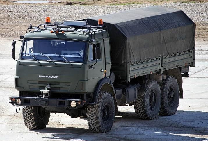
Table of Contents
0. Executive Summary ..................................................................................................................... 4
1. Introduction .................................................................................................................................. 5
1.1. Overview of the AH Route 9 ................................................................................................. 5
1.2. Rationale, Purpose and Scope of the Study ........................................................................... 5
2. Existing Technologies in Smart Transport Systems .................................................................... 7
2.1. Overview of Existing Concepts ............................................................................................. 7
2.1.1. Automated Vehicles (AVs) ............................................................................................ 7
2.1.2. Connected Vehicles (CVs) & Cooperative-Intelligent Transport Systems (C-ITS) ...... 9
2.1.3. Smart Cities .................................................................................................................. 13
2.1.4. Infrastructure Required for Operation.......................................................................... 14
2.2. Specific Status of Countries along the AH 9 Route ............................................................ 15
2.2.1. The Russian Federation ................................................................................................ 15
2.2.2. Kazakhstan ................................................................................................................... 17
2.2.3. China ............................................................................................................................ 18
2.3. Lessons Learned in Asia and the Pacific ............................................................................. 19
2.3.1. Singapore ..................................................................................................................... 19
2.3.2. Australia ....................................................................................................................... 20
2.3.3. The Republic of Korea ................................................................................................. 20
2.3.4. Greater Region ............................................................................................................. 21
2.4. Lessons Learned from Other Regions ................................................................................. 21
2.4.1. Europe .......................................................................................................................... 21
2.4.2. United States ................................................................................................................ 22
2.5. Potential Benefits from Previous Studies ............................................................................ 23
2.5.1. Safety Improvements ................................................................................................... 23
2.5.2. Economic Savings ........................................................................................................ 23
2.5.3. Greenhouse Gas Reduction .......................................................................................... 24
3. Country Feasibility Studies ........................................................................................................ 25
3.1. China ................................................................................................................................... 25
3.1.1. Technical and Operational Condition of the AH route 9 ............................................. 25
3.1.2. Strategic Plans for Smart Highway Development ....................................................... 27
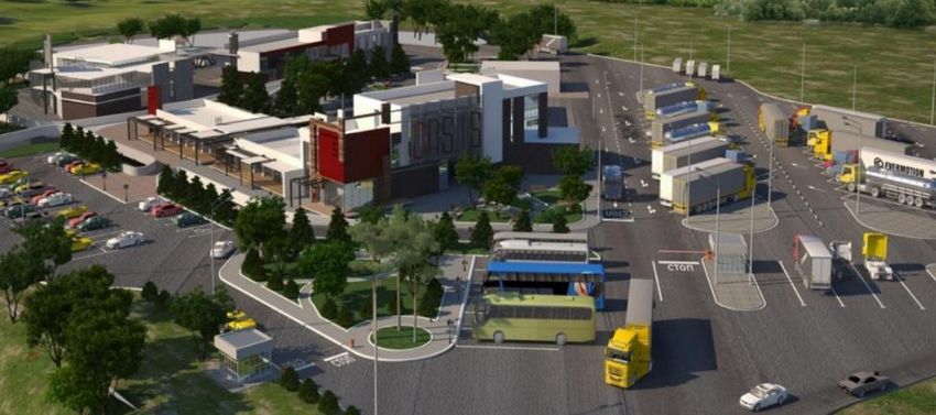
3.1.3. Representative Smart Highway Pilot Projects ............................................................. 32
3.1.4. Availability of Smart Infrastructure ............................................................................. 33
3.1.5. Usage of Highly and Fully Autonomous Vehicles ...................................................... 34
3.1.6. Social Acceptance of HFAV ........................................................................................ 37
3.1.7. Legal and Regulatory Framework................................................................................ 38
3.2. Kazakhstan .......................................................................................................................... 41
3.2.1. Technical and Operational Condition of the AH route 9 ............................................. 41
3.2.2. National and Regional Policy Initiatives ..................................................................... 47
Page 1 / 82
3.2.3.      Research and Development Initiatives ......................................................................... 49
        3.2.4.      Usage of Highly and Fully Autonomous Vehicles ...................................................... 50
        3.2.5.      Current Status and Development Plans for Smart Infrastructure ................................. 50
        3.2.6.      Social Acceptance of HFAV ........................................................................................ 54
        3.2.7.      Data Security and Privacy Concerns ............................................................................ 55
        3.2.8.      Legal and Regulatory Framework................................................................................ 56
     3.3. The Russian Federation ....................................................................................................... 58
        3.3.1. Technical and Operational Condition of the AH route 9 ............................................. 58
        3.3.2.      Strategic Plans for the AH route 9 Development ......................................................... 62
        3.3.3.      Current Status and Plans for ITS Deployment ............................................................. 63
        3.3.4.      Adequacy of the AH route 9 Infrastructure for Autonomous Vehicles ....................... 66
        3.3.5.      Social Acceptance of Highly and Fully Autonomous Vehicles ................................... 67
        3.3.6.      Legal and Regulatory Framework................................................................................ 68
        3.3.7.      Representative Research and Development Projects ................................................... 68
        3.3.8.      Usage of Autonomous Vehicles ................................................................................... 76
4.      Conclusions and Policy Recommendations ............................................................................... 77
     4.1. Lessons Learnt from Technological Status and Regulatory Investigations ........................ 77
     4.2. Lessons Learnt from Feasibility Studies ............................................................................. 78
     4.3. Policy Recommendations .................................................................................................... 79
        4.3.1. Proactive Policy Support at the National Level ........................................................... 79
        4.3.2.      Enhancement of Cooperation and Collaboration Among Neighbouring Countries .... 80
        4.3.3.      Guidelines on Establishing Overarching Strategies Along AH Routes ....................... 80
References .......................................................................................................................................... 82

                                                                                                                                          Page 2 / 82
Abbreviations:

     Abbreviation   Full Name
          AADT      Average annual daily traffic
          ADAS      Advanced driver assistance systems
            ADS     Automated driving system
               AL   Automatization level (of an automated vehicle)
          ATMS      Automated traffic management systems
             BRI    Belt and Road Initiative
            CITS    Cooperative intelligent transport systems
            CEN     Comité Européen de Normalisation (Committee of European standards)
               CT   Committee of Transport of Kazakhstan
            DRT     Directorate of Road Transport of Kazakhstan
           EAEU     Eurasian Economic Union
   ERA-GLONASS      State Automated Information System in Russian Federation
            ETSI    European Telecommunications Standards Institute
            FOC     Fibre optical cable
           FSUE     Federal State Unitary Enterprise (a legal form of state-owned company)
           GOST     National standard in Russian Federation
           GPRS     General Packet Radio Service
          HFAV      Highly and fully automated vehicles (both trucks and cars)
             ICT    Information and Communication Technologies
             ISO    International Organisation for Standardisation
             ITC    International Transport Corridor
              ITS   Intelligent transport system
             LTE    Long-term evolution (wireless broadband communication standard)
            MIID    Ministry of Industry and Infrastructure Development of Kazakhstan
            ODD     Operational design domain
           OICA     Organisation Internationale des Constructeurs d'Automobiles
             V2C    Vehicle to cloud
             V2I    Vehicle to infrastructure
            V2V     Vehicle to vehicle
            V2X     Vehicle to everything

                                                                                             Page 3 / 82
0. Executive Summary

This report assesses the current connectivity status along the Asian Highway 9 (the AH route 9 or the
West Europe – West China International Transport Corridor) identifying policy, infrastructure and
technology gaps and challenges for seamless international connectivity for highly- and fully
automated road vehicles (HFAV) in China, Kazakhstan and the Russian Federation (the target
countries).

In addition to the feasibility analysis, the report also offers possible directions for future development
and use of HFAV along the AH route 9 in the target countries in terms of policies and regulations,
road infrastructure, smart transport systems and onboard vehicle devices.

This report consists of five Chapters organised in the following way:
   - Chapter 1 introduces the purpose and the scope of the Study;
   - Chapter 2 presents basic backgrounds for the existing technologies in ITS and autonomous
       driving covering the definitions and concepts of automated vehicles, connected vehicles,
       cooperative-ITS and smart cities;
   - Chapter 3 discusses the general technical and operational conditions for the use of HFAV
       along the AH route 9 in the target countries, including current status and development plans
       for their physical and smart infrastructures, representative R&D initiatives and application
       experiences of automated vehicles, as well as legal and regulatory frameworks and challenges;
   - Chapter 4 summarises key findings of the Study and provides policy recommendations to help
       to streamline the deployment of HFAV along the AH route 9 in the target countries; and
   - Chapter 5 concludes the report.

The report has been prepared by the Secretariat based on inputs of individual consultants and national
experts engaged by UNESCAP in 2020-2021.

                                                                                                Page 4 / 82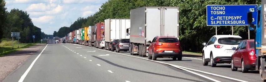
1. Introduction

1.1.   Overview of the AH Route 9
The Asian Highway 9 (AH route 9) is a land route connecting Chinese seaport Lianyungang with
Saint Petersburg, the “north capital” and seaport of the Russian Federation, across the territories of
China, Kazakhstan and the Russian Federation.

                 Figure 1. AH9 route: Intergovernmental Agreement on Asian Highway Network, Annex I

The total length of the AH route 9 is 8,445 km of which 2,233 km run through the territory of the
Russian Federation, 2,787 km through Kazakhstan, and 3,425 km through China.

The route represents a continental alternative to the Trans-Siberian Railway and the maritime traffic
through the Suez Canal aiming to reduce the travel time from 45 days required for sea freight shipping
and 14 days for freight transport along the Trans-Siberian Railway to 10 days by road.

In China, the route is known as “the Lianyungang–Khorgas Expressway” (Lianhuo Expressway, G30)
whereas in Kazakhstan and in the Russian Federation it is referred to as “the West Europe – West
China International Road Corridor”. It encompasses several core national highways across the target
countries as it traverses their national boundaries and huge territories.

The scope of analysis of the study will give particular focus to highly and fully automated vehicles
(HFAV) and smart transport systems along the AH route 9.

1.2.   Rationale, Purpose and Scope of the Study
The use of highly and fully automated vehicles (HFAV) and smart transport systems (also referred to
as ITS) can significantly reduce the economic, social and environmental costs of passenger and freight
transport, while enhancing its overall quality and resilience. Although this potential contribution is
widely acknowledged, their implementation in Asia and the Pacific in general, and in the target
countries in particular, is lagging behind due to various factors, including low awareness of the role
of smart transport systems, limited capacity for implementation and a lack of regional cooperation,
hindering the exchange of best practices and experiences.

The use of highly and fully automated vehicles on international road corridors will depend on the
progress made by countries in implementing smart transport technologies at the national level. At the
same time, highly and fully automated vehicles for international transport will depend on achieving
a common understanding at the regional level of the principles of using smart transport systems, as
well as on the willingness and ability of countries to jointly address issues related to transport
infrastructure and operational needs along highways or at border crossings. As the implementation of
any emerging technologies must come with relevant laws and policies, the development of the
autonomous vehicle industry is also inseparable from the support of the legal system.

                                                                                                      Page 5 / 82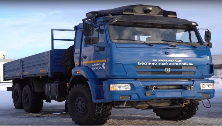
This Study has been launched by ESCAP with the purpose to facilitate the deployment of highly and
fully automated vehicles in road traffic along the AH route 9 within the territories of China,
Kazakhstan, and the Russian Federation, and assist other countries of the region by sharing lessons
learnt and knowledge accumulated to date to increase the common understanding and awareness of
current initiatives, challenges and advantages related with the introduction of HFAV in road traffic
at national, regional and global levels.

In this regard, the scope of the Study includes collection and analysis of available information and
data on the AH route 9 within the target countries and in a broader regional context to assess potential
operationality of HFAV along the AH route 9. Respectively, the research subjects of the Study
include: (i) current status and development plans for road infrastructure and smart systems along the
AH route 9 within the territories of the target countries; (ii) ongoing and planned national initiatives
related to the development and introduction of HFAV in road traffic; and (iii) availability and usage
of ITS and other smart technologies along the AH route 9 which can support smart HFAV operation.

Based on the findings of the Study, the overall adequacy of the existing infrastructure and operational
connectivity was been assessed and existing conditions and gaps of technologies and infrastructure
were identified.

The subject of the Study is highly relevant to support the efforts of the target countries in developing
their smart infrastructure in line with the global trends that would allow a seamless operation of
automated freight road vehicles along the AH route 9 in the future. In this sense, improving the
sustainability performance of international road transport by using highly or fully automated vehicles,
can contribute to the delivery of the region’s sustainable development agenda.

                                                                                              Page 6 / 82
2. Existing Technologies in Smart Transport Systems
2.1. Overview of Existing Concepts
The spotlight on Automated Vehicles (AVs) has increased in recent years as technologies quickly
grow closer to achieving the goal of driverless vehicles operating on public roadways. To begin to
address the status of highly and fully AVs from selected countries along the Asia Highway (AH)
routes, three interconnected concepts are first defined that have been mostly discussed in recent years
–AVs, Connected Vehicles (CVs) and Cooperative-Intelligent Transport Systems (C-ITS) and smart
cities.
2.1.1. Automated Vehicles (AVs)
Automated, autonomous, or self-driving vehicles are defined by the U.S. Department of
Transportation's National Highway Traffic Safety Administration (NHTSA) as “those in which
operation of the vehicle occurs without direct driver input to control the steering, acceleration, braking
and are designed so that the driver is not expected to constantly monitor the roadway while operating
in self-driving mode.” For the sake of standardization, clarity, and consistency, the Society of
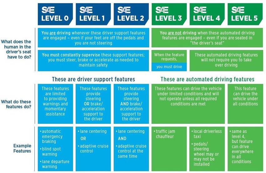
Automotive Engineers (SAE) outlined international definitions for levels of automation. These
definitions divide vehicles into levels based on “who does what and when.” The higher the level, the
more automated the vehicle: The higher the level, the more automated is the vehicle, as shown on
Figure 2 and discussed in detail below.
Figure 2. SAE J3016™ levels of automation.1
• Level 0: No Automation. The human driver does all the driving. The driver is in complete
and sole control of the primary vehicle controls—brake, steering, throttle, and motive
power—at all times.
1
Retrieved from SAE web-site: https://www.sae.org/news/2019/01/sae-updates-j3016-automated-driving-
graphic#:~:text=The%20J3016%20standard%20defines%20six,%2Dvehicle%20(AV)%20capabilities (last accessed on
8 February 2021).
Page 7 / 82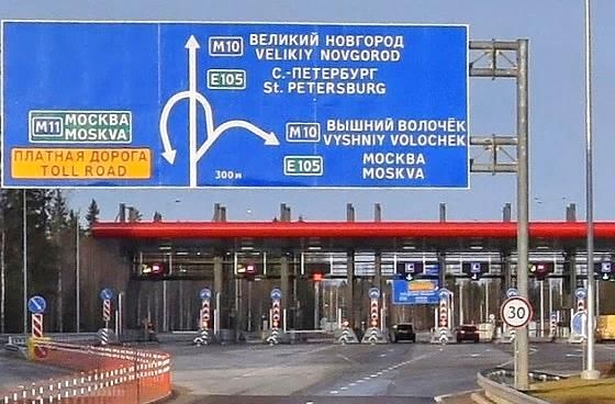
•   Level 1: Function-Specific Automation. Automation at this level involves one or more
        specific control functions. Examples include electronic stability control or pre-charged brakes,
        where the vehicle automatically assists with braking to enable the driver to regain control of
        the vehicle or stop faster than human reaction. An Advanced Driver Assistance System
        (ADAS) on the vehicle can assist the human driver with either steering or
        braking/accelerating.
    •   Level 2: Combined Function Automation. This level involves automation of at least two
        primary control functions designed to work in unison to relieve the driver of control of those
        functions. For example, adaptive cruise control in combination with lane centring is a
        combined function. An ADAS on the vehicle can control both steering and
        braking/accelerating under some circumstances. The human driver must continue to pay full
        attention (“monitor the driving environment”) at all times and perform the rest of the driving
        tasks.
    •   Level 3: Limited Self-Driving Automation. Vehicles at this level of automation enable the
        driver to cede full control of all safety-critical functions to an Automated Driving System
        (ADS) under certain traffic or environmental conditions. The human driver must be available
        for occasional control and be ready to take back control (with adequate transition time)
        whenever the ADS requests the human driver to do so. The driver can rely heavily on the
        vehicle to monitor for changes in those conditions requiring transition back to driver control.
        In all other circumstances, the human driver performs the driving tasks.
    •   Level 4: Full Self-Driving Automation. The vehicle is designed to perform all safety-critical
        driving functions and monitor roadway conditions for an entire trip. Such a design anticipates
        that the driver will provide destination or navigation input but is not expected to be available
        for control at any time during the trip. This includes both occupied and unoccupied vehicles.
        Vehicles with level 4 automation may also be referred to as AVs. An ADS on the vehicle can
        itself perform all driving tasks and monitor the driving environment – essentially, do all the
        driving – in certain circumstances. The human need not pay attention in those circumstances.
    •   Level 5: An ADS on the vehicle can do all the driving in all circumstances. The human
        occupants are just passengers and need never be involved in driving.2

AVs use satellite positioning systems and various sensors (i.e. radar, ultrasonic, infrared, laser, etc.)
to detect and process the surrounding environment.3 These sensors interpret information to find
appropriate paths considering obstacles and traffic signage by using wireless networks, digital maps,
automated controls in vehicles, and information and communication technology.4 Because AVs are
technology-intensive, many private automobile manufacturers and Internet-oriented technology
companies are also actively driving toward research and development.

AVs have existed primarily as prototypes but have recently become commercially available and many
cities are amending the legislations to permit automated driving on roadways. While the leading
countries in Intelligent Transport Systems (ITS) are working to develop such vehicles, some cities
have already made noteworthy progress.5 Vehicles with limited automated driving functions are
already available on the market (SAE Levels 1 and 2),6 while some Level 3 vehicles are commercially

2
  Available from http://autocaat.org/Technologies/Connected_and_Automated_Vehicles/
3
  ESCAP, Review of developments in transport in Asia and The Pacific (Bangkok, 2017).
4
  ESCAP, Policy Framework for the Use and Deployment of Intelligent Transport Systems in Asia and the Pacific –
Study Report (Bangkok, 2018).
5
  Wang, X., 2016. ITS development and deployment in China. EGM on Asian Highway. Intelligent Transportation
Systems Center. Available from
http://www.unescap.org/sites/default/files/3.1%20China_Mr.%20Xiaojing%20Wang.pdf, accessed 3 February 2017
6
  See the details at http://autocaat.org/ Technologies/Automated_and_Connected_Vehicles/
                                                                                                        Page 8 / 82
available in certain leading ITS countries. More and more countries are testing Levels 3 and 4 vehicles
should appear on the market in the early 2020’s.7
2.1.2. Connected Vehicles (CVs) & Cooperative-Intelligent Transport Systems (C-ITS)
Connected Vehicles (CVs)
CV technologies function within a Vehicle-to-Vehicle (V2V) and Vehicle-to-Infrastructure (V2I)
data communications environment, supporting numerous applications to improve roadway safety,
mobility, and environmental impacts.
The infrastructure-based component and vehicle-based component of these applications may be
developed by different stakeholders:
• Infrastructure-based components are expected to be developed by the state and local agencies
responsible for building and maintaining the roadway infrastructure and their contractors.
• Vehicle-based components are expected to be developed by vehicle manufacturers, their
primary suppliers, and aftermarket system suppliers.
CVs use any number of different communication technologies to communicate with the driver, other
cars on the road (V2V), roadside infrastructure (V2I), and the “Cloud” (V2C). This technology can
be used to not only improve vehicle safety, but also to improve vehicle efficiency and commute times.
Performance requirements encourage synchronized and consistent exchange of data between both
infrastructure and vehicle application components in order to best capture the attention of the driver
without confusion.
a. Vehicle-to-Infrastructure (V2I)
Vehicle-to-Infrastructure (V2I) is the next generation of ITS and C-ITS. State and local agencies are
likely to install V2I infrastructure integrated with or alongside existing ITS equipment. Because of
this, the majority of V2I deployments may qualify for similar government-aid programmes as ITS
deployments, if the deploying agency meets certain eligibility requirements. Examples of V2I Safety
Applications are:8
• Curve Speed Warning (CSW): alerts drivers of an upcoming curve and provides a warning
when the vehicle’s current speed may be too high to safely traverse upcoming curves.
• Red Light Violation Warning (RLVW): alerts drivers of an upcoming signalized intersection
and provides a warning when they may violate an upcoming red light based on their speeds
and proximity to a signalized intersection.
• Reduced Speed Zone Warning with Lane Closure (RSZW/LC): alerts drivers of an upcoming
reduced speed zone and/or changed roadway configuration. Provides a warning to drivers
when exceeding speed limits in reduced speed zones and, given lane level accuracy, warns of
7
European Commission, On the road to automated mobility. Available at https://ec.europa.eu/transport/
sites/transport/files/3rd-mobility-pack/com20180283_ en.pdf.
8
See Executive Summary U.S. Department of Transportation, Office of the Assistant Secretary for Research and
Technology Intelligent Transportation Systems Joint Program Office V2I Safety Application Performance
Requirements – Volume 1), available from: https://rosap.ntl.bts.gov/view/dot/3592 (last accessed in October 2021).
Page 9 / 82changed roadway configurations. Reduced speed zones may include school zones, work
zones, and populated areas.
• Spot Weather Information Warning – Reduced Speed (SWIW-RS): uses standalone weather
systems to alert drivers of inclement weather conditions (i.e., fog, wind, adverse surface
conditions, etc.) that may impact travel conditions and provides a warning if a driver should
slow down through the impacted weather zone.
• Spot Weather Information Warning – Diversion (SWIW-D): uses standalone weather systems
to alert drivers of roadway closures related to inclement weather conditions (i.e., fog, wind,
adverse surface conditions, etc.). Alerts the driver when the vehicle approaches a weather-
related road closure and advises an alternate route in advance of the diversion point.
• Stop Sign Gap Assist (SSGA): informs drivers at stop-controlled intersections of unsafe gaps
due to approaching cross-traffic.
b. Vehicle-to-Vehicle (V2V)
Vehicle-to-Vehicle (V2V) communication is a crash avoidance technology that relies on the exchange
of information between nearby vehicles to potentially warn drivers about dangerous situations that
could lead to a crash. V2V communication enables vehicles to wirelessly exchange information about
their speed, location, and direction all while maintaining anonymity of the driver and vehicle. The
technology behind V2V communication allows vehicles to broadcast and receive omni-directional
messages (up to 10 times per second), creating a 360-degree “awareness” of other vehicles as well as
traffic, terrain, and weather in its proximity. V2V messages have a range of approximately 300
meters, which exceeds the capabilities of systems with ultrasonic sensors, cameras, and radar – in
some cases, by nearly twice the distance, allowing more time to warn drivers. V2V communication
extends and enhances available crash avoidance systems to detect potential crash threats as they
develop. The technology can then employ visual, tactile, and/or audible alerts, enabling drivers to
take advance action to avoid crashes. For example, V2V could help warn a driver that a vehicle up
ahead is braking and they need to slow down, or let a driver know that it’s not safe to proceed through
an intersection because another car (yet unseen by the driver) is quickly approaching. V2V
communication technology can increase the performance of vehicle safety systems and help save
lives.
This technology can be comprised of several innovations, such as:
• V2V messages can “see” around corners or “through” other vehicles addressing, for example,
scenarios such as those where an oncoming vehicle emerges from behind a truck, or perhaps
from a blind alley, detecting the threat much earlier than radar or camera sensors.
Additionally, V2V technology can also be combined existing radar and cameras to provide
even greater benefits than either approach alone. This combined approach could also augment
system accuracy, encouraging the introduction of AVs on roads and highways.
• Dedicated Short-Range Communications (DSRC) can enable a number of safety
“applications” that help drivers with different aspects of driving, such as warning of stopped
vehicles in the road ahead, vehicles speeding unexpectedly through intersections, vehicles in
blind spots, etc. DSRC are two-way, wireless communications permitting secure and fast
messaging needed for safety applications, where “short range” is approximately 300 meters
depending on the surrounding environment. These communications are emitted in a 75 MHz
band of the 5.9 GHz spectrum for use by ITS vehicle safety and mobility applications. This
Page 10 / 82band affords a relatively clean operating environment with very few preexisting users,
allowing for a relatively unimpeded and interference-free communication zone. DSRC-based
devices can be installed directly in vehicles when originally manufactured, after initial
manufacture via an “aftermarket” installation, or could potentially be carried into vehicles by
drivers in the form of a handheld device (even as a function on a smart phone).
• Basic Safety Message (BSM) is exchanged between vehicles and contains vehicle dynamics
information such as headway, speed, and location. BSMs are updated and broadcasted up to
10 times per second to surrounding vehicles. The information is received by the other vehicles
equipped with V2V devices and processed to determine collision threats. If necessary, a
warning could be issued to drivers to take appropriate action to avoid an imminent crash.
V2V can enhance the capabilities of other on-board systems and enable warnings that might not
otherwise be available without V2V. Potential applications of V2V technology include:
• Intersection Movement Assist (IMA) warns the driver when it is not safe to enter an
intersection because of an increased potential for colliding with one or more vehicles.
• Left Turn Assist (LTA) warns the driver when there is strong probability they will collide
with an oncoming vehicle when making a left turn. This is especially critical when the driver’s
line-of-sight is blocked by a vehicle also making a left turn from the opposite direction.
• Emergency Electronic Brake Light (EEBL) warns the driver to be prepared to act when a
V2V-equipped vehicle traveling in the same direction but not in the driver’s line-of-sight
decelerates quickly. V2V would allow the driver to “see through” vehicles (particularly in
poor weather conditions) to learn if traffic ahead may be coming to an abrupt stop.
• Forward Collision Warning (FCW) warns the driver of the risk of an impending rear-end
collision with a vehicle ahead in traffic in the same lane and direction of travel.
• Blind Spot Warning (BSW) notifies the driver that a vehicle in an adjacent lane is positioned
in the driver’s “blind spot” zone.
• Lane Change Warning (LCW) warns the driver when making a lane change that another
vehicle is present in or approaching the “blind-spot” zone.
• Do-Not-Pass Warning (DNPW) warns the driver that it is not safe to pass a slower-moving
vehicle when vehicles are approaching from the opposite direction.
Security system design is based on the mature and successfully applied Public Key Infrastructure
(PKI). PKI is widely used in our daily lives, most commonly found in banking and credit card
transactions. However, the system envisioned for V2V is unique in that it involves machine-to-
machine PKI which improves some of the vulnerabilities associated with other PKI systems. PKI for
V2V communication will require a Security Credentials Management System (SCMS) that issues,
distributes, and revokes security credentials for devices operating in the system to ensure V2V
messages can be trusted and to protect the privacy of users. Devices will then need to have valid
certificates in order to communicate. Occasionally, devices will need to securely receive new
certificates via a communications network, which facilitates two-way encrypted communications
between an SCMS and a device (and, potentially, roadside infrastructure).
Page 11 / 82The current proposed design for V2V systems employs a very high level of security and is compliant
with the latest standards to support deployment of V2V technologies in a manner that safeguards the
system from unauthorized access. It is actively engaged with security experts to ensure
comprehensive security prior to system implementation. The V2V system will not collect, broadcast,
or share personal information between vehicles, nor does it permit tracking of specific drivers or their
vehicles. V2V-enabled vehicles only exchange generic and anonymized safety information. The
system is designed with several layers of security and privacy protection to ensure that drivers can
rely on messages sent from other vehicles and that authorities and vehicle manufacturers can identify
defective V2V equipment without collecting or using any personal information about specific
vehicles or drivers.9
c. Vehicle-to-Cloud (V2C)
With the emergence of connected “infotainment” systems (connected navigation, social media, music
streaming, and in-car Wi-Fi) and accompanying automotive application frameworks, more advanced
vehicle connectivity platforms and cloud capabilities are required. It also requires broadband cellular
connectivity, initially 3G, but now increasingly 4G, and with 5G based services. Additionally, Over-
the-Air (OTA) is quickly becoming a key vehicle lifecycle management tool as well as an enabler of
analytics and big data approaches. Finally, with CVs increasingly communicating, interacting, and
engaging with other connected industries such as energy, transportation, and smart homes, the cloud
is quickly becoming a key technology to enable cars to connect with the wider Internet of Everything
(IoE).10
d. Vehicle-to-Pedestrian (V2P)
Vehicle-to-Pedestrian (V2P) detection systems can be implemented in vehicles, within infrastructure,
or with pedestrians themselves to provide warnings between drivers and pedestrians. In-vehicle
warning systems are becoming more and more commonplace (e.g., blind spot warning, forward
collision warning), with even more advanced warning systems on the way (e.g., intersection
movement assist, left turn assist). In-vehicle warnings of pedestrians will also help increase roadway
safety. Handheld devices for pedestrians are perhaps the simplest and most apparent warning system
for pedestrian.
A mobile accessible pedestrian signal system is a V2P application that enables an automated call from
a visually impaired pedestrian’s smart phone to the traffic signal. Additionally, drivers attempting to
make a turn are alerted to the presence of a pedestrian in the crosswalk. Pedestrian in signalized
crosswalk warning (transit) is a similar application that warns transit bus operators when pedestrians
are in the crosswalk of a signalized intersection on the bus’s route. In terms of automated
technologies, some stakeholders have been researching pedestrian crash avoidance and mitigation
systems that can automatically brake to avoid striking a pedestrian (in both intersection and mid-
block conditions). These systems could potentially address up to 46 per cent of pedestrian crashes.
Technologies that notify both vehicles and pedestrians of potential collisions could be enhanced with
infrastructure communication. A pedestrian device that communicates with various infrastructure
components has the potential to more accurately interpret and predict pedestrian movement than a
pedestrian device that only communicates with vehicles within a short range.11
9
Available from http://autocaat.org/Technologies/Connected_and_Automated_Vehicles/
10
Ibid
11
Available from http://autocaat.org/Technologies/Connected_and_Automated_Vehicles/
Page 12 / 82Cooperative-ITS (C-ITS)
Cooperative-Intelligent Transport Systems (C-ITS) is an advanced stage of ITS that utilizes V2V and
V2I technologies and can operate in multimodal and international contexts. These technologies rely
on three major components— vehicular on-board units, infrastructure roadside units, and a central
managerial system.12 C-ITS advances transport systems as it capitalizes on the latest enhancements
and additional services that result from interlinking systems.13
Modern transport systems are continuously evolving together to accurately respond to users’ various
demands, sometimes referred to as a “Complex Adaptive System of Systems”.14 The “Concept of
Operations” is an innovation method to effectively manage the ever-growing complex system of
systems.15 This concept proposes a modular and open design of ITS applications that can easily be
connected in order to create a full ITS network.16 Currently, most ITS work in silos. Even though one
ITS application is an integrated system with various technologies, each individual ITS application is
not easily integrated into other ITS applications. Some ITS applications are combined through a
control centre but are limited in response times to external needs (e.g. disaster or emergency events).
Standardization is necessary to achieve full interoperability among ITS applications, which will
improve resiliency against user’s demands.
2.1.3. Smart Cities
Growing urbanization is causing cities to rethink how to increase the sustainability of cities while
providing adequate infrastructure and services for growing populations. Redesigning infrastructure is
essential to adapt cities to evolving social needs and growing economic competition. Citizens also
have higher expectations for quality of life and public authorities must provide efficient transport
systems with seamless connectivity while meeting environmental challenges through technology
enhancements and capabilities.
Deployment of ITS on a global scale has propagated promising opportunities to transform
socioeconomic life. According to the United Nations Economic Commission for Europe, “ITS is not
only an innovative transport technology. It is a new way of living, a new business approach, and
overall, a new culture for all players. Every portion of the transport sector of the future will be a
receiver and a sender of information. Mega-cities will no longer be about how much to expand
infrastructure to serve the continuous increase in population, but rather how to make the most use of
the existing infrastructure to better serve more people”.17
Smart city status has become a common vision among cities in recent years. The concept of a smart
city does not compete with the efforts already done to improve economic, environmental, and social
sustainability; instead, a smart city can support these progresses already underway. Although each
12
Available from https://ec.europa.eu/transport/themes/its/c-its_en, accessed 3 March 2017.
13
Ministry of Land, Infrastructure and Transport, undated. ITS National Plan 2020 (2nd ver.), Republic of Korea.
14
Johnson, B., and A. Hernandez, 2016. Exploring Engineered Complex Adaptive Systems of Systems. Elsevier B.V.
Available from http://www.sciencedirect.com/science/article/pii/S1877050916324656, accessed 8 April 2017.
15
Chokesomritpol, P., and M. B. Regmi, 2016. Next-generation Intelligent Transport System (ITS): concept of
operations. United Nations Economic and Social Commission for Asia and the Pacific, Transport Division,
unpublished.
16
Available from https://ec.europa.eu/transport/themes/its/c-its_en, accessed 3 March 2017.
17
United Nations Economic Commission for Europe, 2012. Intelligent Transport Systems (ITS) for Sustainable
Mobility. Geneva, Switzerland.
Page 13 / 82city has different emphases according to the future goals, the core concept is to benefit from smart
technologies (i.e. ICT). The World Bank18 outlines two targets of a smart city:
- “A technology-intensive city, with sensors everywhere and highly efficient public services,
thanks to information that is gathered in real time by thousands of interconnected devices.
(For example, trash cans have sensors that indicate when they are full, and trash collectors
follow a specific route based on this information.) All buildings are “intelligent”, with smart
meters and energy saving systems, and transport is painless.”
- “A city that cultivates a better relationship between citizens and governments—leveraged by
available technology. They rely on feedback from citizens to help improve service delivery
and creating mechanisms to gather this information. For example, citizens are more active in
managing their neighbourhoods. Open government data is used by civil society to co-create
smart phone applications (or an SMS service), e.g. to report a full trash can, and trash
collectors can accommodate their routes based on this information.”
Smart cities gain full situational awareness from sensors scattered throughout a city, communicated
through wireless networks, shared with relevant agencies and analysed to understand and take proper
actions in a city.19 Smart city technologies can also prevent traffic and climate situations in advance,
anticipate tasks based on modelled patterns, and eventually, optimize asset operations.20 Smart cities
bring more benefits through the digitalization, centralization, and interconnectedness of transport
systems. Additionally, environmentally friendly transport modes, such as electric vehicles, AVs and
personal rapid transit, can be operated through a combination of intelligent traffic signal operations
and smart infrastructure.21 After all, an eco-friendly transport environment is a product of the
reduction of associated negative externalities in smart cities.
2.1.4. Infrastructure Required for Operation
Automated Vehicles (AVs)
The infrastructure required for the operation of AVs involves integrating cameras, radar, lidar (image
sensing), satellite navigation systems, computer vision, and other technologies that can detect the
traffic environment and its changes. Using this information, the manipulation of the vehicle
mechanisms then follows so that direct human operation of the vehicle can be minimized.22
Cooperative-Intelligent Transport Systems (C-ITS) & Connected Vehicles (CVs)
C-ITS allows CVs to communicate with each other, roadside infrastructure and other wireless
services. They involve sharing real-time information about the surrounding environment with other
vehicles, infrastructure, and access devices, allowing for enhanced mobility and safety. The
infrastructure elements include mobile data networks, wireless technologies (including Wi-Fi), DSRC
and radio frequencies, to enable the creation of a connected vehicle network of Vehicle-to-Everything
(V2X) communication.23 Connections to mobile data networks via phone towers enable V2X
18
Available from http://www.worldbank.org/en/topic/ict/brief/smart-cities, accessed 4 April 2017.
19
Available from http://readinessguide.smartcitiescouncil.com/, accessed 2 April 2017.
20
Ibid
21
Ibid
22
National Association of Counties, ‘Connected and Automated Vehicles Toolkit: A Primer for Counties’, 2019, h
https://www.naco.org/sites/default/files/documents/2019%20CAV%20Toolkit%20Four%20Pager_09.5.19%20v2_FIN
AL_1.pdf.
23
National Association of Counties, ‘Connected and Automated Vehicles Toolkit: A Primer for Counties’, 2019, h
Page 14 / 82communication over large distances to disseminate information such as traffic delays, rapid braking,
slippery road conditions and distances between vehicles travelling in the same direction. DSRC
technology accessed through built-in DSRC car units is effective for distances up to 1 km to determine
when a conflict is likely, based on comparing a car’s own location, direction and speed with other
vehicles.24
Smart Cities
Infrastructure involved in the creation of a smart city is the result of combining physical
infrastructure relating to transport, energy, water, and waste with digital infrastructure involving ICT
such as IoT, sensors, networks, BIM/GIS, Big Data & Machine Learning.25 The infrastructure
elements for the operation of a smart city involve the deployment of a network of static cameras,
sensors and actuators located throughout the urban area together with mobile devices. Within the
transport ecosystem, these elements are facilitated through an integrated cloud platform that connects
vehicles, people, infrastructure and logistic partners with access to their data typically via wireless
mobile devices. In addition to access to real time data on traffic conditions, occupancy of parking
spaces, location of vehicles; the smart city network offers other services such as air/water quality
information, the structural health of bridges, roads, or buildings, and the location and status of city
resources, police officers, or healthcare facilities.26,27
2.2. Specific Status of Countries along the AH 9 Route
2.2.1. The Russian Federation
The Russian Federation is exploring several ITS projects that have the potential to relate to the
Europe-West China smart transport corridor. One such project is an ITS corridor with Finland with
the ultimate goal of using similar technologies to create a full-service international transport corridor
for connected and automated vehicles from Europe to China.28 The corridor consists of two parts:
• СARAVAN – an innovative project of Russian Federal Road Agency (Rosavtodor) which is
aimed to create digital infrastructure on federal roads for common, connected and self-driving
vehicles, using technologies of C-ITS, V2V, V2I, and V2X. The vision of the project is to
create international smart transport corridors with service continuity across borders.
• CAVLANE – the Connected Automated Vehicle Lane Consortia, was initiated by the Finnish
Ministry of transport together with a few private companies from Finland and the Russian
Federation. The objective of CAVLANE is to create new services, products, and standards for
https://www.naco.org/sites/default/files/documents/2019%20CAV%20Toolkit%20Four%20Pager_09.5.19%20v2_FIN
AL_1.pdf.
24
Centre for Road Safety, ‘Connected Vehicles’, New South Wales, November 2021,
https://roadsafety.transport.nsw.gov.au/research/roadsafetytechnology/cits/index.html
25
Mavoco, Smart City – Combining physical and digital infrastructure,2021, https://www.mavoco.com/smart-city-
infrastructure/.
26
S. P. Mohanty, U. Choppali and E. Kougianos, "Everything you wanted to know about smart cities: The Internet of
things is the backbone," in IEEE Consumer Electronics Magazine, vol. 5, no. 3, pp. 60-70, July 2016, doi:
10.1109/MCE.2016.2556879,
https://ieeexplore.ieee.org/stamp/stamp.jsp?tp=&arnumber=7539244&isnumber=7539234.
27
Cassandras, C.G, Smart Cities as Cyber-Physical Social Systems. Engineering. 2. 156-158, 2016,
www.sciencedirect.com/science/article/pii/S2095809916309420.
28
Available from: Vladimir Kryuchkov, Co-deployment of fiber optic cables for cross-border connectivity along the
highway routs in Russian Federation, presentation for UN ESCAP, 2018.
Page 15 / 82crossing borders. New intelligent services increase road safety, improve mobility and
logistics, boost businesses, and create markets for new innovations.
The CAVLANE/CARAVAN smart route, which originates in Finland’s largest cities and runs via
Helsinki through the border with the Russian Federation to Saint Petersburg, Moscow, and Kazan to
the border with Kazakhstan and China. The project tests cross-border interoperability of different
relevant international standards and directives for communication, C-ITS, automatic driving, platoon
driving, use of fibre-optic cables for cross-border and custom procedures, information of travellers,
and road users about traffic and weather conditions, traffic jams and queues at the cross-border points,
road-side services, road works and accidents, navigation and selecting detour routes, etc.
In May 2018, the first demo test of automated trucks and self-driving vehicles within the
CARAVAN\CAVLANE project was presented on the eve of opening the Crimea bridge. The road
infrastructure was equipped with all necessary means to allow automated trucks and vehicles
including real time high-precision vehicle positioning system, incident detection and recording
system, measurement of traffic flows parameters, and a duplicate positioning system. The digital
model of the road was created together with other additional digital services: protection of
information flows of bus and registration of unauthorized impacts on control elements of automated
vehicles and trucks, as well as identification of impact of false base stations of cellular communication
systems on the road infrastructure and demonstration of the imposition of false GPS coordinates;
modular platform for interaction of ITS and road users. The testing site deployed was an LTE standard
cellular system, engineering communications, including fibre-optic cables. Two trucks, one shuttle
bus and two cars were tested. The final aim of CARAVAN\CAVLANE consortia is to create a full-
service international transport corridor for connected and automated vehicles from Europe to China.29
In the Russian Federation, the truck manufacturer produced several prototypes of automated trucks
and is developing the special programme for the platooning of automated trucks within the Russian
Federation and along international transport corridors in cooperation with Federal Road Agency
(Rosavtodor) and State company Avtodor (the federal operator of toll ways in the Russian
Federation). Rosavtodor initiated the international programme, CARAVAN, together with Finnish
Road Administration for creating C-ITS cross-borders transport corridor which connects Europe and
Asia trough the Russian Federation and Kazakhstan with China.
Russian telecom company is working on a special programme for the automated taxi in Moscow,
Kazan, and other cities in the Russian Federation, Kazakhstan, Uzbekistan and Kyrgyzstan.
A few special programmes for AVs have been set in the Russian Federation on the Federal level:
AutoNet, AutoData, Digital trucks and Digital truckers, led by National Technology Initiative. 30 On
March 3, 2020, the Russian Ministry of Construction announced the urban digitalization index "IQ
of cities" along with a rating of digitalization of Russian cities based on this index (based on 2018
data). Developed with Lomonosov Moscow State University, the index of digitalization of urban
economy contains 47 indicators, covering ten areas, including smart city transport and infrastructure
of communication networks. A total of 191 cities participated. Among the largest cities (population
over 1 million people), the first places in the rating were taken by Moscow, Kazan, and St.
Petersburg.31
29
Available from: Vladimir Kryuchkov, Co-deployment of fiber optic cables for cross-border connectivity along the
highway routs in Russian Federation, presentation for UN ESCAP, 2018.
30
Available at https://www.tadviser.ru/index.php/
31
Available at https://www.tadviser.ru/index.php/
Page 16 / 822.2.2. Kazakhstan
Kazakhstan also has several domestic ITS projects underway, particularly those among the 12 priority
projects of the “Digital Kazakhstan” programme. High-quality transport and logistics infrastructure
give a powerful impetus to economic development by increasing the connectivity of the country and
reducing overhead costs for the delivery of goods. In order to obtain the maximum effect from the
development of infrastructure of telecommunication networks, it is necessary to simultaneously
develop the transport connectivity of the country both by developing all types of transport
communication and reducing its costs, as well as by developing the infrastructure of forwarding and
delivery of goods.
The main task of the digitalization of transport and logistics is to increase the volume of freight traffic.
It is expected that the reduction in transit time will significantly increase the volume of cargo in all
directions from China through Kazakhstan to Europe, Turkey, and Iran. The main effect will be
obtained both through the transition to electronic document management and through the introduction
of ITS, which will allow the increase of volume of cargo transport by providing high-quality and safe
road infrastructure between the regions of Kazakhstan and international traffic. ITS will combine the
functions of video surveillance, traffic management, driver notification of weather conditions, and
electronic payment for transport services.
For the system integration of vehicles, infrastructure, users, and information technologies, ITS will
be developed, consisting of sub-components with their phased implementation, including the
automation of the collection of roadway tolls, a system of continuous dynamic weighing of transport
vehicles installed on the main road transport corridors, and a traffic management system. All this
makes it possible to inform drivers about roadway conditions, identify traffic violations, and to
develop systems of analysis so that freight traffic can reliably move through the country of
Kazakhstan.
Developing advanced transport infrastructure based on ITS will be part of the implementation of the
Smart City concept in Kazakhstan.32 Smart City is an initiative to improve the efficiency of urban
resources and services management and improve infrastructure through the introduction of innovative
solutions to create a comfortable environment for citizens.33 The “smartest” cities of Kazakhstan
include Nur-Sultan in first place, Almaty in second, and Uralsk in third, as reported by the press
release from the Ministry of digital development, innovation, and aerospace industry. 34 Employees
of the Ministry evaluated the work on digitalization carried out by the regions. The study involved 14
regional centres and three cities of national significance. The assessment was based on the smart cities
reference standard, which consists of 11 different areas and 80 indicators. They concerned digital
initiatives including transport, telecommunication, and others.35
The representative of the automotive brand predicted optimistic expectations for the appearance of
driverless cars during the second international auto forum in Astana. During the forum, Iveco
representative Lorenzo Bernardeli presented futuristic transport concepts with innovative solutions.
32
References: Analytical report of the Eurasian Economic Commission, "On the existing in the member States of the
Eurasian Economic Union intelligent transport systems used in the field of road transport and road economy", Moscow,
2019. Analytical report of the Eurasian Economic Commission, http://www.eurasiancommission.org . State program
“Digital Kazakhstan”, https://www.digitalkz.kz . State program "Development and integration of transport
infrastructure of the Republic of Kazakhstan until 2020", approved by the decree of the President of the Republic of
Kazakhstan dated January 13, 2014 No. 725, www.miid.gov.kz Kazakhstan presentation: www.alrt.kz ;
www.astana.gov.kz ;www.24.kz
33
Available at https://egov.kz/cms/ru/smart-cities
34
Available at https://tengrinews.kz/kazakhstan_news/nazvanyi-samyie-umnyie-goroda-kazahstana-389334/
35
Available at https://tengrinews.kz/kazakhstan_news/nazvanyi-samyie-umnyie-goroda-kazahstana-389334/
Page 17 / 82You can also read