Archaeological Desktop Assessment Proposed Fire Station, Athenry, Co. Galway
←
→
Page content transcription
If your browser does not render page correctly, please read the page content below
Shanarc Archaeology                       Loreto Secondary School, Bray, Co. Wicklow
                                                   Archaeological Desktop Assessment

Archaeological Desktop Assessment
               Proposed Fire Station,
                 Athenry, Co. Galway

Client:               Vincent Hannon Architects

Issue date:           March 2021

Prepared by:          Edel Barry, Shanarc Archaeology Ltd.
Shanarc Archaeology                                Proposed Fire Station, Athenry, Co. Galway
                                                          Archaeological Desktop Assessment

Copies of this report   The client, Vincent Hannon Architects.
have been presented
to:
Please Note:            The International and European conventions on the protection of cultural
                        heritage ratified in Ireland have been taken into consideration for the
                        purposes of this report. The National Monuments Acts 1930-2014, the
                        Heritage Act 1995, the Architectural Heritage (National Inventory) and
                        Historic Monuments (Miscellaneous Provisions) Act 1999, the Planning and
                        Development Act 2000 (as amended), and relevant guidelines issued by the
                        statutory bodies have been consulted in the assembly of this report.

                        All of the recommendations made within this assessment are based on
                        design plans and information provided by the client at the time of writing.
                        Should any alterations be made to design plans or development proposals,
                        further assessment may be necessary.

                        Recommendations are subject to approval by the National Monuments
                        Service at the Department of Housing, Local Government and Heritage.
Ordnance Survey of      Where Ordnance Survey of Ireland (OSI) material has been reproduced in
Ireland Licence         this report it has been done so under licence EN 0077921 © Ordnance
                        Survey of Ireland/Government of Ireland.
Acknowledgements        Shanarc Archaeology acknowledges the information supplied by the client;
                        information gathered from the SMRand RMP and from the Topographical
                        files at the National Museum of Ireland.
Copyright               The contents of this report, including any original drawings and photographs,
                        are the property of the author(s) and Shanarc Archaeology. Any
                        reproduction of said report requires the written permission of Shanarc
                        Archaeology. Images and drawings supplied by third parties are
                        acknowledged individually.
Report Design and       Shanarc Archaeology 2021.
Template

                                               i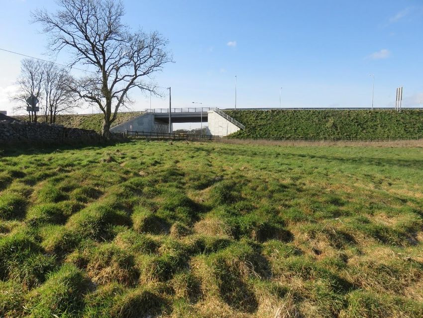
Shanarc Archaeology                                                   Proposed Fire Station, Athenry, Co. Galway
                                                                             Archaeological Desktop Assessment

Contents
1.      Introduction ............................................................................................................. 1
     1.1      Site Location ..................................................................................................... 1
     1.2      Development Description .................................................................................. 3
2.      Assessment Methodology ........................................................................................ 3
     2.1      Legislative Protection for Archaeological, Architectural and Cultural Heritage . 3
     2.2      Desktop Study ................................................................................................... 5
     2.3      On-Site Inspection ............................................................................................. 7
3.      Receiving Environment ........................................................................................... 8
     3.1      Archaeological and Historical Background ........................................................ 8
     3.2      Cartographic Analysis ..................................................................................... 12
     3.3      Toponomy ....................................................................................................... 15
     3.4      Archaeological Heritage .................................................................................. 16
        3.4.1       National Monuments ................................................................................ 16
        3.4.2       Sites and Monuments Record and Record of Monuments and Places ........ 16
        3.4.3       Previous Archaeological Investigations .................................................... 17
        3.4.4       Previous Archaeological Finds recorded in NMI Topographical Files ...... 20
     3.5      Architectural Heritage ..................................................................................... 20
        3.5.1       Galway County Development Plan 2015-2021 ......................................... 20
        3.5.2       National Inventory of Architectural Heritage ............................................ 22
     3.6      Site Inspection................................................................................................. 22
        3.6.1       Plates ....................................................................................................... 24
4.      Impacts and Mitigation Recommendations............................................................. 29
     4.1      Impacts ........................................................................................................... 29
     4.2       Mitigation Measures ....................................................................................... 29
        4.2.1       Pre-Construction Mitigation ..................................................................... 30
        4.2.2       Construction Phase Mitigation.................................................................. 30
5.      Conclusion ............................................................................................................ 31
6.      Bibliography .......................................................................................................... 32
     Cartographic Sources................................................................................................. 33
     Electronic Sources ..................................................................................................... 33

                                                                 ii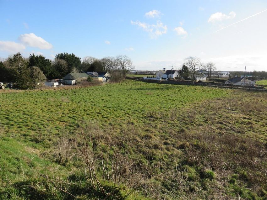
Shanarc Archaeology                                                  Proposed Fire Station, Athenry, Co. Galway
                                                                            Archaeological Desktop Assessment

Figures
Figure 1General location of proposed development site (outlined in red)in wider
contextat Athenry (Source: OSi Licence No. EN0077921)............................................... 2
Figure 2 Location of proposed development site (outlinedin red) in local context at
Athenry(Source: OSi Licence No. EN0077921). .............................................................. 2
Figure 3 Layout of proposed development, sketch design (Source:Vincent Hannon
Architects). ...................................................................................................................... 3
Figure 4 Down Survey map of CountyGalway, showing Athenry town (red
arrow)(Source: www.downsurvey.tcd.ie). ..................................................................... 12
Figure 5Taylor & Skinner's Map 89of the Road from Dublin to Galway,
showingapproximate location of proposed development site (outlined in red)(Source:
www.swilson.info). ....................................................................................................... 13
Figure 6 Extract from hand coloured first edition OS map,1837-43, showing proposed
development site (outlined in red) (Source: OSi Licence No. EN0077921). ................... 14
Figure 7Extract from Cassini 6-inch edition OS map, c.1940, showing proposed
development site (outlined in red) (Source: OSi Licence No. EN0077921). ................... 15
Figure 8 Distribution map of sites listed in the Record of Monuments and Places (red
dots),with associated Zones of Notification (shaded pink),and National Inventory of
Architectural Heritage sites (blue dots)relativeto proposed development site (outlined in
red)(Source: OSi Licence No. EN0077921). .................................................................. 17
Figure 9Athenry Architectural Conservation Area relative to proposed development site
(outlined in red) (Source: Galway County Development Plan, Appendix III, Architectural
Conservation Areas pg. 2,www.galway.ie). ................................................................... 21

Plates
Plate 1 View across subject site from south, looking north-west. ................................... 24
Plate 2 View along southern boundary, looking north-east along the original R348. ...... 24
Plate 3 View to north-west corner. ................................................................................. 25
Plate 4 Natural rise to south-east corner. ........................................................................ 25
Plate 5 View along southern boundary, looking south-west towards motorway, showing
slight dip from south-east to north-west towards the right of the photo. ......................... 26
Plate 6 View across subject site from north, looking south-east. .................................... 26
Plate 7 Strip of recently cleared ground flanking road embankment to south-west of site.
...................................................................................................................................... 27
Plate 8 Extract from Google Earth retrieved 25.02.2021 showing construction compound
inside footprint of proposed development site (outlined in red) (Source:
earth.google.com). ......................................................................................................... 27
Plate 9 View from top of mound in north-west corner, looking south-east. .................... 28
Plate 10 Base of market cross (GA084-111) in field to south-east of proposed
development site............................................................................................................ 28

                                                                  iii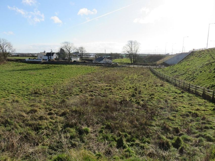
Shanarc Archaeology                                   Proposed Fire Station, Athenry, Co. Galway
                                                            Archaeological Desktop Assessment

1.           Introduction

This archaeological desktop assessment relates to the proposed development of a fire
station at Ballygarraun South,Athenry, Co. Galway (Figure 1). The report has been
prepared by Shanarc Archaeology Ltd.for Vincent Hannon Architects.

The proposed development site is located approximately 45moutside the Zone of
Archaeological Notification/Zone of Archaeological Potential for the historic town of
Athenry (GA084-001).

The assessment is basedon existing archaeological and built heritage records, and
readily available literary and cartographic sources, which were supported by a site
inspection. It will be submitted in support of a planning application for the development
to Galway County Council.

The purpose of the archaeological desktop assessment is to:

     (i)       evaluate the nature and extent of known archaeological, built heritage or
               other cultural heritage assets at the site;

     (ii)      address potential impacts on archaeological, built heritage or other cultural
               heritage assets, including impacts on potential sub-surface archaeological
               remains; and

     (iii)     provide mitigation recommendations to addresspotential impacts                on
               archaeological, built heritage or other cultural heritage assets.

1.1 Site Location
The proposeddevelopment siteis located in a rural area, on the outskirts of Athenry, to
the south-west of the historic town centre and its associated Zone of Archaeological
Notification/Zone of Archaeological Potential (GA084-001). It is sited in the townland of
Ballygarraun South, in the Barony and Civil Parish of Athenry, Co. Galway. Sandwiched
between the Dublin-Galway railway line and the R348 regional road, including a new
road embankment constructed as part of IDA Ireland's Athenry Strategic Site
Infrastructure Works, it is located approximately 1km south-west of the centre of Athenry
(Figure 2). The M6 motorway passes approximately 780m to the south-west.

                                                  1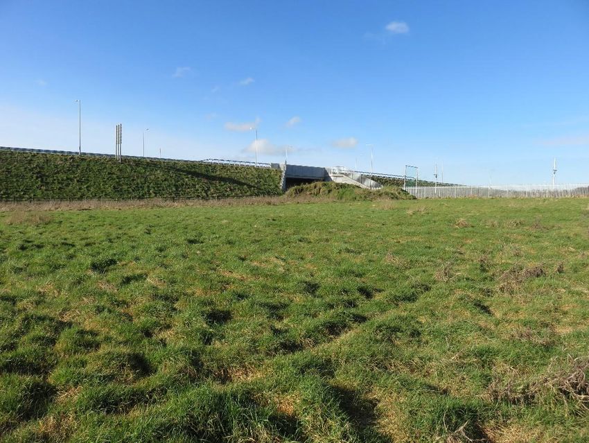
Shanarc Archaeology                                       Proposed Fire Station, Athenry, Co. Galway
                                                                Archaeological Desktop Assessment

Figure 1General location of proposed development site (outlined in red)in wider contextat Athenry (Source: OSi
                                          Licence No. EN0077921).

Figure 2 Location of proposed development site (outlinedin red) in local context at Athenry(Source: OSi Licence
                                              No. EN0077921).

                                                      2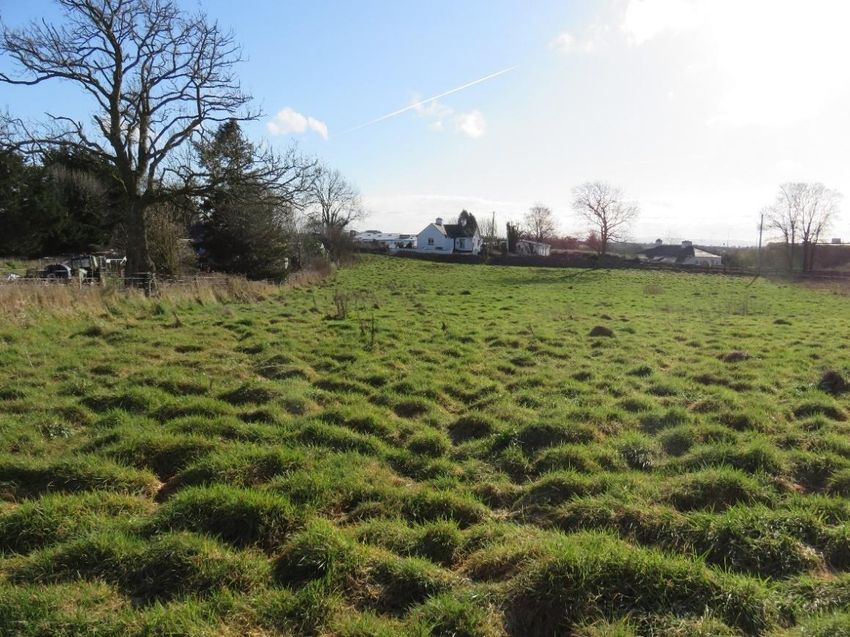
Shanarc Archaeology                                     Proposed Fire Station, Athenry, Co. Galway
                                                              Archaeological Desktop Assessment

1.2 Development Description
The proposed development comprises the development of a fire station, with ancillary
structures including a training tower, as well as car parking facilities, a gas tank, and all
ancillary site works (Figure 3).

        Figure 3 Layout of proposed development, sketch design (Source:Vincent Hannon Architects).

2.      Assessment Methodology

This assessment report is based on a desk-top study of relevant archaeological,
architectural and cultural heritage sources, supported by an on-site inspection. The
assessment is guided by relevant legislation, standards and guidelines in respect of
archaeology, architecture and cultural heritage, as follows.

2.1 Legislative Protection for Archaeological, Architectural
        and Cultural Heritage
Ireland has ratified several international and European conventions on the protection of
cultural heritage, principally:

     • UNESCO World Heritage Convention 1972;

                                                    3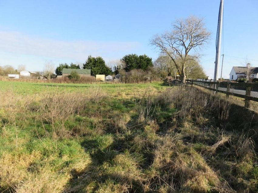
Shanarc Archaeology                               Proposed Fire Station, Athenry, Co. Galway
                                                        Archaeological Desktop Assessment

    • Charter for the Conservation and Restoration of Monuments and Sites (Venice)
       1964;

    • European Convention on the Protection of the Archaeological Heritage (Valetta
       Convention) 1992;

    • European Convention on the Protection of the Architectural Heritage (Grenada
       Convention) 1985;

    • European Council Directive on Environmental Impact Assessment (85/337/EEC)
       (as amended).

National legislation protecting cultural heritage sites comprises:

    • National Monuments Act 1930 (as amended);

    • Heritage Act 1995;

    • Architectural     Heritage    (National      Inventory)   and   Historic   Monuments
       (Miscellaneous Provisions) Act 1999; and

    • Planning and Development Act 2000 (as amended).

The following standards and guidelines were also consulted as part of this assessment:

    • Frameworks and Principles for the Protection of the Archaeological Heritage
       (1999), Department of Arts, Heritage, Gaeltacht & the Islands;

    • Policy and Guidelines on Archaeological Excavation (1999), Department of Arts,
       Heritage, Gaeltacht & the Islands;

    • The Heritage Council, 2000. Archaeology & Development: Guidelines for Good
       Practice for Developers (2000), The Heritage Council;

    • Guidance on the preparation of the EIA Report, 2017, European Commission;

    • European Union (Planning and Development) (Environmental Impact Assessment)
       Regulations 2018;

    • Guidelines on the information to be contained in Environmental Impact
       Assessment Reports (Draft) (August 2017), Environmental Protection Agency;

    • Advice notes on current practice in the preparation of Environmental Impact
       Statements (2003), Environmental Protection Agency;

    • Guidelines for the Assessment of Archaeological Heritage Impacts of National
       Road Scheme (2005), National Roads Authority;

                                              4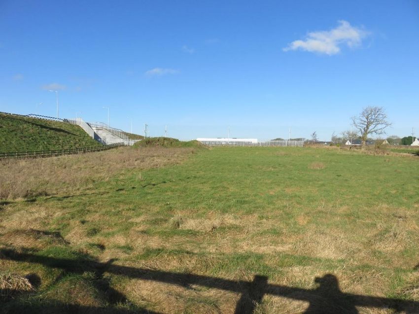
Shanarc Archaeology Proposed Fire Station, Athenry, Co. Galway
Archaeological Desktop Assessment
• Guidelines for the Assessment of Architectural Heritage Impacts of National Roads
Schemes (2005), National Roads Authority; and
Architectural Heritage Protection Guidelines for Planning Authorities (2011),
Department of Arts, Heritage, Gaeltacht & the Islands.
2.2 Desktop Study
The following were the principal desk-based sources consulted:
National Monuments
Under the National Monuments Acts 1930-2014, archaeological sites in the ownership or
guardianship of the State or a Local Authority and sites under Preservation Orders are
designated as National Monuments. Such sites are offered the highest level of protection
under Irish legislation, as the preservation of such sites is considered of national
importance.
Record of Monuments & Places and Sites and Monuments Record
The Record of Monuments and Places (RMP) was established under Section 12 of the
1994 National Monuments (Amendment) Act. The statutory RMP is a list of archaeological
monuments known to the National Monuments Service, and is based on the earlier Sites
and Monuments Record (SMR) files housed at the National Monuments Service. The
record is updated on a constant basis.
Topographical Files of the National Museum of Ireland
The topographical files of the National Museum of Ireland (NMI) are the national archive
of all known antiquities recorded by the NMI. These files relate primarily to artefacts but
also include references to monuments and contain a unique archive of records of
previous excavations. The find-spots of artefacts can be an important indication of the
archaeological potential of an area.
Excavations Bulletin and Excavations Database
The Excavations Bulletin is both a published annual directory and an on-line database
that provides summary accounts of all the excavations carried out in Ireland – north and
south – from 1969 to the present. The on-line database has been compiled from the
5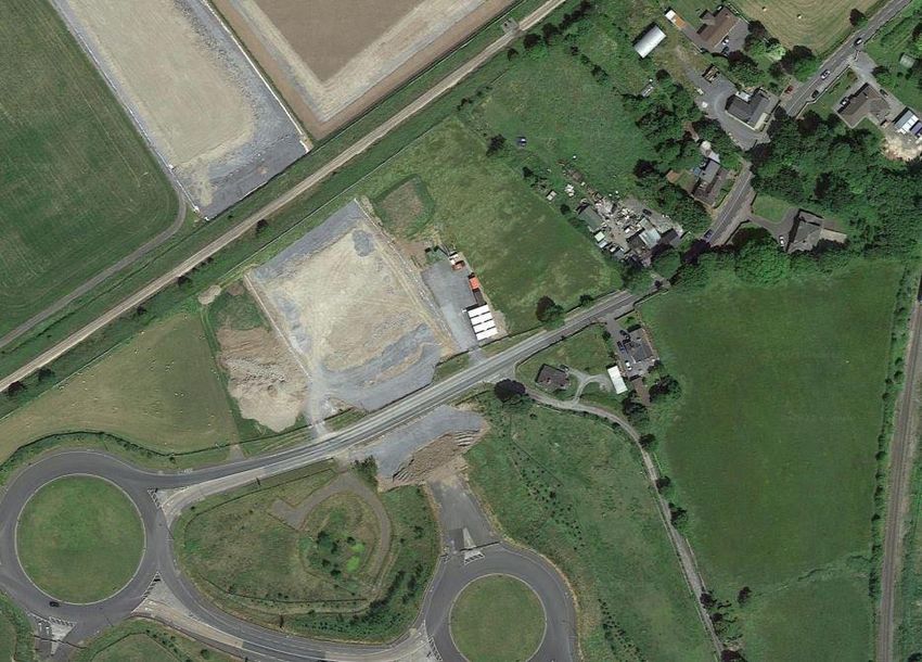
Shanarc Archaeology                              Proposed Fire Station, Athenry, Co. Galway
                                                       Archaeological Desktop Assessment

published Excavations Bulletins from the years 1970-2010, with additional online-only
material from 2011 onwards. The database gives access to summary descriptions of
archaeological monitoring and excavation reports, and is updated on a constant basis.

Galway County Development Plan 2015-2021

Each City and County Development Plan is compiled in accordance with the
requirements of the Planning and Development Act 2000 (as amended) and contains
lists of national monuments, recorded monuments, a Record of Protected Structures (a
list of buildings which cannot be materially altered or demolished without grant of
permission under the Act) and Architectural Conservation Areas (to protect and
enhance the special character of an area).

Heritage is addressed in Chapter 9 of the Galway County Development Plan 2015-2021,
titled ‘Heritage, Landscape & Environmental Management.’ Built Heritage is addressed in
Section 9.4, with Architectural Heritage Policies and Objectives addressed in Section 9.5.
Archaeological Heritage is addressed in Section 9.6, while Archaeological Heritage
Policies and Objectives are listed in Section 9.7. Appendix III contains the Architectural
Conservation Areas, while Appendix V contains the Record of Protected Structures
(revised 21/01/2020).

Athenry Local Area Plan 2013

The Athenry Local Area Plan was adopted on 25 June 2012 as a plan of landuse and
overall strategy for the development of the town from 2012-2022. It was intended to
complement the implementation of the Galway County Development Plan 2015-2021.

Development Policies, Objectives and Guidelines with regard to Built Heritage and
Cultural Heritage are detailed in Section 3.8.

National Inventory of Architectural Heritage

The National Inventory of Architectural Heritage (NIAH) is an ongoing survey withinthe
Department of Housing, Local Government and Heritage (formerly the Department of
Culture, Heritage and the Gaeltacht). The work of the NIAH involves identifying and
recording the architectural heritage of Ireland, from AD1700 to the present day and
includes country houses, churches, mills, bridges and other structures of note. The NIAH

                                             6
Shanarc Archaeology Proposed Fire Station, Athenry, Co. Galway
Archaeological Desktop Assessment
survey of East Galway was carried out in 2008, and is the largest survey of the post-1700
built heritage of East Galway.
Cartographic Sources
Information gathered from cartographic sources is fundamental to the identification of
archaeological and architectural heritage sites, including cultural landscapes e.g.
demesne landscapes, which, based on the level of landscape change, are now often
identified from cartographic records alone. The earliest Ordnance Survey maps date to
the late 1830s and early 1840s, but much change has occurred in the use and treatment
of the landscape in the intervening years, particularly during the second half of the 20th
century, making these a valuable resource in tracing the development of a study area.
Toponomy Sources
A townland name may preserve information relating to its archaeology, history, folklore,
ownership, topography or land use. Most placenames were anglicised by the Ordnance
Survey, which begun in the 1830’s. Despite some inaccuracies in translation, the Gaelic,
Viking, Anglo-Norman and English origins of placenames are generally recognisable. The
Placenames Database of Ireland website (wwww.logainm.ie) hosts online bi-lingual
placename research and archival records for townlands.
Documentary Sources
Documentary sources are a valuable means of completing the written archaeological,
architectural and cultural heritage record of an area, and of gaining insight into the
history of the receiving environment. A list of all consulted documentary sources is
provided in bibliographic form.
2.3 On-Site Inspection
On-site inspection offers the opportunity to examine a study area in light of desk-based
research and evidence. Inspection is essential in determining the nature and extent of
any surviving above-ground evidence, and in predicting the potential effects of a
proposal on potential below-ground remains. A site inspection was carried out by Edel
Barry of Shanarc Archaeology Ltd. on 10 February 2021.
7Shanarc Archaeology Proposed Fire Station, Athenry, Co. Galway
Archaeological Desktop Assessment
3. Receiving Environment
3.1 Archaeological and Historical Background
The extent of prehistoric and historic activity within the wider study area is attested to by
the number and range of known archaeological monuments within the surrounding
landscape.
Athenry is situated on the Esker Riada, a series of natural eskersof gravel or boulder clay
forming a ridge stretching from Dublin to Galway. West of the River Shannon, this largely
conflates with the route of theSlí Mór or ‘great road’ from Dublin to Galway, via
Clonmacnoise (O’Sullivan and Downey 2015, 15). A number of road/trackway sites are
recorded south of Athenry, namely GA084-113, in Prospect townland; and GA084-118, in
Ballygarraun South and Raheen townlands, which are thought to correspond with the Slí
Mór. Archaeological investigation in Ballygarraun South has shown that these roadways
correlate with the surface of a gravel ridge. While documentary records of Athenry begin
with the arrival of the Anglo-Normans, there is some evidence of prehistoric and early
medieval activity in the wider area.
A fulacht fiadh is sited in close proximity, in the townland of Baunmore (GA084-023).
These monuments are described as cooking sites comprising a stone or wood-lined
trough dug into the ground in a location that naturally filled with water, and are
overwhelmingly Bronze Age (c. 2400-500 BC) in date. A cist (GA084-101), also commonly
thought to date to the Bronze Age, was identified, in the adjacent townland of Newford,
by a local farmer to the Ordnance Survey surveyors in 1828. It was overground, as
opposed to the more common sub-surface variety, and contained a crouched burial
and an earthenware vase.
Early medieval sites occur within an approximate 2km radius, including aringfort at
Ballygarraun North (G084-008); a large enclosure at Ballygarraun North (GA084-009) with
an adjacent souterrain (GA084-009001); fourringforts (GA084-028-029, 031-032) and an
enclosure (G084-030) at Boyhill; and a ringfort at Caherroyn (G084-034). A large
enclosure in Raheen (GA084-120) was referred to as ‘the Cashel of Raheen’ in 1918; it
comprised a roughly triangular area defined by an arc of substantial but collapsed
drystone walls. A number of other enclosures have been identified in Ballygarraun South
(GA084-014-016).
8Shanarc Archaeology Proposed Fire Station, Athenry, Co. Galway
Archaeological Desktop Assessment
The barony of Athenry was created 1178 for Piers de Bermingham. However, Meiler
deBermingham received the grant of Atheenry in 1235, in reward for his support of
Richard de Burgo in the invasion of Connacht. DeBermingham had an Anglo-Norman
masonry castle (GA084-001006), comprising a keep and a bawn wall,built c.1235-1240.
Skilled masonry artisanship is exhibited in the windows and doorway, of a level usually
reserved for ecclesiastical structures in this period (Coyne and Fitzgerald 2013, 2). While it
originally comprised a first-floor hall, accessed via wooden stairs, a second floor was
added in the mid-13th century, and the gable ends were raised in the 15th century,
raising the roof above the battlements.The location of the castle occupies a rise, which
overlooked a ford in the River Clarin (Bradley & Dunne 1992, 22-3). The De Bermingham
family resided at the castle until the 15th or 16th century, at which point they moved to a
dwelling in the town square (Coyne and Fitzgerald 2013, 2).
A murage charter, referring to a ‘stone wall’, was granted for three years in 1310 by
Edward II; it is traditionally held that subsequently, the construction and maintenance of
the walls were financed by the spoils of a battle between the Anglo-Normans and native
Irish forces in the area (Thomas 1992, 10). The original town walls of Athenry likely
comprised earthen ramparts, with an outer moat. By the 14th century, however, the town
was enclosed by a curtain wall with inner ramparts, and a fosse 8m in width. The latter
would originally have been fed with water diverted from the River Clarin. They joined with
the bawn wall of the castle to the north-east, in total enclosing an area of approximately
28 hectares. Five gates were originally incorporated into the walls, providing access to
the town, but only the North Gate survives. This likely dates to the 15th century. Six towers
were also placed along the wall, but were likely later insertions rather than integral to the
wall structure (Coyne and Fitzgerald 2013, 2).
Athenry was likely the earliest walled Anglo-Norman urban foundation in Connacht and
was unusually large, being twice the size of the original walled town of Galway. This is
attributed to some competition between de Bermingham and overlord de Burgh, who
developed Loughrea and Galway (Thomas 1992, 11). Two major streets, running north-
south, in addition to a number of cross-streets, appear to preserve the remnants of a
chequered street plan (Coyne & Fitzgerald 2013, 2). A grant for a fair was made to
DeBermingham in 1244 (Thomas 1992, 10).
The hinterland of the walled town was controlled by and large by a native population,
under the control of the O’Connor’s, Kings of the historic territory of Connacht. Attacks
9Shanarc Archaeology Proposed Fire Station, Athenry, Co. Galway
Archaeological Desktop Assessment
by the hostile native population on the town are recorded in the Annals in 1249 and
1316. The second Battle of Athenry took place on 10 August 1316, and resulted in the
defeat of the King of Connacht, Feidhlim O’Connor, by Anglo-Norman forces under the
command of William deBurgh and Richard de Bermingham. This led to the deBurgh
family retaining control over most of Connacht for the remainder of the medieval period,
deviating from the Anglo-Norman administration, and largely integrating into Gaelic
society (Chevalier 2019, 16).
Saint Mary’s Church (GA084-001015) was established as the parish church of Athenry
shortly after the foundation of the town. It was made collegiate by Donatus, Archbishop
of Tuam (1450-1485). Later destroyed by fire during the attack by the sons of the Earl of
Clanricard (1574), its chancel was adapted to incorporate a Church of Ireland church
(NIAH 30332017) in 1828. Parts of the medieval nave and transepts survive. It is situated
within a graveyard (GA084-001024).
A Dominican Priory (GA084-001014), dedicated to Saints Peter and Paul, is situated on
the eastern side of the River Clarin, within an associated graveyard (GA084-001025).
Founded By Meiler de Bermingham, construction was begun in 1241. Both the native Irish
and Anglo-Norman's contributed to the construction of the priory – the refectory was
built by King of Connacht Phelim O’Connor; the dormitory was built by Eugene O’Heyne;
the chapter house by Cornelius O’Kelly; the guest room by Dermot O’Treasy; and the
infirmary by Art MacGallyly (Coyne & Fitzgerald 2013, 2). While no traces of the domestic
buildings or cloister remain extant, the church is well-preserved. The northern aisle and
transept were likely added c.1324, with a tower added c.1425; the latter alterations took
place following extensive damage by fire in 1425, and also incorporated the
replacement of a number of windows, some doorways being blocked and the side
arcade being reduced. Although the priory was exempted from the dissolution of the
monasteries by Henry VIII, it was dissolved in 1574 and granted to the town of
Athenry(Coyne & Fitzgerald 2013, 3). In 1627, it was granted to Galway merchants, who
allowed the friars to return, and restored the buildings. Cromwellian forces expelled the
friars in 1652.
Numerous funerary monuments are contained within the church of the friary, including a
coped grave cover (GA084-001032) thought to mark the grave of the founder, Meiler de
Bermingham; at least ten ornately carved high medieval graveslabes (GA084-001033-
001038; GA084-001076, 001078-001079); decorative 17th century slabs (GA084-001046;
10Shanarc Archaeology Proposed Fire Station, Athenry, Co. Galway
Archaeological Desktop Assessment
GA084-001047), some bearing occupational symbols such as a blacksmiths tools (GA084-
001051) or a plough sock and coulter (GA084-001062, GA084-001065); and a large, 18th
century tomb, dedicated to Lady Matilda Bermingham, in the chancel.
A bridge (GA084-024) carrying the road across the Graigueabbey River led to the ‘Spitle
Gate,’ the south gateway to the medieval town. Wickerwork centering was noted in
three of the bridge arches, indicating that the bridge has a medieval core.
The sons of the Earl of Clanricard, Richard Burke, who resided at Loughrea, were vying
over their future succession to the earldom, their strife having a strong and negative
impact on the surrounding territory. As part of their rebellion against the crown, they
attacked the town of Athenry in 1554, destroying much of it. Lord Deputy Henry Sidney
was charged with the ‘re-edifying of the town’ and set about building an inner wall as
further protection. The Clanricards submitted to Queen Elizabeth. However, in 1577 they
attacked once more, setting the new gates on fire, destroying the recently-constructed
buildings, and driving away the workmen employed in repairing the fortifications (Lewis
1837). In 1584, the queen was petitioned to ‘bring over English artisans and tradesmen to
settle in the town, to rebuild it and improve it and to support a sufficient force for its future
protection’ (Thomas 1992, 10).
In the 18th century, the Dominican priory was gutted, providing materials for the
construction of the military barracks built south thereof.
Athenry House (NIAH Ref. 30332038) was built c.1780, the grand residence of a Mr
Lopdell. Its demesne landscape, incorporating formal gardens, a well (GA084-001017),
and a dovecote (GA084-001021), occupy a significant proportion of the lands at the
south of the town on the first edition Ordnance Survey map (Figure 6).
Newford Country House (GA084-131) was a similar country house, shown as having
considerable gardens, orchards and landscaped grounds, south-west of the town of
Athenry.
The Midland Great Western Railway between Dublin and Galway opened a station at
Athenry in 1851. Later, a line connecting Limerick with Athenry (The Ennis & Athenry
Junction Railway) opened in 1869.
The proposed development site is recorded in Griffith’s Valuation of 1850 as being the
property of James Perry, a prominent Quaker who held a considerable amount of land
around Athenry at the time.
11Shanarc Archaeology Proposed Fire Station, Athenry, Co. Galway
Archaeological Desktop Assessment
3.2 Cartographic Analysis
Relevant extracts are presented from the following consulted historic maps:
Down Survey map of County Galway, 1656-58 (Figure 4);
Taylor & Skinners Map 163, 1777 (Figure 5);
First edition Ordnance Survey 6” map, 1837-43 (Figure 6);
Cassini’s Ordnance Survey map, c.1940 (Figure 7).
Down Survey Maps 1656-58
The Down Survey is a mapped survey carried out from 1656 - 1658 under the direction of
Sir William Petty, which recorded land forfeited after the Cromwellian War in Ireland
(1649-1653). The survey recorded townland boundaries and their areas with precision
throughout Ireland. The resultant maps contain other detail, such as on roads, rivers,
towns, churches, castles, houses and fortifications, as well as topographic and landuse
detail. The 1656-58 Down Survey map of County Galway (Figure 4) indicates the walls
and castle of ‘Athenrey Towne& Liberties.’A number of towers and gates are depicted
along the walls, as well as substantial buildings within, and a structure which is likely the
Anglo-Norman Castle to the north-east.No copy is available of the Barony Map of
Athenry, which was destroyed in 1711.
Figure 4 Down Survey map of CountyGalway, showing Athenry town (red arrow)(Source:
www downsurvey tcd.ie).
12Shanarc Archaeology Proposed Fire Station, Athenry, Co. Galway
Archaeological Desktop Assessment
Taylor and Skinners Maps of the Roads of Ireland, 1777
George Taylor and Andrew Skinner undertook their survey of the Roads of Ireland,
commissioned by the House of Commons (Ireland), in 1777, and produced a volume of
these maps, depicting towns and villages, country seats and other structures en route in
1778.
Taylor and Skinner’s 1777 Map 89of the route from Dublin to Galway (Figure 5) depicts
the layout of the town of Athenry, with a clear street pattern and considerable building,
although the town walls are not shown. An enclosed area to the east of the town may
be the enclosed Anglo-Norman Castle. To the south of the town, Newford demesne is
depicted, as the property of Browne Esq.The southern approach to the town and the
lands around the Newford are tree-lined, and a number of raised pieces of ground are
depicted west and south-west of Athenry. No development is depicted at the
approximate location of the proposed development site.
Figure 5Taylor & Skinner's Map 89of the Road from Dublin to Galway, showingapproximate location of
proposed development site (outlined in red)(Source: www.swilson.info).
13Shanarc Archaeology Proposed Fire Station, Athenry, Co. Galway
Archaeological Desktop Assessment
Ordnance Survey Maps
The first ever large-scale survey of Ireland was undertaken by the Ordnance
Surveybetween 1829 and 1842, producing highly accurate maps at different scales. The
proposed development site is depicted on the first edition Ordnance Survey map (Figure
6). It is contained within a single large field, within a townland which is characterised by a
relatively regular configuration of field boundaries. The townland boundary between
Ballygarraun South and neighbouring Prospect and Newford townlands is marked bya
road at the south-east of the site, the precursor of the R348. A gate lodge is depicted
facing the subject site, guarding the entrance to the demesne landscape of Newford
House, to the south. The outline of an enclosure is depicted to the north-west. The town
of Athenry, to the north-east, is depicted as well-developed, with some of its town wall
depicted.
Figure 6 Extract from hand coloured first edition OS map,1837-43, showing proposed development site (outlined
in red) (Source: OSi Licence No. EN0077921).
The 1908-1913 25-inch edition Ordnance Survey map sheet depicting this area is
unavailable.
The Cassini 6-inch edition Ordnance Survey map, dated c.1940 (Figure 7), depicts some
additional development within the area of the subject site. The Great Southern Railway,
into which all of the railway lines in the Republic had recently been amalgamated, is
now shown traversing the landscape directly behind the subject site. The remaining
14Shanarc Archaeology Proposed Fire Station, Athenry, Co. Galway
Archaeological Desktop Assessment
easternmost corner of Ballygarraun South townland has been divided into long narrow
plots associated with road-fronted workers houses. The north and west of the townland
has had many of its field boundaries removed, now being divided into a small number of
large fields. The enclosure to the north-west is denoted as ‘Mount Shaw'. The town
defences of Athenry are denoted as ‘Ancient Wall,’ with several towers and ‘Loro Gate’
also denoted.
Figure 7Extract from Cassini 6-inch edition OS map, c.1940, showing proposed development site (outlined in
red) (Source: OSi Licence No. EN0077921).
3.3 Toponomy
The name of Athenry may derive from Áth na Rí, the ‘ford of the
kings’(hiips://www.logainm.ie/en/19599 ), but it is thought more likely that it derives from
Baile átha an ríogh, the ‘town of the river ford,’ in reference to its situation adjacent to
the ford over the River Clarin (Coyne and Fitzpatrick 2013, 1).
The townland name of Ballygarraun South derives from Baile an Gharráin, the ‘town of
the grove.’ The placename of Ballinegarraine was first recorded in 1610
(hiips://www.logainm.ie/ga/19602 ).
15Shanarc Archaeology Proposed Fire Station, Athenry, Co. Galway
Archaeological Desktop Assessment
3.4 Archaeological Heritage
3.4.1 National Monuments
Athenry Abbey, A Dominican Priory, is a national monument (NM 164) in State Ownership
(GA084-001004).
Athenry Castle is a national Monument (NM 406) in State Ownership (GA084-001006).
The medieval town defenses as a whole are also considered a National Monument
under the meaning of the Act.
3.4.2 Sites and Monuments Record and Record of Monuments and
Places
The proposed development site lies a short distance outside the Zone of Archaeological
Potential surrounding the historic town of Athenry (GA084-001). Several sub-elements
form part of the historic town, including the town defences (GA084-001001) and the
Anglo-Norman masonry castle (GA084-001006), with a D-shaped bawn (GA084-001085),
some of the walls of which act as a component of the town defences.
A considerable proportion of the town wall survives intact, with the closest remnant
thereof located at a distance of 381m north-east of the proposed development site. This
feature, indicated as ‘Swan Gate’ on the first edition Ordnance Survey map (Figure 6)
and as ‘The Loro Gate (site of)’ on Cassini Ordnance Survey map (Figure 7) was
presumed to have been removed, until archaeological investigations revealed the
internal face of the east side of the gate approximately 0.25m beneath the road surface.
The remains comprise roughly-shaped stone blocks, in random courses. This gate formed
one of the main entrances to Athenry, and is the only surviving remnant of an original
gate (the North Gate, extant, dates to a building phase which took place in the 16th
century).
The RMP sites within a 500m radiusof the proposed development site are presented in
Table 1, and their locations shown on Figure 8.
16Shanarc Archaeology Proposed Fire Station, Athenry, Co. Galway
Archaeological Desktop Assessment
Table 1Recorded Monuments within a 500m radius of the proposed development site.
RMP No. Class Townland ITM ITM Proximity
Easting Northing (m)
GA084-001001 Town Defences Athenry 549850 727545 381m
(‘Loro Gate’)
GA084-014---- Enclosure Ballygarraun South 548962 727609 336m
GA084-101---- Cist Newford 549757 727101 436m
GA084-102---- Quarry Newford 549582 727032 418m
GA084- Redundant Prospect (Athenry By.) 549649 727630 233m
109001- record
GA084- Redundant Prospect (Athenry By.) 549687 727629 240m
109002- record
GA084-110---- Redundant Prospect (Athenry By.) 549580 727502 48m
record
GA084-111---- Cross Prospect (Athenry By.) 549583 727430 85m
GA084-112---- Quarry Prospect (Athenry By.) 549785 727337 316m
GA084-113---- Road - Prospect (Athenry By.) 549732 727499 48m
road/trackway
GA084-118---- Road - Ballygarraun 549332 727978 399m
road/trackway South,Raheen (Athenry
By.)
Figure 8 Distribution map of sites listed in the Record of Monuments and Places (red dots),with associated Zones
of Notification (shaded pink),and National Inventory of Architectural Heritage sites (blue dots)relativeto
proposed development site (outlined in red)(Source: OSi Licence No. EN0077921).
3.4.3 Previous Archaeological Investigations
Asuite of archaeological investigations have been undertaken in thetownland of
Ballygarraun South and in adjacent townlands of Prospect and Newford.
17Shanarc Archaeology Proposed Fire Station, Athenry, Co. Galway
Archaeological Desktop Assessment
Archaeological monitoring and investigation was carried out at Ballygarraun South, in
advance of the construction of a proposed IDA Campus. The groundworks involved
topsoil stripping of a wayleave for an access road, extending north-west from the existing
roundabout on the R348 Athenry Road, and now abutting the proposed development
site, to the site of the proposed campus (see Plate 8). An Archaeological Assessment of
the wider area, then the lands of the Teagasc Research Farm, including geophysicial
survey and preliminary test excavation (Licence No. 06E0107, Excavation Bulletin
No.2006:747) was carried out by Margaret Gowan & Co, identifying no previously
unrecorded archaeological sites that the proposed access route would impact upon; it
noted that there would be a direct impact on GA084-118 (trackway).
A number of known RMP sites in Ballygarraun townland were investigated through
geophysical survey and testing at this time (licence 06E0370, Excavation Bulletin No.
2006:740;). Two levelled sub-rectangular enclosures (GA084-015-016) revealed no
features or deposits of archaeological significance. Test trenches on the surface of
unclassified earthwork (GA084-014), situated 336m north-west of the proposed
development site, and known locally as ‘Mount Shaw,’ revealed a small area of
collapse, around a low rectangular-shaped stone structure on the northern summit. The
circular setting of stones was thought to represent a gate-like feature, to restrict access
to the structure. An earthen bottle plug and several pieces of animal bone were found in
the topsoil cover, while a sherd of medieval pottery, animal vertebrae, ribs and a
shoulder, and a small copper mount were recovered. A short cist (GA084-101) in
Newford townland, which had been identified by workmen while digging at the summit
of a low hill in 1913, was also investigated. One cist contained a food vessel and skeletal
remains; a perforated boar’s tusk likely to be a grave good was also found in one of the
graves. Ten features of archaeological significance were identified through test
trenching in the vicinity of the cist; three were shallow pits, without artefacts; seven were
regular or irregularly-shaped clay spreads, one of which produced five pieces of chert
and one possible piece of burnt bone.
Subsequent investigation in the area of the wayleave of the then-proposed, now-
constructed access road was carried out (Licence 18E0003, Excavation Bulletin No.
2018:508).This work exposed an old field boundary, a 19th-20th century pit/spread, and
the remains of a 19th century wall at the location of GA084-118. Further monitoring and
investigation (licence 18E0003, Excavation Bulletin No. 2018:512) revealed the remnants
of a double-skinned wall foundation, one course deep, and made of dry stone random
18Shanarc Archaeology Proposed Fire Station, Athenry, Co. Galway
Archaeological Desktop Assessment
rubble with packing stones. 19th and early 20th century white table ware, shards of
brown glass, fragments of red and yellow brick and metal debris were found in the
immediate area. The wall was surveyed before being covered with terram geotextile to
be preserved in situ. Monitoring also identified two pits and a linear feature, which
produced modern material.
A site located 14m to the south-east, in the townland of Prospect, was subjected to
archaeological test excavation by Dominic Delaney (21E0018) in January 2021. No finds
or features of archaeological significance were identified (Dominic Delaney, pers.
comm.)
At the site of a proposed new Presentation College at Ballygarraun South, north-west of
the proposed development site, testing was carried out along the alignment of an old
field boundary (GA084-118), which was identified as an ancient road/trackway but not
substantiated as an archaeological monument. Testing and monitoring (licence 13E0030,
Excavation Bulletin No. 2013:551) along this road/trackway suggests it follows the line of a
former gravel ridge. A number of agricultural linear features, such as stone-filled drains
and silted-up furrows were revealed, as well as a large, natural gravel ridge, running east-
west across the south of the site.
Monitoring under licence 17E0632 (Excavation Bulletin Nos. 2018:058; 2018:080) in the
adjacent townland of Newford revealed nothing of archaeological interest.During
further monitoring of topsoil stripping in the townland a series of pits and post-holes were
identified, and subsequently investigated (licence 18E0713, Excavation Bulletin No.
2019:575). A possible kiln and 9 possible pit or post features were identified. A Henry III
type II silver penny, minted between 1251 and 1254, was recovered from the upper fill of
one pit. This activity was thought to be roughly contemporaneous with the earliest
buildings at Athenry.
Test excavation (licence 98E0432, Excavation Bulletin No. 1998:230) was carried out in the
grounds of the early 19th century Athenry House, within the bounds of Athenry town. A
stretch of the medieval town wall, and the site of Spitle Gate, lie in the southern corner of
the site. There was no evidence to suggest this area was settled in the medieval period.
Archaeological testing was carried out on the site of a small housing development at
Swangate (licence 96E0377, Excavation Bulletin No. 1996:147). A U-shaped cut, and an
adjacent D-shaped cut were noted. Occasional finds of animal bone were revealed but
19Shanarc Archaeology Proposed Fire Station, Athenry, Co. Galway
Archaeological Desktop Assessment
no other finds or features of archaeological significance. Adjacent to this site, also known
as ‘Loro Gate’, (C360, E4040; 2014:496) monitoring of excavation work was carried out in
advance of conservation work to Loro Gate. This, one of four gates in the medieval town
walls, was uncovered during monitoring of road works in August 2007. The south-east wall
of the gate as excavated, and comprised a 0.6m wide buttress, built up against the
outer face of the original 1.5m thick wall. It was interpreted as post-dating the original
town defences, comprising the construction of a new gate, or the refortification of an
existing entrance, at this location. Buttressing suggests the structure underwent repair or
was enlarged. A few pieces of badly-corroded iron were recovered, as well as moderate
quantities of animal bone and oyster shell, probably indicative of dumping in the
medieval moat.
The monitoring of a domestic water connection was undertaken in August 2011 in
Prospect townland; the trench for the pipeline crossed the site of the medieval town wall,
where a gateway accessed the property (licence 11E0301, Excavation Bulletin No.
2011:245). It was determined that the gateway had been constructed directly atop the
original town wall. Stones from the wall, which was 0.85m in width, were identified
beneath, apparently having been level off. The water pipe was laid beneath the existing
plinth of the entranceway, avoiding the original wall feature. No other artefacts or
features of archaeological significance were identified.
3.4.4 Previous Archaeological Finds recorded in NMI Topographical
Files
No finds areprovenanced to the townland of Ballygarraun South in the topographical
files.
3.5 Architectural Heritage
3.5.1 Galway County Development Plan 2015-2021
Record of Protected Structures
The Record of Protected Structures (RPS) is contained withinAppendix V of the Galway
CountyDevelopment Plan2015-2021. The proposed development site does not contain
any protected structures, nor are any located within the immediate vicinity. However, 5
protected structures are located within a 500m radius of the proposed development site.
These are listed in Table 2.
20Shanarc Archaeology Proposed Fire Station, Athenry, Co. Galway
Archaeological Desktop Assessment
Table 2 Protected Structures within 500m of the proposed development site.
RPS Location Description Proximity
Ref. (m)
3983 Railway Humpback single-arch rusticated limestone railway 214
Bridge bridge
3984 Saint Detached three-bay two-storey L-plan house, built 316
Bernard’s c.1930.
3985 Fiesole Detached three-bay two-storey L-plan house, built 309
c.1930.
144 Prospect Detached five-bay two-storey house with central half 337
House hexagon bow; round-headed stone doorcase and
rear return, c.1800
3982 House, Detached three-bay two-storey house, built c.1930 465
Prospect,
Athenry
-
Figure 9Athenry Architectural Conservation Area relative to proposed development site (outlined in red)
(Source: Galway County Development Plan, Appendix III, Architectural Conservation Areas pg.
2,www.galway.ie).
21Shanarc Archaeology Proposed Fire Station, Athenry, Co. Galway
Archaeological Desktop Assessment
Architectural Conservation Areas
The Architectural Conservation Areas (ACA) in County Galway are detailed and
addressed within Appendix III of the Galway County Development Plan 2015-2021. The
proposed development site is not contained within any ACA. The closest ACA is that
ofAthenry town centre (Figure 9), within which a medieval townscape survives
remarkably intact. In addition, the extent of the surviving town wall places this as one of
the most complete town wall circuits in Ireland. This area is recognised as a fortified
medieval townscape, evidenced in its street pattern, plot sizes, buildings, and
architectural coherence. Open fields, contained within the town walls, are considered to
be notable feature, being unusual within the walled area.
3.5.2 National Inventory of Architectural Heritage
The National Inventory of Architectural Heritage (NIAH)survey for Galwaylists 5 structures
in close proximity of the proposed development site, albeit none within a 200m radius.
These structures are all located to the east of the subject site, on the outskirts of the town
of Athenry. NIAH structures within a 500m radius of the proposed development site are
listed in Table 3,and their locations shown on Figure 8.
Table 3 NIAH sites within500m ofthe proposed development site.
Reg. No Name/Original Use Date Rating
House 1920-1940 Regional
30332033
Railway Bridge 1865-1870 Regional
30332034
Prospect House 1780-1820 Regional
30332035
Saint Bernard’s 1920-1940 Regional
30332036
Fiesole 1920-1940 Regional
30332037
3.6 Site Inspection
A site inspection, undertaken by Edel Barry of Shanarc Archaeology Ltd.,was carried out
on 10 February 2021. The subject site is a sub-rectangular field, bounded to the south-
west by a recently constructed road carriageway embankment, part of IDA Ireland's
Athenry Strategic Site Infrastructure Works - Road Works Phase 2 (Plate 1), and to the
north-west by the Dublin to Galway railway line, a short distance south-west of Athenry
22Shanarc Archaeology Proposed Fire Station, Athenry, Co. Galway
Archaeological Desktop Assessment
Station. A private domestic site bounds the site on the north-east, and the original
alignment of regional road R348 runs along the south-east boundary (Plate 2). Post-and-
rail fencing encloses the site along the new road embankment and partly along the
R348; a rubble limestone wall forms part of the boundary towards the town end along
the R348. Recent steel fencing runs along the railway track. Sparse trees and scrub are
sited along the north-east boundary. A number of recently planted trees are situated in
the south-east corner, where there is a small rise towards the corner of the field (Plate 4).
The topography of the field, which is in use as pasture currently, slopes very gently
upwards towards the railway line at the north-west, with a slight rise to the south-east,
and a gentle slope towards a dip in the centre of the field (Plates 5 and 6). The grass is
tussocky, and a strip flanking the new road embankment stands out as having rough
grass and thistles, indicative of the ground recovering after having being recently
stripped – this area was cleared for use as a construction compound during the
construction of the IDA Phase 2 roadworks (Plate 8). A heap of rubble, comprising large
stones and including a piece of disused railway track, now overgrown with grass, is
situated to the north-west corner of the field.
No features or anomalies of archaeological interest were identified during the site visit.
In the field to the south-east side of the road, the base of a cross (GA084-111) (Plate 10)
remains extant.
23Shanarc Archaeology Proposed Fire Station, Athenry, Co. Galway
Archaeological Desktop Assessment
3.6.1 Plates
Plate 1 View across subject site from south, looking north-west.
Plate 2 View along southern boundary, looking north-east along the original R348.
24Shanarc Archaeology Proposed Fire Station, Athenry, Co. Galway
Archaeological Desktop Assessment
Plate 3 View to north-west corner.
Plate 4 Natural rise to south-east corner.
25Shanarc Archaeology Proposed Fire Station, Athenry, Co. Galway
Archaeological Desktop Assessment
Plate 5 View along southern boundary, looking south-west towards motorway, showing slight dip from south-
east to north-west towards the right of the photo.
Plate 6 View across subject site from north, looking south-east.
26Shanarc Archaeology Proposed Fire Station, Athenry, Co. Galway
Archaeological Desktop Assessment
Plate 7 Strip of recently cleared ground flanking road embankment to south-west of site.
Plate 8 Extract from Google Earth retrieved 25.02.2021 showing construction compound inside footprint of
proposed development site (outlined in red) (Source: earth.google.com).
27Shanarc Archaeology Proposed Fire Station, Athenry, Co. Galway
Archaeological Desktop Assessment
Plate 9 View from top of mound in north-west corner, looking south-east.
Plate 10 Base of market cross (GA084-111) in field to south-east of proposed development site.
28Shanarc Archaeology Proposed Fire Station, Athenry, Co. Galway
Archaeological Desktop Assessment
4. Impacts and Mitigation Recommendations
4.1 Impacts
The proposed development site is located approximately 45m outside the Zone of
Archaeological Notification/Zone of Archaeological Potential for the historic town of
Athenry (GA084-001).
Several recorded monuments are located within a 500m radius of the proposed
development site, includingthe medieval town's defences (GA084-001001) at ‘Loro
Gate,’ situated 381m to the north-east. An enclosure (GA084-014), situated 336m north-
west, was previously subject to archaeological investigation; some archaeological finds
were recovered, as well as a stone structure; additionally, the adjacent land to the
south-west has been investigated as part of the way-leave for the access road to a
proposed IDA campus, revealing some evidence of 19th/20th century activity, as well as a
double-skin wall foundation.
There are no known RMP sites contained within the boundary of the proposed
development, and proposed development at the subject site will not directly impact
upon any known archaeological monuments or features.
However, the location of the site in close proximity to the Zone of Archaeological
Potential for the historic town, as well as in close proximity to the historictown walls; and
the identification of some archaeological features during prior archaeological
investigation in the immediate vicinity of the subject site, indicates that there may be
potential, hitherto unknown, archaeological remains at a sub-surface level.
No impact is envisaged upon built heritage as a result of the proposed development.
4.2 Mitigation Measures
Mitigation measures are necessary in order to comply with national policy guidelines and
statutory provisions for the protection of archaeological, architectural and cultural
heritage, including the National Monuments Acts 1930-2014, the Architectural Heritage
(National Inventory) and Historic Monuments (Miscellaneous Provisions) Act 1999 and the
Planning and Development Act 2000 (as amended).
29You can also read