A Balancing Act - the Policy Approach to Fragmentation and Conversion of Agricultural Land - Jason Cathcart, Ph.D., P.Ag - Mackenzie County
←
→
Page content transcription
If your browser does not render page correctly, please read the page content below

A Balancing Act - the Policy Approach to
      Fragmentation and Conversion of
                       Agricultural Land

                   Jason Cathcart, Ph.D., P.Ag.
                                 Manager, Land-use Policy
                Alberta Agriculture and Rural Development
                                                Edmonton

         Mackenzie County Council – May 7 2013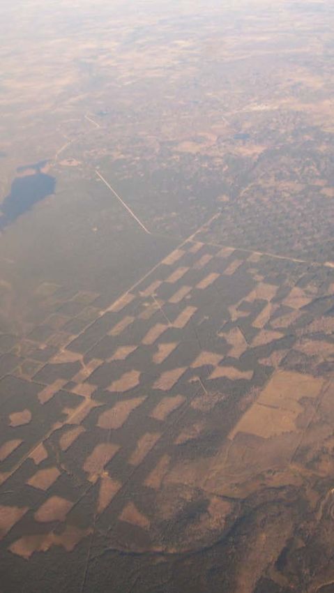
Context
• With the release of the Land-use Framework
(LUF) in December, 2008, fragmentation and
conversion of Alberta’s agricultural land was
identified as an area in need of policy
analysis and development.
• Public concern around food security.
Although Alberta is currently a net exporter of
agricultural products, issues of water scarcity and
climate change present some uncertainties around
the future of some agricultural sectors.
2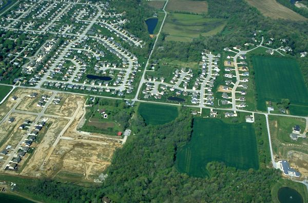
So what is the extent of the issue?
• GOA is not doing enough to stop urban and
rural residential sprawl.
Existing policy is insufficient - agricultural producers
may need some incentive to keep their land in
agricultural production.
• Agriculture and Rural Development (ARD)
along with Municipal Affairs (MA) were
tasked with examining this issue.
3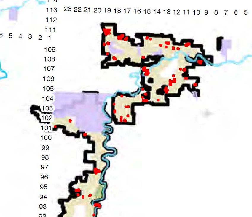
So what is the extent of the issue?
The agricultural land base in Alberta is at
risk due to increasing pressures:
Growth in the natural resource sector;
Urban, industrial, and country residential
development;
Increased competition for land use;
The limited and yet unknown quantity and
quality of northern agricultural lands
available for expansion; and
The unknown effects of climate change.
4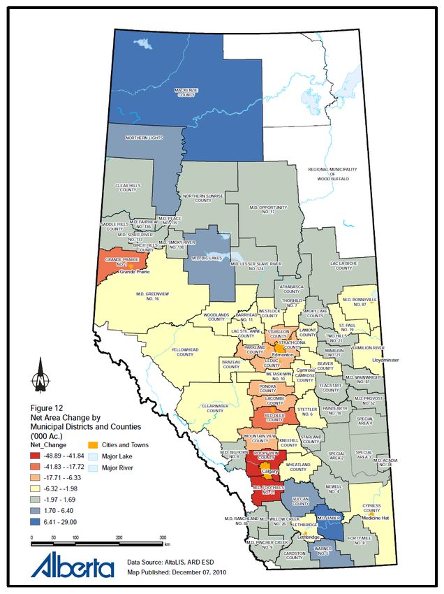
ARD – Past Studies

• From 1976 to 2002, ARD monitored changes in the
  agricultural land base.
• From 1981 to 1995, the province has lost less than one
  tenth of one percent of farmland on a net basis, per five
  year reporting period.
• Much of the agricultural land converted to other uses
  during that time period was of high capability for annual
  cropping (AB CLI 1-3) and occurred within the more
  densely populated regions of the province (e.g., the
  Edmonton – Calgary corridor).
• Conversely, most of the land that has come into
  production (mainly from a series of public land sales
  between 1991 and 1995), has been of lower capability
  (AB CLI 4-7) located primarily in Northern Alberta.
                                                       5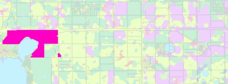
ARD – Past Studies

                         Changes in the Alberta Land Base: 1976-1995

               150

               100

                50
('000 acres)

                                                                       Total Land Additions
                 0                                                     Total Land Deletions
                                                                       Net Land Change
                    76

                    77

                    78

                    79

                    80

                    81

                    82

                    83

                    84

                    85

                    86

                    87

                    88

                    89

                    90

                    91

                    92

                    93

                    94

                    95
                 19

                 19

                 19

                 19

                 19

                 19

                 19

                 19

                 19

                 19

                 19

                 19

                 19

                 19

                 19

                 19

                 19

                 19

                 19

                 19
                -50

               -100

               -150
                                      Year
                                                                                   6
Limitations of Previous Studies
• Most recent data is from 1996
Prior to Alberta’s most recent economic “boom”;
• Data is not spatially aligned;
• Data is unavailable on LUF region;
• No current “baseline” from which to
build new policy;
• Use of the CLI as a rating tool
“Capability” versus “suitability” system
7
Definitions - Fragmentation

•   Occurs when once
    contiguous areas become
    divided into separate
    fragments isolated from each
    other by other, non-
    agricultural land uses.

•   Can also occur within a parcel
    of land by access roads, oil
    and gas developments and/or
    linear infrastructure.

                                     8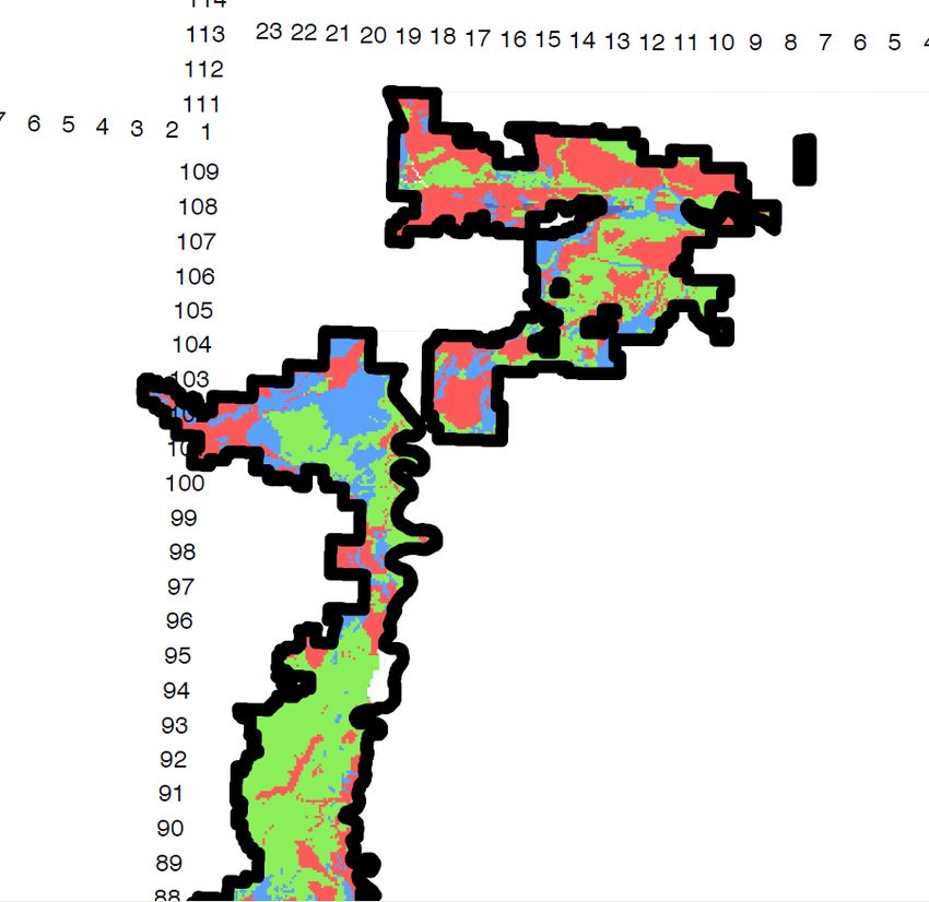
Definitions - Conversion

               •   A land-use change from an
                   agricultural use to a non-
                   agricultural use.

               •   Can be temporary (e.g.,
                   upstream oil and gas
                   development) or permanent
                   (e.g., country residential,
                   urban and/or industrial
                   development).

                                           9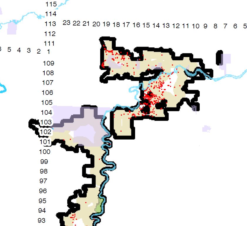
Current State
• Fragmentation and conversion is currently managed
through the Provincial Land Use Policies (PLUPs) and
local statutory land-use bylaws.
• Municipalities are “encouraged” to limit the
fragmentation and conversion of agricultural land.
• The effectiveness of the PLUPs/local bylaws are not
monitored.
ARD collected data from the early 1970s to 1996;
monitoring was discontinued in 1996.
• The current “state” changed on August 22, 2012, with
the release of the Lower Athabasca Regional Plan.
10Work Leading to Policy Approach
• A consultant provided ARD/MA an estimate of provincial
agricultural land-use changes since 1996:
Over 14 years (’96 - ’09), Alberta experienced a net
change (loss) agricultural land resulting from both
permanent and temporary conversions of approximately
400,000 acres.
Permanent loss represented approximately half.
o Represents 0.4% of the total agricultural land base.
Approximately 95% of the total land lost was LSRS 2 & 3.
o Represents 0.8% of the total LSRS 2/3 land base
11Work Leading to Policy Approach
• Trends were evident when assessed by LUF region;
the largest loss of land occurred in the South
Saskatchewan, North Saskatchewan and Red Deer
regions (approximately 80% of total loss).
The Edmonton-Calgary corridor permanently lost
approximately 183,000 acres, 86% of the total provincial
loss.
12Net Area Change by Municipal Land Suitability Rating System for
Districts and Counties Alberta’s Soils
13Land Suitability Rating
14Work Leading to Policy Approach
DELETIONS:
• Deletions from agricultural use show an increasing
trend over the past 15 years.
• Although oil and gas activity sharply declined from a
peak in 2005, to a 15 year low in 2009, urban
annexation and rural subdivisions countered that trend
by increasing dramatically since 2006
Resulted in a net decrease in agricultural land.
15Rural Subdivision
16Work Leading to Policy Approach
ADDITIONS:
• Public land dispositions have increased since 1996.
Recent release of public lands in Mackenzie county
(approx. 136,000 acres) significantly alters net loss.
Issue is changes in land quality and proximity to services.
• The reclamation rate of oil and gas well sites initially
declined during the period from 1996 to 2003, but has
since steadily increased.
17Public Land Dispositions
18125
100
75
50
25
('000 acres)
0
1976
1978
1980
1982
1984
1986
1988
1990
1992
1994
1996
1998
2000
2002
2004
2006
2008
-25
-50
-75
-100
-125
Total Land Additions TotalYear
Land Deletions Net Land Change
19Work Leading to Policy Approach
• A review of the effectiveness of the PLUPs suggest that there
is significant variation as to how well municipalities have
managed agricultural land-use issues; the process of
developing and implementing policy would benefit from
improved land-use data.
• Food “security” was considered a valid reason for reducing
the fragmentation and conversion of agriculture land. While
there are many definitions of food security, public focus on
this area is increasing, and is particularly relevant for the
major urban centres in the province.
The perception of the general public on food security and land
loss is an important consideration regardless of its basis.
20Work Leading to Policy Approach
That said…
• There is limited evidence that the current rate of
fragmentation and conversion has had negative economic,
environmental, and/or social consequences in Alberta.
While this may be true…
• The rate of fragmentation and conversion of farmland
appears to have steadily increased in recent times, and this
loss tends to be of high quality cultivated farm land.
21GOA Approved Policy Direction
Continuation of the intent of the current
provincial land-use policy through
regional planning with the addition of
regular monitoring, evaluation and
reporting of agricultural land
fragmentation and conversion by ARD.
22Expectations under the LARP
• The Implementation Plan of the LARP sets
future provincial direction on fragmentation
and conversion of agricultural land.
• Although not strictly binding on decision
makers, section 7 of the ALSA requires that
decision makers and local government
bodies consider the direction of the
Implementation Plan in making their decision.
Decision makers must be able to respond to how
these components were considered in land-use
decisions. 23LARP – Agricultural Content
Agriculture
Objective: Maintain and diversify the region’s agricultural industry.
Strategies:
a) Municipalities are encouraged to identify areas where agricultural activities, including
extensive and intensive agricultural and associated activities, should be the primary land
use in the region.
b) Municipalities are encouraged to limit the fragmentation of agricultural lands and their
premature conversion to other non-agricultural uses, especially within areas where
agricultural has been identified as a primary land use in the region.
c) Where possible, municipalities are encouraged to direct non-agricultural subdivision and
development to areas where such development will not constrain agricultural
activities or to areas of lower-quality agricultural lands.
d) Municipalities are encouraged to minimize conflicts between intensive agricultural
operations and incompatible land uses by using appropriate planning tools, setback
distances and other mitigative measures.
Indicator:
• Fragmentation and conversion of agricultural land to non-agricultural land uses.
LARP 2012-2022, pp.39-40
24Legal Requirements - described
• ARD must be prepared and able to meet publicly stated
requirements (i.e., indicator) as outlined in the Regional
Plan.
• Direction on how this is to occur is provided within the
Regional Plan itself:
Section 9 “Regulatory Details Plan: Part 1 General” , and
i.e., Reporting frequency
Section 48 “Regulatory Details Plan: Part 8 Monitoring
and Reporting”
i.e., What to report on
25Legal Requirements - described
• Reporting Requirements:
Establish and maintain a program of monitoring and
evaluation on the status of the fragmentation and
conversion indicator, and its overall effectiveness in
responding to the issue,
and to
Report not less than once in the first four years
[from plan approval and implementation], and not
less than once in the following five years.
26Legal Requirements - described
• In reality, ARD’s goal is annually with a roll up
on a five year basis.
Eventual alignment of all LUF Regions.
Annual Report Card: provides the previous years
information on the fragmentation and conversion of
agricultural land.
Target: September, 2013
Five Year Report: Similar to ARD’s historical
reports; provides trend analysis and comment
based on the previous five years of annual
reporting.
Target: September , 2017
27Metrics for Monitoring and
Reporting
Landscape fragmentation comes from the
discipline of conservation biology
Island Biogeography Theory
Metrics are based on:
Composition
Configuration
Contiguity
Edge density and perimeter length
Effect of disturbance zones
28
Brabec and Smith, 2002; Irwin et al. 2003; Munroe et al. 2005, Theobald et al. 1997Metrics for Monitoring and
Reporting
Correlation between all indices is
expected as they are all based on
similar basic parameters:
Size
Shape
Distance
29
Clark et al., 2006; Munroe et al. 2005, Hargis et al., 1998; Theobald et al. 1997ARD Reporting Requirements
Fragmentation Parameter:
• More challenging to develop the
methodology compared with land conversion.
• Employs a ‘Perimeter-to-Area Ratio’.
The perimeter (think: fence line) increases with
each subdivision within a given area.
• The reporting area would be by municipality
and Land Suitability Rating class.
Allows for roll-up to LUF region and the
identification of provincial “hot-spots”.
30ARD Reporting Requirements
Fragmentation Parameter:
• Absolute versus Risk-Fragmentation:
Difference: time frame of conversion.
• Absolute Fragmentation is identified by a physically-
identifiable land-use change.
E.g., the parcel is developed within a year (i.e., reporting
period).
• ‘Risk Fragmentation’ is identified based on changes in
land-title without necessarily a physical change in
land-use.
E.g., the parcel is sub-divided on the expectation that it
will eventually be developed, but maintains current use.
31ARD Reporting Requirements
Conversion Parameter:
• Represents the area extent of land-use
conversion based on changes to the annual
National Crop Inventory and infrastructure
data.
Reported as temporary and permanent area
converted.
• National Crop Inventory generalized to:
- Water bodies - Grasslands
- Exposed Land - Croplands (A and P)
- Developed Land - Other (forest, wetland)
32ARD Reporting Requirements
Conversion Parameter:
• Assesses year-to-year changes from one
classification to another.
e.g., Cropland to Developed Area or Water Body
(slough) to Cropland.
• Area reported by municipality and by Land
Suitability Class.
Allows for roll-up to LUF Region and the
identification of provincial “hot-spots”.
33ARD Reporting Requirements
• Both absolute and risk fragmentation indices
along with the conversion indicator will be
reported annually.
Temporary and permanent considered
• Values published online on both the ARD
and Land-use Framework websites.
• Five-year roll-up, analysis and interpretation
will be completed and posted online, similar
to the historic loss and fragmentation reports.
34Expectations from Reporting
Published information can be used to:
• Inform the public.
• Assist municipalities and other land
managers in making land-use planning
decisions.
e.g., assist in the development/updating of
statutory plans.
• Will be used to inform, over time, the
potential need for further policy development.
Based on the extent of fragmentation and
conversion observed.
35Thank-you
Contact Information:
Jason Cathcart; Ph.D., P.Ag
Manager, Land-use Policy
Alberta Agriculture and Rural Development, Edmonton
780-427-3432
www.landuse.alberta.ca
36You can also read


