What is the GOTHAM project ?
←
→
Page content transcription
If your browser does not render page correctly, please read the page content below
NEWSLETTER #1
                                                                                              FEBR UA RY 2021

What is the GOTHAM project ?

GOTHAM stands for “Governance tool for sustainable
water resources allocation in the Mediterranean through
stakeholder’s collaboration”. It aims at shifting the
paradigm in groundwater management by engaging
end-users. The project is led by Cetaqua and gathers
six partners from the Mediterranean area including
private companies (GAC Group, Ingegneria Informatica),
a university (Universidad de Córdoba), an international
NGO (Istituto per la Cooperazione Universitaria), and a
public institution (The National Agricultural Research
Center in Jordan). Together, they aim at co-creating a
user-driven tool that enables effective governance
for the preservation of the quantity and quality of
groundwater in the Mediterranean basin. The project
is funded by the European Commission under the
PRIMA (Partnership for Research and Innovation in the
Mediterranean Area) programme and started on the 1st
of April 2020.                                                        Therefore, there is a need for a tool capable of allowing
                                                                      data exchange between the different stakeholders and
The Mediterranean basin has been identified as one of                 water users and for integrating this highly valuable
the world’s basins being the most at risk due to climate              information in groundwater governance decisions-
and anthropogenic changes. The population growth of                   making.
the Mediterranean basin as well as the always growing
water demand (through the strong urban expansion, the                 The GOTHAM project aims at providing such a tool,
development of tourism resorts, the increased irrigation              the GTool. The GTool is an innovative groundwater
of crops, etc.) and the unappropriated distribution of                governance tool that is going to be co-designed by
resources has led some Mediterranean rims (in particular              all water stakeholders (regulators, end-water users,
the eastern and southern rims) to face water stress and/              water producers and suppliers). It will allow for a new
or water scarcity.                                                    groundwater management framework based on
                                                                      users (bottom-up approach) instead of the current
To overcome this water stress, GOTHAM has decided                     top-to-down model in which the regulator establishes
to tackle the issues regarding the current groundwater                the enforcing rules on a (almost) single basis. This is
governance models. In fact, a lot of knowledge is                     considered to be the only way to reach a long-term
generated at each decision-making level but few                       sustainable management of aquifers tackling their
exchanges between those levels are taking place. This                 complexity in terms of uncertainty (regarding resources,
lack of transparency is creating doubts, uncertainty and              reservoirs or internal geometry, etc.) and of surveillance
mistrust which consequently leads to conflicts.                       and control by administrations.

 GOTHAM is part of the PRIMA Programme supported by the European Union. The PRIMA programme is supported under Horizon 2020 the European Union’s
 Framework Programme for Research and Innovation. Grant Agreement number: 1922
NEWSLETTER #1
FEBR UARY 2021
GOTHAM’s use cases
To design the GTool, the GOTHAM team will use a co-creation process. Three pilot cases have been designated:
Campo de Dalías in Spain, Iaat Baalbeck-Hermel in Lebanon and Azrag Basin in Jordan. Moreover, the tool will be
implemented in these areas for enabling users’ feedback. These three use cases have been chosen because of the
different types of challenges they aim to overcome through the GOTHAM project:
Iaat
Baalbeck-Hermel
Lebanon
Campo de Dalías Azraq Basim-Zarqa
Spain Jordan
Campo De Dalias Iaat Baalbeck-Hermel Azraq Basin-Zarqa in
in Spain in Lebanon Jordan
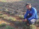
Campo de Dalías is located at the Iaat is a town and municipality The Azraq area includes eight
southeast of the Iberian Peninsula, located in the Beqaa Valley of districts: South Azraq; North
specifically in the southwest of the Lebanon in the North eastern Azraq; Omari; Ein Al Baida; Eastern
province of Almeria. It is located part of the country with an area Farms area; Um Al Mathayel;
in the Hydrological Subsystem of about 42 km2. Administratively Degaileh; and the air force base.
III-4, within the Hydrographic related to Baalbeck-Hermel The total population of Azraq
Demarcation of the Andalusian Governorate (Baalbeck district), district is estimated at around
Mediterranean Basins (DHCMA). which the capital Baalbeck 18,000 inhabitants. The Azraq
Known as the “Plastic Sea”, city comprises an impressive Basin is located in the North-
this peninsula hosts intensive archaeological site designated eastern part of the country with
agriculture in Spain, under green a UNESCO world heritage site in an area of 12,710 km2. In this area,
houses. Intensive pumping of 1984. The excessive underground there is a mismanagement of
groundwater has led to changes water pumping in this area has the groundwater due to the lack
in the behaviour of aquifers and engendered a decline in the water of control of the government
to their deterioration and in the table level. As a consequence, regarding water use and due
overall quality of water. Moreover, the springs dry out which results to the illegal drilling of water by
the excessive agriculture on this in disappearances of the natural private users. This results in a
site has led to a heavy pollution sites. Moreover, there are issues deterioration of water quality and
of the water due to their use related to pollution: leaks of quantity.
of salts, nitrates, fertilizers, and polluted water in the southern
phytosanitary substances. water basin coming from waste-
water treatment plants and
an increased pollution ratio in
underground water.
GOTHAM is part of the PRIMA Programme supported by the European Union. The PRIMA programme is supported under Horizon 2020 the European Union’s
Framework Programme for Research and Innovation. Grant Agreement number: 1922NEWSLETTER #1
FEBR UARY 2021
Our progress
In Campo de Dalías in Spain In Iaat, Baalbeck-Hermel in Lebanon
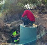
In Spain, GOTHAM team supported the mapping of the local The project team advanced on the Mapping of the stakeholders
stakeholders. In addition, sensors were installed on the field, to in this case study. A list of 25 stakeholders was prepared in
start collecting the data for the GTooL At the end of November, collaboration with Iaat Municipality. This list includes 9 water
the GOTHAM team have installed 4 multi-parameter sensors producers, 9 end-users, 4 water suppliers, 1 regulator,
(CTD-Diver) in four wells all 2 organisations.
around Campo de Dalías. In a The Interviews with stakehold-
first well we have installed a ers were started beginning of
groundwater telemetry system, November and were finalised
composed of one CTD-Diver, at the beginning of February.
which is a sensor for extremely Questionnaires were translated
accurate measurement of level, into Arabic to ensure that all
temperature and electrical stakeholders would have their
conductivity of water. Also, voice heard. Unfortunately,
this sensor is connected to a the slowness in the implementation of these interviews was
“VanWalt DataHub” which performs as a hub to collect data caused by COVID-19 pandemic, in addition to the lockdown of
from the CTD-Diver telemetry. A second well was equipped the country during the last two weeks of November. To date,
the same monitoring system. It also received the accessory 100% of the stakeholders’ interviews were carried out, and
“Dataslave” to send the data by radiofrequency as the data therefore a previously prepared questionnaires were filled.
logger is located far further away from the well.
The aim of installing all this equipment is to observe the In Azraq Basin in Jordan
quantity and quality variation of groundwater by monitoring
the piezometric level and electrical conductivity of each sector The project team has advanced on the stakeholder Mapping
of the deep aquifers of Campo de Dalías. All this information in the case study area. Indeed, 45 stakeholders have been
could provide us the enough knowledge about Groundwater interviewed including water producers, water suppliers,
response to rainfall recharge and Water quantity and quality end-users, regulators and relevant organisations. Currently,
dynamics. The data collected (timestamp between each agricultural and economic data for the Agro-Economic model
measurement is 1h) will also feed the forecasting module. are collected.
Stay tuned on the project website and social media accounts
to have more information on the use cases’ outcomes!
www.gotham-prima.eu
https://twitter.com/GothamPrima
https://www.linkedin.com/company/gotham-prima
THE GOTHAM CONSORTIUM
GOTHAM is part of the PRIMA Programme supported by the European Union. The PRIMA programme is supported under Horizon 2020 the European Union’s
Framework Programme for Research and Innovation. Grant Agreement number: 1922You can also read


