The Euphrates in Crisis - Channels of Cooperation for a Threatened River Research Paper - Chatham House
←
→
Page content transcription
If your browser does not render page correctly, please read the page content below
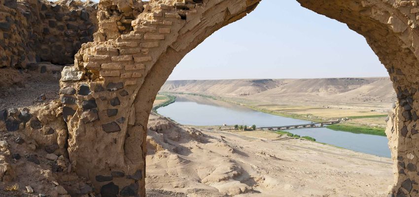
Research Paper
M. Nouar Shamout with Glada Lahn
Energy, Environment and Resources | April 2015

The Euphrates in Crisis
Channels of Cooperation
for a Threatened River
Contents

                    Summary                                              2

                    Introduction                                          7

                    The Euphrates’ Characteristics and Infrastructure    10

                    What is Happening to the Euphrates?                  19

                    Shared Future Challenges                             21

                    The Way Forward                                      26

                    Conclusion                                           35

                    Appendix A: Indicators and Methodology               37

                    Appendix B: The History of Interstate Negotiations   39
                    Over the Euphrates River

                    About the Authors                                    42

                    Acknowledgments                                      43

1 | Chatham House
The Euphrates in Crisis: Channels of Cooperation for a Threatened River Summary The Euphrates River is of critical importance for water, food and energy security in Turkey, Syria and Iraq. Flowing south-east for 2,700 kilometres from eastern Turkey to the Persian Gulf, it supports over 60 million people and – along with the Tigris, with which it runs almost in parallel – has a rich history of sustaining civilization on the Mesopotamian plains. This vast water resource is in crisis. Degradation of the river from over-exploitation, population growth, pollution and other factors has been a serious problem for many years. Now war and violent upheaval in Syria and Iraq are worsening the situation: threatening key infrastructure and preventing policy cooperation. Without urgent attention, stresses on the river’s resources will add to the already catastrophic humanitarian crisis created by the conflict. In the longer term, a vision for cross-border coordination is essential if the river is to retain its vital role in the region. Multiple threats The Euphrates has attracted international attention since 2013 as combatants in Syria and Iraq have competed for control of its vital structures. The forces of Islamic State of Iraq and al-Sham (referred to as ISIS in this paper, though now widely known as ‘Islamic State’ or IS) have sought strategic strongholds along the river. Different sections of the river are in the hands of various state and non-state actors, and control of major dams is contested. In many places, it is not even clear who has authority over the river. The lack of security and blurred authority are compounding water challenges that predate the current conflict. Indeed the Euphrates was under serious stress long before the Syrian crisis erupted in 2011. Rapid and uncoordinated development in the riparian states (Turkey, Syria and Iraq) has changed the river’s flow regime, causing a 40–45 per cent reduction in downstream water flow since the early 1970s. In the past 50 years, some 32 dams and barrages have been built on the river. Their construction – along with growth in water-intensive agriculture, pesticide use and industry – has wreaked havoc on downstream water quality and ecology. The river is the main source of water for 27 million people across the three countries, with tens of millions more reliant on the food and energy it enables. Its deterioration, combined with last decade’s drought, has prompted mass migration from rural areas surrounding the Euphrates in Syria and Iraq. In southern Iraq, acute salinization and pollution have caused human illness and farm losses. In Syria, the resulting urban population pressures and food costs have increased social tensions. Incremental pressures related to population growth, industry and hydro-engineering now threaten conditions for human development more broadly throughout the Euphrates region. Of particular concern are plans for continued upstream dam and infrastructure building. Turkey’s Southeastern Anatolia Project (Güneydoğu Anadolu Projesi, or GAP) – a major development on the Tigris and Euphrates rivers and their tributaries for hydropower and agricultural irrigation, which began in the 1970s – is particularly significant. The project aims to support economic development in Turkey’s southeast, but many Syrians and Iraqis have grave concerns about its impact on their water supplies. 2 | Chatham House
The Euphrates in Crisis: Channels of Cooperation for a Threatened River

Two overarching challenges concern all countries. One is climate change bringing both higher average
temperatures and increased occurrence of extreme weather events. The World Resources Institute,
for example, projects that in 2025 water conditions along the Euphrates will be up to eight times
more stressed than in 2010.1 The other concern is the weak capacity of the riparian states to respond
either individually or collectively to the increased challenges they face. Institutional capacity has been
depleted by conflict in Syria and Iraq, and there remains no mechanism for information sharing or
emergency response across the river basin. Yet the likelihood of events requiring such a response –
from drought to wilful destruction of infrastructure – is increasing.

The need for policy coordination between the riparian states and other stakeholders has never
been greater.

                           At least 40%                                                                      2020
                         of the flow of the
                     Euphrates to downstream
                   countries has been lost due to                       1972
                    over-exploitation since 1972
                                                                         The overall flow of the river is expected
                                                                        to reduce further and faster in the coming
                                                                          decade, exacerbated by climate change

A troubled history of water relations
This paper argues that the challenges facing the Euphrates cannot be met by one state acting alone.
Indeed, the history of poor interstate coordination over the river is precisely one of the factors that have
allowed the deterioration in its condition to occur. Despite almost a century of formal negotiations,
agreement has been limited. Negotiations have been characterized by mistrust, poor communication
and a lack of reliable, common data.

The author’s interviews with 25 people in Turkey, Syria and Iraq formerly involved in, or close
to, transboundary water negotiations, and a literature review, reveal three key factors that have
impeded cooperation. First, a history of regional rivalry has prevented the concept of water sharing
from taking hold. There is no comprehensive or long-term treaty between Turkey, Syria and Iraq
on water sharing, and Turkey’s rejection of the UN Watercourses Convention of 1997 inhibits the
application of international principles to the issue. Second, centralized decision-making in each state
has constrained the power of negotiating teams. And third, discussions have mostly been bilateral,
despite the fact that the river flows through three countries; this has tended to upset the excluded
third party in each negotiation.

1
    The projection is based on data from the Intergovernmental Panel on Climate Change (IPCC).

3 | Chatham House
The Euphrates in Crisis: Channels of Cooperation for a Threatened River
What can be done? This paper makes a number of recommendations based on short- and long-term goals.
Given the security situation in Syria and Iraq, the severing of relations between Turkey and Syria, and
the spread of ISIS’s influence, resuming interstate talks over the river is unthinkable at present. However,
building a common vision among concerned experts to prepare the ground for eventual cooperation
should not be. Moreover, despite their limitations, bilateral protocols established between Turkey and
Iraq, and between Turkey and Syria, between 2008 and 2010 – and emerging international river-basin
cooperation experience – could provide the basis for a more constructive approach.
Syria Iraq
A transboundary
72% 61%
challenge
Share of renewable water resources dependent
on water flowing from other countries
Building a common vision for cooperation
In the near term, opportunities for ad hoc interstate coordination on temporary measures to address
urgent human needs should be seized. Independently of this, a working group of experts both inside
and outside the riparian states could be set up to monitor events affecting the integrity of the river.
This working group could advise responsible authorities and humanitarian agencies on issues such as
water supply, sanitation failures or sudden releases of water from dams.
When political conditions improve, a more formal river committee should be established. Such a
body would assemble a variety of interested parties, researchers and policy-makers with an evolving
mandate that would both build trust and lead to increased management capacity for all riparians.
The priorities for the committee’s work could include:
• Building databases of all existing water-related agreements and disputes and pooling all
available information on the river’s hydrology and meteorology in each state.
• Defining the respective water needs and projected demands of each state, with a focus on
identifying target areas for improving efficiency.
• Developing a durable agreement on water sharing. Rather than focusing on a division of flow,
this could focus more on roles, joint responsibilities and specific processes for defusing tensions
and resolving disputes.
• Building an early-warning system for the prediction of severe climate incidents in the Euphrates
basin, to enable preparation against famine and flooding.
4 | Chatham HouseThe Euphrates in Crisis: Channels of Cooperation for a Threatened River • Promoting regional cross-investment in the GAP, helping to alleviate the concerns of stakeholders in Syria and Iraq. • Fostering wider economic interdependence between states, which could involve the export of oil and gas supplies from Iraq in return for hydroelectric power from Turkey, and food trade between all three countries. • Reviewing legislation on water use and management in the three riparian states, in order to standardize regulations and best practice. Given the limitations on enforcing rulings in all three countries, pragmatism may dictate that such efforts be guided more by the principle, rather than the letter, of international law. 5 | Chatham House
Figure 1: Map of the Euphrates basin
Keban Murat
Thoma Euphra Lake Van
tes
Medik Dicle (planned)
Karakaya Kralkızı
Batman
an
Botan
tm
Ba
Ilısu (planned) Lake
z il S u yu
Urumiyeh
Turkey
Tig
Atatürk Turkey r is
Iran
He
Birecik Gre
Feesh Khabour ate
Hancağız Karkamış r Za
b
Kayacık Bekhme (planned)
Hasakah East
Jallab
Sajur
Sajur Mosul
Hasakah West Hasakah b
r Za
Tishreen te
Balikh
Bassel Al Asad Mosul Gr
ea
Aleppo Raqqah Dukan
Lake Euphra
Assad tes Dibis
Baath
Tabqah rZ
ab
r
ou
sse
Le
ab
Tanje
r u
Kh
Deir ez Zor Derbendikhan
Iraq Ghe
Wadi Tharthar
shla
gh
Tig
Ad Gaveh
Sir
ha
r
im Qur
Adhaim
ah
is
wa
ahtu
l
ya
n
Bukamal Qa
Di
Lake ra
s
Tharthar ou
Samarra Wan
d
Hemrin
Hadithah
Syria wro
n
Tharthar
Diyalah
i Ho
Wad
Baghdad
ir
Say
ng
ma
Ramadi am reh
Ga
h er
Lake Tig nC Sez
a
Habbaniyeh Fallujah r is Ka
nj
eh
Ka
rkheh
ool
ang
Hindiyah Ch Dez
Tib
Lake Tigris
Razzazah
Kut Karkheh
Dw
yyid
l Uba
M
ia
air
Capital city Freshwater lake Wad
ai
An Najaf
ej
n
Ou in
Dr
Ka
tfa
Selected city, town Saltwater lake
a
rk
ll
heh
b
International boundary Selected major dam
ia
iH
ad
Basin boundary Samawah
W
Map by ESCWA and BGR, adapted by Chatham House.
Disclaimer: The boundaries and names shown and Euph
River rates
the designations used on this map do not imply official
Qurnah
un
Canal, irrigation tunnel endorsement or acceptance by the United Nations.
r
Sh
Ka
at
t
Wetland
al
ab
Ar
Basrah
Source: UN-ESCWA and BGR (2013), Inventory of Shared Water Resources in Western Asia, Beirut.
Kuwait
Kuwait CityThe Euphrates in Crisis: Channels of Cooperation for a Threatened River
Introduction
The Euphrates lies at the heart of a region with a history of great riparian civilizations (see Box 1). It
is a vital resource to communities, agriculture and industry in Turkey, Syria and Iraq. Since 2013 the
river has become a focus for conflict as forces of the Islamic State of Iraq and al-Sham (ISIS)2 have
seized territory along its course and used control over its waters to exert influence. But the health of
this river and its tributaries was already endangered well before the Syrian crisis began in 2011. Rapid
and uncoordinated development has affected the river’s flow. Some 32 dams and barrages have been
constructed over the last 50 years. Growth in water-intensive agriculture, pesticide use and industry
has wrought havoc on downstream water quality and ecology.
Box 1: The cradle of civilization
The Euphrates River has always been the life source for the Mesopotamian plains and civilizations.a This river,
which springs from ice-capped mountains in Turkey, flows through semi-arid and arid plains in Syria and
Iraq. These plains have witnessed many human achievements, among them the development of irrigation
engineering; the first treaty describing borders between states and rights over waters; and – perhaps most
pertinent to current challenges – the Code of Hammurabi of 1790 BC, which was the first legal text in history
to regulate irrigation rights.b The importance of the river in the life of its people is also reflected in the sacred
value accorded to it in Islam, Christianity and Judaism.c Interestingly, each religion regards the depletion of
the Euphrates as a portent of the Day of Judgment.d
For millennia, Iraq was the dominant beneficiary of the Euphrates’ waters. It used to be called ‘Ardh Assawad’
(‘black land’ in Arabic) in reference to the dark green vegetation covering the country. This changed in the
20th century with the collapse of the Ottoman Empire and the creation of the sovereign states of Syria, Iraq
and Turkey between 1918 and 1923. For the first time in centuries, control over the Euphrates River was
divided among three national governments.
a
Mesopotamia means ‘between the rivers’ in Greek.
b
Hatami, H. and Gleick, P. (1994), ‘Chronology of Conflict over Water in the Legends, Myths, and History of the Ancient Middle East’ in
‘Water, war, and peace in the Middle East’. Environment, Vol. 36, No. 3, pp. 6–42 (Washington: Heldref Publishers).
c
Islam (Hadith from Sahih Muslim, part 18 p. 186), Christianity and Judaism (Book of Genesis, chapter 2, verse 14).
d
Islam (Hadith from Sahih Muslim, hadith No. 2894), Christianity and Judaism (Book of Revelation, chapter 16, verse 12).
Demographic pressures, hydro-engineering developments and climate change look set further to
affect the river’s flow, seasonal pattern and water quality, with associated impacts on agricultural
land and the natural environment. In particular, Turkey is preparing to complete major works on both
the Euphrates and Tigris rivers and their tributaries in the next 10 years. The Southeastern Anatolia
Project (Güneydoğu Anadolu Projesi, or GAP) has added 12 dams (eight of which are on the Euphrates)
and over 5,000 megawatts (MW) of hydropower capacity since 1977. A further three major dams for
hydroelectric power are planned, along with large-scale expansion of irrigation channels for arable
2
Also known as the Islamic State of Iraq and the Levant, this group renamed itself Islamic State in June 2014, declaring a ‘caliphate’ in the
territory it had captured in Syria and Iraq.
7 | Chatham HouseThe Euphrates in Crisis: Channels of Cooperation for a Threatened River
land.3 Prior to the current security crises in Syria and Iraq, the governments of both countries had also
planned to increase use of water along the Euphrates – although these plans have been interrupted.
Without coordinated management and adaptation measures, changes in the river’s flow will bring
hardship to agricultural communities throughout the region. Reduced availability of surface water
could undermine food security and cause unplanned migration, as has already been seen in parts of
Iraq and Syria. Increased competition for resources would exacerbate distrust between countries,
diminish internal social cohesion and, in the case of Syria, dampen prospects for effective post-
war reconstruction.
But if intergovernmental cooperation is necessary, the means for achieving it are lacking. Since the
formation of the three nation states, each country’s government has contested rights to the river. The
review of negotiations in this research paper shows that intermittent efforts over the last century have
mainly been bilateral, have often ended in acrimony, and have brought no workable river-sharing
agreement. Opportunities in the 1960s and early 1970s for formal technical coordination – which
might have avoided many of the problems we see today – were derailed by politics.
The effects of these failures are now being compounded by violent conflict that threatens to permanently
erode territorial governance arrangements. Critical infrastructure along the river has been damaged.
Worse may be to come as hostilities involving ISIS forces intensify. Not only could this result in further
interruptions of water flow and (potentially catastrophic) destruction of dams and other structures, but
it also raises the possibility that sections of the river could become ungovernable indefinitely.
Regardless of how the political geography changes in the coming months
and years, there remains the need for long-term thinking. Policies will need
to be developed not only to mitigate the effects of over-exploitation and poor
management, but to ensure future sustainability of the river.
Yet regardless of how the political geography changes in the coming months and years, there
remains the need for long-term thinking. Policies will need to be developed not only to mitigate
the effects of over-exploitation and poor management, but to ensure future sustainability of the
river. This paper aims to inform that process. It offers itself as a resource to experts, diplomats and
politicians. It provides a baseline for dialogue: taking stock of the river’s significance to Turkey,
Syria and Iraq respectively, as well as of the threats to it as a water resource. Its findings and
recommendations are based on a six-month study of the Euphrates negotiation processes, drawing
on the available literature, interviews with experts4 in the region, and discussions at a high-level
workshop in June 2014.5
3
The GAP project is composed of 13 sub-projects comprising dams, hydroelectric power and irrigation plans for 1.8 million hectares of land
(18,000 square kilometres). It does not cover all dams on the Euphrates. General Directorate of State Hydraulic Works (DSI) website at www.dsi.
gov.tr; the official GAP page at http://www.gap.gov.tr/dosya_ekleri/gap_son_durum/index.html; and DSI (2009a), ‘Water and DSI’, Ministry
of Forestry and Water Affairs, General Directorate of State Hydraulic Works, accessed at http://www2.dsi.gov.tr/english/water-and-dsi/index.
html#/1/, p. 34; DSI (2009b), Turkey Water Report, General Directorate of State Hydraulic Works, accessed at http://www2.dsi.gov.tr/english/
pdf_files/TurkeyWaterReport.pdf. More information is available in a publication in Turkish, DSI (2013), ‘Recent Status of GAP, 2013’, General
Directorate of State Hydraulic Works, accessed at http://www.gap.gov.tr/dosya_ekleri/gap_son_durum/index.html.
4
The interviews were carried out between November and December 2013 in London, Beirut, Istanbul and Ankara. Respondents to the interviews
have chosen to remain anonymous.
5
The workshop – ‘The Euphrates under Stress: Towards Tripartite Cooperation for Sound River Management’ – was organized by Chatham House
in cooperation with the United Nations Economic and Social Commission for Western Asia (ESCWA) and The Prince’s International Sustainability
Unit (ISU) on 9–10 June 2014. It brought together local academic experts, decision-makers, NGOs and international experts working in the
region; discussions were held under the Chatham House Rule.
8 | Chatham HouseThe Euphrates in Crisis: Channels of Cooperation for a Threatened River Section 2 of this paper outlines the geography and division of the river between states, the extent of each country’s dependence on it, and the infrastructure developments that affect its flow. Section 3 considers the physical changes that the Euphrates has undergone over the past 50 years in terms of flow and quality. Section 4 considers the likely future challenges and the capacity of each state to manage them. Finally, section 5 offers recommendations for politically realistic cooperation. This section draws on the history of transboundary water relations and international experience for insights as to how basin- wide cooperation could be achieved in future. It also proposes interim actions that could be taken to prepare for such cooperation and to keep tripartite channels of dialogue open. 9 | Chatham House
The Euphrates in Crisis: Channels of Cooperation for a Threatened River

The Euphrates’ Characteristics
and Infrastructure

The division of the Euphrates
The Euphrates is the longest river in western Asia.6 It flows 2,700 kilometres through Turkey, Syria
and Iraq, and into the Persian Gulf through the Shatt al-Arab. As shown in Figure 2, the river basin
extends over six countries: Iraq, Turkey, Syria, Saudi Arabia, Kuwait and Jordan (the countries are
listed here in order of basin area, from large to small).

Figure 2: The Euphrates water system (main course, tributaries and sub-basins)

                                                             Total basin area: 441,803 km2
        Turkey              Karasu     Murat
        123,000 km2
                                                                                                                     Khorramshahr
        28% of total                                                                                                     (Iran)
        basin area                Keban
        Surface water
        contribution 89%                                         Iraq
                                    Balikh
                    Karkamış         and                         206,800 km2                                 Shatt al-Arab
                     Sajur          Jallab Khabour               47%                                                                The Gulf
                                                                                                              Qurnah
                                                                 Surface water
                                                                                             Tigris
                                                                 contribution 0%
                                                                                                                    Basrah

                                                                                   Tharthar

                      Jarablus                                                                                                 Kuwait
                                               Bukamal                          Ramadi       Samawah                           2,000 km2
                                                                                                                               0.4%
                          Raqqah
                                      Deir ez Zor             Qaem        Hit            Fallujah      Nasiriyah

         Syria
         96,800 km2              Surface water
         22%                     contribution 11%

       Jordan                Saudi Arabia                                                           The river course
       135 km2               13,068 km2
                                                                                                    Cities
       0.03%                 3%
                                                                                                    Water sources
       Surface water         Surface water
       contribution 0%       contribution 0%                                                        Sub-basins based on international borders

Sources: Shamout, N., based on ESCWA (2013); U.S. Geological Survey; Google Earth Maps; and satellite images.7

6
  Western Asia refers to Turkey, Syria, Iraq, Iran and the Gulf states, which are all considered part of the Euphrates basin in this research paper, as
well as Lebanon, Palestine, Jordan and Israel.
7
  UN Economic and Social Commission for Western Asia (ESCWA) (2013), Inventory of Shared Water Resources in Western Asia,
http://waterinventory.org/sites/waterinventory.org/files/00-Information-brochure-Water-Inventory-web.pdf.

10 | Chatham House
The Euphrates in Crisis: Channels of Cooperation for a Threatened River
Figure 2 shows that Turkey supplies 89 per cent of the Euphrates’ total flow, making it the main
contributor to the river. Syria is the second biggest contributor, accounting for 11 per cent of the
river’s total flow.8 (Turkey disputes this figure, claiming that the Syrian contribution comes from
resources partially within Turkish borders.) Iraq does not make any considerable contribution to the
river flow. The non-riparian countries sharing the Euphrates basin, namely Saudi Arabia, Jordan and
Kuwait, receive no flow from the river and do not make any contribution to it.
Turkey, Syria and Iraq also share some tributaries of the Euphrates, as listed in Table 1.
Table 1: Euphrates tributaries in Syria
River Average Basin area Basin sharing Length Dams and Planned
flow (km2) (km) barrages irrigated
(m3/s) Turkey Syria Iraq lands (ha)
(%) (%) (%)
Sajur 3.1 2,860 40 60 – 108 2 Not known
Balikh/Jallab 3.8–4.4 13,600 62 38 – 196 None reported 303,000
Khabour 29.3 36,200 28 66 6 388 3 404,000
Source: ESCWA (2013).
The water situation in the three riparian states
There are several ways to understand each country’s reliance on the river. One is to consider the
dependence ratio: an indicator that expresses the percentage of a country’s total renewable water
resources that originates outside its borders. This does not reflect the possible state-determined
allocation of water to downstream countries, i.e. by mutual agreement.9 The dependence ratios for
Turkey, Syria and Iraq are shown in Figure 3.
Figure 3: The dependence of Turkey, Syria and Iraq on transboundary water resources
Turkey Syria Iraq
1.5
28
39
61
72
98
% originating within borders
% originating outside borders
Source: FAO (2015), AQUASTAT Database, estimates for 2012.10
8
This comes from precipitation and smaller rivers shown in Figure 2.
9
The full definition of the dependence ratio, as defined by the UN Food and Agriculture Organization (FAO), is available on the FAO’s global water-
information system website, http://www.fao.org/nr/water/aquastat/main/index.stm, FAO (2015), AQUASTAT website, Food and Agriculture
Organization of the United Nations (FAO), accessed on 19 May 2014.
10
FAO (2015), AQUASTAT website, Food and Agriculture Organization of the United Nations (FAO), accessed on 19 May 2014.
11 | Chatham HouseThe Euphrates in Crisis: Channels of Cooperation for a Threatened River
On this measure, Syria exhibits the heaviest dependence on transboundary water resources. However,
a state’s overall water status is not limited to its water dependence; factors such as water-management
efficiency and water scarcity are also important. The water status of countries in the Middle East and
North Africa (MENA) region was assessed in a late 2012 study, in which researchers used a number of
water-poverty indicators (see Appendix A) to assess water scarcity based on the physical availability of
water, as well as on the country’s social and economic needs.11 Table 2 summarizes the findings of this
study for Turkey, Syria and Iraq.
Table 2: A comparison of water-scarcity indicators
Country Falkenmark* Criticality ratio* Social water-scarcity index*
Turkey No stress No stress Beyond the barrier
Syria Scarcity Very high stress Beyond the barrier
Iraq No stress Low stress Beyond the barrier
* See Appendix A for definitions.
Source: Adapted from Jemmali, H. and Sullivan, C. (2012).
Table 3: Aqueduct water risk indicators for commercial companies and investors
Overall water risk Overall risk (Quality) Baseline water stress* Baseline water risk,
(1 = lowest stress, Euphrates area
5 = highest)
Turkey Low to medium Medium to high 3.02 Low to medium
Syria Medium to high Medium to high 3.85 Medium to high
Iraq Medium to high High 3.48 Medium to high, High
*A 2013 World Resources Institute Aqueduct working paper uses the following definition: ‘Baseline water stress measures total annual water
withdrawals expressed as a percentage of the total annual available blue water. Higher values indicate more competition among users.’ Rankings
are given in Appendix A.
Source: Gassert, F.; Reig, P.; Luo, T. and Maddocks, A. (2013).12
The scarcity indicators suggest that Syria faces the worst situation regarding the availability and use
of water resources and the capacity to adapt to water stress. Rapid urbanization and the country’s
focus on water-intensive crop production to meet food self-sufficiency objectives have increased its
dependence on water. The Euphrates accounts for 70 per cent of surface water resources and 50 per
cent of total renewable water resources in Syria. Most of the major water projects in the country
depend on the Euphrates to meet household demands for water. For instance, the city of Aleppo
depends entirely on water from the Euphrates to meet the needs of its inhabitants. Salamiyah is
another city that depends totally on water from the Euphrates. The river supplies water to the
300,000 inhabitants of the city and its suburbs.
Local pressures on other rivers are also increasing dependence on the Euphrates. For instance
greater Damascus, a region of some 6 million people prior to the conflict, has lost water flow through
11
Jemmali, H. and Sullivan, C. (2012), ‘Multidimensional analysis of water poverty in the MENA region’, Social Indicators Research, Volume 115,
Issue 1, pp. 253–77, http://link.springer.com/journal/11205.
12
Gassert, F.; Reig, P.; Luo, T. and Maddocks, A. (2013), ‘Aqueduct country and river basin rankings: a weighted aggregation of spatially distinct
hydrological indicators’, working paper (Washington, DC: World Resources Institute), November 2013, http://wri.org/publication/aqueduct-
country-river-basin-rankings.
12 | Chatham HouseThe Euphrates in Crisis: Channels of Cooperation for a Threatened River the Barada River, whose source springs 70 kilometres to the west. That river’s water resources are completely utilized in meeting the demands of agriculture and the city. As a result the riverbed is almost dry for most of the summer months – a reflection of the degree of pressure on water resources in the region. The scarcity of water and escalating demand in the capital led the Syrian government to explore the option of a major pipeline project to convey water from the Euphrates to Damascus. Iraq is hardly in a better position, despite receiving a ‘no stress’ rating on the basis of the fraction of total annual run-off available for human use. Although water in Iraq is not classified as a scarce resource based on physical availability, its quality is low. The country lies in an arid region with very little rainfall, making it almost fully dependent on surface water from the Euphrates and the Tigris. The Euphrates accounts for 35 per cent of water resources in Iraq.13 Like Syria, Iraq has experienced increased social and economic activity in the last decade, resulting in greater demand for water. This increased demand – coupled with the deteriorating water infrastructure – has reduced the country’s ability to manage water resources effectively. Iraq’s infrastructure has also been dramatically affected by war and economic embargoes. For example, 130,000 tons of munitions were dropped on Iraq in a 43-day span in 1991, devastating infrastructure such as power plants, water facilities and bridges and causing an estimated $232 billion worth of damage.14 Although there is a programme for the rehabilitation of dams and hydroelectric plants, security and governance issues have slowed its progress. The water situation in Turkey is more secure than in the other two riparian states. There is no overall physical scarcity of water resources, although the Aqueduct calculation suggests problems with quality. Compared with its neighbours, the country has highly developed institutions and expertise in water management. Yet Turkey’s economy, the largest in central and eastern Europe, is developing rapidly and will soon require even greater amounts of water. Thus, it is likely that the country’s economic and social needs will continue to challenge the sustainable limits of available water resources. This is illustrated by the social water-scarcity index in Table 2, in which Turkey falls, along with its co-riparian states, ‘beyond the barrier’ in terms of socio-economic capacity to adapt to water stress. Of the three riparian states, Turkey has the largest reserves of renewable water, of which only around one-fifth is consumed each year. In contrast, Iraq and Syria both withdraw more than four- fifths of the total renewable water available to them. The agricultural sector accounts for an average of 75 per cent of total withdrawals in the three countries. Iraq stands out as having the highest water consumption per capita by a significant margin compared with the other riparian states. This is a result of a complex set of factors that include poor infrastructure, large agricultural areas, outmoded methods of agriculture and irrigation, and water-intensive crop cultivation. Figure 4 shows that Turkey, Syria and Iraq are all experiencing dramatic decreases in the total amount of renewable water resources available per capita. Population growth is the main reason for this continuous reduction. In addition, downstream countries have witnessed huge changes in river flow due to heavy exploitation in upstream countries, an aspect discussed later in this chapter. 13 Zaeir, N. and Mohammad, H. (2007), ‘Water statistics in Iraq’, Ministry of Planning and Development Cooperation (2007) (Arabic), http://cosit.gov.iq/images%5Cpdf%5Cresearches%20ar%5C9.pdf. 14 Baroud, R. (2013), ‘Iraq at the brink: A decade after the invasion’, Al-Arabiya News, February 2013, http://www.alarabiya.net/ views/2013/02/15/266366.html. 13 | Chatham House
The Euphrates in Crisis: Channels of Cooperation for a Threatened River

Figure 4: Renewable water resources available per capita, 1962–2014

               14,000
                                                                                                                                       Iraq
                                                                                                                                       Syria
               12,000
                                                                                                                                       Turkey
               10,000
Cubic metres

                8,000

                6,000

                4,000

                2,000

                       0
                           1962     1967   1972      1977   1982    1987     1992   1997      2002     2007     2012    2014

Source: AQUASTAT15 and author’s estimates.

However, this comparison is deceptive in that the quality of water in Iraq is poor, to the extent that
the United Nations expects the country to struggle to meet demands for potable water in 2015.
Meanwhile, major production expansion is expected in Iraq’s oil sector, which will increasingly rely on
water reinjection, a process that requires seawater desalination.16

Water from the Euphrates is not only essential for municipal, agricultural and oil-sector needs but
also for hydroelectric energy – as illustrated in Figure 5. It is the dominant renewable energy source
in Turkey, Syria and Iraq. This is of particular importance for Turkey and Syria due to their limited
reserves of fossil fuels. All three countries plan to use more hydroelectric power.

Figure 5: Electricity production by source in Iraq, Syria and Turkey, percentage share

                             Iraq                                          Syria                                        Turkey
                                                                                                0.1% Biofuels             0.3% Geothermal
                                                                                                0.1% Waste                      2.1% Wind
                           7.6%                                       7.8%
                           Hydro                                     Hydro
                                                                                                                22.8%             28.9%
                                                                                     53.4%                    Hydro                 Coal
                                                                                    Natural
                                            62.1%                                     gas
               30.3%                                        38.7%
                                           Natural                                              0.4%
                Oil                                          Oil
                                             gas                                                 Oil

                                                                                                                   45.4% Natural gas

Source: International Energy Agency (2011).17

15
   FAO (2015), AQUASTAT website, Food and Agriculture Organization of the United Nations (FAO), accessed on 19 May 2014.
16
   International Energy Agency (2012), World Energy Outlook, pp. 101–102, http://www.worldenergyoutlook.org/media/weowebsite/2012/
iraqenergyoutlook/Fullreport.pdf.
17
   http://www.iea.org/statistics/.

14 | Chatham House
The Euphrates in Crisis: Channels of Cooperation for a Threatened River
Current and future hydro-engineering projects in the three riparian states
Over the last half-century, large-scale hydro-engineering projects have taken place along the
Euphrates River, resulting in changes to the river’s shape and flow. Some 32 dams and barrages
have been built, with the most extensive hydro-engineering having taken place in Turkey. All
three countries plan further large-scale development of water resources for agricultural irrigation,
energy, and industrial and municipal uses in the coming decade. This will add pressure to areas and
communities that are already water-stressed.
Modern exploitation of the Euphrates began in 1936 when Turkey’s Electricity Studies
Administration (ESA) established an observation network to ascertain the hydrological
characteristics of the river. The next stage was a detailed feasibility study for construction of the
Keban Dam and hydropower plant. In 1954 the General Directorate of State Hydraulic Works
(known as the DSI) was founded. The DSI became responsible for irrigation, agriculture and
hydropower. While the Keban Dam was under construction, between 1966 and 1974, policy-makers
conceived of the Southeastern Anatolia Project (GAP). This multi-decade undertaking envisioned
the full development of the Euphrates–Tigris basin (which the Turkish government regards, not
uncontroversially, as a single entity). It plans the construction of 22 dams and 19 hydropower plants
on the main rivers and their tributaries (12 dams and 80 per cent of hydropower capacity had been
completed as of end-2014). It also envisages the construction of agricultural irrigation channels
servicing some 18,000 square kilometres of land (some 80 per cent of which is still to be built).
GAP was intended for completion in 2023 to mark the centenary of the foundation of the Turkish
Republic, but a number of projects have been put on hold or delayed due to financial, environmental
and political difficulties, and the target year has been changed to 2047.
The ambitious scale of the GAP reflects Turkey’s formidable projected water needs. The government
expects annual water demand to rise from 50 billion cubic metres (m3) in 2012 to 112 billion m3 in
2023. It forecasts that surface water will account for 95 billion m3 of that total, while 3 billion m3 will
come from neighbouring countries and 14 billion m3 from groundwater.18
The ambitious scale of the GAP reflects Turkey’s formidable projected water
needs. The government expects annual water demand to rise from 50 billion
cubic metres (m3) in 2012 to 112 billion m3 in 2023.
Turkey has significant capacity to control downstream river flow. As of 2014, some 141 dams are
distributed over southeastern Anatolia, eastern Anatolia and central Anatolia. The dams vary in size
and intended purpose. Some are located directly over the Euphrates and Tigris rivers’ main courses
and tributaries, while others are located over smaller local rivers or intermittent wadis (valleys) and
water courses. A country’s storage capacity gives an idea of its ability to deal with fluctuations in river
flow. Turkey has an estimated 90 billion m3 of water-storage capacity. This means that the country is
capable in theory of preventing all flow of the Euphrates from entering Syria for two to three years
(based on average yearly flows).
Water and the DSI (2013) (publication in Turkish summarizing DSI projects), Ministry of Forestry and Water Affairs, General Directorate of State
18
Hydraulic Works.
15 | Chatham HouseThe Euphrates in Crisis: Channels of Cooperation for a Threatened River
Figure 6: Turkish exploitation of the Euphrates water system
Karasu Murat
Alpaslan 1
2,993 MCM
Boztepe Mursal 2008
84 MCM 15 MCM Alpaslan 2
1995 2,431 MCM
Sürgü Keban
Tercan
71 MCM 31,000 MCM Özlüce Kığı
178 MCM
1969 1975 63,872 ha 1,075 MCM 508 MCM
Keban 1988 29,725 ha
Konaktepe Kuzgun 1998
Gölpinar Karakaya 450 MCM 213 MCM
Çat 9,580 MCM 9,580 MCM 1995 22,276 ha Date of completion
240 MCM 1987 1987 Palandöken
1997 220 MCM
2001 11,786 ha Uzunçayır
Medik 308 MCM
22 MCM Hacıhıdır
1975 68 MCM MCM Million cubic metres
Balikh
1989 and
The river course
Kayacık Jallab Khabour
1.8 MCM Dams
2005 Çamgazi
52 MCM Cities
1998 Atatürk
Sajur 48,700 MCM Irrigation projects
1992 882,000 ha Saruc
Hydropower stations
Birecik Under construction
1,120 MCM
2000 92,700 ha
Hancağız Karkamış Turkey: 123,000 km2
100 MCM 160 MCM 28% of total basin area
1999 1999
Note: The figure is not intended to reflect the hydrological system of the Euphrates.
Sources: Shamout, N. based on ESCWA (2013); U.S. Geological Survey; Google Earth Maps and satellite images.
In Syria, the first dam on the Euphrates was the Tabqah Dam19, completed in 1973. Located 40
kilometres upstream of the city of Raqqah20, it is the largest earth-filled dam in the world. In 1987, the
Baath Dam was completed to regulate water flowing from the Tabqah Dam and generate hydroelectric
power. The last dam to be commissioned on the Euphrates in Syria was the Tishreen Dam in 1999; this
was also for hydropower generation. On the Khabour tributary, three main dams were established for
storage and irrigation purposes: the Bassel, Hasakah East and Hasakah West dams. A dam was also
built on the Sajur tributary for storage purposes; it was commissioned in 2005. Of the three riparian
states, Syria has the lowest water-storage capacity, estimated at 14 billion m3.
19
The Tabqah Dam is also known as the Euphrates (Al-Forat) Dam and The Revolution (Al-Thawra) Dam.
20
Pronounced ‘Arraqa’ in Arabic.
16 | Chatham HouseThe Euphrates in Crisis: Channels of Cooperation for a Threatened River
Figure 7: Syrian exploitation of the Euphrates water system
Sajur Jallab Khabour
Jarablus
Hasakah East
Hasakah West
Tishreen
Bassel
Raqqah
Halabiyah
Tabqah
Baath Deir ez Zor Bukamal Qaem
Syria: 96,800 km2
The river course Irrigation projects 22% of total basin area
Dams Hydropower stations Surface water contribution 11%
Cities Flow regulators
Water sources Under construction
Note: The figure is not intended to represent the hydrological system of the Euphrates.
Sources: Shamout, N. based on ESCWA (2013); U.S. Geological Survey; Google Earth Maps and satellite images.
The Syrian government plans to build a new dam – Halabiyah/Zalabiyah – in the area northwest
of Deir ez Zor. The dam will be designed to irrigate 27,000 hectares and generate 1,000 MW
of hydropower.
In Iraq, the main dam on the Euphrates is the Hadithah Dam. It is used for both irrigation and
hydropower generation, and has an installed capacity of 660 MW and storage capacity of 8.5 billion m3.
Fourteen more small to medium-sized dams regulate the river flow according to irrigation needs.
These structures accommodate only one or two hydropower stations, as shown in Figure 8.
The Iraqi government plans to construct another 27 dams on the Euphrates and Tigris rivers.
According to the government, these dams will increase water-storage capacity from 115 billion m3
to 145 billion m3 and will be used to support irrigation and hydropower generation.
17 | Chatham HouseThe Euphrates in Crisis: Channels of Cooperation for a Threatened River
Figure 8: Iraqi exploitation of the Euphrates water system
The river course Irrigation projects
Dams Hydropower stations Khorramshahr (Iran)
Cities Flow regulators
Shatt al-Arab
Qurnah The Gulf
Tigris
Basrah
Nasiriyah
Tharthar Kuwait
2
2,000 km
0.4%
Euphrates Ramadi
Samawah
Qaem
Hadithah Hit
Abbasiyah
Kufah
Hindiyah
Fallujah
Iraq: 206,800 km2
47% of total basin area
Surface water contribution 0%
Note: The figure is not intended to represent the hydrological system of the Euphrates.
Sources: Shamout, N. based on ESCWA (2013); U.S. Geological Survey; Google Earth Maps and satellite images.
18 | Chatham HouseThe Euphrates in Crisis: Channels of Cooperation for a Threatened River
What is Happening to the Euphrates?
Changes to flow
Roughly 75–80 per cent of the Euphrates’ water is used in agriculture in Turkey, Syria and Iraq.21
As irrigation has expanded and new dams have been added, the water volume flowing from Turkey
through Syria to Iraq has dropped. Since Turkish and Syrian dams came into operation in the 1970s,
the flow into Iraq has dropped dramatically – from 700 cubic metres per second (m3/s) to the current
level of 260 m3/s.22 Figure 9 shows a comparison of the average-flow hydrograph of the Euphrates
before and after modern exploitation projects.
Figure 9: Changes in the Euphrates’ flow regime before and after modern exploitation projects
A: 1938–73 B: 1974–98
3,000 Jarablus, Syria
(cubic metres per second)
Mean monthly discharge
2,500 Hit, Iraq
Hindiyah, Iraq
2,000
1,500
1,000
500
0
t v c r r l t v c r r l
Oc No De Jan Feb Ma Ap May Jun Ju Aug Sep Oc No De Jan Feb Ma Ap May Jun Ju Aug Sep
Source: ESCWA (2013).
Hydrograph A shows that the river had a snow-melt system, with a high-flow season (flood season)
between March and July, and a low-flow season between August and February. Hydrograph B shows
that the river’s flow system has changed from a snow-melt system to a regulated-flow system.
For a limited period this change had a positive impact on the agricultural sector in the downstream
countries, as it prevented floods and regulated water flow. For winter crops, water is most needed
between September and October, which would normally be the river’s dry season.23 In addition, the
flood season endangers crops during the harvest period, and regulating the flow reduced this risk.
However, as the flow itself declined, the negative impacts on Syria and Iraq started to outweigh the
positives. A comparison of the hydrographs in Figure 9 illustrates the alarming fact that the river has
lost 40–45 per cent of its flow since the early 1970s, when most of the major dam infrastructure was
established. This drop is a result of the huge storage facilities that have been built along the river. The
change in the flow volume has had a negative effect on the river’s ecology, as demonstrated by the
salinization of the Shatt al-Arab River in Iraq (discussed below).
21
Çarkoğlu, A.and Eder, M. (2001), ‘Domestic Concern and The Water Conflict over The Euphrates-Tigris River Basin’, Middle Eastern Studies, Vol.
37, No. 1, pp. 41–71.
22
This is according to the agreements regulating the flow between Turkey and Syria (1987), and between Syria and Iraq (1990), respectively; see
Appendix B.
23
ESCWA (2013).
19 | Chatham HouseThe Euphrates in Crisis: Channels of Cooperation for a Threatened River In addition to pressures arising from the use of surface water, heavy exploitation of groundwater has radically depleted reserves in Syria and Iraq over the last decade. New technology has allowed observation of these changes, with NASA images from the Gravity Recovery and Climate Experiment (GRACE) satellites revealing a dramatic increase in the dryness of the soil and in the depletion of below-ground water levels between January 2003 and December 2009.24 The Euphrates and Tigris basins register the second fastest rate of regional groundwater storage loss in the world after India. Quality of water Water quality in Syria and Iraq is deteriorating to the point that salinity in some regions is more than double the natural level.25 Drainage of irrigation water into the river is one of the main causes of this deterioration. It is also responsible for the release into the river of hazardous chemicals such as fertilizers and pesticides. The volume of irrigation drainage is so great that it has, for instance, changed the flow regime of the Jallab River from intermittent to continuous. At the same time it has seriously affected water quality: by 2010, salinity levels had risen by around 13 per cent over their average in the late 1990s.26 Salinization in the lower part of the Euphrates basin is a cause of acute concern. The current security situation in Iraq makes reliable data-gathering difficult, but in 1995 it was reported that 17 million tons of salt had been washed into the Persian Gulf through the man-made drainage canal known as the Third River – designed to reclaim water affected by high salinity.27 Studies show that the level of salinity in the area of the Hindiyah Barrage in southern Iraq, for example, has risen at least fourfold since 1980, to a level considered unfit for most agricultural irrigation and unhealthy for animals to drink.28 In Nasiriyah and Basrah, water from the Shatt al-Arab River is becoming more brackish as the weakened flow of the river has allowed seawater to intrude from the Gulf at high tide. The drop in water quality threatens the river’s ecosystem; it has also had negative impacts on agricultural productivity in both Syria and Iraq.29 The Iraqi governorates of Dhi-Qar and Muthanna have been particularly affected by dehydration, sanitation-related illnesses, animal deaths, farm losses and displacement.30 24 Voss, K. A.; Famiglietti, J. S.; Lo, M.; de Linage, C.; Rodell, M. and Swenson, S. C. (2013), ‘Groundwater depletion in the Middle East from GRACE with implications for transboundary water management in the Tigris-Euphrates-Western Iran region’, Water Resources Research, Vol. 49, Issue 2, pp. 904–14, doi:10.1002/wrcr.20078. See also NASA Earth Observatory, ‘Freshwater Stores Shrank in Tigris-Euphrates Basin’, 13 March 2013, http://earthobservatory.nasa.gov/IOTD/view.php?id=80613. 25 ESCWA (2013). 26 Based on ACSAD and Ministry of Irrigation figures given in ESCWA (2013), Inventory of Shared Water Resources in Western Asia, chapter 2, ‘Shared Tributaries of the Euphrates’, p. 89, http://waterinventory.org/sites/waterinventory.org/files/chapters/Chapter-02-Shared-Tribiutaries- of-the-Euphrates-River-web_0.pdf. 27 FAO (2015), AQUASTAT website, Food and Agriculture Organization of the United Nations (FAO). Website accessed on 19 May 2014. 28 Kornfeld, I. (2014), ‘The Middle East: Climate Change, Water Insecurity and Hydrodiplomacy’, in Percival, R. V.; Lin, J.; and Piermattei, V. (2014), Global Environmental Law at a Crossroads (Massachusetts: Edward Elgar), pp. 83–100. 29 UN Iraq (2013), ‘Water in Iraq Fact Sheet’, International Relief website, accessed 20 May 2014, http://reliefweb.int/sites/reliefweb.int/files/ resources/Water-Factsheet.pdf. 30 International Organization for Migration (IOM) (2012), IOM Iraq Special Report: Water Scarcity, http://environmentalmigration.iom.int/iom- iraq-special-report-water-scarcity, see pp. 8–9 and 18–19. 20 | Chatham House
The Euphrates in Crisis: Channels of Cooperation for a Threatened River

Shared Future Challenges

The universal threat from climate change
The effects of climate change are expected to add to the pressures on the Euphrates in the future.
Climate models show that by the end of this century the river basin is likely to see a 3–4°C increase
in temperature. This will increase rates of evaporation and could result in a 30–40 per cent drop in
rainfall over the river basin31, most importantly over the Turkish part of it, where most of the river flow
is generated (see Figure 2, page 10). Increased evaporation would also exacerbate the likely drop in
river flow.

Regional studies conducted by the Water Foundation – a Turkish not-for-profit research organization –
for the Turkish government are more pessimistic. The research suggests that by 2020 the river flow in
Turkey will have dropped by 15–20 per cent compared with ‘normal levels’ established between 1960
and 1990.32 A fall in precipitation has already been recorded at weather stations across the Euphrates
basin. One result is that the Euphrates tributaries in Syria now contribute much less to the main river
flow than in the past, with their total contribution having dropped from an estimated 8 per cent in the
1980s to less than 5 per cent today.33

         The research suggests that by 2020 the river flow in Turkey will have
         dropped by 15–20 per cent compared with ‘normal levels’ established between
         1960 and 1990.

The World Resources Institute’s 2013 Aqueduct study, based on 2007 climate-change scenarios from
the Intergovernmental Panel on Climate Change (IPCC), plots the 2025 water outlook for Turkey,
Syria and Iraq. The study’s projections range from ‘severely’ to ‘exceptionally’ more stressed than the
2010 baseline assessment in all but the WRI’s most optimistic global-warming scenario (called ‘B1’34).
In B1 most of the area around the Euphrates in Turkey and northern Syria remains at a similar or
drier low- to moderate-stress level, although regions from Ankara to Kayseri in Turkey are extremely
and exceptionally more stressed. Even under this ‘positive’ scenario the Euphrates area in Syria south
of Raqqah is seen as ‘extremely more stressed’ and Iraq is accorded an ‘exceptionally more stressed’
rating. Table 4, below, gives an idea of what these projections would mean.

31
   IPCC (2013), Climate Change 2013: The Physical Science Basis. Contribution of Working Group I to the Fifth Assessment Report of the
Intergovernmental Panel on Climate Change [Stocker, T.F.; Qin, D.; Plattner, G.-K.; Tignor, M.; Allen, S.K.; Boschung, J.; Nauels, A.; Xia, Y.;
Bex, V.; and Midgley, P.M. (eds.)]. Cambridge University Press, Cambridge, United Kingdom and New York, NY, USA. Annex I: Atlas of Global and
Regional Climate Projections, p. 1368, http://www.climatechange2013.org/images/report/WG1AR5_AnnexI_FINAL.pdf.
32
   The Water Foundation (2013); an unpublished study from 2013 conducted by the Water Foundation Istanbul on behalf of the Turkish
government was discussed with the author in an interview in November 2013 in Istanbul.
33
   ESCWA (2013).
34
   B1 projects a global mean temperature rise of under 2°C by the end of this century as the most optimistic scenario. See Appendix A for a
summary of scenario assumptions.

21 | Chatham House
The Euphrates in Crisis: Channels of Cooperation for a Threatened River
Table 4: Governance relevance of projected water stress along the Euphrates as
the climate changes
Severely more stressed ‘Conditions are 2.0–2.8 times more stressed than baseline. Awareness of looming increases
in water stress should be widespread. Planning agencies should actively consider adaption
measures and associated investments. Without sufficient investment, communities may face
new restrictions on water use and/or occasional supply disruptions.’
Extremely more stressed ‘Conditions are 2.8–8.0 times more stressed than baseline. Looming changes in water
stress should be among the foremost concerns of residents and planning agencies. Without
major investment, future supply disruptions may be widespread and affect the core
economy.’
Exceptionally more stressed ‘Conditions are more than 8.0 times more stressed than baseline. Basic services (e.g.
power, drinking water distribution) are likely at risk and require significant intervention
and major sustained investments.’
Source: FAO (2011).35
Climate change is also likely to increase the severity and frequency of droughts, floods and heavy storms
in the region. Although it is not possible to definitively attribute individual weather events to climate
change, recent occurrences are in line with the expected pattern.36 The drought of 2006–10 wreaked
devastation on agricultural populations in Syria and southern Iraq. It is estimated that by 2009, over
800,000 Syrians had lost their livelihoods, with hundreds of thousands migrating to cities.37 Several
studies link the Syrian uprising and subsequent outbreak of civil war to this drought and how poorly
it was managed.38 And weather extremes add to the challenges. In 2012 Baghdad suffered its worst
recorded floods in 30 years, and Damascus was paralysed by snowstorms in December 2013.39 The
winter of 2014/15 has brought torrential rain and flooding to both Turkey and Syria.
Demographic challenges
Under the Ottoman Empire, the entire population of Turkey, Syria and Iraq was less than that of
Istanbul today. Since 1923, the region’s population has swelled eightfold to almost 130 million, a
development that has intensified competition for water. In Turkey, the annual rate of population
growth has now dropped to 1.3 per cent (2012 data), but the UN still expects the country’s population
to exceed 86 million by 2030.40 With growth rates of 2 and 2.5 per cent respectively, the populations
of Syria and Iraq could be expected to rise to a combined total of 79 million over the same period,
meaning the region would register an increase of 40 million in just 20 years.41
35
Definitions excerpted from: FAO (2011), ‘The Coca-Cola Company Freshwater Sustainability Analyses: Interpretative Guidelines’, http://www.fao.
org/nr/water/aquastat/water_use/Cocacola2011_freshwater_sustainability_analyses.pdf.
36
Kelleya, C.P.; Mohtadib, S.; Canec, M. A.; Seagerc, R.; and Kushnirc, Y. (2015), ‘Climate Change in the Fertile Crescent and implications of the
recent Syrian drought’, Environmental Sciences, PNAS doi: 10.1073/pnas.1421533112.
37
IRIN (2010), ‘SYRIA: Drought pushing millions into poverty’, 9 September 2010, http://www.irinnews.org/report/90442/syria-drought-
pushing-millions-into-poverty.
38
Kelleya, C.P. et al. (2015), ‘Climate Change in the Fertile Crescent and implications of the recent Syrian drought’, Environmental Sciences,
PNAS doi: 10.1073/pnas.1421533112; de Châtel, F. (2014), ‘The Role of Drought and Climate Change in the Syrian Uprising’, Islamicommentary,
31 January 2014, https://islamicommentary.org/2014/01/francesca-de-chatel-the-role-of-drought-and-climate-change-in-the-syrian-uprising/;
Plumer, B. (2013), ‘Drought helped cause Syria’s war, Will climate change bring more like it?’, Washington Post, 10 September 2013,
http://www.washingtonpost.com/blogs/wonkblog/wp/2013/09/10/drought-helped-caused-syrias-war-will-climate-change-bring-more-like-it/.
39
Disaster Report (2012), ‘Natural Disasters List December 27, 2012-Baghdad worst flooding in 30 years kills four’, http://www.disaster-report.
com/2012/12/ecent-natural-disasters-list-december-27.html.; Ashkenazi, E. (2013), ‘From Syria to Gaza, winter storm takes its toll’, Haaretz,
14 December 2013, http://www.haaretz.com/news/middle-east/1.563510.
40
United Nations, Department of Economic and Social Affairs, Population Division (2013), World Population Prospects: The 2012 Revision, DVD
edition, http://esa.un.org/unpd/wpp/index.htm.
41
Ibid. Period defined as 2010–30. The projected combined population of 165 million is close to the UN’s projection of 167.7 million people for the
three countries by 2030.
22 | Chatham HouseYou can also read