SUB AREA 1 HACKNEY WICK AND FISH ISLAND - Queen ...
←
→
Page content transcription
If your browser does not render page correctly, please read the page content below
BACK TO CONTENTS I PREVIOUS PAGE I NEXT PAGE
179 ADOPTED LOCAL PLAN: THE SUB AREAS
SUB AREA 1
SECTION 10
HACKNEY WICK
AND FISH ISLAND
VISION
Vision
Hackney Wick and Fish Island will become a more vibrant, diverse and well connected series
of mixed and balanced neighbourhoods with places of social, cultural and economic activity.
The established residential areas in the north, historic character in the centre, and industrial
areas to the south, will have been complemented by a mix of new homes, employment
floorspace and community facilities around and within buildings of historic interest, a new
Neighbourhood Centre and the upgraded railway station.
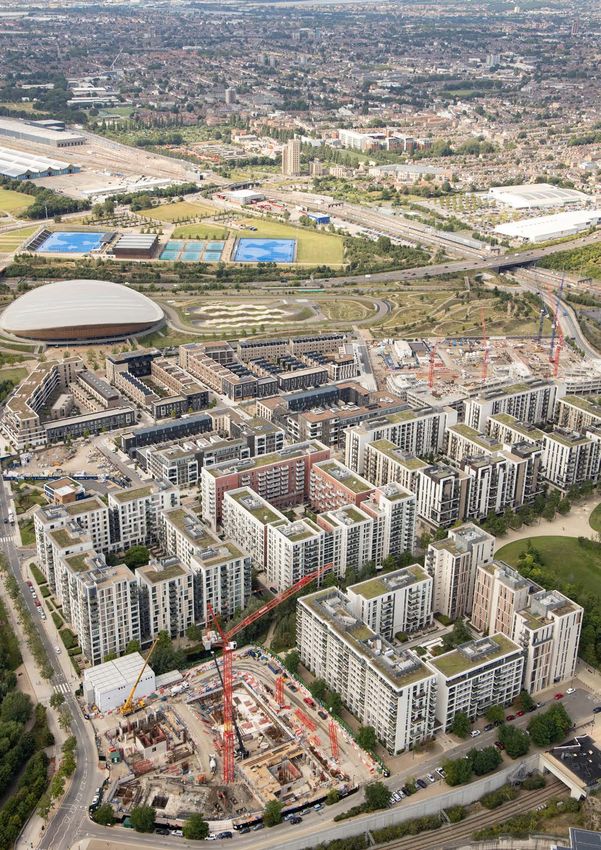
These will be served by and have direct access to the open spaces and world-class
sporting facilities of Queen Elizabeth Olympic Park. A new digital quarter of hi-tech, media,
broadcasting and education activities will be clustered within and around Here East, with
potential designation of Hackney Wick and Fish Island as a Creative Enterprise Zone, this will
be complemented by a significant presence of creative and cultural industries producing
bespoke and artistic products west of the Lee Navigation.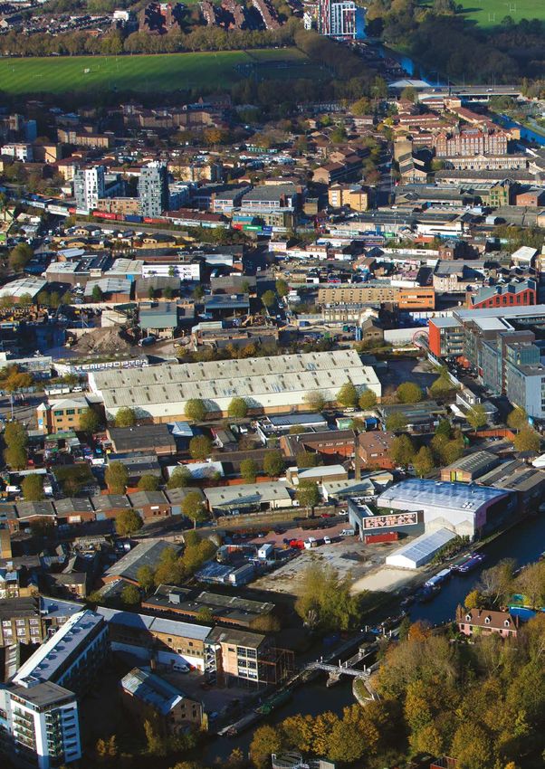
BACK TO CONTENTS I PREVIOUS PAGE   I NEXT PAGE

180   SUB AREA 1: HACKNEY WICK AND FISH ISLAND

                                                                                     A12

                                                                                    Lee Valley
                                                                                     VeloPark

                                        Hackney
                                         Wick
                                                                Copper Box
                                                                  Arena

        Victoria
         Park

                                                  Fish Island                    Stadium

           Figure 30:
           Sub Area 1 key diagram
           KEY

                   Employment
                   designations
                   Neighbourhood
                                                                                                 Pudding
                   Centre
                                                                                                   Mill

                   Green space
                                     Bow
                   Key visitor
                   attraction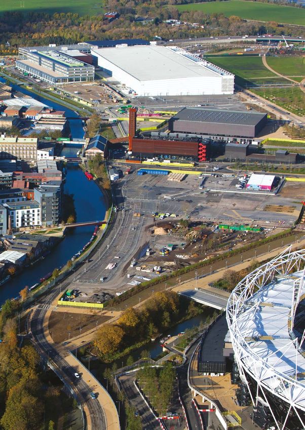
BACK TO CONTENTS I PREVIOUS PAGE   I NEXT PAGE

181    SUB AREA 1: HACKNEY WICK AND FISH ISLAND

                                                                                                                      SECTION 10 SUB AREA 1
       Area profile

10.1   Hackney Wick and Fish Island represents a significant opportunity to integrate and connect
       areas of new development and new communities with established communities and an existing
       concentration of businesses and creative and cultural industries. The area has the potential to
       accommodate many new homes and to create a genuine and vibrant mix of business, retail,
       service and community uses. An integral part of this is the creation of a new Neighbourhood
       Centre around an upgraded Hackney Wick Station. This will ensure that the area is well served
       by shops and services alongside other local facilities, and help deliver improved connections
       along streets and bridges to Queen Elizabeth Olympic Park and other clusters of activity such
       as Roman Road. Here East will complement this by providing a regionally important focus for
       technology and education that attracts further creative and cultural industries to the area.

10.2   Hackney Wick and Fish Island has the potential to become a diverse location, driving a significant
       element of business and employment growth, alongside the delivery of new homes, open
       spaces, education and community facilities. The character of this new development must draw
       upon and respect the form and character set by the existing streets and buildings within the
       area. The Hackney Wick and Fish Island area has the potential to evolve into a more sustainable
       series of communities but still retain its unique identity and sense of place by using its
       architectural and historic legacy to inform new development. This new development will be
       supported and serviced by a Neighbourhood Centre and benefit from the area’s industrial
       heritage, waterside setting, improved transport infrastructure and sporting, leisure, cultural
       and education facilities within Queen Elizabeth Olympic Park.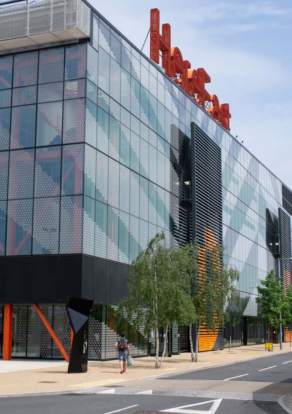
BACK TO CONTENTS I PREVIOUS PAGE   I NEXT PAGE

182    SUB AREA 1: HACKNEY WICK AND FISH ISLAND

       Area priorities

10.3   The priorities for Sub Area 1 have been derived from the analysis of the Sub Area. The policies and
       allocations within this section are tailored to address these priorities and achieve the objectives
       of the Local Plan within the context of Hackney Wick and Fish Island.

       Heritage-led regeneration and high-quality design: Ensuring that proposals for
       development are designed to respond to heritage assets, and where possible, restore
       and reuse those assets in a way that reinforces and celebrates their historic significance.
       Heritage assets are intrinsic to both the historic identity and urban fabric of Hackney Wick and
       Fish Island, and the Legacy Corporation considers them essential to delivering heritage-led
       regeneration within this area. Following an exemplary approach to urban, architectural and
       landscape design will ensure that new residential and employment floorspace is of the highest
       quality. Proposals for development within the Sub Area must restore heritage assets, and
       sustain the heritage value within Hackney Wick and Fish Island.

       Creative and productive employment: Protecting creative and cultural industrial uses that
       support the continuation of Hackney Wick and Fish Island’s entrepreneurial and enterprising
       work culture. The Legacy Corporation in its role as Local Planning Authority will support the
       creative and cultural industries that combine to give Hackney Wick and Fish Island its distinctive
       sense of place. It will also promote development that incorporates a range of employment
       floorspace including ‘affordable workspace, low cost business space, managed workspace,
       incubator, accelerator and co-working space suitable for small and medium enterprises. Hackney
       Wick and Fish Island contains nearly 40 per cent of the employment land within the Legacy
       Corporation area, and a significant proportion of its individual businesses.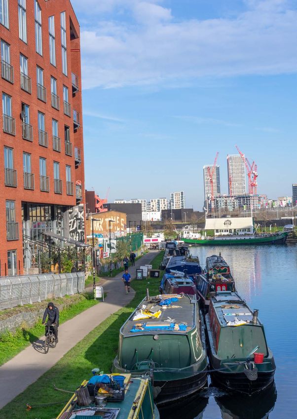
BACK TO CONTENTS I PREVIOUS PAGE   I NEXT PAGE

183   SUB AREA 1: HACKNEY WICK AND FISH ISLAND

                                                                                                                       SECTION 10 SUB AREA 1
      Mix of uses: Accommodating a range of employment uses and a significant increase
      in residential floorspace and community facilities. This Sub Area provides a number of
      opportunities for re-development in the form of cleared sites and where there are buildings
      of lower architectural and townscape quality. These should deliver a range of uses through
      contemporary schemes that are informed by an understanding and evaluation of the area’s
      defining characteristics. Development should not prejudice the comprehensive regeneration
      of the area through piecemeal proposals.

      Neighbourhood Centre: Establishing a new Neighbourhood Centre to provide a focus
      for retail, community, leisure and service uses, and improving the amenities of the area
      to support both existing and new residential communities. In order to support the amount
      of development envisaged within this Sub Area, the area around Hackney Wick Station and
      the Copper Box Arena is designated as a Neighbourhood Centre within this Local Plan. This will
      facilitate the delivery of the retail, community and leisure facilities that are crucial to support
      the demand that will arise from an increase in people living and working in the area. This
      designation will also help to ensure that existing industry and amenities are retained, and that
      the area can capitalise on the increased footfall that will be generated between the Here East
      digital quarter and an improved Hackney Wick Overground Station. The Legacy Corporation
      anticipates that the Neighbourhood Centre will become a destination and the point at
      which routes and spines of activity meet.

      Clusters of activity: Promoting places where public and employment uses animate the
      private and public realm. To the east, across the Lee Navigation, there is an employment cluster
      to support the ongoing development of a technology cluster and associated creative businesses
      at Here East. This provides flexible business/studio floorspace, a data centre, retail uses, and
      conference and education facilities in the former International Broadcast Centre (IBC) and Main
      Press Centre (MPC). Here East will provide an incubator and accelerator space for start-up
      businesses, and will create more than 5,000 jobs within a new quarter for London that supports
      the growth of the digital and creative industries.

      Connectivity: Repairing movement networks by creating new streets, better pedestrian
      and cycle routes across the A12 and the waterways, and enhancing access to an upgraded
      Hackney Wick Station. Local connectivity needs to be improved by repairing, extending and
      enhancing the existing street pattern to deliver a more coherent and legible movement
      network. Priority will be given to pedestrians, cyclists and public transport. Employment areas
      in Hackney Wick and Fish Island currently have poor access to local facilities and amenities.
      Despite the Sub Area having good access to the road network, there is a need to improve
      access to local public transport and the adjacent waterways, and to the Lee Valley Regional Park
      and other local open spaces outside the Legacy Corporation area.

      Waterways and open spaces: Enhancing the waterside environment and facilitating the
      provision of publicly accessible open spaces and the activation of the Blue Ribbon Network.
      A significant proportion of the Sub Area lies within the Lee Valley Regional Park and is situated
      at the southern extent of a continuous area of open spaces and waterways. Opportunities for
      informal leisure on and along the waterways should be provided. As part of the public realm
      improvements for Hackney Wick and Fish Island, a Canal Park runs along the entire western
      edge of Queen Elizabeth Olympic Park adjacent to the Lee Navigation. This is a local park and a
      critical piece of public realm for Queen Elizabeth Olympic Park and Hackney Wick and Fish
      Island. The park accommodates a varied set of landscapes and routes, providing a consistent
      and active edge to the canal. The design for the Canal Park responds to the ecology, history and
      diverse heritage of the Lower Lea Valley and helps to meet the needs of existing and future
      communities including East Wick and Sweetwater.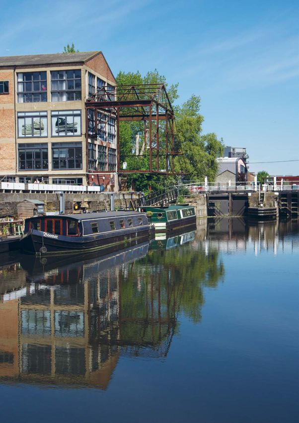
BACK TO CONTENTS I PREVIOUS PAGE   I NEXT PAGE

184   SUB AREA 1: HACKNEY WICK AND FISH ISLAND

      Strategic Links: Safeguarding the Bow Midland West Rail site for rail use and promoting
      access to the surrounding road network. Further south in Fish Island, there is a Strategic
      Industrial Location (SIL) designation that incorporates the safeguarded Bow Midland West Rail
      site (as identified on the Policies Map). New development should not adversely affect existing
      businesses and should be designed to take account of their existence and their existing and
      future operational requirements, particularly where those businesses are located within the
      designated employment clusters.

      Communities: Delivering and integrating development that benefits and connects to
      existing communities, such as those living within or around Hackney Wick, Fish Island, Wick
      Village and Trowbridge Estate. Residents within these areas currently lack sufficient access
      to small-scale retail and community uses. Therefore new development should cater for their
      needs as well as those arising from new residential development.

      Flooding: Parts of Hackney Wick and Fish Island are at risk of fluvial flooding from the River
      Lee Navigation. To ensure future growth in this area is sustainable, development proposals will
      need to incorporate appropriate flood mitigation measures in accordance with Policies S.10 and
      S.11 and the guidance within the most up to date strategic flood risk assessments for this area
      (see evidence base list at page 172 for the current assessments) and the most up to date flood
      modelling held by the Environment Agency.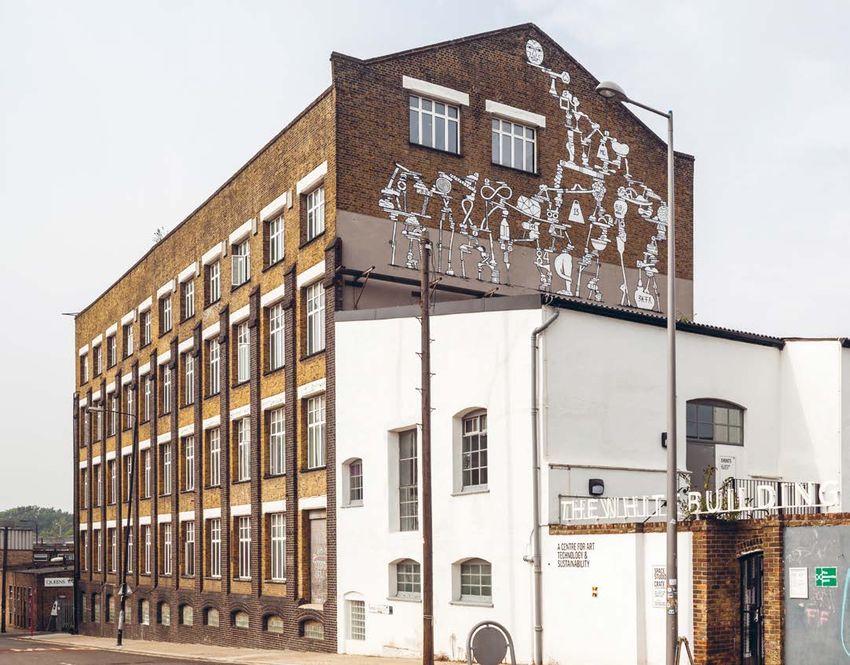
BACK TO CONTENTS I PREVIOUS PAGE   I NEXT PAGE

        185

                                                                                                     SECTION 10 SUB AREA 1
HERE EAST –
SIL (STRATEGIC TECHNOLOGY CLUSTER)
The 2012 Games time Press and Broadcast
Centres in the North West of the Queen Elizabeth
Olympic Park have been transformed into Here
East providing a mix of studio, business, office,
accelerator, education and cultural space, with
5,000 jobs when fully occupied. See Policy B.1
and Table 3 (B.1a1).
Current occupiers and operators include:

• Broadcast and production, including BT Sport

• Plexal Innovation Centre

• V&A research and learning hub and storage
  facility

• Higher education and research (including
  University College London and Loughborough
  University)

• Ford Innovation Office

• Studio Wayne McGregor

• The Trampery on the Gantry – 21 free
  standing affordable workspace studio’s
  (focused on local creative businesses).

• Event and conference facilities
BACK TO CONTENTS I PREVIOUS PAGE   I NEXT PAGE

186    SUB AREA 1: HACKNEY WICK AND FISH ISLAND

        Policy 1.1: Managing change in Hackney Wick and Fish Island                                      POLICY

        Proposals for development within Sub Area 1 will be considered acceptable where they:
        1.	Maintain the overall amount of existing employment floorspace (B Use Class), including
            that used by creative and cultural industries and operating as low-cost and managed
            workspace (in accordance with the provisions outlined under Policies B.1 and B.4)
        2.	Propose employment floorspace falling within B1 (a), B1 (b), B1 (c) Use Classes inside the
            Neighbourhood Centre, and B1 (b), B1 (c), B2 and B8 Use Classes outside it
        3. Within the Neighbourhood Centre boundary, includes floorspace for local retail, cultural
           and other leisure use (within Use Classes A1-A5 and D1-D2). Outside of the boundary
           retail and leisure uses should be small scale and serve an immediately localised need
        4. Restore and reuse heritage assets for employment or other uses.

        Cross-reference to policies: B.1; B.4

       Reasoned justification

10.4   Proposals for development within Hackney Wick and Fish Island must protect the existing
       industrial and economic base of the Sub Area and enhance its overall vitality.

       Policy application

10.5   Proposals for development should be brought forward as part of a comprehensive and
       integrated approach, particularly within the Hackney Wick Station Area allocation boundary.
       A mixture of approaches to the layering and integration of uses is likely to maintain the area’s
       interesting character and deliver an appropriate balance of uses. The balance of uses within
       proposals for mixed use development will be assessed on the basis of the overall viability of a
       proposal and any other overriding factors.
BACK TO CONTENTS I PREVIOUS PAGE   I NEXT PAGE

187    SUB AREA 1: HACKNEY WICK AND FISH ISLAND

                                                                                                                      SECTION 10 SUB AREA 1
        Policy 1.2: Promoting Hackney Wick and                                                          POLICY
        Fish Island’s unique identity and appearance
        Proposals for development within Sub Area 1 will be considered acceptable where they:
        1.	Reinforce local distinctiveness by incorporating high-quality and distinctive architecture
            that uses durable and suitable materials which reference the area’s industrial past
        2. Enhance existing yards and poor-quality and under-used passages and streets
        3. Create new open spaces that complement the identity of the area
        4. Allow for future changes in use through flexible design
        5.	Respect the contribution made by cultural and creative industries to the identity,
            culture and character of the area.

        Cross-reference to policies: BN.1; BN.2; BN.8; BN.17; T.9
        Sub Area Policy: 1.4

       Reasoned justification

10.6   Proposals for development within the Sub Area should reference and reinforce its local
       distinctiveness and use it as a driver for economic, environmental and heritage-led regeneration.
       The overall aim is to deliver place-specific development that is well designed for its context.

       Policy application

10.7   Development must support long-term heritage-led regeneration through positive high-quality
       development that takes account of the baseline information and relevant design principles
       within the Hackney Wick and Fish Island Design and Planning Guidance.
BACK TO CONTENTS I PREVIOUS PAGE   I NEXT PAGE

188    SUB AREA 1: HACKNEY WICK AND FISH ISLAND

        Policy 1.3: Connecting Hackney Wick and Fish Island                                              POLICY

        Proposals for development within Sub Area 1 will be considered acceptable where they:
        1. Relate well to key nodes of public activity and routes
        2. Enable access to north-south walking routes between Wallis Road and Monier Road
        3. Provide active frontages along streets and public routes
        4. Connect with existing/proposed bridges where possible
        5.	Offer passages through yards and building plots where appropriate and support
            the creation of a new network of pedestrian passages and streets
        6.	Improve connections across and into the area, including through the provision of new
            bridges across waterways and the A12, where appropriate.

        Cross-reference to policies: T.1; T.2; T.3; T.5; T.6; T.9; T.10

       Reasoned justification

10.8   With a new foot and cycle bridge built at Wallis Road to connect to East Wick and Here East,
       the planned route that will cut under Hackney Wick Station, and a vehicular bridge planned to
       connect Monier Road to Sweetwater, the most significant barriers to movement left within and
       through Sub Area 1 are the A12 to the west and the limited options for north-south movement
       across the Hertford Union Canal. The potential development sites identified as Site Allocations
       present opportunities to improve the existing movement network and, in some cases, provide
       new infrastructure, including bridges, to help overcome these remaining barriers. The overall
       aim is to achieve new and enhanced walking, cycling and vehicular routes that intersect with
       open spaces and nodes of public activity. Together, these improvements will help create
       a more legible and permeable sense of place.

       Policy application

10.9   New bridges and underpasses should be delivered to overcome the physical severance imposed
       by the waterways, railway embankment, A12 carriageway and the industrial sites either side of
       the Hertford Union Canal. This will improve the fragmented route network, encourage the use
       of streets and sustainable modes of transport, and promote pedestrian movement along routes
       that provide natural surveillance. New connections, particularly those within larger development
       sites, should be supported by new or enhanced green spaces that animate the public realm
       at key intersections.
BACK TO CONTENTS I PREVIOUS PAGE I NEXT PAGE
A12
189 Lee Valley
VeloPark
SECTION 10 SUB AREA 1
Hackney
Wick
Copper Box
Arena
Figure 31:
Sub Area 1 key connections
Victoria
KEY
Park
Principal connection
Stadium
improvement Fish Island
Key connections
(on-road)
Key connections
(off-road)
Key connections to
be enhanced (on-road)
Key connections to
be enhanced (off-road)
Pudding
Mill
BowBACK TO CONTENTS I PREVIOUS PAGE I NEXT PAGE
190
Lee Valley
VeloPark
1
2
3
Hackney
Ber
4 6
ksh
Wick
ire
7
9
Rd
5
oad 8
ridge R 14
Copper Box
Figure 32: Trowb
eet
ad Str Arena
Felste 13 15
Heritage assets situated within Sub Area 1 10
12 16 17
11
KEY
22
Rd 19 22
Heritage buildings/
llis
structures Wa 18 20
21
23
Conservation areas Road
u ry 24
Rothb
W
25
an
ad
sb
1 61 to 79 Eastway Ro
go
eck
2 The Old Baths Tre 26
Roa
3 Trafalgar Mews
Ro
4 St Mary of Eton Church
d
ac
5 32a Eastway 27
hR
6 Gainsborough School
oa
28 ad
d
7 Sewer vent pipe o
eR d
oa 29
8 Warehouse at corner of Wallis Road yk
and Berkshire Road Victoria W i e rR
d
on Roa
9 Central Books and Rubber Works Park Fish M
h y
ac 30
Sm
10 Oslo House
Island Be
eed
11 Lion Works
12 Former Carless Institute Stadium
Rd
13 Spegelstein buildings/Daro Works 31
Da
14 Eton Mission Rowing Club 32 36
ce
35
15 88 Wallis Road
Rd
16 86 Wallis Road 34
33
17 Railway bridge over Lee Navigation
18 Hope Chimical Works Wall
19 Lord Napier public house and
adjacent housing 37
20 Everett House
21 14 Queen’s Yard
22 Queens Yard and Kings Yard/ 38 40
Energy Centre (former Clarnico Works)
23 Carpenter’s Road Bridge 39
24 92 White Post Lane 41
25 Boundary wall to the Hertford Union Canal
26 McGrath House and Outbuildings
27 Carlton Chimney
28 Bottom lock of Hertford Union Canal
29 Former Timber Yard Gatehouse
30 Broadwood’s Piano Factory
31 Algha Works Pudding
32 Wick Lane Rubber Works (East) Mill
33 Wick Lane Rubber Works (West)
34 Britannia Works
35 Swan Wharf
36 Old Ford Lock
Bow
37 Northern Outfall Sewer Bridge
38 Former Christ Church Mission and
Sunday School
39 Former Glass Bending Factory
40 Former Ammonia Works Warehouse
41 Public House, 421 Wick Lane
For further detail please refer to the HW and
FIWPL Conservation Area AppraisalsBACK TO CONTENTS I PREVIOUS PAGE I NEXT PAGE
191
SECTION 10 SUB AREA 1BACK TO CONTENTS I PREVIOUS PAGE I NEXT PAGE
192 SUB AREA 1: HACKNEY WICK AND FISH ISLAND
Policy 1.4: Improving the public and private POLICY
realm in Hackney Wick and Fish Island
In order to ensure that development benefits from the positive qualities of the public
and private realm within Sub Area 1, proposals for development will only be considered
acceptable where they:
1. Relate well to waterways, green infrastructure and Queen Elizabeth Olympic Park
2. Contribute to the provision of green infrastructure and urban greening
3. Promote pedestrian access to, across or along historic canal and river frontages.
Cross-reference to policies: SP.3; S.9; BN.2; T.9; T.6
Sub Area Policies: 1.2; 1.3
Reasoned justification
10.10 Hackney Wick and Fish Island has a mix of private, semi-public and public open spaces that will
inevitably undergo a degree of transition over the coming years. It is important that this change
respects, retains and contributes towards the positive characteristics of the public realm that
are unique to this area.
Policy application
10.11 Proposals for development should have regard to the historic urban grain and street pattern
within the area and demonstrate that their form and function relates well to this and other areas
of existing public realm. Areas of new public realm will need to integrate well with the existing
street network, waterway frontages, and green spaces.BACK TO CONTENTS I PREVIOUS PAGE I NEXT PAGE
193 SUB AREA 1: HACKNEY WICK AND FISH ISLAND
SECTION 10 SUB AREA 1
Application of Policy BN.5 within the sub area
The prevailing height of development within Sub Area 1 has been established at 20 metres
10.12 above ground level, equating to approximately 4-6 storeys of development. This is represented
through a range of intermittent building heights that together form a unique arrangement that
contributes to the area’s townscape. Policy BN.5 sets out the approach that will need to be
applied both in designing new development and in assessing planning applications where this is
proposed to exceed this height. Aside from limited variations, it is expected that new
development will remain at or below this level. Within the boundaries of Hackney Wick
Neighbourhood Centre, Policy BN.5 identifies the centre function and transport connections as
being a potential justification for achieving an element of greater height and density provided
the character of the area, particularly within the Hackney Wick Conservation Area, is not
harmed. Table 10 below specifically sets out the height above which the policy test set out in
Policy BN.5 will apply.
Table 10: Prevailing building heights in Sub Area 1 (heights in metres above existing ground level)
Hackney Wick and Fish Island (Sub 20 metres
Area 1 as a whole)BACK TO CONTENTS I PREVIOUS PAGE I NEXT PAGE 194
BACK TO CONTENTS I PREVIOUS PAGE   I NEXT PAGE

195   SUB AREA 1: SITE ALLOCATIONS

                                                                                                                      SECTION 10 SUB AREA 1
       Site Allocation SA1.1: Hackney Wick Station Area                                    SITE ALLOCATION
       An area around Hackney Wick Station supporting comprehensive employment-focused
       mixed-use development, including a significant number of new homes complemented
       by new retail, leisure, food/drink and community facilities. Development should deliver
       a mix of uses around the rebuilt Hackney Wick Station, integrate with established
       retail frontage at Felstead Street and Prince Edward Road, and utilise buildings of
       heritage value.

       •	Development will be focused around the         • A
                                                            new direct and legible north-south
          improved station at Hackney Wick, with           connection which structures the heart of
          active uses concentrated in clusters on          the area should be delivered between
          primary routes connecting Hackney Wick,          Wallis Road and Monier Road, integrated
          Fish Island, Sweetwater and East Wick            with Hackney Wick Station and an
       •	The overall amount of existing                   improved bridge over the Hertford Union
          employment floorspace (B Use Class)              Canal extending from Roach Road
          within the allocation boundary must be         •	A fine grain of streets, passageways and
          maintained, with a particular emphasis on         yards should be established that should
          retaining and providing for creative and          create informal secondary connections to
          cultural industries and any other businesses      the canal edge
          that are compatible with residential use       •	Existing streets should be reinforced with
       •	Conflict between uses should be avoided           strong building edges and active ground
          by consolidating compatible uses together         floors
          and mitigating potential impacts through       •	Where there is no continuous towpath
          careful design                                    along a canal edge, a series of new public
       •	Yard spaces should be predominantly               spaces should be created which provide
          either residential or employment/                 public access to the water and which also
          workspace focused                                 integrate informal connections between
       •	New retail uses should be mainly focused          adjacent bridges, streets, passages or yards
          around the station                             •	New tall buildings should not be located
       •	Avoid ground-floor residential use where          adjacent to or compete with existing taller
          assessed flood-risk levels indicate such use      buildings such as that housing Central
          is inappropriate                                  Books
       •	Key locations for public activity and local    •	Massing should respond to adjacent
          amenities should be at the points of              existing and proposed public spaces and
          connection between the four                       buildings
          neighbourhoods (Hackney Wick, Fish             •	Development should preserve or enhance
          Island, Sweetwater and East Wick), i.e.           the Conservation Area and, where outside,
          clustered around bridges and connections          enhance its setting.
          below the railway
BACK TO CONTENTS I PREVIOUS PAGE I NEXT PAGE
196 SUB AREA 1: SITE ALLOCATIONS
Site Allocation Hackney
SA1.1: Hackney
Wick Wick Station Area (continued) SITE ALLOCATION
Site Allocation SA1.1:
Hackney Wick Station Area
R OAD
KEY WALLIS
Copper Box
Arena
Open space
Active frontage
Non-residential
ground floor frontage
Principal connection
improvement
Station
R OAD
Key connections RY
HBU
ROT
Supporting development principles Appearance
Mix • Buildings should be detailed to create a
• Development should retain or re-provide sense of weight, solidity and permanence,
existing employment floorspace classified with brick and masonry as the predominant
as B1 Use Class (business) façade material
• Development should re-provide employment • Public realm design should be simple and
floorspace falling within the B2 to B8 Use refined employing a Island
Fish reduced palette of
Classes, as B1 Use Class (business) and/or B2 high-quality robust materials
Use Class (general industry). B2 uses should • Generally, continual roof forms should
be compatible with mixed use development be employed. Where an articulated roof
• Workspace provision should be provided form is proposed, it should be an integrated
at both upper and ground-floor levels to part of the architectural character and
acknowledge the variety of workspace not compete with the setting of existing
typologies buildings.
• Queen’s Yard will act as a high-quality public
Phasing and implementation
space defined by a mixture of cultural and
Delivery on site from 2016 onwards.
public uses that complement existing uses such
as The White Building and the Yard Theatre. Relevant planning history
• The site allocation is expected to yield a – Hackney Wick Masterplan 16/00166/OUT
minimum of 800 new homes with an – White Post Lane and Wallis Road – Hackney
Wick Hub Scheme (LPA ref LTGDC-11-062-OUT)
affordable housing threshold of 35 per cent in
– Upgrade and improvement works to Hackney
accordance with Policy H2.
Wick Station (14/00275/FUL)
Movement
Address
• New passages connecting pockets of public
space should create a varied sense of enclosure Site address: Area to the east and west of the
• Narrower passages should be framed by Lee Navigation around Hackney Wick Station
lower buildings (of two to three storeys) to Existing uses: Employment/cultural/creative/
create an asymmetrical street section. retail/residential
Scale Size: 6.3 ha
• Development should make a positive PTAL rating: 3
contribution to the characteristics and
Flood Zone: 1–3 (areas to the west of the Lee
composition of views within and to/from
Navigation are within Flood Zones 2 and 3)
the area.BACK TO CONTENTS I PREVIOUS PAGE I NEXT PAGE
197 SUB AREA 1: SITE ALLOCATIONS
SECTION 10 SUB AREA 1
Site Allocation SA1.2: Hamlet Industrial Estate SITE ALLOCATION
Mixed-use development including employment and residential floorspace Copper Box
complemented by restaurants/cafes. Arena
• Avoid ground-floor residential use where • New development should vary in height
assessed flood-risk levels indicate such use • Development should respond to the height
is inappropriate and massing of the immediate context
• Development should improve access to • Enhance natural surveillance of the
the lower-level towpath along the western surrounding towpath.
bank of the Lee Navigation Canal. There
is an opportunity for a public use on this
key corner
ANE
PO ST L
Site Allocation SA1.2: HITE
W
Hamlet Industrial Estate
KEY
Active frontage
Non-residential
ground floor frontage
Principal connection
improvement
Key connections
Supporting development principles affordable housing threshold of 50 per cent
in accordance with Policy H2.
• Utilise access to White Post Lane and Queen
Elizabeth Olympic Park (using the Lee
Navigation vehicular bridge) Phasing and implementation
2020 onwards.
• New development should engage with the
established townscape of juxtaposed tall Relevant planning history
and low buildings, such as the relationship Not applicable.
between The White Building and Mother
Studios
Address
• New proposals should positively engage
with 92 White Post Lane through both Site address: Site with White Post Lane to the
architectural character and urban design north, Lee Navigation to the east, Hertford
Union Canal to the south
• Cultural and public uses should be located Fish Island
at the interface of White Post Lane and the Existing uses: Light Industrial Units
Lee Navigation crossing, and have a strong
Size: 0.4 ha
relationship to a public space on the
canal edge PTAL rating: 3
• The site allocation is expected to yield a Flood Zone: 2 and 3 (Flood Zone 3 only along
minimum of 100 new homes with an far-eastern edge of site)BACK TO CONTENTS I PREVIOUS PAGE I NEXT PAGE
198 SUB AREA 1: SITE ALLOCATIONS
Site Allocation SA1.3: Hepscott Road SITE ALLOCATION
Comprehensive mixed-use development including employment, residential, creative
and cultural uses and a linear park.
• Development should provide new walking • Form, connectivity and delivery of
and cycling routes through the site providing development needs to be considered with
connections to the Hertford Union Canal the Neptune Wharf site opposite
towpath, Roach Point Bridge, and Hackney • Any proposal that does not safeguard the
Wick Station existing waste capacity should be resisted
Hackney
• Development should respond
Wick positively to unless it can be demonstrated this capacity
the waterside setting, enhance the character can be more efficiently re-provided
of the canal and enhance strategic views elsewhere within London and otherwise
west towards central London meets the requirements of Policy S.7 of
• Proposals should provide a high-quality this Plan.
Copper
frontage and deliver public realm • Retain and reuse buildings of heritageBox
value.
improvements to Wansbeck Road These buildings should anchor new routes,
• Development should enable the delivery of frontages and public spaces
improved or new north-south connections • Development should preserve or enhance
across the canal the Conservation Area and, where outside,
enhance its setting.
HE
PS
Site Allocation SA1.3:
CO
TT
Hepscott Road
RO
AD
RO
AD
E GO
TR
KEY
Open space
WA
N
Active frontage
SBE
CK R
Non-residential
OAD
ground floor frontage
Principal connection
improvement
Key connections
Fish Island
Supporting development principles Address
• Development should provide a new linear Site address: Site with Trego Road and
park of approximately 1.2 ha, to serve the Hepscott Road to the north, Hertford Union
wider area. Canal to the south and Wansbeck Road to
• The site allocation is expected to yield a the west
minimum of 475 new homes with an Existing uses: Waste Transfer Site
affordable housing threshold of 35 per cent
Size: 2.8 ha
in accordance with Policy H.2 and extant
planning permission. PTAL rating: 3
Phasing and implementation Flood Zone: 1, 2 and 3
2020 onwards.
Relevant planning history
– Mcgrath Works Depot 16/00451/OUT
– 25 Trego Road 17/00225/FULBACK TO CONTENTS I PREVIOUS PAGE I NEXT PAGE
199
SECTION 10 SUB AREA 1BACK TO CONTENTS I PREVIOUS PAGE I NEXT PAGE
200 SUB AREA 1: SITE ALLOCATIONS
Site Allocation SA1.4: Neptune Wharf SITE ALLOCATION
Comprehensive, phased, mixed-use medium density residential development
incorporating public open space and land for a future primary school to help meet
education needs arising across Fish Island.
• Focus active frontages/retail uses around • Ensure building footprints and open spaces
public open space and the waterfront allow for future enhanced walking and
• Ensure improved permeability with the cycling connections across the canal
creation of new north-south and east-west • Building heights must provide a transition
public routes through the site, including a from a frontage height of six storeys along
new access and visual connection to the the Hertford Union Canal down to four to six
Hertford Union Canal from the south storeys along Wyke Road.
Site Allocation SA1.6:
Neptune Wharf
KEY
WA
NS
RO
Open space
BEC
AC
H
K RO
RO
Active frontage
AD
AD
Non-residential
D
ground floor frontage
R OA
Principal connection Y KE
W
improvement Fish Island
School
Playspace
Key connections
Supporting development principles Phasing and implementation
Delivery on site from 2015/16 onwards.
• Development should include 0.44 ha of land
for a future primary school (three-form Relevant planning history
entry) and at least 0.8 ha of public Application reference: 12/00210/OUT. Permission
open space for up to 522 residential units.
• Workspace should be focused around
Address
internal yards or on-street.
Site address: Site with Hertford Union Canal
• The site allocation is expected to yield a
to the north, Roach Road to the east, Wyke
minimum of 520 new homes with
Road to the south and Wansbeck Road to
affordable housing being delivered in
the west
accordance with the current planning
permission. Size: 2.5 ha
PTAL rating: 2–3
Flood Zone: 1BACK TO CONTENTS I PREVIOUS PAGE I NEXT PAGE
201 SUB AREA 1: SITE ALLOCATIONS
Site Allocation SA1.5: East Wick and Here East SITE ALLOCATION
SECTION 10 SUB AREA 1
Employment, technology and education cluster and comprehensive, phased mixed-use
development, including residential, employment, retail, leisure and community
floorspace.
• Development should include two new nurseries Olympic Park
• Development should relate well to Hackney • Routes between East Wick and the
Wick Neighbourhood Centre and Canal Park Neighbourhood Centre should provide
• Development should provide a gateway to frontages to support the generation of
Queen Elizabeth Olympic Park and establish active ground-floor uses.
a high-quality frontage that engages with • Development should support the
both the Lee Navigation and Queen employment, media, education,
Elizabeth Olympic Park technological and creative functions of Here
• Development should support the East, including the intensification and
continuation of direct east-west connections redevelopment of under-utilised areas and
from Hackney Wick and Fish Island to the subsidiary retail, leisure or other ‘walk to’
primary school and Queen Elizabeth services (Table 3, B.1a1).
Non-residential
Site Allocation SA1.7: ground floor frontage
Eastwick and Here East
Principal connection
AD
improvement RO
KEY W
ES
T
H
RT
School NO
Open space
Playspace
WA
TE
RD
Active frontage Key connections
EN
RO
AD
Supporting development principles
– Where development is phased, introduction of
appropriate interim uses is encouraged in
accordance with Policy B.3 Copper Box
Arena
– Routes connecting East Wick and Hackney Wick
Neighbourhood Centre should be attractive and
legible
– The site allocation is expected to yield a Up to 6,888 sqm of community (D1) floorspace,
minimum of 880 new homes with an affordable including a new primary school and two
housing being delivered in accordance with the nurseries.
current planning permission. Here East:
– Here East was granted planning permission on
Phasing and implementation 25 February 2014, subject to conditions and a
2018/19 onwards. Section 106 (S106) Agreement (LPA ref 13/
Relevant planning history 00534/FUM, 13/00536/COU and 13/00537/FUL)
East Wick:
– The East Wick site was granted planning Address
permission on 28 September 2012, subject to Site address: Land with Queen Elizabeth
conditions and a Section 106 (S106) Agreement Olympic Park to the east, Copper Box to the
(LPA ref 11/90621/OUTODA) south and the Lee Navigation to the west
Up to 96,097 sqm residential floorspace, Existing uses: Broadcast Centre
approximately 880 homes
Size: 23.4 ha
Up to 9,001 sqm employment (B1a and B1b/c)
floorspace PTAL rating: 3
Up to 4,725 sqm of retail (A1–A5) and leisure Flood Zone: 1
(D2) floorspaceBACK TO CONTENTS I PREVIOUS PAGE I NEXT PAGE
202 SUB AREA 1: SITE ALLOCATIONS
Site Allocation SA1.6: Sweetwater SITE ALLOCATION
Comprehensive, phased mixed-use development, including residential, employment,
retail and community floorspace (served by an existing primary school and
incorporating a nursery, health centre and library).
• Development should relate well to Hackney • New bridge links should be provided across
Wick Neighbourhood Centre, Canal Park and the Lee Navigation that align with the street
the Stadium pattern of Hackney Wick and Fish Island.
• Development should support the
continuation of direct east-west connections
from Hackney
Hackney Wick and Fish Island to the
Wick
primary school and Queen Elizabeth
Olympic Park
Copper Box
Arena
WHITE POST LANE
Site Allocation SA1.8:
Sweetwater
KEY
Open space
Active frontage
Non-residential
RO
AC
ground floor frontage
H
RO
AD
Principal connection
improvement
School
Playspace Fish Island Stadium
Key connections
Supporting development principles – Up to 1,065 sqm of employment (B1a)
floorspace
The site allocation is expected to yield a minimum
– Up to 2,576 sqm of retail (A1–A5) floorspace
of 650 new homes with an affordable housing
being delivered in accordance with the current – Up to 8,410 sqm of community (D1)
planning permission. floorspace, including:
Phasing and implementation – nursery, health centre, library.
2021 onwards
Address
Relevant planning history
Site address: Area east of the Lee Navigation,
– This site was granted planning permission on south of the London Overground railway Line
28 September 2012, subject to conditions
and a Section 106 (S106) Agreement (LPA Existing uses: Vacant site
ref 11/90621/OUTODA) Size: 11.2 ha
Pudding
Mill Lane
– Up to 67,730 sqm residential floorspace, PTAL rating: 2
approximately 650 homes
Flood Zone: 1BACK TO CONTENTS I PREVIOUS PAGE I NEXT PAGE
203 SUB AREA 1: SITE ALLOCATIONS
SECTION 10 SUB AREA 1
Site Allocation SA1.7: Bartrip Street South SITE ALLOCATION
Land with potential for gypsy and traveller site. Development should:
• Make provision for at least seven gypsy and traveller pitches
• Design must incorporate noise mitigation measures.
Hackney
Wick
WICK R
OAD
D
OA
KR
Site Allocation SA1.9:
R
Bartrip Street South
PA
Victoria
IA
Park
OR
KEY
CT
VI
Key connections
Supporting development principles Phasing and implementation
Delivery on site is expected to meet the
• Development should be stepped back
first five-year requirements for pitches
from surrounding roads and orientated
(between 2020–25).
towards Wick Road
• Development should maintain the green Relevant planning history
amenity and green infrastructure value Not applicable.
of the site and existing vegetation where
appropriate Address
• The site should be accessed from the
Site address: Triangle of land at Bartrip Street,
corner of Bartrip Street/Wick Road.
to the north of Wick Road
Existing uses: Former operational land
Size: 0.42 ha
PTAL rating: 3
Flood Zone: 1Signposting Other designations applying to this Sub Area are: Employment Clusters B.1a1, B.1a2, B.1a3, B.1b1, B.1b2, B.1b3, B.1b4, B.1b5 – see Policy B.1 Metropolitan Open Land – see Policy BN.7 Local Open Space – see Policy BN.8, Figure 15, Table 7 and the Policies Map. Hackney Wick Neighbourhood Centre – see Table 4 Evidence base references The London Plan. The Spatial Development Strategy for London consolidated with alterations since 2011 (Greater London Authority, 2015) Draft new London Plan (Greater London Authority, 2017) Mayor’s Olympic Legacy Supplementary Planning Guidance (Greater London Authority, 2012) Hackney Wick and Fish Island Design and Planning Guidance (LLDC, 2013) Infrastructure Delivery Plan (LLDC, 2013) Revised Infrastructure Delivery Plan (LLDC, 2018) Combined Economy Study Part A(i) - Employment Land Review (March 2018) Combined Economy Study Part A (ii) - Business Survey (March 2018) Combined Economy Study Part B – Creative & Cultural Opportunities Assessment (March 2018) Combined Economy Study Part C – Retail & Town Centre Needs Assessment (March 2018) Hackney Wick Fish Island Strategic Connectivity Study (LLDC, 2013) Research and viability study of affordable and managed workspaces supporting artistic practices in east London (LLDC, 2014) Hackney Wick Area Action Plan (London Borough of Hackney, 2012) Fish Island Area Action Plan (London Borough of Tower Hamlets, 2012) Legacy Communities Scheme Planning Application: 11/90621/OUT (LLDC, 2012)
BACK TO CONTENTS I PREVIOUS PAGE   I NEXT PAGE

205
BACK TO CONTENTS I PREVIOUS PAGE I NEXT PAGE
You can also read