Minnesota River Valley - A place where adventures in nature and history abound - Renville County
←
→
Page content transcription
If your browser does not render page correctly, please read the page content below
Final - June 2017

        RECREATION AND
        CONSERVATION MASTER PLAN

Minnesota River Valley
A place where adventures in nature
             and history abound...

Renville County
Redwood County
Minnesota Department of Natural Resources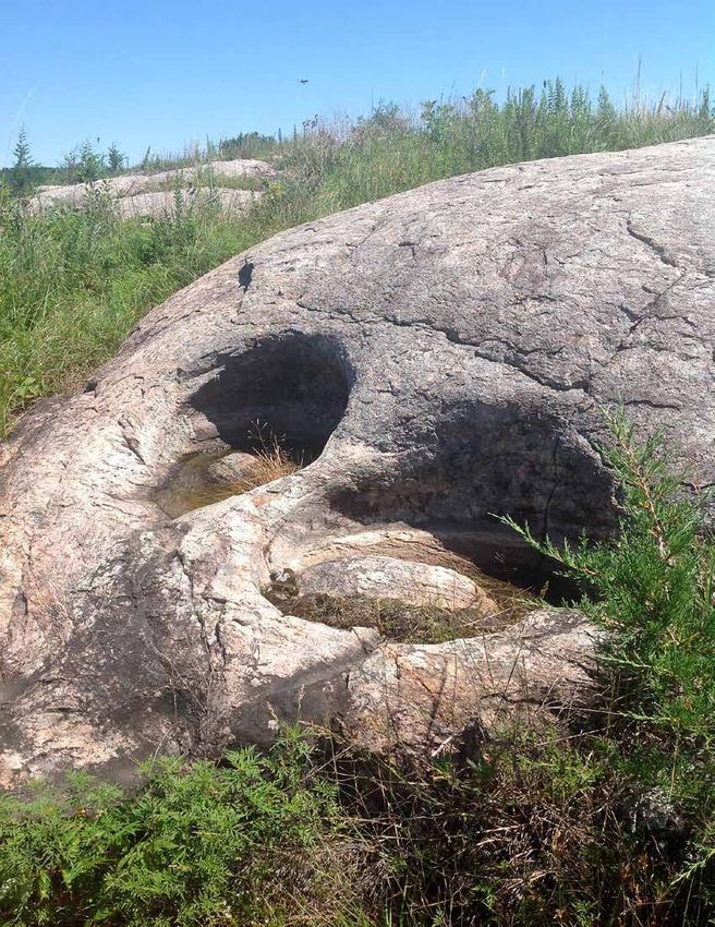
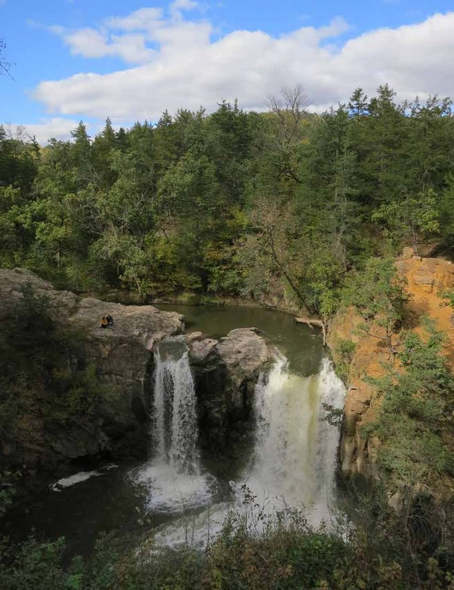
Photo – Ramsey Falls on the Redwood River
Final - June 2017

RECREATION AND
CONSERVATION MASTER PLAN
Minnesota River Valley
a p l a ce w h e r e a d ve n t u r e s i n n a t u r e a n d h i s t o r y a b o u n d. . .

prepared for:
Renville County, Redwood County, Minnesota Department of Natural Resources

                         RPA
prepared by:
Great Outdoors Consultants
Robert Peccia & Associates
Red Canoe
I&S Group

Funding for this project was provided by the Minnesota Environment and Natural
Resources Trust Fund as recommended by the Legislative-Citizen Commission on Minne-
sota Resources (LCCMR).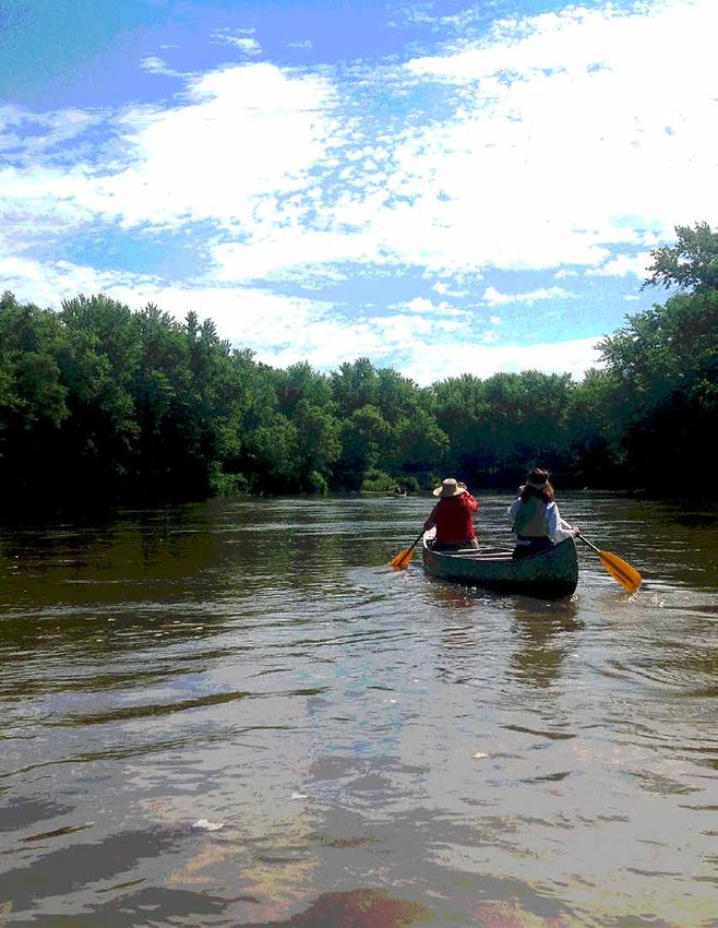
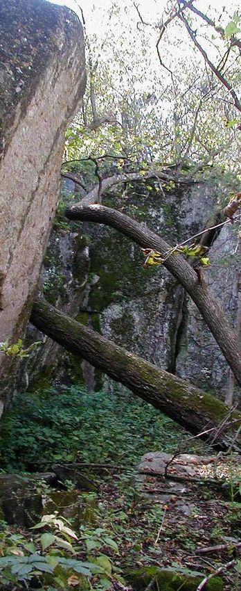
Photo - Precambrian crystalline rock with depression created by smaller rocks and erosion
Forward
Massive rock walls rising directly from the
water to form the bank of the river. Similar
rock walls, waiting for climbers or sightseers,
stand in the county parks along the river. The
rock making up these walls, at over three
billion years old, is among the oldest exposed
rock on our planet earth.
H
orseback riding and hiking trails follow the river on the floodplain
and climb the bluffs of the valley. A short hike from the main river
channel alongside any one of the numerous streams brings the
explorer to waterfalls.
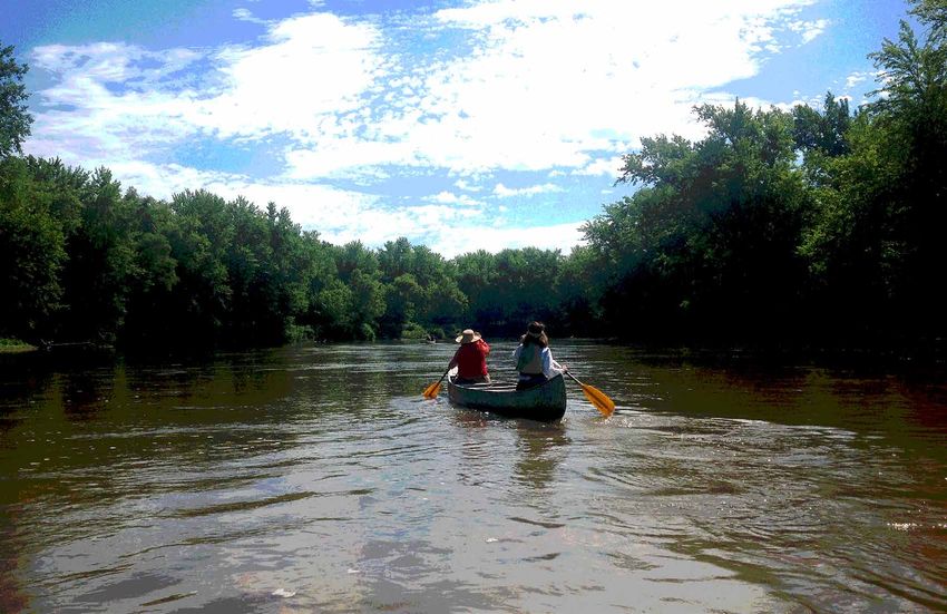
Paddlers on the river can experience miles of wilderness without seeing a bridge
or a power line. Although paddlers will see bald eagles, deer, otters, and water-
Photo - Canoeing on the MN River fowl and might see a few cows grazing along the shore. Getting on or off the river
is easy at the frequent landings.
Visitors who wish to camp along the river can find everything from primitive tent sites to fully equipped RV
sites, motel, or Bed and Breakfast in a nearby town.
People who want to take it a bit easier can stay in their car and drive the miles of scenic Minnesota River
Byway and connecting but equally scenic rural roads.
Not far from the main channel of the river, several historic monuments commemorate one of the most im-
portant Minnesota History events since European settlement: the 1862 war between the Dakota People and
the United States.
Yet, this phenomenal collection of outdoor recreation opportunities, enveloped in historic significance, is
largely ignored by the people who live right next door and is virtually unknown to anyone living outside the
local area.
Most people in Minnesota, including local residents, think corn and soybeans when the think about Redwood
County and Renville County. Yet, the Minnesota River and the valley that separate the two counties are home
to what can and should be a premier outdoor recreation destination for our region and beyond. Every feature
mentioned and described in the first five paragraphs of this forward is found in the Renville/Redwood sec-
tion of the Minnesota River Valley. A place many locals refer to as Tatanka Bluffs.
Rightly our story should start a little over 13,000 years ago when glacial Lake Agassiz broke through its south-
ern moraine and the resulting Glacial River Warren carved the valley, in some places five miles or more from
bluff top to bluff top, that is now the home of the meandering Minnesota River.
A better, and more current place to start is about two decades ago when citizens, local to Redwood and Ren-
ville counties, began looking at outdoor recreation and history tourism as an economic engine and a possible
solution to the loss of rural population that accompanied consolidation of farming into fewer and larger
operations.
Minnesota River Valley Recreation And Conservation Master Plan | Forward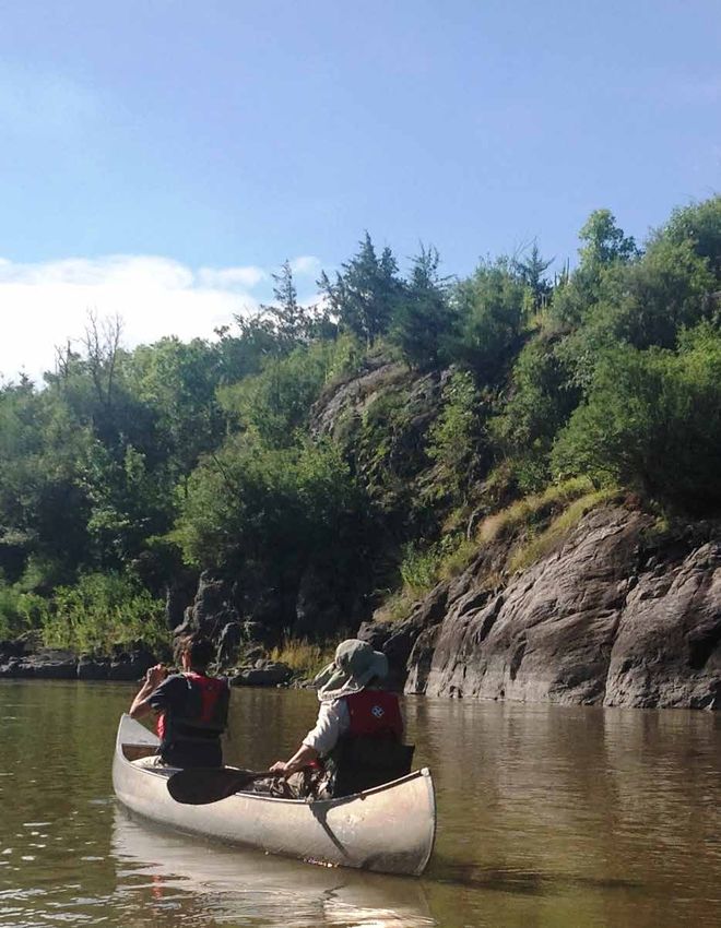
Forward                                 page 2
Rivers, the original avenues of human migration and economic activity in the United States, have become the
focus of urban revitalization and tourism across the nation. The question was asked; why could our Minneso-
ta River, home to spectacular scenery and extensive history, not be the centerpiece of an outdoor recreation
and tourism destination?

Answering the question; Why Not Our River? Resulted in a journey, as meandering as the Minnesota River
itself, that leads us to this Master Plan.

The Minnesota River Valley Recreation and Conservation Master Plan was envisioned as a way to describe
how a Minnesota River Outdoor Recreation and History Tourism Destination might look. The plan describes
what the primary tourism features might be, provides a plan for getting from the situation now to that desired
future situation, and to serve as a basis for seeking funding to implement the plan.

Much of what is needed in a destination tourism area is already in place. The Minnesota Legislature desig-
nated the Minnesota River State Trail in (2002). That State Trail should form the backbone of the Outdoor
Recreation Destination. The State of Minnesota owns, in the form of Wildlife Management Areas, Aquatic
Management Areas, Parks and Trails Properties, and Scientific & Natural Areas, an impressive amount of
public land in the area. The existing Renville County Parks and Ramsey Park in Redwood Falls provide camp-
ing sites and trails and plenty of space for a wide range of additional outdoor recreation.

This Master Plan will provide a guide as to the additional, and renovated and improved features and facilities
to make the Renville/Redwood county segment of the Minnesota River and its adjacent valley, the Tatanka
Bluffs, into a highly desirable and much visited Outdoor Recreation and Tourism destination.

Many people and groups played a role in bringing this planning process into existence and in completing the
Master Plan. While it is perhaps unwise to specifically credit individual groups given the many involved, two
specific groups deserve mention and credit. The Tatanka Bluffs Corridor and its members played an immea-
surable role in bringing the idea of a Tourism Destination to the public’s attention and keeping it on the pub-
lic discussion agenda. Without Tatanka Bluffs constant push to move the discussion forward, these efforts
would likely not be taking place. Renville and Redwood Counties also deserve credit for partnering together
and taking the initiative to obtain a grant from the Legislative Citizen Commission on Minnesota’s Resources
to fund this planning process. Without the Counties’ commitment of time and resources, this planning pro-
cess would never have taken place.

Writing a Master Plan is only a first step, then the real work begins. The people of Renville County and Red-
wood County, and others from government agencies and other organizations concerned with tourism and
outdoor recreation must look for ways and find the resources to implement this plan. If this work is done,
our Tatanka Bluffs area will someday be a magnet for tourists, with the accompanying bustle of economic
activity in our nearby towns, as much as it is known for corn and soybeans.

Ted L. Suss
Chairperson, Redwood county Parks and Trails Commission
March 2017

Forward | Minnesota River Valley Recreation And Conservation Master Plan

MNDNR Forward
                                          There is something about a major river like the Minnesota River
                                          that is magnetically attracting. The power of rushing water in the
                                          spring and the still quiet backwater pools in the summer can be

                                          T
                                          mesmerizing.
                                                       he Minnesota River Valley scene is picturesque. Cattle are grazing in
                                                       a lush green pasture with the river in the background. Straight rows
                                                       of corn are growing next to the pasture. Not far away on the tree
                                                       lined rock bluff a researcher carefully measures and records the vital
                                          statistics of a five line skink that was captured from under a flat rock. The skink
                                          is on the threatened species list and is quickly released to scurry back under the
                                          rock. On the river a group of canoeists silently glides past a sandbar where they
                                          see a few forked sticks sticking up in the sand that are evidence that recently a
                                          group of anglers was fishing. They were probably fishing for world class size
                                          catfish. On top of the bluff history minded visitors stop and read kiosks about
                                          the tragic history of the United States-Dakota War of 1862. Further down the
                                          valley a hunter stops at one of many wildlife management areas to scout for a
                                          good location for the fall hunting season. Not far away a family van enters into
                                          a county park and pulls into a camp ground for a few nights of camping and
Photo - Minnesota River                   family fun. The thread that weaves all these activities together is the Minneso-
                                     ta River. The Minnesota River flows through the valley and this river is the state’s
           namesake. In fact the river created the valley when the river was known as the Glacial River Warren that
           drained a huge lake formed when a northern glacier melted. This current generation of people is only the lat-
           est population to identify this valley as a very special place. There are archeological sites that date habitation
           of the valley to thousands of years ago. Two State Parks bookend this section of the river valley.

           There is something about a major river like the Minnesota River that is magnetically attracting. People are
           drawn to a major river. The power of rushing water in the spring and the still quiet backwater pools in the
           summer can be mesmerizing. The valley is far different than the prairie ecosystem through which it flows.
           Generations of local prairie residents have grown up “going to the river” to fish, hunt, hike, visit a historic
           site or state park or enjoy the ambience of a forested bluff. It was different than the prairie and the differ-
           ence was an interesting attraction. It was part of a rural community where people knew each other as neigh-
           bors and didn’t object to a hiker or an angler going across their land to the fishing hole.

           Time has brought changes to the valley. It now seems to flood oftener. Land ownership has changed and ac-
           cess has diminished. The land is not all locally owned. Once abundant natural resources are now diminished.
           Rare geological formations are threatened. What hasn’t changed is that people are still drawn to the magic
           of the river and the valley through which it flows. The management plan is an ambitious effort to maintain
           public access to a wide array of outdoor recreation opportunities, protect ecologically sensitive plants and
           endangered animals and maintain the agricultural tradition of the area. It is an effort to ensure that future
           generations will feel the magic of the river valley and find at their doorstep the outdoor recreation opportuni-
           ties that psychologist suggest is therapeutic, rejuvenating and healthy.

           It is an ambitious effort but for those of us who grew up “going to the river” it is an effort worth pursuing
           and accomplishing.

           Dennis Frederickson, Director
           DNR Southern Region
           May 2017

                                                     Minnesota River Valley Recreation And Conservation Master Plan | MNDNR Forward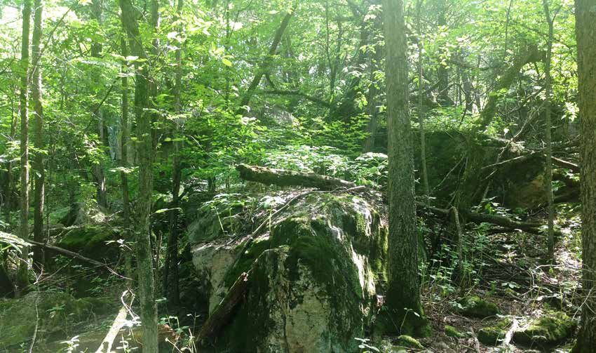
GRANITE
                         FALLS

                                                   Minnesota River
                          UPPER SIOUX
                           COMMUNITY

                                            Upper Sioux                              Skalbekken
                                           Agency State                              County Park
                                                   Park                                            RENVILLE

Executive
                                                                                                    COUNTY

			Summary
                                                                                                              Vicksburg
                                                                                                              County Park

                                                      The purpose of this Recreation
                                                      and Conservation Master Plan
                                                      is to create a shared vision to
                                                      protect, restore, and enhance                            DELHI
                                                      the natural, historical, and                 REDWOOD
                                                      cultural resources of the
                                                      Minnesota River Valley (the                   COUNTY
                                                      Valley) for current and future
                                                      generations to explore and
                                                      enjoy.

                                         The Valley can provide economic opportunity to
                      Photo - MN River Valley
                                         improve the quality of life for residents and     Redwood River
develop an outdoor recreational destination promoting regional economic growth, recreation
development, and tourism.

Renville and Redwood Counties collaborated with the Minnesota Department of Natural
Resources (MN DNR) to create the Master Plan. Funding was provided in part by the Minnesota
Environment and Natural Resources Trust Fund as recommended by the Legislative-Citizen
Commission on Minnesota Resources (LCCMR). MN DNR and the Counties contributed staff
time and other resources to the process. The plan addresses natural and cultural resources,
interpretive services, recreational opportunities, and administrative activities. It also provides
recommendations on a management unit designation of the area under the Minnesota
Outdoor Recreation System (MN ORS).

Executive Summary | Minnesota River Valley Recreation And Conservation Master Plan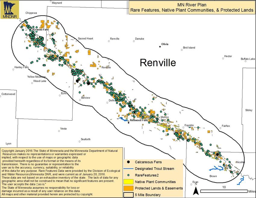
Photo - Canoeing on the MN River

                                                 Figure 1.

                                                 MINNESOTA RIVER VALLEY
                                                 RECREATION NETWORK CONCEPTUAL DIAGRAM
                                                 Key Recommendations on the Diagram:
                                                 •      Establish a Trail System to Connect Communities to Public
                                                        Lands, Rivers, History, and Recreation
                                                 •      Protect Important Habitat Areas
                                                 •      Improve Access and Facilities to the Minnesota River
                                                 •      Scenic Byway Connects People to Interesting Sites and
                                                        Experiences
                                                                                                MINNESOTA RIVER VALLEY
                                                 •      Communities Provide Recreation and Tourism  Services
              GRANITE
                FALLS
                                                                                                RECREATION NETWORK DIAGRAM
                                                                                                                               Key Recommendations on the Digram:
                                   Minnesota River                                                                             • Establish a Trail System to Connect Comm
               UPPER SIOUX
                                   Beaver Falls                                                                                  Public Lands, Rivers, History, and Recreat
                COMMUNITY          County Park                                                                                 • Protect Important Habitat Areas
                                                                                                                               • Improve Access and Facilities to the Minn
                              Upper Sioux                      Skalbekken
                             Agency State                     Birch   Coulee
                                                              County Park                                                      • Scenic Byway Connects People to Interes
Alexander                            Park                                 RENVILLE                                               Experiences
                                                              County Park
  Ramsey                                                                     COUNTY                                            • Communities Provide Recreation and Tou
 City Park
                                                              MORTON
                                                                                       Vicksburg
                                                                                       County Park

   REDWOOD              LOWER SIOUX                                                     FRANKLIN
      FALLS              COMMUNITY
                             Lower Sioux Agency
                               State Historic Site                                                   Anderson Lake
                                                                                        DELHI
                                                                                                     County Park             Beaver Falls
                                                                            REDWOOD                                          County Park
                   LEGEND
                                                                             COUNTY                                                           Birch Coulee
                   State Water Trails                                                                  Alexander
                                                                                                         Ramsey     Mack Lake                 County Park

                   Minnesota River National Scenic Byway
                                                                                                        City Park   County Park              MORTON
                                                                                                                                              Fort
                   Conceptual Trail Connections
                   Note: Trails Illustrate Connections, not
                                                                                                                                              Ridgely
                   Specific Locations
                                                                                    Redwood River         REDWOOD       LOWER SIOUX           State          FRANKLIN
                                                                                                             FALLS       COMMUNITY
                                                                                                                                              Park
                                                                                                                             Lower Sioux Agency
                   State Water Trail Access Sites                                                                              State Historic Site                Anderson Lake
                                                                                                                                                                  County Park
                   Parks
                                                                                                                                                                           Mack Lak
                   Important Habitat Areas                                                                                                                                 County P

                   Communities & Services

                   Note: Not all State Lands are shown

                                                                  Minnesota River Valley Recreation And Conservation Master Plan | Executive Summary
Executive Summary                                                                        (continued)
Master Plan Vision
The Minnesota River Valley in Redwood and Renville Counties is a shared landscape with:
• Nature-based recreation opportunities in a conserved agricultural prairie riverine ecosystem
• An outstanding example of natural, cultural, historical, and agricultural resource conservation
• Increased public access to diverse outdoor recreation opportunities
• Essential local and state partnerships that effectively lead conservation, nature-based
   recreation and tourism, management, marketing, and interpretation of the area
• Successful management and marketing that strengthens the rural regional economy, resulting
   in a higher quality of life for residents and visitors alike

The Valley is celebrated as a place where adventures in nature and history abound.

Desired Visitor Experiences
The Minnesota River Valley (MRV) is a beautiful landscape that has been taken care of and
enjoyed for many generations. The Minnesota River and its landscape helps define local culture
and lifestyle. Scenic roads, trails, parks, conservation lands, rivers, lakes, historic sites, and
agritourism make up a recreation network that connects communities and other services that
greatly enhance recreation opportunities in the Valley.

Outdoor activities in a beautiful natural setting create unforgettable memories, encouraging
return visits. Scenic touring with many overlooks, interpretive stops and recreation sites benefit
many people with varying degrees of physical abilities. Hunting and fishing opportunities are
better than ever in the Valley with improved information and access to the river and public wildlife
habitats. Anglers, boaters, paddlers and wildlife watchers will find numerous improved access
sites to the river, its tributaries and natural areas.

Many residents and visitors enjoy camping in well designed and maintained public and private
campgrounds with connections to the River and trails. The Minnesota River Valley has a rich
history and culture that residents and visitors will enjoy exploring with improved programs,
                                                                     information, and facilities.
                                                                     This collection of recreation
                                                                     experiences improves the quality
                                                                     of life for residents and draws
                                                                     visitors to the area again and
                                                                     again.

                                                                                     Photo - Morton Outcrops Scientific
                                                                                     and Natural Area

Executive Summary | Minnesota River Valley Recreation And Conservation Master Plan
Desired Resource Conditions
The Master Plan seeks to preserve historic/cultural resources and traditional lifestyles while
enhancing ecological diversity. Programs, expertise and funds are sought to support private
conservation-based agriculture and other private lands. Rare and sensitive ecological resources
are protected. Habitat restorations occur in wetlands, woodlands, rock outcrops, and native
prairie. Habitats are managed to strengthen wildlife populations which benefits recreation
opportunities such wildlife viewing, hunting and fishing. Historic and cultural resources are
protected and interpreted to increase their value and appreciation. Public park and conservation
lands are strategically expanded to manage habitat while providing balanced recreation
opportunities. The Minnesota River Valley is a beautiful natural landscape that is conserved for its
own inherent value and for people to enjoy today and into the future.
Goals, Actions & Implementation
Master plan goals and actions were developed through a participatory and professional process
including interested citizens, representatives from city, county, state governments, and consultants.
The research section of the Master Plan describes the participatory process and research used to
help define the goals and actions. The Master Plan has five general goals including:
• Recreation
• Conservation
• Culture & heritage
• Nature & culture interpretation/education
• Framework for land use
The implementation section of the Master Plan provides guidance for phasing, priorities,
organization, responsibilities, support, and funding to achieve the Master Plan vision. The
Minnesota River Valley in Redwood and Renville Counties is a regionally significant opportunity to
continue the tradition of conservation, outdoor recreation, nature-based tourism, and sustainable
agriculture for many generations to come.
Photo - MN River Valley National Scenic Byway
Minnesota River Valley Recreation And Conservation Master Plan | Executive SummaryTable of Contents
Foreword
Executive Summary
Introduction 1
Purpose of the Master Plan 2
Scope of the Plan 3
Participants 4
Project Funding 4
Desired Outcomes 4
Background 5
Geography /Geology 5
Region 5
Climate 6
History and Land Uses 6
Community 6
Economy 6
Land Use 9
Natural Resources 9
Natural Resource Impacts 15
Cultural Resource Impacts 16
Recreational Uses 16
Public Land Management 19
Significance & Uniqueness 20
Constraints 20
Research 24
Related Planning Efforts 24
Online Survey Summary Results & Trends in Outdoor Recreation 26
Regional and National Context 26
Public Survey Results 27
Public Outreach 29
Vision, Goals, Actions 32
Vision 32
Desired Resource Condition 33
Desired Visitor Experience 33
Goals & Actions 34
Implementation 45
Recommended Designations and Management Category 46
Organizational Framework 46
Implementation Strategy 48
Contributors, Appendixes, References 51
Photo - Upper Sioux Agency State ParkIntroduction
The Valley can provide economic opportunity to improve
quality of life for residents and to develop an outdoor recreation
destination promoting regional economic growth, recreation
development, and tourism.
Photo - Historic railroad bridge over the Minnesota River
Redwood and Renville County citizens care deeply services, recreational opportunities, administrative
about the Minnesota River Valley landscape, its people activities and provides recommendations on a
and its future. They cared enough to seek assistance management unit designation of the area under the
through state and federal programs in 2009 to explore Minnesota Outdoor Recreation System.
options for protecting and promoting its natural
and cultural heritage. In 2013, a group of citizens,
business owners, conservation groups and landowners
came together to provide recommendations to the
Commissioner of the Minnesota Department of Natural
Resources (MN DNR) on how this might be done.
This Minnesota River Valley Recreation and
Conservation Master Plan (Master Plan) was prepared
to create a shared vision to protect, restore, and
enhance the natural, historical, and cultural resources
of the Minnesota River Valley (the Valley) for current
and future generations to explore and enjoy. The Valley
can provide economic opportunity to improve quality of
life for residents by developing an outdoor recreation
destination. Destinations such as these result in regional
economic growth, recreation development, and tourism
while protecting the resources it is based on.
Renville and Redwood Counties collaborated with the
MN DNR to create the Master Plan. The Master Plan
addresses natural and cultural resources, interpretive
Photo - Agricultural fields in the Minnesota River Valley.
MINNESOTA RIVER VALLEY | RECREATION AND CONSERVATION MASTER PLAN page 12016 Minnesota Statutes CHAPTER The Minnesota Legislature directed the MN DNR to develop a Master
86A. OUTDOOR RECREATION SYS- Plan for the Valley area in Redwood and Renville Counties as described
TEM in 2014 MN Session Law, Chapter 290—H.F. No. 2852, Sec. 65.
MINNESOTA RIVER VALLEY; MASTER PLAN. Redwood and Renville
86A.03 DEFINITIONS. Counties determined to create a Master Plan for this same area in
2015, hiring a consultant to assist them. A collaborative effort of these
§Subd. 3. Outdoor recreation. entities developed this Master Plan. Sections within and addendums to
“Outdoor recreation” means any the Master Plan may be different for the MN DNR in order to meet its
voluntary activity, including hunting, planning requirements.
fishing, trapping, boating, hiking,
camping, and engaging in winter The Minnesota River Valley Recreation and Conservation Master Plan
sports, which is conducted primarily (Master Plan) will not define specific trail alignments or multi-use sites,
for the purposes of pleasure, rest, or but may discuss several preferred concepts and search areas. The
relaxation and is dependent upon Master Plan includes recommendations in five goal areas identified by a
or derives its principal benefit from public input process. Key implementation actions are outlined.
natural surroundings; “outdoor
recreation” shall also mean any The Master Plan is a catalyst for future conversations about how to
demonstration, structure, exhibit, or invest in the Valley for ways to increase the value and benefits of valley
activity which is primarily intended to resources for those who live in or visit the area. The shared vision in this
preserve, demonstrate, or explain a plan creates a picture of what the Valley can become in the future.
significant aspect of the natural and
cultural history, and archaeology of Purpose
Minnesota. The long-term purpose of this plan is to:
Develop an outdoor recreation destination that would promote
regional economic growth, development, and tourism while
Photo - Canoeing on the Minnesota River
respecting private lands and the agricultural heritage of the area.
Photographer: Scott Kudelka
Enhance the conservation of the of the Minnesota River Valley area
in Redwood and Renville Counties.
Provide for the shared use, enjoyment, and understanding of
these resources through a broad selection of outdoor recreational
opportunities and recreational travel routes that connect units of
the outdoor recreation system in the river valley.
Outline impacts to the natural and cultural resources, interpretive
services, recreational opportunities, and administrative activities in
the area and provide recommendations on the unit designation of
the area under the MN ORS act.
2 page MINNESOTA RIVER VALLEY | RECREATION AND CONSERVATION MASTER PLANScope of Master Plan
This plan addresses those lands in Renville and
Redwood Counties that are in the Valley, bluffs, ¼
mile beyond blufflines of the Minnesota River and its
tributaries 2 miles from their mouth; and connections to
Upper Sioux Agency and Fort Ridgely State Parks. This
plan includes:
65 miles of the Minnesota River and Water Trail
Parks and Outdoor Recreation Areas
Conservation Areas
Culture and Heritage Areas
Nature and Culture Education Areas
Sustainable Agriculture and Agro-tourism
Marketing for an Outdoor Recreation Destination
See the Master Plan Appendix section for a listing
of state, county, and city public conservation and
recreation lands in the project area. These lands
include state Wildlife Management Areas (WMA),
Aquatic Management Areas (AMA), State Parks (SP)
and Waysides, Public Water Accesses (PWA), Water
Trail Campsites, Scientific and Natural Areas (SNA),
designated historic sites and monuments, county parks
and city parks.
The Master Plan recommendations focus on the river
valley, bluffs, and lands within in Renville and Redwood
Counties, Minnesota. The two state parks mentioned
above, while mostly located outside of Renville County
(only small part of Fort Ridgely SP is in Renville County),
are considered book ends to the project area and
provide an added value to the Valley experience.
Photo - Path in Alexander Ramsey Park
MINNESOTA RIVER VALLEY | RECREATION AND CONSERVATION MASTER PLAN page 3Participants
This planning process was a collaboration between
Redwood and Renville Counties and the MN DNR.
Redwood and Renville Counties hired the consulting
firm Great Outdoors Consultants to facilitate the
public input process, provide national expertise, and
coordinate development of the Master Plan. MN DNR
participated in the public input process and provided
materials, data and planning related to the natural and
recreational resources in the project area.
Numerous individuals, agencies and interest groups
contributed input on issues and opportunities for the
Master Plan. A summary of contributors is listed in the
research section and detailed in the public input reports
listed in the reference section. The project planning
team is grateful to all who took time to express
their opinions and provide personal experience and
knowledge.
Project Funding Photo - Master Plan Public Meeting
Funding for this Master Plan was provided in part by
the Minnesota Environment and Natural Resources Desired Outcomes
Trust Fund as recommended by the Legislative-Citizen A Common Vision for a recreation and
Commission on Minnesota Resources (LCCMR). MN conservation network with connectivity in the
DNR contributions to the Master Plan development Minnesota River Valley in Redwood and Renville
included planning and GIS services. Funding through Counties
the Southwest Regional Sustainable Development Increased protection, enhancement and
Partnership provided two interns for GIS analysis and management of natural and cultural resources
biological research. on public and private lands
Future funding for this project may come through a Increased access to public lands for a broad
variety of sources. State acquisition and easement funds range of outdoor recreation activities
may come through state bonding, LCCMR or other Increased inter-agency cooperation in
grants, Legacy funding, and landowner donations. development of an outdoor recreation destination
County acquisitions and easements may come through
similar funding sources and may include some direct
county funds. Conservation and recreation groups
may be another source of funding for specific types
of projects or volunteers. Other state agencies such
as the Minnesota Department of Health or Minnesota
Department of Transportation may have programs
that are complementary and could contribute funds to
common goals.
Funding and staffing for project development and
maintenance will require a long term commitment
by all partners and local communities interested in
the benefits that can be derived from creating a high
Graphic - Minnesota Environment and Natural
quality outdoor recreation destination. Resources Trust Fund Logo
4 page MINNESOTA RIVER VALLEY | RECREATION AND CONSERVATION MASTER PLANBackground
Minnesota lies at the center of North America where the
prairie, boreal forest, and eastern deciduous forest meet.
Photo - Forest in Whispering Ridge AMA
Geography/Geology Region
The project area landscape has been shaped and Minnesota lies at the center of North America where
influenced by glaciers, rivers, wind, and fire with fire the prairie, boreal forest, and eastern deciduous forest
being the most common natural disturbance before meet. There are four major ecological provinces in
settlement. The Glacial River Warren cut through glacial Minnesota: the Eastern Broadleaf Forest (green), the
drift and soft rock formations to form the river valley. Laurentian Mixed Forest (violet), the Prairie Parkland
In Redwood and Renville Counties, this erosion cut (yellow) and the Tallgrass Aspen Parklands (bright
down to the Precambrian crystalline bedrock formations green). All four are parts of much larger systems that
resulting in rock outcrops and pools unique to the area. cover major areas of central North America.
Numerous waterfalls occur where the larger tributaries These ecological provinces are divided into subsections
to the Minnesota River intersect the valley. – distinct landscapes of Minnesota, defined by
vegetation, geology, and other resource criteria.
Agriculture is the main land use and occurs on flatter,
upland portions of the project area. Tiling, grazing, Descriptions of the subsections are important for
crop production, timber harvest, and other human recreation and conservation planning purposes
activities are now common in the area. Remnant prairie because they provide the context for trail alignments,
remains on hillsides and in lowland areas that were trail development, resource management, and
not prime for farming. The valley and its numerous interpretation recommendations. The following
tributaries provide a variety of topography and soil description is drawn from the MN DNR website (mndnr.
types, that provide opportunities for grass based gov/ecs).
agriculture, conservation, and recreation purposes.
Changes in land use, artificial drainage, and climate The entire project area (indicated by red oval in figure
have altered the hydrology of the area, which has in 2-1) is within the Minnesota River Prairie subsection.
turn, changed the make-up of the river valley and its The subsection consists of a gently rolling ground
associated uplands. moraine. The Minnesota River occupies a broad valley
that splits the subsection in half. The valley was created
MINNESOTA RIVER VALLEY | RECREATION AND CONSERVATION MASTER PLAN page 5by Glacial River Warren, which drained Glacial Lake
Agassiz. Agriculture is the predominant land use in this
subsection.
Climate
The Minnesota River valley, like the rest of Minnesota,
experiences a continental climate with extremes in
temperature from summer to winter. At Redwood Falls,
the average temperature ranges from a low of 4.0°F to
a high of 22.0°F in January. In July the average low is Figure 2-1. The four ecological provinces in Minnesota:
62°F and the average high is 84°F. (U.S. Climate Data Eastern Broadleaf Forest (green), Laurentian Mixed
Website) Forest (violet), Prairie Parkland (yellow), and Tallgrass
Aspen Parklands (bright green). Project area indicated
The project area receives on average 26.64 inches of with oval.
rainfall (Redwood Falls data). Mean annual snowfall
is about 35.1 inches in Redwood Falls. The average difficult, vast wetlands in the uplands prompted more
growing season is 157 days. grazing there in the past. The 1920’s massive ditch
campaign changed this and the hydrology of the
Minnesota River watershed forever. Tillable lands in
History and Land Uses the counties changed from about 50% to 98% today.
Before European peoples entered the River Valley it was The counties of Redwood and Renville are some of the
a functioning prairie and river floodplain ecosystem most productive agricultural lands in the state. Grazing
with a wide diversity and abundance of plant and operations still flourish at a number of locations in
animal life. Dakota people and other Native American the valley. This area is also known for its rich mineral
tribes lived in villages near the Minnesota River thriving content. These include Gneiss or Granite and Kaolin
on hunting, fishing and cultivation of food crops. The which are quarried in the area today.
vast prairie landscape supported bison, elk, wolves and
other wildlife. The Dakota claimed this area as their
Community
homeland and called it “Mni Sota” (Minn-ey-show-tah)
meaning sky-tinted water. Redwood Falls, the county seat in Redwood County, is
located along the Redwood River near its confluence
Few Europeans entered the area before 1853 unless with the Minnesota River. It is the largest community
they came for government, geographical, geological within the project area, with a population of 5,254 at
and zoological documentation. Other records are the 2010 census. Other communities in or close to
found in the diaries and journals of fur traders who the project area that may provide services to visitors
visited the area. Steamboats reached the area in 1853 could include Belview, North Redwood, and Delhi in
on the Minnesota River near North Redwood. Redwood County, and Morton, Franklin and Sacred
Heart in Renville County. In the 2010 census, Renville
The first land claims occurred around 1856 resulting County population was 15,730 and Redwood County
in a wide range of Canadians and other Europeans population was 16,059. A large portion of the 1,743
settling in the area. The growing influx of people and acre Lower Sioux Indian Community also falls within
a number of other factors resulted in the six week the project area.
Dakota/ US War in 1862 which began in the Redwood
Falls area and spread to surrounding counties. Most Economy
Dakota were forcibly removed from or fled the area. Redwood County is home to 528 businesses providing
This tragic event shaped the future of the area and the 6,474 jobs. Redwood County is part of the 23-county
people who live here. Settlement began in earnest two Southwest Minnesota Planning Region, which is
years later in 1864. projected to expand jobs by +2.7 percent from 2012 to
2022 with a gain of 5,685 new jobs.
Over time agriculture became the major land use in
the area. While rock in the valley made row cropping
6 page MINNESOTA RIVER VALLEY | RECREATION AND CONSERVATION MASTER PLANThe fastest growing industry is expected to be mining, As compared to the average greater Minnesota
although it’s a relatively small industry, by 2022 there county, Renville County has a higher percentage of
should be roughly 458 jobs. The largest increase in employment in agriculture and forestry, manufacturing
jobs is expected to come from the health care and and transportation and warehousing industries. It
social assistance industry, which may account for over trails the average employment in the professional
71 percent of total projected growth in the region and business services and health and social services
from 2012 to 2022. The region is also expected to industries.
see significant employment growth in construction,
professional and technical services, administrative Figure 2-2. Employment Types in Renville County
support and waste management services – which
includes temporary staffing agencies. In contrast, the
region is expected to see declines in information and
utilities.
In 2015, there were 5,797 jobs in Renville County.
Job growth in Renville County has not kept pace with
national and industry trends. The largest industry is
agriculture and forestry, employing 20 percent of the
workforce. In 2015, Renville County was the largest
corn and soybean producing county in Minnesota. It is
the second largest sugar beet producing county in the
state. The chart below shows employment by industry.
Graphic - Tatanka Bluffs Logo
Photo - Corn Statue in Olivia, MN
MINNESOTA RIVER VALLEY | RECREATION AND CONSERVATION MASTER PLAN page 7Photo - Lower Sioux Agency State Historic Site Figure 2-3. Land Use and Land Cover of the Minnesota River Valley 8 page MINNESOTA RIVER VALLEY | RECREATION AND CONSERVATION MASTER PLAN
Land Uses                                                     Natural Resources
Land use information is taken from the 2011 Land              A detailed description of the most significant types
Use Land Cover on the DNR website. The table                  of natural features in the Redwood and Renville
below summarizes percent land use/land cover. It              County portions of the Valley is found in Native Plant
also compares percentages between the two counties            Communities & Rare Species of the Minnesota River
individually and the project area as described above.         Valley Counties. Additional information about wildlife
The counties are very similar in composition, being           species is in the Minnesota River State Trail Master Plan
mostly of agricultural land use. The valley, while still      and the MN Wildlife Action Plan, 2015-2025. Below is
mainly agricultural, contains much higher percentages         a brief summary of natural resources in the area from
of open water, forests, herbaceous (grass/forbs), hay/        these documents.
pasture, wetlands and barren (includes rock) land
covers. Categories in the table have been lumped with         Presettlement Vegetation
similar categories for ease of presentation.                  Pre Euro-American settlement, tallgrass prairie covered
                                                              the largest portion of the lands outside the river
                                                              valley bottoms. Mesic, tall grass prairie was the most
Figure 2-4. Percent Land Use Cover
                                                              prevalent community due to the moist, loamy soils.
Land Use Type     Renville      Redwood      River Valley     However, small areas of Oak Openings and Barrens
                  County         County         Area          did occur, associated with lakes, wetlands and streams
Open Water          0.9           0.5            3.7          that provided protection from fire.

Developed           5.6           6.0            5.4
                                                              Floodplain forests integrated with prairies and
Barren              0.1           0.1            0.2          savannas covered a continuous corridor on the bottom
Forest              2.2           1.7           11.7          of the Minnesota River Valley. Smaller streams such
Herbaceous          0.6           1.0            3.3          as the Redwood River lacked these floodplain forests
Hay/Pasture/        87.1         87.1           63.2          of silver maple and instead had wet/mesic hardwood
Crops                                                         forests composed mostly of American elm, rock elm,
                                                              red elm, basswood and green ash.
Wetlands            3.5           3.6           12.5

                                                              Vegetation Today
                                                              The Minnesota County Biological Survey (MCBS)
                                                              surveyed native plant communities and rare plants
                                                              within the Minnesota River Counties from 1987 to
                                                              2002. This data is continuously updated via monitoring
                                                              and additional surveys. The information below is
                                                              excerpted from Native Plant Communities & Rare
                                                              Species of the Minnesota River Valley Counties (34 MB).

                                                              Locations of 21 rare plant species in the project
                                                              area are tracked in the Minnesota Natural Heritage
                                                              Information System (NHIS) of Minnesota since records
                                                              began in 1970. Twenty-one rare plant communities
                                                              have been recorded in the project area.

                                                              One of the major groups of rare plant species
                                                              documented within these two counties are species that
                                                              occur on bedrock outcrops. Other large groups of
Photo - Wetland in the Valley
                                                              rare plant species occur on upland prairies, savannas,
                                                              and wet prairies. These species are rare due to land
                                                              use changes to row crop agriculture, mining, invasive
                                                              species introduction and habitat conversion over the

MINNESOTA RIVER VALLEY | RECREATION AND CONSERVATION MASTER PLAN                                                 page   9
of bedrock outcrop communities, though small, are
at the following sites: Vicksburg County Park and
Cold Springs WMA (Renville County); Swede’s Forest
Skink SNA, Cedar Rock WMA, and Cedar Mountain
SNA (Redwood County). Each of these sites preserves
different combinations of the plants and plant
communities associated with rock outcrops.
The upland prairie, which once dominated this area,
now covers less than 0.5% of the area Marschner
mapped as prairie. The remaining remnants are small
and scattered, often overtaken by Red Cedar trees due
to the lack of fire and grazing. Many of these remnants
remain in private ownership and some receive
Photo - Hiking trail in Whispering Ridge AMA assistance through the State’s Prairie Bank Easement
last 150 years. The third group of rare plants in this program for management and restoration.
project area occurs in calcareous fens. These wetlands
form in unusual conditions of cold groundwater Vegetation Management
seepage and elevated mineral concentrations, and are Recommendations found in existing MN DNR or multi-
among Minnesota’s rarest wetland habitats. agency plans for this area will apply to the appropriate
DNR management units. See the Related Planning
Several Basswood-Bur Oak-Green Ash forest stands Efforts section for a listing of these plans.
can be found on the north side of the river along Hawk
Creek, Middle Creek and Beaver Creek in Renville
County. Other stands occur on the south side of the
river on smaller streams such as at the junction of
Ramsey Creek and the Redwood River in Redwood
County. Portions of these stands were never grazed and
contain a high biodiversity of native hardwood forest
wildflowers.
Flood plain forests, remain mostly as small patches
separated by heavily logged areas, cultivated fields
or previously cultivated fields. Several high quality
floodplain forest stands remain in the river valley in
Redwood and Renville counties. Most remaining stands
lack a dense, continuous canopy due to the die-off
of American elms and recent logging. The invasive
species of garlic mustard and common buckthorn have
invaded many remnants in the area.
The rock outcrop plant communities in the project
area are rarely seen elsewhere in Minnesota. These
plant communities occur on the exposed igneous or
metamorphic crystalline bedrock mentioned above. Photo - Rock prairie pool. by Ron Bolduan
Many of the plant species are adapted to frequent
extreme drought. Many rock outcrops also have
permanent and ephemeral wetland pools in shallow
to deep depressions in the rock. These wetlands
contain several rare plant species. Good examples
10 page MINNESOTA RIVER VALLEY | RECREATION AND CONSERVATION MASTER PLANWater Resources and Fisheries Flood plains
Numerous wetlands historically dotted the uplands. A Much of the Minnesota River valley between the bluffs
large percentage of precipitation moved towards the lies within the 100-year flood plain, defined as that
river very slowly through the dense prairie sod and land that is covered by the “100-year” or “regional”
wetlands. In order to farm the rich prairie soils, most flood – that is, a flood that has a 1 percent chance
wetlands have been drained with intensive ditching of occurring in any given year. Flooding is a natural
and tiling; dramatically changing the hydrography occurrence of a river’s riparian zone and provides
from pre-settlement times. Precipitation now moves many benefits, including groundwater recharge, settling
very quickly over the surface or through tiles into the out sediment and supporting valuable wildlife habitat.
Minnesota River and its tributaries.
Flooding only becomes a concern to people when they
impact the river’s floodplain, either by adding structures
or planting crops. People have added to flooding
problems primarily by intruding on the flood plain
and altering the natural channels of the Minnesota
River and its tributaries. Development and land use
changes in the watershed also increase the amount of
impervious surface on the terrain and displace natural
water storage on the landscape.
The Minnesota River has experienced many major
floods, including events in 1881, 1952, and 1965,
considered the most devastating flood to date. Recent
flooding in July, 2015, temporarily stranded canoeists
Photo - Minnesota River
on the river near Fort Ridgely State Park.
Because of the large proportion of the valley floor
The project area receives water directly from three located within the 100-year flood plain, it is unlikely
major watersheds of the Minnesota River Basin: the that any trail alignment or other recreational lands
Yellow Medicine/Hawk Creek, Redwood River and the within the valley could entirely avoid the flood plain.
Middle Minnesota. Twelve larger streams meet the Trail or recreational development within flood plains
Minnesota River within the project area. Several form must be undertaken with care, so that flood elevation
waterfalls and or steep rapids as they fall to meet the levels are not increased and so that the trail or facility
river. Land use choices, conservation practices and itself is designed to withstand periodic flooding.
agricultural best practices are reflected in the poor
though slowly improving water quality.
Much of the 65 miles of Minnesota River in this section
already benefits from adequate soil erosion buffers due
to Conservation Reserve Enhancement Program (CREP)
in the 1990’s. Watershed studies show that closing
gaps and adding buffers to smaller streams, ravines,
ditches and intakes will help improve impairment
issues. MPCA monitoring indicates mercury or PCB in
fish tissue, E. coli, Fecal Coliform, and Turbidity occur
in most rivers and streams of the project area.
Monitoring also shows nitrate pollution above
consumption standards in some groundwater within the
project area in Renville County.
Photo - Redwood River
MINNESOTA RIVER VALLEY | RECREATION AND CONSERVATION MASTER PLAN page 11Fisheries
The Minnesota River is an important Conservation
Focus Area for DNR Fisheries. Angler use of the
Minnesota River appears to be steadily increasing, with
Walleye and Channel Catfish pursued most commonly.
MN Department of Health fish consumption advice for
fish in Reach 2 is present because of PCB and mercury
persistence. Eight water access sites and 2 canoe carry-
in access site are located on the river stretch within the
project area.
There are several tributaries in the middle Minnesota
River reach that receive ground water via springs
and seeps as they drop in elevation from agriculture
dominated uplands, over the Minnesota River bluff,
to the floodplain confluence with the Minnesota River.
Ramsey Creek (Redwood County) is designated as a
trout stream tributary to Minnesota River. It is annually
stocked with 300 two-year old Brown Trout Salmo Photo - Catfish caught in the Minnesota River
trutta and 300 Rainbow Trout Oncoryhnchus mykiss issues characterize many of the currently acknowledged
yearlings. Ramsey Creek is managed as put-n-take limiting factors. Turbidity, bacteria, and nutrients,
trout fishery, meaning natural reproduction does not particularly phosphorus and nitrogen, negatively affect
sustain the population. Fort Ridgely Creek, which flows water quality of the Minnesota River and its tributaries.
through Fort Ridgely State Park, is a tributary managed No dams are located within the project focus area to
for trout, but it is not a designated trout stream. It is the mouth of the river.
managed as a put-n-take trout fishery and annually
stocked with 300 two-year old Brown Trout and 300 Invertebrates – Freshwater Mussels
Rainbow Trout yearlings. Freshwater mussels play a vital role in marine
ecosystems in Minnesota. These mollusks live on river
Historical accounts of the river allude to clear water and lake bottoms and filter oxygen and particles from
and a beautiful white sand substrate, with wild rice the water. They modify the habitat around them to
stands and bulrush beds along its banks. Today, habitat make it more suitable for both themselves and other
degradation resulting from the profound landscape aquatic organisms. Many species serve as important
changes of the past 150 years is the primary factor hosts to fish larvae and are critical to fishery success.
limiting the fishery resource and recreational value of These invertebrates are also an important food source
the Minnesota River. Water quality and quantity related for many animals such as several species of fish,
muskrats, and raccoons.
Photo - Redwood River Falls
Mussel populations are threatened by dams
fragmenting river connections; stream channelization,
dredging, and streambed destabilization; commercial
harvesting; non-point and point water pollution and
sedimentation; and zebra mussel infestations upstream
in Lac Qui Parle Lake. Eleven mussel species of special
concern occur in the project area; see Native Plant
Communities & Rare Species document in Reference
section for a listing. The primary causes for mussel
decline in the Minnesota River are pollution and habitat
degradation.
12 page MINNESOTA RIVER VALLEY | RECREATION AND CONSERVATION MASTER PLANWildlife
Mammals
Common mammal species in the valley area include:
white-tailed deer, coyote, beaver, squirrels, raccoon,
red and gray foxes, voles, badgers and mink.
Birds
The Minnesota River is a major migratory corridor in Photo - Mink on log by Ron Bolduan
the Mississippi Flyway. It is a transition zone between
the eastern woodlands and western prairie. It is also Reptiles and Amphibians
an important area for north-south migration. The Many amphibian species are found in the area. These
numerous WMAs, SNAs, and AMAs provide important include the eastern tiger salamander, mudpuppy,
habitat for birds. American toad, Great Plains toad, and four species of
frogs. Frog species include Cope’s gray treefrogs, gray
The project area is part of the Upper Minnesota River treefrogs, boreal chorus frogs, and northern leopard
Valley Important Bird Area (IBA) consisting of the frogs.
Valley (hereafter the Valley) extending from the City
of Le Sueur in the northeast to Lac Qui Parle Lake on Turtle species in the area include snapping turtle,
the west. The IBA contains globally significant bird painted turtle, false map turtle, and spiny softshell
habitat in an intensely agriculture area. Monocultures turtle.
of corn and soybean extend for hundreds of miles in
all directions from the IBA boundaries. In this intensely Numerous species of snakes are found in the project
farmed area, the river valley corridor provides the only area. Common species include plains hog-nosed
prime bird habitat in this part of Minnesota. The Valley snake, milksnakes, western foxsnake, gophersnake,
is also a natural corridor for migrating birds such as Dekay’s brownsnake, red-bellied snake, plains
vireos, chimney swifts, waterfowl, shorebirds, raptors gartersnake, and common gartersnake. Other reptile
and passerine species such as warblers, thrushes, species found in the search area include common five-
flycatchers and sparrows. At least 240 bird species lined skinks and prairie skinks.
have been documented in this IBA. See the eBird list for
this IBA for a listing of species plus 21 additional taxa. Insects and Pollinators
Insects and pollinators in the Valley project area have
Common birds in the area include: various songbirds, not received much study or monitoring. Three species,
eastern bluebird, western meadowlark, yellow shafted Iowa Skipper (Atrytone arogos iowa), Ottoe Skipper
flicker, tree sparrows, king birds, red-winged blackbird, (Hesperia ottoe), Regal Fritillary (Speyeria idalia) are
red-tailed hawks, bald eagle, wild turkey, ring-necked associated with wet to dry prairie plant communities
pheasant, owl, and Canada geese. and listed as endangered or special concern species.
Photo - Deer in Lower Sioux Agency State Park
MINNESOTA RIVER VALLEY | RECREATION AND CONSERVATION MASTER PLAN page 13Species in Greatest Conservation Need (SGCN) terrestrial and aquatic habitats, buffers and corridors
Species in Greatest Conservation Need (SGCN) are that represent a diversity of habitats that support
identified and classified on a statewide basis. “Key SGCN. The MN River Valley project area is within the
habitats” are the habitats or native plant communities Wildlife Action Network zone and generally rates a
that SGCN rely on; these are defined by Ecological medium to High importance score.
Classification System (ECS) subsection.
A complete list of SGCN and key habitats by subsection
SGCN include animal species that meet the is included in Minnesota’s State Wildlife Action Plan:
following criteria: Tomorrow’s Habitat for the Wild and Rare.
Species whose populations are identified as
being rare, declining, or vulnerable in Minnesota,
including species with legal protection status
(federal or state endangered or threatened
species);
Species at risk because they depend upon rare,
declining, or vulnerable habitats; Rare, Threatened, Special Concern Species
Species subject to specific threats that make them Minnesota County Biological Program (MCBS)
vulnerable (e.g. invasive species); initially surveyed rare animals in Redwood and
Species with certain characteristics that Renville Counties in 1998 and 1999. Mammal,
make them vulnerable (e.g. highly localized Bird, and Amphibian and Retile surveys were
distribution); completed. Insects were not surveyed. Surveys in
2015 and 2016 focused on the Five Lined Skink,
Species with stable populations in Minnesota that
Gophersnake and Plains hog-nosed snakes.
are declining outside of Minnesota.
Records are continually being updated and added
to by MN DNR staff, volunteers and landowners.
There are 93 SGCN in the Master Plan project area,
The chart below is a summary of species groups
80 of which are listed as federal or state endangered,
and their status. A complete list of R/T/SC species
threatened, or of special concern. Birds make up the
for Redwood and Renville County species can be
majority of these species because they are the most
found on the reference tab of the project website.
surveyed group. The Minnesota River Valley is a major
migratory corridor in the Mississippi Flyway and its
upland areas are designated as an important area for
nesting prairie ducks. The area includes many state
WMAs, AMAs, parks and SNAs that are important for
SGCN. Key habitats in this subsection include prairie,
non-forested wetlands, shallow lakes, cliff/talus areas,
and rivers. The Wildlife Action Network is a map of
Figure 2-5. Rare, Threatened, Endangered and Special Concern Species Summary
Status Birds Fish Insects Mammals Mussels Plants Reptiles/ Total
Amphibians
Watchlist 11 2 1 0 2 21 2 39
SPC 17 3 10 8 3 34 6 81
THR 1 3 2 1 8 27 2 44
END 5 2 3 0 11 17 1 39
Total 34 10 16 9 24 99 11 203
14 page MINNESOTA RIVER VALLEY | RECREATION AND CONSERVATION MASTER PLANNatural Resource Impacts Providing opportunities for local residents and visitors
to value nature, especially sensitive resources, will likely
Successfully developing an outdoor recreation
result in positive behaviors for resource protection and
destination will result in more people visiting the
conservation.
area and recreating on public lands. Without careful
planning and visitor education, this could negatively
Positive Impacts may include:
impact the very things people are drawn to visit here.
Increased acres managed for larger conservation
However, there could be a number of positive outcomes goals or a landscape approach
due to the increased awareness through adequate Increased awareness of unique and rare features
interpretation of how unique and sensitive much of the in valley, resulting in greater stewardship by
area is in relation to the surrounding region. As more residents and visitors
detailed planning occurs, attention will need to focus
Increased perennial cover on the landscape
on mitigating actions and landscape capacity required
for areas of more intense recreation activities and Reduced fragmentation of floodplain forests
facilities. Increased buffering along all water bodies
Increase number of prairie remnants managed
Increase acres of native prairie restored and
managed
Increased protection of viewsheds and bluff lines
Negative impacts may include:
Increased risk of invasive species spread due to
trail construction, increased human and livestock
visitation
Reduced habitat values for some areas adjacent
to trails (small percentage of overall area) due to
wildlife disturbance, easier predator access, and
habitat fragmentation
Creation of user created “social trails” increasing
habitat fragmentation
Localized over hunting/angling/trapping of some
wildlife populations due to increased visitation
Degradation of some rock prairie communities
due to trampling by humans and livestock
Localized soil compaction and erosion from trail,
parking and other recreation development
Loss of habitat or agricultural lands to tourism
development (although limited)
Wildlife death or injury due to facility or trail
construction and materials
Photo - Cactus in prairie
MINNESOTA RIVER VALLEY | RECREATION AND CONSERVATION MASTER PLAN page 15You can also read