Hurricane Preparedness - Douglas Hilderbrand NOAA/National Weather Service Preparedness & Resilience Lead
←
→
Page content transcription
If your browser does not render page correctly, please read the page content below
Hurricane
Preparedness
     Douglas Hilderbrand
NOAA/National Weather Service
Preparedness & Resilience Lead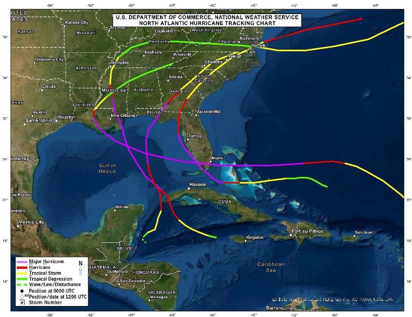
It Has Been BUSY
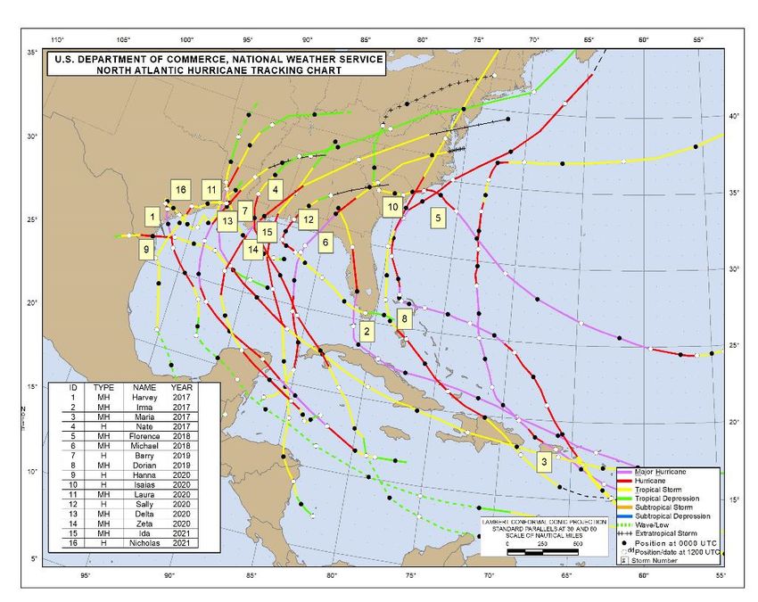
U.S. Landfalling Hurricanes 2017-2021
From 2017-2021:
Estimated Total U.S. Damage:
$320 Billion
Number of billion dollar
storms:
18
Number of 10 billion dollar
storms:
7
(Hurricane Ida: $75.25 billion)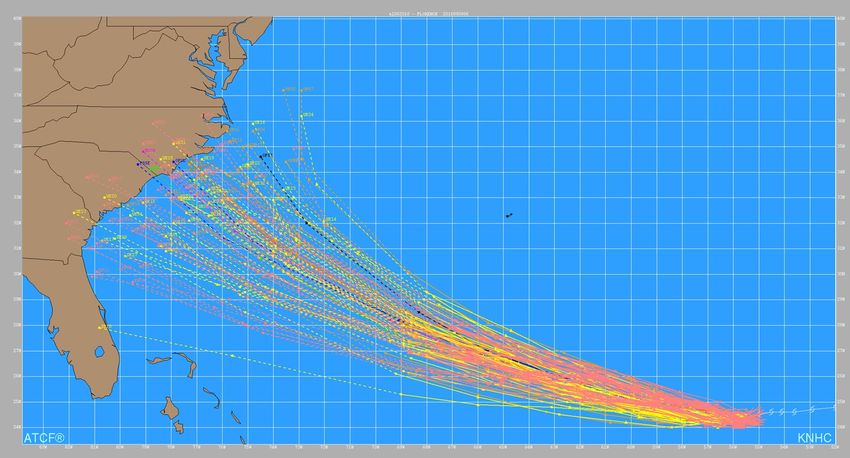
“It only takes one.”
2022 National Hurricane
  Preparedness Week

  www.noaa.gov/hurricane-prep
Let’s focus on…

Real life “gotchas”

1. Hurricanes don’t care about your timelines
 The Nation’s Strongest - Category 5 HurricanesAll Tropical Storms 3 Days Before Landfall

 U.S. Category 5s

1935 – Labor Day
1969 – Camille
1992 – Andrew                                                  Andrew
                                                                 50 mph
2018 – Michael

                                                     Labor Day
                                                      40 mph

                               Michael     Camille
                                50 mph     65 mph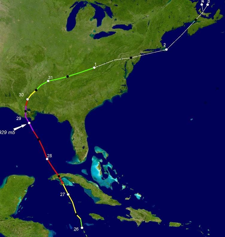
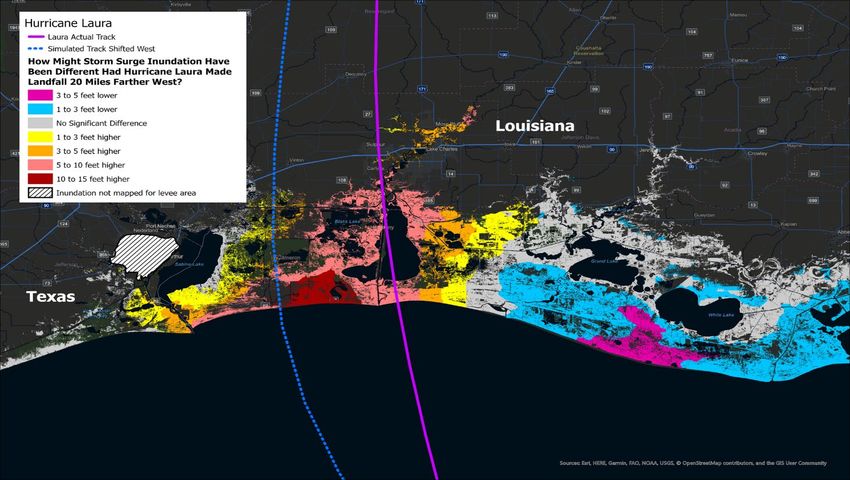
2. Little Wiggles Matter
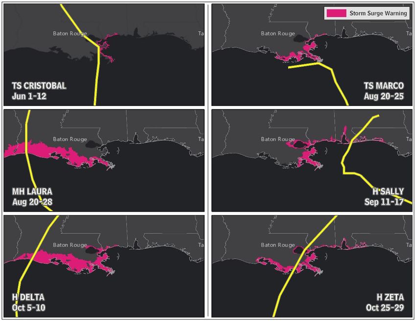
3. Every Storm is Different

                    As the initial
                    intensity of the
                    storm increases,
                    NHC average
                    track error gets
                    smaller!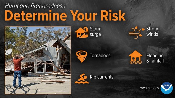
3. Every Storm is Different
                   Other factors come
  Laura            into play; interaction
                   with other storms,
                   forward speed, wind
           Marco
                   shear, eyewall
                   structure, and
                   confidence in
Sally              weather patterns
4. Indirect Fatalities
“The storm is past me, I’m safe now”

                                                  14%         1963-2012 indirect
                                                              deaths (heart
                                                              attacks, power
                                                              problems (e.g., no
                                                              A/C, lights,
                                                              medical
                                                              equipment), etc.).

                                    58%
                                                              Outnumber direct

                                                      28%     deaths in some
                                                              storms.

                                                              Based on
                                                              Rappaport and
                                                              Blanchard 2016

  8 times as many victims age over 60 as under 21 years old
Ida Direct vs. Indirect Fatalities
55 direct fatalities
4 in Louisiana,
2 in Mississippi
49 direct fatalities
49 in the NE U.S.
in the NE U.S.
Primary Causes: 4 direct fatalities in
● 51 Freshwater Flooding (mostly NE) SE Louisiana, 2 in
● 2 Wind (Louisiana) Mississippi
● 1 Storm Surge (Louisiana)
● 1 Tornado (Pennsylvania)
Hurricane Ida
2021Ida Direct vs. Indirect Fatalities
32 indirect fatalities
(26 in Louisiana, 2 in Alabama) 4 indirect fatalities
elsewhere in the U.S.
Primary Causes:
• 13 heat related
• 6 Carbon Monoxide 26 indirect fatalities in
Louisiana, 2 in Alabama
Hurricane Ida
20215. Deterministic Concerns The forecast from NHC has a lower average track error and is more consistent than any individual model overall
Excessive Rainfall Outlook
                                                     Generally answers the question:
                                                   Where is the greatest risk of
                                                  rainfall -induced flash flooding?
                                                               The ERO is:
                                                    A situational awareness and
                                                            planning tool

                                                            The ERO is *NOT*:
                                                   A forecast of flash flooding at a
                                                          specific location

WEATHER PREDICTION CENTER
NATIONAL OCEANIC AND ATMOSPHERIC ADMINISTRATION
WPC High Risk Days are a BIG DEAL
High Risks are only issued by WPC on ~4% of days, but “High Risk Days” have accounted1 for:
2/5 of ALL Flood-related Fatalities 4/5 of ALL Flood-related Damages
HIGH HIGH
39% MDT 83%
Percent of Percent of
Total US
4% Total US
Flood Flood
Fatalities Damages
1 From 2010 to 2020.
Includes flood, flash flood,
heavy rain, and debris flow
Storm Data. Excludes Oso,
WA landslide which
occurred well after rainfall
and on a sunny day.
MDT Damage estimate used for
Montecito debris flow.
17%
WPC High Risks are a strong indicator of a
potentially deadly and damaging flash flood day6. Forecast Accuracy = Better Decisions
Forecast Models
Be careful looking at one run
of one model. We are
looking at more than 50!6. Forecast Accuracy = Better Decisions
Why does this matter?
NHC Track Forecasts for Floyd from NHC Track Forecasts for Dorian from
06Z 13 Sep - 06Z 16 Sep 1999 06Z 1 Sep - 06Z 6 Sep 2019
2.6 million people evacuated As many as 3 million people NOT evacuated7. Words Matter 15 to 20 feet Above Ground
7. Words Matter

Storm Surge
  Warning
7. Words Matter

“We still have
  people not
 evacuating,
 what can we
    say?”
7. Words Matter Unsurvivable
7. Words Matter

No Storm
 Surge
Fatalities
8. No Such Thing as Storm “Justa”
                                2010-2020
                       In the U.S., Category 1
                          hurricanes* have
                         caused 185 direct
                        deaths $110 billion

                      *Irene, Isaac, Sandy, Hermine, Matthew,
                          Nate, Florence, Barry, Hanna, and
                                        Isaias
9. All About the Impacts
Forecast Cone/Wind Warnings/Size Wind Speed Probabilities Time of Arrival of Winds
Storm Surge Warnings Storm Surge Potential Inundation Weather Prediction Center Rainfall9. All About the Impacts
10. No Such Thing as a “fish storm”
  Second Deadliest 2019 Atlantic Basin Storm
Lorenzo – 19 Direct Fatalities – All Water Related
       Hurricane Lorenzo     •   11 offshore deaths due to
                                 sinking of the tug boat
                                 Bourbon Rhode
                             •   3 crew rescued
                             •   8 rip current deaths in the
                                 United States, from
                                 Florida to Rhode Island
Path Forward: What Are We Going To Do About It?
Path Forward: What Are We Going To Do About It?

•   Identify ways to localize and personalize information.
•   Improve accessibility of products and services.
•   People search for different information during different phases of the life cycle of a threat.
•   Timing information is critical for decision-making thus the timing of when forecasts are issued is
    important too.
•   Uncertainty information is important to communicate, but it is not always communictated well.
•   Graphical products are important but need to improve their depiction of risk and/or uncertainty.
•   Misperception among forecasters and partners that the public does not understand uncertainty
    information.
•   Misperception that emergency managers are highly numerate like weather forecasters.

                                                                                                     28
You can also read


