COMMUNITY REBRANDING Unincorporated Communities of Phelan & Piñon Hills San Bernardino, CA
←
→
Page content transcription
If your browser does not render page correctly, please read the page content below
COMMUNITY
                                                     REBRANDING

                                                         PPHCSD
                                                        April 7, 2021
Unincorporated Communities of Phelan & Piñon Hills
               San Bernardino, CA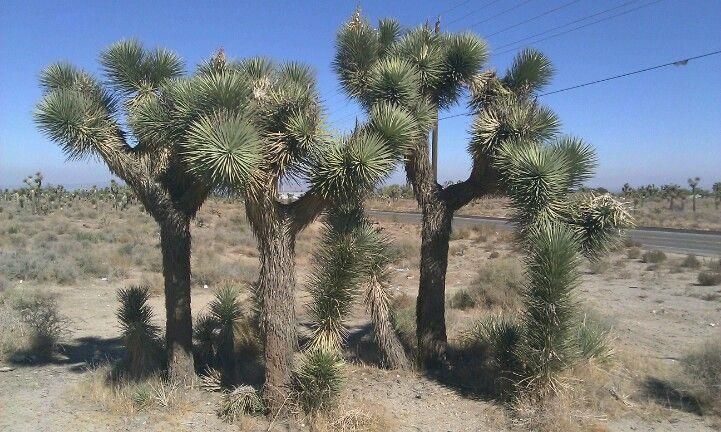
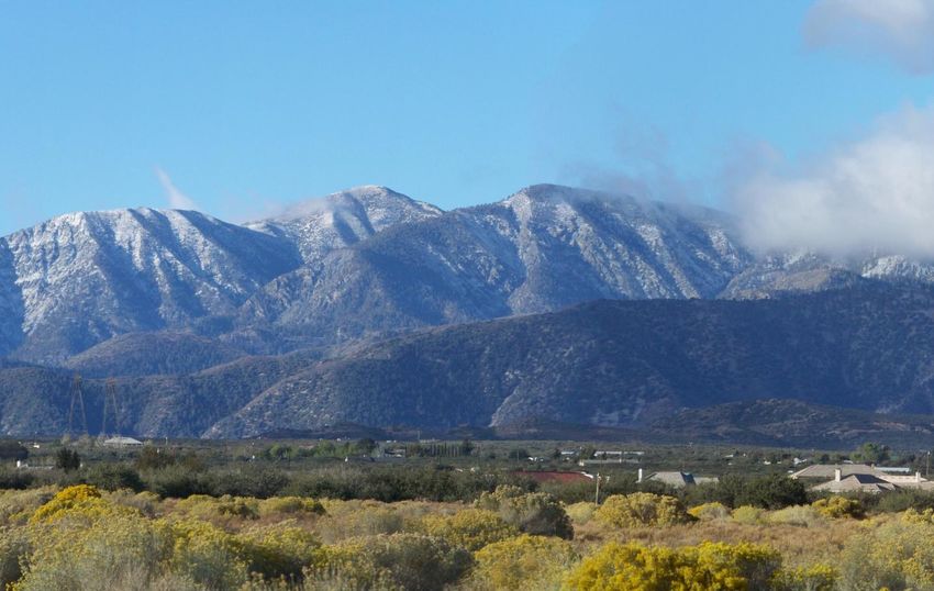
• Phelan & Piñon Hills are unincorporated communities in San
  Bernardino, CA, in the Mojave Desert to the north of the San
  Gabriel Mountains.
  • Phelan Population: 14,304 (2010 Census)
                                                                             Area
  • Piñon Hills Population: 7,272 (2010 Census)                              Background
• Both are considered separate Census Designated Places                      Phelan & Piñon Hills

  • A census-designated place is a concentration of population defined
    by the United States Census Bureau for statistical purposes only. CDPs
    are populated areas that generally include one officially designated
    but currently unincorporated community, for which the CDP is named.
• Both communities have similar population statistics, terrain,
  and weather
• Both communities are served by the Phelan Piñon Hills
  Community Services District (a governmental entity), SJUSD,
  and San Bernardino County (Library, Sheriff, roads, etc.)
• Each have their own post office and chamber of commerce
• History of Phelan
  • “Land of Champagne Climate”
  • Settled as people passed through the area during the days of the
    Mormon Trail                                                             Area
  • Named after Senator James D. Phelan
     • James D. Phelan was also mayor of San Francisco and was active in
                                                                             Background
       restricting Chinese and Japanese immigration. Campaign platform was   Phelan & Piñon Hills
       “White is Right” & “Keep California White”
     • Never lived in the community

• History of Piñon Hills
  • “Where the Desert Meets the Mountains”
  • Originally named “Border Town” because of its location on the county
    line
  • Homesteaders and cattle ranchers settled the area
     • Area sometimes referred to as Horine Springs after prominent family
     • Developed Smithson Springs Water Company
     • Area began to be referred to as Smithson Springs
  • Renamed to “Desert Springs”
     • Post office confusion with Desert Hot springs led to current name
  • Renamed to “Pinon Hills” after the Pinyon Pine
COMMUNITY IDENTITY
• County Communitywide Plan (Adopted Oct 2020 after 5 year process)
  • Both areas referred to simultaneously throughout the Countywide Plan
  • Shared Identities
REBRANDING CONCEPT
• Combine Phelan & Piñon Hills into one unincorporated area & rename
  (NOTE: This is NOT incorporating – this is combining two unincorporated communities into one
         and changing the name)
  • Proposed Community Name: “Serrano Hills”
       • Name isn’t currently utilized as a census designated place/unincorporated community name in CA
       • Recognizes the Serrano people native to the area (Morongo, San Manuel, and Soboba Bands)
• Proposed Motto: “Where the Mojave Meets the Mountains”
• Benefits of Rebranding
  •   Creates one cohesive community
  •   One potential census area to potentially facilitate grant opportunities
  •   Eliminates controversial community name
  •   Easier to spell!
  •   ?
• Drawbacks of Rebranding
  • Significant time investments from SCC and others
  • Community may not want to rebrand
  • ?
REBRANDING
COMPONENTS
BUILD
SUPPORT
CDP
WORK WITH
PROCESS
COUNTY
2030
WORK WITH
COMMUNITY
ORGSREBRANDING COMPONENTS
• COMMUNITY DESIRE/INPUT
• Would the community support this?
• Present concept to school district, PPHCSD, Realtors, other
community organizations
• Residential survey/Facebook group/meetings
• APPLY TO USGS
• Previously thought this was a county-level process, however new information
from County Counsel indicates it is a federal process and the county could
“likely comment as a means to influence the federal decision.”
• Overall process TBD but it appears to be an application and review process
with USGS and this concept appears to be within USGS guidelinesREBRANDING COMPONENTS
• PREPARE FOR AND PARTICIPATE IN 2030 CENSUS PROCESS
• Designate combined area as one Census Designated Place (CDP)
• CDPs are generally based on identified communities so if the communities are
combined, it is likely the combined community will be designated as a single
CDP automatically
• Multiple communities can be combined as one CDP
When the identities of communities have become so intertwined that the communities are commonly perceived and referenced as a
single place. For example, the communities of Arden and Arcade in California have grown together over time and residents commonly
use the place name Arden-Arcade. Further, because of the intertwined identity, residents would have difficulty identifying a boundary
between the separate, historical communities of Arden and Arcade. Multiple communities may also be defined as a single CDP when
there are no distinguishable or suitable features in the landscape that can be used as a boundary between the communities, even if the
two communities still have separate identities. For example, the CDP of Ashton-Sandy Spring in Maryland encompasses two communities
that still maintain separate identities in common, daily usage. The two communities, however, have grown together to such an extent
that a clear break between the two communities is no longer identifiable in the landscape. In general, when considering whether to
combine multiple communities as a single CDP, the following questions should be taken into account:
• Do residents commonly perceive and refer to the communities as a single entity?
• Are there landscape elements, such as signs, that use a hyphenated name for the community?
• Can residents or other knowledgeable individuals identify clear, commonly accepted boundaries for the individual communities?NEXT STEPS?
Obtain more
Meet with community information from USGS
Informal community
organizations & gauge on process to
survey to gauge interest
interest rename/combine
communitiesYou can also read


