Bantry Inner Harbour Development - Environmental Impact Statement - Delivering Sustainable Solutions for our clients
←
→
Page content transcription
If your browser does not render page correctly, please read the page content below
Bantry Inner Harbour Development
Environmental Impact Statement

                  Delivering Sustainable
                 Solutions for our clients

                                             rpsgroup.com/ireland
BANTRY HARBOUR DEVELOPMENT
                ENVIRONMENTAL IMPACT STATEMENT

                   DOCUMENT CONTROL REPORT

Client                    Bantry Bay Harbour Commissioners

Project Title             Bantry Harbour Development

Document Title            Environmental Impact Statement

Document No.              IBE0 558

                          DCS        TOC        Text        List of Tables   List of Figures    No. of Appendices
This Document Comprises
                           1          1          1                -                 -                  7

                                                           Approved
Rev.      Status     Author(s)        Reviewed By                            Office of Origin       Issue Date

                      Ruth Barr       Alan Barr &
  1        Draft    Sinead Henry                           Alan Barr             Belfast           28 June 2012
                                     Mark McConnell
                   Francis Mackin

                      Ruth Barr
                    Sinead Henry      Alan Barr &
  2        Final                                           Alan Barr             Belfast           31 Aug’ 2012
                   Francis Mackin    Mark McConnell

Bantry Harbour Development
Environmental Impact Statement                                         Contents

                                 TABLE OF CONTENTS

1.0      Introduction                                           1.0
         1.1    Project Summary                                 1.1
         1.2    Project Justification                           1.2
         1.3    Consideration of Alternatives                   1.5
         1.4    Planning Process                                1.8
         1.5    Scope and Format of the EIS                     1.34

2.0      Consultation Process                                   2.0
         2.1   Introduction                                     2.1
         2.2   Statutory and Relevant Bodies Consultation       2.1
         2.3   Public Consultation                              2.11
         2.4   Conclusions                                      2.11

3.0      Site Description                                       3.0
         3.1    Site Location and Site Context                  3.1
         3.2    Existing Land Use                               3.4

4.0      Project Description
         4.1    Introduction                                    4.1
         4.2    Proposed Development Works                      4.1
         4.3    Construction Methods                            4.10
         4.4    Phased Approach                                 4.20

5.0      Air and Climate                                        5.1
         5.1    Introduction                                    5.1
         5.2    Methodology                                     5.1
         5.3    Description of the Existing Environment         5.5
         5.4    Predicted impacts of the Proposed Development   5.6
         5.5    Mitigation Measures                             5.5
         5.6    Likely Effects of the Proposal                  5.6

6.0      Noise and Vibration                                    6.1
         6.1   Introduction                                     6.1
         6.2   Study Methodology                                6.1
         6.3   Existing Environment                             6.5
         6.4   Impact of the Proposed Development               6.10
         6.5   Mitigation Measures                              6.16
         6.6   Likely Effects of the Proposal                   6.18

7.0      Material Assets                                        7.1
         7.1    Water Supply                                    7.1
         7.2    Sewerage Infrastructure                         7.1
         7.3    Electricity Supply                              7.1

IBE00558/EIS01                                  i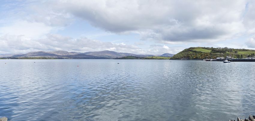
Bantry Harbour Development
Environmental Impact Statement                                      Contents

         7.4      Navigation                                  7.2
         7.5      Future Development in Bantry and Environs   7.2

8.0      Geology and Soils
         8.1   Geology                                        8.1
         8.2   Soils                                          8.5
         8.3   Hydrogeology                                   8.6
         8.4   Sediment Quality – Material to be Dredged      8.7
         8.5   Summary Evaluation of Impacts                  8.9

9.0      Cultural Heritage                                    9.1
         9.1    Introduction                                  9.1
         9.2    Proposed Development                          9.1
         9.3    Sources and Frameworks                        9.1
         9.4    The Receiving Environment                     9.5
         9.5    Marine Geophysical Survey                     9.19
         9.6    Intertidal and Underwater Inspection          9.27
         9.7    Impact Assessment                             9.47
         9.8    Recommendations and Mitigation Measures       9.53

10.0     Flora and Fauna                                      10.1
         10.1 Marine Mammals                                  10.1
         10.2 Birds                                           10.13
         10.3 Terrestrial Fauna                               10.26
         10.4 Benthic and Intertidal Flora and Fauna          10.33
         10.5 Appropriate Assessment Screening Exercise       10.111

11.0     Aquaculture and Fisheries                            11.1
         11.1 Aquaculture                                     11.1
         11.2 Commercial Fisheries                            11.4
         11.3 Other Issues – Pier Access                      11.4
         11.4 Potential Impacts                               11.5
         11.5 Mitigation                                      11.22
         11.6 Monitoring                                      11.26

12.0     Human Beings                                         12.1
         12.1 Baseline Information                            12.1
         12.2 Employment                                      12.3
         12.3 Potential Impacts of the Proposal               12.13

13.0     Roads and Traffic                                    13.1
         13.1 Introduction                                    13.1
         13.2 Existing Situation                              13.1
         13.3 Proposed Development                            13.13
         13.4 Traffic Survey                                  13.17
         13.5 Traffic Impact Assessment – Operational Phase   13.19

IBE00558/EIS01                               ii
Bantry Harbour Development
Environmental Impact Statement                                                  Contents

         13.6     Junction Analyses                                          13.24
         13.7     Car Parking Assessment                                     13.28
         13.8     Traffic Impact Assessment - Construction Phase             13.29
         13.9     Conclusions                                                13.34

14.0     Landscape                                                           14.1
         14.1 Introduction                                                   14.1
         14.2 Methodology                                                    14.2
         14.3 Receiving Environment                                          14.9
         14.4 Project Description                                            14.12
         14.5 Landscape and Visual Impacts                                   14.13
         14.6 Mitigation Measures                                            14.24
         14.7 Conclusions                                                    14.25

15.0     Coastal Processes                                                   15.1
         15.1 Overview                                                       15.1
         15.2 Existing Hydraulic Regime                                      15.1
         15.3 Harbour Layout Modelling                                       15.8
         15.4 Modelling the Impact of Dredging Operations                    15.12
         15.5 Disposal of Dredged Material                                   15.22
         15.6 Summary                                                        15.43

16.0     Water                                                               16.0
         16.1     Consultation                                               16.1
         16.2     Potential Impacts                                          16.1
         16.3     Current Water Quality Status                               16.2
         16.4     Assessment of Potential Impacts                            16.9
         16.5     Mitigation                                                 16.11
         16.6     Flood Risk Assessment                                      16.13

17.0     Summary Chapter                                                     17.0
         17.1 Introduction                                                   17.1
         17.2 Interactions                                                   17.7
         17.3 Technical Difficulties                                         17.9
         17.4 Conclusions                                                    17.9

REFERENCES AND BIBLIOGRAPHY

APPENDICES

Appendix 1        Results of Chemical Sediment Testing
Appendix 2        Cultural Heritage Appendix
Appendix 3        Flora and Fauna
Appendix 4        Roads and Traffic
Appendix 5        Flood Risk Assessment
Appendix 6        Photomontages for Landscape and Visual Impact Assessment

IBE00558/EIS01                                iii
Bantry Harbour Development
Environmental Impact Statement         Contents

Appendix 7        Consultations

IBE00558/EIS01                    iv
Bantry Harbour Development
Environmental Impact Statement Introduction
1.0 INTRODUCTION
This Environmental Impact Statement (EIS), as required by the Planning and Development
Regulations, 2001, has been prepared in support of the Planning Application for the
proposed development. This EIS was prepared by RPS with a number of specialist sub-
consultants.
1.1 Project Summary
Bantry Town located about 90 km west of Cork City is a bustling county town in the tourism
hotspot of West Cork. Bantry Town is located at the head of Bantry Bay which is one of the
deepest harbours in Europe and the longest Bay in Ireland. It is a major tourist attraction in
Ireland in its own right and attracts large numbers of Irish and overseas visitors on an annual
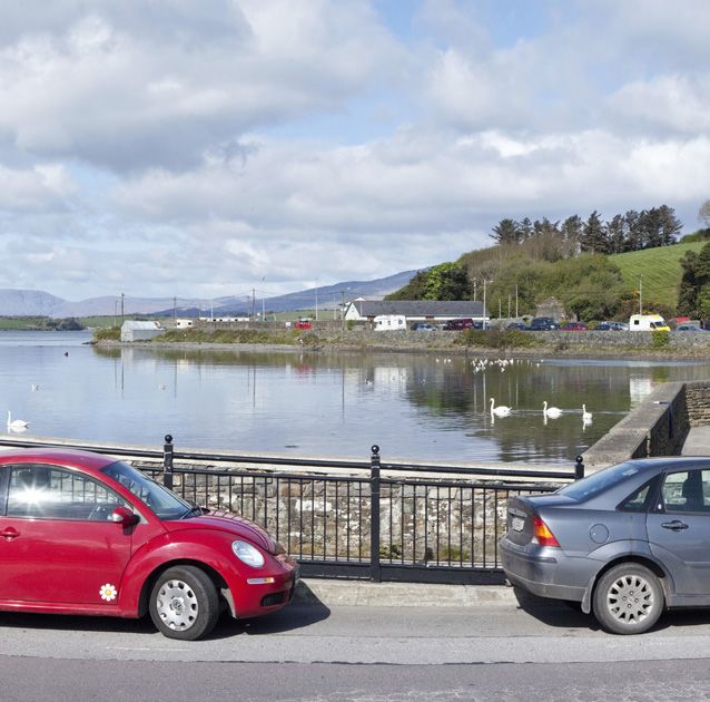
basis. The town itself has a large harbour which makes up a substantial portion of the town
and is a significant backdrop and focal point for the town. The Harbour is currently
constrained by the available water depths. At low water parts of the harbour dry out leaving
exposed areas of mudflats. Therefore at present, it is not suitable for use by vessels at all
states of the tide.
RPS were commissioned by Bantry Bay Harbour Commissioners in 2008 to examine options
for developing the Inner Harbour. Various design criteria were given to RPS which steered
the design process. There were also constraints such as contamination issues with sediment
in the Inner Harbour. RPS in partnership with Bantry Bay Harbour Commissioners and other
stakeholders devised a scheme which will provide a sheltered harbour environment and
marina with increased water depth and improved pier facilities to promote fishing and tourism
activities in the Bantry area. The scheme will also provide additional and improved
recreational and amenity areas. The scheme includes proposals for the beneficial re-use of
clean dredged material at adjacent, and connected, locations for beach re-nourishment and
land reclamation. The proposed scheme is described in detail in Chapter 4 of this EIS, but
the following are the main components of the project:
• Dredging of the Inner Harbour to depths of up to - 3m CD thereby providing a
harbour with water at all states of the tide;
• Dredging of the Outer Harbour approaches to depths of up to – 6m CD;
• Provision of pontoon berths for 200 vessels;
• Provision of reclamation area to the north of the pier which can be used for amenity
purposes;
• Use of clean dredged spoil for beach renourishment at Cove Beach to the north of
Bantry Harbour
• Use of dredge spoil for land reclamation at Abbey to the South of Bantry Harbour.
It is envisaged that the project will proceed in phases subject to the availability of funding.
The funding for this project will be provided by a combination of local and central government
and the overall capital cost is in the region of 21 millions. The timescale for commencing this
project provided all statutory permissions are in place is Autumn 2013.
IBE00558/EIS01 1-1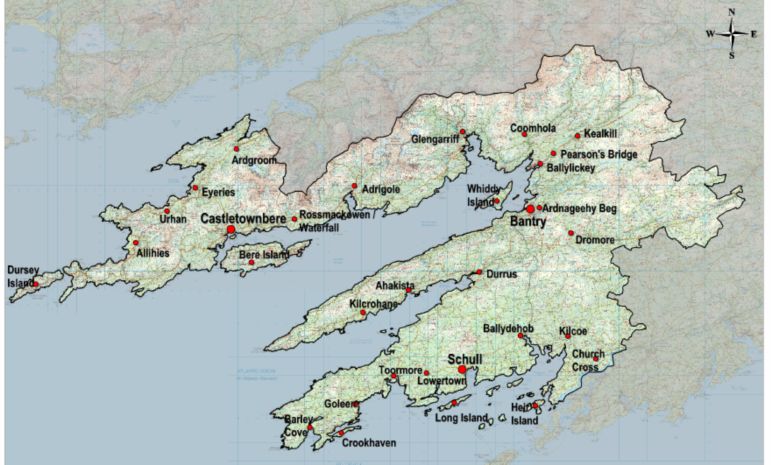
Bantry Harbour Development
Environmental Impact Statement                                                            Introduction

1.2      Project Justification

It has long been recognised that the failure to dredge the Inner Harbour at Bantry has
affected the economic and tourism growth of Bantry in particular and West Cork in general. It
is for this reason that an alliance of Bantry Bay Harbour Commissioners, Cork County
Council and Bantry Town Council came together to look at options for developing the
resource of Bantry harbour for the overall benefit of the town and environs.

Bantry Bay is an area of immense beauty and unfulfilled tourism potential. The Bay itself is
one of the deepest in Europe and popular for sailors for its wide expanses of water and
favourable sailing conditions. The Inner Harbour at Bantry however due to its limited depths
does not offer the same attractiveness to Sailors and parts of it are deemed off limits due to
the fact it dries out at low water. In fact, it can appear visually unattractive at low water due to
the sight of exposed mudflats. There are significant constraints also in terms of the berthing
facilities at the two piers in the town with frequent congestion on the piers giving rise to
health and safety issues.

What is clearly lacking also in the Bantry Bay area from a tourism viewpoint is a high quality
amenity beach. The Bay does not contain any sandy beach and long distances need to be
travelled from Bantry to reach beaches in Allihies and Barley Cove. A good quality
recreational beach within walking distance of Bantry Town would benefit the local community
in terms of amenity asset but also in terms of bringing additional tourists and in turn revenue
to the town.

In the past, the constraints on depth have meant that Bantry has missed out on some
prestigious events e.g. the Bantry Rowing Club were denied holding the All Ireland
Championship in 2007 because the Rowing Federation felt that facilities were too inadequate
in Bantry. Equally Rivercruise Ireland would be interested in basing one of their pleasure
cruise boats in Bantry during the tourist season because of the demand for sail trips from the
area but they could not do so because they cannot dock safely at the port. They have
mentioned that the pier is so unsightly and unsafe that even in high water it really is not a
suitable pick-up and drop-off point for their customers.

Aquaculture and fishing are very important local industries. The availability of the full pier at
all time would enhance their socio-economic value. Bantry Bay Sea Foods Ltd is a major
local employer that processes all local mussel catch and is in a position to process further
local catch if it were available. At €800 a tonne, this would have a major impact on that sector
of local industry.

It is envisaged that the prospects for both general and marine leisure tourism arising from the
proposed works are immense: the proposed 200 berth marina and other opportunities
including sea angling, sea adventure activities and boat and yacht chartering will become
major attractions both for the people of Bantry and tourists, and will encourage then to stay,
enjoy and make use of the facilities offered. Research carried out by the Irish Marine
Federation has found that visiting boats remain on average three nights at each location with
an average daily spend of €150 excluding berthing charges of between €20 and €30 per day.

IBE00558/EIS01                                 1-2
Bantry Harbour Development
Environmental Impact Statement                                                          Introduction

This may well be a conservative spend as the British Marine Federation estimates that
visiting boats to UK marinas contribute on average £150 (€227) each per night to the local
economy.

It is estimated that for every Euro spent by an out of state tourist, 52 cent eventually ends up
with the government through VAT, excise duty, PAYE etc. Also, every one million Euro of
tourism revenue supports some 17.4 full-time equivalent (FTE) jobs. The construction sector
is also a major contributor to the Exchequer returning 30 per cent of the capital cost through
taxes.

The potential broad direct and indirect economic benefit to Bantry consequent to the
proposed works over five years is some €40 million with a return to the Exchequer of a
minimum of €13 million. Additional employment is estimated at 264 Full-time equivalent
(person-year) positions.

It complies with the principles enunciated in the County Council’s North and West Cork
Strategic Plan 2002 to 2020 that underlies the importance of integrated and synergistic
development. The Department of the Environment, Community and Local Government has
already made a serious contribution to the environment and infrastructure of Bantry by
recently investing €21 million in the Bantry Sewerage Scheme and Bantry Water Supply
Scheme. A failure to develop the Harbour would mean that the full benefits of the proposed
schemes would not be achieved.

The key findings of the report investigating the reasons why this development is entirely
justifiable are outlined below:

    1.       The failure to address Bantry harbour in terms of its unappealing appearance,
             lack of water depth, contaminated spoil problem and unavailability of the full pier
             is a constraint on local development.
    2.       The Pier plays an important safety and commercial role in the area: the local
             fishing vessels tie up there; the ferries to and from Whiddy Island operate from
             there, and visiting yachts often moor there.
    3.       Because only a small proportion of the Pier is usable, there are conflicting
             demands on its single access point at times.
    4.       The Inner Harbour works are seen as a catalyst for the development of the town
             both in terms of enhancing its profile as a tourist resort as well as becoming a
             marine leisure centre which will offer a range of opportunities for marine tourism.
    5.       Bantry Rowing Club is at a severe disadvantage due to the lack of slipping,
             launching and shore facilities.
    6.       Rivercruise Ireland have indicated that they would be interested in basing one of
             their pleasure cruise boats in Bantry during the tourist season. They would also
             like to be able to dock the Jeanie Johnston as they have had a lot of demand for
             sail trips from the area but which cannot be fulfilled as they cannot safely dock at
             the port. They have mentioned that the pier is so unsightly and unsafe that even
             in high water it really is not a suitable pick-up and drop-off point for their
             customers.

IBE00558/EIS01                                 1-3
Bantry Harbour Development
Environmental Impact Statement Introduction
7. There is a general consensus that the dredging, as a first stage of the
infrastructure development will have a significant impact on the economic and
tourism potential of the town and region.
8. The overall costs of the proposed works are in the region of 21 millions. When
indirect and induced effects are taken into account, the overall economic impact
of that spend is of the order of €13.5 million with an overall labour content of
approximately 112 man-years. At an average wage of €39,000 and a tax-take of
30 per cent, the return to the state from income tax alone is some €1.3 million.
9. The commencement and success of developments that are presently being drawn
up for sites adjacent to the Harbour and the town in general depend very much on
the clean-up of the Inner Harbour. The town’s people have huge confidence in the
potential of the area and therefore very supportive of the proposals.
10. The recent construction of the new hotel and apartments in the harbour area is a
reflection of the confidence that local developers have in the area.
11. The proposed scheme will provide other opportunities in the marine leisure
industry e.g. sea angling, sea adventure activities and boat/yacht chartering.
There will also be a need for support services such as boat repairs and chandlery.
12. According to Failte Ireland statistics, the average stay of visitors to the South
West in 2005 was some 6.2 days and the average daily spend was some €80 or
€114 when the multiplier effect is taken into account.
13. The attraction of cruise ships to Bantry would have a significant local and regional
economic impact as the average daily spend of such visitors is €315, or €450
when the indirect and induced effects are included.
14. The average daily spend of a visiting yacht comprising two people varies between
€150 and €227. Yachts stay on average two days at a location before moving on.
15. An increase in tourists to Bantry could support a growth in tourism on Whiddy
Island where there has been no tourism facilities for some time. The island has
some unique battlements which would have an appeal for those with an interest in
historical settlements and buildings.
16. Aquaculture and fishing are important local industries. The availability of the full
pier at all times would enhance their socio-economic value through facilitating the
landing of additional catch.
17. There are many non-monetary benefits arising from the proposed works including
health and safety, the elimination of offensive smells at the harbour,
environmental effects as well as the “feel-good” factor that will arise from the
expected improvements.
18. The marina itself will become a tourist attraction in its own right whereby people
come to Bantry to view the boats and walk on the newly created walkways and
amenity areas. This in turn could provide opportunities for local businesses to
capitalise on the increase in visitors into the area and thereby increase their
revenues.
In summary, the case for development is clear as there are significant economic, socio-
economic, environmental and community benefits to be achieved. The partnership of Bantry
Bay Harbour Commissioners, Cork County Council and Bantry Town Council is committed to
the development of the Bay and is anxious to proceed without delay. It is a project which has
IBE00558/EIS01 1-4Bantry Harbour Development
Environmental Impact Statement Introduction
been discussed and longed for over more years that the local population can remember and
now with the current momentum to develop the harbour at this level, it is now time to write
the next chapter of the development of Bantry by proceeding without delay in starting this
ambitious but great development for the town.
1.3 Consideration of Alternatives
The consideration of alternatives is an important requirement of the Environmental Impact
Assessment (EIA) process. For the purposes of the EIA Regulations, alternatives may be
described at three levels:
• Alternative Locations;
• Alternative Designs;
• Alternative Processes
The consideration of location, design and processes were given careful consideration during
the EIA process.
1.3.1 Alternative Locations
With regards to location, it was decided that as the current location of Bantry harbour is the
optimum location in Bantry for the new harbour development, there was no need to seek an
alternative location. The Harbour is ideally located close to the town, main businesses etc.
To move it to an alternative location would be un-realistic and not beneficial.
1.3.2 Alternative Designs
The design of the harbour and the other components of the proposed development were
given careful consideration. The following design criteria emerged for the development of a
sheltered harbour:
(a) Treatment and/or removal of contaminated material from the harbour seabed.
(b) Provision of adequate berthing for the local fishing industry.
(c) Pier widening and extension to improve berthing facilities for the fishermen and
permit the turning of an articulated lorry on the pier head.
(d) Provision of public and amenity areas on reclaimed lands.
(e) Provision of sufficient water depths at low tides for the anticipated range of
vessels.
(f) Provision of a sheltered berthing facility for a range of uses including commercial
use, fishing industry and tourism.
(g) Consideration of maintenance requirements, particularly with respect to
sedimentation at berths and within the dredged harbour basin.
(h) Advice on costs associated with reinstating fishing docks by either piling or
underpinning.
IBE00558/EIS01 1-5Bantry Harbour Development
Environmental Impact Statement Introduction
(i) Assess feasibility of providing a quay at the breakwater head.
(j) Provide pontoons adjacent to the proposed hotel apartment complex.
All of the above design criteria were considered when arriving at the proposed scheme that is
now going forward for planning and described in detail in Chapter 4 of this EIS.
1.3.3 Alternative Processes
The consideration of alternative processes and options was considered in terms of how to
deal with the dredged spoil arising from the dredging of the Inner and Outer Harbour.
There has been a problem with contaminated sediment in the upper layers of Bantry Harbour
for a long time and this is one of the main reasons why development has never taken place
as the issue of how to remove and dispose of the contaminated spoil was always a major
obstacle and stumbling block. The material underneath the contaminated spoil is deemed to
be uncontaminated and will be used for beach re-nourishment at Cove Strand. As part of this
project, RPS have assessed the various options for dealing with the contaminated portion of
the material to be dredged and have arrived at a solution to the problem which has held up
development in Bantry for too many years.
The options for disposal/treatment of the contaminated spoil were as follows:
1. Disposal of the Contaminated Dredged Spoil at Sea
Disposal of dredged spoil at sea is a traditional method of disposal of material if no
alternative uses can be found for it as part of the proposed development. In order to be
allowed dispose of material at sea under a Dumping at Sea Permit, the material must be
within specified guidelines for chemical quality.
Extensive testing of the material to be dredged was carried out (refer also to Chapter 8 of this
EIS) and the results were discussed with the Marine Institute. Based on the level of
contamination in the upper layers of the harbour, the Marine Institute responded as follows:
“Based on the Guidelines for Suitability of Dredged Material for Dumping at Sea, the
uppermost material would not be considered suitable for dumping at sea”. Dumping at sea
was then ruled out as an option for disposal of the contaminated sediments from Bantry
Harbour.
2. Treatment on Site Prior to Disposal/Re-use
Technology is available which would provide for treatment of the contaminated material on
the site prior to disposal. One possible treatment technique suitable for the contaminated
material within Bantry inner harbour is stabilisation/solidification. This would be achieved by
mixing the contaminated material with a treatment additive such as modified clay, which
would have the capability to deal with inorganic heavy metals and organic tins.
IBE00558/EIS01 1-6Bantry Harbour Development Environmental Impact Statement Introduction Such technology has been successfully employed in a number of sites throughout the UK, specifically for dealing with harbour sediments. One such example is Falmouth Harbour in Cornwall. A suitable area would be set aside for the treatment facility. The mixing strategy would be based on using a tractor mounted spade which can mix the sediments and the treatment additives at a rate of around round 300m3 per day (this can be increased to 600m3 per day if a second treatment operation is established). Two options were then considered for the disposal of treated contaminated material; Reuse as Construction Fill on site There is a need for construction fill for the proposed reclamation areas in the harbour development and it has been calculated that the anticipated volume of contaminated material could be incorporated within the planned amenity area and pier reclamation area. Consultations with the Marine Institute, has indicated it is their opinion that the contaminated material within the inner harbour at Bantry is suitable for treatment and reuse as fill within the reclaimed areas of the proposed development. Disposal to non-hazardous/inert landfill site The second option for the disposal of material which has been treated on site is to transport to a suitably licensed non-hazardous landfill site. Due to the lack of space available for storage of material, the treated material would be transported directly to the landfill site(s) where it would self compact whilst curing. The rate of transportation of material to the landfill site(s) would be determined by the rate of treatment, i.e. 300m3 per day if one treatment operation used, 600m3 per day if a second operation was used. Suitable landfill availability to receive the nature and quantity of material proposed is extremely limited. Suitable sites are not available in close proximity to Bantry. The closest potential receptor sites are located in the greater Dublin area, those being Kilmurry South (Co. Wicklow), Ballymore Eustace (Co. Kildare), Drehid Waste Management Facility (Co. Kildare) and at Naul (Co. Dublin). If the treated soil is transported in a reasonably saturated state there may be a requirement for particular measures to be implemented to minimise the risk of spillage before soil is in transit. This may involve part loading which could increase transportation costs. 3. Transport Contaminated Sediment Off-site for treatment and disposal Offsite treatment of the dredged material can be carried out wherever facilities are available at the most cost effective rates. Options considered for off-site treatment were as follows: IBE00558/EIS01 1-7
Bantry Harbour Development
Environmental Impact Statement                                                         Introduction

Remove contaminated material to treatment facility in Ireland and then dispose to
landfill
There are several waste management companies within Ireland who specialise in the
treatment of contaminated soil in dedicated facilities, such as Enva (Portlaoise, Co. Laois),
Indaver (Dublin, Co. Dublin) and Rilta (Rathcoole, Co. Dublin). Contaminated soil is
transported to such facilities where it is then suitably treated, repackaged and made available
for disposal. The closest suitable treatment centre to Bantry is the Enva facility at Portlaoise,
approximately 240km away.

Remove contaminated material to hazardous landfill in mainland Europe
A further option is the direct export of spoil off site to a hazardous landfill site in mainland
Europe provided that the volumes of soil are significant enough to warrant the use of barges.
Transfer of spoil outside of Ireland is classed as a Trans-Frontier Shipment (TFS). All TFS
licenses in Ireland are granted subject to the discretion of the National TFS Office of Dublin
City Council.

1.3.3.1 Preferred Option for Resolving Contaminated Spoil Problem

After careful consideration of all the above options involving many different alternative
processes, it was decided that the most effective method of dealing with the contaminated
material will be to treat the material on site and to incorporate the remediated material as fill
in the proposed reclamation area. This option can also be considered as having an
advantage in terms of sustainability as transport is negated and there is no usage of what is
generally very limited existing landfill capacity.

It also negates the need to import vast quantities of fill material into the site as the dredged
material itself will be used as fill material.

Further details on the dredging processes and treatment facilities are provided in Chapter 4.0
– Project Description.

1.4      Planning Process

1.4.1 Introduction

This section of the Environmental Impact Statement (EIS) provides an assessment of the
proposal against prevailing National, Regional and Local Planning Legislation and Policy in
the Republic of Ireland (RoI). This EIS is an all encompassing document prepared cognisant
of the planning and marine licensing processes. It is submitted in association with
appropriate applications presented to the relevant authorities for consideration.

1.4.2 Description of Proposal

A summary of the scheme is provided below. Described collectively as “Bantry Inner Harbour
Development,” the main components of the proposal comprise:

IBE00558/EIS01                                1-8
Bantry Harbour Development
Environmental Impact Statement                                                          Introduction

    •    A breakwater Construction – This will incorporate a quay structure with a berthing
         facility on both sides;
    •    Dredging of the Harbour Basin – Required to provide adequate water depths for all
         tide access and berthing;
    •    Refurbishment of the Fishing Pier – This includes widening the existing pier by 4
         metres along its entire length as well as extending and widening the head of the pier
         to accommodate access to a floating pontoon and to allow the turning of Heavy
         Goods Vehicles;
    •    Land Reclamation at the inner harbour will facilitate the creation of an amenity area,
         play area and fun park;
    •    A sufficient number of car parking spaces are to be provided to serve the proposal;
    •    A suitable package of hard and soft landscaping proposals will be augmented across
         the site; Installation of pontoons and marine services – Other works as described
         including breakwater, shore protection and land reclamation will allow a basin capable
         of providing up to 200 marina berths;
    •    Land Reclamation at Abbey Site and Beach Re-nourishment at Cove and Beicin Sites
         – It is proposed that uncontaminated materials accumulated through the dredging
         process will be utilised at the Abbey, Cove and Beicin sites. At the Abbey site,
         dredged material will be transported by barge to the existing slipway facility for
         treatment. Afterwards it will be placed behind armoured bunds. At the Cove and
         Beicin sites, material will be transported from the inner harbour by barge, beached at
         low tide and profiled to form the beach;
    •    Marine Security – A suitable locking gate is proposed at the top of the access
         gangway whilst pontoons are adequately separated from adjacent structures to
         prevent unauthorised access;
    •    Safety Measures – Pontoons will be restrained by vertical steel piles driven into the
         bedrock. Life buoys will be placed strategically around the marina;
    •    Services – A metered supply of electricity will be available on-site. Water taps will be
         provided. No sewerage pump out facilities for vessels will be provided; and
    •    A fuel supply will be available on site.

The above information comprises only a short summary of the complete project description
which is contained within Chapter 4.0 of this EIS.

1.4.3 Methodology

Consideration of why the proposal constitutes EIA development is provided in a brief
summary of relevant European and jurisdictional EIA legislation. Further to EIA
considerations, to establish the Plans and Policy Context for the area it was necessary to
undertake:

    •    Analysis of key planning legislation as applied to the project;
    •    An analysis of relevant planning policy to be applied during the assessment of this
         proposal; and
    •    A review of further material considerations which fairly and reasonably relate to the
         application concerned.

IBE00558/EIS01                                 1-9
Bantry Harbour Development
Environmental Impact Statement Introduction
Consideration of the following documents has taken place:
• Planning & Development Act 2000;
• National Spatial Strategy (NSS);
• Regional Planning Guideline for the South West Region– 2010 – 2022;
• Cork County Development Plan 2009;
• Bantry Electoral Area Local Area Plan; and
• Further Material Considerations.
Conclusions were informed by a critique of the above documents as well as the information
contained within other tailored EIS Chapters regarding specific issues.
1.4.4 EIA Consideration
Environmental Impact Assessment (EIA) is a key instrument of European Union (EU)
environmental policy. EIA is a procedure required under the terms of European Union
Directives 85/337/EEC on assessment of the effects of certain public and private projects on
the environment
Article 2 of the Directive requires that “Member States shall adopt all measures necessary to
ensure that, before consent is given, projects likely to have significant effects on the
environment by virtue, inter alia, of their nature, size or location are made subject to a
requirement for development consent and an assessment with regard to their effects.” Article
8 then requires that “The results of consultations and information gathered pursuant to [the
EIA process] must be taken into consideration in the development consent procedure”.
The EIA Directive has been amended three times, in 1997, in 2003 and in 2009:
• Directive 97/11/EC brought the Directive in line with the UN ECE Espoo Convention
on EIA in a Transboundary Context. The Espoo (EIA) Convention sets out the
obligations of Parties to assess the environmental impact of certain activities at an
early stage of planning. It also lays down the general obligation of States to notify and
consult each other on all major projects under consideration that are likely to have a
significant adverse environmental impact across boundaries
• Directive 2003/35/EC - seeking to align the provisions on public participation with the
Aarhus Convention. This grants the public rights regarding access to information,
public participation and access to justice, in governmental decision-making processes
on matters concerning the local, national and transboundary environment. It focuses
on interactions between the public and public authorities.
• Directive 2009/31/EC amended the Annexes I and II of the EIA Directive, by adding
projects related to the transport, capture and storage of carbon dioxide (CO2).
In Ireland, EIA requirements under domestic planning legislation have been consolidated into
Part X of the Planning and Development Act 2000 (as amended) and Part 10 of the Planning
and Development Regulations 2001 (as amended).
IBE00558/EIS01 1-10Bantry Harbour Development
Environmental Impact Statement Introduction
1.4.4.1 EIA Screening
Whilst an official EIA Screening Exercise has not taken place, the decision to proceed with
the preparation of an Environmental Impact Statement was taken, advised through
consultation with Cork County Council. It is further informed by RPS’ experience and in
consideration of all project elements against the relative legislative context.
Schedule 5 (Development for the purposes of Part 10 - EIA) of the Development Regulations
(2001) sets out the classes of development for which an EIA is compulsory. Schedule 5 is
divided into Parts 1 and 2 which reflect Annexes 1 and 2 of the EIA Directive respectively.
The approach adopted in the Directive is that EIA is mandatory for all Annex I projects on the
basis that these project classes will always have significant environmental effects. In most
cases, mandatory thresholds are specified in respect of the project classes in Annex I.
In the case of Annex II projects, the Directive gives Member States considerable discretion in
determining the need for EIA. The overriding consideration (as set out in article 2 of the
Directive) is that projects likely to have significant effects on the environment by virtue, inter
alia, of their nature, size or location should be subject to EIA. In transposing the Annex II
requirements of the Directive into Schedule 5 Part 2, Ireland chose to set mandatory
thresholds for each of the project classes in Annex II.
Irish implementing legislation addresses the possible need for EIA below the Annex II
national thresholds where the competent/consent authority considers that a development
would be likely to have significant effects on the environment. Such developments are
described as “sub-threshold.” Article 102 of the Regulations states: “Where a planning
application for sub-threshold development is accompanied by an EIS, the application shall be
dealt with as if the EIS had been submitted in accordance with section 172(1) of the Act.”
Article 103 states: “Where a planning application for sub-threshold development is not
accompanied by an EIS, and the planning authority considers that the development would be
likely to have significant effects on the environment, it shall, by notice in writing, require the
applicant to submit an EIS.”
Relevant thresholds which upon initial inspection, could relate to the project are as follows:
• Part 2.1 (g) - Reclamation of land from the sea, where the area of reclaimed land
would be greater than 10 hectares.
• Part 2.2 (d) - Extraction of stone, gravel, sand or clay by marine dredging (other than
maintenance dredging), where the area involved would be greater than 5 hectares or,
in the case of fluvial dredging (other than maintenance dredging), where the length of
river involved would be greater than 500 metres.
• Part 2.10 (e) - New or extended harbours and port installations, including fishing
harbours, not included in Part 1 of this Schedule, where the area, or additional area,
of water enclosed would be 20 hectares or more, or which would involve the
reclamation of 5 hectares or more of land, or which would involve the construction of
additional quays exceeding 500 metres in length.
• Part 2.10 (k) - Coastal work to combat erosion and maritime works capable of altering
the coast through the construction, for example, of dikes, moles, jetties and other sea
IBE00558/EIS01 1-11Bantry Harbour Development
Environmental Impact Statement Introduction
defence works, where the length of coastline on which works would take place would
exceed 1 kilometre, but excluding the maintenance and reconstruction of such works
or works required for emergency purposes.
• Part 2.12 (b) - Sea water marinas where the number of berths would exceed 300 and
fresh water marinas where the number of berths would exceed 100.
Schedule 5 Part 13 also includes a requirement for EIA in developments incorporating any
change or extension of development which would result in the development being of a class
listed in Part 1 or paragraphs 1 to 12 (Part 2) of Schedule 5, and result in an increase in size
greater than:
• 25%; or
• An amount equal to 50% of the appropriate threshold – whichever is the greater
At Bantry Inner Harbour, the total footprint area of the proposed new reclaimed amenity area
and breakwater is approximately 15,960m² (1.596h) which is 41% of the current area of the
harbour basin (which currently stands at approximately 38,500m² - 3.85h). The proposals do
not however, lead to listing as per Part 1 – or paragraphs 1-12 of Part 2.
Accordingly detailed consideration revealed that none of the above thresholds have been
exceeded by the proposals and as such they can be described as “sub-threshold.”
Nevertheless the holistic consideration of the following issues has led to the production of
this voluntary EIS – including the:
• Range and scale of activities to occur;
• Receiving waters are subject to an EU Shellfish designation; and
• Contamination of some of the material to be dredged.
When combined the proposals could have the potential to have significant impacts on the
environment.
1.4.4.2 EIA Scoping
A targeted EIA Scoping exercise was undertaken by RPS. The scoping exercise is described
in Section 1.5 of this Chapter of the EIS and also in Chapter 2 of this EIS which deals with
the Consultation process. All relevant responses have been considered during the
preparation of this Environmental Impact Statement.
1.4.5 Planning Legislation
The starting point for the modern planning code is the Planning and Development Act 2000.
This Act consolidated all planning (and relevant associated environmental) legislation from
1963 to 1999 and codified much of what had grown up in custom and practice during that
time, clarifying and simplifying the overall process into one self-contained piece of legislation.
The 2000 Act remains the basis for the Irish planning system however there have been a
number of amendments to the legislation the most significant of which include the Planning
and Development (Amendment) Act 2002, the Planning and Development (Strategic
IBE00558/EIS01 1-12Bantry Harbour Development
Environmental Impact Statement Introduction
Infrastructure) Act 2006, as well as the recently commenced Planning and Development
(Amendment) Act 2010.
The principal regulations underpinning the Planning and Development Acts 2000 (as
amended) are the Planning and Development Regulations 2001. They also consolidate all
previous Regulations made under the 2000 Act and replace the Local Government (Planning
and Development) Regulations 1994 - 2000. They prescribe the detail of the various planning
processes and procedures in the RoI. Some significant amendments have been made to
these regulations, notably the Planning and Development Regulations 2006 which inter alia
underpinned the new strategic consent procedure established under the Planning and
Development (Strategic Infrastructure) Act 2006.
A key provision of the Planning and Development (Amendment) Act 2010 is to ensure a
closer alignment between the National Spatial Strategy, Regional Planning Guidelines,
Development Plans and Local Area plans. The 2010 act also transposes the provisions of
the Habitats Directive directly into planning legislation and clearly outlines the obligations for
Planning Authorities and An Bord Pleanála in respect of same.
All development, unless specifically exempted, needs planning permission. This proposal
does not constitute exempted development. In general all decisions to grant or to refuse
planning permission are firstly for the relevant planning authority. Anyone applying for
planning permission in Ireland and anyone who made valid, written
submissions/observations to the planning authority on a planning application can appeal a
subsequent planning decision to An Bord Pleanála, within the appropriate period. An Bord
Pleanála (‘the Board’) is the Irish national planning appeals board. In this regard, Ireland is
one of the few European countries to have an independent third party planning appeals
system.
The primary legislation governing planning and development in Ireland is the Planning &
Development Act 2000 (PDA), as amended by various subsequent acts. However as noted
above, the Planning and Development (Strategic Infrastructure) Act 2006 introduced a new
planning regime to streamline the planning process for major infrastructure projects. Certain
developments of strategic importance to the state or regions can apply for permission /
consent directly to the Board rather than submitting a planning application to the local
authority in the first instance in a process designed to reduce the delays involved in planning
for such projects.
Section 37A(2) of the Planning and Development (Strategic Infrastructure) Act 2006,
describes Strategic Infrastructure Development (SID) as that which:
• Is considered to be of national strategic economic or social importance;
• Would contribute significantly to the fulfilment of any of the objectives of the National
Spatial Strategy or any regional planning Guidelines for an area; and
• Would have significant effects on the area of more than one planning authority.
Accordingly, Bantry Harbour development does not constitute SID.
IBE00558/EIS01 1-13Bantry Harbour Development
Environmental Impact Statement Introduction
1.4.6 Marine Legislation
Given the nature of the proposal, some project elements are proposed to occur on the
foreshore. This is defined as the seabed and shore below the line of high water of ordinary or
medium tides and extends outwards to the limit of twelve nautical miles (approximately 22.24
kilometres).
Following on from the enactment of the Foreshore and Dumping at Sea (Amendment) Act
2009 responsibility for certain foreshore functions has transferred to the Minister for the
Environment, Heritage and Local Government with effect from 15 January 2010. This
includes:
• All foreshore energy-related developments (including oil, gas, wind, wave and tidal
energy);
• Aggregate and mineral extraction developments on the foreshore; and
• Foreshore projects in respect of port companies and harbour authorities governed by
the Harbours Acts, 1946, 1996, and 2000, and foreshore projects in respect of any
other harbour and harbour-related developments intended for commercial trade. All
other foreshore projects, other than those relating to aquaculture and sea fisheries.
The Foreshore Acts 1933-2005 entitles the Minister to grant leases/licences and permissions
to individuals or bodies to occupy or use the foreshore. Leases are granted under the Acts
for the erection of long-term structures (e.g. piers, marinas, bridges, roads, carparks).
Licences are granted for other works (e.g. laying of submarine pipelines and cables) and
purposes (e.g. aquaculture).
The Minister has absolute discretion to accept or reject a proposal to use state-owned
foreshore. Collectively, the Foreshore Acts can be cited as the Foreshore Acts 1933 to 2005
and comprise of the following:
• Foreshore Act 1933;
• Foreshore (Amendment) Act, 1992;
• Section 5 of the Fisheries and Foreshore (Amendment) Act 1998;
• Fisheries (Amendment) Act, 2003 (Part 5);
• Maritime Safety Act 2005 No. 11 (Part 6);
• Foreshore and Dumping at Sea (Amendment) Act 2009; and
• Consolidated Foreshore Acts (Unofficial).
As a point of note, the entire foreshore in Ireland is presumed to be state owed unless
alternative valid deed of title is provided. Given the variety and scope of the Bantry Bay
works, it is anticipated that this project will necessitate a requirement for both marine license
and lease.
IBE00558/EIS01 1-14Bantry Harbour Development
Environmental Impact Statement Introduction
1.4.7 Planning Policy
In RoI the development plan serves as the primary statement on land use planning at city,
town and county levels in and provides a reasonable level of guidance for developers, the
public and those involved in or responsible for making planning decisions within planning
authorities and An Bord Pleanála.
The development plan is part of a systematic hierarchy of land use and spatial plans,
including the National Spatial Strategy and Regional Planning Guidelines. It is also informed
by the plans and strategies of the Government and other public agencies in general. An
overview of the hierarchy of plans and their inter-relationships with other documents is
provided in Figure 1.1.
11. National Spatial Strategy (NSS) &
National Guidelines [DOECLG]
Other National Level Other Regional/Local
Plans / Guidance e.g. Level Plans e.g. CDB
Policies and 2. Regional Guidelines
Strategies
programmes of Govt. [Regional Authorities]
Departments Capital Programmes
3. Development Plans
Capital Programmes Housing Strategy
[Planning Authorities] ]
Planning Guidelines Waste Strategy
4. Local Plans
Urban and Village Water Quality
[Planning Authorities]
Renewal Management Plan
Figure 1.1 – Planning Hierarchy and Links – Republic of Ireland
National, regional and local planning policy documents perform an important function in the
physical implementation of development. It is critical that plans are prepared to take account
of further government policy documents so that they can be translated locally via the plan led
system.
1.4.7.1 National Development Plan 2006 – 2013 (Currently under Review)
NDP - Transforming Ireland – A Better Quality of Life for All - sets out the Government’s
roadmap to Ireland’s future within the context of funding streams and investment targets. The
“better quality of life” espoused will be characterised by:
• A strong, competitive economy, delivering quality, sustainable employment in a more
regionally balanced manner;
• Affordable, quality housing, complemented by efficient access to facilities and
services for work, education, healthcare, childcare, sports, recreation and culture;
• A sustainable, high quality environment; and
• A greater level of participation in society by all.
IBE00558/EIS01 1-15Bantry Harbour Development
Environmental Impact Statement Introduction
Among the high level objectives of the Plan are:
• Balanced Regional Development;
• Environmental Sustainability; and
• Supporting Enterprise Innovation and Productivity.
Chapter 4 of the NDP focuses on development of the rural economy and supporting inter
alia:
• Enhancement of villages and small towns;
• Conservation of areas of high natural and cultural value; and
• Enhancement of cultural and leisure facilities for rural communities.
Funding commitments are given to ensure improved harbours and landing facilities to assist
the sustainability of rural communities and it is recognised that diversification away from the
traditional fishing industry towards marine tourism and leisure will be required to provide
alternative forms of employment. Tourism is noted as a strong contributor to the vitality and
sustainability of a wide variety of local enterprises particularly in rural areas.
1.4.7.2 National Spatial Strategy (NSS)
The NSS is a twenty-year spatial strategy designed to achieve a better balance of social,
economic, physical development and population growth between regions. It is the overall
framework for planning in Ireland and other plans at regional and local level.
To achieve its goals, the Strategy identifies a network of gateways and hubs which are the
focus for and driving influences of development in each region. The strategy sets out a
framework for the development of Ireland in a way that is internationally competitive, socially
cohesive and environmentally sustainable. The hope is that through closer matching of
where people live with where they work, different parts of Ireland will for the future be able to
sustain:
• A better quality of life for people;
• A strong, competitive economic position; and
• An environment of the highest quality.
In addition to providing a framework for the actions of government, its agencies and the
private sector, the key to the implementation of the NSS lies in the actions of regional and
local authorities. Regional guidelines, integrated planning frameworks, county and city
development plans and strategies and local strategies all support the NSS, reflecting its
policies and influencing appropriately at regional and local levels.
Sustainable development underpins the strategy. This is described as development that
meets the needs of this generation without compromising the ability of future generations to
meet their needs. The need for the NSS was formally recognised by the Government with the
publication of the 2000-2006 National Development Plan (NDP), under which the NSS is
mandated to:
IBE00558/EIS01 1-16Bantry Harbour Development
Environmental Impact Statement Introduction
• Identify broad spatial development patterns for areas, and
• Set down indicative policies in relation to the location of industrial development,
residential development, services, rural development, tourism and heritage.
The NSS contains four main messages in its regional approach to spatial planning:
• Frameworks for spatial planning of cities around the country and their catchments
must be developed and implemented. This involves addressing the planning issues
for metropolitan and hinterland areas of cities in an integrated way. Cities and
surrounding counties must put in place sustainable and public transport-centred
settlement and development strategies within the planning system to support
continued progress and competitiveness into the future.
• The county town and large town structure must be strengthened. This will be
achieved through regional and county level settlement and planning policies. These
should support the towns, as both generators of business activity and delivery points
for the key services that people need if they are to continue living in or be drawn to a
particular area.
• A renewed emphasis is needed on the potential role of the small town and village
structure. This can be achieved through public and private investment in essential
services such as water services and the use of local authority powers to tackle
blockages in the supply of development land. It will also be important to improve the
attractiveness of towns and villages through community and other activities such as
urban and village renewal schemes and urban design initiatives by local authorities.
• Key rural assets must be protected and the local potential of rural areas developed.
This will be achieved through identifying, conserving and developing on a sustainable
basis the various types and combinations of economic strengths of rural areas, with
the support of appropriate levels of infrastructure provision. Their potential for
economic activity, such as natural resource, local enterprise and tourism related
development, and qualities that underpin such activity such as a clean and attractive
environment will be central to this process.
Although described later in the NSS as a medium sized town, Bantry fits most comfortably
within the definition of a small town – a described by the structure above.
Bantry is located within the South-West Region as defined by the NSS, comprised of
Counties Cork and Kerry. Cork City is recognised as a regional city and designated as a
gateway with considerable potential for further development and expansion. Of the regional
cities, Cork is thought to have the most immediate potential to be developed to the national
level scale required to complement Dublin. The Cork Area Strategic Plan (CASP) sets a
positive agenda for proceeding in this direction, given the emphasis in it on enhancing Cork’s
capabilities as a metropolitan, business friendly, public transport based and physically
attractive city.
Section 4 of the NSS describes Bantry as a medium sized town with important economic and
service functions along remoter parts of the coastline within the southwest region. The
Strategy notes that: “Accessibility and effective local planning frameworks and initiatives to
IBE00558/EIS01 1-17Bantry Harbour Development
Environmental Impact Statement Introduction
release capacity in terms of land and services for sustainable growth are critical factors in
activating the potential of such centres in their important county roles.”
Section 5.2.2 of the Strategy recognises tourism as a significant economic driver that can be
further developed however notes that the resource and the potential differs greatly
throughout the country. Cork is described as an established tourism area. Developments in
marine and natural resource sectors offer significant advantages for stable, long-term
economic activity in rural areas. Furthermore it is noted that, “Coastal infrastructure,
commensurate with the needs of the seafood and marine leisure sectors, at strategic ports
and other key locations of particular importance for local economies must be developed.”
The agriculture, food, forestry, fishing and aquaculture sectors and other activities in the natural
1.4.7.3 Regional Planning Guidelines (RPSs) (for the South West Region) 2010 - 2022
The South West Regional Authority is the statutory authority for the South West Region of
Ireland, covering Cork City and County and County Kerry (Figure 1.2). The Planning and
Development Act, 2000 requires Regional Authorities to make Regional Planning Guidelines
in respect of their region and to review the Guidelines at intervals not exceeding six years.
This is a strategic policy document designed to steer the future growth of the region over the
medium to long term and implement the strategic planning frameworks contained within the
NSS as well as the National Development Plan 2007 – 2013. RV01 – Regional Vision
Statement declares that, “The broad vision for the south west region is to maintain and
develop a sustainable and competitive economy, optimise the quality of life of its residents
and visitors, protect and enhance its unique environment, culture and heritage.” The RPG
policies inform local authorities in the review and preparation of development plans and
provide a link between local and national policies. They are underpinned by the promotion of
sustainability and growth. The RPG’s for the South West Region were adopted in 2004 and
are due for review again in 2016. Within the document the South West Region is divided into
4 main planning areas comprising:
• Greater Cork Area (including Cork Gateway and Mallow hub);
• Tralee/Killarney linked hub;
• Northern Area; and
• Western Area.
Bantry is located within the Western Area, comprising a combination of the peninsulas of
County’s Kerry and Cork (Figure 1.3). This is described as a predominantly rural area of high
amenity and cultural value with a strong tourist base. The peninsular topography of the area
means it is relatively peripheral to the hubs of Cork/Mallow and Killarney/Tralee as well as
being separated from the Atlantic Corridor. This, when combined with the decline on
traditional employment areas of fishing and agriculture means employment opportunities are
fewer than in the other defined areas.
IBE00558/EIS01 1-18You can also read