Severe Weather Impacts from Tuesday March 12, 2019
←
→
Page content transcription
If your browser does not render page correctly, please read the page content below
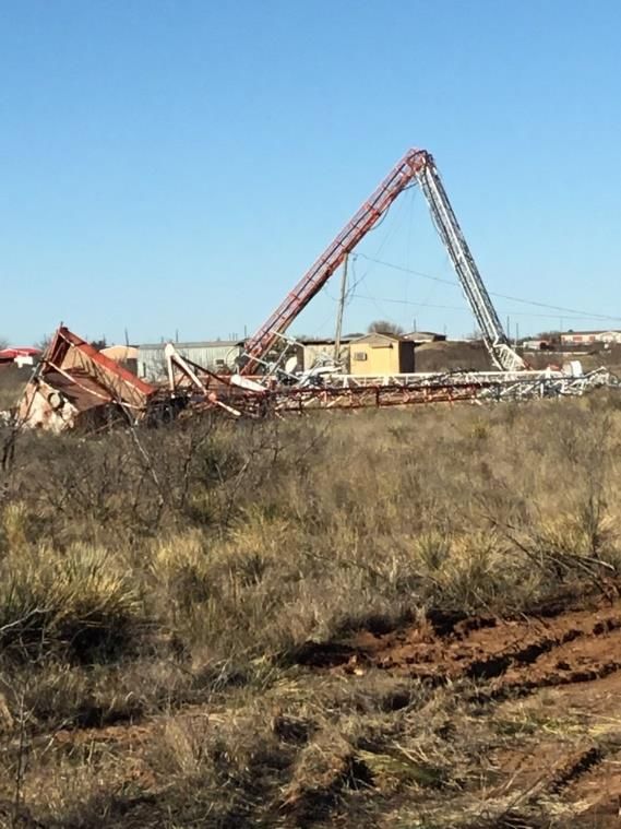
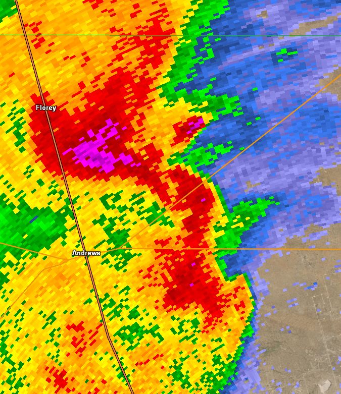
Severe Weather Impacts from Tuesday March 12, 2019
On Thursday, March 14, the National Weather Service in Midland conducted damage surveys at
3 locations that were impacted by severe weather on Tuesday evening and very early
Wednesday morning. The following are the determinations of those teams:

Andrews County – EF1 tornado
On Tuesday evening, a line of thunderstorms extended from near Levelland to near Seminole to
Andrews, and southward into Ector County to near Interstate 20. It was noted on radar
imagery the presence of small circulations called meso-vortices along this line, at various
locations. The following radar image from 9:48 pm CDT shows an example of a meso-vortex,
and the presence of paired front and rear inflow notches near the circulation.

This favorable setup was conducive for further development of this circulation. By 9:51 pm
CDT, as the storm crossed Highway 385 south of Andrews, the presence of a hook echo was
noted on radar. The radar imagery from 9:57 pm CDT shows an even more defined circulation
and hook echo along Highway 176 east of Andrews near Hamrick Loop. The survey team noted
that damage extended from along County Road 2601 from SE 650 Road to SE 1000 Road, and
then northeastward for approximately 3.5 miles to just north of Hamrick Loop. The survey
team also noted the majority of the damage coincided with the radar location of the meso-
circulation and hook echo. See the 9:51 pm CDT and 9:57 pm CDT radar images below.
Approximate tornado path
                                    9:55 CDT – 10:01 CDT

With the close correlation of the meso-circulation
with observed damage, the survey team determined
that damage was the result of a tornado. Damage to
outbuildings, residential structures, power poles, and
to a 300-foot transmission tower (image to the right)
suggest that the most significant damage is indicative
of a moderate to high end EF-1 tornado, with wind
speeds estimated at 80-100 mph. The tornado was
estimated to be 1/5 mile wide and traveled northeast
along a path approximately 3.5 miles long. Based on
radar and damage information, it is believed that the
tornado had a life span of 6 minutes, from
approximately 9:55 pm to 10:01 pm. The radar image
below, from 10:02 pm CDT, shows the pronounced
rear inflow notch, a weakened and occluding
circulation, and a newly developing circulation further
south.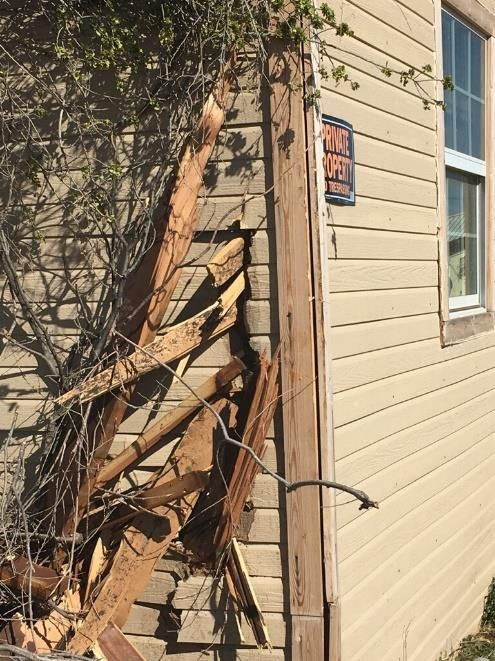
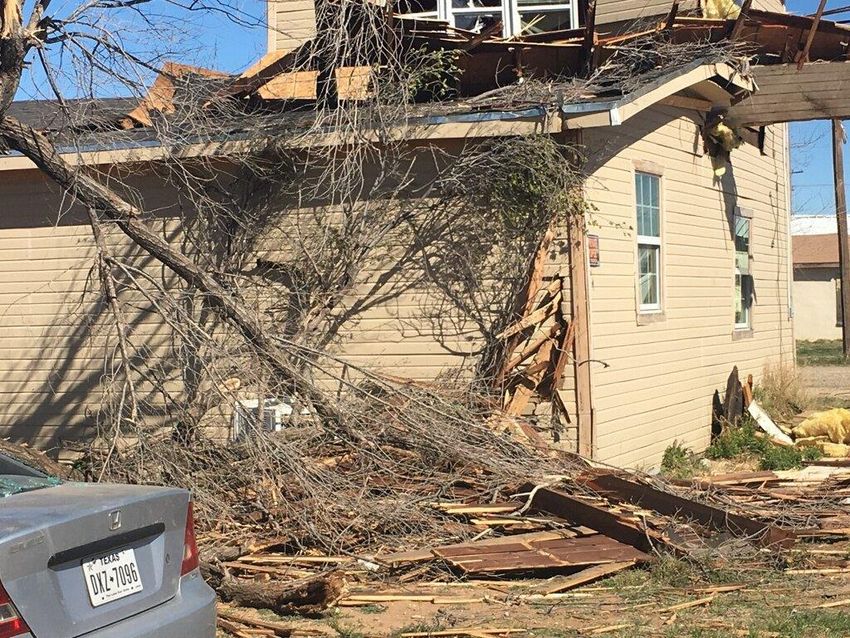
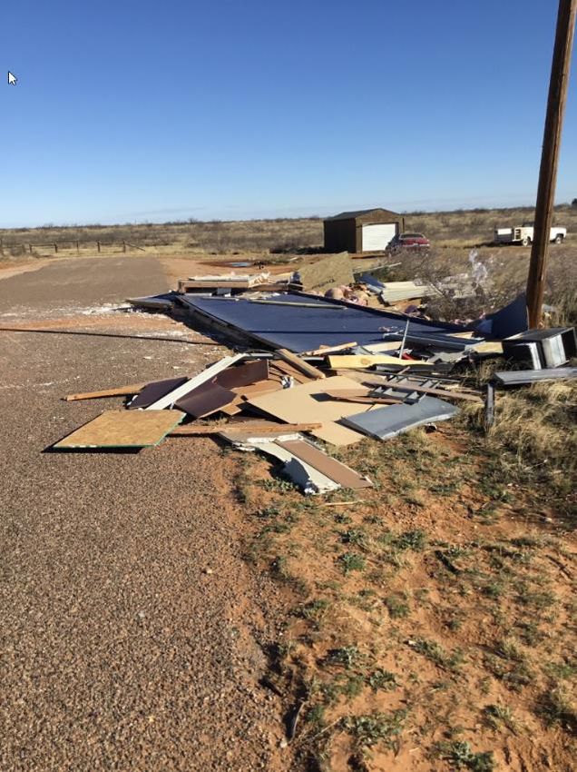
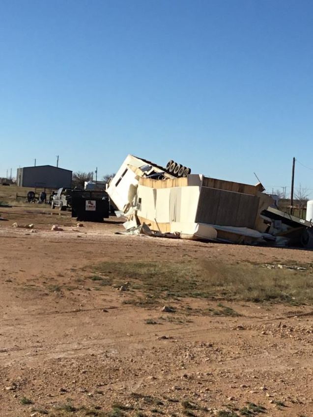
The image on the left shows a rolled manufactured trailer on SE
650 Rd. On the right is a destroyed outbuilding on SE 2601 Rd.
Scurry County – Straight-line winds

The line of thunderstorms that affected Andrews County continued to progress eastward across
area, reaching the city of Snyder around midnight. Unlike in Andrews County, the squall line did
not appear to exhibit meso-circulations. However, radar imagery does indicate an area of
enhanced reflectivity aloft. See the following image.

The survey team found the first indications of damage southwest of Snyder, just west of
Highway 351 and approximately 2 miles south of Highway 180. From this location, the swath of
damage extended northeastward across the city of Snyder for nearly 4 miles. The NWS survey
team found the damage to residential and business structures indicative of that produced by
winds of 85 to 100 mph. With no circulations evident, the event has been determined to be a
straight-line wind event. This weather event provided an excellent example of how significant
damage can occur without the presence of a tornado. The following image shows the swath of
damage for this event.
Approximate damage time -
12:00 am CDT – 12:07 am CDT

       The images above show debris blown from a local business
       at least a block away. Photos provided by Nathan Hines.
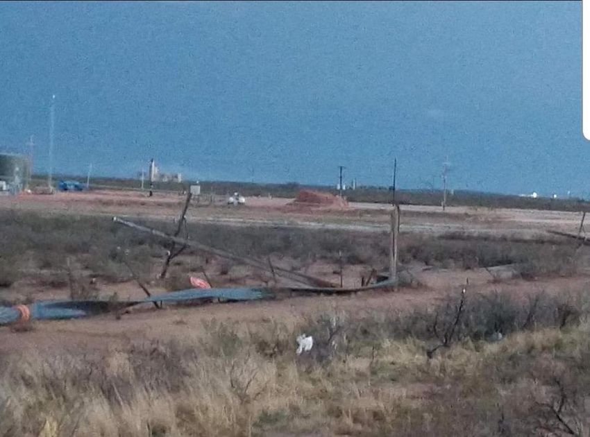
Eddy County -
EF2 Tornado,
Malaga, NM

Another NWS survey team
investigated a tornado that
was spotted south of the
community of Malaga in Eddy
County New Mexico. A
special thank you to Stacy
Gifford for allowing us to use
this image for the survey
writeup.

Based on radar imagery, the tornado appeared to develop just west of U.S. Highway 285,
approximately 2-3 miles south of Malaga and progressed northeast, possibly for a number of
miles. The exact path could not be determined during the survey due to the tornado’s
containment within private lands, without roads to access the potential path. With insufficient
ground information, the wooden electric power poles along Highway 285 were the only
damage indicators available to assess tornado intensity.

Based on radar
information, it
appears the Malaga
tornado formed at
approximately 6:08
pm MDT, just
southwest of the
power poles on
Highway 285 and
lifted around 6:30
pm MDT (nearly
crossing NM
Highway 128, 3
miles east of
junction with NM
Highway 31)
covering a distance
of 15 miles.

Damaged power poles (image to the
right, provided by Malaga Volunteer Fire
Dept.) along Highway 285 were located
slightly further south than was indicated
on radar, 3.75 miles to 4.05 miles south
of Malaga. This was used as a starting
point. With the tornado crossing the
power poles at approximately a 45-
degree angle, the width of the tornado
was estimated at 1/5 mile.
Approximately 10 power poles that
were damaged to some degree as the
tornado crossed Highway 285. Poles on
the north and south limits were snapped
at 1/2 to 2/3 height from the ground, while near the center-line of the tornado's path, poles
were snapped close to ground level. The observed damage is consistent with damage of an EF2
tornado, with winds estimated at approximately 112 mph.

Additional Damage
In addition to tornado and straight-line wind damage, there were several reports of large hail.
These reports included…

    •   2.75-inch hail (baseball size) 6-7 miles north of
        Pecos, TX.
    •   1.75-inch hail (golfball size) in Loving, NM and
        at Carlsbad Caverns.
    •   1.25-inch hail (half dollar size) in eastern Loving
        County, TX.
    •   1 inch hail was also reported in
        various locations across
        southeastern NM and West TX.
    •   Hail damage also occurred in
        Malaga, NM although it is
        unknown how large this hail
        was at the time.                                            Photo above provided by
                                                                    Carlsbad Caverns Park
                                                                    Ranger, David Hall.

                                                                    Photo to the left of
                                                                    Loving, NM hail provided
                                                                    by Wendell Malone.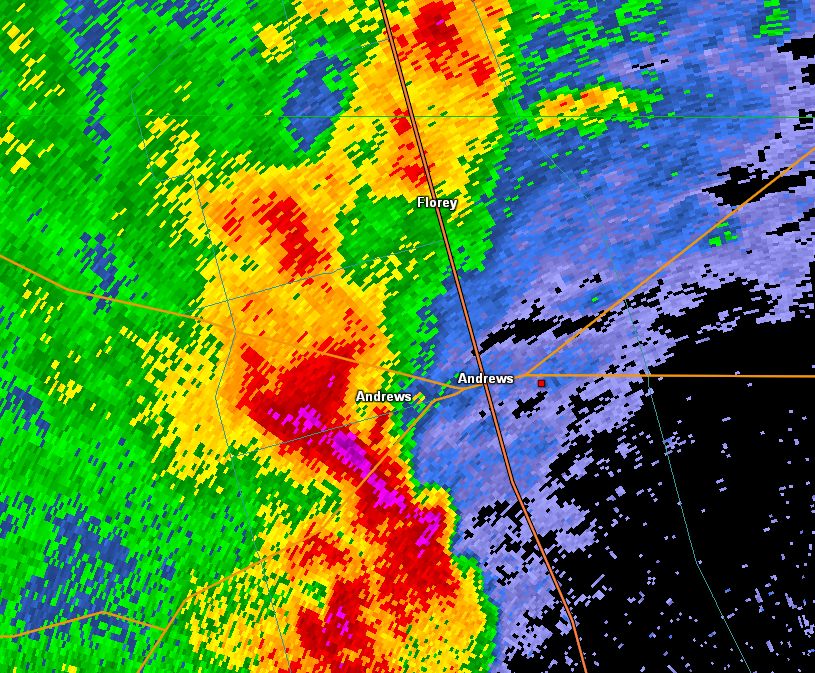
You can also read


