SD28 - From Estelline to SD15 Grading, Interim Surfacing - dot.sd ...
←
→
Page content transcription
If your browser does not render page correctly, please read the page content below
Public Information
P-PH 0028(36)355, Deuel County, PCN 04HM
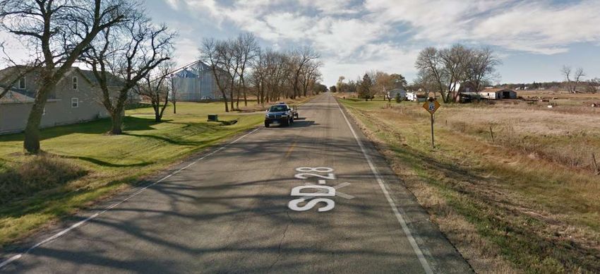
SD28 - From Estelline to SD15
Grading, Interim Surfacing
Public Meeting Information @
https://dot.sd.gov/projects-studies/projects/public-meetings
The South Dakota Department of Transportation provides services without regard to race, color,
gender, religion, national origin, age or disability, according to the provisions contained in SDCL
20-13, Title VI of the Civil Rights Act of 1964, the Rehabilitation Act of 1973, as amended, the
Americans With Disabilities Act of 1990 and Executive Order 12898, Federal Actions to Address
Environmental Justice in Minority Populations and Low-Income Populations, 1994.
Any person who has questions concerning this policy or who believes they have been
discriminated against should contact the Department’s Civil Rights Office at 605-773-3540.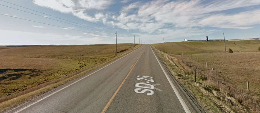
Public Meeting Purpose of the Meeting
SD Highway 28 Involve the public in the planning and
design process
From Estelline to SD15
Provide a Project Overview
Deuel County • Background Information
• Proposed Project
P-PH 0028(36)355 PCN 04HM • Project Schedule
Paul Nikolas, PE Gather Input and Comments
Road Design Engineer
March 2021
1 2
Project Limits Background Information
2025 Construction
Grading in 1943 and 1950
Peg Munkey Run Creek Structure in 2004 (Project
Exception)
Interstate Grading in 1971 (Project Exception)
Resurfaced in 2010
Sand Seal in 2013
3 4
1
Traffic Volumes Crash History
5 Year Period from 2015 to 2019
• 22 Reported Crashes
o 8 Animal Hit
o 6 Fixed Object
o 6 overturned
o 1 Angle-Intersection
From Estelline to I29 o 1 Ped
2019 Average Daily Traffic (ADT) = 1246 • 10 Injuries
2049 Projected ADT = 1619 • 0 Fatalities
12.2% Average Truck Traffic Rural Principal Arterial
From I29 to SD15 • Weighted Crash Rate = 1.57
2019 Average Daily Traffic (ADT) = 2169 • Statewide Weighted Crash Rate = 1.73 (Rural
2049 Projected ADT = 2364 Minor Arterial) (crashes per million vehicle miles of travel)
7.3% Average Truck Traffic
5 6
Highway Deficiencies Proposed Improvements
Poor Vertical Alignment
Limited Passing Opportunities
Narrow Shoulders – 1-2 feet
Increase Passing Opportunities
Existing No Passing = 2.57 miles (16 zones)
Proposed No Passing = 0.49 miles (2 zones)
Improve Intersection Sight Distance
Widen Roadway – 8 ft Shoulders
Replace Culverts
Interim Gravel Surfacing
New Asphalt Surfacing - 2026
7 8
2
Proposed Typical Section Right of Way (ROW)
Existing Width - 100 feet total
Purchase additional ROW - 150 feet
total
• May reduce width near residences
Temporary Easements as needed for
construction
See Handout
9 10
Access Management Encroachments
Encroachments - Private Property
Located Within the Public ROW
• Federal Highway Regulations Safety
Examples of Encroachments
• Signs
• Private Use (Parking)
To provide safe, efficient access to streets and • Landscaping Items
highways
Owners of Encroachments will be
Limit number of direct accesses to major roadways Notified by the Watertown Area Office
See Handout See Handout
11 12
3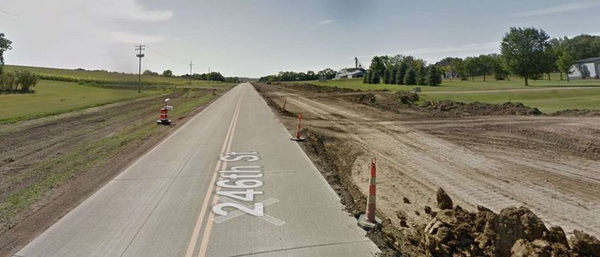
Utility Coordination Utility Coordination
Some Utilities may need to be Any Known Private Utilities?
relocated • Waterlines
• Drainfields
Utility Companies may negotiate • Septic Tanks
easements with landowners as needed
• Underground Storage Tanks
Ottertail Power HD Electric Coop • Underground Power Lines
Northwestern Energy Interstate Telecom Coop
Western Area Power Administration Brookings Deuel Water Contact SDDOT
Magellan Midstream Partners
Northern Border Pipeline
See Handout See Handout
13 14
Environmental, Social Environmental, Social
& Economic Concerns & Economic Concerns
This project is being developed in A cultural resources survey will be
conducted.
accordance with applicable State and
Federal environmental regulations. The project is being reviewed to determine
extent of wetland impacts.
National Environmental Policy Act of 1969 Endangered and Threatened Species:
(NEPA), as amended. Coordination has • Birds: Rufa Red Knot
been initiated with State & Federal resource • Mammals: Northern Long-Eared Bat
agencies. • Fish: Topeka Shiner
• Invertabrates: Dakota Skipper and Powershiek
Skipperling
See Handout See Handout
15 16
4
Construction Traffic Control Construction Detour
Detour Route
Road will be closed to through traffic during
construction
Local traffic and emergency vehicle access
will be maintained at all times
17 18
Landowner Meetings Tentative Project Schedule
Fall 2021 Dependent on Federal Funding
• Will be contacted by SDDOT to schedule
Landowner Meetings Fall 2021
appointment
Final Design 2022
Held with individual landowners adjacent
to the project ROW Acquisition 2022-2023
• Driveway location / widths Process
• Fence Construction 2025-2026
• Drainage
• Trees Estimated Grading Cost: $15.1 million
• Temporary Easements or ROW acquisition (Grading)
See Handout Final Surfacing is planned for 2026: $6.4
million
19 20
5
Option Borrow SD15 Reconstruction
From SD28
to Clear Lake
• Grading in
2024
• Asphalt
Surfacing in
• Borrow dirt needed for the project 2025
• Shave hill or dig pond
• 1 mile to project preferred
• If Interested Contact:
Jeff Steen SDDOT (605)626-7883
21 22
Questions or Comments
Please Submit Questions or Comments by
March 5, 2021 to:
Paul Nikolas
South Dakota Department of Transportation
5316 W 60th Street North
Sioux Falls, SD 57107
Paul.Nikolas@state.sd.us
Public Meeting Information @
https://dot.sd.gov/projects-studies/projects/public-meetings
23
6
Access Management
South Dakota’s Commitment to Safety
and Smart Investment Decisions in
Transportation
What is Access Management?
Access Management is the process of providing highway entrances only at locations where they
can be provided safely and efficiently.
Consider that each access point added to an undivided highway in an urban or suburban area
increases the annual crash rate by 11 to 18 percent on that highway segment. In rural areas,
each added access point increases the annual crash rate by 7 percent. Overall, driveway-access
crashes alone cost South Dakota approximately $36.5 million each year.
Each additional access point also contributes to congestion. The more driveways on a street the
more places where people are slowing, changing lanes and turning. A five-lane street can quickly
become a parking lot when there are many driveways in each block. When that happens, our
valuable transportation investments are wasted and access to adjacent businesses is restricted.
Controlled access facilities are segments of highway where either no access or only limited
access to the highway is allowed. Interstate highways are an example of controlled access
facilities where no access to the highway is allowed.
Good access depends on the following:
Limiting the number of conflict points (places where there is a potential for crashes)
Separating conflict areas
Reducing interference with through traffic
Providing good on-site circulation and storage
Properly spaced traffic signals
How does Access Management affect businesses?
Studies have shown that access management can provide three benefits to businesses adjacent
to highways:
Making sure that drivers can get in and out of businesses without being blocked by other traffic
Making the highway more attractive by reducing congestion
Extending the business’ effective service area by reducing travel times
These benefits come not from having many driveways, but by having well-planned, well-located,
high-capacity access points on the highway.
Even skeptical business owners have found that proper access management results in an
improved business climate, as customers can easily get in and out of their business
establishment.
For more information, please contact:
Joe Sestak
Access Management Engineer
1306 W. 31st
Yankton, SD 57078-9662
Phone: 605-668-2929
E-Mail: Joseph.Sestak@state.sd.us
Right of Way Information

Individual Landowner Meetings
During the early stages of the project’s design, SDDOT will schedule a meeting with individual
landowners having property adjacent to the project. See the following page for an explanation of
the landowner meeting.

Property Acquisition Offer
After the project construction plans have been prepared and the right of way limits have been
established, you may be contacted by an appraiser or negotiations agent to visit with you for that
portion of your property that is needed for construction of the project. Your property will be valued
and a written offer presented to you by a negotiating agent who will contact you for an appointment
to make the written offer.

Relocation Assistance Program
This program provides a variety of services and payments to owners and tenants who have
personal property affected by the right of way being acquired for the project.

Relocation payments are in addition to payments made for the real property being acquired. To
preserve your eligibility for payments, do not move property until you have received a written
relocation offer or have contacted John Keyes of the SDDOT Right of Way Program in Pierre.
His phone number is 605-773-3746. Anyone not satisfied with the relocation offer made to them
may appeal using the procedures described in the Relocation Brochure.

The landowner may be reimbursed for various fair and reasonable incidental expenses that may
be incurred during the transfer of property to the State depending on impacts to personal property
and qualifications.

Right of Way Information Brochures
Two brochures “Better Roads Brochure” and “Relocation Assistance Brochure” have been
prepared which explain the SDDOT’s Right of Way process. They provide information on your
rights regarding the acquisition of your property and the benefits available to you with regard to
the Relocation Assistance Program. These brochures are available at this meeting on the “Sign-
in” table. Please feel free to take a copy of each with you. These brochures are available at the
following SDDOT website: https://dot.sd.gov/inside-sddot/forms-publications/brochures

Individual Landowner
Meetings
The purpose of this meeting is to provide you with an opportunity to comment on various issues
pertaining to the design of this highway project as it relates to your property.
The following topics will be discussed at the meetings. Please note that not all topics will apply
to every property owner.
Permanent purchase and/or temporary use of your property.
Locations and widths of entrances to your property: The standard South Dakota Department
of Transportation (SDDOT) entrance-width for rural highways is 24 feet. Note: In general,
existing entrance widths along rural State Highways are 24 feet or smaller. A maximum width
of 40 feet is allowed at locations where it is deemed appropriate and necessary. Entrances
in urban areas can vary from 16 feet to 40 feet.
The goal of the SDDOT is to provide property owners located adjacent to the project with the
access they need, and at the same time, enhance highway safety and reduce project costs.
In some instances, the SDDOT may seek to combine duplicate entrances. For example, if
your property has two or three entrances to the same property that are located close to each
other, we would ask you to assess your current entrance needs and consider one entrance
location that will meet those needs.
Permanent fencing adjacent to the highway: SDDOT’s fencing policy allows for the
replacement of all disturbed fence with like-kind fence.
Two fence types are typically installed: Type 2: 4-strand barbed wire with 8-inch wire spacing,
and Type 6: 32-inch woven wire with 1 strand of barbed wire on the bottom and 2 strands of
barbed wire on the top. Page 12 of the “Better Roads Brochure” contains added discussion
of your permanent fencing options. This brochure will be available at the meeting.
Temporary fencing adjacent to the highway: Do you anticipate having livestock in pastures
located adjacent to the proposed project during highway construction activities?
Are you aware of any waterlines, drainfields, septic tanks, underground storage tanks,
underground power lines, etc. that are located adjacent to the project and may be impacted
by construction activities?
Are there any highway-related drainage or flooding problems located along your property or
elsewhere along this section of highway?
Possible sites for gravel and additional fill material: Are you aware of potential material
available for construction that might be located adjacent to the highway?
Temporary access during construction activities.
Please review your property and be prepared to discuss the above issues, as well as any other
issues that you feel are unique to your property. No offers to acquire property will be made at
these meetings since revisions to the plans may occur from your input.Encroachments in ROW
Federal Regulations (CFR 23.1) require that the State Highway Department (SDDOT) will be
responsible for preserving such ROW free of all public and private installation, facilities, and
encroachments.
No improvements shall be allowed to remain in the ROW unless they are deemed in the best
interest of the pubic and will not impair the highway or interfere with the free and safe flow of
traffic.
Encroachments are any private property or improvement in the public ROW that is not approved
by permit such as:
Landscaping Items
Fence
Signs
Buildings
Etc.
SDDOT Staff will survey the project limits to identify all encroachments. Prior to the project being
let to contract, landowners will be contacted by the SDDOT or City Government regarding how
each encroachment will be addressed or handled. If it is determined that the removal of an
encroachment is required, it will be the landowner’s responsibility to remove the encroachment.
For additional information, please contact:
Matt Brey
Area Engineer
SDDOT Watertown Area Office
5000 9th Ave SE
Watertown, SD 57201
Phone: 605-882-5166
E-Mail: Matt.Brey@State.SD.USEnvironmental, Social &
Economic Impacts
and
Advanced Utility
Coordination
Environmental, Social & Economic Impacts
Project will comply with all state and federal environmental regulations
No splitting of neighborhoods will occur as a result of this project
Project will be coordinated with the following state and federal agencies:
• SD Dept. of Environment & Natural Resources
• SD Dept. of Game, Fish & Parks
• US Fish & Wildlife Service
• State Historic Preservation Office
• US Forest Service
For additional information, please contact:
Joanne Hight
Environmental Engineer Manager
SDDOT Administration Office
700 E. Broadway Ave.
Pierre, SD 57501
Phone: 605-773-3721
E-Mail: Joanne.Hight@state.sd.us
Advanced Utility Coordination
Highway projects may require adjustments or relocation of existing utilities located along or
crossing the highway project. The SDDOT has an "Advanced Utility Coordinating Process" in
place that addresses all existing utility involvement. This process involves meeting with the
utility owner and project designers to review any conflicts and determine the most cost-
effective option of changing the design to avoid the existing utility or adjusting the utility. If the
utility is required to relocate, all replacement utility easement acquisition and relocation work
will be addressed and coordinated between the landowner and the utility company.
For additional information, please contact:
Bronson Blow
Utility Coordinator
SDDOT Road Design Office
700 E. Broadway Ave.
Pierre, SD 57501
Phone: 605-773-3433
E-Mail: Bronson.Blow@state.sd.usWetland Mitigation
Registry Form
Federal regulations require that unavoidable wetland impacts caused by highway construction be
mitigated. Examples of acceptable wetland mitigation include:
Wetland creation
Wetland restoration – plugging an existing, drained wetland
Wetland enhancement - adding buffer around an existing wetland.
The South Dakota Department of Transportation (SDDOT) may participate in the cost of wetland
creation/restoration/enhancement, if the wetland can be used to mitigate wetland impacts caused
by highway construction.
If you are interested in creating, restoring, or enhancing wetlands on your property, please
complete the attached form and mail to:
Joanne Hight
Environmental Engineer Manager
SDDOT Administration Office
700 E. Broadway Ave.
Pierre, SD 57501
Your name will be added to the SDDOT Wetland Mitigation Registry and a SDDOT
representative will contact you with additional information.
Yes, I am interested in assisting the SDDOT to mitigate wetland impacts by
creating or restoring wetlands on my property.
Name:
Address:
Phone #: Email:
Location of property: 1/4 of Section
Township , Range , County
Please note: Completion of this form does not commit either you or the SDDOT
to a mitigation project. It is a statement of interest only.Public Comments
P-PH 0028(36)355, Deuel County, PCN 04HM
SD28 - From Estelline to SD15
Grading, Interim Surfacing
Name: Date:
Address:
Telephone #: and/or Cell #:
Written testimony will be included in the meeting record.
Please submit comments by March 5, 2021 to:
Paul Nikolas
SDDOT Road Design Office
5316 W 60th Street North
Sioux Falls, SD 57107
E-Mail Address: Paul.Nikolas@state.sd.usYou can also read


