Pakenham East Precinct Structure Plan - July 2020 - Amazon AWS

Page created by Jonathan Holt
 
CONTINUE READING
Pakenham East Precinct Structure Plan - July 2020 - Amazon AWS
Pakenham East
Precinct Structure Plan

July 2020
Pakenham East Precinct Structure Plan - July 2020 - Amazon AWS
Contents
    1.0 INTRODUCTION                                                   5       3.4 Bushfire resilience, biodiversity, threatened species
                                                                                   and native vegetation retention                         31
           1.1   How to read this document                              7
                                                                                   3.4.1 Bushfire resilience                               31
           1.2 Land to which the PSP applies                            7          3.4.2 Biodiversity, threatened species and native
           1.3 Background information                                   7                vegetation retention                              31
           1.4 Pakenham East Infrastructure Contributions Plan (ICP)    7      3.5 Transport and movement                                  33
           1.5 Native Vegetation Precinct Plan                          7          3.5.1 Street network                                    33
                                                                                   3.5.2 Public transport                                  35
    2.0 OUTCOMES                                                       9           3.5.3 Walking and cycling                               35
                                                                               3.6 Integrated water management, utilities, energy
           2.1 Vision		                                                9
                                                                                   and sustainability                                      37
           2.2 Objectives		                                            10
                                                                                   3.6.1 Integrated water management                       37
           2.3 Summary land use budget                                 13          3.6.2 Utilities                                         41
                                                                                   3.6.3 Energy and sustainability                         43
    3.0 IMPLEMENTATION                                                 15
                                                                               3.7 Infrastructure Delivery and Staging                     43
           3.1 Image, character, topography, housing & heritage        15          3.7.1 Subdivision works by developers                   43
                 3.1.1   Image and character                           15          3.7.2 Development staging                               44
                 3.1.2   Topography                                    16      3.8 Precinct Infrastructure                                 45
                 3.1.3   Housing                                       16
                 3.1.4   Heritage                                      18   4.0 APPENDICES 	                                               50
           3.2 Local centres and employment                            19
                                                                               4.1 Appendix A: Parcel-specific land use budget             50
                 3.2.1 Local Town Centre                               21
                                                                               4.2 Appendix B: Local Town Centre (LTC) and
                 3.2.2 Local Convenience Centre                        23
                                                                                   Local Convenience Centre (LCC) Design Principles        54
           3.3 Open space, community facilities and education          25
                                                                               4.3 Appendix C: Street cross sections                       58
                 3.3.1 Open space                                      25
                                                                               4.4 Appendix D: Service placement guidelines                70
                 3.3.2 Community facilities and education              30
                                                                               4.5 Appendix E: Open space delivery guidelines              71

2   PAKENHAM EAST PRECINCT STRUCTURE PLAN - July 2020
PLANS                                                              FIGURES
Plan 1     Regional context                                    4   Figure 1   Pakenham East Local Town Centre (LTC) Concept Plan                   20
Plan 2     Precinct features                                   6   Figure 2   Northern Sports Reserve (SR-01) Concept Plan                         27
Plan 3     Future urban structure                              8   Figure 3   Southern Sports Reserve (SR-02) Concept Plan                         28
Plan 4     Land use budget                                    12   Figure 4   Hilltop Park (LP-01) Concept Plan                                    29
Plan 5     Image and character, housing & community           14
Plan 6     Open space                                        24
Plan 7     Road network                                      32
Plan 8     Public transport and path network                 34
Plan 9     Integrated water management                       36
Plan 10    Utilities                                         40
Plan 11    Precinct infrastructure                           42

TABLES
Table 1    Summary land use budget 	                         13
Table 2    Housing type by lot size                           18
Table 3    Housing delivery guide                             18
Table 4    Town centre hierarchy                             19
Table 5    Anticipated employment creation in the precinct   19
Table 6    Open space delivery guide                         26
Table 7    Water infrastructure                              39
Table 8    Precinct infrastructure                           45
Table 9    Parcel-specific land use budget                   50
Table 10   Servicing guidelines                              70

                                                                                                      PAKENHAM EAST PRECINCT STRUCTURE PLAN - July 2020   3
4   PAKENHAM EAST PRECINCT STRUCTURE PLAN - July 2020
1.0 INTRODUCTION
       The Pakenham East Precinct Structure Plan (the PSP) has been prepared by the                      The PSP is informed by:
       Victorian Planning Authority (VPA) and Cardinia Shire Council, in collaboration with
       government agencies, service authorities, major stakeholders and the community.
                                                                                                          •   the State and Local Planning Policy Framework set out in the Cardinia Planning
                                                                                                              Scheme
       The PSP is a long term strategic plan to guide urban development. It describes how                 •   the Precinct Structure Planning Guidelines (Growth Areas Authority, 2009)
       land is expected to be developed, what natural assets must be protected, and how and
       where services are planned to support this development.                                            •   the Growth Corridor Plans: Managing Melbourne’s Growth Areas (Growth Areas
                                                                                                              Authority, 2012)
       The PSP guides proposed development within the Pakenham East Precinct.
                                                                                                          •   Plan Melbourne 2017-2050 (Victorian Government, 2017)
       Generally, the PSP:                                                                                •   the State Environment Protection Policy (Waters of Victoria) made under the
       •   sets out plans to guide the delivery of quality urban environments in accordance                   provisions of the Environment Protection Act 1970
           with Victorian Government guidelines listed in this section
                                                                                                         The following documents have been developed in parallel with the PSP to inform and
       •   enables the transition of non-urban land to urban land                                        direct the future planning and development of the Precinct:

       •   sets the vision for how land should be developed and desired outcomes to be                    •   Pakenham East Precinct Structure Plan Background Report (December 2017).
           achieved
                                                                                                          •   Pakenham East Infrastructure Contributions Plan (ICP).
       •   outlines the projects required to ensure that future residents, visitors and workers
                                                                                                          •   Pakenham East Native Vegetation Precinct Plan (NVPP) (October 2018).
           within the Precinct will be provided with timely access to services, transport, jobs,
           open space and recreation facilities to support a healthy and affordable lifestyle             •   Guidelines for Slope Management in Subdivisions, Cardinia Shire Council
                                                                                                              (Dec 2017)
       •   sets out objectives, requirements and guidelines for land use and development

       •   provides Government agencies, the Council, developers, investors and local
           communities with greater certainty about future development

       •   addresses the requirements of the Environment Protection and Biodiversity
           Conservation Act 1999 (EPBC Act 1999)1

1   On 9 January 2018 a referral response was received from the Department of Environment and Energy under Part 7 of the Environment Protection and Biodiversity Conservation Act 1999
(EPBC Act). It deemed that Cardinia Amendment C234 (Pakenham East PSP) was not a controlled action, and therefore did not require further assessment and approval under the EPBC Act.
This decision relates only to the specific matters protected under Chapter 2 of the EPBC Act. A copy of the document is available at http://epbcnotices.environment.gov.au/referralslist/ with
reference number 2017/8069.

                                                                                                                                              PAKENHAM EAST PRECINCT STRUCTURE PLAN - July 2020   5
Plan 2 – Precinct features                                                                                                                                                                                                                                                                  1:20,000 @ A4
                                                                                                                                                                                                                                                                                     0          200          400         600         800        1,000m
                              Pakenham East Precinct Structure Plan

                                                                                                                                                                                                                                                                                                 precinct boundary
                                                                                                                                                                                                                                                                                                 urban growth boundary
                                                                                                                                                       Transmission easeme
                                                                                                                                                                               nt                                                                                                                existing urban area
                                                                                                                                                                                                                                                                                                 contours (5m interval)

                                                                                                                                                                                             H anco s G ully
                                                                                        ek
                                                                                    Cre
                                                                                                                                                                                                                                                                                                 land subject to inundation

                                                                                                                                                                                                   ck
                                                                                     p
                                                                                 Dee
                                                                                                                                                                                                                                                                                                 easement – gas pipelines

                                                                                                                                                                                                                                          TH
                                                                                                                                                                                                                                                                                                 gas transmission city gate

                                                                                                              ment

                                                                                                                                                                                                                                    AD NOR
                                                                                                                                      OAD
                                                                                                                                                                                                                                                                                                 easement – electricity transmission

                                                                                                             ease
                                                                                                                                                                                                                                                                                                 existing utility facility

                                                                                                                                    DORE R
                                                                                                            Gas

                                                                                                                                                                                                                                  RAT RO
                                                                                                                                                                                                                                                                                                 area of Aboriginal cultural heritage sensitivity
                                                                                                                                                                                                                                                                                                 further investigation for post-contact

                                                                                                                                                                                                                                MT. ARA
                                                                                                                                                                                                                                                                                                 archaeological assessment

                                                                                                                                                 Gas easement
                                                                                                                                                                                                                                                                                                 extractive industry interest area
                                                                                                                                                                                                                                                                                                 existing native vegetation
                                                                                                                                                  PRINCES HIGH
                                                                                                                                                                        WAY
                                                                                                                                                                                                                                                                                                 existing native trees
                                                                                                                                                                                                                                                                                                 proposed heritage overlay
                                                                                                                sement                                                                                                                                                                           slope 10.1–15%

                                                                                                                                                                                                                                                 SOUTH
                                                                                                                                                                                                                                                                                                 slope 15.1–20%
                                                                                                              Gas ea

                                                                                                                                                                                                                                                                                                 slope >20%

                                                                                                                                                                                                                                                      D
                                                                                                                                                                                                                                                                                                 existing roads

                                                                                                                                                                                                                                               AT ROA
                                                                                   reek

                                                                                                                                                                                                                                                                                                 watercourse
                                                                                 Deep C

                                                                                                                                                                                                                                                                                                 trees to be retained for landscape value

                                                                                                                                                                                                                                                   R
                                                                                                                                                                                                                                           MT. ARA
                                                                                                                                                                                                                                                                                                 prominent ridge line
                                                                   OAD

                 PAKENHAM                                                                                                                                                                                                                                                                        high point
                                                             RYAN R

                 GOLF CLUB                                               CANTY L
                                                                                  ANE                                                                                                                                                                                                            Melbourne Water Deep Creek fishway
                                                                                                                                                                                                                                                                                                 (existing)

                                                                                                                                                                                                                                                                                    NOTES:

                                                                                                                                                                                                                                      W LANE
                                                                                                                                                                                                               Hanco
                                                                                                                                                                                                                                                                                    •    Areas of Aboriginal cultural sensitivity is based on
                                                                                                                                                                      AY                                                                                                                 ACHRIS data April 2017.
                                                                                                                                                                    EW

                                                                                                                                                                                                                cks G
                                                                                                                                                                   E

                                                                                                                                                                                                                                   OAKVIE
                                                                                                                                                               FR                                                                                                                   •    Refer to plan 10 for high pressure gas transmission
                                                                                                                                                       C  ES                                                                                                                             pipeline notification zone.

                                                                                                                                                                                                                  ully
                                                                                                                                                 P RIN

                                                                                                                                                             ay line
                                                                                                                                                     Railw

     6            PAKENHAM EAST PRECINCT STRUCTURE PLAN - July 2020
© Victorian Planning Authority, 2020. The State of Victoria does not warrant the accuracy or completeness of information in this publication and any person using or relying upon such information does so on the basis that the State of Victoria shall bear no responsibility or liability whatsoever for any errors, faults, defects or omission in the information.
1.1   How to read this document                                                                      1.3   Background information
      The PSP guides land use and development where a planning permit is required under                    The Pakenham East PSP Background Report provides detailed background
      the Urban Growth Zone (UGZ) or another zone where that zone references this PSP.                     information relating to the precinct, including its local and metropolitan context, history,
                                                                                                           landform and topography, biodiversity, drainage, open space, transport infrastructure,
      A planning application and planning permit must implement the outcomes of the PSP.                   employment and community facilities. The report also summarises various background
      The outcomes are expressed as the vision and objectives.                                             technical studies that have informed the preparation of the PSP.

      Each element of the PSP contains requirements and guidelines as relevant.
                                                                                                     1.4   Pakenham East Infrastructure Contributions Plan
      Requirements must be adhered to in developing the land. Where they are not
      demonstrated in a permit application, requirements will usually be included as a
                                                                                                           (ICP)
      condition on a planning permit whether or not they take the same wording as in this                  The Pakenham East ICP sets out the requirements for development proponents to
      PSP. A requirement may include or reference a plan, table or figure in the PSP.                      contribute towards basic and essential infrastructure required to support development
                                                                                                           of the precinct. The ICP is a separate document incorporated into the Cardinia
      Guidelines express how discretion will be exercised by the responsible authority in
                                                                                                           Planning Scheme and implemented through Schedule 1 to Clause 45.11 of the
      certain matters that require a planning permit. If the responsible authority is satisfied
                                                                                                           Cardinia Planning Scheme. The ICP applies to the same land as the PSP.
      that an application for an alternative to a guideline implements the outcomes, the
      responsible authority may consider the alternative. A guideline may include or                       Table 8 - Precinct Infrastructure identifies the infrastructure projects that are funded
      reference a plan, table or figure in the PSP.                                                        through the ICP, and also those that are funded by the council, or state.

      Meeting these Requirements and Guidelines will implement the outcomes of the PSP.
                                                                                                     1.5   Native Vegetation Precinct Plan
      Conditions that must be included in a planning permit are outlined in Schedule 5 to the
      Urban Growth Zone (UGZ5) in the Cardinia Planning Scheme.                                            The Pakenham East Native Vegetation Precinct Plan (NVPP) has been prepared
                                                                                                           concurrently with the PSP. The NVPP identifies:
      Meeting these requirements, guidelines, and conditions will implement the vision of the PSP.
                                                                                                           •   native vegetation to be protected
      Development must also comply with other Acts and approvals where relevant, e.g. the                  •   native vegetation that can be removed, destroyed or lopped without a planning
      Heritage Act 2017 and the Aboriginal Heritage Act 2006 in the case of cultural heritage.                 permit
      Not every aspect of the land’s use and development is addressed in this PSP and a                    •   the offsets that must be sourced by landowners, as outlined in table 6 of the NVPP,
      responsible authority may manage development and issue permits as relevant under                         prior to the removal of native vegetation mapped for removal as per the NVPP
      its general discretion.
                                                                                                           The statutory basis for the NVPP is Clause 52.16 of the Cardinia Planning Scheme.

1.2   Land to which the PSP applies                                                                        The NVPP will be incorporated into the Cardinia Planning Scheme under Clause 81.01
                                                                                                           (Incorporated documents) and is a separate document to the Precinct Structure Plan.
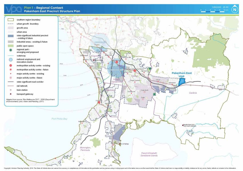
      The PSP covers 629.95 hectares located approximately 56km south east of the
      Melbourne CBD and applies to PSP1210 (Pakenham East). The precinct is bounded
      by properties that abut Seymour Road and is traversed by an electricity transmission
      line easement to the north, Mount Ararat Road to the east, the Princes Freeway to the
      south and Deep Creek and Ryan Road to the west. The precinct is illustrated on Plan 2
      - Precinct Features.

                                                                                                                                                   PAKENHAM EAST PRECINCT STRUCTURE PLAN - July 2020      7
Plan 3 – Future Urban Structure                                                                                                                                                                                                                                                             1:20,000 @ A4
                                                                                                                                                                                                                                                                                     0          200          400         600         800        1,000m
                              Pakenham East Precinct Structure Plan

                                                                                                                                                                                                                                                                                                      precinct boundary
                                                                                                                                                                                                                                                                                                      urban growth boundary
                                                                                                                                                         Electricity easeme
                                                                                                                                                                             nt                                                                                                                       walkable catchment boundary
                                                                                                                                                                                                                                                                                                      residential

                                                                                        ek

                                                                                                                                                                                               H a ncoc s G u lly
                                                                                    Cre
                                                                                                                                                                                                                                                                                                      local town centre

                                                                                                                                                                                                       k
                                                                                     p
                                                                                 Dee
                                                                                                                                                                                                                                                                                                      small local enterprise precinct

                                                                                                                                                                                                                                          TH
                                                                                                                                                                                                                                                                                                      local convenience centre

                                                                                                              ment

                                                                                                                                                                                                                                    AD NOR
                                                                                                                                      OAD
                                                                                                                                                                                                                                                                                                      proposed government school

                                                                                                             ease
                                                                                                                                                                                                                                                                                                      potential non-government school

                                                                                                                                    DORE R
                                                                                                           Gas

                                                                                                                                                                                                                                  RAT RO
                                                                                                                                                                                                                                                                                                      community facilities
                                                                                                                                                                                                                                                                                                      indoor recreation

                                                                                                                                                                                                                                MT. ARA
                                                                                                                                                                                                                                                                                                      credited open space
                                                                                                                                                 Gas easement                                                                                                                                         conservation area
                                                                                                                             CES H       IGHWAY
                                                                                                                         PRIN                                                                                                                                                                         utilities easement - electricity
                                                                                                                                                                                                                                                                                                      utilities easement – gas
                                                                                                                                                                                                                                                                                                      utilities – substation
                                                                                                                sement
                                                                                                                                                                                                                                                                                                      uncredited open space / drainage

                                                                                                                                                                                                                                                  SOUTH
                                                                                                                                                                                                                                                                                                      watercourse
                                                                                                              Gas ea

                                                                                                                                                                                                                                                                                                      existing arterial road reserve (Princes Hwy)

                                                                                                                                                                                                                                                      D
                                                                                                                                                                                                                                               AT ROA
                                                                                                                                                                                                                                                                                                      existing urban
                                                                                   reek

                                                                                                                                                                                                                                                                                                      primary arterial road
                                                                                 Deep C

                                                                                                                                                                                                                                                   R
                                                                                                                                                                                                                                                                                                      connector street – boulevard

                                                                                                                                                                                                                                           MT. ARA
                                                                D

                                                                                                                                                                                                                                                                                                      main street
                                                                    OA

                 PAKENHAM
                                                             RYAN R

                 GOLF CLUB                                                                                                                                                                                                                                                                            connector street
                                                                         CANTY                                                                                                                                                                                                                        local access street – level 1 & 2
                                                                                 LANE
                                                                                                                                                                                                                                                                                                      road bridge / culvert

                                                                                                                                                                                                                                         W LANE
                                                                                                                                                                                                                                                                                                      pedestrian / cyclist bridge

                                                                                                                                                                                                                    Hanco
                                                                                                                                                                      AY                                                                                                                              potential future sports reserve
                                                                                                                                                                    EW

                                                                                                                                                                                                                     cks G
                                                                                                                                                                 RE

                                                                                                                                                                                                                                   OAKVIE
                                                                                                                                                             F
                                                                                                                                                          ES                                                                                                                                          key interparcel connection
                                                                                                                                                     INC

                                                                                                                                                                                                                       ully
                                                                                                                                                 PR

                                                                                                                                                             ay line
                                                                                                                                                      Railw

     8            PAKENHAM EAST PRECINCT STRUCTURE PLAN - July 2020
© Victorian Planning Authority, 2020. The State of Victoria does not warrant the accuracy or completeness of information in this publication and any person using or relying upon such information does so on the basis that the State of Victoria shall bear no responsibility or liability whatsoever for any errors, faults, defects or omission in the information.
2.0 OUTCOMES
2.1   Vision
      The PSP outlines and manages the transition of the Pakenham East Precinct from an          Community hubs featuring schools, open space and community services will be
      historic agricultural area at the foothills of the Dandenong Ranges to a thriving part     developed on both sides of the Princes Highway to ensure that all neighbourhoods
      of Metropolitan Melbourne. The PSP recognises and enhances the local heritage,             within the precinct are provided with integrated local services, facilities and community
      landscape and environmental values of the area, while delivering a variety of housing      infrastructure. These will be linked via a strong public transport and path network.
      options and community and recreational facilities as a logical extension of the
      Pakenham Township.                                                                         The precinct will offer diverse and affordable housing choices. Along with more
                                                                                                 traditional detached housing that meet the housing density requirements of the PSP,
      The Precinct will offer its community distinct residential neighbourhoods that create a    higher density housing will be delivered within and surrounding the local town centre
      strong sense of place by ensuring development is safe and diverse, provides a high         and in close proximity to key bus routes, community hubs and the local convenience
      standard of urban design and amenity, while protecting environmentally sensitive           centre.
      areas.
                                                                                                 A diverse mix of retail and commercial jobs within the local town and convenience
      The PSP will embrace the natural landscape and cultural heritage features of the           centres, along with jobs within the community hubs and schools will support the
      precinct by protecting the ridgelines from inappropriate development, facilitating         delivery of a range of goods and services to support residents, workers, visitors and
      appropriately scaled and responsive development on steeper land, safeguarding views        businesses. Each centre will have its own distinct character, featuring places for people
      to and from hilltops, creating habitat corridors along Deep Creek and other waterways,     to gather.
      maintaining significant native vegetation and conserving and celebrating places of
      Aboriginal cultural heritage and post-contact cultural heritage.                           Sport and recreation reserves will attract visitors to the area by providing a range of
                                                                                                 activity options, all integrated with an extensive path and open space network.
      The PSP will also plan and respond to the existing built environment and land uses,
      by providing appropriate infrastructure to both the north and south of the Princes
      Highway, ensuring appropriate development along the interface to existing residential
      development to the west of the precinct, the farming land to the north and east, and the
      Princes Freeway to the south.

                                                                                                                                       PAKENHAM EAST PRECINCT STRUCTURE PLAN - July 2020     9
2.2 Objectives
            The development of the Pakenham East PSP is guided by the following objectives.                      OPEN SPACE, COMMUNITY FACILITIES & EDUCATION
                                                                                                                       Deliver an accessible network of local parks, sports reserves and neighbourhood
             OBJECTIVES                                                                                                community hubs across the precinct that provide access to social, education,
                                                                                                                 O14   recreation, and health services that include flexible, adaptable design to facilitate a
             IMAGE, CHARACTER, TOPOGRAPHY, HOUSING & HERITAGE                                                          variety of uses.
                     Ensure subdivision design, developments and public spaces are functional, safe,
             O1      aesthetically pleasing and incorporate environmentally sustainable design.                  O15
                                                                                                                       Provide walking, cycling and recreation opportunities by developing an open
                                                                                                                       space network along natural and constructed waterways, the high pressure gas
                     Ensure the landscape, waterways, topographical features and the historic/cultural                 transmission easements, streets, parks and public spaces.
             O2      characteristics of the precinct are utilised to guide the pattern of development, streets         Encourage the retention of native and non-native trees where they are located in
                     and public spaces.                                                                          O16   the public domain and open space network and provide for planting of canopy trees
                     Preserve view corridors to and from the ridgeline and ensure development does not                 along streets, pedestrian and cycle networks, open spaces and waterways.
             O3      detract from the visual amenity of the area.                                                      Provide for government and non-government school site(s) to meet the strategically
                     Capitalise on gateways and focal points for future landmarks, site, squares,
                                                                                                                 O17   justified need for government and non-government education in the area.
             O4      landscape features and/or public art.                                                             Ensure that the health, safety and wellbeing of residents are protected by delivering
                                                                                                                       a built environment of facilities and amenities that promote healthy lifestyle
                     Deliver approximately 7,229 new homes across the precinct and promote increased             O18
             O5      housing choice, affordability and density within a walkable catchment of high                     practices, social interaction, civic engagement, access to services and passive
                                                                                                                       surveillance.
                     amenity features and public transport.
                     Support the provision of social and community housing within a walkable catchment           BUSHFIRE RESILIENCE, BIODIVERSITY, THREATENED SPECIES & NATIVE
             O6      of high amenity features and public transport.                                              VEGETATION RETENTION
                     Provide a sensitive interface to existing adjoining development, cultural heritage, post          Plan for the long term conservation of significant flora and fauna species through
             O7      contact heritage and conservation areas.                                                    O19   protection of habitat, particularly along Deep Creek, Princes Highway road
                                                                                                                       reservation and within the local conservation reserve.
                     Protect, conserve and celebrate places of Aboriginal cultural heritage and post-
             O8                                                                                                        Ensure development responds to flora species and habitats in accordance with the
                     contact cultural heritage significance.
                                                                                                                 O20   Pakenham East Native Vegetation Precinct Plan.
                     Encourage a strong sense of place through the protection, enhancement and
             O9      interpretation of places of post-contact cultural heritage significance.                          Ensure that bushfire hazards are identified and that protection measures are

             TOWN CENTRES & EMPLOYMENT
                                                                                                                 O21   considered in the layout and design of the local street network, subdivisions and
                                                                                                                       buildings and works.
                     Strengthen the local economy by creating opportunities for new businesses (in
             O10     appropriate locations) and a variety of local jobs.
                                                                                                                 TRANSPORT & MOVEMENT
                                                                                                                       Provide a high-amenity, low speed and permeable local road network that prioritises
             O11     Maximise accessibility for all ages and abilities to employment areas and                   O22   community access and safety.
                     community facilities, with a particular focus on walking, cycling and public transport.
                                                                                                                       Establish an integrated and permeable transport network to encourage public
                     Deliver highly accessible, functional and vibrant local town and convenience
                     centres of appropriate scale, with high quality architecture, active street frontages,      O23   transport, walking and cycling, reduced car dependency and safety and connectivity
                                                                                                                       for all road users.
             O12     strong urban character and a sense of place that encourages social interaction and
                     community engagement through a diverse mix of uses, including retail, commercial,                 Promote public transport movements by providing a bus capable road network that
                     leisure, entertainment, health, community service activities and accommodation.             O24   integrates with Pakenham railway station, and services key destinations throughout
                                                                                                                       the precinct, particularly the local town centre.
                     Develop the Pakenham East Local Town Centre and Local Convenience Centre
             O13     with a civic focus and an ability to adapt and evolve with the surrounding residential
                     community and employment areas.

10   PAKENHAM EAST PRECINCT STRUCTURE PLAN - July 2020
INTEGRATED WATER MANAGEMENT, UTILITIES, ENERGY & SUSTAINABILITY
      Prepare for the impacts of climate change by encouraging resilient, environmentally
O25   sustainable design and development across the Precinct.
      Ensure sensitive land uses are minimised within the area subject to planning
O26   controls responding to the high pressure gas transmission pipeline and that
      construction is managed to minimise risk of any adverse impacts.
      Facilitate the use of renewable energy including the installation of localised
O27   systems.
      Deliver an integrated and resilient water management system that reduces reliance
      on reticulated potable water, increases the re-use of alternative water through
O28   stormwater harvesting, minimises flood risk, ensures the environmental health of
      waterways and bays, protects public health, delivers affordable essential water
      services and contributes towards a sustainable and green urban environment.

INFRASTRUCTURE DELIVERY & STAGING
      Deliver cohesive and integrated neighbourhoods by co-ordinating development with
O29   the delivery of key local and state infrastructure.

                                                                                            PAKENHAM EAST PRECINCT STRUCTURE PLAN - July 2020   11
Plan 4 - Land Use Budget                                                                                                                                                                                                                                                                                                                                                     @ A4
                                        Pakenham East Precinct Structure Plan

                                                                                                                                                                                                                                                                                                                                                                                   precinct boundary
                                                                                                                                                                                                                                                                                                                                                                                   arterial road - existing road reserve
                                                                                                                                                                                                                                                                                                                                                                                   non-arterial road - retained exisitng road reserve
                                                                                                                                                                                                                                                                                                                                                                                   arterial road - widening/intersection flaring
                                                                                                                                                                                                                                                                                                                                                                                   non-arterial road - widening/intersection flaring
                                                                                                                                                                                                                                                                                                                                                                                   proposed government school
                                                                                                                                                                                                                                                                                                                                                                                   potential non-government school
                                                                                                                                                                                                                                                                                                                                                                                   local community facility
                                                                                                                                                                                                                                                                                                                                                                                   local indoor recreation
                                                                                                                                                                                                                                                                                                                                                                                   conservation reserve
                                                                                                                                                                                                                                                                                                                                                                                   waterway & drainage reserve
                                                                                                                                                                                                                                                                                                                                                                                   utilities easement
                                                                                                                                                                                                                                                                                                                                                                                   local sports reserve
                                                                                                                                                                                                                                                                                                                                                                                   local park
                                                                                                                                                                                                                                                                                                                                                                                   utility sub-station / facility
                                                                                                                                                                                                                                                                                                                                                                                   electricity transmission easement
                                                                                                                                                                                                                                                                                                                                                                                   NDA - residential
                                                                                                                                                                                                                                                                                                                                                                                   NDA - employment
                                                                                                                                                                                                                                                                                                                                                                              07   parcel number & parcel identification number

     12                 PAKENHAM EAST PRECINCT STRUCTURE PLAN - July 2020
Copyright, Victorian Planning Authority, 2020. The State of Victoria does not warrant the accuracy or completeness of information in this publication and any person using or relying upon such information does so on the basis that the State of Victoria shall bear no responsibility or liability whatsoever for any errors, faults, defects or omission in the information.
2.3 Summary land use budget                                                                                              DESCRIPTION
                                                                                                                                                                                    PSP
                                                                                                                                                                                    % OF
                                                                                                                                                                      HECTARES                % OF NDA
                                                                                                                                                                                   TOTAL
    Table 1- Summary land use budget provides a summary of the land required for
    transport, community facilities, government education facilities and open space and        OPEN SPACE
    identifies the total amount of land available for development.                             Uncredited Open Space

                                                                                               Conservation Reserve                                                    2.98       0.47%       0.72%
    The Net Developable Area (NDA) is established by deducting the land requirements
    for transport, community facilities, public and private education facilities, open space   Waterway and Drainage Reserve                                           78.60      12.48%      18.96%
    (sports reserves and local parks), drainage corridors, conservation areas and other        Utilities Easements                                                     11.84      1.88%       2.86%
    encumbered land from the Total Precinct Area.
                                                                                               Sub-total Service Open Space                                            93.42      14.83%      22.53%
    The total area of the Precinct is 629.95 hectares. The NDA is 414.63 hectares meaning      Credited Open Space
    approximately 65.82% of the land within the PSP is available for development. The
                                                                                               Local Sports Reserve (Public purpose land)                              24.37      3.87%       5.88%
    residential NDA is 413.93 hectares, meaning approximately 65.71% of the land
    (inclusive of the local town centre and local convenience centre) within the precinct      Local Network Park (Public purpose land)                                19.92      3.16%       4.81%
    is available for residential development, while 0.70 hectares, or 0.11% of the land is     Sub-total Credited Open Space                                           44.29      7.03%       10.68%
    available for dedicated employment uses.
                                                                                               Total All Open Space                                                    137.71     21.86%      33.21%
    Based on the estimated residential development yield established in Table 3 - Housing      OTHER
    Delivery Guide, the Pakenham East PSP will generate approximately 7,229 dwellings
                                                                                               Utilities Sub-stations / facilities (acquired by relevant authority)    0.89       0.14%       0.21%
    to accommodate around 20,200-20,400 new local residents.
                                                                                               Electricity Transmission Easement                                       22.81      3.62%       5.50%
    Table 1 Summary land use budget
                                                                                               Sub-total                                                               23.70      3.76%       5.72%
                                                                            PSP                TOTAL NET DEVELOPABLE AREA - (NDA) HA                                  414.63      65.82%
                             DESCRIPTION                                    % OF
                                                             HECTARES               % OF NDA
                                                                           TOTAL
                                                                                               NET DEVELOPABLE AREA - RESIDENTIAL (NDAR) HA                           413.93      65.71%
     TOTAL PRECINCT AREA (ha)                                  629.95
                                                                                               NET DEVELOPABLE AREA - EMPLOYMENT (NDAE) HA                             0.70        0.11%
     TRANSPORT
     Arterial Road - Existing Road Reserve                     21.14      3.36%      5.10%
     Arterial Road - New / Widening / Intersection Flaring                                     Residential Local Open Space (expressed as % of NDAR)                  Hectares    % of NDAR
                                                               2.85       0.45%      0.69%
     (Public purpose land)
                                                                                               Local Sports Reserve (Public purpose land)                              24.37      5.89%
     Non-Arterial Road - Retained Existing Road Reserve        7.32       1.16%      1.77%
                                                                                               Local Network Park (Public purpose land)                                19.92      4.81%
     Sub-total Transport                                       31.31      5.0%       7.55%
                                                                                               Sub-total                                                               44.29      10.70%
     COMMUNITY & EDUCATION
     Government School                                         15.40      2.44%      3.71%     Employment Local Open Space (expressed as % of NDAE)                   Hectares    % of NDAE

     Potential Non-Government School                           3.50       0.56%      0.84%     Local Network Park (Public purpose land)                                    0.00     0.00%

     Local Community Facility (Public purpose land)            2.20       0.35%      0.53%     Sub-total                                                                   0.00     0.00%
     Local Indoor Recreation (Public purpose land)             1.50       0.24%      0.36%
     Sub-total Community & Education                           22.60      3.6%       5.5%

                                                                                                                                              PAKENHAM EAST PRECINCT STRUCTURE PLAN - July 2020          13
Plan 5 – Image, Character, Housing & Community                                                                                                                                                                                                                                              1:20,000 @ A4
                                                                                                                                                                                                                                                                                     0          200          400         600         800        1,000m
                              Pakenham East Precinct Structure Plan

                                                                                                                                                                                                                                                                                                      precinct boundary
                                                                                                                                                                                                                                                                                                      urban growth boundary
                                                                                                                                                         Electricity easeme
                                                                                                                                                                             nt                                                                                                                       walkable catchment boundary
                                                                                                                                                                                                                                                                                                      residential – within walkable catchment

                                                                                        ek

                                                                                                                                                                                               H a ncoc s G u lly
                                                                                    Cre
                                                                                                                                                                                                                                                                                                      residential – outside walkable catchment

                                                                                                                                                                                                       k
                                                                                     p
                                                                                 Dee
                                                                                                                                                                                                                                                                                                      interface housing area 1

                                                                                                                                                                                                                                          TH
                                                                                                                                                                                                                                                                                                      interface housing area 2

                                                                                                              ment

                                                                                                                                                                                                                                    AD NOR
                                                                                                                                      OAD
                                                                                                                                                                                                                                                                                                      residential within and north of the

                                                                                                             ease
                                                                                                                                                                                                                                                                                                      transmission easement

                                                                                                                                    DORE R
                                                                                                           Gas

                                                                                                                                                                                                                                  RAT RO
                                                                                                                                                                                                                                                                                                      Pakenham East local town centre &
                                                                                                                                                                                                                                                                                                      community hub
                                                                                                                                                                                                                                                                                                      east local community hub

                                                                                                                                                                                                                                MT. ARA
                                                                                                                                                                                                                                                                                                      west community hub
                                                                                                                                                 Gas easement
                                                                                                                                                                                                                                                                                                      south community hub
                                                                                                                             CES H       IGHWAY
                                                                                                                         PRIN                                                                                                                                                                         local convenience centre
                                                                                                                                                                                                                                                                                                      viewlines

                                                                                                                sement                                                                                                                                                                                gateway site
                                                                                                                                                                                                                                                                                                      potential treatment for gateway to

                                                                                                                                                                                                                                                  SOUTH
                                                                                                                                                                                                                                                                                                      Pakenham urban area
                                                                                                              Gas ea

                                                                                                                                                                                                                                                      D
                                                                                                                                                                                                                                               AT ROA
                                                                                    ek  re
                                                                                 Deep C

                                                                                                                                                                                                                                                   R
                                                                                                                                                                                                                                           MT. ARA
                                                                D   OA

                 PAKENHAM
                                                             RYAN R

                 GOLF CLUB
                                                                         CANTY
                                                                                 LANE

                                                                                                                                                                                                                                         W LANE
                                                                                                                                                                                                                    Hanco
                                                                                                                                                                      AY
                                                                                                                                                                    EW

                                                                                                                                                                                                                     cks G
                                                                                                                                                                 RE

                                                                                                                                                                                                                                   OAKVIE
                                                                                                                                                             F
                                                                                                                                                          ES
                                                                                                                                                     INC

                                                                                                                                                                                                                       ully
                                                                                                                                                 PR

                                                                                                                                                             ay line
                                                                                                                                                      Railw

    14            PAKENHAM EAST PRECINCT STRUCTURE PLAN - July 2020
© Victorian Planning Authority, 2020. The State of Victoria does not warrant the accuracy or completeness of information in this publication and any person using or relying upon such information does so on the basis that the State of Victoria shall bear no responsibility or liability whatsoever for any errors, faults, defects or omission in the information.
3.0 IMPLEMENTATION                                                                                            Street trees must be provided on both sides of all roads (including common
                                                                                                              property roads) and streets (excluding laneways) at regular intervals appropriate
                                                                                                              to tree size at maturity and not exceeding the average intervals below unless
      The following requirements and guidelines will enable future development and works                      otherwise agreed by the responsible authority:
      within the PSP to achieve key objectives identified in Section 2.                                R6     AVERAGE INTERVAL                TREE SIZE
                                                                                                              10 – 12 metres		                Medium trees (10 – 15 metre canopy)
3.1   Image, character, topography, housing & heritage                                                        12 – 15 metres		                Large trees (canopy larger than 15 metres)
                                                                                                              Trees to be retained for landscape values, as shown on Plan 2 – Precinct
3.1.1 Image and character                                                                                     Features, must be incorporated into the subdivision design and within the public
                                                                                                       R7     realm where practicable, unless otherwise approved by the responsible authority.

       REQUIREMENTS                                                                                    GUIDELINES
                 Subdivisions must be designed to maximise the number of lots with direct views               Street trees should be selected to provide local landmarks and definition to key
        R1       to landscape features and public open spaces.                                         G1     nodes, local town centre, park frontages and key intersections and entrances.
                                                                                                              Streets should be provided directly abutting waterway reserves, open spaces and
                 Trees in streets, civic spaces and the open space network must be:
                 • complementary to the existing native, indigenous and exotic species where
                                                                                                       G2     utilities easements to ensure houses generally face these public spaces.
                      appropriate                                                                             Appropriate landscape treatments should be provided throughout the precinct to
                 • larger species to facilitate continuous canopy cover, wherever space allows         G3     the satisfaction of the responsible authority, particularly in streetscapes and along
                                                                                                              creek and drainage waterway corridors.
                 • planted in modified and improved soil to support tree establishment
        R2       • appropriate in size to nature strips, nearby utilities and built form and                  Street networks within subdivisions should be designed to maximise the
                 • suitable for local conditions                                                       G4     number of connections and direct views to the open space network, to and from
                                                                                                              ridgelines, town centres and/or the closest community hub.
                 All public landscaped areas must be planted and designed to the satisfaction of
                 the responsible authority.                                                                   Buildings and structures should be designed to protect view lines to and from
                 Key built form treatments must be provided at gateway sites, as shown on Plan         G5     landscape features, utilise natural materials consistent with the surrounding
                                                                                                              environment and be screened by vegetation where required.
                 5 – Image, Character, Housing and Community to:
                 • establish an attractive and prominent entry to the precinct                                Subdivision design should incorporate natural and built design elements which
                 • positively address the Deep Creek corridor, Princes Highway corridor and            G6     respond to topography and local heritage to assist in place making and achieve a
        R3           views to the ridgeline                                                                   “sense of place”.
                 • present a strong sense of address to the corner of Princes Highway and the                 Built form on corner lots should provide a positive address to both frontages. This
                     North-South Connector Street to create a high quality entry into the Local
                     Town Centre
                                                                                                       G7     can be achieved through the appropriate use of glazing and other architectural
                                                                                                              treatments.
                 All public landscape areas must be consistent with the Cardinia Shire Council                Built form should add to the precinct character by providing an attractive street
                 Developer Landscape Guidelines, January 2017 (or as amended) and:                     G8     address that encourages passive surveillance and visual interest.
                 • Comprise a mix of native flowering and non-flowering species, both                         Sites in prominent locations, such as the Local Town Centre and major
                      indigenous, native and exotic, and other species as appropriate to the                  intersections, should be developed to respond to their strategic location and
       R4             location and design. Edible planting (e.g. fruits, nuts, herbs and bush foods)
                                                                                                       G9     preferably have greater height, density and architectural quality (refer Appendix
                      are encouraged.                                                                         B- Local Town Centre (LTC) and Local Convenience Centre (LCC) Design
                 • Be planted in modified and improved soil suitable to the location conditions               Principles).
                      required to support tree longevity.
                                                                                                              A consistent suite of street lighting and street furniture should be used across
                 If required by the responsible authority, the inclusion of public art and
                 complementary infrastructure for public creative and cultural activities in
                                                                                                       G10    neighbourhoods, appropriate to the type and role of street or public space unless
                                                                                                              otherwise approved by the responsible authority.
                 open space areas in key nodes of district, municipal and regional open space
        R5       and primary paths and trails must be consistent with Cardinia Shire Council
                 Developer Landscape Guidelines January 2017 (or as amended) and Cardinia
                 Shire Council Public Art Policy 2017 (or as amended).

                                                                                                                                           PAKENHAM EAST PRECINCT STRUCTURE PLAN - July 2020          15
3.1.2 Topography                                                                                         3.1.3 Housing

             REQUIREMENTS                                                                                           REQUIREMENTS
                                                                                                                              Residential subdivision of land within the Precinct boundary shown on Plan 3
                       Any retaining walls in public places and within lots (with the exception of those
                                                                                                                              - Future Urban Structure, must create lots suitable for the delivery of standard,
                       which are part of a building) must be:
                                                                                                                              medium or higher density housing as outlined in Table 2 – Housing type by lot
                       • no more than 1.0 metre in height between a dwelling and a street or where                            size and Table 3 - Housing Delivery Guide, and:
                           the retaining wall is constructed parallel to a street or public space
                                                                                                                              • Achieve a minimum average density of 22 dwellings per net developable
                       • set back at least 1.0 metre from any building envelope                                                   hectare inside the walkable catchment.
                       • staggered, with a minimum 1.0 metre distance between each stagger to
                           allow for the inclusion of landscaping, where cutting and filling is deeper than
                                                                                                                    R9        • Achieve an average density of 17 dwellings per net developable hectare
                                                                                                                                  outside the walkable catchment (excluding interface housing areas and
              R8           1.0 metre
                       • positioned so that associated drainage infrastructure and structural
                                                                                                                                  within and north of the transmission easement shown on Plan 5).
                                                                                                                              Applications for subdivision that can demonstrate how target densities can be
                           foundations are fully located within the same lot
                                                                                                                              achieved over time, to the satisfaction of the responsible authority, shall be
                       • no more than 2.0 metres in overall height for a staggered retaining wall to                          considered.
                           avoid unreasonable overshadowing of secluded private open space and
                           habitable room windows                                                                             Subdivision applications must include indicative building envelopes for any lots
                                                                                                                              identified for medium density, high density, or integrated housing that suitably
                       Unless otherwise approved by the responsible authority as part of a slope
                                                                                                                              demonstrate:
                       management plan.
                                                                                                                              • active interfaces with adjacent streets, open spaces and waterways
             GUIDELINES                                                                                            R10        • safe and effective vehicle and pedestrian access and internal circulation, as
                       The street network should be designed to respond to the natural land form,                                 appropriate
             G11       avoiding the need for significant cut-and-fill.                                                        • servicing arrangements

                       Subdivision and dwellings should be designed to respond to the natural                                 Lots and dwellings, where possible must front or side:
                       topography of the site, avoiding the use of retaining walls and excessive cut-and-                     • drainage channels and waterways
                       fill where possible. This may include:                                                                 • open space and utilities reserves
             G12       • split level designs                                                                        R11       • arterial roads and connector streets
                       • large and wider lot sizes                                                                            The siding of lots to waterways, open space and primary street frontages must
                       • single and double storey components that respond to the slope of the land                            be kept to a minimum.
                       Where streets are aligned up/down a slope identified on Plan 2 – Precinct                              Subdivision of land within the Interface Housing Area 1 & 2 , as identified in Plan
             G13       Features as greater than 10%, crossovers should be located on the downhill side
                       of the lot.
                                                                                                                              5 – Image, Character, Housing and Community, to minimise amenity impacts on
                                                                                                                              surrounding areas, must:
                       Any proposed works on a site, including but not limited to the installation of                         • be a single dwelling on a lot
             G14       retaining walls, should be designed to minimise impact on the amenity of adjoining                     • have a minimum front setback of 8 metres
                       lots and consider the implication on the drainage requirements for all lots.                 R12       • have a minimum side setback of 1 metre for the first 3 metres of the building
                                                                                                                                  envelope
                                                                                                                              • have no front or side fences greater than 1.2 metres in height within the first
                                                                                                                                  3 metres of the lot
                                                                                                                              • provide wider lot frontages

16   PAKENHAM EAST PRECINCT STRUCTURE PLAN - July 2020
Subdivision of land in Interface Housing Area 2 as shown in Plan 5 – Image,                 Rear loaded lots suitable for town houses and terrace housing should be
       Character, Housing and Community must provide:                                              provided where housing directly fronts open space or where it is considered
       • a building envelope to maximise the retention of native and non-native
                                                                                             G20   advantageous to limit vehicle cross overs, to the satisfaction of the responsible
          vegetation and respond to the environmental sensitivity of the area (Deep                authority.
          Creek and Canty Lane)                                                                    Double storey and rear loaded dwellings should be provided on key streets and
R13    • nominal vehicle crossings/driveways to access and egress from the site              G21   boulevards to provide a strong built form presence.
       • demonstration that the application will achieve an average minimum lot size               Where rear access lanes are provided, they should:
          of 800m2
                                                                                                   • be linear with no T-intersection or bends
       • fencing that is low scale and facilitates wildlife permeability
       Where a street frontage to the open space network (including waterway reserve,
                                                                                             G22   • ensure garages and rear fences are constructed to the edge of the road
                                                                                                      reserve of the laneway (with zero setback)
       open space or utilities easement functioning as open space), is not provided, lots          • be a maximum paved width of 6 metres
       must:
                                                                                                   Environmentally Sustainable Development principles should be explored and
       • directly front the open space and allow for vehicular access via a rear
                                                                                                   encouraged in all development, such as the inclusion of, but not limited to:
           laneway
R14    • allow for a primary point of access from the footpath of a minimum width of               • material re-use and recycling
           1.5 metres along the frontage of the lot                                                • use of materials with reduced embodied energy
       Unless otherwise approved as part of a slope management plan by the                   G23   • electrical self-generation, car charge schemes, smart grids and battery
       responsible authority.                                                                         storage
                                                                                                   • use of tools such as Built Environment Sustainability Scorecard (BESS)
GUIDELINES                                                                                            Measures that reduce the urban heat island effect
       Residential subdivision should deliver a broad range of lot sizes capable of                • waste management initiatives
G15    accommodating a variety of housing types, as described in Table 2 - Housing
       type by lot size.
                                                                                                   Affordable housing, including social and community housing, should be located
                                                                                                   within a walkable catchment of high amenity features and public transport.
       Specialised housing forms such as retirement living or aged care facilities should,
                                                                                             G24   Homes specifically designed to accommodate working from home should also be
       subject to limitations imposed by utilities                                                 located in such areas.
       • be integrated into the wider urban structure                                              An existing and/or original dwelling should not be retained on a lot greater than
       • be built with building frontage to the public street network
                                                                                             G25   1000 square metres unless otherwise approved by the responsible authority.
       • be located in close proximity to town centres and community hubs
G16    • be accessible by public and active transport
                                                                                                   Subdivision of residential land outside the walkable catchment boundary shown
                                                                                                   on Plan 3 – Future Urban Structure, should achieve the average density outlined
       • not present a barrier to movement from adjoining development to key hubs                  in Table 3 – Housing delivery guide. Applications for residential subdivision
           and destinations or active and public transport routes                            G26   that can demonstrate how target densities can be achieved over time, to the
                                                                                                   satisfaction of the responsible authority, will be considered. Lot sizes greater
       • be located outside the pipeline notification zone as identified on Plan 10 –
           Utilities                                                                               than 0.2ha should be considered on land within and north of the transmission
                                                                                                   easement as a response to local constraints.
       Residential development should avoid high fences, blank walls and prominent
G17    (including separated) garages that face streets and public spaces, and ensure
       garages are not the dominant front façade element across the width of a lot.
       Subdivision of land should maximise north-south orientation of street blocks to
G18    facilitate appropriate solar orientation of lots apart from where areas of steep
       slope prevent north-south orientation.
       Different lot arrangements/configuration should be investigated to provide
       appropriate built form along sensitive interfaces and to allow for tree retention
G19    where conventional configurations do not support this, to the satisfaction of the
       responsible authority.

                                                                                                                               PAKENHAM EAST PRECINCT STRUCTURE PLAN - July 2020       17
Table 2 Housing type by lot size                                                                  3.1.4 Heritage
            The following table provides an example of the typical range of lot sizes that supports the
            delivery of a broad range of housing types.
                                                                                                                    REQUIREMENTS
                                                                         TYPICAL LOT SIZE (M2)                             Any subdivision or development of land adjoining a heritage site identified under
                     INDICATIVE HOUSING TYPE                                                                               the Heritage Overlay in the Cardinia Planning Scheme and/or Aboriginal cultural
                                                               LESS THAN       BETWEEN        MORE THAN                    heritage significance must have regard to the cultural/heritage significance of
                                                                 300 m2        301-600 m2      >600 m2              R15    the site and provide a sensitive interface with appropriate scaled development,
             Small lot housing including townhouses,                                                                       proportion and materials, to the satisfaction of the responsible authority.
             terraces and attached, semi-detached and                                                                     Historical interpretative signage must be delivered in LP-06 as identified on Plan
             detached houses, including shop-top                                                                           6 – Open Space to portray historical information of the historical significance
             Dual occupancies, duplexes                                                           
                                                                                                                    R16    of the precinct, particularly the site that existed at 140 Ryan Rd, Pakenham,
                                                                                                                           informing residents and visitors about the rich history of Cardinia Shire.
             Detached houses                                                                                      GUIDELINES
             Multi-unit housing sites including terraces,                                                                  Development of land subject to the Heritage Overlay in the Cardinia Planning
                                                                                                                         Scheme should ensure that the heritage place is recognised within, and well
             row houses and villas
                                                                                                                    G27    integrated with, the subdivision.
             Stacked housing including apartments, shop-                                                                   Heritage place(s) should be appropriately secured against damage as a result of
                                                                                                                          works, deterioration, and the effects of weather, trespassing or vandalism.
             top living and walk-up flats
                                                                                                                           Proponents undertaking development of land identified on the Victorian
                                                                                                                           Aboriginal Heritage Register, and/or as an area of Aboriginal cultural heritage
            Note: Lots less than 300m can be created on a medium density superlot.
                                       2
                                                                                                                           sensitivity identified on Plan 2 – Precinct Features, should liaise with the

            Table 3 Housing delivery guide
                                                                                                                    G28    designated Registered Aboriginal Party (or Aboriginal Victoria and Traditional
                                                                                                                           Owner Groups in its absence) to ascertain whether heritage interpretation is
                                                                                                                           appropriate in these identified locations, and how the heritage site(s) should be
                                                                                                                           incorporated into the design of the subdivision.
                                                             NDAR (HA) &
                                                                                                                           Adaptive reuse of the heritage listed places may be appropriate if it is
                          RESIDENTIAL TYPE
                                                             ELECTRICTY
                                                            TRANSMISSION
                                                                               DWELLINGS /
                                                                                 NDHA
                                                                                                DWELLINGS           G29    demonstrated that it will contribute to their long term conservation.
                                                              EASEMENT                                                     Encourage further investigation of post-contact archaeological artefacts should
                                                                                                                    G30    be undertaken within the areas of assessment as shown on Plan 2 – Precinct
                                                                                                                           Features.
             Residential within walkable catchment              93.54            22.00             2058

             Residential outside walkable catchment            274.26            17.00             4662
             Residential outside walkable catchment -
             Interface housing area 1 (except within and        13.25            12.00             159
             around the transmission easement)
             Residential outside walkable catchment -
                                                                11.70             9.50              111
             Interface housing area 2
             Residential outside walkable catchment
             within and north of the electricity                37.27             2.80             104
             transmission easement
             Residential within Town Centre                     6.72             20.00             134

             Total                                             436.74            16.55            7,229

             Anticipated population @ 2.8 persons per dwelling                                       20,242

             Anticipated population @ 3.1 persons per dwelling                                       22,411

18   PAKENHAM EAST PRECINCT STRUCTURE PLAN - July 2020
The Pakenham East Precinct Structure Plan provides for a local town centre and a
3.2 Local centres and employment                                                                 local convenience centre shown on Plan 3 - Future Urban Structure and detailed in
                                                                                                 Table 4 - Town centre hierarchy.
    The local town and convenience centres in Pakenham East will be local destinations
    that provide retail, services, lifestyle, leisure and commercial needs for the surrounding   Table 4 Town centre hierarchy
    residential catchment.
                                                                                                    TOWN CENTRE            SHOP FLOOR           LOCATION AND ANCILLARY USES
    The location of the local town centre will maximise the exposure of the site to passing                                  SPACE
    traffic on the Princes Highway, and both centres will be easily accessible from connector
                                                                                                  Local Town Centre         11,000m2       Located in the east of the Precinct.
    and local access streets without compromising the viability of the existing local centres
                                                                                                                                           Expected to service the higher order
    located in Windermere Boulevard, Cardinia Lakes, to the west of the Precinct.
                                                                                                                                           retail and community needs of future
    Each centre will have a distinctive character and sense of place by addressing the                                                     residents as well as providing opportunities
    adjacent landscaped waterway corridor and local road network. The public realm will                                                    for entertainment, employment and
    be a pedestrian priority area with links to surrounding land uses visually and physically.                                             accommodation.
                                                                                                  Local Convenience         3,600 m2       Located opposite a proposed government
    It is envisaged that shoppers, workers and residents will be able to:                         Centre                                   primary school in the south west of the
    •   access the town centre or convenience centre from the connector and local access                                                   precinct to service the convenience needs
        streets through pedestrian focused environs                                                                                        of the local residents and people visiting
                                                                                                                                           the school and sporting reserve. Cafes and
    •   access the town centre from the Hancock’s Gully corridor and the local                                                             small offices encouraged. Residential and
        convenience centre from Canty Lane and the boulevard connector road                                                                office uses are encouraged on upper floors.
    •   recreate and enjoy the amenity provided by the public realm within the town
        centre with Hancock’s Gully and the local convenience centre with Canty Lane,            Table 5 Anticipated employment creation in the precinct
        conservation reserve and the boulevard connector road
                                                                                                                                                              QUANTITY       ESTIMATED
    •   congregate and linger in the public realm and surrounding open space                               LAND USE            MEASURE             JOBS
                                                                                                                                                               IN PSP          JOBS

    The design philosophy of the local town centre and convenience centre will:                   Community centre           Jobs per centre      10.00          3              30

    •   respond to the existing landscape and environmental features                              Primary school             Jobs per school      40.00          3              120

    •   respond to the pedestrian, bicycle and vehicular movement hierarchy                       Secondary school           Jobs per school      90.00          1              90

    •   create an active, fine grain main street centre                                           Retail                      Jobs per m2         0.03         14,600           438

    •   enhance the public realm by having the local town centre address the Hancock’s            Commercial/mixed use        Jobs per m2         0.05         5,600            280
        Gully waterway corridor and the local convenience centre address Canty Lane and
                                                                                                  Small local enterprise    Jobs per precinct
        the conversation reserve                                                                                                                 117.00          1              117
                                                                                                  precinct
    •   provide a small local enterprise precinct within the Local Town Centre to encourage       Home-based business       Jobs per dwelling     0.05         7,229            361
        lower-cost, flexible space for a range of localised enterprises, to ensure these
        centres have an ability to adapt and evolve over time                                     Total                                                                        1,436
    •   activate the frontages that address the connector boulevard and the Hancock’s
        Gully waterway corridor and conservation reserve

    •   demonstrate best practice environmentally sustainable design

                                                                                                                                       PAKENHAM EAST PRECINCT STRUCTURE PLAN - July 2020   19
Figure 1 - Pakenham East Local Town Centre (LTC) Concept Plan                                                                                                                                                                                                                                                         SCALE 1:3,000
                                Pakenham East Precinct Structure Plan                                                                                                                                                                                                                                    0            30           60           90           120           150

                                                                                                                                                                                                                                                                                                                                anchor retail
                                                                                                                                                                                                                                                                                                                                commercial
                                                                                                                                           PRINCES HIGH                                                                                                                                                                         mix of commercial uses (residential over)
                                                                                                                                                               WAY
                                                                                                                                                                                                                                                                                                                                small local enterprises
                                                                                                                                                                                                                                                                                                                                specialty retail
                                                                                                                                                                                                                                                                                                                                community facility
                                                                                                                                                                                                                                                                                                                               car parking
                                                                                                                                                                                                                                                                                                                                potential non-govt school
                                                                                                                                                                                                                                                                                                                                local park
                                            RESIDENTIAL                                                                                                                                                                                                                                                                         constructed waterway
                                                                                                                                                                                                                                                                                                                                medium density residential
                                                                                                                                                                                                                                                                                                                                residential
                                                                                                                                      CAR PARKING
                                                                                                                                                                                                                                                                                                                               prominent site/key built form
                                                                                          AD

                                                                                                                                                                                                                                                                                                                                plaza
                                                                                        RO
                                                                                     OR

                                                                                                                                                                                                                                                                                                                               high quality public realm treatment
                                                                                   CT
                                                                                 NE

                                                                                                                                                                                                                                                                                                                                active frontage
                                                                                N
                                                                             CO

                                                                                                                                                                                                                                                                                                                                arterial road (6 lanes)

                                                                                                                                                                                                                                                                                                                               connector street
                                                                                                                                                                                                                                                                                                                                connector street - boulevard
                                                                                                                                                                                                                                                                                                                                feature main street
                                                                                                                                                                                                                                                                                                                                local access street

                                                                                                                                                                                                 LOCAL
                                                                                                                                                                                                                                                                                                                                indicative pedestrian priority location
                                                                                                                                                                                                                                                                                                                                (e.g. pavement treatment)
                                                                                                                                                                                                   PARK                                                                                                                         loading dock
                                                                                                                                                                                                                                                                                                                                signalised intersection
                                                                                                                                                                                                                                                                                                                                left-in left-out
                              LOCAL
                               PARK                                                                                                                                                                                                                                                                                             bike route

                                                                                                            CAR PARKING                                                                                                                                                                                                        car park access
                                                       R ROAD

                                                                                                                                                               COMMUNITY                                                                                                                                                        view line
                                                                                                                                                                 FACILITY                                                                                                                                                       trees to be retained
                                                           TO
                                                    CONNEC

                                                                                                                                                                                                                                                                                                               Note:
                                                                                                                                                                                                                                                                                                               • This concept plan provides an indicative example of
                                                                                                                                                                                                                                                         POTENTIAL NON-GOVT                                    how the local town centre could be developed
                                                                                                                                                                                                                                                               SCHOOL                                          • Trees to be retained within private land or road
                                                                                                                                                                                                                                                                                                               reserve
                                                                                                                                                                                                                                                                                                               • Intersection design to the satisfaction of the
                                                                                                                                                                                                                                                                                                               responsible authority
                                                                                                             RESIDENTIAL

    20              PAKENHAM EAST PRECINCT STRUCTURE PLAN - July 2020
Copyright, Victorian Planning Authority, 2018. The state of Victoria does not warrant the accuracy or completeness of information in this publication and any person using or relying upon such information does so on the basis that the State of Victoria shall bear no responsibility or liability whatsoever for any errors, faults, defects or omission in the information.
3.2.1 Local Town Centre                                                                                 Higher density residential development must provide a transition between the
                                                                                                        Local Town Centre and the surrounding residential neighbourhood and:
                                                                                                        • Provide at ground level a maximum front set back of 4 metres with a zero
      REQUIREMENTS                                                                                          side setback.
             Land use and development within the Local Town Centre must respond to:                     • Be constructed to a minimum of 2 storeys for the majority of the building
             • Figure 1 – Pakenham East Local Town Centre (LTC) Concept Plan                                envelope.
             • the design principles outlined in Appendix B- Local Town Centre (LTC) and                • Provide vehicular access from a rear lane only.
      R17       Local Convenience Centre (LCC) Design Principles                                  R20   • Encourage the inclusion of verandas and balconies to the street frontage.
             • the Urban Design Guidelines for Victoria, DELWP, unless otherwise                        • Provide front facades that maximise passive surveillance opportunities of the
                approved by the responsible authority                                                       public realm and include the dwellings’ main entrance.
                                                                                                        • Provide front fencing to a maximum height of 1.2 metres.
             The Local Town Centre must focus on the Main Street and provide active
             frontages to the public realm.                                                             • Consider the context for any residential development at ground floor level
                                                                                                            to have a raised ground floor level of up to 1 metre above natural ground
             Larger built form core retail developments in the Local Town Centre must:                      level to partially restrict views into dwellings and allow passive surveillance
             • be sleeved behind specialty retail or permissible use built form, as illustrated             opportunities from the dwellings.
      R18        in Figure 1 – Pakenham East Local Town Centre (LTC) Concept Plan
                                                                                                        The built form of community facilities in the Local Town Centre must:
             • screen all loading areas, loading docks and all other service areas from
                 public realm areas                                                                     • provide a primary frontage to the main street
             • minimise views to car parking areas                                                      • provide a zero setback from the footpath with a continuous frontage
                                                                                                        • screen views of car parks and service areas from the public realm
             The built form of sleeving uses, including specialty retail, mixed use and
                                                                                                        • contribute to a consistent town centre streetscape
             commercial development in the Local Town Centre must:
             • contribute to the development of a traditional town centre urban pattern
                                                                                                  R21   • locate pedestrian entrances to the primary street façade or public realm
                                                                                                           space adjoining the built form
                focused on a main street
                                                                                                        • provide active frontages with windows and entrances as the predominant
             • be provided to a zero setback from the footpath with a continuous frontage                  elements of the ground floor façade
             • provide for buildings up to four storeys                                                 • provide a continuous weather protection canopy along the full length of the façade
             • promote commercial uses at ground floor level and commercial and/or
                residential at upper levels                                                             The design of the town square must:
     R19     • focus pedestrian movement and activity on the main street                                • provide appropriate street furniture and amenities to comply with the Cardinia
             • locate the principal pedestrian entrances to the main street                                  Street Furniture Guidelines
             • provide highly activated frontages with windows and entrances as the                     • provide required circulation space around outdoor dining areas
                predominant elements of the ground floor façade                                   R22   • provide built form interfaces to civic spaces that provide appropriate
             • maximise opportunities to enhance passive surveillance of the public realm                    activation and connectivity
             • provide a continuous weather protection canopy along the full length of any              Street furniture will need to meet the requirements of Council’s urban designers
                ground floor façade that interfaces with a street                                       until the Street Furniture Guideline is developed.

                                                                                                                                    PAKENHAM EAST PRECINCT STRUCTURE PLAN - July 2020          21
THIS PAGE HAS BEEN LEFT
                                                          INTENTIONALLY BLANK

22   PAKENHAM EAST PRECINCT STRUCTURE PLAN - July 2020
The main street must:                                                             3.2.2 Local Convenience Centre
      • prioritise pedestrian and cycle movement
      • provide pavements of a sufficient width to accommodate street furniture,              REQUIREMENTS
         landscape treatments, weather protection and outdoor dining
      • maximise continuous built form                                                               The Local Convenience Centre must be oriented towards the connector street/s
R23   • minimise vehicle crossovers                                                          R27     and consider the relationship and interface with surrounding uses.
      • protect view corridors and vistas                                                            Development proposals within the Local Convenience Centre area must address:
      • provide public accessible areas that can accommodate temporary events                        • The local convenience centre design principles outlined in Appendix B- Local
         such as markets, festivals, concerts, etc.                                                      Town Centre (LTC) and Local Convenience Centre (LCC) Design Principles
      The secondary street network of the town centre must support the functioning of        R28     • Urban Design Guidelines for Victoria, DELWP
      the Main Street and:                                                                           Unless otherwise approved by the responsible authority.
      • Support direct access and connectivity between the town centre and
R24       surrounding uses.
                                                                                                     Buildings as part of a local convenience centre must:
                                                                                                     • provide primary access to tenancies from the connector street
      • Be utilised for the main vehicular access to car parking and loading areas.
                                                                                                     • provide active and articulated frontages to the adjoining street network
      On-street parking must be:
      • maximised in all town centre streets and is to be provided via indented on-          R29     • have active frontages and must be designed in a way which contributes to
                                                                                                         the public domain and
R25      street parallel car parking bays                                                            • incorporate sensitively designed loading areas which do not impact the
      • prioritised for short-stay parking to cater for customers and visitors                           surrounding residential area nor detract from the design of the centre
      Off-street car parking areas must be:                                                          Safe and convenient pedestrian access must be provided to the local
      • responsive to the topography of their site and consider under croft, multi-                  convenience centre, including a safe pedestrian street crossing and nearby bus
          decked or basement car parking formats                                             R30     stop locations.
      • located behind built form that is oriented toward and presents an active
                                                                                              GUIDELINES
          frontage towards the public realm and be generally screened from view from
          the public realm                                                                           Two-storey built form that is well articulated and of high quality design should be
      • designed to not disrupt the continuity of the main street                            G31     considered for the local convenience centre.
      • designed to ensure:                                                                          The design of the local convenience centre should:
R26       »» car parking areas are screened from street frontages through the use of                 • feature clear circulation and a high degree of permeability for pedestrians
               built form, landscaping or facade treatments                                          • provide for a mix of tenancies
          »» safely designed pathways are incorporated to, from and within the car
               park                                                                          G32     • incorporate a range of uses including retail, offices, medium and higher
                                                                                                        density residential
          »» appropriate detail has been considered such as landscaping and                          • locate any servicing infrastructure or car parking to the rear or centre of
               provision of canopy trees to enhance amenity                                             the allotment in a manner that protects the amenity of the surrounding
      • passive surveillance can be provided from adjacent development, while not                       neighbourhood
          adversely impacting on future development opportunities

                                                                                                                                 PAKENHAM EAST PRECINCT STRUCTURE PLAN - July 2020         23
You can also read