Improving Monitoring, Data Consistency, Archiving, and Access for Improved Regional Integration of Renewable Energy Science Workshop Summary on ...
←
→
Page content transcription
If your browser does not render page correctly, please read the page content below
OCS Study
                                        BOEM 2022-001

Improving Monitoring, Data Consistency,
Archiving, and Access for Improved Regional
Integration of Renewable Energy Science

Workshop Summary on Satellite and GPS
Tracking of Avian Species
June 29-30, 2021

December 2021

U.S. Department of the Interior
Bureau of Ocean Energy Management
Office of Renewable Energy Programs
Sterling, VA
OCS Study
                                                                             BOEM 2022-001

Improving Monitoring, Data Consistency,
Archiving, and Access for Improved Regional
Integration of Renewable Energy Science

Workshop Summary on Satellite and GPS
Tracking of Avian Species
June 29-30, 2021

December 2021

Workshop Facilitator:

Patrick Field, Consensus Building Institute

Workshop Conveners:

Kyle Baker, David Bigger, and Mary Cody, Bureau of Ocean Energy Management, Office of
Renewable Energy Programs

Pamela Loring, U.S. Fish and Wildlife Service, Division of Migratory Birds

Emily Shumchenia, Regional Wildlife Science Entity
DISCLAIMER
This report has been technically reviewed by BOEM, and it has been approved for publication.
The views and conclusions contained in this document are those of the authors and should
not be interpreted as representing the opinions or policies of the U.S. Government, nor does
mention of trade names or commercial products constitute endorsement or recommendation for
use.

                                REPORT AVAILABILITY
To download a PDF file of this report, go to the U.S. Department of the Interior, Bureau of
Ocean Energy Management webpage (https://www.boem.gov/renewable-energy-research-
completed-studies). The report is also available at the National Technical Reports Library at
https://ntrl.ntis.gov/NTRL/.

                                          CITATION
Field, P., Bigger, D., P. Loring, M.B. Cody, K. Baker, and E. Shumchenia. 2021. Improving
        Monitoring, Data Consistency, Archiving, and Access for Improved Regional Integration
        of Renewable Energy Science: Workshop on Satellite and GPS Tracking of Avian
        Species - June 29-30, 2021. Workshop report prepared by Consensus Building Institute
        for the U.S. Department of the Interior, Bureau of Ocean Energy Management, Sterling,
        VA. OCS Study BOEM 2022-001.

                                  ABOUT THE COVER
The cover shows an endangered rufa red knot (Calidris canutus rufa) with a satellite tag
attached. The photograph was taken by Larry Niles, Wildlife Restoration Partnerships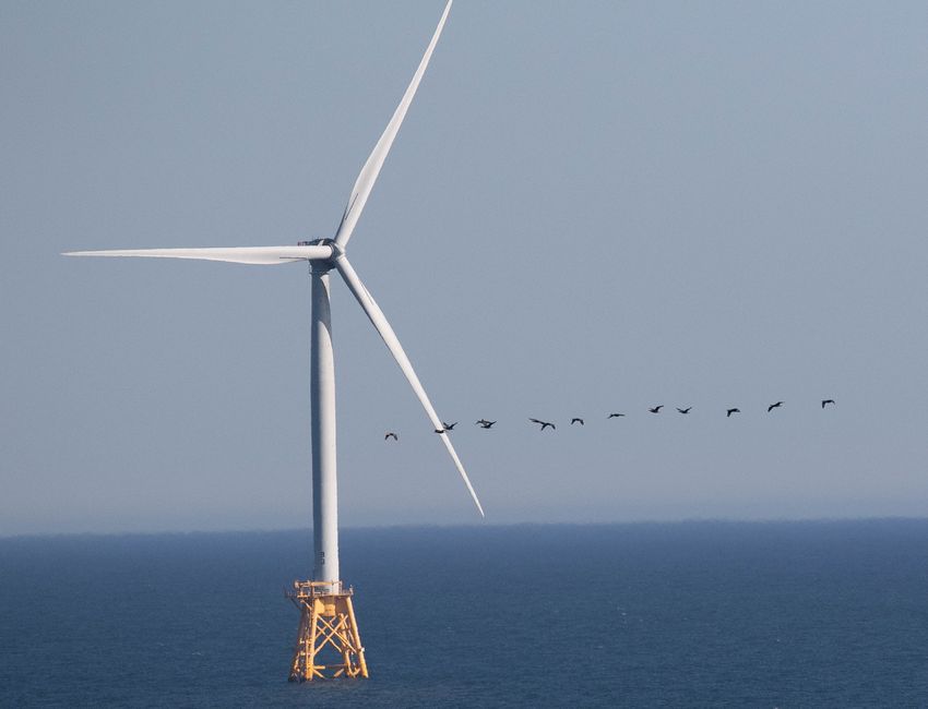
OCS Study
                                                                                                                    BOEM 2022-001

TABLE OF CONTENTS
Workshop in brief .......................................................................................................................... 1
Workshop Presentations ............................................................................................................... 2
   Why We Are Here ..................................................................................................................... 2
   GPS and Telemetry Tracking for Avian Species ....................................................................... 3
   Sector Reflections ..................................................................................................................... 3
   Data Management Project Examples ........................................................................................ 4
   Exploring the Idea in Depth ....................................................................................................... 5
Key Discussion Themes ............................................................................................................... 5
   Types of Data Needs ................................................................................................................. 5
   Value and Benefits of Improving Monitoring, Data Consistency, Archiving, and Access .......... 7
   Data Production and Storage .................................................................................................... 8
   Data Collating and Archiving ..................................................................................................... 8
   Data Harvesting......................................................................................................................... 9
   Data Synthesis ........................................................................................................................ 10
   Management Decisions ........................................................................................................... 11
Closing Remarks and Next Steps ............................................................................................... 12

Appendix A Workshop Agenda ............................................................................................... A-1
Appendix B Attendee List ....................................................................................................... B-1
Appendix C Mentimeter Results ............................................................................................. C-1
Appendix D Workshop Presentations ..................................................................................... D-1

                                                                      i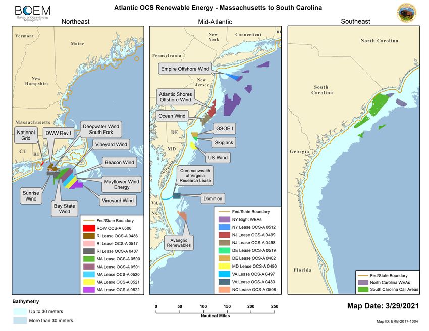
OCS Study
                                                                               BOEM 2022-001

WORKSHOP IN BRIEF
On June 29 and 30, 2021, the Bureau of Ocean Energy Management (BOEM) convened a
workshop titled Improving Monitoring, Data Consistency, Archiving, and Access for Better
Regional Understanding across Projects: Satellite and GPS Tracking of Avian Species. Building
on a previous BOEM workshop that focused on tracking and monitoring marine mammals, this
workshop focused on improving monitoring, data consistency, archiving, and access for better
regional understanding across projects specifically related to tracking avian species off the
Atlantic Coast of the United States.

The objectives of the workshop were to:
   •   Ensure consistency and compatibility of data sets across the various lease and non-lease
       areas
   •   Provide for storage in a more centralized location accessible to federal agencies and
       others

Additional information on the workshop topics and objectives can be found in the Workshop
Agenda in Appendix A.
Over 65 practitioners and subject matter experts from federal and state agencies, non-profit
organizations, private industry, and research institutes participated in the workshop. At the
beginning of the workshop, participants were asked to respond to several demographic questions
to see who was “in the room”:

   •   27 of the 44 poll respondents reported that they represented federal agencies. Other
       attendees represented state, non-profit, academic, and business sectors.
   •   Over half of the attendees who responded to the demographic poll reported they were
       based in the Mid-Atlantic region or in New England. Other attendees were based in
       Alaska, the Southeast, West Coast, and Midwest of the United States as well as Canada
       and Europe.
   •   The areas of expertise most represented among attendees included biology, animal
       behavior, methods and tools, ecology, avian species regulation, and study design and
       statistics.

A list of workshop participants can be found in the Attendee List in Appendix B. The 2-day
workshop included several presentations by staff representing federal agencies including the
BOEM, U.S. Fish and Wildlife Service (USFWS), United States Geological Survey (USGS) and
the National Oceanic and Atmospheric Administration (NOAA). The workshop included
Mentimeter Polls (Appendix C) of the stakeholder groups in attendance. Workshop
Presentations were also given by subject matter experts representing various federal and state
agencies, non-profit organizations, and research institutes (Appendix D).

                                               1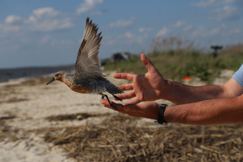
OCS Study
                                                                                   BOEM 2022-001

The workshop also featured several breakout and discussion sessions that allowed participants to
ask questions, engage in dialogue, share best practices, and brainstorm solutions and next steps.
There was general consensus among workshop participants that the need for improved
coordination is urgent and should be addressed as soon as possible. While the discussion
uncovered the need for new tools and systems, most participants advocated for the use of
existing tools and systems to expedite the use of standardized workflows.

The workshop was facilitated by Patrick Field, Senior Mediator at the Consensus Building
Institute (CBI), supported by Emily Shumchenia of the Regional Wildlife Science Entity
(RWSE).

WORKSHOP PRESENTATIONS

WHY WE ARE HERE
David Bigger, Ph.D., BOEM, Office of Renewable Energy Programs, Environmental Protection
Specialist, began the presentations with an overview of the purpose and objectives of the
workshop (Appendix D). He highlighted the need for better data consistency and coordination
related to tracking avian species along the Atlantic Outer Continental Shelf (OCS) from the
Carolinas to Gulf of Maine. He provided an overview of the renewable energy process from
leasing to turbine installation, an overview of current and upcoming offshore wind projects off
the Atlantic Coast and discussed how Office of Renewable Energy Programs and the
Environmental Studies Program have been working together to inform the leasing and permitting
decisions for those projects as follows:

    •   Identifying avian species populations that may be vulnerable to offshore wind
        development in the Atlantic.
    •   Understanding where avian species are and where they are not to avoid conflicts.
    •   Knowing how and under what conditions avian species move through the OCS.
    •   Understanding how these species will respond during and post-construction and
        operations of offshore wind turbines.

David shared that BOEM sees an opportunity to use GPS and satellite data to better inform
regional analyses and impact assessments of offshore wind infrastructure on the Atlantic and
asked workshop participants to consider and share ideas related to:

   •    Increasing the capacity of using the tracking data to better describe bird use in the region;
   •    Improving accessibility to the data;
   •    Standardizing these data for future analyses;
   •    Leveraging existing tools and resources; and,
   •    Building partnerships to improve communication and coordination.

                                                  2
OCS Study
                                                                                 BOEM 2022-001

GPS AND TELEMETRY TRACKING FOR AVIAN SPECIES
Pam Loring, USFWS, Division of Migratory Birds, Biologist, delivered a presentation that
focused on how GPS and telemetry tracking is being deployed on the Atlantic Coast to collect
data on the movement of avian species (Appendix D). She discussed how data used in offshore
assessments and shared two examples of telemetry projects to explain the key differences
between satellite telemetry and radio telemetry. She ended her presentation by highlighting some
of the key challenges and information gaps related to tracking birds, especially for small-bodied
species tracking where technologies are currently limited.

SECTOR REFLECTIONS
After the first two presentations, representatives from the states, developers, academics, and
NGOs were each given an opportunity to discuss opportunities for a more regional approach on
data and the challenges and barriers to collaborating at a more regional scale. Representatives
included the following individuals.

   •   Andrew Gill, Ph.D., Centre for Environment, Fisheries and Aquaculture Science
   •   Matt Robinson, Vineyard Wind
   •   Don Lyons, Ph.D., National Audubon Society, Seabird Institute
   •   Peter Paton, Ph.D., University of Rhode Island, Department of Natural Resources Science
   •   Amanda Dey, Ph.D., New Jersey Fish and Wildlife
   •   Paul Phifer, Ph.D. Atlantic Shores Offshore Wind LLC

While each sector representative provided unique perspectives, several common themes emerged
from their remarks.

   •   Studies should be coordinated regionally so that highest interest species and populations
       are identified, sampling and study design is optimized for statistical rigor, and data can
       address regional needs while also meeting the needs of specific projects.
   •   There are a lot of data sitting on computers and bookshelves. We need to find it,
       standardize it, process it, and make it accessible.
   •   Standardized protocols/best practices, QA/QC, and data protections are needed to make
       sure that everyone is collecting and using accurate data.
   •   There should be some standardization and coordination of the types of tracking
       technologies used, tag programming and options (e.g., duty cycle, additional sensors,
       calibration), data workflow and management. This could also help streamline the
       permitting process for tagging efforts.

                                                3
OCS Study
                                                                                  BOEM 2022-001

   •   Offshore wind development is rapidly expanding, and we need to select a central
       repository very soon.

DATA MANAGEMENT PROJECT EXAMPLES
After the sector representatives shared their reflections, three projects were presented that
showcased different organizations and agencies that have created data repositories and are
working to improve how data is gathered, managed, used, and shared.

David Douglas, USGS Alaska Science Center gave a short presentation about the origins and
organization of the USGS Alaska Science Center Wildlife Tracking Data Collection (Appendix
D). To ensure that future biologists could easily access and use the center’s data, the data
collection stores data sets in the ASCII format that act as building blocks and will allow for
future unified variable naming conventions. David noted that due to government data and
security requirements, USGS felt it necessary to create this database under the federal aegis.
Key features of the data collection include:

   •   Metadata
   •   Data packages with raw Argos data and packaged data
   •   Suggested citations
   •   Versioning if data is appended or new data is added
   •   ‘Read Me’ files that provide an overview of what each data set is
   •   Supplementary materials and processed data files
   •   Data visualizations that pool data and show each bird separately
   •   Landing pages that look the same for all species
   •   Tracking maps available for use by the public, teachers, and journalists
   •   Publicly available datasets after they are published

Sarah Davidson, Movebank, discussed an overview of the Movebank website
(https://www.movebank.org/cms/movebank-main), a global database for animal tracking and
animal-borne sensor data, hosted by the German Max Planck Institute of Animal Behavior.
Movebank is a global project with no user fees and allows different projects to use Movebank at
different points in the data life cycle regardless of project or funding source. Sarah also shared
information about Movebank’s tools and services for working with data throughout its life cycle.
Key features of Movebank include the following.

   •   Users own their data and retain ownership and access when they use Movebank
   •   Users can set different access levels for managers, collaborators, and the public ranging
       from a summary of the data to full download capabilities

                                                 4
OCS Study
                                                                                 BOEM 2022-001

   •   Data are harmonized to a shared model and vocabulary during input
   •   Users can stream their data feeds/real time data directly to Movebank in a way that is
       standardized and upload files like Argos DIAG and .csv and import tables.
   •   Movebank has tools to identify and flag outliers in datasets
   •   Users can download data in a number for formats for analysis
   •   Movebank has created animal tracking apps for mobile phones
   •   A new tool called Moveapp is being beta tested and helps users build repeatable
       workflows out of user-contributed data to help movement ecologists publish data

Arliss Winship, CSS, Inc. under contract to NOAA, discussed the Northwest Atlantic Seabird
Catalog NWASC database which was created to provide access to published studies and
designed as a repository for survey information. The relational database includes survey and
tracking data from a wide variety of data sources with different data points including photos,
videos, and aerial- and boat-based data from at-sea surveys and sightings of marine birds. There
is no public access point for the database, but NOAA shares it with anyone upon request. Many
of the data contributors are also users, such as government agencies, consultants, non-profits, and
academics.

EXPLORING THE IDEA IN DEPTH
On the Day 2 of the workshop, Pam Loring, USFWS, Division of Migratory Birds Biologist,
synthesized some of the key themes of the workshop and shared some thoughts and ideas to
address near- and long-term data needs. She noted that as technology is changing, like the
availability of smaller tags, there is an increased interest and an immediate need to coordinate
tagging studies for ESA-listed species. She also discussed the longer-term need for a repository
to safeguard data into the future and combine data from multiple studies. Her presentation ended
with an emphasis on the numerous benefits of collaboration for anyone working in specifies
management and scientific research.

KEY DISCUSSION THEMES
During the workshop, key themes emerged related to different types of data needs, current
challenges and barriers to data management and collaboration, and the benefits of improving
consistency, archiving, and access related to avian species tracking data.

TYPES OF DATA NEEDS
Participants identified and discussed two main types of data needs in the context of tracking
avian species.

                                                 5
OCS Study
                                                                                BOEM 2022-001

   •   Finding, standardizing, and processing existing data and making it accessible
   •   Creating standard workflows and processes for collecting, storing, and sharing new data

On Day 2 of the workshop, David Douglas created and shared the image below with attendees,
noting the relationship between data sources and data repositories and highlighting the need for a
common archive or tool that collects and/or hosts data from multiple repositories.

        Figure 1. The relationship between data sources and data repositories

Pam Loring shared that improved data coordination is needed in both the short- and long-term.

   •   Short-term coordination to provide agencies with timely access to information for more
       informed decision-making. These needs could be met with the following sample
       workflow:
          o Projects register tags in Movebank with standardized metadata (e.g., species, band
              #, attachment type, start date & location)
          o Tags set to “live feed”
          o Agency contact on account as collaborator
          o Data can be set to different levels of access depending on the user (i.e., does not
              have to be public)
          o Use of data in site specific and regional offshore wind assessments

                                                6
OCS Study
BOEM 2022-001
• Long-term coordination to standardize processes and create a widely used repository to
archive and safeguard data for the long-term. These needs could be met with a repository
like that used by USGS Science Center:
o Intuitive interface
o Solid data architecture
o Includes metadata protocols (e.g., dead/shed)
o Transportable to other databases
o Works with various tag types
o Government-controlled so not subject to various funding and administrative
vagaries over time.
VALUE AND BENEFITS OF IMPROVING MONITORING, DATA
CONSISTENCY, ARCHIVING, AND ACCESS
Throughout the workshop, panelists and attendees discussed the value of improving monitoring,
data consistency, archiving, and access related to satellite and GPS tracking of avian species. The
following are some of the key benefits of a collaborative and standardize data tracking approach
that were identified:
• There are many potential uses of studies beyond their original purpose.
• Information value is maximized when data are used collectively.
• Gaps in existing data would be easier to identify.
• It would ensure that data is up to date so that the best available science could be used for
assessments in the immediate future and over the long term.
• It would save time and money for researchers, industry, agencies, and other stakeholders
• A long-term repository would safeguard data.
• It would provide a standardized, transparent, consistent, and automated workflow.
• It would identify data gaps and facilitate coordination of studies at a regional level which
is needed to address migratory species and species who use larger scale habitats for
various behaviors and needs.
• It would provide more opportunities for collaboration and complimentary uses of data
(species management, scientific papers).
During the workshop, participants were asked to share their perspectives and priorities via an
online polling tool called Mentimeter. Among participants who responded to the poll, the
greatest value of a more centralized, shared approach to their organizations were:
• Consistency
• Accessibility
• Efficiency
• Transparency
7OCS Study
BOEM 2022-001
Participants were asked “What kinds of hypotheses or questions could a data base with GPS and
telemetry help answer regionally?” Participants submitted responses and were invited to upvote
responses from other attendees. The following responses received the most support:
• Migratory movements, timing, and weather of shorebirds in Atlantic OCS region.
• What are cumulative impacts of many individual projects across Atlantic Coast?
• What areas or movement paths are used consistently but perhaps not for long periods of
time?
• How do migratory movements change with construction of multiple offshore wind
developments?
• Does the current distribution of MOTUS stations (largely to the land-based side of the
areas we are most interested in) bias the inferences from movement models?
• What level of variation in habitat use occurs regionally over time?
• Examining trade-offs in space use as a function of food availability, development, and
other abiotic conditions.
• Where do seabirds exhibit site fidelity, particularly for foraging behaviors?
DATA PRODUCTION AND STORAGE
Key Barriers and Challenges:
• Data exists in many places (including file cabinets).
• Data exists in in many different formats and in many different databases.
• Managing data is time intensive. Taking existing, cleaning it, storing it, providing access
to it, and analyzing it takes a lot of time.
• Managing data is also expensive. It is hard to know how much funding is needed to track
down existing data and compile it or develop a new system for storage.
• Upgraded technology gives different kinds of data with columns flipped or small tweaks
(e.g., different transmitters give different types of data depending on the manufacture).
• Workflows are not standardized.
• Many federal agencies have strict data storage requirements.
Key Considerations and Areas for Further Exploration:
• Standardize workflows.
• QA/QC rules need to be developed and implemented before data is shared to ensure data
is accurate and consistent.
• Long-term storage of raw data is needed and more useful data available across tools to
meet people’s needs.
• Provide funding to move data from “file cabinets” and into repositories.
DATA COLLATING AND ARCHIVING
8OCS Study
BOEM 2022-001
Key Barriers and Challenges:
• Metadata standards and maintenance are different across the different tag types.
• There are no standards for how the data is processed.
• Data redundancy is likely when multiple users are using the same or similar data sets.
• Study results may change if data published too early.
• Studies that are supported by graduate students often wait to be published until they have
graduated.
• Everyone is at different stages of publishing and willingness to share data. Everyone is
working at different time scales.
• Concerns that if data on hunted and endangered species, especially for waterfowl and
ducks, is published immediately, the data would be used for hunting and other unintended
purposes.
• Some federal agencies require that data be publicly available.
Key Considerations and Areas for Further Exploration:
• Develop consistent workflows and standards for collating and archiving historic, new,
and real time data so that they can be usable and accessible when moved from providers
to a repository.
• Develop QA/QC rules before data is shared.
• When studies are privately funded, create agreements that no data can be classified, and
the data will be made available and accessible to BOEM and other federal agencies and
researchers in a reasonable and named timeframe.
• Require manuscripts be included with datasets to make sure people understand the data.
• Expedite and streamline internal review processes that often delay data releases and
publishing.
• Provide support and incentives to motivate data providers to share their data such as:
o Offering co-authorship on manuscripts and reports to the data providers.
o Appropriate sharing controls and notification of use.
o Provide analytical tools.
DATA HARVESTING
Key Barriers and Challenges:
• Data owners want to be able to track where their data is going and how it is used.
• If private entities are collecting or funding data, they may be very reluctant to share any
kinds of data and proprietary information is very important.
9OCS Study
BOEM 2022-001
• Raw data can easily be misinterpreted or misconstrued. It is hard to have confidence that
data will be used appropriately if it is widely available and accessible.
• Variable speeds of data access across projects.
• Some data is public and other data is protected and needs to be requested from the data
owners.
Key Considerations and Areas for Further Exploration:
• Many of the issues and challenges seem to be political and privacy-related rather than
technical.
• Data privacy is extremely important. There needs to be data sharing agreements,
discussions about permissions, and qualifications of how the data can be used and shared,
especially if it is publicly and/or instantly available.
• When data is requested from owners, there is always a well-defined request for what they
need and why. BOEM should clearly define their specific need so that data owners
understand where their data is going and that this is not just a data grab by big
government.
• Incentivize data owners to allow their data to be accessed by telling them that the data
will be helping the U.S. government.
• We need well defined, priority questions and hypothesis that can drive data harvesting
efforts to specific ends.
• How can we ensure the continuity of a central repository? Movebank standardizes data
and helps make it accessible but how can we be assured it will be around for the
foreseeable future?
DATA SYNTHESIS
Barriers and Challenges
• We cannot see all the data in one place, so it is hard to know what the data gaps are.
• We do not know if there are new studies that need to be coordinated at a regional level
because there is no repository to identify gaps in polygons and geographic areas.
• Different tools vary in usability, longevity, accuracy, and accessibility.
• Movebank has been the go-to for North America avian tracking data for many but not
everyone uses it.
• Metadata in Movebank may not be present, updated, and/or accurate.
Considerations and Areas for Further Exploration
• A central place where we can search projects by geography and across databases would
be extremely useful.
10OCS Study
BOEM 2022-001
• Decisionmakers should use the best of what exists vs. developing new systems and
prioritize systems as needed.
• Identify which visual and analytical tools are most useful and develop those.
• Provide funding and incentives to create data products that are compatible with user
tools.
• Tools for synthesis should make it easy for data owners to transfer data from repositories
to analytics.
• Work with Movebank to develop and refine apps, workflows, and data standards.
• Create an OCS-specific synthesis of survey and movement data.
MANAGEMENT DECISIONS
Barriers and Challenges
• There is a cost to analyze data in a timely way to use for offshore wind purposes.
• Several agencies, entities, and groups are having similar conversations and it is hard to
make sure everyone is on the same page.
Considerations and Areas for Further Exploration
• Think about what data decisions are needed for planning, siting, mitigation, permitting,
and other activities.
• Identify data sharing agreements.
• Develop standards for metadata and QA/QC
• Think about long term study needs, plan for the future, and ensure longevity.
• Convene and coordinate conversations with other experts to make sure everyone is on the
same page.
• Explore opportunities to collaborate with and partner with other stakeholder groups and
data platforms such as:
o NYSERDA working groups
o Regional Wildlife Science Entity
o National Science Foundation’s Office of Advanced Cyberinfrastructure
o Sciencebase
o North American Bat Monitoring Program’s (NABat) data sharing network
o Smithsonian Atlas of Migratory Connectivity
o BirdLife Database – international database for seabirds
11OCS Study
BOEM 2022-001
CLOSING REMARKS AND NEXT STEPS
At the end of the workshop, participants were asked to indicate their level of interest and
anticipate effort in supporting a more centralized approach to data sharing. Overwhelmingly,
participants indicated their support and willingness to support a centralized approach to data
sharing indicating the value of a collaborative approach was widely understood among
participants. Table showing the average responses and distribution of Mentimeter poll responses
can be found in Appendix C.
To close the workshop, David Bigger and Pam Loring thanked attendees for their engagement
and contributions to the two-day workshop and identified the following next steps for the
agency:
• Define BOEM’s data needs in writing.
• Develop a framework that would map out a standardized workflow.
• Identify where we could provide incentives and reduce barriers to encourage people to
follow standardized workflows.
• Partner with the Regional Wildlife Science Entity to collaborate on defining and
prioritizing regional studies, as well as to develop a framework that is coordinated and
not ad-hoc.
• Brainstorm with Movebank to demo Moveapp and new tools.
12OCS Study
BOEM 2022-001
APPENDIX A WORKSHOP AGENDA
Improving Monitoring, Data Consistency, Archiving, and Access for Better Regional
Understanding across Projects
Satellite and GPS Tracking of Avian Species
Bureau of Ocean Energy Management (BOEM)
June 29 and 30, 2021
Register in advance for this meeting:
https://cbuilding.zoom.us/meeting/register/tJYrde-hrzkqHtQ-t_WFU2rDiskV7XOBQ4gq
After registering, you will receive a confirmation email containing information about joining the meeting.
Objectives for Workshops:
• Ensure consistency and compatibility of data sets across the various lease and non-lease areas;
• Provide for storage in a more centralized location accessible to federal agencies and others.
Optional Pre-Reads:
• NYSERDA/BRI Bird and Bat Research Meeting Summary (https://a6481a0e-2fbd-460f-b1df-
f8ca1504074a.filesusr.com/ugd/78f0c4_201120060f394e9f967cfab207fb1d59.pdf)
Day 1: Agenda
TIME
PURPOSE ITEM PRESENTER
(ET)
12:45 Tech Check Opening of Platform CBI
• Participants may sign-on 5 minutes ahead of the
start of the conversation to get adjusted to the
web-based technology, sound and video check
1:00 Introduce Welcome CBI
• Welcome, agenda, rules of the road
1:10 Level Set Why We Are Here David Bigger, BOEM
• Why BOEM decided to host these workshops
• What we are covering and not covering in this
workshop (regional from Carolinas to GOM,
telemetry and GPS tracking of avian species (not
MOTUS), not mitigation
• What we’ll produce as a product
• Overview of OSW specific efforts by multiple actors
over the last 10 or so years – geographic focus,
intent, sponsor, scale, data produced
• Brief overview on methods and emerging
technologies, analyses, data, storage, and archiving
• Q&A
A-1OCS Study
BOEM 2022-001
TIME
PURPOSE ITEM PRESENTER
(ET)
1:40 Learning What are GPS and Telemetry tracking, Where and Pam Loring, USFWS
Why it is being deployed on the Atlantic Coast for
Avian Species
• Brief description of MOTUS and NYSERDA funded
project
• Brief intro to satellite/GPS technology
• What kind of questions can these tools help
answer?
• Questions and Answers
2:10 Break Break
2:20 Sharing Sector Reflections Panel
• A representative from sectors given 5 minutes each
to discuss: 1) opportunities for a more regional
approach on data; 2) challenges and barriers to
collaborating at a more regional scale
• General Discussion
2:40 Learning Current Management of these and Other Data
• USGS Alaska Science Center Wildlife Tracking (15 David Douglas, US
minutes, 5 min Q&A) Geologic Survey
• MoveBank and Max Plank Institute (15 minutes, 5 Sarah Davidson, Max
min Q&A) Planck Institute
• Northwest Atlantic Seabird Catalogue (15 minutes, Arliss Winship,
5 min Q&A) NOAA (David)
• General Q&A
3:40 Closing Preview of Day 2 CBI
• High level summary of Day 1
• Plan for Day 2
3:45 Adjourn
Day 2: Agenda
TIME
PURPOSE ITEM PRESENTER
(ET)
12:55 Tech Opening of Platform CBI
Check • Participants may sign-on 5 minutes ahead of the
start of the conversation to get adjusted to the
web-based technology, sound and video check
1:00 Welcome Welcome CBI
Back • Welcome, agenda, rules of the road
• Summary of Day 1 and key issues raised
1:15 Discussion What is the shared value of a more centralized, shared CBI
approach
• Share results for first day Mentimeter response
A-2OCS Study
BOEM 2022-001
TIME
PURPOSE ITEM PRESENTER
(ET)
• Discussion
1:30 Small Exploring the Idea in Depth
Group • A sample approach as food for thought (10 Pam Loring, USFWS
Discussion minutes)
• Go to breakout groups, mixed groups across sectors SMEs and Facilitators
• What are the challenges or barriers to have a
shared approach to data collection and sharing (i.e.
data format and consistency, cost of data
management, permitting or regulatory barriers or
opportunities, confidentiality and data sharing,
etc.)?
• What might be the means or method for doing so?
• What is needed shorter and longer term?
2:20 Report Report Outs All
Back • Each break out group reports ideas and brief
questions and discussion on each
• Discussion
• Facilitator summarizes findings
2:45 Break • During break develop polling on key ideas from CBI + Organizers
each group
3:00 Prioritizing Polling and Discussion CBI
• Group is polled on key ideas and options
• Group discusses polling results and implications
3:30 Next Steps Final Group Comments Mary Cody and
• Next steps for BOEM, FWS and the RWSE David Bigger, BOEM
Pam Loring, USFWS,
Emily Shumchenia,
RWSE
3:45 Adjourn Adjourn
A-3OCS Study
BOEM 2022-001
APPENDIX B ATTENDEE LIST
Name Email
Alicia Berlin USGS aberlin@usgs.gov
Amanda Dey NJ DEP amanda.dey@dep.nj.gov
Amy Hoenig Commonwealth of Massachusetts amy.hoenig@mass.gov
Division of Marine Fisheries
Andrew Gilbert Biodiversity Research Institute andrew.gilbert@briloon.org
Andrew Vitz MassWildlife andrew.vitz@mass.gov
Arliss Winship NOAA arliss.winship@noaa.gov
Ashley Lohr North Carolina Museum of Natural ashley.lohr@naturalsciences.org
Sciences
Autumn-Lynn Harrison Smithsonian Migratory Bird Center harrisonal@si.edu
Bill Beatty USGS wbeatty@usgs.gov
Blake Massey USFWS blake_massey@fws.gov
Caleb Spiegel USFWS caleb_spiegel@fws.gov
Cameron Hager CBI chager@cbi.org
Carmen Johnson North Carolina Wildlife Resources carmen.johnson@ncwildlife.org
Commission
Catherine Jarjour Environment and Climate Change catherine.jarjour@canada.ca
Canada
Chris Field University of Connecticut christopher.field@uconn.edu
Christopher Churchill USGS cchurchi@usgs.gov
Courtney Shaw Environment and Climate Change courtney.shaw@ec.gc.ca
Canada
Darren Ireland LGL direland@lgl.com
Dave Brandt USGS dbrandt@usgs.gov
David Bigger BOEM david.bigger@boem.gov
David Mizrahi NJ Audubon david.mizrahi@njaudubon.org
David Pereksta BOEM david.pereksta@boem.gov
Don Lyons National Audubon Society dlyons@audubon.org
Elizabeth Hansel Vineyard Wind ehansel@vineyardwind.com
Emily Argo USFWS emily_argo@fws.gov
Emily Shumchenia E&C Enviroscape emily.shumchenia@gmail.com
Eric Schrading USFWS eric_schrading@fws.gov
Evan Adams Biodiversity Research Institute evan.adams@briloon.org
Henrietta Bellman Delaware Shorebird Project henrietta.bellman@delaware.gov
Holly Goyert AECOM holly.goyert@aecom.com
B-1OCS Study
BOEM 2022-001
Iain Stenhouse Biodiversity Research Institute iain.stenhouse@briloon.org
Jay VonBank USGS jvonbank@usgs.gov
Jeff Gleason USFWS jeffrey_gleason@fws.gov
John Reed USGS jareed@usgs.gov
John Stanton USFWS john_stanton@fws.gov
Jonathan Felis USGS jfelis@usgs.gov
Jordan Terrell Delaware Department of Natural jordan.terrell@delaware.gov
Resources and Environmental Control
Katharine Goodenough University of Oklahoma kgoodenough@ou.edu
Kathy Clark NJ DEP kathy.clark@dep.nj.gov
Keith Pardieck USGS kpardieck@usgs.gov
Kyle Baker BOEM kyle.baker@boem.gov
Laura McKay VA DEQ laura.mckay@deq.virginia.gov
Lesley Howes ECCC lesley.howes@canada.ca
Mary Cody BOEM mary.cody@boem.gov
Matt Robertson Vineyard Wind mrobertson@vineyardwind.com
Meaghan McCormack NY DEC meaghan.mccormack@dec.ny.gov
Megan McKinzie Monterey Bay Aquarium Research mmckinzie@mbari.org
Institute
Michelle Fogarty Equinor mfog@equinor.com
Mike Wellik USGS mwellik@usgs.gov
Mona Khalil USGS mkhalil@usgs.gov
Nate Lash CBI nlash@cbi.org
Nellie Tsipoura New Jersey Audubon nellie.tsipoura@njaudubon.org
Nick Napoli Northeast Regional Ocean Council nicknapoli01@gmail.com
Pam Loring USFWS pamela_loring@fws.gov
Patrick Field CBI pfield@cbi.org
Paula Estornell DOI paula_m_estornell@ios.doi.gov
Peter Paton The University of Rhode Island ppaton@uri.edu
Sadia Sabrina USGS ssabrina@contractor.usgs.gov
Samantha Robinson Delaware Department of Natural samantha.robinson@delaware.gov
Resources and Environmental Control
Sarah Davidson Movebank/MPIAB sdavidson@ab.mpg.de
Scott Lawton Dominion Energy scott.lawton@dominionenergy.com
Shilo Felton National Audubon Society shilo.felton@audubon.org
Susanna von Oettingen USFWS susi_vonoettingen@fws.gov
B-2OCS Study
BOEM 2022-001
T.J. Zenzal USGS tzenzal@usgs.gov
Todd Callaghan Massachusetts Office of Coastal Zone todd.callaghan@mass.gov
Management
Tori Mezebish The University of Rhode Island tmezebish@uri.edu
Véronique Drolet- Environment and Climate Change veronique.drolet-gratton2@canada.ca
Gratton Canada
B-3OCS Study
BOEM 2022-001
APPENDIX C MENTIMETER RESULTS
During the workshop, participants were asked to share their perspectives and priorities via an
online polling tool called Mentimeter. The questions and results of those polls are below.
C-1OCS Study
BOEM 2022-001
C-2OCS Study
BOEM 2022-001
C-1APPENDIX D WORKSHOP PRESENTATIONS
D-1Avian Tracking Data for Offshore Wind Assessments in US Atlantic
Photo: P. Paton
Pam Loring
U.S. Fish and Wildlife Service
Division of Migratory Birds, North-Atlantic Appalachian RegionMain Types of Data Used in Offshore Assessments
Survey data Tracking data
• Site-specific distribution and abundance • Individual flight paths and altitude
• Data bounded in space and time • Data collected across space & time
(snapshot) (within limits of technology)Main Types of Tracking Data
Photo: P. Paton
Photo: J. Fiely
Satellite Telemetry Radio Telemetry
• Transmitters communicate with • Transmitters emit radio signals
satellites • Signals received by antennas
• Satellites estimate locations • Tracking coverage is limited to locations
• Tracking coverage is global and range of antennasMotus: Collaborative Automated Radio Telemetry • Small radio tags: 0.25 – 2 g • High temporal resolution (~5-10 s) • Tracked by receiving stations (antenna towers, range
Tracking Movements of Migratory Shorebirds in the U.S.
           Atlantic Outer Continental Shelf Region
• Collaborative shorebird study – data
  from Arctic Canada to South America

• Included 12 species of shorebirds
  (n=1,363) tagged across 21 sites

• Regional movements & flight
  altitudes within US Atlantic study area
  (MA to VA)

• Timing & weather of offshore flights
• 65% of tagged birds detected
within Study Area (n=594)
• Spring offshore flights from mid
May to early June, when winds
blowing to the north-northeast
• Fall offshore flights from July
(peak) to Nov when winds blowing
to the south-southeast
• Offshore data limited by range of
land-based Motus stations (Developing a Framework for Offshore Automated Radio
Telemetry (Motus)
• Funding: New York State Energy Research and Development
Authority (NYSERDA)
• Co-leads: USFWS Migratory Birds, Biodiversity Research
Institute, University of Rhode Island, Birds Canada
• Timeframe: 2020-2022Objectives of Offshore Motus Network • Motus stations on buoys and offshore wind turbines • Online study design tool • Framework for coordinating tagging studies • Offshore Motus Data Portal • Stakeholder advisory group and workshops
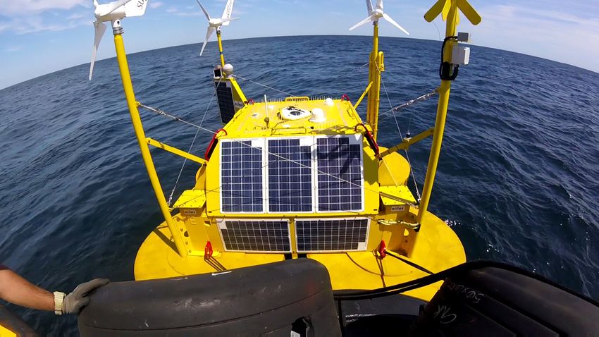
Piloting Offshore Tracking Stations on Wind
             Turbine and Buoys
Information Gaps – Avian Movements & Offshore Wind
• Movements throughout entire Atlantic region (Motus data limited
to detection range of stations,Satellite Telemetry Technologies
• Location estimation: Argos (doppler shift), GPS
• Spatial resolution:
• Argos (2-D): 250 to >1,500 m
• GPS (3-D): ± 10 m (lat/lon), ± 20 m (altitude)
• Temporal resolution (varies):
• Battery size/weight & type (e.g. solar)
• Data transfer method (= power consumption)
• Data transfer: loggers (need recapture), base stations (need bird to
fly in range), cellular/GSM, satellite uplinkSatellite Telemetry Pilot Study – Common Terns (2017)
• 2-g solar PTTs (Argos)
• N = 5 Common Terns tagged on Petit Manan
Island in Maine, USA during incubation
• Attached with backpack harness, no adverse
effects to behavior or productivity observed
• Average 11 pts/day, tracked 102 – 652 days
• Spatial resolution: 250 – 1,500 m accuracyPiloting Lightweight GPS tags on Red Knots in Coastal NJ
• 2.6 g GPS-Argos tags
• 60 locations + altitude, relay
to satellites
• Accuracy: ± 20 m
Royal Netherlands Institute for Sea Research
• Fall departure flights (NJ) and
spring northbound routes
(from Brazil)Technology Trade-offs
• Radio telemetry/Motus
• Requires detection by stations
• Resolution of data varies with station coverage
• Collaborative Motus network maximizes sample size &
information obtained
• Satellite:
• Global tracking coverage
• High resolution data including altitude
• Small sample sizes – could be leveraged by more coordinated
approachhttps://doi.org/10.5066/P9VYSWEH
David Douglas
U.S. Geological Survey
Alaska Science Center
ddouglas@usgs.gov
Use of trade names does not imply endorsement by the U.S. Government
BOEM Workshop: Improving Tracking Data Consistency, Archiving, and Access. June 29-30 2021, onlineWhat will biologists want
100+ years from now?
Development Team:
Lee Tibbitts, John Reed, John Pearce, Dennis Walworth, and David Douglas
Answer:
• Everything
• in ASCII format
• with metadata
BOEM Workshop: Improving Tracking Data Consistency, Archiving, and Access. June 29-30 2021, onlineData releases are by species, each with a unique DOI
Species
Emperor Goose (Anser canagicus) Common Murre (Uria aalge)
Greater White-fronted Goose (Anser albifrons) Thick-billed Murre (Uria lomvia)
Tundra Swan (Cygnus columbianus) Kittlitz’s Murrelet (Brachyramphus brevirostris)
Whooper Swan (Cygnus cygnus) Tufted Puffin (Fratercula cirrhata)
Blue-winged Teal (Anas discors) Gull Species and Hybrids (Larus spp.)
Northern Pintail (Anas acuta) Red-throated Loon (Gavia stellata)
Spectacled Eider (Somateria fischeri) Pacific Loon (Gavia pacifica)
Surf Scoter (Melanitta perspicillata) Yellow-billed Loon (Gavia adamsii)
Black Scoter (Melanitta americana) Northern Fulmar (Fulmarus glacialis)
Whimbrel (Numenius phaeopus) Red-faced Cormorant (Phalacrocorax urile)
Marbled Godwit (Limosa fedoa) Pelagic Cormorant (Phalacrocorax pelagicus)
BOEM Workshop: Improving Tracking Data Consistency, Archiving, and Access. June 29-30 2021, onlineFor example, Tundra Swan
Data visualizations
Data packages
Raw & Processed data
Citation w/DOI
and versioning
BOEM Workshop: Improving Tracking Data Consistency, Archiving, and Access. June 29-30 2021, onlineData visualizations (pooled data)
Data visualizations (each animal)
Google Earth (kml)
Static (jpg)
Interactive (Leaflet html)
BOEM Workshop: Improving Tracking Data Consistency, Archiving, and Access. June 29-30 2021, onlineData packages – Raw data & Processed data
Data Packages
Argos Satellite Telemetry Data
These data packages contain the data collected from satellite transmitters attached
to free-ranging animals. The packages include both raw and processed location and
sensor data. The raw data includes data as originally retrieved from the Argos System.
The processed data have been filtered for location plausibility, and sensor data have
been decoded into standard measurement units. For most users, the processed
data will be preferred.
•Raw Data [Metadata] [Data Download]
•Processed Data [Metadata] [Data Download]
•Read Me [PDF]
BOEM Workshop: Improving Tracking Data Consistency, Archiving, and Access. June 29-30 2021, onlineRaw data package: contains ASCII and PDF files only
BOEM Workshop: Improving Tracking Data Consistency, Archiving, and Access. June 29-30 2021, onlineProcessed data package: contains ASCII and PDF files only
BOEM Workshop: Improving Tracking Data Consistency, Archiving, and Access. June 29-30 2021, onlineProcessed data package: Deployment attributes file
Data_Release_DOI Animal_BandID
Data_Release_Version Animal_Sex
Animal_LifeStage
Animal_ID Animal_ReproCondition
Animal_Species Animal_Mass
PTT_ID Animal_MortalityType
PTT_Manufacturer
Deployment_Start_Timestamp_UTC
PTT_Model
Deployment_End_Timestamp_UTC
Important Deployment_Fate
PTT_Mass
PTT_Attachment
Deployment_End_Type
PTT_PowerOutput
PTT_PowerSource
Deployment_Start_Latitude
PTT_RepetitionPeriod
Deployment_Start_Longitude
Deployment_Start_Locale PTT_DutyCycle
PTT_ReadoutMethod
PTT_LocationAlgorithm
BOEM Workshop: Improving Tracking Data Consistency, Archiving, and Access. June 29-30 2021, onlineProcessed data package: Deployment fate
Attribute:Attribute_Label: Deployment_Fate
Attribute_Definition: Deduced final status of the animal and satellite transmitter (PTT) at the
time tracking of the live free-ranging animal ended (i.e., animal died, transmitter
failed/detached, or tracking of a live animal was otherwise terminated). Determined by
assessment of sensor and movement data. For example, activity sensor values that remain
constant, temperature sensor values that emulate ambient conditions, and/or lack of expected
movement.
Enumerated_Domain_Value: alive
Coded if there was no evidence or knowledge that the animal died or the satellite
transmitter was shed. The 'Deployment_End_Timestamp_UTC' was set to the date/time
of the last obtained transmission from the PTT or shortly thereafter.
Enumerated_Domain_Value: shed
Enumerated_Domain_Value: dead
Enumerated_Domain_Value: shed/dead
Enumerated_Domain_Value: undetermined
The 'Deployment_End_Timestamp_UTC' was set to the date/time of the most recently
obtained transmitter data indicative of attachment to the live free-ranging animal.
(+6 months of shed/dead data collections are added to the data release)
BOEM Workshop: Improving Tracking Data Consistency, Archiving, and Access. June 29-30 2021, onlineProcessed data package: Location data file
Added variables
Data_Release_DOI Location_Timestamp_UTC PTT_ID
Data_Release_Version Location_Class PTT_Program
Location_NOPC Pass_Satellite_ID
Animal_ID Location_ErrorRadius Pass_Messages_N
Animal_Species Location_ErrorSemimajor Pass_Messages_gt120dB
Location_ErrorSemiminor Pass_Messages_BestLeveldB
Latitude Location_ErrorOrientation Pass_Duration
Longitude Location_ErrorGDOP Pass_EstimatedFrequency
Location_IndexQuality
Binary flag Location_DAF_Filter
Location_LI_Index
Location_QQ_Index
Alive? Tracking_Status
Location_AssumedAltitude
Lat_ShedDead
Location_Lat_Solution_1
Lon_ShedDead
Location_Lon_Solution_1
Location_Lat_Solution_2
Location_Lon_Solution_2
BOEM Workshop: Improving Tracking Data Consistency, Archiving, and Access. June 29-30 2021, onlineProcessed data package: Decoded sensor data file
Data_Release_DOI
Data_Release_Version
Animal_ID
Animal_Species
Alive? Tracking_Status
PTT_ID
PTT_Program
Pass_Satellite_ID
Sensor_Timestamp_UTC
Sensor_Temperature_C
Sensor_Voltage
Sensor_Activity
BOEM Workshop: Improving Tracking Data Consistency, Archiving, and Access. June 29-30 2021, onlineAll the data releases are available in Movebank
> searchMovebankStudies(x="USGS_ASC", login=Login)
[1] "blackScoter_USGS_ASC_argos"
[2] "blueWingedTeal_USGS_ASC_argos"
[5] "commonMurre_USGS_ASC_argos"
[6] "emperorGoose_USGS_ASC_argos"
[7] "glaucousWingedGull_USGS_ASC_argos"
[8] "gullSpecies_USGS_ASC_argosGPS"
[9] "marbledGodwit_USGS_ASC_argos"
[10] "northernFulmar_USGS_ASC_argos"
[11] "northernPintail_USGS_ASC_argos"
[12] "pelagicCormorant_USGS_ASC_argos"
[13] "redFacedCormorant_USGS_ASC_argos"
[14] "redThroatedLoon_USGS_ASC_argos"
[15] "spectacledEider_USGS_ASC_argos"
[16] "surfScoter_USGS_ASC_argos"
[17] "thickBilledMurre_USGS_ASC_argos"
[18] "tuftedPuffin_USGS_ASC_argos"
[19] "tundraSwan_USGS_ASC_argos"
[20] "whimbrel_USGS_ASC_argos"
[21] "whooperSwan_USGS_ASC_argos"
[22] "yellowBilledLoon_USGS_ASC_argos"
>
BOEM Workshop: Improving Tracking Data Consistency, Archiving, and Access. June 29-30 2021, onlineThe ASCII Data Foundation
Any number of targeted hypothesis-driven
objectives, or data visualizations
Data path…….
Ephemeral
Movebank Unified Variable Naming Conventions
Data path…….
Locked-in
USGS-2 STATE-Q UNIV-II
USGS-1 FWS-B FWS-C UNIV-1
FWS-A BOEM-Z FWS-Y NGO-X BRI-A
BOEM Workshop: Improving Tracking Data Consistency, Archiving, and Access. June 29-30 2021, onlineSample Approach for Data Coordination
Photo: P. PatonNeed to Coordinate Tracking Data • Smaller tags = increased interest in ESA-listed species • Risks of tagging animals versus value of information • Information value maximized when data used collectively • Immediate need for framework to coordinate • Long-term need for data safeguard/repository
Importance of Data Coordination
        Across Studies

     Study A: Red Knot Tags (N=10), MA - Early Fall
Importance of Data Coordination
Across Studies
Study A: Red Knot Tags (N=10), MA - Early Fall
Study B: Red Knot Tags (N=10), MA – Late FallImportance of Data Coordination
Across Studies
Study A: Red Knot Tags (N=10), MA - Early Fall
Study B: Red Knot Tags (N=10), MA – Late Fall
Study C: Red Knot Tags (N=10), NJ – Early FallImportance of Data Coordination
Across Studies
Study A: Red Knot Tags (N=10), MA - Early Fall
Study B: Red Knot Tags (N=10), MA – Late Fall
Study C: Red Knot Tags (N=10), NJ – Early Fall
Study D: Red Knot Tags (N=10), NJ – Late Fall
N = 40 sample size when data combined
from multiple studies
Population level variation and inferences
Best available information on site-specific
and cumulative exposure estimatesShort-term Coordination Framework
• Aim: agencies timely access to information (e.g. offshore wind)
• Sample Workflow:
• Projects register tags in Movebank with standardized metadata
(e.g. spp, band #, attachment, start date & loc)
• Tags set to “live feed”
• Agency contact on account as collaborator
• Use of data in site specific and regional offshore wind
assessments
• EnvData & MoveApp tools – help to standardize/streamline
workflow to increase efficiency, consistency and transparency?Long-Term Coordination Framework
• Aim: long-term repository to safeguard data (agency-funded &
other data used in decision-making)
• Alaska USGS Science Center Approach
• Intuitive interface
• Solid data architecture
• Metadata protocols (e.g. dead/shed)
• Transportable to other databases
• Works w/various tag types
• With additional funding, possible to expand or duplicate for
Atlantic studies?Benefits of Tracking Data Framework • Long-term repository to safeguard data • Standardized, transparent, consistent & automated workflow • Save time and money • Best available science for assessments both in the immediate future and over the long term • More opportunities for collaboration and complimentary uses of data (species management, scientific papers)
Thank you!

             Photo: P. Paton
OCS Study BOEM 2022-001
OCS Study
BOEM 2022-001
U.S. Department of the Interior (DOI)
The DOI protects and manages the Nation's natural resources and cultural heritage;
provides scientific and other information about those resources; and honors the
Nation’s trust responsibilities or special commitments to American Indians, Alaska
Natives, and affiliated island communities.
Bureau of Ocean Energy Management (BOEM)
BOEM’s mission is to manage development of U.S. Outer Continental Shelf energy
and mineral resources in an environmentally and economically responsible way.You can also read