Celebrating 75 Years of the BLM - Supporting Text
←
→
Page content transcription
If your browser does not render page correctly, please read the page content below
Celebrating 75 Years of the BLM
          Reimagine Your Public Lands – 245 Million Acres of Possibilities

Supporting Text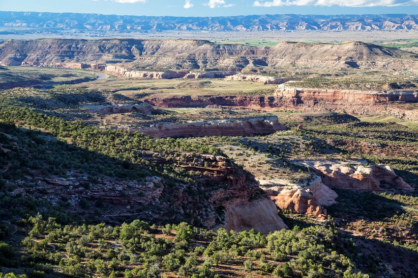
Agenda
10 a.m.      Virtual Meeting Begins
10:10 a.m.   Housekeeping and Introductions
10:30 a.m.   Opening Remarks
10:45 am.    Fall 2020 District Boundary Realignment/NW RAC Composition
             •   Realignment Maps
             •   NW RAC Composition with SW RAC Additions / Members up for Renominations
             •   Call for Nominations
11:00 a.m.   Upper Colorado River District and Field Manager Updates
11:30 a.m.   Lunch
12:25 p.m.   Reconvene
12:30 p.m.   Northwest Colorado District and Field Manager Updates
1:30 p.m.    Public Comment Period (Use Raise Hand Feature)
2:00 p.m.    Sarvis Cabin Business Plan and Fee Proposal
2:45 p.m.    Closing Remarks
3:00 p.m.    Adjourn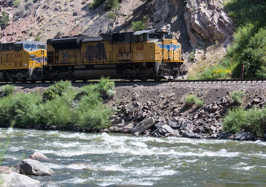
Celebrating 75 Years of the BLM
                Reimagine Your Public Lands – 245 Million Acres of Possibilities

    Supporting Text
                           Zoom Protocol
• Use the “Raise Hand” feature under the “Reactions Tab” to make a comment or ask a
  question – prevents members from talking over each other.

•   Please keep your microphone off unless participating in a question/discussion.
•   Please keep your video ON during sessions; OFF when taking a break.
•   Utilize “Gallery View” to see multiple member screens .
•   Utilize “Presenter View” to highlight speaker.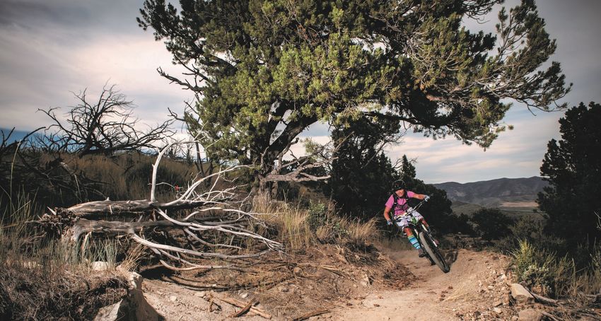
Celebrating 75 Years of the BLM
          Reimagine Your Public Lands – 245 Million Acres of Possibilities

Supporting Text

                            Icebreaker
RAC Boundary Realignment

                    Realignment Boundary
 Current Boundary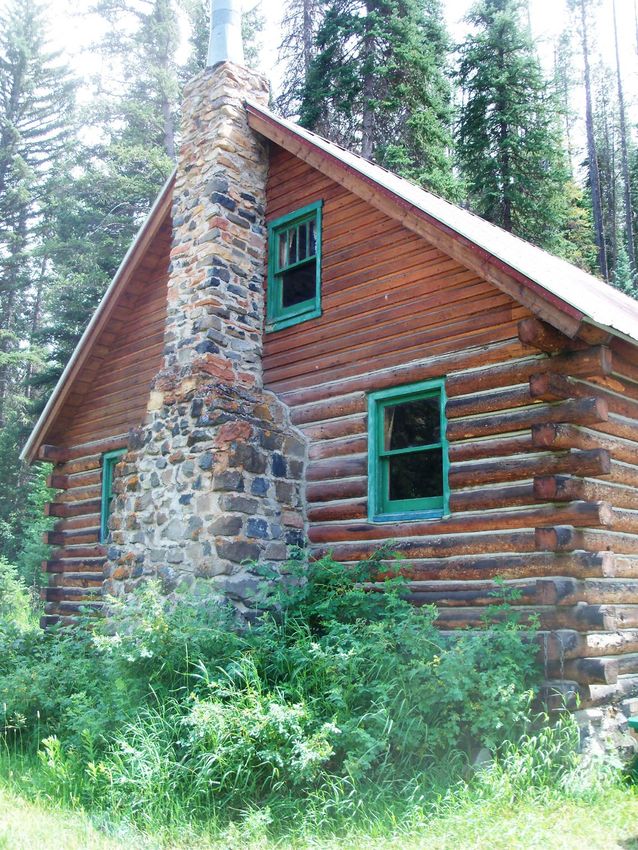
Federal Register Notice
                           Call for Nominations
ACTION: Notice of call for nominations.

SUMMARY: The purpose of this notice is to request public nominations for the Bureau
of Land Management (BLM) Colorado's Northwest Resource Advisory Councils (RAC) to
fill existing vacancies, as well as member terms that are scheduled to expire. The RACs
provide advice and recommendations to the BLM on land use planning and
management of the National System of Public Lands within their geographic areas.

DATES: All nominations must be received no later than June 21, 2021.

FOR FURTHER INFORMATION CONTACT: Chris Maestas at cjmaestas@blm.gov or 970-
761-8069.

Federal Register :: Statewide Call for Nominations for Colorado Resource Advisory
Councils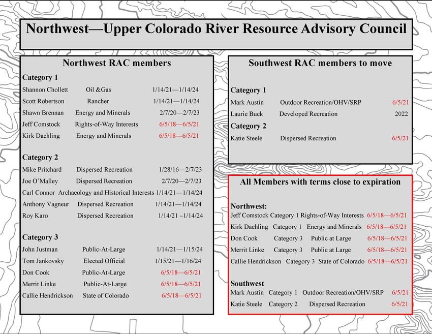
Celebrating 75 Years of the BLM
          Reimagine Your Public Lands – 245 Million Acres of Possibilities

Supporting Text

           UCR District Overview
Celebrating 75 Years of the BLM
          Reimagine Your Public Lands – 245 Million Acres of Possibilities

Supporting Text

            NW District Overview
Celebrating 75 Years of the BLM
          Reimagine Your Public Lands – 245 Million Acres of Possibilities

Supporting Text

         Public Comment Period
Sarvis Cabin Business Plan
and Fee Proposal
Northwest Resource Advisory
Council
May 26, 2021Proposal • LSFO-BLM is seeking the NW RAC’s approval for a $120.00/night fee for Sarvis Cabin rental. • The $120.00/night fee would be adjusted as necessary based on the Consumer Price Index. • Rental of the cabin would be managed through www.recreation.gov.
Fee Proposal Steps
Background
• In 2013, the BLM, in partnership with Yampa River
System Legacy Project Partnership, acquired a 45-
acre private parcel using funds from the LWCF
under the AGO initiative. Western Rivers
Conservancy facilitated the purchase by acting as
the immediate buyer until BLM could assemble the
funding for the purchase.
• The parcel is located approximately 15 miles south
of Steamboat Springs, CO, below Stagecoach
Reservoir, along the Yampa River.
• 40 acres were placed under management by the
USFS in the existing 44,000-acre Sarvis Creek
Wilderness Area.
• 5 acres were retained by BLM, which contain a
segment of the Yampa River and historic cabin.
• The acquisition added another 1,535 feet of Yampa
River frontage open to the public for world class
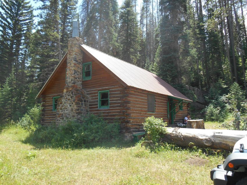
trout fishingBackground Continued • The acquisition included a cabin built in 1956. • The property was part of a summer ranch for landowners whose main livestock operation was inundated by the construction of Stagecoach Dam in 1989. • The parcel is bordered by Colorado State Wildlife Areas, a Colorado State Park, and the USFS Sarvis Wilderness Area.
Prior to Renovation
Renovations
2014-2021
Vault Toilet Installation 2020
Renovations
     Complete:                     Incomplete:
     New windows                   Insulation
     New flooring                  Replace roof
     New propane tank              ADA ramp
     New gas appliances            ADA fishing access
     New kitchen design
     New vault toilet
     New parking area
     New fencing
     New front door
     New partial foundation
     New stairs
     New BBQ
     New locking bear-proof shutters
Sarvis Cabin Business Plan Recreation use fee of $120 would be applied for overnight use of the Sarvis Creek Cabin. The specific fee amount has been determined through development of a business plan. Use of the cabin will be limited to 6 adults at one time for day or overnight use. Length of stay would be limited to seven nights.
Facility Stipulations
o All trash would be packed out by the renter.
o Renters would be responsible for cleaning the cabin and grounds, as
well as restocking firewood prior to leaving.
o Wash and sanitize dishes, pots, and pans with wash basins and
sanitizer provided; strain and dispose of greywater through greywater
disposal system.
o Pack in all water. Water collected onsite (from Yampa River or
snowmelt) requires treatment and/or filtration.
o Provide own linens/bedding.
o Campfires are limited to the outdoor steel fire ring provided.
Fires must be attended at all times.
Fires must be cold to the touch with the bare hand when left
unattended.
Fires are prohibited when local fire bans/restrictions are in effect.Amenities & Materials Provided
• The following are provided:
o Pots, pans, plates, utensils, wash basins, greywater strainer, dish
sanitizer
o Propane for heating, cooking, lighting and refrigeration
o Five beds
o Vault toilet on grounds
o Greywater disposal system
o Toilet paper
o Refrigerator
o Broom and dustpan
o Snow shovel
o Firewood
• The following are not provided:
o No potable water, no towels, linens or blankets, no electricitySarvis Cabin Rental Public Response • 69% Positive • 25% Negative • 6% Positive with additional considerations Comments from 30-day comment period, in 2019, on the Business Plan Draft
Partners

• The Yampa River System Legacy Partnership
• Yampa Valley Community Foundation
• Friends of the Sarvis Cabin
Celebrating 75 Years of the BLM
          Reimagine Your Public Lands – 245 Million Acres of Possibilities

Supporting Text

                  Closing Remarks
District Managers Report
Upper Colorado River District – Colorado
Grand Junction Field Office (GJFO)
including McInnis Canyons National Conservation Area (MCNCA) and
Dominguez-Escalante National Conservation Area (DENCA)
COVID Response
The public area of the office is open to a limited number of visitors and about 80 percent of staff are
teleworking several days a week. We expect high visitor use at recreation sites in the spring and plan to keep
recreation sites open to the public. We have adjusted Special Recreation Permits and events to be consistent
with county group size restrictions.
Pine Gulch Fire
The Pine Gulch Fire was started by a lightning strike on July 31, 2020, approximately 18 miles north of Grand
Junction, Colorado. Initial Attack resources were unable to corral this remote wildfire as it spread rapidly
through grass, sage, pinyon-juniper, and fir. The combination of drought-stressed vegetation, unseasonably hot
weather, and steep terrain led to weeks of active burning. Smoke columns were often visible from Grand
Junction and the surrounding area as the wildfire exhibited extreme fire behavior.
During the night of August 18, the fire grew quickly due to a thunderstorm with winds up to 40 mph for a three
to four-hour period. As a result, the fire increased by more than 30,000 acres overnight. Firefighters worked to
protect homes and outbuildings using a combination of bulldozers and hand crews to build fire lines. Road
systems were used as control lines where crews initiated firing operations to slow the fire spread. On August 27,
the Pine Gulch Fire became the largest wildfire in Colorado State history, surpassing the Hayman Fire that
burned near Colorado Springs in the summer of 2002. In October, both the East Troublesome and Cameron
Peak fires surpassed the Pine Gulch Fire in size. Suppression repair has been completed and rehabilitation is
ongoing.
The BLM prepared an Emergency Stabilization and Rehabilitation plan for the Pine Gulch Fire, which burned
approximately 139,000 acres. The plan outlines emergency stabilization and rehabilitation strategies to address
resources impacted by the fire. The strategies include aerially reseeding approximately 22,0000 acres that was
completed in February 2021. The BLM will also treat any invasive weeds in the burned area; rest burned
livestock allotments for a period of two years; and, for recreation, replace signage, repair trail limiters, and
reestablish trails that were impacted by the fire.
The GJFO has been coordinating with various partner agencies and organizations such as Colorado Parks and
Wildlife, U.S. Geologic Service, Colorado State University, and the Mule Deer Foundations on researching
additional rehabilitation efforts not included in the plan.
Most of the emergency stabilization has been funded. In February 2021, the BLM completed the NEPA and
began implementing the strategies. Additionally, the GJFO is working with grazing permitees affected by thefire to either rest the allotments for a minimum of two years or to identify unburned portions of allotments that
may be available for grazing.
Managing Livestock During Drought
In February 2021, letters were sent to all livestock operators to provide early notice that continued drought and
associated reduction in forage production could result in the need to reduce permitted numbers by at least 50
percent. While BLM managers are still optimistic that late season snow and precipitation will result in improved
drought conditions, the intent of this early notice was to provide operators time to make potential adjustments to
their operation. The letter asked permittees to contact field office rangeland management specialists to discuss
their ideas and options to accomplish a 50 percent reduction.
Use of e-Bikes on Non-Motorized Trails
The BLM is taking steps to increase opportunities for e-bikes on public lands per guidance in both Secretarial
Order (SO) 3376 - Increasing Recreation Opportunities through the use of Electric Bikes and BLM Information
Bulletin (IB) 2020-003. The SO directed the BLM to revise regulations to better accommodate e-bike use on
trails currently open for traditional non-motorized bikes. In response, the BLM asked the public to comment on
a proposed rule change that would allow field managers to exempt e-bikes from being treated as motorized
vehicles. The comment period for the proposed rule change closed on June 9, 2020. The BLM received over
24,000 comments.
After considering all the comments, the BLM published its final rule in the Federal Register on November 2,
2020, and the rule will take effect on December 2, 2020. The final rule allows decision makers to exempt e-
bikes from being defined as motor vehicles. Under the new rule, any decision to exempt e-bikes or to allow e-
bikes on designated trails closed to motorized use will require a formal planning process. The GJFO anticipates
that the North Fruita Desert (18 Road) bike trail system will be the first trail system currently closed to
motorized use where e-bike use will be considered.
27¼ Road OHV Staging Area
The GJFO has completed Phase 1 construction of a new off-highway vehicle (OHV) staging and event area at
the Grand Valley OHV Open Area on 27¼ Road next to the Grand Junction Regional Airport. In June 2019, the
BLM conveyed 188 acres to the airport for a runway expansion project and the airport contributed funds to the
BLM to construct the staging area. The first phase included construction of an access road and gravel parking
lot for 150 vehicles, with 22 spaces for large trailers. Phase 2 of staging area development is underway and is
approximately 90% complete. The completed developments include an OHV unloading wall in the lower
parking area and additional gravel in the upper parking/event area. We are waiting on the delivery of a shade
shelter for the upper area. Aggregate paths and a concrete pad for staging portable toilets in the lower area are
yet to be constructed. In addition, minor drainage improvements and installation of post-and-cable fencing
around the parking areas should be completed soon. A construction contract separate from the Phase 2
development includes building a steel post and rail fence around the existing motocross track.
North Fruita Desert (18 Rd) Event Staging Area
GJFO implemented a campground fee increase in the fall of 2020. The BLM awarded a contract to start
construction at the new event and camping area and work began during the summer of 2020. A new access
road, event parking, and 20 campsites have been completed. Since bids were lower than expected, additional
campsites will be added in the campground expansion area during 2021. Summer 2020, a youth crew from
Western Colorado Conservation Corps installed 25 new trail direction signs on the trail system. The GJFO is
working with Recreation.gov to get a reservation system set up for the campground. BLM expects reservations
will be available sometime in 2021.
Palisade Plunge Singletrack Trail
Phase 1 construction (17 miles) of the Palisade Plunge non-motorized single-track trail was completed in
2September, but has not yet officially opened to the public, pending final approval from the Forest Service, and
completion of a Mesa County Search and Rescue plan. The Grand Junction Economic Partnership has
conducted several guided preview rides to highlight the trail to various media organizations. The 14-mile phase
2 construction on Forest Service-managed lands across the top of Grand Mesa was completed in November
2020. The agencies and partners involved are planning to have a ribbon cutting mid-2021 for the entire trail
completion and opening.
Project partners include Mesa County, the Town of Palisade, City of Grand Junction, Grand Junction Economic
Partnership, U.S Forest Service, Powderhorn Ski area, and the Colorado Plateau Mountain Bike Trail
Association. The partners were recently honored with a “Great Places in Colorado” designation from the
Colorado Chapter of the American Planning Association.
Grand Mesa Bowmen (GMB)
In March 2019, the BLM determined that GMB’s authorization does not conform to policy and law. Key
concerns included structures and other facilities on the property, fencing, and physical restriction of public lands
access to GMB members only. A gravel driveway and parking lot, along with an array of ATV trails also exist
on the property. In August 2019, the BLM met with GMB and Senator Gardner's staff to present several options
and offer solutions to assist with specialist surveys and NEPA, based on the direction GMB chooses. GMB
presented these options to their Board of Directors with the assistance of Senator Gardner's staff and have
decided to pay for an appraisal to determine if GMB can afford to acquire a lease or right-of-way without
additional support from Mesa County. GJFO Realty staff have received the appraisal and annual rent for a
ROW which would be $1,550. It is likely that GMB will be able to afford this annual rent and we will be able to
proceed with a ROW authorization.
Zone L Salinity Project and Travel management
GJFO completed travel management route designations for the majority of the field office in 2015. Route
designations for Zone L (North Desert) were deferred to enable the BLM to gather missing data and to allow for
closer collaboration with the public in designing the future route system. Over the past two years, GJFO has
been collecting a robust data set that will quantify erosion rates from the uplands and roads which can be used
to calculate erosion and salinity reduction values when management changes occur.
The primary benefit of this project will be to quantitatively measure and calculate soil erosion rates on 114
square miles, determine appropriate road densities, and calculate sediment reduction rates from reducing,
maintaining, or rerouting roads and trails in the area north of Interstate 70. Once data collection is complete and
appropriate management actions are taken, the BLM will estimate reductions to soil erosion. The BLM will be
able to use this information, along with public input, to design a route system that meets resource and recreation
interests in the Zone L area.
McInnis Canyons National Conservation Area
Rabbit Valley Campgrounds
The BLM installed metal fire grates, picnic tables, and two restrooms in approved campground campsite
locations during 2020. The Federal Register Notice for charging fees for camping, which will provide
maintenance funds, is under review at BLM Headquarters. BLM engineers began design work for the
campgrounds in 2020 and the office is currently preparing signs and materials for implementation. The BLM
expects construction on the Knowles Overlook Campground expansion to occur in the fall of 2021.
Ruby-Horsethief Canyon Colorado River camping permits
River trips on the Colorado River from Loma to Westwater, through Ruby and Horsethief Canyons, have
become increasingly more popular. Due to crowding, BLM began requiring a permit with fees for camping in
32013. Rafters, canoeists, kayakers, and jet boaters can obtain camping permits on Recreation.gov. A permit is
required year-round, but fees are only charged April through October. Day use does not require a permit. Since
2013, use has increased from approximately 11,000 visitors to 28,000 in 2020. Most of the growth is during
weekdays and between April and October. The BLM estimates the number of campsite reservations is still only
about 50% of capacity, so there is still room to grow without negatively impacting resources or recreation
experiences. Due to unfulfilled capacity, the BLM will be accepting applications for new river outfitters in
2021. The BLM is also working with Colorado Parks and Wildlife to determine how to implement their new
requirement for all users 16 and older to obtain a hunting or fishing license to use Loma Boat Launch State
Wildlife Area, the primary boat launch for Ruby-Horsethief.
Dominguez-Escalante National Conservation Area
Gunnison River Campsite Designation and Permit System
The BLM implemented a decision from the 2017 D-E NCA RMP to require overnight boaters on the Lower
Gunnison River, from Delta to Whitewater, to obtain a permit. BLM staff updated signage and conducted
outreach regarding the change with places like Mountain Buzz and American Whitewater. For now, the BLM
has implemented a free, self-issued, permit that is filled out on-site. We estimate compliance at 50-70% and
expect compliance to increase with additional education and outreach.
Moving forward, the BLM will refine the permit system, implement a reservation system, designate river
campsites, and develop an allocation for permitted outfitters. Staff spent over 50 days in the field conducting
outreach to the public on input to the planning process. Staff also contacted river outfitters and collaborated
with partners like Colorado Canyons Association to outreach through social media. The BLM received twelve
comments to date, most with insightful and helpful information.
Cactus Park Special Recreation Management Area
The 2017 D-E NCA RMP designated the Cactus Park Area as a Special Recreation Management Area targeting
family friendly motorized trail riding and associated camping. The BLM is currently working with Western
Slope ATV Association (WSATVA) on projects to improve recreation opportunities and protect sensitive
resources in the area. WSATVA received a motorized trail grant from Colorado Parks and Wildlife to conduct
archaeological surveys on the proposed new Ponderosa Loop Trail. In addition, the BLM is working on layout
and design of the Farmers Canyon Trail reroute. This will reroute users outside the mule deer winter range that
is closed to travel during the winter to protect mule deer. The BLM anticipates planning to be complete by the
winter of 2021-2022.
The Gibbler Gulch Trail Crossings Environmental Assessment analyzed several reroutes of the popular Gibbler
Gulch ATV Trail. The reroutes will decrease sediment contributions to an intermittent creek and improve trail
access during higher water levels. In addition, the project designates approximately one mile of trail as open to
ATV, motorcycle, bicycle, equestrian and foot travel. The newly designated trail is on lands BLM recently
acquired through purchase using the Land and Water Conservation Fund. The new trail ends at a historic cabin
on the acquired public land that will be available for heritage tourism and interpretation. The BLM anticipates
signing the Decision in March of 2021 with implementation, in partnership with Western Slope ATV
Association, in the fall of 2021.
4Colorado River Valley Field Office (CRVFO)
Mid-Continent Quarry Proposed Expansion
Rocky Mountain Industrials, Inc. (RMI, formerly RMR) submitted a plan of operation modification which
proposes expansion of the Mid-Continent Quarry. The proposed quarry expansion would enlarge the quarry
footprint from about 20 acres to more than 300 acres and potentially increase truck traffic from about 20 trips
a day to more than 450 trips a day. The potential expansion has raised significant concern from the City of
Glenwood Springs, Garfield County, and the community. In addition to the major visual concerns, the City
and others are concerned about impacts to the area’s hot springs, as well as their tourism base in general.
A number of studies are needed to inform the Environmental Impact Statement (EIS) on the proposal. A
mineral exam, called a Determination of Common Variety (DCV), is one key study needed. The DCV is a
thorough and detailed study that will provide BLM the necessary information to make a legally defensible
determination on whether RMI’s limestone mining claims should be managed under1872 Mining Law
regulations for locatable minerals or saleable minerals and gravel. The BLM anticipates completion of the
DCV in mid-2021. Following the DCV, the BLM will complete an Environmental Assessment to whether
there are significant impacts of drilling water quality monitoring wells for a hydrologic study that is needed to
better understand the impacts of the proposal on underground water resources. Other studies for the EIS
include standard biological/cultural surveys, a cave/karst study, and an ethnographic study for the project
area. The EIS may begin as early as the fall of 2021 if these studies are complete or far enough along to
inform the EIS.
Supplemental EIS/RMP Amendment for Oil & Gas
CRVFO and GJFO are court-ordered to complete a Supplemental EIS to address issues related to analysis of
downstream greenhouse gas emissions and the range of alternatives for acres available for leasing under
their 2015 RMPs and Records of Decision. This may be done through a combination of a BLM team with
support from a contractor managed by the Colorado State Office. The BLM is currently conducting pre-work
related to the contract and considering a range of leasing alternatives. This may satisfy the plaintiffs
(consortium of environmental groups); however, this may create controversy for local governments who rely on
oil and gas in their local economies.
Managing Livestock during drought
In February 2021, letters were sent to all livestock operators providing early notice that continued drought and
associated reduction in forage production could result in a need to reduce grazing numbers by at least 50
percent. While the BLM managers are still optimistic that late season snow and precipitation will result in
improved drought conditions, the intent of this early notice was to provide operators time to make potential
adjustments to their operation. The letter asked permittees to contact field office rangeland management
specialists to discuss their ideas and options to accomplish a 50 percent reduction.
American Gypsum mine expansion
In June, the field office approved American Gypsum’s proposal to increase their 191-acre Eagle-Gypsum
Mine’s surface disturbance by about 100 acres. The Eagle-Gypsum Mine is Colorado’s largest gypsum mine
5and has been operating since 1984. The mine and associated dry wall plant employ nearly 100 people. The
drywall plant produces about 600 million square feet of drywall per year.
Campground fee proposal nearing implementation
Last year, the NW RAC approved a fee proposal for CRVFO campgrounds in Prince Creek and along the
Colorado and Eagle Rivers. This project is awaiting final publication in the Federal Register. The field office
can begin implementing the fees six months after the notice publishes. Fees at two campgrounds increase from
$10 to $20 per night and four campgrounds, that previously did not charge fees, will charge $20 a night.
Revenues generated will be used to maintain and improve these facilities.
CRVFO reviewing proposed Grand Hogback trail system
In May 2020, the field office approved a proposal to designate 18 miles of new mountain bike trails and a
parking area north of Rifle Arch along the Grand Hogback. The field office and partners hope that a high-
quality, well-designed trail system along the Grand Hogback would offer a more desirable alternative for
mountain bikers to help reduce unauthorized trail construction and user conflicts with recreational target
shooters in the Fravert Reservoir area. The Rifle Area Mountain Bike Organization, the Town of Rifle and
Garfield County are in partnership with BLM to resolve these issues. The field office also approved the use of
Class 1 e-bikes on the new Grand Hogback trails. At the same time, the field office approved the addition of 10
miles of new trails in the New Castle Extensive Recreation Management Area (ERMA). The field office’s 2015
Approved Resource Management Plan designated the New Castle ERMA for non-motorized recreation, and
specifically identified e-bikes as motorized vehicles. Therefore, the New Castle trails do not allow e-bikes.
Sutey Ranch implementation
The CRVFO continues to implement the Sutey Ranch Management Plan approved in April 2019. The BLM
acquired the 557-acre parcel in Garfield County though the Sutey Ranch Land Exchange in 2017. In May,
approximately 1,000 domestic goats were brought to Sutey Ranch to graze on noxious weeds and other non-
native plants. Goat grazing was targeted at reducing invasive species, reducing fuels and fire risk, and
improving wildlife habitat. The field office is working with the Red Hill Council and Roaring Fork Mountain
Bike Association to complete the alignment of a 3.2-mile mountain bike access trail connecting to the Red Hill
SRMA. In the fall of 2021, the field office is surveying along an irrigation ditch in advance of an engineering
design for future replacement of the open ditch with a pressurized pipe and sprinkler system. The BLM awarded
a contract for a parking lot expansion which will accommodate horse trailers. Construction should begin around
the end of September. The field office is also working with the Rocky Mountain Youth Corps and Wilderness
Workshop to remove fences that impede wildlife.
Upper Colorado River Fire Management Unit (UCR)
Overview
The Upper Colorado River Interagency Fire Management Unit is a service-first organization made up of
employees from the BLM - Upper Colorado River District, and USFS - White River National Forest. The
program operates under the direction of a dual delegated Fire Management Officer that reports to a two-
member board of directors consisting of the BLM Upper Colorado District Manager, and the White River
National Forest Supervisor.
2020 Recap
UCR Fire overcame many challenges during the busy 2020 fire season. The staff fulfilled the UCR mission to
safely manage wildland fire by protecting our communities, natural resources, and maintaining ecological
6health during a record setting season. Limiting exposure of COVID-19 to our staff and communities by
following Center of Disease Control guidelines was paramount in preventing potential virus spread. The UCR
fire unit did an excellent job adapting to a COVID-19 era and adjusting the operations. During the 2020 fire
season, the UCR had 113 fires that burned around 174k acres. The two most significant fire in the UCR fire
unit were the Pine Gulch Fire and the Grizzly Creek Fire.
The UCR BLM Fuels Program continued to be successful in completing pile burning, mechanical and
chemical treatments. Between the GJFO and CRVFO, over 3000 piles were burned, 1300 acres were
chemically treated and over 1500 acres were mechanically treated.
2021 Outlook
As we enter the 2021 fire season, the BLM forecasts it to be above normal for significant fire risk, resulting
from expectations of drought intensification and earlier than average spring snowpack runoff. Drought is
expected to persist if not worsen across much of the West.
The UCR fire unit continues to support local communities through the Rural Fire Readiness program, which
provides a streamlined process for BLM to transfer no longer needed firefighting equipment to local
cooperators in strategic areas that benefit BLM’s wildland fire mission. This program aids the capability and
capacity of local cooperators and increases the safety and effectiveness of the collaborative wildland fire
response.
This year, the UCR will transfer a Type 6 wildland fire engine to the Lower Valley Fire District and mobile
radios to Clifton, Gypsum, and East Orchard Mesa Fire Protection Districts, as well as the Colorado River
Fire Rescue. Also, through an agreement with the Western Colorado Conservation Corps, the UCR provides
education and experience for young women 18-25 to work in BLM and the fire program.
7District Managers Report Northwest District – Colorado Northwest District Fire and Aviation (Craig) James Michels, Fire Management, (970) 826-5036, jmichels@blm.gov 2020 Fire Season Summary The NW Dist. Fire and Aviation (NWDFA) program is responsible for fire management on 3.15 million ac of BLM Managed lands within the Craig Dispatch zone’s 8.5 million acres. The remaining 5.35 million acres is comprised of USFS, NPS, FWS, State and Private lands. Through agreements NWDFA assist on those lands when requested and these agreements allow for a reciprocal request. The 2020 fire season started abnormally with COVID-19 and the challenges it brought, but mitigations limiting exposure to the Firefighting personnel were successful. No positive cases of COVID-19 were recorded and with the cooperation from Division of Fire Prevention and Control and their efforts, multiple tests were administered to Firefighting resources on large fires. The climate started off normal after an average winter with an average snowpack. Even with that, the southern portion of the Dispatch zone was abnormally dry by March. By the end of July, the entire Dispatch zone reached moderate drought conditions and by October the entire zone was in either extreme or exceptional drought conditions. For these reasons, the BLM and all the partners within the Dispatch zone, were in restrictions by midsummer into November. Within the Craig Dispatch zone, firefighters responded to 158 fires last year with 76 of those fires starting on BLM managed lands. The account for 130,322.2 acres burned across the landscape of the Dispatch zone with 23,100.8 acres on BLM Managed lands. There were 8 large fires involving BLM lands with 4 fires managed under a Type 2 Incident Management Team Organization. Many of the fires were in Sagebrush, Pinyon/Juniper, and timber vegetation types. The largest of the fires burned predominantly in beetle killed timber. The largest of which was the East Troublesome Fire at 193,812 acres, of which 17,858 acres were BLM. Seasonally cooler temperatures, less sunlight and snow ended the fire season by December. Overall, the fire season was below the 5 year average for total number of fires (183) but well over the 5 year average for acres burned (61,234). The season ended in Extreme to Exceptional drought.
For 2021, the Dispatch zone has already experienced above normal spring fires with the largest over 1,000 acres in size. Current drought conditions present are Extreme to Exceptional across the Dispatch zone. Little Snake Field Office (Craig) Bruce L. Sillitoe, Field Manager, (970) 826-5089, bsillitoe@blm.gov Banjo Solar 500 kV Transmission Line: The BLM Public Land portion of the Banjo Solar project consists of a 1 mile long 500 kV aerial transmission line. The power originates from a 352 MW AC solar PV generating facility on 1,280 acres of private land in Moffat County, Colorado (landowner Salibury Livestock). The transmission line terminates at Pacificorp's planned Gateway South (GWS) transmission line. The project is scheduled to commence construction in the second quarter of 2022 with completion scheduled for the second half of 2023. This schedule is linked to the Gateway South transmission line, which itself is expected to commence commercial operations by year end 2023. Outcome Based Grazing: The Little Snake Field Office was selected as one of 11 demonstration projects in six states to pilot the BLM’s Outcome Based Grazing program. Outcome Based Grazing offers a more collaborative approach when issuing grazing authorizations between the BLM and its partners within the livestock grazing community. The purpose of this project is to improve BLM’s management of grazing on public lands by offering livestock operators greater flexibility in livestock management with greater consideration to economic flexibility and specific goals and outcomes of rangeland resources. Decreasing the response time to changing field conditions is one of the primary goals of the demonstration project. The Little Snake Field Office Environmental Assessment which is designed to authorize the program with one livestock operator is scheduled for public review in summer 2021. Sand Wash Basin Wild Horse Herd Management Area: The Sand Wash Basin Herd Management Area is located 45 miles west of Craig, Colorado. The HMA encompasses 157,730 total acres, of which 154,940 acres are managed by the BLM, 1,960 acres are privately-owned inholdings, and 840 acres are managed by the State of Colorado. The Appropriate Management Level for wild horses in the Sand Wash Basin Herd Management Area was set by the Little Snake Field Office Resource Management Plan (2011) as a population range of 163-362. A population inventory in March 2019, and adjusted for 2020/2021 reproduction, provides a population estimate for the HMA and nearby lands at over 900 wild horses. A draft EA was released for public review in early March. Based on the analysis contained in the EA, the BLM will decide whether to approve or deny the proposed gather operations and fertility control measures and if
so, under what terms and conditions. The BLM must remove animals from public lands after the Authorized Officer (AO) has made a determination that excess wild horses exist (43 CFR 4720.1). Large Transmission Lines - TransWest Express and Pacificorp’s Gateway South: GWS plans to obtain a Notice to Proceed by the end of 2021, with a construction start date in the middle of 2022. TWE is also working towards their NTP and construction start date. The local BLM office is working on reviewing Greater Sage Grouse Mitigation Plans Cultural Resources Historic Properties Treatment Plans, Micro-Sited Mapping Plan of Development, coordinating with the companies on biological resources surveys, geotechnical drilling and soil resistivity testing. Travel Management Planning: The Little Snake Field Office has been engaged in detailed, route-by-route travel management evaluation since the completion of the Resource Management Plan Revision in 2011. The RMP made area designations and directed the LSFO to develop implementation level decisions for approximately 4,700 miles of routes. Three EAs for three Travel Management Areas have been reviewed by the public and are now ready for Decision Records. White River Field Office (Meeker) Kent Walter, Field Manager, (970) 878-3802, k1walter@blm.gov Rangeland Management: Wild Horses: The White River Field Office (WRFO) recently completed an aerial flight census within the locations of known wild horses both inside and outside the Piceance East Douglas Horse Management Area (PEDHMA). This data is currently being analyzed and WRFO should have the finalized data soon. The estimated number of wild horses currently is 1041-1141. WRFO is also currently working on a Private land bait trap to gather up to 25 wild horses, this is in response to one of several letters from private landowners who have requested that WRFO gather some of the wild horses that are negatively impacting their private land. Lastly, the WRFO has recently completed two NEPA documents to allow for the gathering of wild horses to appropriate management levels (AML), which is 135 to 235 animals. These NEPA documents are ten-year documents and allow for us to use all the tools available to complete this task and analyzed and approved the use of fertility control techniques that will assist in the management of the AML. Livestock Grazing and Drought Conditions: The White River Field Office (WRFO) is aware and concerned about the current drought conditions that are affecting our area. The WRFO has been proactive in working with the ranching community by having the
staff personally reach out to every single permit holder. These conversations focused
on what the permittee plans to do to ensure we maintain a healthy landscape for all
resources. These conversations were followed up with a drought letter to encourage
permittees to work with the WRFO to ensure we are doing all we can to allow for a
sustainable multi-use landscape. The WRFO will continue to have an open line of
communication with all permittees to ensure we are doing everything possible to
maintain a healthy ecosystem.

Mineral Development:
Oil and Gas Development: The White River Field Office (WRFO) currently completes the
oil and gas processing for all three field offices (Kremmling Field Office (KFO), Little
Snake Field Office (LSFO, and WRFO) within the Northwest District Office. There are
approximately 4,000 active oil and gas wells located within the Northwest District Office
(approximately 3,400 in WRFO, 300 in LSFO, and 200 in KFO), The largest oil and gas
workload within the district is currently located within the WRFO. In 2020, the WRFO’s
workload included processing a total of 64 Applications for Permits to Drill (APD) (46 in
WRFO, 2 in LSFO, and 16 in KFO), as well as completing the NEPA analysis for the lease
sale parcels located within the Northwest District which were offered as part of
Colorado’s four quarterly lease sales. In 2021, the WRFO has already completed 172
APDs (169 in WRFO, and 3 in LSFO), and is actively working on processing six additional
well developments throughout the District. In addition to the processing of APDs the
field office processes approximately 3,000 sundry notices. The WRFO also completes the
oil and gas inspection and enforcement covering all three field offices as well. Currently,
WRFO has two active drilling rigs on two separate company well pad locations. The
WRFO anticipates completing over 370 total oil and gas inspections (265 within WRFO
and 105 within LSFO and KFO planned).

Solid Minerals (Nahcolite): The Piceance Creek Basin of Colorado contains North
America’s only known significant deposit of nahcolite (sodium bicarbonate), commonly
known as baking soda. Natural Soda LLC is currently the only company taking advantage
of this world class resource and as a result, is North America’s second largest producer
of sodium bicarbonate. Through deep wells, the naturally occurring sodium bicarbonate
is obtained by solution mining by essentially injecting and pumping hot water to dissolve
and recover the resource. Natural Soda produces pure, natural sodium bicarbonate
from its extensive nahcolite leases which cover more than 9,400 acres at their
processing facility located in the Piceance Creek Basin. Natural Soda LLC has 77
employees between the manufacturing plant and the warehouse facility in Rifle. An
additional 11 full time contract employees are utilized to transport packaged sodium
bicarbonate from the manufacturing plant to the Rifle warehouse as well as
transportation of bulk product to the West Rifle rail transloading facility. Natural Soda
produces approximately 240,000 tons of sodium bicarbonate annually. This versatile
chemical is widely used and found in food, personal care products, animal feed, pool
care, and many industrial applications.

Travel Management:
The BLM is preparing to issue the Decision Record approving the Travel Management
Resource Management Plan (RMP) Amendment. The decision provides access for
diverse recreational opportunities, including off-road motorized areas and places for
high-quality big game hunting in non-motorized areas. Most of the lands managed by
the field office (1.29 million acres) would allow motorized and mechanized travel on
designated routes. Two small areas (26 acres) near the Towns of Meeker and Rangely
would be open to cross-country motorized travel to allow for the development of a
future OHV skills training course and continued public use of a unique hill climb feature.
Two other proposed open areas would be managed as limited to designated routes until
the BLM completes additional consultation with the State Historic Preservation Office.
Twelve areas (80,200 acres) would continue to allow non-motorized access, including
nine areas where non-motorized big-game hunting would be emphasized. The six
Wilderness Study Areas within the WRFO (79,900 acres) would also continue to be
managed as non-motorized areas. Once the State Director signs the amendment, the
information will be incorporated into updated BLM 100k maps. The Field Office will also
begin the detailed, route-by-route evaluations and designations for use, where they will
continue to involve the cooperating agencies, other stakeholders, and the public.

Land Tenure Adjustments:
Buffalo Horn Land Exchange: In January 2021, the BLM issued a decision to approve a
land exchange with Buffalo Horn Properties, LLC that will convey 14 parcels of Federal
lands in Rio Blanco and Moffat Counties in the Strawberry Creek area (total of 2,652
acres) to acquire one parcel of non-Federal lands in Rio Blanco County in the Smith
Gulch area (total of 1,327.06). (Note: Land exchanges are balanced based on appraised
values rather than acreage.) The BLM will also accept Buffalo Horn's offer to donate four
parcels of non-Federal land in Rio Blanco County (totaling 508.2 acres) that are isolated
"inholdings" between the non-Federal exchange parcel and
other BLM-managed public land. The BLM received three protests of the decision (from
Cody Barnes, Brandon Siegfried, and Colorado Wild Public Lands) which the BLM
Colorado State Office is currently reviewing.
CNCC Shooting Range: The BLM is preparing to publish a combined Notice of Intent and
Notice of Reality Action to announce its proposal to sell 3.73 acres of BLM public lands
in Rio Blanco County to Colorado Northwestern Community College (CNCC) to resolve
inadvertent, unauthorized use of public lands. CNCC previously leased this parcel of
public land for the operation of a shooting range. The lease expired in 2006 and the
shooting range is currently operating without a lease. In 2008, the BLM issued direction
to dispose of developed shooting ranges on public lands through direct sale (the agency-
preferred method) or by patent through the Recreation and Public Purposes Act. In
2017, CNCC applied to purchase the parcel containing its shooting range from the BLM.
The field office has prepared an Environmental Assessment (EA) to amend the 1997
White River RMP. The amendment would add the parcel containing CNCC’s shooting
range to a list of public lands identified for disposal, making the land available for direct
sale to CNCC. Under a direct sale, the 3.73 acres of land would be sold to CNCC for no
less than fair market value, as appraised by the Appraisal and Valuation Services Office
of the Department of the Interior ($25,000). The shooting range facility serves local
communities by providing a resource for law enforcement education and training at
CNCC, along with local police, sheriff’s, and federal agencies for qualifying their law
enforcement personnel.
Sale of 6 Parcels in Strawberry Creek and Grand Hogback Areas: The BLM is preparing
to publish a Notice of Realty Action proposing a non-competitive direct sale of two
parcels of public land and a modified competitive sale of four parcels, totaling 400 acres.
Two parcels totaling 200 acres are in Garfield County along the Grand Hogback about 20
miles north of Rifle. Four parcels totaling 200 acres are in Rio Blanco County in the
Strawberry Creek area about five miles north of Meeker. The parcels represent less than
0.03 percent of the 1.5 million-acres of BLM lands managed by the White River Field
Office and have no public access. The parcels are also specifically identified (by legal
description) in the 1997 RMP as available for sale. The White River Lodge nominated
the parcels for the sale. Two of the parcels are surrounded by private land owned by
White River Lodge and would be offered through a direct sale to the lodge. The
remaining four parcels would be offered through a modified competitive sale in which
bidders are limited to adjacent landowners with legal access, which includes the White
River Lodge. The land would be sold for no less than the fair-market value as appraised
by the Department of the Interior’s Appraisal and Valuation Services Office (minimum of
$400/acre). The sale would be for the surface only. The federal government would
retain the mineral rights. White River Lodge is reimbursing BLM for its staff time
processing this sale.
Realty/Infrastructure Projects:
Change in Alignment for Gateway South Powerline across Raven Ridge ACEC: In
December 2016, the BLM issued a Record of Decision to approve the Energy Gateway
South Transmission Project which includes the construction of a 416-mile 500-kilovolt
(kV) transmission line which spans Wyoming, Colorado, and Utah. Within Colorado, the
transmission line would traverse the Little Snake and White River Field Offices. In March 2021, PacifiCorp submitted an application to the BLM to re-route a short segment (approximately 2.9 miles) of the approved (but not yet constructed) powerline at the Colorado/Utah border. The proposed alternative route would avoid having to either move or cross the existing Western Area Power Administration’s Bears Ears to Bonanza 345kv transmission line. The proposed alternative would involve spanning the Raven Ridge Area of Critical Environmental Concern (ACEC) which would require an amendment to the RMP. The BLM is currently preparing an EA-level RMP amendment to evaluate this proposal. Wolf Creek Reservoir: In January 2021, the Rio Blanco Water Conservancy District (RBWCD) was approved for a conditional water right of up to 66,720 acre-feet (AF) for the proposed Wolf Creek dam and reservoir along the White River between Rangely and Meeker. The RBWCD is considering both an off-channel location and a mainstem location as the primary alternatives for the dam and reservoir. Both alternatives would require a right-of-way from the BLM. The BLM would also need to amend the RMP to consider changes in management in this area. The BLM completed a formal pre- application meeting with the RBWCD in March 2021 and anticipates receiving an application from the RBWCD in summer 2021. At that time, the BLM would begin work on preparing an EIS-level RMP amendment to evaluate the proposal. It is expected that the BLM would be the lead Federal agency and that the EIS would be prepared in conjunction with the U.S. Army Corps of Engineers (which is responsible for issuing a permit under section 404 of the Clean Water Act). Kremmling Field Office (Kremmling) Bill Mills, Field Manager, (970) 724-3001, wmills@blm.gov Blue Valley Land Exchange: The BLM proposes to exchange nine parcels, totaling 1,489 acres of Federal lands managed by the BLM in Grand County, Colorado for nine parcels totaling 1,830 acres of non-Federal lands in Summit and Grand counties, Colorado, owned by Galloway, Inc., the owners of the Blue Valley Ranch (BVR). The exchange results in a net gain of 341 acres of public land. Over the past two years the proposal offered by the proponent has been updated to include public easements and the construction of Recreation Design Features to benefit public use. Three easements provide increased public access at the base of Green Mountain where current public access is very limited, and one easement is a public rest stop located on ranch property approximately half-way through the normal float time of lower Blue River. All easements and Recreation Design Features will be secured in perpetuity through a Binding Exchange Agreement that will be executed at the closing of the exchange.
Continental Divide Trail: BLM has been involved CDTC (formerly CDTA) for more than 20
years. In 2020 BLM signed a national multi-agency MOU with CDTC that details roles
participating in the partnership. A member of the Kremmling Staff actively participates
in the Muddy Pass Working Group. The Muddy Pass Section of CDT is the #1 priority for
the entire trail. BLM is interested in working with CDTC and Rocky Mountain Elk
Foundation to acquire state owned land under LWCF that could support a trail reroute
away from CO HWY 14.

Current Funding
 Amount / Year           Source                     Purpose
 $15K - FY21             Kremmling Field Office     50% labor/50% ops for kiosks
                                                    and signage for wayfinding and
                                                    interpretation
 $12K – FY21             BLM NLCS                   Muddy Pass Planning
North Sand Hills Special Recreation Management Area (SRMA): Colorado's only open sand dune area for OHV recreation is situated at the eastern edge of North Park at the toe of the Medicine Bow Mountain Range. North Sand Hills provides unique riding opportunities for dirt bike, ATV, side- by-side and sand rail riders. The North Sand Hills Instant Study Area is adjacent within the OHV area. The North Sand Hills ISA represents a Cold Climate Eolian sand deposit, which comprises three active dune areas in Colorado. The morphology here consists of two large, active parabolic dunes with small, internal dunes migrating up the windward slopes. Several archaeological sites have been discovered, increasing the historical and cultural values of the area. The area is very popular, especially on holiday weekends during the summer.
You can also read