Bay Trail Richmond New Year 2023 Report - "There is an inherent legacy in trails - one that honors the past
←
→
Page content transcription
If your browser does not render page correctly, please read the page content below
Bay Trail Richmond
                                         New Year 2023 Report

                      “There is an inherent legacy in trails – one that honors the past,
                          enriches the present and provides a gift to the future.”
                                       – Keith Laughlin, Rails-to-Trails Conservancy

This 24th New Year report by TRAC, the Trails for Richmond Action Committee, summarizes San Francisco Bay Trail progress
in the City of Richmond. The City has 36 miles of Bay Trail completed, representing over 10% of the existing 355 miles of the
planned 500-mile walking, jogging and cycling route encircling San Francisco and San Pablo Bays. Nevertheless, six miles of gaps
remain in Richmond as shown on the report’s last page map.

Read on to learn about progress toward completing and improving the Bay Trail in Richmond. Stay healthy and enjoy the Bay Trail!

P O I N T M O L AT E B AY T R A I L                                 working ports and boatyards. This “quick build” project is 95%
                                                                    compete, despite an unexpected ruling by BNSF Railway and
East Bay Regional Park District (EBRPD) has partnered with
                                                                    the CA Public Utilities Commission that automated drop
the City to build 2.5 miles of Bay Trail along the shoreline
                                                                    gates costing an estimated $100,000 each would be required
north from the Richmond San Rafael (RSR) Bridge past Point
                                                                    at railroad grade crossings for bicyclists traveling counterflow
Molate Beach Park to the Winehaven Historic District using
                                                                    to motor vehicle traffic in the planned two-way bikeway.
over $6 million in grants secured by the City and the District.
                                                                    Plans were revised to avoid this cost by installing one-way
Construction bidding is expected in early 2023 followed
                                                                    bikeways on each side of Cutting Blvd. and rerouting portions
by construction 2023-2024. The trail will open up a scenic,
                                                                    of the bikeway on Harbour Way South. Weather permitting,
historic stretch of San Francisco Bay shoreline where there is
                                                                    construction should resume in January, including the bikeway
no public access other than at Point Molate Beach.
                                                                    on Hoffman Blvd. between Cutting Blvd. and the Castro St.
                                                                    approach to the RSR Bridge Trai. This $447,000 project includes
E X T E N D I N G T H E B AY T R A I L T O P I N O L E ,            extending the protected two-way bikeways on Garrard Blvd. &
HERCULES & RODEO                                                    Tewksbury Ave. and improving bus stops.

The Bay Trail now ends one mile north of the Atlas Road
Bridge entry to Point Pinole Regional Shoreline. EBRPD is
developing the preferred alternative for closing this gap to link
with San Pablo Bay Regional Shoreline in Pinole, Hercules
and Rodeo. Public engagement for choosing the route will
take place this winter/spring.

C A R RY I N G O U T T H E F E R RY T O B R I D G E
T O G R E E N WAY P L A N
Too many plans sit on a shelf gathering dust. Not so for the
award-winning Ferry to Bridge to Greenway Complete
Streets Plan (F2B2G Plan) approved by the City Council
in 2021. The City secured funds and is building 2-1/4 miles
of protected bikeway on Harbour Way South, Hoffman &
Cutting Boulevards where the Bay Trail detours inland around

                                                                    Harbour Way South Bikeway
                                                                                                         TRAC | New Year Report 2023
Grant funds were secured for pedestrian and cyclist safety R I C H M O N D S A N R A FA E L B R I D G E T R A I L
improvements through the Point Richmond Historic District There have been over 280,000 bicycle & pedestrian trips
between Cutting Blvd. and the Castro St. approach to the RSR across the RSR Bridge Trail since it opened in November
Bridge Trai. This $447,000 project includes extending the 2019 as a four-year pilot project. Over 150 bicyclists turned
protected two-way bikeways on Garrard Blvd. & Tewksbury out on November 20 for a ride organized by Rich City Rides
Ave. and improving bus stops. to celebrate the third anniversary of opening the trail. A UC
Berkeley group published a report analyzing the project and
RICHMOND WELLNESS TRAIL concluded that the trail had no significant impact on traffic
The first phase of the Richmond Wellness Trail was completed congestion. Usage will be pivotal in deciding whether the trail
as a collaborative project of Trust for Public Land, the City remains open after the pilot ends in late 2023. It’s a great trip
and local non-profits. It provides an attractively landscaped for both recreation and commuting.
two-way protected bikeway and wide sidewalk linking the
Richmond BART Station with the Richmond Greenway and
Cutting Blvd. via Marina Way South. Funding was secured
for Phase 2, which will complete the Bay Trail on Marina Way
South to Lucretia Edwards Park.
PRIVATE SECTOR
FUNDING OF BAY TRAIL IMPROVEMENTS
RSR Bridge Trail
NEW ADVENTURE CENTER ON BAY TRAIL
Richmond Wellness Trail REI Co-Op opened the Bay Area Adventure Center at 1387
Marina Way South offering bicycles, kayaks, paddle boards and
other gear for rent, as well as outdoor classes and experiences.
P R I VAT E S E C T O R F U N D I N G O F B AY You may rent a bike for a Bay Trail ride, as well as a kayak or
TRAIL IMPROVEMENTS board for paddling along Richmond’s 32 miles of shoreline.
Seven development projects conditionally approved by thte
City’s Design Review Board and Planning Commission will
fund major improvements to the Bay Trail. This includes 0.25
miles of new Bay Trail, $242,000 for implementing the F2B2G
Plan, seven interpretive signs, 500 feet of new shoreline access
and 0.4 miles of old trail widened and repaved.
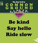
THE BAY TRAIL IS COMMON GROUND SIGNS
The City’s Public Works Department printed, plated and REI Co-Op
installed 16 “The Bay Trail Is Common Ground - Be Kind”
signs along the trail. The signs were developed by the Thank you for supporting completion of the Bay Trail in
Richmond Bicycle and Pedestrian Richmond. Please share this report with your friends and
Advisory Committee working with neighbors, encouraging them to join the Richmond Bay Trail
Jan Brown of Spokewise, who Network at no cost by e-mailing baytrailtrac@gmail.com.
prepared the graphic design. The
aim is to improve trail safety and TRAC Steering Committee : Donald Bastin, Bruce Beyaert-Chair, Bruce Brubaker-
reduce user conflicts. -Vice Chair, Andrew Butt, Aimee-Flynn-Curran, Claudia Garcia & Michelle Hook
Learn More About the Bay Trail!
For maps, guides and more
information about the Bay Trail
in Richmond, visit https://www.
pointrichmond.com/bay-trail/
TRAC | New Year Report 2023Bay Trail
Complete
Incomplete
Connector Trail Point
Complete Wilson
Incomplete
Water Trail site Point Pinole
Regional
Shoreline
Water Trail site
(planned)
At las R d
Parks/Open Space
Water Bodies
Av e
abl o
nP
Richmond
Sa
Goodrick Ave
ay
kw
ar
Richmond P
Landfill
San Pablo
Point San Pablo
Point San Pablo Loop Trail
Yacht Harbor
k Tra il
at Cree
W ildc
Wildcat
Marsh
Trail
Gertrude Ave
St
ley
ns
Winehaven
He
Historic District
Richmond
Point
Molate
Pennsylvania Ave
Point Molate Beach Park
80
y
kw
dP
Barrett Ave
mon
Richmond
S te n ma
Nevin Ave
t
oS
West Macdonald BART Station
Trail Open — Pi
ch
str
lot Project rk
Ri
Ca
Dr Richmond
Museum of History
El Cerrito
vd
Richmond-San Ra
fael Bridge
Bl
rd
rra
Ohio Ave Richmond Greenway
Richmond
Ga
Wellness
Point Trail
23rd St
Cutting Blvd
Richmond
Boat El Cerrito del Norte
Ho
Ramp St m BART Station
an Wright
Ca 580
Oh
Keller na
M
Beach lB
l on
y Soutn
Marina W y
ar y
lvd R ega tt a B l
Dornan Dr
ina
Pk
vd
eG
w
Bay
re e
Miller-Knox
Welcome to
H arbou r Wa
Regional
nw
Shoreline
ay
St
a rd Cove Hall
Marina Marina
51st
ky Bay
Richmond
B ri c Bay Park
Kaiser RegioTo Point Is
Ferry Shipyard 3 nal S a
hore bel El
line
Point Jay & Pl
Over 36 miles of Bay Trail SS
Point Red Oak
Lucretia Barbara
Edwards Vincent Shimada
Park
BA
St
Park Park
linking a necklace of
Potrero Victory
Richmond- Rosie the Riveter/ Point Isabel
San Francisco WWII Home Front Regional
12 shoreline parks Ferry Terminal NHP Visitor Center Shoreline
Brooks Island
January 2023
MILES
August 2022 0 0.25 0.5 0.75 1
Open
Fall
TRAC | New Year Report 2023 2019
14.6” x 17.3” — Garrard Blvd.You can also read


