Achany Extension Wind Farm - SSE Renewables Otter and Water Vole Survey Report
←
→
Page content transcription
If your browser does not render page correctly, please read the page content below
SSE Renewables

      Achany Extension Wind Farm
                  Otter and Water Vole Survey Report

Wood Environment & Infrastructure Solutions UK Limited – June 2021
2            © Wood Environment & Infrastructure Solutions UK Limited

Report for                                                                          Copyright and non-disclosure notice
                                                                                    The contents and layout of this report are subject to copyright
Karen Anderson                                                                      owned by Wood (© Wood Environment & Infrastructure
Consent Manager                                                                     Solutions UK Limited 2020) save to the extent that copyright
                                                                                    has been legally assigned by us to another party or is used by
SSE Renewables                                                                      Wood under licence. To the extent that we own the copyright
One Waterloo Street                                                                 in this report, it may not be copied or used without our prior
Glasgow                                                                             written agreement for any purpose other than the purpose
G2 6AY                                                                              indicated in this report. The methodology (if any) contained in
                                                                                    this report is provided to you in confidence and must not be
                                                                                    disclosed or copied to third parties without the prior written
                                                                                    agreement of Wood. Disclosure of that information may
Main contributors                                                                   constitute an actionable breach of confidence or may
Hannah Rowding                                                                      otherwise prejudice our commercial interests. Any third party
                                                                                    who obtains access to this report by any means will, in any
                                                                                    event, be subject to the Third Party Disclaimer set out below.

Issued by
                                                                                    Third party disclaimer
Hannah Rowding                                                                      Any disclosure of this report to a third party is subject to this
.................................................................................   disclaimer. The report was prepared by Wood at the instruction
                                                                                    of, and for use by, our client named on the front of the report.
                                                                                    It does not in any way constitute advice to any third party who
                                                                                    is able to access it by any means. Wood excludes to the fullest
                                                                                    extent lawfully permitted all liability whatsoever for any loss or
Approved by                                                                         damage howsoever arising from reliance on the contents of
                                                                                    this report. We do not however exclude our liability (if any) for
Alastair Miller                                                                     personal injury or death resulting from our negligence, for
.................................................................................   fraud or any other matter in relation to which we cannot legally
                                                                                    exclude liability.

Wood                                                                                Management systems
                                                                                    This document has been produced by Wood Environment &
Doc Ref. 805906-WOOD-XX-XX-RP-OE-0004_S3_PO1.3                                      Infrastructure Solutions UK Limited in full compliance with the
                                                                                    management systems, which have been certified to ISO 9001,
                                                                                    ISO 14001 and OHSAS 18001 by LRQA.

                                                                                    Document revisions

                                                                                     No.       Details                                Date

                                                                                     1         Draft                                  17/12/20

                                                                                     2         Draft                                  08/04/21

                                                                                     3         Draft                                  15/06/21

June 2021
Technical Appendix 8.3: Otter and Water Vole Survey Report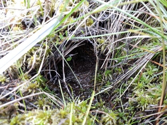
3      © Wood Environment & Infrastructure Solutions UK Limited

Contents

1.           Introduction                                                       4
1.1          Purpose of this Report                                              4
1.2          Site and Study Area Description                                     4

2.           Methodology                                                        5
2.1          Desk Study                                                          5
             Data Search                                                         5
             Previous Survey Work                                                5

2.2          Field Survey                                                        5
             Otter                                                               5
             Water vole                                                          6

2.3          Survey Limitations                                                  6

3.           Results                                                            8
3.1          Desk Study                                                          8
             Data Search                                                         8
             Previous Survey work                                                8

3.2          Field Survey                                                        9
             Otter                                                               9
             Water vole                                                         10

4.           Summary                                                            11
4.1          Desk Study                                                         11
4.2          Field Survey                                                       11
             Otter                                                              11
             Water vole                                                         11

             Figure 8.3.1      Site Location and Study Area
             Figure 8.3.2      Otter Survey Results
             Figure 8.3.3      Water Vole Survey Results

             References                                                         13

             Annex A                         Relevant Legislation
             Annex B                         Otter and Water Vole Field Signs
             Annex C                         Representative Photographs
             Annex D                         Confidential Annex

June 2021
Technical Appendix 8.3: Otter and Water Vole Survey Report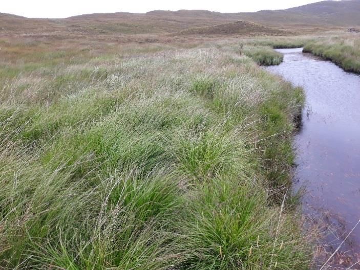
4     © Wood Environment & Infrastructure Solutions UK Limited

1.           Introduction

1.1          Purpose of this Report
1.1.1        Wood Group UK Ltd (Wood) was commissioned by SSE Renewables (SSER) to undertake survey
             work in relation to protected species at the proposed Achany Extension Wind Farm, ‘the Site’.

1.1.2        This report provides the results of an otter (Lutra lutra) and water vole (Arvicola amphibius) survey
             carried out in August 2020. The aim of the survey was to identify the presence of, and/or potentially
             suitable habitat for, otter and water vole, as well as any other features of ecological interest that
             may pose a potential constraint to works. Protected species legislation relevant to this report is
             summarised in Annex A.

1.1.3        This report outlines the methods employed to carry out the survey, followed by presentation of
             results and a summary of key findings.

1.2          Site and Study Area Description
1.2.1        The Proposed Development is a 20-turbine extension to the existing Achany Wind Farm; an
             operational 19-turbine wind farm situated south-east of the Site. The Site itself is located
             onGlencassley and Glenrossal Estates, approximately 4.5km north of the village of Rosehall, and
             approximately 11km west-north-west of Lairg within the Scottish Highlands (central Ordnance
             Survey [OS] grid reference: NC 45997 07903).

1.2.2        The Site is positioned on the east side of Glen Cassley, approximately 1.5km from the River Cassley
             which runs parallel to the south-western part of Site. The elevation of the Site ranges from
             approximately 220 metres (m) Above Ordnance Datum (AOD) at Allt an Rāsail watercourse, to 476m
             AOD at the summit of Beinn Sgeireach. Landscape within the Site is formed of open upland habitat,
             comprised primarily of wet heath, blanket bog, and marshy grassland habitat. There are two main
             watercourses within the Site – the Allt an Rāsail and Allt Ban na t-Sagairt, with associated minor
             tributaries. The Allt an Leacach watercourse lies just outside the Site, defining the north-western
             red-line boundary. All watercourses flow into the into the River Cassley catchment.

1.2.3        The otter and water vole ‘Study Area’ is defined by the Site boundary and associated 200m buffer
             (Figure 8.3.1). The existing access route through the operational Achany Wind Farm Site was
             subject to an Extended Phase 1 Habitat walkover and has been further informed through the
             completion of annual water vole monitoring surveys, most recently in April 2021.

June 2021
Technical Appendix 8.3: Otter and Water Vole Survey Report
5 © Wood Environment & Infrastructure Solutions UK Limited
2. Methodology
2.1 Desk Study
Data Search
2.1.1 To inform the survey design and provide context for assessment, records of protected species
within 2km of the Site boundary were requested from the Highland Biological Records Group
(HBRG). These data were obtained in March 2020 (Wood, 2021).
Previous Survey Work
2.1.2 The Glencassley Wind Farm Environmental Statement (ES) (Environ, 2012) details the results of
protected species survey work carried out in 2011, which has been reviewed to provide contextual
information about the Study Area.
2.1.3 A recent report relating to the Habitat Management Plan (HMP) for the operational Achany Wind
Farm (Applied Ecology, 2020) was also reviewed to provide information on the potential presence
of protected species adjacent to the Study Area and along the proposed Site access track.
2.2 Field Survey
2.2.1 The otter and water vole survey was carried out by Hannah Rowding (BSc, MSc, ACIEEM) and David
Knox (BSc, MEnSt, MCIEEM) between 04th and 06th August 2020. Both surveyors meet the CIEEM
competency standards for undertaking protected species surveys (CIEEM, 2013a and b).
Otter
2.2.2 The survey for otter comprised a walkover assessment of all water features, associated banks, and
up to 50 meters (m) from bank tops, plus any other areas of suitable otter habitat, within the Study
Area (Figure 8.3.1). Surveyors walked along alternative watercourse edges/banksides in order to
cover the area efficiently, and to comply with health and safety requirements associated with work
in/near water.
2.2.3 Otter field signs were recorded by location, type, condition, and age. Field signs are described by
Harris and Yalden (2008), Bang and Dahlstom (2006), and Chanin (2003), and include the following:
⚫ Holt – underground features where otters shelter and rest. They are often situated in natural
cavities, such as tunnels along the edge of riverbanks, underneath tree root plates, heather
root matrices, or boulder piles. Holts can also be located within man-made structures such as
drains or embankments;
⚫ Couch – typically above ground resting sites that are used for sleeping or grooming. Often
located on the banks of watercourses, ponds or lochans, and occasionally found further inland
in thick vegetation or reed beds. Rolling places, where the otter dries and grooms its fur after
leaving the water, may also be used as couches. For ease of description, couches have been
categorised into ’covered’ or ‘open’ within this report, as described below:
Couch (covered) – Resting sites providing cover from above, however lack a distinct
underground tunnel system, e.g. below overhanging peat turves; and
June 2021
Technical Appendix 8.3: Otter and Water Vole Survey Report
6 © Wood Environment & Infrastructure Solutions UK Limited
Couch (open) - Resting sites that do not provide overhead cover, such as lying out sites in
rushes or heather.
⚫ Spraints - otter faeces, which tend to be black or green-black in colour. They have distinct
aromas and are generally composed of fish remains and crustacean shells. Spraints are often
located on prominent features within the channel or river bank, such as large rocks, and can
also be found close to, or within, the entrance to holts or couches;
⚫ Sign heap – a small mound of sand, gravel, grass, or mud scraped up by an otter to form a
prominent landmark on which to deposit spraint.
⚫ Feeding signs - remains of prey such as fish and skinned amphibians;
⚫ Prints - otters have five toes and unique footprints that can be identified in mud, silt or sand
at the edge of waterbodies;
⚫ Paths - routes that otters use to traverse across land, often between watercourses and resting
places; and
⚫ Play areas/ slides - located in areas where otters travel down a steep, often grassy, bank,
sliding down on their tummy.
2.2.4 Features that surveyors considered to support suitable otter habitat, e.g. as resting sites, but where
clear signs were lacking, were recorded as ‘potential resting sites’ and categorised as above.
Water vole
2.2.5 A search for water vole was carried out in conjunction with the otter survey, during which all
watercourses and waterbodies within the Study Area were assessed.
2.2.6 Water vole field signs are described in Strachan and Moorhouse (2011), and include the following:
• Faeces - cylindrical droppings with blunt ends, measuring approximately 12mm long and 4-5mm
wide, resembling a large ‘tic-tac’. Colour can vary depending on diet, ranging from green to dark
purple/ black;
• Latrines - these are the most distinctive field signs left by water voles. Latrines are faeces that are
often deposited in discrete locations. Latrines can be used to mark territories between February
and November;
• Feeding stations - water voles often bring food items to feeding stations along their pathways, at
burrow entrances, or on platforms along the water’s edge. These include neat piles of chewed
vegetation (such as coarse grasses, reeds, sedges and rushes) up to 10cm long that are left after
feeding. Sections typically have 45-degree cuts to their ends;
• Burrows - these appear as a series of holes along the water’s edge within banking, up to 3m from
the water’s edge. Holes typically have a diameter of 4-8cm;
• Runways - low tunnels leading through vegetation close to the water’s edge; and
• Nests - in some areas of rush pasture, water voles make woven nests above ground amongst
tussocks. Nests are generally around 20cm wide.
2.3 Survey Limitations
2.3.1 It was not possible to survey the lower section of the Allt bad na t-Saigairt (positioned within the
200m buffer surrounding the Site boundary) in detail as the watercourse flowed into a deep
June 2021
Technical Appendix 8.3: Otter and Water Vole Survey Report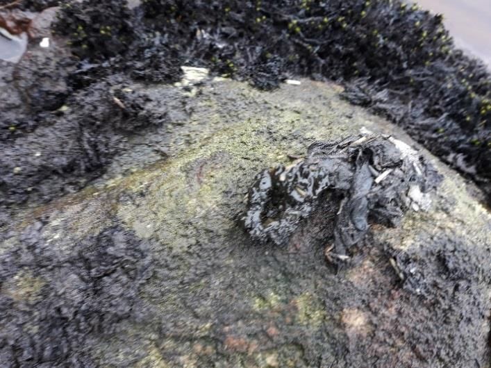
7      © Wood Environment & Infrastructure Solutions UK Limited

             wooded ravine as it travelled downgradient, which was not possible to access for health and safety
             reasons. This section of watercourse was therefore surveyed from a safe distance at the top of the
             ravine with the use of binoculars. Despite this limitation, it is considered that a robust set of data
             relating to otter activity within the Study Area has been obtained.

June 2021
Technical Appendix 8.3: Otter and Water Vole Survey Report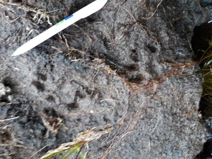
8     © Wood Environment & Infrastructure Solutions UK Limited

3.           Results

3.1          Desk Study

             Data Search

             Statutory and Non- Statutory Designated Sites
3.1.1        Seven statutory designated sites are present within 10km of the Site boundary, one of which
             (Caithness & Sutherland Peatlands Special Area of Conservation [SAC]) supports otter as a
             qualifying feature. The boundary of this SAC borders the eastern perimeter of the Site.

3.1.2        A review of the most recent condition monitoring assessment of Caithness & Sutherland Peatlands
             SAC otter population was undertaken (Findlay et al., 2015). The Caithness & Sutherland Peatlands
             SAC was reported to be in favourable condition in 2003-04. The most recent assessment (2011-12)
             showed a continued decline in otter presence and the SAC was suggested in this report to be in
             unfavourable condition. Less than 80% of sites were found to have evidence of otter, coupled with
             a reduction in positive sites for two consecutive cycles and an apparent contraction in range from
             peripheral areas.

3.1.3        In addition, while otter may not be listed as a qualifying feature of the River Oykel SAC, the River
             Cassley forms part of its catchment area (located approximately 1.5km south-west of Site), of which
             is likely to support suitable commuting, foraging, and resting habitat for otter.

3.1.4        For full details relating to statutory and non-statutory site descriptions and locations, please refer to
             Technical Appendix 8.1 (Desk Study and Phase 1 Habitat Survey Report).

             Protected and notable species
3.1.5        The data search carried out by HBRG for legally protected/ priority species within 2km of the Site
             boundary returned no records of otter or water vole within the last 10 years (2010 -2020).

             Previous Survey work
3.1.6        Protected species surveys were carried out by Alba Ecology between June and July 2011 to support
             the 2012 ES. The results of these surveys are summarised below:

             Otter
3.1.7        No evidence of otter was identified within the Site boundary during the 2011 survey. Otter field
             signs were however identified within the wider study area (outside the Site boundary) including:

             ⚫    A single otter spraint on a boulder within the Allt an Rāsail watercourse, just outside the Site
                  boundary;

             ⚫    An otter couch and spraint within the lower reaches of Allt an Dubh Loch Bhig; and

             ⚫    Otter sightings and single spraint were recorded at the edge of Loch Langwell.

             Water vole
3.1.8        A patchy distribution of water vole field signs and suitable habitat was identified within the Site
             boundary, including:

June 2021
Technical Appendix 8.3: Otter and Water Vole Survey Report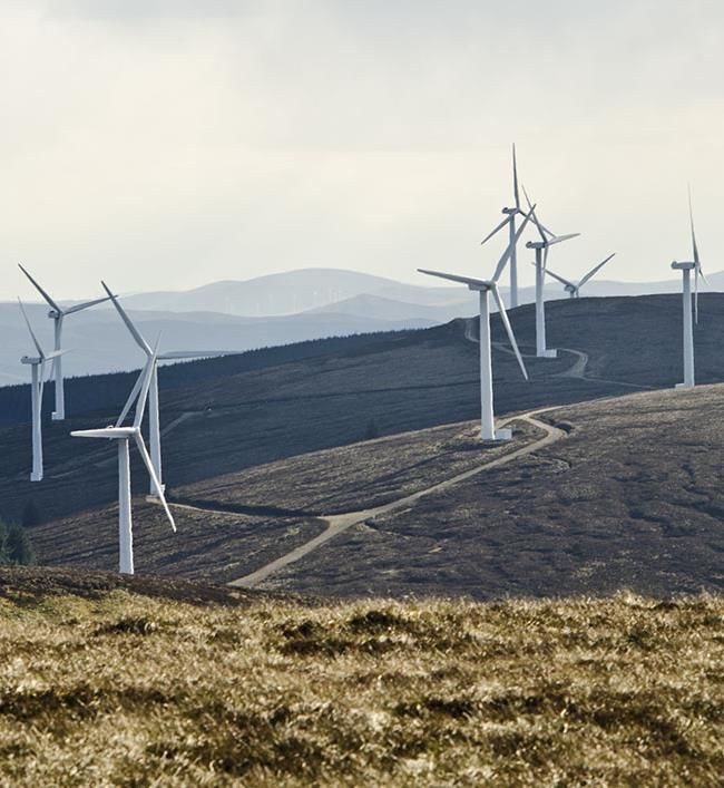
9     © Wood Environment & Infrastructure Solutions UK Limited

             ⚫    Burrows, runways, and latrines within marshy grassland habitat along the mid-reaches of the
                  Allt an Rāsail watercourse;

             ⚫    Inactive (old) water vole burrows present along the Allt an Leacach watercourse;

             ⚫    Water vole field signs present along a small tributary of the Allt Langwell;

             ⚫    Burrows and a water vole sighting identified within marshy grassland adjacent to Allt an Dubh
                  Loch Bhig; and

             ⚫    Potential water vole habitat along the banks of Dubh Loch Mor outflow burn.

3.1.9        For full details of previous survey results, please refer to Environ (2012).

3.1.10       In addition to ecological information presented within the 2012 ES, water vole data relating to the
             existing Achany Wind Farm HMP was considered. HMP objectives included the implementation of
             water vole habitat enhancement works, which were carried out in two main areas of Achany Wind
             Farm. Post construction monitoring for water vole has subsequently been conducted between years
             2008 and 2021.

3.1.11       Water vole activity within the habitat enhancement area adjacent to the lower reaches of Allt Sron
             nan larnachan/ start of Allt a' Bhadain was recorded consistently between 2010 and 2015, however
             this reduced to only intermittent field signs until late 2018/ early 2019. In contrast, water vole
             activity within the second habitat enhancement area (situated near the headwaters of the un-
             named tributaries of the Ghruididh Burn) was identified throughout the ten-year post-construction
             monitoring period, with all enhancement sites showing evidence of occupation or use as habitat
             corridors.

3.1.12       A review of the most recent 2021 survey records for Achany Wind Farm HMP identified the
             presence of seven discrete water vole colonies within the operational wind farm site boundary
             (Applied Ecology, 2021). Water vole colonies were located along the following watercourses:

             ⚫    The Allt a' Bhadain and Allt Sron nan larnachan - positioned within 20m of the existing wind
                  farm access track at its closest point. The access track also crosses the Allt a' Bhadain near the
                  site entrance;

             ⚫    Three un-named tributaries of the Ghruididh Burn - positioned approximately 70m from an
                  operational turbine and 470m from the main wind farm access track; and

             ⚫    Adjacent to the headwaters of a further un-named tributary of the Ghruididh Burn, within the
                  north-west of the wind farm site, approximately 100m from the existing wind farm access track.

3.2          Field Survey
3.2.1        The results of the 2020 otter and water vole field survey are described below. Target notes (TNs)
             relating to the location of field signs are displayed in Tables B.1 and B.2 in Annex B, while
             representative photographs are displayed in Annex C. The TNs are designed to accompany the
             mapped results in Figures 8.3.2 [Confidential] and Figure 8.3.3. Confidential records are presented
             separately in Annex D.

             Otter
3.2.2        Widespread evidence of otter activity was identified along the two main watercourses within the
             Study Area – the Allt an Rāsail and Allt Bad na t-Sagairt (Figure 8.3.2). Otter field signs observed
             include spraints (TNs 1 – 18, and TN 24), prints (TNs 20, 26, and 27), three active resting sites (TNs

June 2021
Technical Appendix 8.3: Otter and Water Vole Survey Report
10     © Wood Environment & Infrastructure Solutions UK Limited

             19, 25 and 28) and three potential resting sites (TNs 21 – 23). No evidence of otter activity was
             recorded along the Allt an Leacach watercourse within the north-west of the Study Area.

3.2.3        Survey results indicate that the highest level of otter activity was recorded along the Allt an Rāsail
             watercourse. This is illustrated in Figure 8.3.2 by the presence of numerous spraints along the main
             stem of the watercourse and associated minor tributaries. An otter couch (TN 19) was also recorded
             on the south-eastern bank of the main stem of the watercourse. Further upstream, within the banks
             of a small hill loch (of which is connected to the Allt an Rāsail watercourse by a minor outflow
             stream), a potential holt was recorded (TN 21). In addition, otter prints were recorded within peaty
             substrate along the edge of Loch an Rāsail (TN 20) in the upper reaches of the Allt an Rāsail (TN
             27).

3.2.4        Otter activity was also identified along the Allt Bad na t-Sagairt, whereby two potential holts (TN 22
             and 23), and an otter couch (TN 25) were identified on the south bank of the watercourse. Further
             upstream, otter prints and scratch marks were identified within peaty substrate along the southern
             edge of the watercourse (TN 26).

3.2.5        An otter holt was also recorded within the lower reaches of the Allt Bad na t-Sagairt, outside of the
             study area. The holt was characterised by the presence of several old spraints within a deep
             sheltered alcove formed by boulders on the south bank of the watercourse (TN 28).

             Water vole
3.2.6        Suitable upland water vole habitat (comprising well-vegetated banks of rush vegetation and/ or
             purple moor grass mire) was found to exist along sections of all watercourses and associated
             tributaries within the Study Area.

3.2.7        During the survey, water vole field signs were identified adjacent to the Allt an Rāsail watercourse
             and associated tributaries, and within the upper reaches of the Allt Bad na t-Sagairt (Figure 8.3.3).

3.2.8        Two main areas of water vole activity were identified along the Allt an Rāsail watercourse. The first
             was positioned adjacent to a minor tributary within the south of the survey area (TNs 29 – 30),
             whereby water vole burrows, fresh droppings, and runways were recorded within marshy grassland
             habitat immediately adjacent to the watercourse. The second, and most extensive, area of water
             vole activity was recorded within the upper reaches of the Allt an Rāsail, along the eastern
             boundary of Site. Here, several pockets of active habitat (with substantial burrow systems, runways
             and fresh latrines) were identified (TNs 39-45). For example, one pocket of active habitat contained
             a minimum count of 40 burrows, with well-defined runways between entrances, and large latrine
             areas (TN 39), indicating a high population density of water vole in this area.

3.2.9        In addition to active water vole habitat, evidence of old, potentially inactive, water vole burrows
             were also identified along the central stretch of the Allt an Rāsail (TNs 31-34, 46 and 47).

3.2.10       Water vole habitat (in the form of burrows and runways) was also recorded along the upper
             reaches of the Allt Bad na t-Sagairt (TNs 35 – 38).

June 2021
Technical Appendix 8.3: Otter and Water Vole Survey Report
11 © Wood Environment & Infrastructure Solutions UK Limited
4. Summary
4.1 Desk Study
4.1.1 The data search carried out by HBRG for legally protected/ priority species within 2km of the Site
boundary returned no records of otter or water vole within the last 10 years (2010 -2020). Survey
work carried out in 2011 also identified very limited evidence of otter activity within the Site.
4.1.2 Evidence of active water vole habitat was identified within the Site (along the mid-reaches of the
Allt an Rāsail watercourse) during survey work carried out in 2011 to support the 2012 ES. In
addition, active water vole habitat is also known to exist along watercourses that intersect the
adjacent Achany Wind Farm, in the form of seven discrete water vole colonies. Further survey work
undertaken in April 2021 along the Allt a’ Bhadain and the Allt Sron nan lamachan (watercourses
located in close proximity to the proposed access track) have further informed any required
mitigation for protection of active water vole habitat that may otherwise be affected by the
Proposed Development.
4.2 Field Survey
Otter
4.2.1 The survey carried out in August 2020 identified widespread evidence of otter activity along
watercourses within the Study Area, in the form of spraints, prints, and resting places. A total of
three resting places (two couches and one holt) were identified, with an additional three potential
resting places (one potential couch and two potential holts) also recorded within the Study Area.
4.2.2 The highest level of otter activity appears to be located along the Allt an Rāsail, as highlighted by
numerous spraints and presence of resting sites identified along the surveyed stretch of this
watercourse.
4.2.3 The overall level of otter field signs recorded within the Study Area during the 2020 surveys was
found to be greater than those recorded in 2011, which may be related to seasonal and temporal
variations in the pattern of otter activity, climatic conditions, or changes in food source.
4.2.4 The results of the 2020 field survey indicate that otters utilise watercourses within the Study Area
for foraging, commuting and resting purposes. Any development within the Site should therefore
consider the presence of this European Protected Species (Annex A). Further survey work may be
required, along with the incorporation of appropriate mitigation measures, if the Proposed
Development is considered to have direct or indirect effects on this species.
Water vole
4.2.5 Evidence of active water vole habitat was identified in pockets along watercourses within the Study
Area, in the form of burrows, runways, and latrines. The most extensive areas of active water vole
habitat were distributed along the upper reaches of the Allt an Rāsail watercourse, of which defines
part of the eastern boundary of the Site. Smaller pockets of active habitat were also present to the
south of the Study Area and along the upper reaches of the Allt Bad na t-Sagairt watercourse.
These results correspond with findings of previous studies (e.g. Lambin et al, 1998; Aars et al, 2001),
of which suggest that upland water vole populations tend to be naturally fragmented, formed of
small, widely scattered colonies. This pattern of distribution is likely to be related to the localised
nature of preferred habitat, resulting in several small populations occupying favourable habitat
June 2021
Technical Appendix 8.3: Otter and Water Vole Survey Report12 © Wood Environment & Infrastructure Solutions UK Limited
patches, separated from similar populations by areas of less suitable land (Aars et al, 2001;
Capreolus Wildlife Consultancy, 2005).
4.2.6 The overall distribution of water vole field signs recorded along Allt an Rāsail and Allt Bad na t-
Sagairt watercourses appears be greater during surveys carried out in 2020 than those recorded
during the 2011. This may be attributed to spatial and temporal changes in the suitability of habitat
to sustain water vole populations (Capreolus Wildlife Consultancy, 2005), and may also indicate a
natural pattern of multi-annual fluctuations in water vole abundance (Aars et al. 2001).
4.2.7 In addition to active water vole habitat, areas of rush and purple moor grass mire vegetation with
potential to support water vole (in which field signs were not recorded) exist along all watercourses
within the Study Area. Potential therefore remains for water vole to colonise different parts of the
watercourses in the future. On this basis, appropriate mitigation measures have been considered
within Chapter 8 - Ecology.
June 2021
Technical Appendix 8.3: Otter and Water Vole Survey Report13 © Wood Environment & Infrastructure Solutions UK Limited References Aars, J., Lambin, X., Denny, R., and Griffin, A., Cy. (2001). Water vole in the Scottish Uplands: distribution patterns of disturbed and pristine populations ahead and behind the American mink invasion front. Animal Conservation 4, 187–194. Achany Extension Wind Farm EIA Report, Technical Appendix 8.1: Desk Study and Phase 1 Habitat Survey Report. Applied Ecology (2020). Achany Wind Farm Habitat Management Plan – 10 year review. Bang, P., Dahlstrom, P. (2006). Animal Tracks and Signs. Oxford University Press. Chanin, P. (2003). Monitoring the otter Lutra lutra. Conserving Natura 2000 Rivers Monitoring Series No. 10. English Nature, Peterborough. Capreolus Wildlife Consultancy (2005). The ecology and conservation of water voles in upland habitats. Scottish Natural Heritage Commissioned Report No. 099 (ROAME No. F99AC320). CIEEM (2013a). Competency for species survey: Eurasian otter. https://cieem.net/wp- content/uploads/2019/02/CSS-EURASIAN-OTTER-April-2013.pdf CIEEM (2013b). Competency for species survey: Water vole. https://cieem.net/wp- content/uploads/2019/02/CSS-WATER-VOLE-April-2013.pdf Findlay, M., Alexander, L. & Macleod, C. 2015. Site condition monitoring for otters (Lutra lutra) in 2011-12. Scottish Natural Heritage Commissioned Report No. 521.Harris, S., Yalden, D. (2008). Mammals of the British Isles: Handbook, 4th Edition. Mammal Society. Lambin, J.C., Fazey, I., Sansom, J., Dallas, J., Stewart, W., Piertney, S., Palmer, S., Bacon. P. & Webb, A. (1998). Aberdeenshire water vole survey: the distribution of isolated water vole populations in the upper catchment of the rivers Dee and Don. Scottish Natural Heritage Research, Survey & Monitoring Report No.118. Strachan, R., Moorhouse, T., Gelling, M. (2011). Water Vole Conservation Handbook, 3rd edition. Wildlife Conservation Research Unit, Great Britain. July 2021 Technical Appendix 8.3: Otter and Water Vole Survey Report
A1    © Wood Environment & Infrastructure Solutions UK Limited

Annex A
Relevant Legislation

Otter
The otter is a European Protected Species and receives full protection under the Conservation (Natural
Habitats & c.) Regulations 1994 (as amended) (The Habitats Regulations) 1. This legislation makes it an
offence to deliberately or recklessly:

             ⚫    capture, injure or kill such an otter;

             ⚫    harass an otter or group of otters;

             ⚫    disturb an otter while it is occupying a structure or place used for shelter or protection;

             ⚫    disturb an otter while it is rearing or otherwise caring for its young;

             ⚫    obstruct access to a breeding site or resting place, or deny an otter use of a breeding site or
                  resting place;

             ⚫    disturb an otter in a manner or in circumstances likely to significantly affect the local
                  distribution or abundance of the species; and

             ⚫    disturb an otter in a manner or in circumstances likely to impair its ability to survive, breed or
                  reproduce, or rear or otherwise care for its young.

It is also an offence to:

             ⚫    damage or destroy a breeding site or resting place of such an animal (whether deliberately or
                  recklessly); and

             ⚫    keep, transport, sell or exchange, or offer for sale or exchange, and wild otter (or any part or
                  derivative of one) obtained after 10 June 1994.

Any activity which is likely to affect such species requires consultation with the relevant statutory nature
conservation organisation prior to any works commencing. In Scotland, this is NatureScot.

Water vole
The water vole receives partial protection under Schedule 5 of the Wildlife and Countryside Act 1981 (as
amended). In Scotland, this legal protection is currently restricted to the water vole’s places of shelter or
protection. This legislation makes it an offence to intentionally or recklessly:

             ⚫    damage, destroy or obstruct access to any structure or place that water voles use for shelter or
                  protection; and

             ⚫    disturb a water vole while it is using any such place for shelter or protection.

Any work that may potentially cause disturbance to such species requires prior consultation with NatureScot.

1 The Conservation (Natural Habitats, &c.) Regulations 1994 (as amended) have been amended by the Conservation
(Natural Habitats, &c.) (EU Exit) (Scotland) (Amendment) Regulations 2019. The regulations as detailed above therefore
remain in force following the UK’s departure from the European Union.

July 2021
Technical Appendix 8.3: Otter and Water Vole Survey Report
B1 © Wood Environment & Infrastructure Solutions UK Limited
Annex B
Otter and Water vole Field Signs
Table B.1 Otter Field Signs
TN Field sign Grid reference Description
1 Spraint NC 49042 05516 Three old spraints (shells and bones remaining) on large mossy
boulder in centre of watercourse.
2 Spraint NC 46312 06900 Small, fresh spraint on boulder on eastern side of watercourse
3 Spraint NC 46172 07083 Fresh otter spraint on boulder in centre of watercourse.
4 Spraint NC 46087 07275 Fresh spraint on boulder in watercourse.
5 Spraint NC 46072 07313 Old spraint (scales and bones remaining) on soil mound on north-
east edge of watercourse.
6 Spraint NC 46023 07399 Old spraint on boulder in centre of watercourse.
7 Spraint NC 45986 07467 Small, old spraint on boulder in centre of watercourse.
8 Spraint NC 45948 07584 Recent otter spraint on rock on western bank of watercourse.
9 Spraint NC 46021 07906 Recent otter spraint on rock on south bank of watercourse.
10 Spraint NC 46012 08043 Old otter spraint on rock in centre of watercourse.
11 Spraint NC 46015 08057 Old otter spraint on rock in centre of watercourse.
12 Spraint NC 46009 08206 One recent and one old spraint on rock in centre of small
watercourse.
13 Spraint NC 46010 08310 Old otter spraint on rock in centre of watercourse.
14 Spraint NC 46083 07908 Fresh otter spraint on rock on north bank of watercourse.
15 Spraint NC 46132 07900 Recent otter spraint on boulder in centre of watercourse.
16 Spraint NC 46632 08430 Very fresh otter spraint on rock in centre of watercourse.
17 Spraint NC 46697 08440 Very fresh otter spraint on rock in centre of watercourse.
18 Spraint NC 46734 08435 One very fresh and one old spraint on large boulder in centre of
watercourse.
19 Couch NC 46966 08649 Otter resting place in east bank of watercourse – comprise of
(covered) overhanging heather that forms a sheltered alcove, stretching
approximately 3m along the bankside. Two old otter spraints
present on rocks inside.
20 Prints NC 47384 08680 Otter prints in peat on south bank of loch.
21 Potential holt CONFIDENTIAL ANNEX D
22 Potential holt CONFIDENTIAL ANNEX D
July 2021
Technical Appendix 8.3: Otter and Water Vole Survey ReportB2 © Wood Environment & Infrastructure Solutions UK Limited
TN Field sign Grid reference Description
23 Potential holt CONFIDENTIAL ANNEX D
24 Spraint NC 44358 10238 Old Spraint on boulder in watercourse.
25 Couch NC 44407 10222 Overhanging peat turves on south bank of watercourse has created
(covered) a shallow (up to 0.5m depth) sheltered alcove. One recent and one
very old spraint on rock at entrance. Grass at entrance also looks
slightly flattened.
26 Prints NC 44770 10226 Many otter prints (with scratch marks also present) in peat substrate
on southern edge of watercourse.
27 Prints NC 47090 09220 Otter prints in peat at edge of watercourse.
28 Holt CONFIDENTIAL ANNEX D
July 2021
Technical Appendix 8.3: Otter and Water Vole Survey ReportB3 © Wood Environment & Infrastructure Solutions UK Limited
Table B.2 Water vole Field Signs
TN Field sign Grid reference Description
29 Burrows NC 46365 06916 Water vole burrows with fresh droppings present within marshy
grassland habitat adjacent to a minor tributary. Several burrows
were observed within 1m of the watercourse (e.g. one burrow at NC
46365 06916, three at NC 46370 06919 and one at NC 46383
06929).
30 Burrows NC 46400 06984 Water vole burrows with droppings also present on both sides of
watercourse at this location. A minimum count of three burrows
were noted within two meters of the watercourse. Both fresh and
old droppings present. Runways also observed throughout rushes.
31 Burrows NC 46133 07165 Water vole burrows situated on western bank of watercourse, next
to a stretch of very slow flowing water. However, there was no fresh
evidence observed to suggest burrows are currently active.
32 Burrows NC 45909 07694 Single old burrow present on eastern edge of watercourse – no
signs to indicate burrow is currently in use.
33 Burrows NC 45890 07823 Single old burrow present on eastern edge of watercourse – no
signs to indicate burrow is currently in use.
34 Burrows NC 45935 07830 Two old burrows in marshy grassland habitat on southern bank of
watercourse - no signs to indicate burrow is currently in use.
35 Burrows NC 45365 10533 Minimum count of eight burrows identified along a 7m stretch of
watercourse between NC 45356 10540 and NC 45368 10530 (on
southern side). While no droppings or clippings were observed at
this location, the burrows are well defined and smooth inside, with
clear connecting runways along the water edge. One burrow also
appeared to be blocked with mud and grass, suggesting current
use. Burrows measured 12-15cm diameter at entrances.
36 Burrows NC 45374 10518 Well defined runways in rushes on both sides of the watercourse,
with a minimum count of three burrows present.
37 Burrows NC 45395 10504 Single burrow on north side of watercourse with fresh clippings near
entrance. Runways present within rushes until NC 45400 10483.
38 Burrows NC 45735 10529 Minimum count of three burrows next to watercourse. Well defined,
however no other field signs present.
39 Burrows NC 46929 09736 Water vole colony present within marshy grassland habitat on east
side of watercourse. Evidence of presence starts at NC 46929 09736
and continues approximately 40m up the tributary watercourse to
NC 46959 09785. A minimum count of 40 burrows was noted,
although there is likely to be more. Well defined runways
throughout rushes and large latrine areas also present within
runways.
40 Burrows NC 46988 09830 Pocket of five water vole burrow with connecting runways in rushes
on both sides of watercourse.
41 Burrows NC 46985 09816 Seven water vole burrows noted next to watercourse. Burrows are
well defined with smooth, muddy entrances.
42 Burrows NC 46959 09681 Two water vole burrows on east side of watercourse (within 1m of
bank). Entrances are well defined, however no other field evidence
observed.
July 2021
Technical Appendix 8.3: Otter and Water Vole Survey ReportB4 © Wood Environment & Infrastructure Solutions UK Limited
TN Field sign Grid reference Description
43 Burrows NC 46986 09648 Water vole colony in marshy grassland (rush) habitat on both sides
of a minor watercourse. A minimum count of 30 burrows was
recorded. Droppings were also observed within runways on the
north-west side of the watercourse. Field signs stat at NC 46985
09648 and end at NC 47008 09683.
44 Burrows NC 47085 09351 Minimum count of 18 burrows observed on west side of
watercourse. These may be old burrows as do not look as well
utilised as those noted previously. Two burrows were also noted on
the east side of the watercourse in this location, however seemed
slightly overgrown. Field signs started at NC 47085 09351 and
ended at NC 47098 09318.
45 Burrows NC 47090 09195 Six water vole burrows with recent clippings and droppings present
on east side of watercourse. Nine burrows were also observed on
the west side of the watercourse in this location.
46 Historic NC 45920 07691 Location of water vole burrows recorded during previous surveys –
burrows however no signs of recent water vole activity or obvious burrows
were observed on the western bank of the watercourse during 2020
survey.
47 Historic NC 45885 07796 Location of water vole burrows recorded during previous surveys –
burrows no signs of recent activity or obvious burrows in area during 2020
survey.
48 Historic NC 43662 11807 Location of water vole burrows recorded during previous surveys –
burrows however no signs of recent water vole activity or obvious burrows
were observed on during 2020 survey.
July 2021
Technical Appendix 8.3: Otter and Water Vole Survey ReportB5 © Wood Environment & Infrastructure Solutions UK Limited Annex C Representative Photographs Photo 1: Recent otter spraint on rock at edge of watercourse (TN Photo 2: Otter prints in muddy substrate at edge of watercourse 8) (TN 20) Photo 3: Otter couch formed of overhanging peat turves (TN 19) Photo 4: Potential holt in banking of small lochan (TN 21) July 2021 Technical Appendix 8.3: Otter and Water Vole Survey Report
B6      © Wood Environment & Infrastructure Solutions UK Limited

 Photo 5: Example of suitable water vole habitat adjacent to the     Photo 6: Example of a water vole burrow present on the Site (TN
 Allt an Rāsail watercourse                                          31)

 Photo 7: Old water vole droppings (TN 30)

July 2021
Technical Appendix 8.3: Otter and Water Vole Survey Report
240000 245000 250000 255000 260000
915000
Key
Site Boundary
Study Area
!
( Turbine
Lidar Location
"
Floated Track
Founded/Cut Track
Existing Track to be
"
Upgraded
!
(
!
( !
(
!
(
!
(
!
(
Hardstanding
910000
Borrow Pit
!
( !
(
Temporary Construction
!
(
!
( !
(
Compound, Security and
!
(
!
(
Storage and Batching Plant
!
(
!
(
!
(
Extension to Existing
Operations Building
Substation, Welfare Facility
!
(
!
(
!
( !
( and Store
Temporary Construction
Compound, Security and
Storage
905000
Scale 1:75,000 @ A3
±
900000
Km
0 1 2
Figure 8.3.1
Site Location and Study Area
Achany Extension Wind Farm
EIA Report - Technical Appendix 8.3:
Protected Species Survey Report
© Crown copyright and database rights 2021 Ordnance Survey 0100031673July 2021 Technical Appendix 8.3: Otter and Water Vole Survey Report
You can also read