Sun Prairie High School Traffic Impact Analysis - City of Sun Prairie Dane County, Wisconsin - VendorNet
←
→
Page content transcription
If your browser does not render page correctly, please read the page content below
PO Box 128
                          Cedarburg, WI 53012
                                800.605.3091
                              www.tadi-us.com

Sun Prairie High School
Traffic Impact Analysis
City of Sun Prairie
Dane County, Wisconsin

April 5, 2021
TRAFFIC IMPACT STUDY FOR:

                       SUN PRAIRIE HIGH SCHOOL
                   CITY OF SUN PRAIRIE, DANE COUNTY, WISCONSIN

                              DATE SUBMITTED: April 5, 2021

PREPARED FOR:
Sun Prairie Area School District
501 S. Bird Street
Sun Prairie, WI 53590
Phone: (608) 834-6683
Contact Persons: Janet Rosseter, Assistant Superintendent of Operations

PREPARED BY:
Traffic Analysis & Design, Inc.
N36 W7505 Buchanan Street
Cedarburg, WI 53012
Phone: (800) 605-3091
Contact Persons: Don Lee, P.E.                      (WisDOT TIA Certification # SE05-804-046)
                 John Bieberitz, P.E., PTOE         (WisDOT TIA Certification # SE05-804-044)

“I certify that this Traffic Impact Analysis has been prepared by me or under my immediate
supervision and that I have experience and training in the field of traffic and transportation
engineering.”

______________________
Donald J. Lee, P.E.
Wisconsin Registration #35214-006
Traffic Analysis & Design, Inc.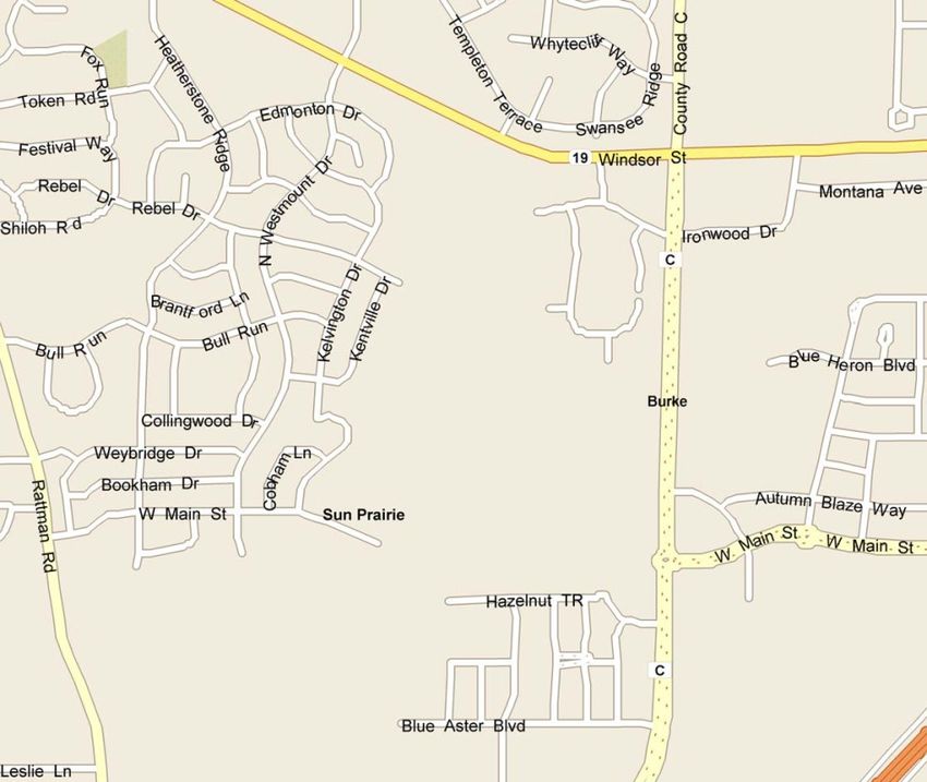
Sun Prairie High School
                                               Traffic Impact Analysis
                                                 Table of Contents

LIST OF EXHIBITS ....................................................................................................................... ii
LIST OF APPENDICES ................................................................................................................ iv
CHAPTER I – INTRODUCTION & EXECUTIVE SUMMARY..................................................1
   Part A – Purpose of Report and Study Objectives .......................................................................1
   Part B – Executive Summary .......................................................................................................1
CHAPTER II – PROPOSED DEVELOPMENT .............................................................................9
   Part A – On-Site High school ......................................................................................................9
   Part B – Study Area ...................................................................................................................10
   Part C – Off-Site Land Use ........................................................................................................10
   Part D – Site Accessibility .........................................................................................................10
CHAPTER III – ANALYSIS OF EXISTING CONDITIONS......................................................13
   Part A – Physical Characteristics ...............................................................................................13
   Part B – Traffic Volumes ...........................................................................................................13
   Part C – Capacity Level of Service ............................................................................................13
   Part D – Sources of Data ............................................................................................................15
CHAPTER IV – FORECASTED TRAFFIC .................................................................................16
   Part A – Background Traffic Forecasting ..................................................................................16
   Part B – Site Traffic Forecasting ...............................................................................................16
   Part C – Build Traffic ................................................................................................................18
CHAPTER V – TRAFFIC AND IMPROVEMENT ANALYSIS ................................................19
   Part A – Site Access...................................................................................................................19
   Part B – Capacity Level of Service Analysis .............................................................................19
   Part C – Queueing Analysis .......................................................................................................21
   Part D – Pedestrian, Bicycle, Bus Service and Multi-Use Trail Considerations .......................22
   Part E – Warrant Analysis..........................................................................................................22
CHAPTER VI – RECOMMENDATIONS AND CONCLUSION ...............................................27
   Part A – Recommendations .......................................................................................................27
   Part B – Conclusion ...................................................................................................................31
Sun Prairie High School – City of Sun Prairie, Wisconsin                              April 5, 2021

                                     LIST OF EXHIBITS

Exhibit 1-1 ........Project Overview Map
Exhibit 1-2 ........Conceptual Site Plan
Exhibit 1-3 ........Existing Traffic Recommended Modifications
Exhibit 1-4 ........Year 2022 Background Traffic Recommended Modifications
Exhibit 1-5 ........Year 2032 Background Traffic Recommended Modifications
Exhibit 1-6 ........Year 2022 Initial Build Traffic Recommended Modifications
Exhibit 1-7 ........Year 2032 Full Build Traffic Recommended Modifications

Exhibit 2-1 ........Project Overview Map
Exhibit 2-2 ........Conceptual Site Plan

Exhibit 3-1 ........Existing Transportation Detail
Exhibit 3-2A......Existing Traffic Volumes
Exhibit 3-2B ......Year 2022 Background Traffic Volumes
Exhibit 3-3A......Existing Traffic Operations – Without Modifications
Exhibit 3-3B ......Year 2022 Background Traffic Operations – Without Modifications

Exhibit 4-2 ........Year 2032 Background Traffic Volumes
Exhibit 4-3A......Approved School Loading - Initial Build (with Target Student Population) On-
                  Site Trip Generation & Distribution Tables
Exhibit 4-3B ......Approved School Loading - Full Build (with Maximum Capacity Student
                   Population) On-Site Trip Generation & Distribution Tables
Exhibit 4-4 ........Trip Distribution - Approved School Loading
Exhibit 4-5 ........Initial Build New Trips - Approved School Loading
Exhibit 4-7 ........Full Build New Trips - Approved School Loading
Exhibit 4-8 ........Legacy Way Residential New Trips
Exhibit 4-11 ......Year 2022 Initial Build Traffic - Approved School Loading
Exhibit 4-13 ......Year 2032 Full Build Traffic - Approved School Loading

Exhibit 5-2 ........Year 2032 Background Traffic Operations – Without Modifications
Exhibit 5-3 ........Year 2022 Initial Build (Approved School Loading) Traffic Operations –
                    Without Modifications
Exhibit 5-5 ........Year 2032 Full Build (Approved School Loading) Traffic Operations – Without
                    Modifications
Exhibit 5-9 ........Existing Traffic Operations – With Modifications
Exhibit 5-10 ......Year 2022 Background Traffic Operations – With Modifications

Traffic Analysis & Design, Inc.                                                                  ii
Sun Prairie High School – City of Sun Prairie, Wisconsin April 5, 2021
Exhibit 5-11 ......Year 2032 Background Traffic Operations – With Modifications
Exhibit 5-12A....Year 2022 Initial Build (Approved School Loading) Traffic Operations – With
Modifications
Exhibit 5-12B ....Year 2022 Initial Build (Approved School Loading) Traffic Operations –
Traffic Signal/Roundabout Comparison
Exhibit 5-14A....Year 2032 Full Build (Approved School Loading) Traffic Operations – With
Modifications
Exhibit 5-14B ....Year 2032 Initial Build (Approved School Loading) Traffic Operations –
Traffic Signal/Roundabout Comparison
Traffic Analysis & Design, Inc. iiiSun Prairie High School – City of Sun Prairie, Wisconsin April 5, 2021
LIST OF APPENDICES
Appendix A ......Traffic
Existing Traffic Counts
WisDOT Traffic Forecasts
Existing Traffic Signal Timings
Expected Trip Generation for Ongoing Residential Development at Legacy Way
Approved New High School Boundary
Appendix B ......Existing/Background Traffic – Peak Hour Analysis Outputs
Existing Traffic
Year 2022 Background Traffic
Year 2032 Background Traffic
Appendix C ......Build Traffic – Peak Hour Analysis Outputs
Year 2022 Initial Build Traffic - Approved School Loading
Year 2032 Full Build Traffic - Approved School Loading
Appendix D ......Peak Hour Improvement Analysis Outputs
Existing Traffic - With Modifications
Year 2022 Background Traffic - With Modifications
Year 2032 Background Traffic - With Modifications
Year 2022 Initial Build Traffic - Approved School Loading - With Modifications
Year 2032 Full Build Traffic - Approved School Loading - With Modifications
Appendix E ......Roundabout Analysis Outputs
Grand Avenue at Main Street
Grand Avenue at STH 19
Grand Avenue at Blue Heron Boulevard
Appendix F.......Warrant Analysis
Traffic Signal Warrant Analysis
Main Street at Legacy Way
Grand Avenue at Blue Heron Boulevard
PHB & RRFB Warrant Analysis
STH 19 at Charlotte’s Way
Appendix G ...Conceptual Designs and Cost Estimates
Traffic Analysis & Design, Inc. ivSun Prairie High School – City of Sun Prairie, Wisconsin April 5, 2021
CHAPTER I – INTRODUCTION & EXECUTIVE SUMMARY
PART A – PURPOSE OF REPORT AND STUDY OBJECTIVES
The Sun Prairie Area School District is expecting significant growth within the district into the
foreseeable future. To plan for this growth; the construction of an additional new high school, to
supplement the existing high school, is being planned. The proposed high school is planned to
be located on a vacant parcel of land west of North Grand Avenue, between State Trunk
Highway (STH) 19 and Main Street on the west side of the City of Sun Prairie and within the
Town of Burke, Dane County, Wisconsin. The existing Sun Prairie High School is located on
the west side of Grove Street/CTH N, approximately ½ -mile south of STH 19 and
approximately three miles southeast of the proposed high school. As part of the proposed high
school plans, the City of Sun Prairie and the Wisconsin Department of Transportation (WisDOT)
have requested a traffic impact analysis be conducted to determine the additional traffic expected
to be generated by the proposed high school and to identify roadway modifications, if any,
attributed to the new high school for the opening year (2022) and horizon year (2032) traffic
scenarios. This study builds off the previously submitted and conditionally approved TIA dated
September 16, 2020. At the time of the previous study the new high school boundary study was
not finalized. The Sun Prairie Area School District recently approved the school boundary limits
for their two middle schools and two high schools in a report titled “Sun Prairie Area School
District Community Growth and Projections Report”, dated September 28, 2020. This report
updates the assumptions and analysis based on that approved study.
This report documents the procedures, findings and conclusions of the traffic impact analysis.
The analysis identifies recommended modifications based on existing intersection geometrics,
background traffic volumes and additional traffic expected to be generated by the anticipated
high school within the limits of the study area.
PART B – EXECUTIVE SUMMARY
The executive summary includes a description of the study area, description of the proposed high
school and conclusions based on the findings of the TIA.
B1. Location of Study Site with Respect to Area Roadway Network
The proposed high school is planned to be constructed on a vacant parcel of land located west of
North Grand Avenue, between STH 19 and Main Street on the west side of the city in the City of
Sun Prairie and within the Town of Burke, as shown in Exhibit 1-1. Per discussions with the
WisDOT and the City of Sun Prairie, the study area for the high school includes the following
intersections:
STH 19 with Charlottes Way/Proposed School Access Roadway (existing one-way
stop control from the north)
STH 19 with Oxford Place (existing right-in/right-out access one-way stop control
from the south)
STH 19 with Grand Avenue (existing traffic signal control)
Grand Avenue with Ironwood Drive (existing traffic signal control)
Grand Avenue with Blue Heron Boulevard (existing two-way stop control)
Grand Avenue with Main Street (existing dual lane roundabout control)
Main Street with Legacy Way/Proposed School Access Roadway (existing two-way
stop control)Sun Prairie High School – City of Sun Prairie, Wisconsin April 5, 2021
Under the original study, two access options were evaluated with the first option including a new
full access roadway connection onto STH 19 across from Charlotte’s Way and the second option
looking at the transportation network without this additional STH 19 access. Based on the
analysis from the previous study, the access onto STH 19 was dropped from further
consideration since operational issues were expected and traffic signal control was not expected
to be warranted.
B2. On-Site Description
A copy of the conceptual site plans for the high school is illustrated in Exhibits 1-2. Parking at
the school is proposed on the north and west sides of the building. In addition to the new high
school building which is proposed to be located on the southwest corner of the site, several
sports fields are proposed within the site. Specifically, two baseball fields, two softball fields,
eight tennis courts and two soccer/football practice fields are planned on the northern portion of
the site and a multi-use stadium with track and bleachers is planned near the middle of the site,
immediately northwest of the high school building. Smaller practice fields are also proposed on
the very south end of the site, near the existing elementary school. The proposed new high
school is expected to include the following:
Student population target capacity – 1,658 students (with a 2,073-maximum capacity)
Based on the Sun Prairie Area School District planning projections, student populations are
expected to increase over the next 5 to 10 years with the anticipated growth expected to occur
throughout the district as lower grade class populations have grown. The anticipated growth is
expected to occur via a combination of new neighborhoods throughout the district and within the
existing neighborhoods themselves as more families with younger children age into the high
school. A map showing the approved boundary limits for the proposed high school is included
in the appendix of this report.
The target student population was included in the year 2022 initial build traffic volume
conditions and the maximum capacity student population was included in the year 2032 full
build traffic volume conditions.
B3. Off-Site Description
No specific off-site development was identified for this study; however, background traffic
growth was included in the traffic projections provided by WisDOT to account for off-site
development growth. In addition, residential uses along the north side of Main Street,
immediately east of the proposed access drive were also included in the background traffic
volumes as shown in the appendix of this report.
B4. Site Generated Traffic
The traffic volumes expected to be generated by the proposed school for the weekday morning
arrival and weekday afternoon school discharge peak hours were calculated based on trip rates
provided from a previous study for the existing Sun Prairie high school located on the east side
of Sun Prairie. The previous study existing high school rates, which were calculated based on
actual counts taken at the existing high school in 2008, were compared to the rates as published
in the Institute of Transportation Engineer’s (ITE) Trip Generation Manual, 10th Edition, 2017.
The previous study rates were significantly higher than the published ITE rates. It is noted that
the counts taken at the existing high school included a student population made up of grades 10
thru 12; whereas the proposed school is planned to accommodate grades 9 thru 12. Regardless,
since the previous study rates were based on actual count data for the local school district and
they represent higher worst-case trip rates when compared to the published ITE rates, they were
utilized for this study.
Traffic Analysis & Design, Inc. 2Sun Prairie High School – City of Sun Prairie, Wisconsin April 5, 2021
The expected traffic volumes generated by the proposed school for the typical weekday evening
commuter peak hour were calculated based on trip rates from the ITE manual. The expected
traffic volumes generated by the proposed school for the typical weekday were calculated by
factoring (1.68 factor) the trip rates from the ITE manual to reflect the same increase as the peak
hour existing high school volumes compared to the ITE rates for peak hour.
Under initial build (with target student population), the proposed high school is expected to
generate 1,345 new trips (915 entering/430 exiting) during a typical weekday morning peak
hour. During a typical weekday afternoon school discharge peak hour, the proposed high school
is expected to generate 945 new trips (300 entering/645 exiting). During a typical weekday
evening commuter peak hour, the proposed high school is expected to generate 230 new trips
(110 entering/120 exiting). On a typical weekday, the proposed high school is expected to
generate approximately 5,650 new trips (2,825 entering/2,825 exiting) under initial build (with
target student population) conditions.
Under full build (with maximum capacity student population), the proposed high school is
expected to generate 1,680 new trips (1,140 entering/540 exiting) during a typical weekday
morning peak hour. During a typical weekday afternoon school discharge peak hour, the
proposed high school is expected to generate 1,180 new trips (380 entering/800 exiting). During
a typical weekday evening commuter peak hour, the proposed high school is expected to
generate 290 new trips (140 entering/150 exiting). On a typical weekday, the proposed high
school is expected to generate approximately 7,070 new trips (3,535 entering/3,535 exiting)
under full build (with maximum capacity student population) conditions.
B5. Proposed Access
Access connections to the new high school are proposed along Main Street at Legacy Way to the
south, along Blue Heron Boulevard and Ironwood Drive to the east and at Rebel Drive to the
west. An additional access onto STH 19, at Oxford Place is also proposed via the existing
internal connection at Ironwood Drive. With the exception of the STH 19 intersection with
Oxford Place which is a right-in/right-out access, all access points are proposed as full access
intersections. As stated above, the STH 19 full access at Charlotte’s Way was removed from
consideration.
B6. Existing Traffic – Recommended Modifications
The existing traffic volumes do not include the proposed high school and are based on the
turning movement counts taken as part of this study. The analysis was conducted using existing
intersection geometrics, traffic control and traffic signal timings. The following modifications,
shown in Exhibit 1-3, are recommended to accommodate the existing traffic volumes.
Modifications are for jurisdictional consideration and are not legally binding. The City of Sun
Prairie and the WisDOT reserve the right to determine alternative solutions.
STH 19 & Grand Avenue
Adjust the existing traffic signal timings.
Provide protected/permitted left turn phasing for the northbound movements and
permitted (flashing yellow) phasing for the southbound movements.
Provide a dedicated left-turn lane, two through lanes and a dedicated right-turn
lane on the north approach. [Addition of one through lane]
Extend the left-turn lane on the south and west approaches as shown on Exhibit 1-
3.
Traffic Analysis & Design, Inc. 3Sun Prairie High School – City of Sun Prairie, Wisconsin April 5, 2021 The southbound movements at the STH 19 intersection with Charlotte’s Way are expected to continue to operate unacceptably during the weekday afternoon school discharge and weekday evening peak hours. It is expected that if delays become excessive for these movements, frequent drivers will utilize the eastern neighborhood access connection to Grand Avenue at Whytecliff Way. Consideration could be given to providing a dedicated right-turn lane to allow right-turn vehicles to exit the residential neighborhood with less delay as they would not be required to wait behind a left-turning vehicle to make their intended movement. However, it is expected that gaps created by the existing traffic signal located immediately to the east along STH 19 at Grand Avenue are allowing this intersection to operate better than reflected in the modeling software; therefore, this intersection should be monitored and modifications should be considered as delays increase. Adding a southbound through lane, adjusting the traffic signal timings and phasing, and extending turn bay lengths at the STH 19 intersection with Grand Avenue is expected to improve operations at this intersection. It is noted that the extension of the northbound left-turn lane is needed to allow all left-turning vehicles to exit the through lane; thereby allowing northbound through vehicles to continue unhindered. Currently backups in the northbound left-turn lane are being experienced during the typical weekday evening commuter peak period and these backups are expected to worsen over time. Extensions of the eastbound left-turn is recommended based on the expected queue lengths for the eastbound through movement. Extending the left-turn lane as recommended is expected to allow left-turning vehicles to enter the left-turn lane based on a 50th percentile queue length for the through movements. The eastbound and westbound left-turn and through movements at the Grand Avenue intersection with Blue Heron Boulevard are expected to continue to operate unacceptably during the weekday afternoon school discharge and weekday evening peak hours. With the western approach of this intersection operating as one of two main driveways to the existing elementary school, it is expected that these delays are due to the typical school “surge” during the afternoon school traffic. Regardless, with dedicated left- and right-turn lanes currently existing on the west approach at this stop-controlled intersection, without restricting eastbound and westbound left- turn movements; no additional geometric modifications are expected to be available since a traffic signal warrant analysis was completed based on projected future traffic volumes and traffic signal warrants are not expected to be met under background traffic conditions, even in the design year. This intersection should be monitored and a higher level of traffic control such as traffic signal control should be considered once traffic volumes reach a level where traffic signals are warranted. Except as noted, all intersections are expected to operate acceptably under the existing traffic volumes with these recommended modifications. B7. Year 2022 Background Traffic – Recommended Modifications Year 2022 background traffic volumes do not include the proposed high school; however, they do include background growth based on the WisDOT provided traffic projections. The analysis was conducted using existing intersection geometrics, traffic control and traffic signal timings. No additional modifications, shown in Exhibit 1-4, above and beyond the existing traffic recommended modifications, are recommended to accommodate the Year 2022 background traffic volumes. Modifications are for jurisdictional consideration and are not legally binding. The City of Sun Prairie and the WisDOT reserve the right to determine alternative solutions. Except as noted, all intersections are expected to operate acceptably under the year 2022 background traffic volumes with these recommended modifications. Traffic Analysis & Design, Inc. 4
Sun Prairie High School – City of Sun Prairie, Wisconsin April 5, 2021
B8. Year 2032 Background Traffic – Recommended Modifications
Year 2032 background traffic volumes do not include the proposed high school; however, they
do include background growth based on the WisDOT provided traffic projections. The analysis
was conducted using existing intersection geometrics, traffic control and traffic signal timings.
No additional modifications, shown in Exhibit 1-5, above and beyond the existing traffic or year
2022 background traffic recommended modifications, are recommended to accommodate the
Year 2032 background traffic volumes. Modifications are for jurisdictional consideration and
are not legally binding. The City of Sun Prairie and the WisDOT reserve the right to determine
alternative solutions.
Except as noted, all intersections are expected to operate acceptably under the Year 2032
background traffic volumes with these recommended modifications.
B9. Year 2022 Initial Build Traffic – Recommended Modifications
Year 2022 initial build traffic volumes include the initial build out of the proposed high school
site which includes the target student population at the school. The following additional
modifications, shown in Exhibit 1-6, above and beyond the existing traffic or Year 2022
background traffic recommended modifications, are recommended to accommodate the Year
2022 initial build traffic volumes. Modifications are for jurisdictional consideration and are not
legally binding. The City of Sun Prairie and the WisDOT reserve the right to determine
alternative solutions.
STH 19 & Grand Avenue
Adjust the existing traffic signal timings.
Coordinate traffic signal timings with adjacent intersections to the south along
Grand Avenue.
Provide protected left-turn phasing for the westbound left-turn movements.
Extend the dedicated right-turn lane on the west approach back to Oxford Place.
Provide dual left-turn lanes, a dedicated through lane and a dedicated right-turn
lane on the east approach. [Addition of one left-turn lane]
ALTERNATE MODIFICATION: Provide dual lane roundabout control with dual
lane entry for all approaches.
Grand Avenue & Blue Heron Boulevard
Provide fully actuated traffic signal control with protected/permitted left turn
phasing for the northbound movements.
Provide a dedicated left-turn lane and a shared through/right-turn lane on the east
and west approaches. [Switch lane configurations from current shared
through/left-turn lane and dedicated right-turn lane utilizing pavement marking]
Provide a dedicated left-turn lane, two through lanes and a dedicated right-turn
lane on the north approach. [Addition of one right-turn lane]
ALTERNATE MODIFICATION: Provide multi-lane roundabout control with dual
lane entry for the northbound/southbound approaches and single lane entry for the
eastbound/westbound approaches.
The southbound movements at the STH 19 intersection with Charlotte’s Way are expected to
continue to operate unacceptably during the weekday morning and weekday afternoon school
Traffic Analysis & Design, Inc. 5Sun Prairie High School – City of Sun Prairie, Wisconsin April 5, 2021 discharge peak hours with delays expected to be approximately 7 seconds higher than the acceptable delay for the southbound movements under background traffic conditions. It is expected that if delays become excessive for these movements, frequent drivers will utilize the eastern neighborhood access connection to Grand Avenue at Whytecliff Way. Consideration could be given to providing a dedicated right-turn lane to allow right-turn vehicles to exit the residential neighborhood with less delay as they would not be required to wait behind a left- turning vehicle to make their intended movement. However, it is expected that gaps created by the existing traffic signal located immediately to the east along STH 19 at Grand Avenue are allowing this intersection to operate better than reflected in the modeling software; therefore, this intersection should be monitored and modifications should be considered as delays increase. The use of some form of pedestrian control treatment was evaluated for the STH 19 intersection at Charlotte’s Way to determine the potential for a pedestrian crossing treatment to improve the safety for both the pedestrian and motoring public at this location. Since the speed limit on STH 19 is greater than 35-mph, a Rapid Rectangular Flashing Beacon (RRFB) is not recommended by FHWA as this application is only recommended for lower speed corridors. In addition, a warrant analysis was completed to see if a Pedestrian Hybrid Beacon would be warranted at this location; however, pedestrian volume thresholds are not expected to be met for this application either. The school district is currently working on an unusually hazardous transportation plan (UHT) for the entire district and should consider this location and this northern neighborhood in that plan to provide for safe pedestrian accommodations or busing of students, if applicable. In addition, the recommended modifications at the STH 19 intersection with Grand Avenue as stated under the existing traffic and Year 2022 background traffic recommended modifications section, the construction of dual left-turn lanes on the east approach of the intersection is required to improve operations at this intersection to acceptable levels under the initial build scenario. Although not recommended, a roundabout option was also evaluated at this intersection and a dual lane roundabout would be required to allow the intersection to operate acceptably under roundabout control. Traffic signal control is recommended at the Grand Avenue intersection with Blue Heron Boulevard based on a traffic signal warrant analysis completed as part of this study. Traffic volume thresholds were easily met for both the weekday morning school arrival and afternoon school discharge peak hours under the peak hour warrant and were also met for the 4-hour warrant under rural warrant assumptions. Therefore, traffic signals should be installed at this intersection prior to opening of the new high school. In addition, due to the changed traffic patterns at this intersection, the lane designations on the east and west approach should be modified to provide a dedicated left-turn lane to allow for the higher volume of eastbound left- turn movements expected to exit the west approach during the peak periods. Without these lane designation modifications, the intersection is not expected to operate acceptably, even with traffic signal control. Except as noted, all intersections are expected to operate acceptably under the year 2022 initial build traffic volumes with these recommended modifications. B10. Year 2032 Full Build Traffic – Recommended Modifications Year 2032 full build traffic volumes include the full build out of the proposed high school site which includes the maximum capacity student population at the school. The following additional modifications, above and beyond the Year 2022 initial build traffic volume recommended modifications, shown in Exhibit 1-7, are recommended to accommodate the Year 2032 full build traffic volumes. Modifications are for jurisdictional consideration and are not Traffic Analysis & Design, Inc. 6
Sun Prairie High School – City of Sun Prairie, Wisconsin April 5, 2021
legally binding. The City of Sun Prairie and the WisDOT reserve the right to determine
alternative solutions.
STH 19 & Grand Avenue
Adjust the existing traffic signal timings.
Provide permitted/overlap right-turn phasing for the northbound right-turn
movements.
Provide a dedicated left-turn lane, two through lanes and a dedicated right-turn
lane on the west approach. [Addition of one through lane]
Provide an additional receiving lane for eastbound traffic on the east side of the
intersection. This lane should continue and tie into the existing dedicated right-
turn lane at Ironwood Drive. “Right-Lane Must Turn Right” signage should be
provided immediately east of Grand Avenue to designate this additional lane as a
drop lane for eastbound through traffic.
Extend the dual left-turn lanes on the east approach as shown on Exhibit 1-7.
ALTERNATE MODIFICATION: Provide dual lane roundabout control with right-
turn by-pass lanes on the north, south and west approaches. [Addition of by-pass
lanes]
Grand Avenue & Ironwood Drive
Extend the left-turn lane on the east approach as shown on Exhibit 1-7.
An additional through lane is recommended for eastbound traffic on the west approach of the
STH 19 intersection with Grand Avenue. With the outside eastbound lane on the east approach
of the intersection operating as a dedicated right-turn lane at the downstream intersection at
Ironwood Drive, this outside lane should be signed to inform eastbound drivers using this lane as
an eastbound through lane through the intersection that the lane ends as a dedicated right-turn
lane downstream. It is noted that the minimum tangent distance recommended in the FDM to
drop a downstream through lane is 775-feet with a desired downstream distance of 975-feet.
With the Ironwood Drive intersection approximately 1,100-feet downstream, the tangent section
fits within both of these requirements. However, in addition to the aforementioned signage to
alert for the right lane ends recommendation shown in Exhibit 1-7, an alternate design has also
been included and shown in Exhibit 1-7 (alternate), showing the tangent section further to the
east of Ironwood Drive for comparison purposes.
The southbound movements at the STH 19 intersection with Charlotte’s Way are expected to
continue to operate unacceptably during the weekday morning and weekday afternoon school
discharge peak hours with delays expected to be up to approximately 11 seconds higher than the
acceptable delay for the southbound movements under background traffic conditions for the
weekday morning school discharge. It is expected that if delays become excessive for these
movements, frequent drivers will utilize the eastern neighborhood access connection to Grand
Avenue at Whytecliff Way. Consideration could be given to providing a dedicated right-turn
lane to allow right-turn vehicles to exit the residential neighborhood with less delay as they
would not be required to wait behind a left-turning vehicle to make their intended movement.
However, it is expected that gaps created by the existing traffic signal located immediately to the
east along STH 19 at Grand Avenue are allowing this intersection to operate better than reflected
in the modeling software; therefore, this intersection should be monitored and modifications
should be considered as delays increase.
Traffic Analysis & Design, Inc. 7Sun Prairie High School – City of Sun Prairie, Wisconsin April 5, 2021 Conceptual designs and cost estimates are included in the appendix of this report. Except as noted, all intersections are expected to operate acceptably under the Year 2032 full build traffic volumes with these recommended modifications. B11. Conclusion To accommodate the full build out of the proposed high school site which includes the potential maximum capacity student population at the school, recommended modifications are expected to be necessary at the study area intersections. Except as noted, all movements at the study area intersections are expected to operate safely and efficiently with the modifications identified in this TIA through the Year 2032. Traffic Analysis & Design, Inc. 8
Sun Prairie, Wisconsin

                                                                                                                           0 mi                  0.2                       0.4                 0.6

                                                                                                                             LEGEND
                                                                                                                                     Study Area Intersection
                                                                                                                                     Proposed School Campus
                                                                                                                                     Proposed Site Roadways/Connections

     Copyright © and (P) 1988–2012 Microsoft Corporation and/or its suppliers. All rights reserved. http://www.microsoft.com/streets /
     Certain mapping and direction data © 2012 NAVTEQ. All rights reserved. The Data for areas of Canada includes information taken with permission from Canadian authorities, including: ©
     Her Majesty the Queen in Right of Canada, © Queen's Printer for Ontario. NAVTEQ and NAVTEQ ON BOARD are trademarks of NAVTEQ. ©2012 Tele Atlas North America, Inc. All rights
     reserved. Tele Atlas and Tele Atlas North America are trademarks of Tele Atlas, Inc. © 2012 by Applied Geographic Solutions. Al l rights reserved. Portions © Copyright 2012 by Woodall
     Publications Corp. All ri ghts reserved.

                                                                                                                                                                EXHIBIT 1-1
                                            N                                                                                                        PROJECT OVERVIEW MAP

2654; 04/05/21                         NOT TO SCALE

                                                                                                                                                                 SUN PRAIRIE, WISCONSIN
Pedestrian/Bicycle Connection Only
EXHIBIT 1-2
N CONCEPTUAL SITE PLAN
2654; 04/05/21 NOT TO SCALE
SUN PRAIRIE, WISCONSINAdjust Signal Timings
Provide Northbound
Charlotte’s
protected/permitted
left-turn phasing &
Southbound flashing
Way
yellow left-turn phasing
250’
Windsor Street
19
* 450’(+285’)
350’ (+175’)
Oxford
Place
Ironwood Drive
LEGEND
Traffic Signal
Stop Sign
Roundabout Sign
XX’ Storage Length (In Feet)
XX’ 2032 Proposed Storage Length (In Feet)
Existing Lane Configuration
Planned Lane Configuration
Divided Roadway Median
BLUE Existing/Background Traffic Modifications
Blue Heron Blvd
* Based on 50th percentile queue length of
adjacent eastbound thru lane.
Main Street
Legacy
Way
Avenue
Grand
EXHIBIT 1-3
N EXISTING TRAFFIC
RECOMMENDED MODIFICATIONS
2654; 04/05/21 NOT TO SCALE
SUN PRAIRIE, WISCONSINAdjust Signal Timings
Provide Northbound
Charlotte’s
protected/permitted
left-turn phasing &
Southbound flashing
Way
yellow left-turn phasing
250’
Windsor Street
19
* 450’
350’
Oxford
Place
Ironwood Drive
LEGEND
Traffic Signal
Stop Sign
Roundabout Sign
XX’ Storage Length (In Feet)
XX’ 2032 Proposed Storage Length (In Feet)
Existing Lane Configuration
Planned Lane Configuration
Divided Roadway Median
BLUE Existing/Background Traffic Modifications
Blue Heron Blvd
* Based on 50th percentile queue length of
adjacent eastbound thru lane.
Main Street
Legacy
Way
Avenue
Grand
EXHIBIT 1-4
N YEAR 2022 BACKGROUND TRAFFIC
RECOMMENDED MODIFICATIONS
2654; 04/05/21 NOT TO SCALE
SUN PRAIRIE, WISCONSINAdjust Signal Timings
Provide Northbound
Charlotte’s
protected/permitted
left-turn phasing &
Southbound flashing
Way
yellow left-turn phasing
250’
Windsor Street
19
* 450’
350’
Oxford
Place
Ironwood Drive
LEGEND
Traffic Signal
Stop Sign
Roundabout Sign
XX’ Storage Length (In Feet)
XX’ 2032 Proposed Storage Length (In Feet)
Existing Lane Configuration
Planned Lane Configuration
Divided Roadway Median
BLUE Existing/Background Traffic Modifications
Blue Heron Blvd
* Based on 50th percentile queue length of
adjacent eastbound thru lane.
Main Street
Legacy
Way
Avenue
Grand
EXHIBIT 1-5
N YEAR 2032 BACKGROUND TRAFFIC
RECOMMENDED MODIFICATIONS
2654; 04/05/21 NOT TO SCALE
SUN PRAIRIE, WISCONSINProvide Westbound Adjust Signal Timings
Protected Left-Turn Provide Northbound
Charlotte’s
Phasing protected/permitted
left-turn phasing &
Southbound flashing
Way
yellow left-turn phasing
250’
200’
350’
Windsor Street
19
* 450’
Continuous to Oxford
350’
Alternate
Oxford
Roundabout
Place
Option
Ironwood Drive
LEGEND
Adjust lane designations
Traffic Signal on east and west Install New Traffic Signal
Stop Sign approaches
Roundabout Sign
XX’ Storage Length (In Feet)
XX’ Proposed Storage Length (In Feet)
225’
Existing Lane Configuration
Planned Lane Configuration
Divided Roadway Median 50’
BLUE 2032 Background Modifications Alternate Blue Heron Blvd
GREEN 2022 Build Modifications Roundabout
Option 125’
* Based on 50th percentile queue length of
adjacent eastbound thru lane.
Main Street
Legacy
Way
Avenue
Grand
EXHIBIT 1-6
N YEAR 2022 INITIAL BUILD TRAFFIC
APPROVED SCHOOL BOUNDARY
RECOMMENDED MODIFICATIONS
2654; 04/05/21 NOT TO SCALE
SUN PRAIRIE, WISCONSINProvide Westbound Adjust Signal Timings
Protected Left-Turn Provide Northbound
Charlotte’s
Phasing & protected/permitted
Northbound right-turn left-turn phasing &
Southbound flashing
Way
permitted/overlap phasing
yellow left-turn phasing
250’
200’
375’ (+25’)
Windsor Street
19
275’
250’
Continuous to Oxford
350’
Alternate
Oxford
Roundabout
Place
Option
Provide signage for
“Right-Lane Must Turn
Right”
150’ (+50’)
Ironwood Drive
LEGEND
Adjust lane designations
Traffic Signal on east and west Install New Traffic Signal
Stop Sign approaches
Roundabout Sign
XX’ Storage Length (In Feet)
XX’ Proposed Storage Length (In Feet)
225’
Existing Lane Configuration
Planned Lane Configuration
Divided Roadway Median 50’
BLUE 2032 Background Modifications Alternate Blue Heron Blvd
GREEN 2022 Build Modifications Roundabout
RED 2032 Build Modifications Option 125’
Main Street
Legacy
Way
Avenue
Grand
EXHIBIT 1-7
N YEAR 2032 FULL BUILD TRAFFIC
APPROVED SCHOOL BOUNDARY
RECOMMENDED MODIFICATIONS
2654; 04/05/21 NOT TO SCALE
SUN PRAIRIE, WISCONSINProvide Westbound Adjust Signal Timings
Protected Left-Turn Provide Northbound
Charlotte’s
Phasing & protected/permitted
Northbound right-turn left-turn phasing &
Southbound flashing
Way
permitted/overlap phasing
yellow left-turn phasing
250’
200’
375’ (+25’)
Windsor Street
19
275’
250’
Continuous to Oxford
350’
Alternate
Oxford
Roundabout
Place
Provide minimum 775’
Option (975’ desired) tangent
east of Ironwood Drive
prior to merging to a single
eastbound thru lane
(likely tie into exist right-
turn lane at Thompson Rd)
150’ (+50’)
Ironwood Drive
LEGEND
Adjust lane designations
Traffic Signal on east and west Install New Traffic Signal
Stop Sign approaches
Roundabout Sign
XX’ Storage Length (In Feet)
XX’ Proposed Storage Length (In Feet)
225’
Existing Lane Configuration
Planned Lane Configuration
Divided Roadway Median 50’
BLUE 2032 Background Modifications Alternate Blue Heron Blvd
GREEN 2022 Build Modifications Roundabout
RED 2032 Build Modifications Option 125’
Main Street
Legacy
Way
Avenue
Grand
EXHIBIT 1-7 (Alternate)
N YEAR 2032 FULL BUILD TRAFFIC
APPROVED SCHOOL BOUNDARY
RECOMMENDED MODIFICATIONS
2654; 04/05/21 NOT TO SCALE
SUN PRAIRIE, WISCONSINSun Prairie High School – City of Sun Prairie, Wisconsin April 5, 2021
CHAPTER II – PROPOSED DEVELOPMENT
PART A – ON-SITE HIGH SCHOOL
A1. Description and Site Location
The proposed west high school, expected to supplement the existing eastern high school, has
been proposed on a vacant parcel of land west of North Grand Avenue, between STH 19 and
Main Street on the west side of the City of Sun Prairie and within the Town of Burke, Dane
County, Wisconsin. A project overview map illustrating the location of the proposed high school
is shown in Exhibit 2-1.
A2. Land Use and Intensity
The proposed site is a vacant parcel of land bordered by residential neighborhoods to the east,
west and north of the site. To the south, a parcel designated for residential use exists along the
north side of Main Street. On the south side of Main Street, an additional residential
neighborhood exists. In addition, commercial uses are currently present along Grand Avenue
near STH 19 to the northeast of the site and near Main Street to the southeast of the site. An
existing elementary school also exists to the east along Blue Heron Boulevard, adjacent to the
site.
A3. Site Plan
Parking at the school is proposed on the north and west sides of the building. In addition to the
new high school building which is proposed to be located on the southwest corner of the site,
several sports fields are proposed within the site. Specifically, two baseball fields, two softball
fields, eight tennis courts and two soccer/football practice fields are planned on the northern
portion of the site and a multi-use stadium with track and bleachers is planned near the middle of
the site, immediately northwest of the high school building. Smaller practice fields are also
proposed on the very south end of the site, near the existing elementary school. The proposed
new high school is expected to include the following:
Student population target capacity – 1,658 students (with a 2,073-maximum capacity)
A copy of the conceptual site plans for the high school is illustrated in Exhibits 2-2. Access
connections to the new high school are proposed along Main Street at Legacy Way to the south,
along Blue Heron Boulevard and Ironwood Drive to the east and at Rebel Drive to the west. An
additional access onto STH 19, at Oxford Place is also proposed via the existing internal
connection at Ironwood Drive. With the exception of the STH 19 intersection with Oxford Place
which is a right-in/right-out access, all access points are proposed as full access intersections.
A4. Proposed Phasing
Based on the Sun Prairie Area School District planning projections, student populations are
expected to increase over the next 5 to 10 years with the anticipated growth expected to occur
throughout the district as lower grade class populations have grown. The anticipated growth is
expected to occur via a combination of new neighborhoods throughout the district and within the
existing neighborhoods themselves as more families with younger children age into the high
school. A map showing the approved boundary limits for the proposed high school is included
in the appendix of this report.
The target student population was included in the year 2022 initial build traffic volume
conditions and the maximum capacity student population was included in the year 2032 full
build traffic volume conditions.
Traffic Analysis & Design, Inc. 9Sun Prairie High School – City of Sun Prairie, Wisconsin April 5, 2021
PART B – STUDY AREA
B1. Influence Area
The Sun Prairie Area School District recently approved the school boundary limits for their two
middle schools and two high schools in a report titled “Sun Prairie Area School District
Community Growth and Projections Report”, dated September 28, 2020. A map showing the
approved school boundary limits is included in the appendix of this report. As shown, the
proposed west high school is expected to draw from within the central and western limits of the
overall Sun Prairie Area School District.
B2. Area of Significant Traffic Impact
Per discussions with the WisDOT and the City of Sun Prairie, the study area for the high school
includes the following intersections:
STH 19 with Charlottes Way/Proposed School Access Roadway (existing one-way stop
control from the north)
STH 19 with Oxford Place (existing right-in/right-out access one-way stop control from
the south)
STH 19 with Grand Avenue (existing traffic signal control)
Grand Avenue with Ironwood Drive (existing traffic signal control)
Grand Avenue with Blue Heron Boulevard (existing two-way stop control)
Grand Avenue with Main Street (existing dual lane roundabout control)
Main Street with Legacy Way/Proposed School Access Roadway (existing one-way stop
control from the south)
Under the original study, two access options were evaluated with the first option including a new
full access roadway connection onto STH 19 across from Charlotte’s Way and the second option
looking at the transportation network without this additional STH 19 access. Based on the
analysis from the previous study, the access onto STH 19 was dropped from further
consideration since operational issues were expected and traffic signal control was not expected
to be warranted.
PART C – OFF-SITE LAND USE
No specific off-site development was identified for this study; however, background traffic
growth was included in the traffic projections provided by WisDOT to account for off-site
development growth. In addition, residential uses along the north side of Main Street,
immediately east of the proposed access drive were also included in the background traffic
volumes as shown in the appendix of this report.
PART D – SITE ACCESSIBILITY
D1. Study Area Roadways
The study area roadways are discussed below:
Windsor Street (STH 19) is a two-lane undivided east/west arterial highway that transitions to a
median divided highway with turn lanes at the signalized intersection with Grand Avenue. The
posted speed limit on STH 19 is 45 miles per hour (mph) within the limits of the study area.
According to WisDOT, the Year 2018 annual average daily traffic (AADT) volumes on STH 19
were approximately 13,600 vehicles per day (vpd) west of Charlotte’s Way and approximately
12,700-vpd to the east of Grand Avenue. Multi-use trails currently exist along the south side of
Traffic Analysis & Design, Inc. 10Sun Prairie High School – City of Sun Prairie, Wisconsin April 5, 2021 STH 19 throughout the project limits and along the north side of STH 19 from Grand Avenue to the east within the limits of the study area. Grand Avenue is a four-lane median divided north/south arterial highway with a 40-mph posted speed limit within the limits of the study area. The Year 2018 AADT volumes along Grand Avenue were 5,000-vpd north of STH 19; 12,400-vpd (2015 count) south of STH 19 and 13,700- vpd south of Main Street. Multi-use trails (or sidewalks near Main Street) currently exist along both sides of Grand Avenue within the limits of the study area except north of STH 19, where the trail only exist along the east side of the roadway. Main Street is a two-lane undivided east/west arterial roadway that transitions to a median divided street at the roundabout controlled intersection with Grand Avenue. The posted speed limit on Main Street is 30-mph to the west of Grand Avenue and 35-mph to the east. The Year 2009 AADT volumes along Main Street were 3,700-vpd east of Grand Avenue. There is currently no AADT data available along Main Street to the west of Grand Avenue; however, based on the peak period counts taken as part of this study, the ADT was extrapolated to be approximately 3,600-vpd within this stretch of roadway. A multi-use trail currently exists along the north side of Main Street and sidewalks exist along the south side of the street within the limits of the study area. Charlotte’s Way is a two-lane median divided local roadway with an assumed 25-mph speed limit that exists as the north leg of a conventional full access “T” intersection with STH 19. Charlotte’s Way provides access to a residential neighborhood to the north. There is currently no AADT data available along Charlotte’s Way; however, based on the peak period counts taken as part of this study, the ADT was extrapolated to be approximately 500-vpd north of STH 19. Sidewalks do not currently exist along Charlotte’s Way within the limits of the study area. Oxford Place is a two-lane undivided local roadway with an assumed 25-mph speed limit that exists as the south leg of a conventional right-in/right-out “T” intersection with STH 19. Oxford Place provides access to a commercial area and residential neighborhood to the south. There is currently no AADT data available along Oxford Place; however, based on the peak period counts taken as part of this study, the ADT was extrapolated to be approximately 550-vpd south of STH 19. Sidewalks currently exist along both sides of Oxford Place within the limits of the study area. Ironwood Drive is a two-lane undivided east/west roadway with a 25-mph posted speed limit within the limits of the study area. Ironwood Drive provides the main access to commercial and residential areas located adjacent to Grand Avenue. There is currently no AADT data available along Ironwood Drive; however, based on the peak period counts taken as part of this study, the ADT was extrapolated to be approximately 6,600-vpd east of Grand Avenue and 2,300-vpd to the west. Sidewalks currently exist along both sides of Ironwood Drive within the limits of the study area. Blue Heron Boulevard is a two-lane undivided east/west roadway with a 25-mph posted speed limit within the limits of the study area. Blue Heron Boulevard provides access to a residential neighborhood to the east of Grand Avenue and to an existing elementary school and additional residential uses to the west. There is currently no AADT data available along Blue Heron Boulevard; however, based on the peak period counts taken as part of this study, the ADT was extrapolated to be approximately 400-vpd east of Grand Avenue and 650-vpd to the west. Sidewalks currently exist along the north side and a multi-use path exists along the south side of Blue Heron Boulevard within the limits of the study area. Traffic Analysis & Design, Inc. 11
Sun Prairie High School – City of Sun Prairie, Wisconsin                              April 5, 2021

Legacy Way is a two-lane undivided roadway with a 25-mph posted speed limit that exists as the
south leg of a conventional full access “T” intersection with STH 19. The north leg of the
intersection is currently under construction. Legacy Way provides access to a residential
neighborhood to the south. There is currently no AADT data available along Legacy Way;
however, based on the peak period counts taken as part of this study, the ADT was extrapolated
to be approximately 1,300-vpd south of STH 19. Sidewalks currently exist along the west side
and a multi-use path exists along the east side of Legacy Way within the limits of the study area.
D2. Alternative Modes of Transportation
Sidewalks or multi-use paths are provided along both sides of most roadways within the limits of
the study area. In addition, on street bicycle lanes are provided along both sides of Grand
Avenue within the limits of the study area.
A school bus service is expected to be provided for students living outside a 1.5-mile walking
distance from the new high school front doors.
Metro Transit currently provides commuter bus route 23 along the south edge of the study area
running along Main Street from the east and heading south along Grand Avenue. Metro route 23
provides services between Sun Prairie and the State Capitol.

Traffic Analysis & Design, Inc.                                                                  12
Sun Prairie, Wisconsin

                                                                                                                           0 mi                  0.2                       0.4                 0.6

                                                                                                                             LEGEND
                                                                                                                                     Study Area Intersection
                                                                                                                                     Proposed School Campus
                                                                                                                                     Proposed Site Roadways/Connections

     Copyright © and (P) 1988–2012 Microsoft Corporation and/or its suppliers. All rights reserved. http://www.microsoft.com/streets /
     Certain mapping and direction data © 2012 NAVTEQ. All rights reserved. The Data for areas of Canada includes information taken with permission from Canadian authorities, including: ©
     Her Majesty the Queen in Right of Canada, © Queen's Printer for Ontario. NAVTEQ and NAVTEQ ON BOARD are trademarks of NAVTEQ. ©2012 Tele Atlas North America, Inc. All rights
     reserved. Tele Atlas and Tele Atlas North America are trademarks of Tele Atlas, Inc. © 2012 by Applied Geographic Solutions. Al l rights reserved. Portions © Copyright 2012 by Woodall
     Publications Corp. All ri ghts reserved.

                                                                                                                                                                EXHIBIT 2-1
                                            N                                                                                                        PROJECT OVERVIEW MAP

2654; 04/05/21                         NOT TO SCALE

                                                                                                                                                                 SUN PRAIRIE, WISCONSIN
Pedestrian/Bicycle Connection Only
EXHIBIT 2-2
N CONCEPTUAL SITE PLAN
2654; 04/05/21 NOT TO SCALE
SUN PRAIRIE, WISCONSINSun Prairie High School – City of Sun Prairie, Wisconsin April 5, 2021
CHAPTER III – ANALYSIS OF EXISTING CONDITIONS
PART A – PHYSICAL CHARACTERISTICS
Exhibit 3-1 shows the existing transportation detail for the study area intersections. More
specifically, the exhibit illustrates intersection lane configurations, intersection traffic controls,
posted speed limits and approximate intersection spacing.
PART B – TRAFFIC VOLUMES
The weekday morning school arrival, weekday afternoon school discharge and typical weekday
commuter evening peak hours are expected to drive the modifications needed to adequately
accommodate the high school, as they represent the highest trip generation for the site and the
highest volumes along the adjacent roadways. Therefore, in early-May of 2019, Traffic Analysis
& Design, Inc. conducted weekday morning (6:00 to 9:00 am) and weekday afternoon (2:00 to
6:00 pm) turning movement traffic counts at the previously listed study area intersections. The
high school bell schedule is expected to match the current high school bell schedule with
morning bell at 8:00 am and afternoon dismissal bell at 3:14 pm.
A separate weekday afternoon school discharge peak hour turning movement count was also
conducted at the Grand Avenue intersection with Blue Heron Boulevard in June of 2019 and
again in September of 2019 to check and recheck the volumes at this intersection. The June
2019 counts were utilized in the study; however, the intersection was also reevaluated using the
September 2019 counts as a sensitivity check to ensure that the recommended modifications
were valid.
Based on the turning movement counts and the anticipated bell schedule, the weekday morning
school arrival, weekday afternoon school discharge and typical weekday commuter evening peak
hours were identified as being 7:30 to 8:30 am, 3:15 to 4:15 pm, and 4:00 to 5:00 pm,
respectively. It is noted that even though the weekday morning peak hour is listed as the school
arrival peak hour throughout this study, the school arrival peak hour coincides with the weekday
commuter peak hour. The existing traffic volumes, balanced within the study area, are shown in
Exhibit 3-2A. The traffic counts used to determine peak hour factors and truck percentages have
been included in the appendix of this study.
The turning movement counts were submitted to WisDOT for its use in developing forecasts for
the year 2020 and year 2030. The growth rates provided in these forecasts were then used to
calculate the year 2022 and year 2032 background traffic volumes used in the study. The
WisDOT forecasts are included in the appendix. The year 2022 background traffic volumes,
balanced within the study area, are shown in Exhibit 3-2B. Since residential development and
the roadway infrastructure is currently ongoing on the north side of Main Street at Legacy Way,
the new trips expected from these residential uses (as shown on Exhibit 4-8) was also included in
the year 2022 background traffic volumes.
PART C – CAPACITY LEVEL OF SERVICE
C1. Level of Service Definitions
The study area intersections were analyzed based on the procedures set forth in the 2010
Highway Capacity Manual (HCM), 6th Edition. Intersection operation is defined by “level of
service”. Level of service (LOS) is a quantitative measure that refers to the overall quality of
flow at an intersection ranging from very good, represented by LOS ‘A’, to very poor,
represented by LOS ‘F’. For the purpose of this study, LOS D was used to define acceptable
peak hour operating conditions. Descriptions of the various levels of service are as follows:
Traffic Analysis & Design, Inc. 13You can also read