Stonnington Public Transport Advocacy: Reference Document
←
→
Page content transcription
If your browser does not render page correctly, please read the page content below
Stonnington
Public Transport
Advocacy:
Reference Document
JULY 2018
Message from the Mayor

I’m pleased to present to you the Stonnington Public Transport
Advocacy Reference Document 2018, Council’s manuscript of
public transport advocacy actions that will be pursued on behalf
of our community.

Improved and connected transport is essential for Stonnington’s
growing population. With an expected 32,000 more residents
and 25,000 more jobs by 2036, it is important we act now to
push for public transport changes that will build the network’s
capacity to accommodate our growing community.

Our Public Transport Advocacy Reference Document highlights
areas of concern across all public transport networks that run
through the City of Stonnington, and presents improvement
opportunities for all three services - trams, trains and buses.

Council looks forward to working with the State Government,
public transport operators and the community to ensure the
improvements contained in the document are given the
necessary priority.

Cr Steve Stefanopoulos
Mayor, City of Stonnington
Contents

Summary                                        4

1. Introduction                                6

2. Stonnington’s Travel task                   7
   2.1 Land use, population and employment     8
   2.2 Travel patterns                         9
   2.3 Future growth                          11

3. Transport infrastructure and services      13
   3.1 Roads                                  13
   3.2 Public transport                       17
   3.3 Rail                                   17
   3.4 Tram                                   22
   3.5 Bus                                    25
   3.6 New technologies in transport          27

4. The advocacy plan                          28
   4.1 Rationale                              28
   4.2 List of advocated actions              29

Appendix A: Bibliography                      33
Appendix B: Journey-to-work analysis          34
Appendix C: Traffic flows in Stonnington      37
Appendix D: Public transport in Stonnington   44
Appendix E: Level crossings data              49
Summary
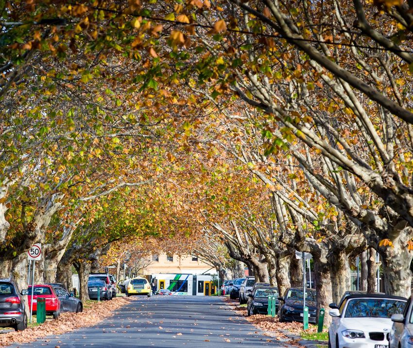
The City of Stonnington lies immediately south-east of Central Melbourne (Figure 1).
Several significant radial and circumferential transport routes pass through and alongside
the area, carrying substantial amounts of through movement.
Public transport is essential to travel in and around the »» Key projects like the Metro Tunnel will help, but the
City of Stonnington. As the area continues to grow at omission of Metro platforms at South Yarra significantly
pace with Melbourne as a whole, Stonnington will need limits the benefit to Stonnington travellers. More train
to accommodate 32,000 more people and 25,000 more services and larger trains are needed.
jobs by 2036. »» The tram network needs modernising, with key route
Although public transport network coverage is good changes, more frequent, larger low-floor trams,
compared with many parts of Melbourne, the services, accessible stops and faster travel times to enable it
vehicles and infrastructure are substandard in many to play its part fully.
instances. Also many services, especially trains, serve
»» Bus services are substandard in many instances,
other areas and are often too full to accommodate
especially regarding service frequency and
Stonnington demand. This discourages use by
coordination with other public transport, especially
Stonnington residents and workers and limits the
opportunities for growth. train services. Substantial improvement is needed
to bring them up to acceptable standards.
There are very few opportunities to significantly increase
road capacity for private vehicles. Public transport, cycling A comprehensive list of advocacy actions has been
and walking must take the bulk of the growth in travel prepared, as summarised in the table below and given
demand, and public transport infrastructure and services in full in Chapter 4 – The advocacy plan.
need comprehensive improvement to enable this.
The City of Stonnington will work with the state
government, public transport operators and the
community to give these improvements the necessary
priority.
Summary of advocated actions
Planning
Develop an integrated transport plan for Melbourne to guide continued development of transport options.
Stonnington will need substantial public transport improvements to cater for projected demand, given the
limited opportunities to increase road capacity.
Monitor and encourage research into the effects of new transport technologies, pursuing opportunities
for improved capacity, reliability, emissions, safety, flexibility and cost-effectiveness.
Investigate options for improved north–south public transport connectivity between Gardiner and Caulfield
(based on a Burke Road alignment).
4 Public Transport Advocacy: Reference Document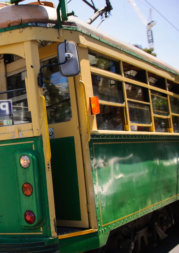
Summary of advocated actions

Trains

Frankston and        Provide more peak period train capacity at stations in Stonnington.

Cranbourne/          Upgrade the existing South Yarra station and provide more train services. Build Metro Tunnel platforms.

Pakenham lines       Upgrade Caulfield station to improve the interchange and access between platforms and to/from the station.
                     Upgrade Malvern station to Premium status, provide bicycle storage and improve access between
                     platforms and to/from the station.
                     Provide bicycle storage, improve access to/from the station and to nearby bus services at
                     Hawksburn, Toorak and Armadale stations.

Glen Waverley line   Increase train services on completion of the Metro Tunnel.

                     Improve entry/exit facilities and access between stations and nearby bus services.

Sandringham line     Increase train services on completion of the Metro Tunnel.
                     Upgrade Prahran and Windsor stations to Premium status, provide bicycle storage and improve
                     passenger entry/exit.

Level crossings      Agree on the design and commit to constructing the Toorak Road grade separation by 2021.
                     Prepare grade separation designs for Tooronga Road, High Street and Glenferrie Road as part of a
                     corridor upgrade with Toorak Road.
                     Improve the existing level crossings at Greville and Union streets, employing the latest technology
                     and safety measures.
                     NOTE: Council advocates for ‘rail under road’ solutions to level crossing removals in Stonnington.

Trams
Traffic              Increase tram priority at intersections and separation from traffic at accessible stops to improve
                     travel times and reliability.
Stops                Prepare a master plan in consultation with Council to develop and implement accessible stops along
                     all tram routes in Stonnington.
Routes and           Develop plans for post-Melbourne Metro Tunnel tram network changes, including relocating routes
extensions           from St Kilda Road to run further west through the CBD.
                     Extend route 3 to East Malvern station.
                     Extend route 5 to Darling station.
                     Extend route 6 to Glen Iris station.
                     Ensure the best interchange arrangement for route 58 at the new Anzac station
                     (route stays on Toorak Road West).
                     Extend route 64 to terminate at Malvern station. Combine the north–south section
                     of the route with route 16.
                     Continue route 78 west along Victoria Street towards the city.
                     Consult closely with Council while studying the proposed Caulfield-Chadstone-Clayton
                     campus-Rowville light/heavy rail project.

Services             Replace high-floor trams with larger low-floor trams on all Stonnington tram routes.
                     Increase peak services to a five-minute headway on all Stonnington routes.

Buses
Stops                Provide full disability access provisions at all bus stops.

Services             Upgrade bus services to coordinate fully with train and tram services at interchanges,
                     and to meet minimum standards of the bus service.
                     Improve the span of bus services at Chadstone Shopping Centre.
Traffic              Provide substantial improvements in bus travel times and reliability.

                                                                                                                                  5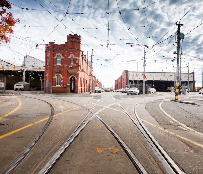
Introduction

    This document discusses improved public
    transport serving the City of Stonnington.
    It advocates a comprehensive set of
    actions and priorities for the Victorian
    and commonwealth governments, public
    transport operators and others concerned
    with maintaining and improving transport
    in our area.

    The report is laid out as follows:

    » Chapter 2 summarises travel patterns in
      Stonnington.

    » Chapter 3 describes existing and planned
      public transport.

    » Chapter 4 presents the advocacy plan.

    The appendices contain supporting information
    including references to other reports, data
    summaries and analyses.

6   Public Transport Advocacy: Reference Document
2 Stonnington's travel ask
The City of Stonnington lies immediately south-east of Central Melbourne (Figure 1).
Several significant radial and circumferential transport routes pass through and alongside
the area, carrying substantial amounts of through movement. This influences the transport
choices available to Stonnington residents and workers alike.

Figure 1: City of Stonnington

Source: .id consulting pty ltd

Stonnington covers the suburbs of South Yarra, Prahran, Windsor, Toorak, Armadale, Kooyong,
Malvern, Glen Iris and Malvern East.

                                                                                              7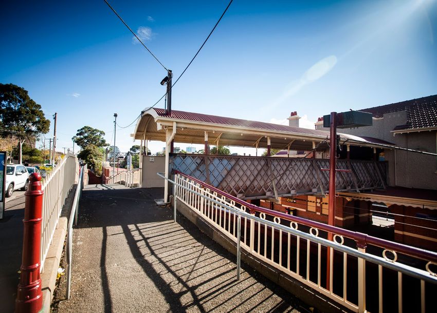
2.1 Land use, population and employment
    In 2016 Stonnington’s population was 111,600 people, including a resident workforce of
    56,500. The area contains about 55,000 jobs (Table 1).

    Table 1: City of Stonnington dwellings, population, workforce and employment, 2016

                                                                            People/
     Suburb                    Dwellings          Population                                Workforce        Employment
                                                                           dwelling
     South Yarra                     13,044              22,677                  1.74             12,512              12,738

     Prahran                          7,419              14,037                  1.89              7,882              10,220

     Windsor                          3,840               7,071                  1.84              4,141

     Toorak                           7,109              13,938                  1.96              6,486               4,633

     Armadale                         4,679               9,797                  2.09              4,893               6,059

     Kooyong                           398                     876               2.20                406              10,501

     Malvern                          4,598              10,866                  2.36              4,980

     Glen Iris                        4,100               9,204                  2.24              4,705

     Malvern East *                   8,937              23,140                  2.59             10,576              10,812

     Stonnington total               54,111             111,606                  2.06             56,532              54,963

    Source: Australian Bureau of Statistics (ABS) 2016 Census data analysis. Employment estimated from workplace data.
    * Includes Chadstone Shopping Centre.

    Dwelling sizes (people per dwelling) increase from west          Jobs are also concentrated more in the west of the area
    to east through Stonnington, while dwelling density              than the east, with the notable exception of Chadstone
    decreases, from nearly 50 dwellings/ha in South Yarra            Shopping Centre in East Malvern. South Yarra is an
    to fewer than 12 in Malvern East. The lower densities in         important employment centre, with 23 per cent of all
    the eastern part of Stonnington make public transport            the jobs in Stonnington.
    more dispersed and therefore less attractive to many             Prahran/Windsor and Armadale also have significant job
    residents there.                                                 numbers, centred on the main shopping strips in these
                                                                     areas. Most of the job concentrations are served by
                                                                     trains and trams.

8        Public Transport Advocacy: Reference Document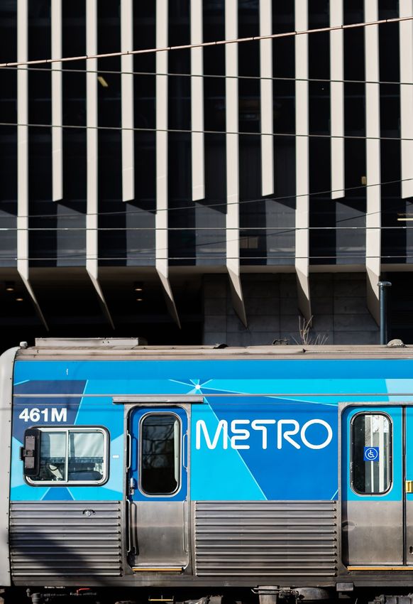
2.2 Travel patterns

To, from and within Stonnington
According to the Australian Bureau of Statistics (ABS)   Figure 2 and Figure 3 show that most of the workers
journey-to-work data, while there are roughly the same   living in Stonnington travel to the CBD for work, while
number of jobs and resident workforce, only about        most people working in Stonnington come from the
20 per cent of workers who live in Stonnington also      immediate south and east.
work here. The ABS data tells us 81 per cent of
residents work elsewhere, and 80 per cent of
workers live elsewhere.

Figure 2: Employment locations for Stonnington residents, 2016

Source: .id consulting pty ltd

                                                                                                                   9
Figure 3: Residential locations for Stonnington workers, 2016

Source: .id consulting pty ltd

In Stonnington, 54 per cent of residents travel to work by      Most of these are from areas south and east of
car or motorcycle, 33 per cent use public transport and         Stonnington, where public transport services are much
12 per cent use active transport (walking and cycling).         less extensive.
Of those travelling to the CBD, 21 per cent travel by car,      There is insufficient recent survey data available to
72 per cent by public transport and 7 per cent by               examine non-commuting travel patterns in such detail.
active transport. This reflects the high capacity of public     However, using typical trip-making rates per person, the
transport services available between Stonnington and            resident population probably generates around 400,000
Melbourne CBD. The proportion travelling by car to the          trips per weekday, of which about 110,000 are trips to
CBD is relatively high compared with other parts of Inner       and from work, leaving about 190,000 trips a day that are
Melbourne, although this is partly because of lower use         for non-work purposes (school, personal business,
of active transport from Stonnington.                           shopping, leisure and so on).

Examining journey-to-work data by parking precinct              Jobs in Stonnington generate about 100,000 trips a day
shows that travel to work by car is highest (and public         to and from outside, while other attractors (schools,
transport use lowest) in the eastern part of the municipality   shops, restaurants and so on) could generate about
(east of Glenferrie Road). It is also higher in areas around    180,000 trips a day.
railway stations.
                                                                Generally speaking, non-work trips are shorter than work
Public transport use is therefore clearly related to supply     trips, so proportionately more of them will probably take
and ease of access, especially to train and tram services.      place wholly within Stonnington.

In contrast, 71 per cent of trips to work in Stonnington are    Using assumptions like these, an unofficial estimate
by car or motorcycle, with only 20 per cent by public           of travel to, from and within Stonnington can be
transport and 8 per cent by active transport.                   estimated, as summarised in Table 2.

10      Public Transport Advocacy: Reference Document
Table 2: Estimated 2016 weekday daily travel to, from and within Stonnington
To From Within Total
Commuter trips 100,000 100,000 22,000 222,000
Other trips 140,000 140,000 140,000 460,000
Total daily trips 240,000 240,000 162,000 682,000
Through travel
A recent study (Sinclair Knight Merz, 2013) showed that Through-movements on public transport are concentrated
travel through Stonnington is substantial. However, on the rail lines (Cranbourne/Pakenham, Frankston and
through-traffic on roads is mainly concentrated on Sandringham) serving Stonnington, and to a lesser extent
Monash Freeway and Dandenong Road (largely forming on the tram routes (because most of them terminate
the northern and southern boundaries of the area), within Stonnington). Buses provide limited through-travel
although Warrigal Road, Burke Road and Toorak Road opportunities, although SmartBus routes and the large
also carry significant volumes. number of buses serving Chadstone Shopping Centre are
important.
2.3 Future growth
Future growth in population and employment is expected to be strong in Stonnington, focusing
in areas that are already highly active.
Between 2016 and 2036, forecasts suggest that
Stonnington will need to accommodate an extra 32,000
people and 25,000 jobs (Table 3). South Yarra will have
continued strong growth in population and employment,
with an additional 10,700 people and 6,300 jobs. Prahran,
Glen Iris and Malvern East will have population growth
approaching 30 per cent, while Windsor, Toorak,
Armadale, Kooyong and Malvern will have less than 20
per cent growth. Significant employment growth is also
anticipated in Malvern East (mainly due to growth at
Chadstone Shopping Centre), Prahran/Windsor and
Malvern/Glen Iris.
11Table 3: City of Stonnington population and employment forecast, 2016–2036
Population Employment
Suburb
2016 2036 2016–2036 2016 2036 2016–2036
South Yarra 22,700 33,400 10,700 (47%) 12,700 19,000 6,300 (49%)
Prahran 14,000 17,900 3,900 (28%)
10,200 15,200 5,000 (49%)
Windsor 7,100 8,700 1,600 (23%)
Toorak 13,900 15,700 1,800 (13%) 4,600 7,700 3,100 (67%)
Armadale 9,800 11,900 2,100 (21%) 6,100 9,200 3,100 (50%)
Kooyong 900
14,100 2,300 (19%)
Malvern 10,900 10,500 13,900 3,400 (32%)
Glen Iris 9,200 11,800 2,600 (28%)
Malvern East 23,100 29,900 6,800 (29%) 10,800 15,000 4,200 (39%)
Stonnington total 111,600 143,400 31,800 (28%) 54,900 80,000 25,100 (46%)
Source: Population: .id consulting pty ltd. Employment: estimated from available trends data.
Combined with Melbourne’s overall growth, especially in It is estimated that, by 2036, Stonnington will need to
the central area and to the south and east of Stonnington, cater for an additional 180,000 trips to, from and within
this growth will increase demand for travel and mobility the municipality, a 25 per cent increase over 2016 levels.
through and within Stonnington. Intensified development in With limited opportunities to expand road capacities (see
already dense and congested areas will increase the Chapter 3), public transport will probably have to take
pressure on all transport facilities serving key activity most of this increase; this implies up to a 50 per cent
centres in Stonnington. increase in public transport use, although walking and
cycling may also take some of the growth.
12 Public Transport Advocacy: Reference Document3 Transport infrastructure and services
3.1 Roads
Roads in Stonnington, as elsewhere, serve a multitude of It is important to remember that roads are vital to public
functions including: and active transport, as well as for private travel by car,
»» an arterial function, facilitating longer-distance travel truck and motorcycle. It has often been pointed out that
through the area larger passenger vehicles (i.e. buses and trams)
take up a lot less road space than single or
»» for distribution, providing access to and from smaller low-occupancy cars for the same amount of
areas passenger throughput. There will always be a need
»» for local access, providing the last step in travel to and to cater for all forms of transport on the road network and
from specific points to optimise and harmonise all uses rather than favouring
one over the others disproportionately.
»» as public transport routes (buses and trams), including
passenger infrastructure for boarding and alighting However, in established areas like Stonnington,
where roads are heavily used and there are limited
»» as cycling and walking routes, giving safe and opportunities for road expansion, travel growth must
convenient access for active transport be accommodated by enhancing more space-efficient
»» as vehicle parking areas for access to roadside land transport modes (walking, cycling and public transport).
uses of all types.
13Existing conditions
Traffic flows on the busiest roads in Stonnington are summarised in Table 4. More details are
given in Appendix C: Traffic flows in Stonnington.
Table 4: Traffic flows on Stonnington’s busiest roads
Traffic Divided/ Tram/ 2016 AADT 2016 %CVs
Road
lanes undivided bus From To From To
Monash Freeway 8–10 D 157,000 176,000 10% 12%
Dandenong Road 6–8 D T, B 56,000 66,000 3% 5%
Warrigal Road 6 D B 28,000 53,000 6% 6%
Punt Road 4–6 U B 27,000 50,000 2% 6%
Chapel Street 4 U T 12,800 66,000 2% 6%
Glenferrie Road 4 U T 11,900 14,800 6% 6%
Grange Road 4 U 31,000 31,000 2% 2%
High Street 4 U T 11,600 19,400 2% 6%
Orrong Road 4 U B 11,700 12,900 6% 6%
Toorak Road 4 U T, B 17,900 38,000 2% 7%
Wattletree Road 4 U T 8,800 16,000 1% 6%
Alexandra Avenue 2–4 U B 7,800 30,000 4% 6%
Burke Road 2–4 U T, B 15,700 22,000 5% 6%
Malvern Road 2–4 U T, B 8,200 19,200 2% 6%
Tooronga Road 2–4 U B 13,200 18,700 6% 6%
Waverley Road 2–4 U T, B 10,400 27,000 1% 6%
Williams Road 2–4 U B 12,000 23,000 3% 6%
Commercial Road 2 U T 12,800 66,000 3% 6%
Upton Road 2 U 19,600 19,600 6% 6%
AADT = annual average daily traffic; CV = commercial vehicle
14 Public Transport Advocacy: Reference DocumentFreeways and tollways Multilane arterials
The Monash Freeway / CityLink runs along Stonnington’s The only divided multi-lane arterials in Stonnington are
northern boundary. It has eight to ten lanes and carries Dandenong Road and Warrigal Road, which largely
an annual average daily traffic (AADT) in the range of form the southern and western boundaries of the area
160,000–180,000 vehicles, which roughly equates to respectively.
about 1,800 vehicles per lane per hour (vplph) at peak Dandenong Road has six to eight lanes and carries up
times. to 70,000 vehicles AADT and peak flows of about
This is close to the maximum theoretical vehicle capacity 750–1,000 vplph. Warrigal Road has six lanes and
of a traffic lane, which in turn equates to about 2,000 carries up to 50,000 vehicles (peak flows 500–1,000
people per lane per hour (at a typical average car vplph). The lower peak flows are due to the capacity
occupancy of 1.1) being dictated much more by the intersections with
other roads than the ‘mid-block’ road capacity.
Green times on the major roads at signalised intersections
can vary between 50 and 70 per cent of total time in road
networks like Melbourne’s.
Dandenong Road accommodates a tram route in the
median for much of its western half and bus routes further
east in the vicinity of Caulfield and Chadstone Shopping
Centre. Warrigal Road has several bus routes, also
centred on Chadstone Shopping Centre.
15Undivided main roads Planned changes
Stonnington has a comprehensive network of undivided Currently planned changes to roads in and around
main roads with two to four lanes of traffic. Most of these Stonnington include the following:
roads also carry tram and bus routes and have multiple
intersections with each other and minor roads, which » Monash Freeway / CityLink – the West Gate Tunnel
dictate the vehicle throughput capacity of the network. Project will ostensibly relieve the West Gate Bridge.
They also run through typical shopping strips with Widening of the Monash Freeway from EastLink to
kerbside parking (clearways operating at peak times). Clyde Road (and smart technology from Chadstone to
These multiple uses reduce their peak traffic carrying Pakenham) is an associated project. This will increase
capacity considerably to anything between 300 and traffic, including trucks, on the portion of the route in
800 vplph. Stonnington.
Punt Road is managed to accommodate more » Punt Road – the Minister for Planning formed an
vehicle traffic than most other roads in Stonnington, advisory committee in 2015 to advise on the future of
despite being mostly only four lanes (undivided). the Public Acquisition Overlay (PAO) related to the
It accommodates flows of 30,000–50,000 AADT possible future widening of Punt Road.
Main east–west undivided roads include Alexandra The committee recommended in 2016 that the PAO be
Avenue, Toorak Road, Malvern Road, High Street, retained and measures undertaken to increase the road
Wattletree Road and Waverley Road. capacity; they concluded that a four-lane road with
Main north–south undivided roads are Punt Road and widening for turn lanes at intersections would be
Chapel Street as well as Williams, Orrong, Kooyong, adequate, rather than six lanes throughout. The
Glenferrie, Tooronga, Burke, Darling, Belgrave, Chadstone Minister for Planning has considered the advisory
and Warrigal roads. committee’s report and decided to retain the entire
Punt Road PAO.
As already mentioned, there are limited opportunities to
increase road space in Stonnington. Increasing the role of
public transport, and giving it greater priority on the road
network, is a good way to improve the road network’s
passenger throughput. It also provides more mobility
choices for all travellers.
16 Public Transport Advocacy: Reference Document3.2 Public transport
Stonnington’s public transport is illustrated in Figure 4 and summarised below. More detail is
given in Appendix C: Traffic flows in Stonnington
Figure 4: Public transport in and around Stonnington
Source: Public Transport Victoria. For larger version, see Appendix C.
3.3 Rail
Melbourne’s metropolitan rail system is extensive, Figure 5 shows the number of morning peak train services
comprising 16 regular service lines on 869 km of track. above and below crowding benchmark levels in May
It has 218 stations and carries about 415,000 passengers 2017, by line. Most crowding occurs on lines north of the
per average weekday.¹ city (especially South Morang and Craigieburn), although
The latest (May 2017) train load standards survey report the Dandenong and Sandringham lines, serving
(Transport for Victoria, 2017) reports that, network-wide, Stonnington, also experience some overcrowding.
the number of morning peak train services above
benchmark crowding levels has reduced since May 2016.
However, this is mainly because trains have been
reconfigured (fewer seats and more standing room)
since then and the benchmark has increased from
798 to 900 passengers per train.
17Figure 5: Morning peak train services above and below 900 passengers in
May 2017 surveys
Above benchmark Below benchmark
10
0
Number of AM peak services
10
20
30
40
50
Glen Waverley
Hurstbridge
South Morang
Dandenong
Sandringham
Craigieburn
Alamein
Sunbury
Ringwood
Werribee
Williamstown
Frankston
Source: Transport for Victoria, 2017
Rail services in Stonnington
Stonnington has four rail lines passing through the area: Stonnington has four Premium stations (South Yarra, East
the Pakenham/Cranbourne (Dandenong) line, Malvern and Darling), which are staffed daily. Some of the
the Glen Waverley line, the Frankston line and the remaining stations (Malvern, Armadale, Holmesglen and
Sandringham line. On all lines, inbound services are Tooronga) are staffed for the weekday morning peak, and
heavily loaded as they enter Stonnington because of the the remainder are unstaffed.
extensive residential areas they serve to the east and Park-and-ride parking is provided at all stations on the
south-east. Glen Waverley line except Heyington, at Caulfield on the
Trains run at roughly 10-minute intervals in the peaks Cranbourne and Pakenham lines, and on the Frankston
on all lines, so between Caulfield and South Yarra there line. Stations between Caulfield and South Yarra have
is a train every three minutes or so, with 10-minute significant on-street parking around the stations, and
in all places car parking is well patronised.
services on the Sandringham line.
Taxi ranks are few and far between, and bicycle parking
facilities are limited to the Glen Waverley line. There are
Railway stations opportunities to provide more secure bike parking at all
stations.
There are 15 railway stations in Stonnington, and Caulfield Most stations have accessible platforms, although the
station (just outside Stonnington’s boundary) is important ramps from ground level are often too steep to meet
to Stonnington travellers as well.Table 5 summarises the Disability Discrimination Act 1992 (DDA) standards.
facilities at each station (as described on Public Transport It appears there is still some work to be done to provide
Victoria’s website), and Figure 6 illustrates the relative full DDA-compliant facilities at all stations.
patronage.
18 Public Transport Advocacy: Reference DocumentTable 5: Railway stations in Stonnington
Waiting
Ticketing Car, taxi & bike Accessibility Gneral facilities
area
Staff
myki
machines
myki checks
V/Line
bookings
Car parking
Taxi rank
Racks
Lockers
Cage
Wheelchair
areas
Stairs
Escalator
Lift
Tactile paths
Hearing loop
Seating
Lighting
Lockers
Public phone
Public toilet
Indoor
Sheltered
Lines Station Status
Cranbourne/
Pakenham Caulfield Premium 1 Y N Y 105 Y 4 0 Y 2 Y N N N N N Y 0 Y Y Y Y
& Frankston
Malvern Host 2 Y N N 0 N 0 0 N 1 N N N N N N Y 0 Y Y N Y
Armadale Host 2 Y N N 0 N 0 0 N 0 N N N Y N N Y 0 Y Y N Y
Toorak Host 0 Y N N 0 N 0 0 N 0 N N N N N N Y 0 Y Y N Y
Hawksburn Host 0 Y N N 0 N 0 0 N 0 N N N N N N Y 0 Y Y N Y
South Yarra Premium 1 Y N Y 0 N 0 0 N 1 N N N N N N Y 0 Y Y N Y
Glen
Homesglen Host 2 Y N N 195 N 5 10 Y 3 N N N Y N N Y 0 Y Y Y Y
Waverley
East Malvern Premium 1 Y N N 676 N 5 6 Y 4 N N N N N N Y 0 Y Y Y Y
Darling Premium 1 Y N N 309 N 6 0 N 4 N N N N N N Y 0 Y Y Y Y
Glen Iris Host 0 Y N N 50 N 5 6 N 3 N N N N N N Y 0 Y Y N Y
Gardiner Host 0 Y N N 217 Y 6 0 Y 3 Y N Y Y N N Y 0 Y Y Y Y
Tooronga Host 2 Y N N 189 N 3 8 N 3 N N N Y N N Y 0 Y Y Y Y
Kooyong Host 0 Y N N 70 N 5 0 N 3 N N N Y N N Y 0 Y N Y Y
Heyington Host 0 Y N N 0 N 0 0 N 0 Y N N N N N Y 0 Y N Y Y
Sandringham Windsor Host 2 Y Y N 0 N 0 0 N 0 Y N N N N N Y 0 Y Y N Y
Prahran Host 2 Y N N 0 N 0 0 Y 0 N N N Y N N Y 0 Y Y N Y
Key: Staff Wheelchair accessible
0 None 0 No 3 Parking, phone
1 Daily, first train to last train 1 Toilets 4 Parking, phone, toilets
2 M-F, 0630 - 0900 2 Parking, toilets
Source: Public Transport Victoria (details of station facilities may not be up to date or comprehensive). Caulfield station is
included as it is important to Stonnington travellers, although it is just outside the municipal boundary.
South Yarra and Caulfield are the busiest stations by far, The Premium status of East Malvern and Darling stations
with well over 10,000 station entries per weekday. South is not justified based on patronage alone; it seems that
Yarra is the busiest station outside the City Loop. Prahran, the large number of parking spaces at these two places is
Windsor and Malvern all exceed 3,000 entries per a factor. Given the high patronage at Prahran, Windsor
weekday, while the remainder have around 2,000 or fewer. and Malvern stations, they should be considered for
Patronage at South Yarra station has grown considerably Premium status with all-day staffing.
since 2013–14 according to regular pedestrian counts by
Council staff at the station entrance.
19Figure 6: Station patronage comparison
total
weekday
Premium station Host station
entries
14,000
12,000
Station entries 2013-14
10,000
8,000
AM peak entries
(0700-0930)
6,000
4,000
2,000
0
South Yarra
Darling
Glen Iris
Homesglen
Toorak
East Malvern
Tooronga
Kooyong
Heyington
Armadale
Prahran
Malvern
Gardiner
Hawksburn
Windsor
Source: Public Transport Victoria station fact sheet (2015 issue)
Level crossings
The Level Crossing Removal Authority (LXRA) is The Tooronga Road, High Street and Glenferrie Road
implementing level crossing removals throughout Victoria. crossings are all adjacent to railway stations on the Glen
The current commitment is ‘the elimination of 50 Waverley line. Glenferrie Road also carries trams across
dangerous and congested level crossings across the railway tracks (called a ‘tram square’). All carry
metropolitan Melbourne by 2022’. ² The chosen crossings significant traffic; Tooronga Road is a secondary state
are not the most dangerous 50. Compared with the arterial while High Street and Glenferrie Road are both
Australian Level Crossing Assessment Model (ALCAM) primary state arterials. Grade separations would be highly
ranking of 300 crossings in 2008, they rank between the desirable, especially when train services are increased on
first and the 270th. Fifteen crossings in the top 50 are the Glen Waverley line.
omitted from the present commitment. Council’s position is that ‘rail under road’ solutions to
There are six active road-rail level crossings in Stonnington these level crossings are preferred to ‘rail over’.
(listed in Table 6). This excludes the Burke Road, Glen Iris The Greville Street and Union Street crossings are both on
level crossing, which was grade separated in 2016. Only the Sandringham line, and both are on Council-managed
Toorak Road, Kooyong is included on the LXRA’s current local roads. No grade separation plans have been
list. It is understood to be at the planning stage, with a developed. The light traffic flows, combined with low
projected completion date of 2022. The design has not ALCAM risk scores, indicate that they are a very low
yet been decided. priority. Grade separation of these level crossings is
unlikely to be justified, however, improvements to safety
and accessibility for local vehicle users and pedestrians
should be pursued.
20 Public Transport Advocacy: Reference DocumentTable 6: Stonnington level crossings
Location ALCAM 2008 LXRA Daily flow Comments
status (veh)
Risk Rank
score
Complex site next to
Toorak Road, Kooyong 2257 33 Planning 37,000
Monash Fwy
Tooronga Road, Glen Iris 2042 39 None 17,000 Next to Tooronga station
High Street, Glen Iris 1674 53 None 28,000 Next to Glen Iris station
Tram square, next to
Glenferrie Road, Kooyong 1318 71 None 14,000
Kooyong station
Greville Street, Prahran 443 127 None 4,800 Local road
Union Street, Windsor 81 208 None 1,600 Local road
Source: 2008 ALCAM risk scores and rankings from https://www.danielbowen.com/2014/09/24/level-crossing-list/
Current commitments
Current commitments affecting Stonnington rail services include the following:
» Cranbourne/Pakenham line upgrade – removal of level » Metro Tunnel Project: on completion, removal of
crossings and other works will improve train travel Cranbourne/Pakenham–Sunshine trains from the City
times and reliability. New, higher capacity trains will be Loop will free up more capacity to increase services on
operated on completion. However, Cranbourne/ all rail lines, including those serving Stonnington.
Pakenham trains only stop at Caulfield and South Yarra However, the project will reduce train service levels and
stations, so the benefits for Stonnington are limited, connectivity at South Yarra station (although this will be
especially as they will be removed from South Yarra mitigated to some degree by extending Werribee line
by the Metro Tunnel Project. trains through the city and South Yarra to the
Sandringham line, which is under consideration).
» Grade separation of level crossings: Burke Road was
completed in 2016. Discussions are beginning about
Toorak Road, Kooyong.
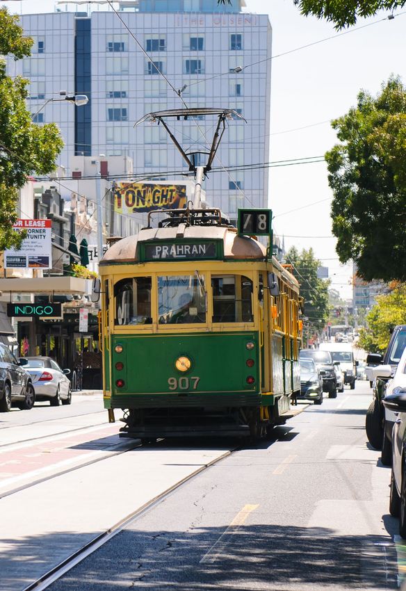
213.4 Tram
Existing conditions Routes
Melbourne has the world’s largest tram / light rail network Eight tram routes currently service Stonnington. All but
largely because, unlike other Australian cities, its trams two of them serve the Melbourne CBD via St Kilda Road,
were not removed in the 1960s and 1970s. Much of the the exceptions being route 58 (Toorak to West Coburg via
network, including nearly all the routes serving Kingsway and William Street) and route 78 (North
Stonnington, share space with traffic on roads. This Richmond to Balaclava via Chapel Street). Five of the
causes considerable delays and inefficiencies in operation remaining routes (3, 5, 16, 64 and 72) start and finish at
and makes passenger access difficult and hazardous the University of Melbourne, and one runs further north
compared with modern light rail systems in their own (route 6 to Moreland).
rights of way with platform stops.
Tram patronage has grown particularly strongly in recent Virtually all these routes operate at 6- to 10-minute
years, and many services now run at full passenger headways in the peaks, reducing to 12 minutes between
capacity in peak times and directions. peaks. Services generally start between 5am and 6am on
weekdays and run until about 1am the following day. They
Work is continually under way to maintain, modernise and run later on Friday and Saturday nights to provide more
improve the tram system: choices for leisure and entertainment activities.
» Tracks and power supplies are regularly replaced. Key operational features of the routes serving Stonnington
are summarised in Table 7.
» New, larger low-floor trams are built to enable more
services and to replace older, smaller high-floor
vehicles.
» Tram stops are replaced and sometimes removed to
provide safer access to trams and to improve
segregation from road traffic.
Table 7: Key operational features of tram routes serving Stonnington
Route in
Overall route
Tram Stonnington
Route types From depot
Avg. Avg.
used Length Length
speed speed
(km) (km)
(km/h) (km/h)
3 East Malvern–Melb Uni A, B, Z Glenhuntly 14.8 14.6 1.6 16.2
5 Malvern–Melb Uni D, Z Malvern 12.8 15.3 6.1 20.0
6 Glen Iris–Moreland D, Z Malvern/Brunswick 19.1 15.4 6.8 18.3
16 Kew–Melb Uni D, Z Malvern 20.4 14.3 5.7 15.7
58 Toorak–West Coburg B, D, Z Malvern/Essendon 18.3 16.0 4.0 16.1
64 East Brighton–Melb Uni A, B, Z Glenhuntly 16.3 16.4 4.9 19.7
72 Camberwell–Melb Uni D, Z Malvern 17.0 14.8 8.4 16.9
Balaclava–North
78 A Kew 6.8 12.9 3.6 12.2
Richmond
Source: Estimated from route information and timetables
22 Public Transport Advocacy: Reference DocumentMost tram routes serving Stonnington are operated using With the exception of Dandenong Road, tram routes in
high-floor (A, B and Z class) trams. Low-floor trams (so far Stonnington operate in mixed traffic along undivided,
only D class) are becoming more common as they replace four-lane roads, which makes them among the slowest in
the Z-class trams through cascading the fleet, but A- and Melbourne.
B-class trams will be around for some years to come. The Table 7 shows that route 78 averages about 12 km/h
full benefit of installing platform stops will only come when (along Chapel Street), with other routes generally
low-floor trams are operating on all routes, although in the operating at higher average speeds in Stonnington than
meantime (and depending on the designs used) they will overall, mainly because they also pass through the CBD
provide more waiting space and safer boarding/alighting. where tram speeds are very low.
23Current conditions
Transport for Victoria has advised the following: After the Metro Tunnel opens, reorganising the tram
network is essential, yet the state government has not
» The Metro Tunnel Project (via the new Anzac station) will committed to doing this. Plans for tram network changes
provide passengers with an alternative to the St Kilda have not been published or discussed with stakeholders.
Road trams, which will allow some routes to be
redirected to the west of the CBD. Melbourne Metro Rail The state government recently announced a study into
Authority is building the Park Street link that will allow establishing a light rail connection from Caulfield to
these service changes to occur. Chadstone and Monash University’s Clayton campus, and
eventually to Rowville. This would benefit Stonnington by
» The Rolling Stock Strategy (Victorian Government, 2015) improving public transport access between Monash’s
outlines the requirements to move towards full fleet Caulfield and Clayton campuses as well as to and from
accessibility by 2032. Chadstone Shopping Centre. The extent of this opportunity
will become known as details of the route and its operation
» Tram stops must be upgraded to Disability emerge.
Discrimination (DDA) compliance to meet Disability
Standards for Accessible Public Transport legislation,
dependent on state government funding. Currently
there is no funding allocated to stops in Stonnington.
Opportunities such as new developments, major
projects (like the Metro Tunnel Project and level crossing
removals) and tram track renewals often provide good
opportunities to provide upgraded tram stops.
24 Public Transport Advocacy: Reference Document3.5 Bus
Bus routes in Stonnington are summarised in Table 8.
Table 8: Bus routes serving Stonnington
Services per hour
Via Stations served
Route AM Inter- PM
(in Stonnington) in Stonnington
peak peak peak
Sunshine station–
216 Malvern Rd, Williams St/Hotham Rd 2 2 2
Brighton Bch
Sunshine South–
219 Malvern Rd and Williams St/Hotham Rd 2 2 2
Gardenvale
Sunshine City–
220* Malvern Rd and Orrong Rd 4 4 4 Toorak
Gardenvale
Elsternwick–Clifton
246 Punt Rd 6 6 5
Hill
Alexandra Ave, Orrong
Gardenvale–Flagstaff
605* and Kooyong rds 4 3 4 Armadale, Toorak
station
612* Box Hill–Chadstone High St, Waverley and Chadstone rds 2 2 2 Glen Iris, East Malvern
Glen Waverley–St
623 Dandenong and Warrigal rds 2 2 2
Kilda
624* Kew–Oakleigh Tooronga, Dandenong and Warrigal rds 3 2 2 Tooronga, Holmesglen
Elsternwick–
625 Dandenong Rd (E of Chadstone SC) 2 2 2
Chadstone
Middle Brighton–
626 Dandenong Rd 2 2 2
Chadstone
Glen Iris–Glen
734* High St 3 2 2 Glen Iris
Waverley
742 Eastland–Chadstone Dandenong Rd (E of Chadstone SC) 2 2 2
Dandenong Rd, Chadstone SC,
767 Southland–Box Hill 3 2 3
Warrigal Rd
Dandenong–
800 Warrigal Rd (S of Chadstone SC) 3 3 3
Chadstone
Dandenong–
802 Warrigal Rd (S of Chadstone SC) 1 1 1
Chadstone
Dandenong–
804 Warrigal Rd (S of Chadstone SC) 1.5 1.5 1
Chadstone
Chadstone–
822 Dandenong Rd 2 2 2
Sandringham
Dandenong–
862 Warrigal Rd (south of Chadstone SC) 1.5 1.5 1.5
Chadstone
Rowville–Chadstone–
900* Dandenong Rd 6 4 6 Caulfield
Caulfield
Altona–Chadstone–
903* Warrigal Rd (north of Chadstone SC) 7 5 8 Holmesglen
Mordialloc
City–Caulfield–
969 Dandenong Rd 2 (night service only)
Rowville–Ringwood
* These routes serve rail stations in or adjacent to Stonnington
25Apart from SmartBus routes (900-series) and those Many of the bus routes connect Chadstone Shopping
serving the CBD (mostly 200-series routes), many of the Centre with surrounding areas and provide regional
routes in Stonnington only operate a 30-minute service all connections there, especially to and from Dandenong.
day (including peaks). This is not generally suitable or However, many of the routes run at low frequencies,
convenient for commuters. especially on weekends (when use of Chadstone is at its
Several bus routes run close to rail stations in peak) and in the evenings. More could be done to improve
Stonnington, but only Glen Iris station (where two bus this, both for shoppers and centre workers.
routes terminate) has well-integrated interchange facilities. Patronage figures for each route are given in Table 9.
In general, there is little or no coordination of bus and train Although three years old, these figures give a good
timetables; this has long been an issue in Melbourne. indication of the relative patronage of each route.
However, they represent boardings on the whole routes,
rather than just the portion in Stonnington.
Table 9: Bus route patronage, 2014–15
Annual Average Average Average
Route
patronage weekday Saturday Sunday
216 Sunshine station–Brighton Beach 936,270 3,027 1,707 1,103
219 Sunshine South–Gardenvale 730,674 2,318 1,537 879
220 Sunshine City–Gardenvale 1,655,158 5,142 3,778 2,245
246 Elsternwick–Clifton Hill 1,538,713 4,975 2,775 1,846
605 Gardenvale–Flagstaff station 275,662 1,006 171 –
612 Box Hill–Chadstone 362,880 1,333 284 –
623 Glen Waverley–St Kilda 591,992 1,926 961 755
624 Kew–Oakleigh 684,531 2,309 888 685
625 Elsternwick–Chadstone 262,722 856 418 340
626 Middle Brighton–Chadstone 308,702 1,001 531 381
734 Glen Iris–Glen Waverley 325,660 1,141 312 223
742 Eastland–Chadstone 783,529 2,545 1,441 851
767 Southland–Box Hill 1,070,804 3,441 1,842 1,479
800 Dandenong–Chadstone 631,507 2,312 540 –
802 Dandenong–Chadstone 283,579 1,086 – –
804 Dandenong–Chadstone 395,289 1,363 753 –
822 Chadstone–Sandringham 492,320 1,618 858 490
862 Dandenong–Chadstone 410,361 1,202 987 869
900 Rowville–Chadstone–Caulfield 1,876,335 5,789 3,931 3,095
903 Altona–Chadstone–Mordialloc 6,032,559 19,310 10,990 8,100
969 City–Caulfield–Rowville–Ringwood N/A (Night bus)
Source: Transport for Victoria
Routes serving the CBD (200-series) and SmartBus routes (900-series) have the greatest patronage.
The 600/700-series routes are generally shorter and less frequent, and attract lower patronage as a result.
26 Public Transport Advocacy: Reference Document3.6 New technologies in transport
New technologies are emerging in transport, including: » driverless public transport vehicles (trains, trams and
buses) may reduce costs and improve efficiencies,
» changes to energy sources, primarily through many
although the effect on jobs is an issue. Although these
major manufacturers introducing electric vehicles
technologies are under active development, full
» autonomous (self-driving) vehicles, both as privately adoption could take many years. Their effects
owned/used and shared (taxi-style) options should be better anticipated, and planned for,
by all concerned.
» use of autonomous drones for local deliveries including
Driverless vehicles will probably not replace mass transit in
parcels and fast food.
cities; it is more likely that shared driverless vehicles will
There is much discussion and speculation about their offer a new option to provide access to and from mass
effects on travel choices and impact on existing transport transit as well as for tasks currently fulfilled by taxi/ride
modes. Implications for public transport include: share providers. They could also provide shuttle-type
services at airports, shopping centres and other high-
» greater use of electric vehicles for buses and more
density locations. Individually owned autonomous vehicles
efficient means of generating and storing electrical
will probably fulfil a very similar role to today’s conventional
energy for all public transport vehicles
private cars, with added flexibility, reliability and safety.
» improved local air quality and reduced noise where
electric vehicles replace diesel ones
» changes to effective road capacities through
autonomous vehicles travelling closer together and
responding more quickly (although the overall effects
are not yet known; greater use of such vehicles may
counteract these benefits)
274 The advocacy plan
4.1 Rationale
As shown in this report, through-travel and movements to Some of the required actions will be fulfilled by existing
and from Stonnington are growing strongly, as commitments (such as the Melbourne Metro Rail Tunnel
Stonnington grows apace with growth in Melbourne as a and continuous improvements to trains, trams and
whole. This is expected to continue for the foreseeable buses), but many are not presently planned by the state
future. There is little or no spare land available to add new government.
capacity for private vehicle transport, therefore much of The absence of detailed, long-term planning for public
the increase will have to be carried by public transport, transport (apart from large projects like Melbourne Metro
which will need substantial ongoing improvement. and level crossing removals) is a considerable concern.
Through-travel will need to be concentrated on major There is no defined strategy to increase public transport’s
routes to enable the rest of Stonnington’s transport role, nor its share of travel demand. Melbourne’s future
network to cater for travel to, from and within the area. growth requires an integrated and sustainable approach,
Suburban rail services will have to take steadily increasing with public transport investment as a central, core
proportions of travel, especially through-travel and travel strategy.
to and from Stonnington. Tram and bus services will also New technologies in transport will not alter the important
need to increase in line with growth, and improvements role that public transport needs to perform. Driverless
are needed on all public transport modes to modernise private vehicles could, on the one hand, increase road
and provide better, safer access for all passengers. capacities by more efficient traffic flow, but they could
Comprehensive improvements are needed to train, tram also dramatically increase the demand for vehicular
and bus services covering: movement by adding empty positioning runs to the mix.
Applied to public transport, driverless technology could
» vehicles and rolling stock improve the efficiency and frequency of mass transit as
well.
» routes and operations
» level and span of services
» station and stop facilities
» public transport information, and
» assistance for people with disabilities.
28 Public Transport Advocacy: Reference Document4.2 List of advocated actions
Table 10 lists the actions that the City of Stonnington will advocate for continuous
improvement of public transport over the short and medium term.
Table 10: Advocated actions for public transport in Stonnington
Advocated actions
Planning Timing Importance
General Develop an integrated transport plan for Melbourne to guide continued Short High
development of all forms of transport to achieve sustainable,
environmental and social outcomes in accordance with the principles
of the Transport Integration Act. Stonnington will need substantial
public transport improvements to cater for projected demand,
given the limited opportunities to increase road capacity.
Monitor and encourage research into the effects of new transport Medium Medium
technologies including those applicable to public transport.
Opportunities for improved capacity, reliability, emissions, safety and
flexibility, as well as cost-effectiveness, should be actively pursued.
Technologies include autonomous/driverless vehicles (of all types),
ride-sharing and delivery initiatives, and clean and renewable energy for
motive power.
Investigate options for improved north–south public transport Medium Medium
connectivity, particularly between Gardiner and Caulfield
(based on a Burke Road alignment).
Trains Timing Importance
Rail lines and stations
Note: Station actions may be subject to heritage considerations at individual locations
Frankston and South Yarra Develop an integrated transport plan for Melbourne to guide Short High
Cranbourne/ continued development of all forms of transport to achieve
Pakenham lines sustainable, environmental and social outcomes in accordance
with the principles of the Transport Integration Act. Stonnington
will need substantial public transport improvements to cater
for projected demand, given the limited opportunities to
increase road capacity.
Commit to providing more train services at the existing South Medium High
Yarra station.
Commit to build Metro Tunnel platforms and entry/exit/
interchange facilities at South Yarra (all Metro Tunnel trains to stop Short High
there).
Hawksburn Provide adequate, safe bicycle storage, improve passenger entry/ Short Medium
exit (including full DDA requirements).
29Advocated actions Timing Importance
Trains Timing Importance
Rail lines and stations
Note: Station actions may be subject to heritage considerations at individual locations
Frankston and Toorak Provide adequate, safe bicycle storage, improve passenger entry/ Short Medium
Cranbourne/ exit (including full DDA requirements). Improve access between
Pakenham lines the station and nearby bus services.
Armadale Provide adequate, safe bicycle storage, improve passenger entry/ Short Medium
exit (including full DDA requirements). Improve access between
the station and nearby bus services.
Malvern Upgrade to Premium status, provide adequate, safe bicycle Short Medium
storage, improve access between platforms and passenger entry/
exit (including full DDA requirements).
Caulfield Upgrade to improve access between platforms and all aspects Short High
of passenger entry/exit and interchange, including full DDA
requirements. Improve pedestrian access between the station and
surrounding areas, and with nearby bus and tram services.
Glen Waverley line Heyington Improve passenger entry/exit (including full DDA requirements). Short Medium
Kooyong Improve passenger entry/exit (including full DDA requirements). Short Medium
Tooronga Improve passenger entry/exit (including full DDA requirements). Short Medium
Improve access between the station and nearby bus services.
Gardiner Monitor performance of the new station (in particular the park- Short Medium
and-ride and bicycle storage facilities) and improve as and if
required to keep pace with demand and passenger access/egress
and interchange needs.
Glen Iris Improve passenger entry/exit (including full DDA requirements). Short Medium
Improve access between the station and nearby bus services.
Darling Improve passenger entry/exit (including full DDA requirements). Short Medium
East Improve passenger entry/exit (including full DDA requirements). Short Medium
Malvern Improve access between the station and nearby bus services.
Homesglen Improve passenger entry/exit (including full DDA requirements). Short Medium
Improve access between the station and nearby bus services.
Sandringham line Prahran Upgrade to Premium status, provide adequate, safe bicycle Short High
storage, improve passenger entry/exit, including full DDA
requirements.
Windsor Upgrade to Premium status, provide adequate, safe bicycle Short High
storage, improve passenger entry/exit, including full DDA
requirements.
30 Public Transport Advocacy: Reference DocumentAdvocated actions Timing Importance
Trains Timing Importance
Level crossings
Note: Council advocates for ‘rail under road’ solutions to level crossing removals in Stonnington.
Tooronga Road As one of the 50 most dangerous crossings, Tooronga Road should be Short High
prioritised for grade separation. A design should be prepared in consultation
with Council and the community for early action.
High Street High Street should be prioritised for grade separation. Ideally the solution should Short Medium
include extending tram route 6 to Glen Iris station. A design should be prepared
in consultation with Council and the community for early action.
Glenferrie Road As a ‘tram square’, the benefits of grade separating Glenferrie Road at Short Medium
Kooyong station are likely to be significantly higher than other level crossings.
A design should be prepared in consultation with Council and the community
for early action.
Greville and Union The Greville Street and Union Street level crossings are not candidates for Medium Medium
streets grade separation. Existing facilities need to be reviewed and upgraded to ensure
the latest technology is used to warn pedestrians, cyclists and road vehicles
of approaching trains, including ‘second train coming’ warnings and all DDA
requirements.
Services
and routes
Cranbourne / Explore further options to provide more peak period train capacity at stations Medium High
Pakenham line throughout Stonnington.
Glen Waverley line Confirm that Glen Waverley line services will be increased on completion of the Medium High
Metro Tunnel Project.
Sandringham line Confirm that Sandringham line services will be increased on completion of the Medium High
Metro Tunnel Project.
Other Commit to providing more services at the existing South Yarra station. Medium High
Operations
Rail safety Improve the ‘safety-proofing’ of the rail network throughout Stonnington to Short Medium
reduce unauthorised access to rail tracks.
31Advocated actions Timing Importance
Trams
Traffic
Priority Improve reliability and travel times for trams by reducing interaction with other Medium Medium
road users at intersections (tram priority) and at accessible stops.
Stops
General A master plan for all tram routes in Stonnington should be established in Medium High
consultation with Council to develop and implement accessible stops along
all tram routes in Stonnington, with a coordinated plan for each route segment
including urban design, pedestrian and cyclist treatments, parking provisions
and traffic management.
Routes and
extensions
General Develop plans for post-Melbourne Metro tram network changes, including Medium High
relocating routes from St Kilda Road to run further west through the CBD.
Route 3 Extend to East Malvern station. Medium Medium
Route 5 Extend to Darling station. Medium Medium
Route 6 Extend to Glen Iris station (coincident with High Street level crossing removal), Medium Medium
provide bus/tram/train interchange.
Route 16 See route 64.
Route 58 Ensure the best interchange arrangement for route 58 at the new Anzac station Medium High
(this requires that the route stays on Toorak Road West).
Route 64 Extend to and terminate at Malvern station. Combine the north-south section of Medium Medium
the route with route 16.
Route 78 Continue west along Victoria Street towards the city instead of terminating Medium Medium
at the Church/Victoria intersection (details of city-bound end of route to be
determined).
Other Consult closely with Council while studying the proposed Caulfield-Chadstone- Short High
Clayton campus-Rowville light / heavy rail project.
Services Services Services
Replace high-floor trams with newer, larger capacity low-floor trams on all Stonnington tram routes, Medium High
coordinated with platform stop projects and increasing passenger demand.
Increase tram services on all routes to five-minute headways during peak times. Medium Medium
Services Upgrade bus services in Stonnington to coordinate fully with train Medium High
and tram services at interchanges and to meet or exceed established
minimum standards of bus service.
Improve bus services at Chadstone Shopping Centre to better cater for Short Medium
centre employees and shoppers.
Traffic Install bus priority lanes and signalling at major intersections to provide Medium Medium
substantial improvements in bus travel times and reliability.
32 Public Transport Advocacy: Reference DocumentYou can also read