Report of the WMO/IMO International Symposium 'Extreme Maritime Weather: Towards Safety of Life at Sea and a Sustainable Blue Economy' - MMO ...
←
→
Page content transcription
If your browser does not render page correctly, please read the page content below
MMO SERIES No. 3

                        Report of the WMO/IMO
                        International Symposium ‘Extreme
                        Maritime Weather: Towards Safety
                        of Life at Sea and a Sustainable
                        Blue Economy’

                        23–25 Ocotber 2019
                        IMO Headquarters
                        London (United Kingdom)
WEATHER CLIMATE WATER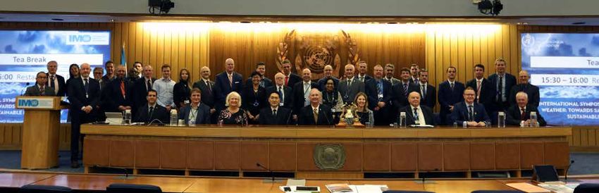
© World Meteorological Organization, 2020

The right of publication in print, electronic and any other form and in any language is reserved by WMO. Short
extracts from WMO publications may be reproduced without authorization, provided that the complete source is
clearly indicated. Editorial correspondence and requests to publish, reproduce or translate this publication in part or
in whole should be addressed to:

Chair, Publications Board
World Meteorological Organization (WMO)
7 bis, avenue de la Paix                            Tel.: +41 (0) 22 730 84 03
P.O. Box 2300                                       Fax: +41 (0) 22 730 80 40
CH-1211 Geneva 2, Switzerland                       Email: Publications@wmo.int

NOTE

The designations employed in WMO publications and the presentation of material in this publication do not imply the
expression of any opinion whatsoever on the part of WMO concerning the legal status of any country, territory, city
or area, or of its authorities, or concerning the delimitation of its frontiers or boundaries.

The mention of specific companies or products does not imply that they are endorsed or recommended by WMO in
preference to others of a similar nature which are not mentioned or advertised.

The findings, interpretations and conclusions expressed in WMO publications with named authors are those of the
authors alone and do not necessarily reflect those of WMO or its Members.

This publication has been issued without formal editing.
Speakers, Moderators and the Organizing Committee at the First WMO-IMO Symposium on Extreme Maritime Weather, October 2019.
WMO/IMO International Symposium:
         “Extreme Maritime Weather: Towards Safety of Life at Sea and a Sustainable Blue Economy”

The WMO/IMO International Symposium Extreme Maritime Weather:
  Towards Safety of Life at Sea and a Sustainable Blue Economy
Background
         The first International Symposium on “Extreme Maritime Weather: Towards Safety of
Life at Sea and a Sustainable Blue Economy” was held in London at the International Maritime
Organization (IMO) Headquarters from the 23rd to 25th October 2019. Jointly organized by
the World Meteorological Organization (WMO) and the IMO, over 200 participants from over
40 different countries attended, representing both private and public sectors, and including
Ministers and Ambassadors. The structure of the Symposium consisted of Plenary Sessions,
with invited presentations and panel discussions. The Symposium Programme and
presentations are available at https://public.wmo.int/en/events/meetings/londonsymposium.

Executive Summary
         Under the Safety of Life at Sea (SOLAS) Convention, the WMO and IMO have
collectively worked to reduce the risk and vulnerability of the maritime community in the event
of hazardous or extreme maritime weather. Despite this longstanding partnership, there exist
areas in which the WMO and IMO can close the gap in understanding between the maritime
industry and the metocean1 community. Topical sessions highlighted the need for educational
trainings for both mariners and metocean forecasters that would increase awareness between
mariners and forecasters of each community’s needs and operational constraints. Specifically,
to build a broader understanding among various stakeholders will require forecasters to have
a clearer understanding of forecast-dependent maritime operations and decision making and
likewise will require mariners to understand the forecasting process.
         This Symposium also highlighted the need to tighten connections in the value chain
between the collection of metocean data, metocean data assimilation, marine weather
forecasting, and the dissemination of marine forecasts and services to users and stakeholders.
It also demonstrated the value in looking to the research community to inform operational and
policy and decision making, from which the results can in turn inform subsequent research
priorities. Participants identified opportunities for increased metocean data collection through
the extant WMO Voluntary Observing Ship (VOS) programme as well as private industry (e.g.
oil and gas). Participants observed that there is a need for more explicit encouragement for
ships to actively participate in programmes as well as an improved understanding of how to
better facilitate the onboard collection of metocean data. Moreover, this Symposium
demonstrated the need for authoritative data sources officially endorsed to increase
confidence in product users and a closer look at data management and dissemination is
required to promote the exchange of relevant data.
         Finally, the Symposium highlighted a growing demand for marine services that
communicate impact-based weather forecasts as well as ancillary support in decision making.
Future efforts could include developing vessel class-specific impacts that correspond with
varying marine weather conditions. Presenters also highlighted the need for improved forecast
portrayal and visualization of weather impacts that would include forecast confidence and
uncertainties, thereby shifting the focus of communications from what the ‘weather will be’ to

1
    Metocean: Meteorology and (physical) Oceanography

                                              Page 1 of 27
WMO/IMO International Symposium:
“Extreme Maritime Weather: Towards Safety of Life at Sea and a Sustainable Blue Economy”
instead: ‘what it will do’. The definition of impact is dependent on risk, exposure, and
vulnerability; therefore, coordination with the maritime industry is necessary to determine
individualized impacts resulting from hazardous marine conditions. This Symposium
demonstrated that public-private partnerships could most efficiently address this need.
The Symposium concluded that better communication between metocean forecasters
and the maritime industry is urgently needed to ensure the safety of life and property at sea
while increasing the efficiency of maritime operations. Increased data collection could improve
forecasts, which allows marine service providers to tailor and communicate the impacts of
hazardous marine conditions on vessels and ports. The implications of a more efficiently and
effectively operated value chain would provide wide ranging societal benefits. Examples of
such benefits include a reduction in the loss of life and property at sea and along coastlines
from the utilization of impact-based marine weather forecasting and real-time conditions in
ports and harbours, improved operational efficiency and reduced emissions resulting from
optimal voyage routing, environmental monitoring and forecasting to aid coastal management,
and more effective search and rescue and environmental emergency response efforts.
Participants observed that a formalized collaboration between WMO and IMO
regarding extreme maritime weather issues would help attain the aforementioned needs and
goals. Ad hoc thematic entities might be needed to solve specific issues. A WMO-IMO
collaboration should endeavour to provide education and training, for improved messaging of
metocean conditions for mariners. The next International Symposium on “Extreme Maritime
Weather” could be organized jointly with IMO and WMO in two years’ time. The date and the
place of the next Symposium should be advertised as soon as possible. Between the
symposiums, topics addressed in the first International Symposium on “Extreme Maritime
Weather: Towards Safety of Life at Sea and a Sustainable Blue Economy” should be
discussed in the appropriate IMO, WMO and other relevant bodies.
Opening Session
Mr Thomas Cuff (Office of Observations, National Weather Service, National Oceanic
and Atmospheric Administration; Chair, JCOMM Services) opened the Symposium, inviting
Mr Hiroyuki Yamada (IMO) and Dr. Xu Tang (WMO) to make opening remarks on the scope
and goals of this joint Symposium organized by the IMO and WMO. Participants also heard
from Ambassador Peter Thomson (United Nations Secretary General’s Special Envoy for the
Ocean).
Mr Yamada stated that shipping is the engine that keeps the global economy moving.
He posited that to keep that engine running, cooperation between the maritime community,
marine weather forecasters, and marine service providers is necessary in order to increase
the safety of life and property at sea. Mr Yamada expressed his concerns that a changing
climate will present new challenges and risks to vessels. He suggested that the maritime
community must mitigate these by means of improved readiness with the use of new
technologies and multi-disciplinary collaboration on a global scale. Dr. Tang (WMO) remarked
on the increased quality in marine forecasting but commented on the continuation of accidents
at sea that occur as a result of severe and extreme maritime weather. Dr. Tang called for the
continuation and amplification of marine services to the maritime community to facilitate
improved decision making. He tasked the forecasting community to continue developing the
most efficient and effective means to deliver marine hazard information to the maritime
community. In a recorded message to Symposium participants, Ambassador Thomson
commented on the timeliness of the joint Symposium, noting that extreme weather continues
Page 2 of 27WMO/IMO International Symposium:
“Extreme Maritime Weather: Towards Safety of Life at Sea and a Sustainable Blue Economy”
to cause loss of life and cargo, as well as environmental damage. He reasoned that adequate
access to metocean forecasts could have prevented many recent losses. Ambassador
Thomson also highlighted the importance of scaling up ocean science to meet sustainable
development goals (SDGs).
Mr Cuff concluded the opening session, delivering the keynote address, highlighting
the great improvements in forecasting accuracy over the last 60 years. However, like the other
opening speakers, he posed the question: ‘If marine weather forecasts are improving, what
factors allow for the loss of life and property due to inclement weather to continue occurring?’
Echoing the sentiments of Ambassador Thomson, Mr Cuff noted that as the Global Blue
Economy continues to grow, the maritime industry must adapt to adequately balance the cost
and ship routing and scheduling against the likelihood of a hazardous maritime weather event.
In particular, Mr Cuff expressed his concerns regarding the increase in maritime traffic in
response to sea ice loss in a warming world, noting that unlike relatively short-lived extreme
weather events, sea ice poses a constant and often hidden threat. He also noted the
importance of identifying authoritative data sources in a world where data sources are
abundant. Mr Cuff concluded that ultimately, increased meteorological training for mariners
and enhanced marine services from forecasters, and the insurance and private sectors can
together reduce the loss of life and property at sea.
Session 1 - International regulatory framework
The WMO and IMO have worked closely together for decades to improve maritime
safety under the SOLAS Convention
International collaboration is requisite in the exchange of meteorological information
and the provision of marine services to the maritime community
In order to provide high quality marine services, greater collaboration between
NAVAREA and METAREA coordinators is required
The first session moderated by Mr Thomas Cuff (Office of Observations, National
Weather Service, National Oceanic and Atmospheric Administration; Chair, JCOMM
Services), provided an overview of current international regulatory framework that guides
decision making in the maritime community. Mr Osamu Marumoto (Maritime Safety Division,
IMO) opened the session with a discussion of the Safety of Life at Sea (SOLAS) Convention,
first adopted in 1914 following the sinking of the RMS Titanic. Mr Marumoto also outlined how
the SOLAS Convention supports marine meteorology, especially under chapter V: Safety of
Navigation. He also discussed the oversight of maritime safety information (MSI), defined
under SOLAS, and its distribution through the Global Maritime Distress and Safety System
(GMDSS).
Dr. Sarah Grimes (Marine Meteorology and Ocean Affairs (MMO) Division, WMO)
continued the discussion of formal and informal contributions of the WMO to the maritime
community through interagency partnerships (e.g. The Arctic Council, SENDAI Framework,
Intergovernmental Panel on Climate Change, etc.) and through the WMO Marine Meteorology
and Oceanography (MMO) Division. Dr. Grimes also emphasized the degree of international
collaboration the WMO facilitates for the exchange of meteorological information across
international borders. Mr Neal Moodie (Marine Weather Services, Bureau of Meteorology,
Australia; Chair, JCOMM WWMIWS-C) concluded the session with an overview of the
Worldwide Metocean Information and Warning Service (WWMIWS). Mr Moodie noted that
Page 3 of 27WMO/IMO International Symposium:
“Extreme Maritime Weather: Towards Safety of Life at Sea and a Sustainable Blue Economy”
WWMIWS and its 21 METAREA regional coordinators are responsible for delivering MSI
through the GMDSS. Nine of the 21 coordinators presented at this Symposium on several
topics. Mr Moodie concluded that there is a need for increased collaboration among
NAVAREA and METAREA coordinators.
Session 2: Extreme Maritime Weather - Case Studies
Forecasting of extreme marine weather events has greatly improved but technological
constraints hinder effective deliverance of forecasts to vessels
There is an increase in demand for impact-based weather forecasting in the maritime
community
Decision support services to the maritime community can contribute towards helping
mariners maximize routing efficiency when rerouting due to weather
The second session, moderated by Mr Peter Hinchliffe (Executive Board, Nautical
Institute), addressed extreme maritime weather in different ocean basins and demonstrated
its impact on the maritime community. Mr Hinchliffe noted that, while much of the conversation
surrounding the shipping industry and climate change focuses on the impact of shipping on
Earth’s climate system, fewer discussions highlight the impact of climate change on the
shipping industry. Mr Hinchliffe raised three broad concerns: 1) whether ships are currently
designed and constructed to withstand deteriorating weather conditions, 2) the need for
continued hydrographic mapping in response to sea level rise, especially in and around ports,
and 3) the status of port infrastructure to accommodate rising sea levels and continued vessel
access. Speakers in this session presented case studies that emphasize current opportunities
to improve communication of marine weather forecasts to the maritime community.
In his presentation, Mr Joseph Sienkiewicz (Ocean Prediction Center, National
Weather Service, National Oceanic and Atmospheric Administration) demonstrated that
comparing automatic identification system (AIS) vessel tracking with marine warning areas
illustrates vessel avoidance practices during hazardous weather conditions. However, he
cautioned that although forecasting abilities have improved, the successful receipt at sea of
those forecasts vary widely and is dependent on a vessel’s technological capacity. Mr
Sienkiewicz noted that many vessels still receive Marine Safety Information (MSI) via dot
matrix printers that receive text data but are not able to receive forecast visualizations and are
not integrated with vessel navigation system. He concluded that this often tasks mariners with
deciphering and interpreting forecasts in relation to vessel position.
Ms Nelly Florida Riama (Indonesian Agency for Meteorology, Climatology, and
Geophysics (BMKG); Vice-Chair JCOMM Expert Team for Disaster Risk Reduction (ETDRR))
reiterated the need to focus on dissemination of forecasts in a way that is accessible to the
maritime community. She drew on examples of Indonesian Marine Weather Services that aim
to improve the forecast in terms of timeliness as well as effective communication. Ms Riama
also stated that an increased demand for impact-based forecasting exists within the maritime
community. One of the ways in which Indonesia seeks to fill this gap is through the
implementation of a “Fisherman Field School”, which works to train fishermen in interpreting
weather and climate data for decision-making purposes.
Finally, Ms Petty Leung (StormGeo Ltd.; Member of Nautical Institute) discussed how
to address the apparent conflict between safety and economic pressure, where storm
avoidance behaviours maximize safety, but often at a higher operation cost. She concluded
Page 4 of 27WMO/IMO International Symposium:
“Extreme Maritime Weather: Towards Safety of Life at Sea and a Sustainable Blue Economy”
her presentation demonstrating the need for decision support services that aid captains in
decision-making when rerouting in response to hazardous weather conditions. The session
concluded with a discussion that re-emphasized the needed for integrated services that
include 1) authoritative weather sources, 2) improved warning communication and
visualizations, and 3) auxiliary decision support services.
Session 3: Extreme Maritime Weather - Views from Protection, Indemnity, and
Insurance
Interagency cooperation within a nation can be a valuable resource for implementing
protocol changes in response to accidents at sea
Shipping companies with a stronger safety culture file fewer insurance claims
Improving operational practices and cargo stowage can reduce loss of life and property
at sea
Mr Peter Hinchliffe (Chair, Executive Board, Nautical Institute), opened the third
session, which provided an overview of some of the risks associated with extreme maritime
weather that result in damage or loss to ships, cargo, and the marine environment (e.g. oil
spills). This session featured presentations from the United States Committee on the Marine
Transportation System (CMTS) as well representatives from the international marine
insurance industry.
Ms Helen Brohl (U.S. Committee on the Marine Transportation System) presented on
steps the U.S. CMTS takes to investigate incidents in marine transportation and facilitate
interagency cooperation to make recommendations and implement protocol changes where
appropriate. She emphasized the need for well-defined weather categories, standardization
of electronic chart display and information systems (ECDIS), enhancing real-time weather
observations from vessels, and increasing international collaboration and data sharing to
improve forecasts.
Mr Marius Schønberg (Loss Prevention and Risk Assessment, Gard AS) presented a
comprehensive overview of risk from an insurer’s point of view. He discussed the importance
of fostering a culture of safety among shipping companies, demonstrating that while most
shipping companies had strong safety cultures, those which did not filed a higher frequency
of insurance claiMs Mr Sean Dalton (International Union of Marine Insurance) closed the
session noting that the overall number of shipping losses has decreased but that has resulted
in a larger percentage of losses being a result of weather, highlighting the need for more
informative weather forecasts. Mr Dalton stated that many of the losses consist of cargo ships
and that as much as 67% of losses are attributable to human error. To reduce the number of
losses and incidents, he recommended an increased focus on improving operational
practices, an improvement to cargo stowage that would reduce exposure of transported items,
and increased transparency in terms of the type of cargo a vessel is transporting.
The session concluded with a discussion on factors that contribute to a vessel’s risk in
extreme maritime weather. Participants agreed that the timeliness of authoritative weather
data is a critical factor in reducing risk and that adjustments could be made to shipboard
requirements for the capacity to receive MSI, as is a vessel’s sea worthiness, especially in the
context of a changing climate that brings more extreme maritime weather.
Page 5 of 27WMO/IMO International Symposium:
“Extreme Maritime Weather: Towards Safety of Life at Sea and a Sustainable Blue Economy”
Session 4: Extreme Maritime Weather - Stakeholder Perspectives
Marine weather events can result in crew fatigue, oftentimes leading to compromised
decision making
Growth in Maritime Autonomous Surface Ships (MASS) is greatly outpacing the ability
to regulate them in the context of SOLAS
Extreme weather events can damage ports and greatly impact a vessel’s ability to
access ports
The fourth session, moderated by Mr Nick Ashton (United Kingdom Met Office; Vice-
Chair, JCOMM Services), highlighted the impacts of extreme weather events on operational
aspects of sea-going vessels, autonomous vehicles, and the broader marine community. This
session focused on challenges faced at sea as well as when accessing ports.
Captain Morgan McManus (State University of New York) discussed his experience at
sea as master of a training ship, sailing for deep sea oil and gas, and as an instructor of
mariners at sea every summer. Captain Morgan emphasized that weather affects everyday
operations on a ship, such as regular maintenance and job risk assessment, and that weather
induced fatigue often stresses crews, consequently resulting in errors and consequences that
can have grave consequences. He also noted that weather routing brings operational
efficiency (e.g. speed and fuel consumption) and that captains must balance safe weather
routing and maximum efficiency. To do this, he stated the importance of meteorological
training for mariners, especially to prepare for cases when technological assistance fails.
Mr Andrew Colenutt (United Kingdom Maritime and Coastguard Agency)
demonstrated that autonomous surface ships operating with some degree of independence
from humans illustrates the need for better data handling, paired with Geographic Information
Systems (GIS) and modelling to gather more marine data. He also cautioned that the
implementation of autonomous surface ships is quickly outpacing the regulation of
observations collected from them. Mr Colenutt concluded by stressing the need for regulation
and data validation soon.
Captain Don Cockrill (UK Maritime Pilots Association) rounded out the session with a
discussion of how extreme weather events and changing climate effects port pilotage. He
outlined the main factors affecting port accessibility (e.g. wind, visibility, tidal levels, tidal
currents, river levels, river currents, and siltation) and provided examples of how weather can
compound many of these factors and cause significant damage to ports. Captain Cockrill
suggested that ports must begin to consider their vulnerability and implement plans to increase
the resilience of their infrastructure and operations.
Session 5: Impact, Value, and Opportunities of the Voluntary Observing Ships
and Related Programs
Multiple opportunities exist for vessels to participate in the voluntary collection of
metocean data; however, increased observations from more ships would greatly
improve our global observational capacity
The Global Ocean Observing System is working to expand its capacity to include
metocean data as well as biogeochemical and biological data
As the quantity of data increases, so does the need to validate data and ensure proper
use of scientific equipment onboard vessels participating in voluntary observations
Page 6 of 27WMO/IMO International Symposium:
“Extreme Maritime Weather: Towards Safety of Life at Sea and a Sustainable Blue Economy”
Mr Thomas Cuff (Office of Observations, National Weather Service, National Oceanic
and Atmospheric Administration; Chair, JCOMM Services) moderated the fifth session, which
presented the various ship observation programs currently collecting metocean data. This
session also emphasized the need for an improved awareness of the need for voluntary
observations from ships and other platforms at sea to increase our global observational
capacity.
Ms Emma Steventon (Surface Marine Networks, United Kingdom MetOffice and
Member, JCOMM Ship Observations Team) began the session with an overview of the status
of the Ship Observations Team (SOT), discussing the Voluntary Observing Ship (VOS)
scheme, the Automated Shipboard Aerological Programme (ASAP), and the Ship of
Opportunity Programme (SOOP). These programs provide metocean data to modellers and
forecasters in real time, enhancing safety services to mariners. Ms Steventon emphasized the
need to increase participation in these programs to expand observational capacity globally.
Mr Mathieu Belbeoch (WMO/IOC JCOMMOPS) continued discussing global
observations with an overview of the Global Ocean Observing System (GOOS) and its
implications for marine operations, climate, and ocean health. Mr Belbeoch noted ways in
which GOOS is expanding to include marine meteorology, physical oceanography,
biogeochemical oceanography, and biology. He also stated the importance of cooperation with
multiple sectors of society, including the private sector, non-governmental organizations, and
citizens. Mr Belbeoch also acknowledged the value that partnerships with the shipping industry
have in working towards closing gaps in spatial and temporal gaps in observational data.
Discussion following the presentations focused on the need to ensure data validity, training
ship crews to properly use scientific equipment, and quality control.
Session 6: Weather and Ocean Data to Improve Forecasts at Sea
The creation of a comprehensive global metocean observation network will require
international collaboration, as has been the case in some of the most recent metocean
projects (e.g. MOSAiC, Copernicus)
Metocean data is critical to the planning, construction, and operation of ports
Metocean data is critical for modelling environmental impacts in marine environments
Mr Thomas Cuff, (Office of Observations, National Weather Service, National Oceanic
and Atmospheric Administration; Chair, JCOMM Services) moderated the sixth session, which
demonstrated how metocean data are used to generate marine forecasting information and
provided examples of how some maritime sectors successfully utilize such data. Examples
focused on marine services such as Copernicus and Spain’s Meteorological and
Oceanographic Support System.
Mr Pierre Bahurel (Mercator Ocean International; Chair, JCOMM Expert Team on
Operational Ocean Forecasting Systems (ETOOFS)) began the session highlighting the
growth that has occurred in the ocean observations community between one of the earliest
expeditions, the Fram expedition in 1893, to the most recent, the MOSAiC Expedition on the
German icebreaker Polarstern. Mr Bahurel emphasized the importance of international
collaboration in the success of the most recent expedition and noted that the same degree of
investment in operational marine services would be of incredible value. He used the
operational marine service Copernicus as a successful example of the implementation of such
services on regional scale.
Page 7 of 27WMO/IMO International Symposium:
“Extreme Maritime Weather: Towards Safety of Life at Sea and a Sustainable Blue Economy”
Dr. Enrique Alvarez Fanjul (Physical Oceanography Department, Port of Spain; Vice-
Chair, JCOMM ETOOFS) continued to demonstrate how information from ocean forecasting
is successfully utilized in the maritime community, specifically by port authorities. He explained
that ports need metocean data through its entire life cycle, from the design phase to the
exploitation phase. He discussed some of the ways in which the Port of Spain utilizes forecast
data from its Meteorological and Oceanographic Support System (SAMOA) to support
operations. He concluded that monitoring and forecasting the marine environmental is a
definitive need for port authorities and that user feedback is a critical component of successful
programs to address this need.
Mr David Pino (Technical Management, Port of Barcelona) concluded the session with
an overview of how the Port of Barcelona, the fastest growing port in Europe, employs SAMOA
to forecast not only meteorological conditions but also environmental information that can help
mitigate damage from oil spills and other environmental hazards, especially given that 20 spills
occurred in the Port of Barcelona in 2018 alone. The discussion following the presentations
highlighted the importance of warnings and actions in ports, not only to notify when port
conditions will deteriorate but also when conditions are forecast to improve.
Session 7: Advances in Weather and Ocean Forecasting to Support Decision
Making
Panellists introduced the concept of impact-based forecasting and warnings
Impact-based forecasting must consider the hazard, exposure, vulnerability, and risk
to best suit end users’ needs
Panellists and Symposium participants agreed that increased dialogue between
forecasters and mariners is needed in order to best determine risk from a multitude of
end user perspectives
The seventh session, moderated by Mr Nick Ashton (United Kingdom Met Office; Vice-
Chair JCOMM Services), opened an interactive discussion with participants about probability-
based information to support MSI and marine safety products. This session also introduced
the concept of an impact-based warning system. Additionally, this session sought to identify
ways in which impact-based warnings could contribute to global and local shipping industries.
The discussion panel included Mr Neal Moodie (Marine Weather Services, Bureau of
Meteorology, Australia; Chair, JCOMM WWMIWS-C), Mr John Parker (Prediction Services
Operations – Marine, Ice, and East Division, Meteorological Services of Canada; Vice-Chair,
JCOMM WWMIWS-C), and Mr Daniel Peixoto de Carvalho (Navy Hydrographic Center, Brazil;
JCOMM WWMIWS-C).
The panel opened the discussion with a brief overview of the current impact-based
warning framework. They stated that they key elements to consider in such a system are 1)
the hazard, hydrometeorological in nature that poses some level of threat to life, property, or
the environment, 2) exposure, who and what a particular hazard will affect, 3) vulnerability,
the susceptibility of humans and their livelihoods and property, and 4) risk, the probability and
magnitude of harm predicted to impact humans, their livelihoods, and assets to exposure and
vulnerability to a particular hazard. Mr Parker used the example of the Canadian Air Force to
highlight how forecasts impact their operations globally and notes that users need to be able
to toggle different environmental variables (e.g. temperature, wind, etc.) Mr Peixoto de
Carvalho reiterated that the key focus should be on the partnership between the maritime and
Page 8 of 27WMO/IMO International Symposium:
“Extreme Maritime Weather: Towards Safety of Life at Sea and a Sustainable Blue Economy”
meteorological communities and uses the occurrence of rare tropical storms in the Southern
Atlantic as an example of the importance of conversations between these communities.
Participants engaged in a thorough discussion of best practices for converting forecast
variables into vulnerability and exposure information, which can in turn be converted to impact-
based forecasts specific to users’ needs. Participants also discussed the need to specifically
identify the end users of such information: individuals on the bridge, office personal guiding a
particular vessel, or perhaps both. Discussants agreed that meteorologists are somewhat
familiar with hazards but are not necessarily trained to think about vulnerability, which
highlights the need for the maritime community to participate in developing impact-based
forecast recommendations. Session participants concluded the discussion considering
whether or not observations from nearby vessels could be incorporated into real-time
forecasting.
Session 8: Enabling Digital Delivery of Maritime Safety Information
The IMO’s Strategy Implementation Plan endorses the use of the International
Hydrographic Organization’s S-100 standard for data access and services
Most MSI is text only and can result in ambiguities about a vessel’s location in relation
to an extreme weather event
GMDSS is not currently configured to transmit the amounts of data that visualizations
of weather hazards would require
Mr John Parker (Prediction Services Operations – Marine, Ice, and East Division,
Meteorological Services of Canada; Vice-Chair, JCOMM WWMIWS-C) moderated the eighth
session focusing on ways to improve electronic delivery of ice, weather, and hazard data
directly to shipboard navigation systeMs This session also discussed how to increase
awareness among users and producers of new digital charting standards for weather and ice
information.
Mr Javier Yasnikouski (Operational Safety, Maritime Safety Division, IMO) provided an
outline of the IMO’s E-Navigation Strategy Implementation Plan (SIP), which began
development in 2006 and continues into the present. Mr Yasnikouski presented on the most
relevant SIP developments such as the identification of user needs, the gap between cost-
benefit and risk analyses, and a potential list of e-navigation solutions. He stated that the SIP
had recognized the use of the International Hydrographic Organization’s (IHO) S-100 standard
as the baseline for creating a framework for data access and services under the scope of
SOLAS. Mr Yasnikouski emphasized the importance of the further development of marine
services such as MSI services, vessel shore reporting, maritime assistance services, nautical
chart and publication services, ice navigation services, and meteorological information
services.
Mr Eivind Mong (Electronics and Informatics, Integrated technical Services, Canadian
Coast Guard; Chair, IHO Group S-124) continued the discussion presenting on some of the
challenges of delivering MSI to Electronic Chart Display and Information System (ECDIS). Mr
Mong highlighted the fact that most MSI information is digital but mostly text without
visualizations, resulting in ambiguity in the location of extreme weather occurrences,
consequently hindering the shipboard decision-making process. Mr Mong stated that one of
the largest challenges for improving the delivery of MSI is one of connectivity and bandwidth,
as Internet connectivity to ECDIS is not required for system operations and, in many cases,
Page 9 of 27WMO/IMO International Symposium:
“Extreme Maritime Weather: Towards Safety of Life at Sea and a Sustainable Blue Economy”
not implemented because of cost and cyber security concerns. Mr Mong suggested that
visualization of MSI is needed and should be harmonized between S-124 and S-412
standards, and that IMO Regulations and Guidance for connecting to ECDIS may require
updates.
Dr. Jürgen Holfort (Ice Service and Baltic Sea-Level Service, German Federal Maritime
and Hydrographic Agency; Vice-Chair, JCOMM ETSI) extended this discussion to needs in
the communication of sea ice data. He noted that the first operational S-411 ice charts were
available and viewable in geographic information system (GIS) programs in 2013 but that there
is still no available S-411 capable ECDIS, though test systems currently exist. Dr. Holfort
discussed some of the challenges in creating S-411 capable ECDIS and thoughts towards
portrayals that would include vessels ice capabilities and WMO ice concentration and stages
of development coded with different colours.
Mr Joseph Sienkiewicz (Ocean Prediction Center, National Weather Service, National
Oceanic and Atmospheric Administration) concluded the session with an overview of
standards for wind, wave, and weather hazards. Mr Sienkiewicz stated that a major goal is to
develop a navigation safety S-100 based product specification for weather information for use
in Electronic Chart Systems (ECS), including ECDIS. He also proposed the use of wave and
weather polygons that would reduce confusion regarding the location of potential marine
weather hazards. He noted that some of the challenges to consider include coordination
amongst METAREA providers, dissemination, and implementation (training and
collaboration). Another concern raised is that GMDSS is not currently configured to receive
the amount of data that visualizations can include.
Session 9: Decision Support Services in Polar Regions
Support for navigation in ice-covered waters comes from many different sources in
different manners
An international effort to standardize sea ice information transmitted to vessels would
greatly increase safety for vessels traveling in Polar Regions
Incorporating ice charts into shipboard ECDIS could increase safety for vessels
traveling in Polar Regions
Mr Helge Tangen (Development Centre for Weather Forecasting, Norwegian
Meteorological Institute; JCOMM WWMIWS-C) moderated the ninth session focusing on
decision support services in Polar Regions. This session described how metocean data is
delivered in Polar Regions and how meteorological services are working with gaps in
metocean data to improve forecasts at sea. This session also established a broader
understanding of the Polar Code, operational services, and long-range services available to
stakeholders in Polar Regions.
Mr Keld Qvistgaard (Greenland Ice Service, Danish Meteorological Institute; JCOMM
Expert Team on Sea Ice (ETSI)) opened the session discussing how the Polar Code applies
to maritime navigation and operations. Mr Qvistgaard stated that support for navigation in ice-
covered waters is found through SOLAS, government tasks and national regulations, WMO
resolutions, and the Polar Code. However, he noted that a major challenge for delivering ice
navigation services is the highly variable nature of ice itself. He cited changes in the timing of
operations due to a changing climate, increased vessel traffic and class variability, and the
differing requirements dependent on proximity to ice as other potential challenges. Mr
Page 10 of 27WMO/IMO International Symposium:
“Extreme Maritime Weather: Towards Safety of Life at Sea and a Sustainable Blue Economy”
Qvistgaard highlighted the Danish National Ice Services as an example of a marine service
that incorporates standards agreed upon and approved by the JCOMM ETSI to deliver ice
information to ships via GMDSS.
Mr John Parker (Prediction Services Operations – Marine, Ice, and East Division,
Meteorological Services of Canada; Vice-Chair, JCOMM WWMIWS-C) summarized the state
of extended range sea ice forecasting by drawing on examples from Argentina, Norway,
Finland, Canada, and the United States. Mr Parker demonstrated that a temporal range of
forecasting exists, from seasonal to ten-day forecasts for sea ice. Mr Parker emphasized the
need for a coordinated international effort to develop and standardize the communication of
sea ice information to vessels.
Mr Thomas Cuff (Office of Observations, National Weather Service, National Oceanic
and Atmospheric Administration; Chair, JCOMM Services) closed the session presenting on
the work of the International Ice Charting Working Group (IICWG), established in 1999, as a
forum for coordinating sea ice and iceberg service matters and is an important advisory
committee. Mr Cuff recounted the sinking of M/S Hans Hedtoft as an example of where
services of the like provide by IICWG could save lives. Mr Cuff indicated that particularly as
sea ice extent continues to decline, an increase in vessel traffic will bring more mariners in
contact with ice covered waters. He presented the International Ice Patrol (IIP) as an example
of one way monitoring for icebergs can provide relevant warning products to the maritime
community. Mr Cuff ended the presentation with a few ideas to work towards in the future,
including incorporating ice chats into shipboard ECDIS, approve established standards for ice
forecasters and analysts, and improving iceberg models to predict location, drift, and
deterioration.
Session 10: Voyage Routing Optimization
Routing optimization services can help ships balance the demands between the most
efficient shipping routes and potentially hazardous weather conditions
Improved routing optimization can help ships increase operational efficiency and
simultaneously reduce emissions
A shift to wave power, which considers both wave height and swell, could improve our
ability to understand the changing sea state in various regions
Captain. Nick Nash (P&O Princess Cruises, Carnival Group; President, The Nautical
Institute) moderated this session, which aimed to motivate a dialogue on route optimization
services, including issues of lost time to companies, potential products that companies can
use, and a discussion to learn further about the gaps and needs of the industry.
Mr Gavin Roser (Large EU Freight Network) began the session with an overview of
European Freight and Logistics. He stated that the goals of Freight and Logistics are to
improve communication and understanding between supply chain professionals. Mr Roser
emphasized that they offer services that are driven by manufacturers and that their
participation includes consultation about key shipper concerns such as supply chain disruption
(e.g. airfreight options, geopolitics, volcanic eruptions, etc.). He concluded his discussion with
some of Freight and Logistics’ goals for the future, which include initiating and supporting new
ideas through dialogue, and introducing new ideas in the community through supporting
speakers, visits, and webinars.
Page 11 of 27WMO/IMO International Symposium:
“Extreme Maritime Weather: Towards Safety of Life at Sea and a Sustainable Blue Economy”
Mr Charles Wyng (Voyage Solutions, Wärtsilä Voyage) presented on Sea Traffic
Management (STM), which works to provide information from stakeholders that is then
integrated into traffic management software. Mr Wyng stated that some of STM’s primary
goals include reducing emissions, providing better voyage plans, and enhancing maritime
safety. He argued that efficient routing is a major component of achieving STM’s goals
because it allows for fuel reduction, port synchronization, and integrates ECDIS into its
operations. He also recommended replacing the phrase “estimated time of arrival” with
“planned arrival time” to reduce some of the pressure placed on mariners to arrive at a
particular time.
Mr Huw Davies (StatrumFive, Ltd.; Member of Nautical Institute) continued with a
discussion of how weather-related issues can add additional pressure to chartered vessels.
He described how charterers pay for fuel while the vessel performance is ensured by the
owner. Mr Davies noted that the result creates a situation where ship owners are incentivized
to over exaggerate their vessel’s performance, masters are under pressure to perform and
exaggerate the weather conditions experienced and weather and routing companies are
incentivized to underestimate the weather conditions that ultimately leads to sub-optimal
decision making in terms of ship safety. To address this, Mr Davies suggested that vessel
progress should be monitored to ensure it is taking the most efficient route and that upon
completion of the voyage, a report should be generated that compares planned speed and
fuel consumption to actual speed and consumption.
Dr. Gianandrea Mannarini (Applications Research, OPA Division, Euro-Mediterranean
Centre on Climate Change) concluded the session focusing on the role of metocean forecasts
in ship routing to work towards the IMOs decarbonisation goal. Dr. Mannarini proposed that
shifting from using wave height and wave period as independent metrics to using wave power
could greatly assist in this effort, which is sensitive to both extreme wave height and swell. He
demonstrated there have been statistically robust observed wave power changes from 1985
to 2008, where wave power in the northern hemisphere has generally decreased and in the
southern hemisphere it has increased. In the Arctic, Dr. Mannarini noted that a significant
reduction in sea ice has resulted in an enhancement of sea state and potentially greater wave
heights in some Arctic regions. He concluded that operational energy efficiency measures for
ship routing are the only means of emissions reduction until it is possible to develop a low-
carbon fleet of significant size.
Session 11: Decision Support for Passenger Ship Navigation
The architecture of cruise ships exposes them to wind forces that can exceed the
power of engine thrusters
Passenger ships have the additional economic pressure of entertaining passengers
and meeting their experience expectations
High-resolution forecasts and authorized weather apps, particularly in high-latitude
routes, could greatly enhance the ability of passenger ship captains to assess
potentially hazardous conditions
Ms Petty Leung (Storm Geo Ltd; Member, Nautical Institute) moderated this session,
which highlighted needs in passenger ship navigation and how decision support services can
be improved. Presenters distinguished between controllable and uncontrollable factors and
Page 12 of 27WMO/IMO International Symposium:
“Extreme Maritime Weather: Towards Safety of Life at Sea and a Sustainable Blue Economy”
how support services can help reduce risk in the cruise industry while minimizing the economic
impact.
Captain. Nick Nash (P&O Princess Cruises, Carnival Group; President, Nautical
Institute) opened the session discussing the impact of wind force on cruise ships, which even
on a large cruise ship can be greater than 200 tonnes at just 35 knots. He stated that this is
problematic because conventional thrusters can only handle up to 150 tonnes. He suggested
that the WMO should consider accrediting web based programs such as Windfinder, Accu-
Weather, and Windy to ensure staff is able to appropriately provide weather guidance in the
marine context. He also noted that in addition to the economic pressures that the shipping
community must consider in decision making, the cruise industry must also consider
passenger satisfaction.
Mr Thomas Bøggild (Greenland Pilot Service) concluded the session with a discussion
of the Greenland Pilot Service, which was established in Nuuk, Greenland to deliver licensed
pilots to passenger vessels in Greenland waters. Mr Bøggild noted that Greenland Pilot
Service provides decision support both before and during pilotage. However, he emphasized
that high winds, restricted visibility, and bergy waters can certainly complicate this effort. He
outlined areas of improvement that can reduce risk, such as the availability of high-resolution
forecast.
Session 12: Decision Support for Offshore Industry
One of the biggest risks to the offshore community is the risk of wave-in-deck
The effect of warming oceans on waves, especially in extra-tropical regions, is one of
primary areas of concern for the offshore industry
The development of medium and long-range forecasts can improve risk-based
decision making in the offshore industry
The twelfth session, moderated by Mr Tero Jokilehto (MMO, WMO), focused on
perspectives from the offshore industry (i.e. oil and gas) and their needs for meteorological
and oceanographic information as well as improved decision support services.
Mr John Upton (Shell U.K. Limited; Member of International Association of Oil and Gas
Producers) opened the session with a summary of the needs of the oil and gas industry to
plan for extreme maritime weather events. Mr Upton highlighted how the International
Association of Oil and Gas Producers (IOGP) works with oil and gas companies to promote
safe, responsible, and sustainable exploration and production practices. He noted that IOGP
has a meteorology and oceanography committee whose objectives are to ensure best
practices, safety and efficiency, codes and standards, innovation, and collaboration. Mr Upton
stated that one of the biggest risks in offshore product is wave-in-deck loading, which has
increased, particularly in extra-tropical regions. He emphasized the use of probabilistic
forecasting to improve risk-based decisions to minimize subjectivity in the forecasts. He also
emphasized the need for historical re-analyses and an analysis of how changing climate is
likely to affect operations. He concluded that the development of medium and long-range
forecasts, sharing of data, methods, best practices and collaboration within oil and gas
companies can improve risk-based decision making in the offshore industry.
Mr Jacob Sørenson (Danish Hydraulic Institute) concluded the session presenting on
metocean data provision and support services for operation and design of offshore energy
development. He underlined the need for channel optimization and presented NCOS Online,
Page 13 of 27WMO/IMO International Symposium:
“Extreme Maritime Weather: Towards Safety of Life at Sea and a Sustainable Blue Economy”
a digital model of ports to support strategic and operational needs, environmental modelling
(e.g. hydrodynamics, waves, wind, and sediment transport), vessel response, and external
data. Mr Sørenson noted challenges to decision support tools for risk-based assessment
include harsh environmental conditions, uncertain forecasts of many parameters, uncertain
processes, and complex decisions.
Dr. Øyvind Breivik (Norwegian Meteorological Institute) concluded that the effect of
trends in 20th and 21st century climate, particularly sea surface temperatures, on waves must
be further considered to adequately prepare coastal and offshore operations. He mentioned
the Intergovernmental Panel on Climate Change (IPCC) models have varied effects on wind
and waves. Average wind speed and wave height are projected to decrease, but extreme
storms are not projected to decrease, variance increases while the mean goes down. Half of
the world’s coastlines are at risk of a robust change in at least two of the parameters (wave
height, wave direction, wave period), which will lead to increased coastline erosion.
Session 13: Maritime Safety and Other Concerns
Recommendations for wave-based vessel classes were established in 1986 and likely
require updating
Machine learning may enable the maritime sector to forecast vessel traffic in open
water
Expansion in marine services can greatly improve operational efficiency and safety of
life and property at sea and in ports
Dr. Sarah Grimes (MMO, WMO) moderated session thirteen, which considered
perspectives on maritime safety and other concerns, and how decision support services can
be improved while considering potential areas for improvement in the provision of metocean
information for stakeholders.
Mr Håvard Austefjord (International Association of Classified Societies), opened the
session with a discussion of the role of the International Association of Classified Societies
(IACS) in the maritime industry, including defining technical rules with which ships must
comply (e.g. defining what types of waves different vessels can withstand). Mr Austefjord
referenced Recommendation No. 34, where standard wave data includes a scatter diagram
defining sea states used to determine the lifetime evaluation of ship loads and response. He
pointed out that this recommendation is based on visual observations from ships in the BMT
Atlas (1986) and archived by WMO. However, Mr Austefjord cautioned that this
recommendation may be outdated and challenges the validity of outdated data in a changing
climate. He concluded emphasizing the importance of an array of observational methods,
including voluntary ship observations and hindcast modelling, opining that greater participation
will greatly improve marine weather forecasts.
Mr Jani Poutiainen (Finnish Meteorological Institute) continued the discussion with the
introduction of machine learning in the context of railway traffic with implications for forecasting
maritime traffic. Mr Poutiainen explained that informed railway operation centres can take
several actions to increase its workforce, reduce train shifts, and improve communication. He
also emphasized the importance of meteorological data in forecasting railway traffic and
delays. Mr Poutiainen asserted that similar methods can be employed in the maritime sector
and applied to forecast vessel traffic delays in open water, with considerations for establishing
a database for actual deviations from original estimated time of arrival and safety related
Page 14 of 27WMO/IMO International Symposium:
“Extreme Maritime Weather: Towards Safety of Life at Sea and a Sustainable Blue Economy”
decision making. He concluded with the thought that similar methods may also be applicable
for forecasting port activities.
Mr Thomas Bruns (Marine-Meteorological Services, Deutscher Wetterdienst; JCOMM
ETDRR) concluded the session with a presentation summarizing the challenges and
opportunities surrounding wave forecasting. He demonstrated that Deustcher Wetterdienst
(DWD) participates in numerous types of marine services, including participation in VOS and
ASAP programs, archiving and disseminating quality controlled observational data, running
operational wave forecasting models, and providing meteorological services for ships. In
addition, DWD offers weather routing services and are currently supporting German research
vessels. Mr Bruns echoed the sentiment of several Symposium participants that the services,
including onboard route optimization and shore-based routing from ensemble forecasting and
metocean experts, can greatly improve route optimization and safety of life and property at
sea.
Session 14: Search and Rescue (SAR) and Environmental Emergency
Response
Accurate metocean forecasting is imperative in search and rescue operations for
recovery as well as operational safety
Examples of support services for SAR and environmental emergency response in
Belgium, Canada, China, France, Indonesia, Italy, Japan, Norway, and the United
States are highlighted
Metocean forecasting is a critical component to modelling the spread and mutation of
environmental disasters
Mr Javier Yasnikouski (IMO) moderated session fourteen, which heard multiple
perspectives from the Search and Rescue (SAR) and environmental emergency and disaster
entities. Presenters discussed preventing and responding to maritime disasters and identified
challenges and areas for improvement in collect metocean data and communication of
extreme marine weather.
Ms Nelly Florida Riama (Indonesian BMKG; Vice-Chair JCOMM ETDRR) discussed
the role of national weather services on maritime search and rescue in Indonesia. She outlined
how BMKG facilitates users integrating products into SAR operational systems, and further
stated that the effectiveness of SAR depends almost entirely on accurate maritime weather
and ocean forecasting (e.g. how drift direction can impede SAR operator’s ability to locate
distressed vessels). She highlighted aviation incidents of Air Asia in 2014 and Lion Air in 2018
to demonstrate the need of accurate meteorological and oceanographic forecasting in
recovering the wreck sites. She concluded that shifting to a common platform would better
facilitate integration with systems that stakeholders use to receive such information.
Mr Giovanni Coppini (Ocean Predictions and Applications, OceanLab, Euro-
Mediterranean Centre on Climate Change; Chair, JCOMM Expert Team Marine
Environmental Emergency Response (ETMEER)) presented on support services for SAR and
environmental emergency response in Belgium, China, Japan, France, Italy, Canada, and
Norway. He outlined the range of services that such organizations have been able to provide
in SAR and environmental response operations.
Mr Clement Chazot (IMO) closed the session focusing on marine environmental
emergency response. He presented the adoption, in 1990, of the International Convention on
Page 15 of 27WMO/IMO International Symposium:
“Extreme Maritime Weather: Towards Safety of Life at Sea and a Sustainable Blue Economy”
Oil Pollution, Preparedness, Response and Cooperation (OPRC) following the Exxon Valdez
accident in Prince William Sound, Alaska. This convention notably emphasizes the importance
of developing pollution emergency plans for ships, offshore units, sea ports and oil handling
facilities, as well as reporting requirements and adequate response capacity. The convention
also provides a framework for mutual aid and international cooperation. Mr Chazot explained
that the weather could not only be the cause of a maritime incident, it could also impact the
mounting of a response effort to a marine pollution. In that regard, Mr Chazot stressed the
importance of weather considerations, and highlighted the decision-support role of forecasting
models. Forecasting models can indeed assist in simulating temporal and spatial surface, sub-
area, and atmospheric mobility of a pollutant, understanding the amount and rate of
evaporation, and predicting a change in properties (e.g. emulsification). Mr Chazot concluded
that these services are particularly useful in remote locations, or when aerial surveillance of a
pollution incident is limited.
Session 15: Open Discussion – Gaps, Actions, Next Steps
Educational trainings for mariners and forecasters could help close gaps in
communication between these communities
The establishment of accredited forecast sources could increase confidence in marine
hazard forecasts from such sources
Strengthening of public-private partnerships can help increase observational data and
help improve forecast products
Mr Nick Cutmore (Secretary General, International Maritime Pilots Association)
moderated the final session, closing the Symposium with a discussion of the topics presented
over the course of the three days. Mr Cutmore emphasized the need to consider the next
steps forward in order to ensure that the goals outlined for the Symposium are translated into
actionable iteMs Symposium participants outlined numerous areas where joint efforts could
reduce the risk of loss of life and property at seas.
One key area where increased collaboration could benefit the maritime community is
with educational training for both mariners and forecasters, to help each group better
understand the needs and capabilities of the other. For example, mariners would benefit from
training that demonstrates how to properly interpret and use marine weather forecasts.
Conversely, forecasters would benefit from training that helps them identify the constraints
and risks associated with vessel operations in hazardous conditions that would better inform
communications of hazardous weather conditions. Furthermore, participants discussed the
unique challenge of safety in ports, given that ports are not under IMO jurisdiction, yet vessels
are vulnerable to hazards that exist inside harbours.
Participants also discussed the need to publicly recognize the value of vessels
voluntarily collecting observational data and connect their participation to its impacts in the
weather forecasting community. Furthermore, participants emphasized the need to then
accredit authoritative sources of weather forecast information to reduce the reliance on less
reliable forecast data. Continuing the conversation surrounding data, participants also
identified the need to further develop stronger relationships between public and private
sectors in order to better utilize proprietary data from private business. Finally, participants
highlighted the need to consider new platforms for the delivery of MSI (e.g. satellite internet)
while considering the limitations and challenges of implementing new technology.
Page 16 of 27You can also read