KUALA LUMPUR MONSOON ACTIVITY CENTRE - MALAYSIAN METEOROLOGICAL DEPARTMENT MINISTRY OF ENVIRONMENT AND WATER - Jabatan ...
←
→
Page content transcription
If your browser does not render page correctly, please read the page content below
KUALA LUMPUR MONSOON ACTIVITY CENTRE

 MALAYSIAN METEOROLOGICAL DEPARTMENT
        MINISTRY OF ENVIRONMENT AND WATER

www.met.gov.my      malaysiamet       @malaysianmet   metmalaysia

  myCuaca        mygempa.met.gov.my   1-300-22-1638   RakanMET
Introduction
Atmospheric and oceanic systems reflected ENSO neutral from May to September. In May, near-
average sea surface temperatures (SSTs) prevailed over the equatorial Pacific. During this month, low-level
easterly and upper-level westerly anomalies prevailed over the equatorial Pacific. Average convection was also
observed in the western and central Pacific during this period. However, conditions have been edging towards
La Niña. By August-September, suppressed convection was observed near the Date Line and enhanced
convection over Indonesia. In addition, above-average SSTs were observed in the western Pacific and near-to-
below average SSTs elsewhere in the equatorial Pacific. Anomalous low-level easterly winds were observed
over most of the equatorial Pacific in this period. Forecast consensus and multi-model ensemble predicted a 70-
80% chance of La Niña during winter.
Negative Indian Ocean Dipole (IOD) was observed in the Indian Ocean. The Dipole Mode Index (DMI)
was below negative IOD threshold from the middle of May. During this period, large parts of the eastern Indian
Ocean showed above-average SSTs with below-average SSTs near the Horn of Africa. This SST pattern is
characteristic of a negative IOD event. Negative IOD was declared in July after 8 consecutive weeks of DMI
index below the negative IOD threshold. The event peaked in July – August but weakened in September. Most
international climate models predicted weak IOD persisting through October followed by return to IOD neutral
in December. Negative IOD is also associated with low-level westerly and upper-level easterly anomalies across
the Indian Ocean, with ascending (descending) branch in the eastern (western) Indian Ocean. Negative IOD is
characterized by active convection in the equatorial eastern Indian Ocean. The Madden Julian Oscillation (MJO)
was observed over the Maritime Continent (MC) between 19 – 25th May, 15 – 22nd July, and 9 – 20th September.
This is known as phase 4 and 5 of the MJO. In this period, enhanced convection is observed over the MC, with
stronger than usual low-level westerly winds over the Indian Ocean (phase 4) and both the Indian Ocean and
South China Sea (phase 5).
Fourteen storms that achieved tropical storm or higher intensity were observed between May to
September, where May had the least number of storms (1), followed by June (2) and July (3). August and
September had the most storms (4 each). The most powerful storms in this period were typhoons In-Fa and
Chanthu with maximum winds of 80 and 115 knots respectively. The Philippines, Vietnam and Laos were
Southeast Asian countries directly affected tropical storms during this period. Based on 1991-2020 tropical
storm climatology from RSMC Tokyo, the average number of storms is 17.1 between May to October.
Therefore, the number of storms this period (14) was slightly less than usual.1. Weather Conditions from May to September 2021
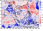
The southwest monsoon over the Maritime Continent (MC) and South China Sea (SCS) region began
in the middle of May. In May, westerly low-level flow (850hPa) prevailed throughout the Bay of Bengal (BOB)
and penetrated Indochina until southern China as southwesterlies (refer to Figures 1). The subtropical ridge
was well established over the northern Philippines and northern SCS. In this period, the southern part of
Southeast Asia including Sumatra, Indonesia, Borneo, Peninsular Malaysia, the Gulf of Thailand, and southern
Philippines were wetter than normal whereas Indochina was drier than normal. By June, the subtropical ridge
has fully retreated into the western Pacific, allowing intrusion of westerlies from the equatorial Indian Ocean
(IO) all the way to the northern SCS and north-west Pacific. This shows that the southwest monsoon is fully
established over the MC. The trough is clearly visible in northern Indochina – southern China. In June, Indonesia
and Malaysia generally experienced near-normal rainfall while parts of northern Vietnam and southern China
experienced slightly greater than normal rainfall. During this period, westerly winds strengthened and
broadened over the equatorial IO and SCS. The low-level wind flow in July resembled June, characterized by
slightly stronger westerly zonal wind component compared to the previous month, stretching from the equatorial
Indian Ocean towards the SCS until the western Pacific.
However, there is a gradual increase in precipitation in the equatorial Maritime Continent, shifting from
drier than usual condition to average and slightly wetter than usual in that region. This trend of increased
precipitation continues in August and September. Wetter than usual conditions increased significantly during
this period near southern Sumatra – eastern Indian Ocean, and eastern Indonesia while Malaysia experienced
above-average (August) to near-normal rainfall in September. The enhanced rainfall near Sumatra, Indonesia is
a characteristic of mature negative IOD episode that peaked in August-September, while enhanced rainfall near
Papua, Indonesia near the equatorial western Pacific is a characteristic of developing La Niña.
In August, the southwesterlies began to weaken, and retreated from the Philippines and western Pacific.
By September, the southwesterlies retreated from Indochina and northern SCS, and is dominant only over the
BOB and equatorial SCS. The monsoon trough has retreated from Southern China – Northern Indochina (June
– August; 20 – 25 oN) to Indochina (September; 15 oN). This indicates the withdrawal of the southwest monsoon
in late September.
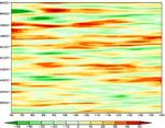
Figure 2 depicts time longitude plots of anomalous zonal winds. In the near-equator (0 – 15 o N), the
southwest monsoon began in the middle of May, where intense westerly anomaly in the Indian Ocean penetrates
to the western Pacific. In May, July, and September, eastward propagation of westerly anomalies was observed
from the Bay of Bengal (80 – 100 o E) to the Maritime Continent (100 – 120 o E), consistent with phases 4 and
5 of the MJO (Refer to black arrows in Figure 2). On the other hand, anomalous easterly winds were observed
to propagate from the western Pacific to the Indian Ocean (Refer to dark blue arrows in Figure 2). This becomes
more frequent and intense from August – September onwards, in conjunction with atmospheric and oceanic
conditions edging from ENSO neutral to La Niña. By August-September, for both Indochina and near-equator,
anomalous easterly winds are dominant, reflecting the gradual withdrawal of the southwest monsoon.(a) (b)
(c) (d)
(d)
Figure 1: Mean wind analysis at the 850hPa atmospheric pressure levels (vectors) and precipitation
anomalies (shaded) for (a) May, (b) June, (c) July, (d) August and (e) September 2021.(a) Averaged Equator to 15 oN (b) Averaged 10 – 30 oN
Figure 2. Time longitude cross-section of anomalous zonal wind from May – September 2021 (top –
bottom vertical) and 70 E – 140 E (left to right horizontal). Black arrows denote eastward propagating
westerly anomalies associated with MJO phase 4 and 5 (Maritime Continent) while dark blue arrows
denote westward propagating easterly anomalies.
2. Outgoing Longwave Radiation (OLR)
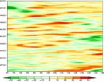
Figure 3 shows time-longitude cross-section of anomalous OLR from May to September 2021.
Indochina (90 – 120 o E) located between 10 – 30 o N was drier than usual in the second week of June until
August. Westward propagating regions of anomalous convection was observed from the western Pacific (140 o
E) moving eastwards to Indochina (110 o E). This may be attributed to tropical storms coming from the western
Pacific and making landfall in Indochina. On the other hand, eastward propagation of anomalous convection
was observed between the equator to 15 o N. Regions of enhanced convection was observed to propagate from
the Bay of Bengal (80 – 90 o E) to the Maritime Continent (90 – 120 o E) over a period of 30 – 60 days. This is
consistent with MJO. In general, the side of the equatorial Maritime Continent closest to the western Pacific
(east of 115 o E) experienced more convection than usual from August – September onwards in conjunction
with developing La Niña atmospheric and oceanic conditions.
(a) Averaged Equator to 15 oN (b) Averaged 10 – 30 oN
Figure 3. Time – longitude cross-section of May – September 2021 (vertical top to bottom) and 70 – 100
o E (horizontal left to right) anomalous OLR. Black arrows show eastward propagation of anomalous
enhanced OLR (cool colours). Dark blue arrows show westward propagation of anomalous enhanced OLR.3. Weather Outlook from October – November – December 2021
In general, the upcoming northeast monsoon is associated with heavy rainfall over southern Thailand,
eastern Peninsular Malaysia, east Malaysia, and Indonesia due to convergence between cold surges linked to
the Asian winter monsoon and Pacific easterlies.
Seasonal outlook over the Maritime Continent was taken from the ASMC (ASEAN Specialized
Meteorological Centre) updated on 2nd October 2021. In the season of October-November-December 2021 a
greater chance of above-normal rainfall is predicted over most of the Maritime Continent especially over the
southern and eastern parts. The central and eastern part of the Southeast Asia Mainland is predicted by most
models to have slightly increased chance of above-normal rainfall
Seasonal outlook for Malaysia was taken from MET Malaysia updated on 30th September 2021. In the
month of October, slightly above average rainfall is expected over the states of Perlis, Kedah, Pulau Pinang,
and western Perak in Peninsular Malaysia. Slightly above average rainfall is also expected in the divisions of
Kuching, Samarahan, Sri Aman and Betong in the state of Sarawak. In the state of Sabah, the divisions of Kudat
and West Coast are expected to receive slightly above average rainfall in October. During the month of
November, the state of Kelantan and northern part of Terengganu in Peninsular Malaysia are expected to receive
slightly above average rainfall. In the state of Sabah, the divisions of Kudat, Sandakan and Tawau are expected
to get slightly above average rainfall in November. Meanwhile in December, the states of Kelantan and
Terengganu in Peninsular Malaysia are expected to receive slightly above-average rainfall. At the same time,
the divisions of Kudat, Sandakan and Tawau of the state of Sabah are expected to receive slightly above average
rainfall. Elsewhere normal rainfall is expected.
Seasonal forecast is performed based on forecaster consensus with climate model outlooks from NCEP
CFSv2 (National Centres for Environmental Prediction Climate Forecast System Model version 2), JMA
Ensemble Prediction System (Tokyo Climate Centre), European Centre for Medium Range Weather Forecast
(ECMWF) and Seasonal Climate Forecast, International Research Institute for Climate Society (IRI). Key
climate drivers such as the MJO, IOD, and ENSO are considered in the process of making seasonal forecast.
Acknowledgement
Monthly low-level wind charts were plotted using ERA5 reanalysis data produced by the ECMWF
(European Centre for Medium-Range Weather Forecasts) and downloaded from the Copernicus Climate
Change Service. Daily low-level zonal wind anomalies were plotted using JRA55 (Japanese 55-year Reanalysis)
dataset produced by the Japan Meteorological Agency. OLR anomalies were obtained from the NOAA
(National Oceanic and Atmospheric Administration) Physical Sciences Laboratory. Tropical storm data was
taken from the Digital Typhoon project and RSMC Tokyo. Seasonal outlook for Southeast Asia was obtained
from the ASMC (updated 2nd October 2021). Seasonal outlook for Malaysia was produced by MET Malaysia
(updated on 30th September 2021).
Notes
The base period of climatology used in this report is 1991 – 2020.You can also read


