KINGBOROUGH TRACKS AND TRAILS STRATEGIC ACTION PLAN 2017 2022
←
→
Page content transcription
If your browser does not render page correctly, please read the page content below
KINGBOROUGH TRACKS AND TRAILS

    STRATEGIC ACTION PLAN

          2017 - 2022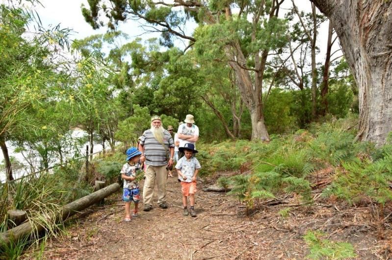
TABLE OF CONTENTS

1.0   EXECUTIVE SUMMARY: .................................................................................................................... 1

2.0   INTRODUCTION ............................................................................................................................... 2
      2.1 BACKGROUND .................................................................................................................................. 2
      2.2 PURPOSE AND OBJECTIVES .............................................................................................................. 3
      2.3 DEMOGRAPHIC CHARACTERISTICS OF KINGBOROUGH .................................................................. 4

3.0   PLANNING OVERVIEW ..................................................................................................................... 6
      3.1 BENEFITS OF TRACKS ....................................................................................................................... 6
      3.2 STATE-WIDE AND REGIONAL PLANS AND POLICIES......................................................................... 7
           3.2.1 TRAILS TASMANIA STRATEGY ................................................................................................ 7
           3.2.2 TASMANIAN OPEN SPACE POLICY & PLANNING FRAMEWORK 2010.................................... 7
           3.2.3 TASMANIA’S CYCLE TOURISM STRATEGIC ACTON PLAN TO 2020 – DRAFT
                 (released Sept 2016) .............................................................................................................. 7
           3.2.4 GREATER HOBART MOUNTAIN BIKE MASTERPLAN 2011 ..................................................... 8
           3.2.5 DEPARTMENT OF PRIMARY INDUSTRIES PARKS WATER ENVIRONMENT ............................. 8
                 MOUNTAIN BIKING POLICY & PROCEDURES ......................................................................... 8
           3.2.6 DEPARTMENT OF STATE GROWTH ........................................................................................ 8
                 TASMANIAN WALKING AND CYCLING FOR ACTIVE TRANSPORT STRATEGY ......................... 8
      3.3 KINGBOROUGH COUNCIL’S STRATEGIES AND PLANS ...................................................................... 9
           3.3.1 KINGBOROUGH COUNCIL’S STRATEGIC PLAN 2015 – 2025 .................................................. 9
           3.3.2 KINGBOROUGH SPORT & RECREATION FACILITIES STRATEGY 2013 ..................................... 9
           3.3.3 KINGBOROUGH COUNCIL TRACKS & TRAILS ACTION PLAN 2009 ....................................... 10
           3.3.4 OTHER RELEVANT COUNCIL DOCUMENTS .......................................................................... 10
      3.4 PARTICIPATION TRENDS ................................................................................................................ 11

4.0   STRATEGIC DIRECTIONS ................................................................................................................. 13
      4.1 VISION AND GUIDING PRINCIPLES ................................................................................................. 13
      4.2 PROTOCOLS .................................................................................................................................... 14
      4.3 GUIDING PRINCIPLES – KINGBOROUGH’S TRACKS AND TRAILS KEY STRATEGIES ......................... 15
           4.3.1 GUIDING PRINCIPLE 1: EXTENSIVE AND INTEGRATED TRACK PLANNING .......................... 15
           4.3.2 GUIDING PRINCIPLE 2: DESIGN AND CONSTRUCTION........................................................ 16
           4.3.3 GUIDING PRINCIPLE 3: COMMUNICATION OF A CONSISTENT TRACK
                 CLASSIFICATION SYSTEM ..................................................................................................... 16
           4.3.4 GUIDING PRINCIPLE 4: MAINTENANCE ............................................................................... 18
           4.3.5 GUIDING PRINCIPLE 5: INFORMATION, SIGNAGE & PROMOTION ...................................... 20
           4.3.6 GUIDING PRINCIPLE 6: RESOURCING................................................................................... 23
           4.3.7 GUIDING PRINCIPLE 7: COMMUNITY INVOLVEMENT & PARTNERSHIPS ............................ 24

5.0   IMPLEMENTATION PLAN................................................................................................................ 26
      5.1 PLANNING AND MANAGEMENT ACTION PLAN:                                              SUMMARY OF RECOMMENDED
           ACTIONS ......................................................................................................................................... 28

6.0   APPENDICES .................................................................................................................................. 30
      APPENDIX A TRACKS ACTIVITY PLAN................................................................................................... 31
      APPENDIX B TRACKS PROPOSED PROJECT LIST .................................................................................. 32
      APPENDIX C COMPLETED TRACK PROJECTS SINCE 2009 ACTION PLAN ............................................. 40
      APPENDIX D OVERVIEW OF CURRENT TRACKS AND TRAILS ............................................................... 41
      APPENDIX E     SUPPORTING INFRASTRUCTURE..................................................................................... 42
      APPENDIX F     SIGNAGE ......................................................................................................................... 43
      APPENDIX G TRACKS AND TRAIL ASSESSMENT CRITERIA ................................................................... 43
      APPENDIX H TRACK STANDARDS AND GUIDELINES ............................................................................ 45
1.0 EXECUTIVE SUMMARY:
The Kingborough Tracks and Trails Strategic Action Plan has been developed to provide a clear, co-
ordinated and strategic approach to guide Council’s planning, development, management and promotion
of a municipal wide network of tracks into the future. This strategy aims to identify Council’s key guiding
principles as guide for decision-making and based on a policy framework that incorporates regional and
statewide strategies for tracks and trails planning to align within the larger planning context.
The Strategy captures in greater detail the desired future tracks and strategic missing links to the
Kingborough network and prioritised lists of identified projects. These identified projects from previous
community consultation, will strictly guide Councils considerations for resources over the next five to ten
years with a review after five years. It provides recommendations for achieving those strategic directions
and guiding principles and a framework for implementation.
The Strategic Action Plan incorporates:
An overview of the benefits of tracks and trails and Kingborough’s current tracks;
Current trends, participation data and demographic profile;
A policy framework incorporating regional and statewide strategies for tracks and trails planning with
Councils strategies aligning within the larger planning context, for new track development;
Seven key guiding principles forming a strategic direction, including guidance on aspects of track
classification, consistent signage, communication, criteria for assessing new track proposals,
planning, design and management; and
A revised Implementation Plan setting out well defined priorities for the planning, development,
management and promotion of Kingborough’s tracks into the future.
Coastal Communities Day, Coningham
Page | 1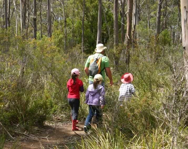
2.0 INTRODUCTION
WHY WE NEED A STRATEGIC ACTION PLAN FOR KINGBOROUGH’S TRACKS
Kingborough has a significant network of recreational trails across the municipality. These provide both
essential informal recreational opportunities for residents and visitors alike as well as passive commuting
options.
The demand for quality, recreational trail networks has grown in Tasmania and the local community, from
walkers and trail runners, mountain bikers and horse riders seeking a quality experience that is accessible.
Associated with this is a push for land managers to better manage existing tracks and the construction of
new ones.
The Tasmanian Government’s, Trails Tasmania Strategy (2007) found that the highest priority needs are for
trails close to where people live and that are easily accessible to them. Tasmania is renowned as a world-
class bushwalking destination and there is significant potential for Tasmania to build on this reputation and
become a world-class trails destination. This will require improved trail networks and the development of
improved trail opportunities for specific user groups such as mountain bikers and horse riders (Trail
Tasmania Strategy, 2007).
The recent surge in mountain bike tourism in Tasmania since 2015, (in particular in the north east of the
State), has seen other regional Councils seeking to increase visitation and tourism numbers to their
municipal areas and drive economic growth. Tasmania’s growing reputation as a mountain biking
destination has presented Tasmania and local areas with opportunities to encourage healthy, active
lifestyles whilst building on Tasmania’s profile as an outstanding adventure tourism and nature based
destination.
2.1 BACKGROUND
In response to the rapid residential growth, healthy lifestyle requirements, alternative transport
route requirements and tourism growth, Council, in conjunction with the Kingborough Landcare
Advisory Group held the Kingborough Tracks and Trails Forum in 2006. This forum was organised to
discuss tracks and trails development in Kingborough and neighbouring communities including the
following:
What linkages have been achieved locally as well as statewide and interstate strategies;
Identify the processes involved in planning and maintaining tracks and trails; and
Consider the community’s future involvement in planning and maintaining walkways and
linkages in Kingborough and connecting to adjoining municipalities.
From the forum, a list of two hundred ideas for tracks and trails developments was compiled for use
in future planning. A Tracks & Trails Advisory Group was also formed as a result of the forum with
membership drawn from relevant stakeholders and key interest groups. The Advisory Group worked
through all the suggestions from the original forum and analysed and prioritised all the information
which resulted in 50 tracks and trail links of varying proposed use, achievability and priority that were
identified and mapped.
The 2007 Trails Tasmania Strategy highlighted a range of identified trail needs within the Tasmanian
Community. As a result of this, the Kingborough Tracks & Trails Action Plan was developed in 2009 to
help guide decision making and development of tracks in Kingborough. Council was proactive in the
following years in planning and developing recreation tracks across the municipality which included
bringing together the advisory group from the community and other stakeholders and the
Page | 2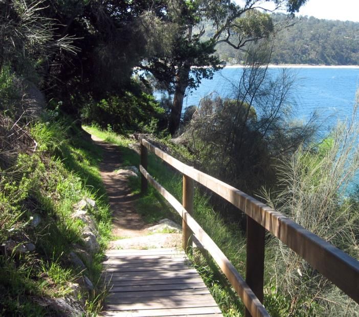
development of a prioritised list of projects for the future. At this time there was also funding
available to apply to the State Government for the Trails and Bikeways Grant Program which ran
from 2008 until 2014 for trail projects that were consistent with the Trails Tasmania Strategy. It
played a significant role in supporting local government at the time to develop and expand walking
and cycling infrastructure.
During 2007 the Huon Valley Council expressed interest in joining with Kingborough in the
establishment of an iconic trail linking communities in the region south of Hobart. Preliminary work
was undertaken and funding was secured to develop a project proposal for a multi-use ‘Regional
Trail’ linking Mt Nelson to Kingston and further down the Channel to Huonville and Dover. Some land
owner negotiation discussions were commenced and in-principle support gained by some for the first
section from Mt Nelson to Kingston.
Much of the track work that has been undertaken in Kingborough over the past years since the 2009
Action Plan includes sections that would make up this bigger picture Trail including upgrading and
further stages of Alum Cliffs Track and improvements to the Kaoota Tramway Track. Many projects
listed in this Strategic Action Plan as separate tracks, would in fact continue to build towards these
linkages of a ‘Regional Trail’ to link communities in the municipality.
The demand for recreational tracks and trails is growing. National physical activity trends indicate
that participation in unstructured recreational activities is increasing. Both nationally and in
Tasmania, walking is the most popular recreational activity, with cycling in fourth place.
Australian Bureau of Statistics reports from 2013-2014 states that walking for exercise was the most
popular physical recreation activity, with 19% of people aged 15 years and over walking for exercise
at least once in the 12 months prior to interview.
The newly revised 2017 Kingborough Tracks and Trails Strategic Action Plan seeks to review what
progress has been made to date from what was identified in 2009, and capture in greater detail the
desired future tracks and identify strategic missing links to the Kingborough network. It also takes
into consideration further aspects of integrated track planning, design, communication and
information, maintenance, resourcing and community partnerships.
2.2 PURPOSE AND OBJECTIVES
The purpose of revising and developing a Tracks & Trails Strategic Action Plan is to provide a co-
ordinated and strategic approach to guide Council’s planning, development, management, and
promotion of a municipal wide network of tracks into the future. It will provide recommendations for
achieving those strategic directions and guiding principles, and a framework for implementing the
proposed projects.
This network will include longer iconic multi-purpose (walking, cycling, horse riding) trails as well as
useful urban linkages to provide residents with walking and cycling options within their daily life to
visit friends, go to school and shops and to access community facilities and public transport.
Kingborough Council will work closely with the relevant government bodies, related community
groups and interested individuals to:
Coordinate the planning, development, marketing and maintenance of a municipality wide
network of tracks and trails;
Facilitate the involvement of appropriate community groups and individuals in the
development, management and maintenance of tracks;
Page | 3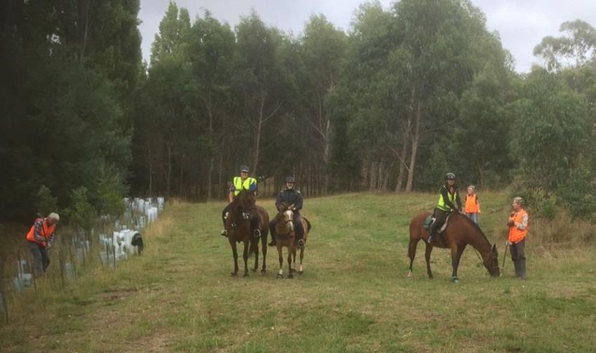
Establish a database of tracks and trails information to support the effective development of
facilities and services in the Kingborough Municipality; and
Promote the Kingborough tracks and trails network to local residents, visitors, tourists, media
and business interests as a cost effective, beneficial and widely accessible community
resource.
2.3 DEMOGRAPHIC CHARACTERISTICS OF KINGBOROUGH
Statistics from the ABS Census 2016
Kingborough Council is one of the fastest growing local government municipalities with a population
of approximately 35,800 residents. Over the next 20 years, Kingborough is predicted to have the
greatest increase in population compared to other municipalities in Tasmania.
The median age of people in Kingborough is 42, which is the same as the State’s median age. 1
The percentage of people in Kingborough over 55 in 2011 was 29% and in 2016 this figure is
32% 1
Kingborough’s aging population is consistent with that of the Greater Hobart region. 1
Population projections for Kingborough indicate:
By 2022, Kingborough’s population is likely to reach 40,000. This rate of growth for the next ten years
will add about the same number of additional residents (6,000) to the population as has occurred in
the last 10 years. Importantly, all of this net growth will likely be in the above 40 age groups.
ERASS (Exercise Recreation and Sport Survey 2010) figures show that Tasmanians in the 45 plus age
groups are more likely to participate in informal activities only, more so than those in younger age
groups.
Due to considerable growth expected in the Kingston and Huntingfield areas, including new large
subdivisions just south of Kingston, it will be important to continue to update and
improve recreational infrastructure including recreational cycling and walking track linkages in this
area.
1
ABS Census 2016
Page | 4
POPULATION DISTRIBUTION BREAKDOWN:

The chart below shows the distribution of the population throughout the municipality.
    Town/Suburb               Population             Town/Suburb              Population
        Taroona                  3070                     Snug                   1,199

      Bonnet Hill                 505                 Lower Snug                  442

       Kingston                 10,409                Coningham                   253

    Blackmans Bay                7,145                Oyster Cove                 319

     Huntingfield                 428                  Kettering                  803

       Howden                     676                 Woodbridge                  503

       Margate                   3,920                Birches Bay                  93

        Sandfly                   310                  Middleton                  252

     Allens Rivulet               487                   Gordon                    199

       Electrona                  364                 North Bruny              237 (2011)
      Leslie Vale                 351                 South Bruny              534 (2011)
        Longley                   234                Lower Longley                279

             Figure 1- Population by Town/Suburb in Kingborough – 2016 ABS Census

                                         Snug River Track

                                                                                        Page | 5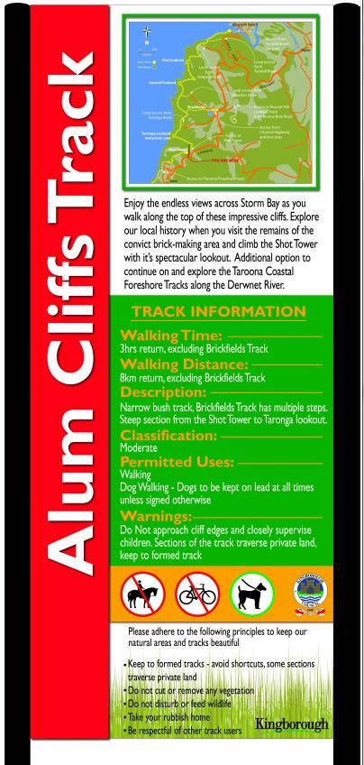
3.0 PLANNING OVERVIEW
           3.1      BENEFITS OF TRACKS

                    Walking and recreational trails provide many benefits to both the individual and the Tasmanian
                    Community as a whole. Quality trails provide safe, convenient linkages between community facilities
                    and open spaces, and provide alternative commuting options. They are associated with a range of
                    benefits from increased health and wellbeing, increased physical activity, sustainable transport
                    options, tourism and economic opportunities.

                    Walking is the most popular recreational activity in Australia with 42.6% of the population
                    participating.2 Recreational walking is also the most popular activity in Tasmania according to the
                    2010 ERASS (Exercise, Recreation and Sport Survey) and cycling is in the top five recreational
                    activities. Australian Bureau of Statistics results from 2011-12 showed that walking for exercise
                    attracted the largest number of both male and female participants. Cycling was the third most
                    popular recreational activity for men and 5th for women. Jogging and running was in the top five
                    activities for both men and women.

                    Sustainable transport is also a key strategic goal in Council’s Strategic plan and one of the desired
                    strategic outcomes is to provide an attractive and user friendly network of footpaths and tracks for
                    both pedestrians and cyclists.

                    BENEFITS OF RECREATIONAL TRACKS AND TRAILS

                     Community,                o    Greater opportunity for a more active lifestyle
                     Health and                o    Improved health, fitness and wellbeing
                     Wellbeing
                                               o    Improved mental health by connecting with nature and the outdoors
                                               o    Disease prevention by incorporating an active lifestyle
                                               o    Facilitation of participation and social interaction between a diversity of community
                                                    members, age groups, individual and families and multi-users
                                               o    Increased options for pet owners to exercise their dogs
                                               o    Helps connect people and places and to develop a sense of place and community
                                                    pride
                                               o    Partnerships created between government, landowners, community and user groups
                     Environmental             o    Walking or cycling is a cheap, sustainable form of alternative transport
                                               o    Safe commuting options minimising time on roads and around vehicles Conservation
                                                    of the natural environment can be enhanced through improved management
                                                    practice in relation to tracks and surrounds
                                               o    Educational and interpretation opportunities and increased environmental and
                                                    cultural awareness through access of natural areas
                                               o    Reduced impact on natural areas by appropriate planning, sustainable design and
                                                    management practices
                                               o    Opportunities for community participation in conservation, and activities such as
                                                    revegetation and weeding
                     Economic                  o    Reducing health costs through encouraging increased activity and opportunities to
                                                    recreate
                                               o    Purpose built trails can attract other tourism specific markets eg. mountain bikers,
                                                    horse riders, trail runners
                                               o    Can be an important aspect of a visitor experience to stay in an area to explore longer
                                               o    Flow on effect to local business, food outlets for locals and visitors to spend in the
                                                    area
                                               o    Increased option of trail based events to attract people to an area

2
    AIS AusPlay Participation data for the sport sector, Summary of key national findings (Oct 2015 – Sept 2016 data)

                                                                                                                               Page | 6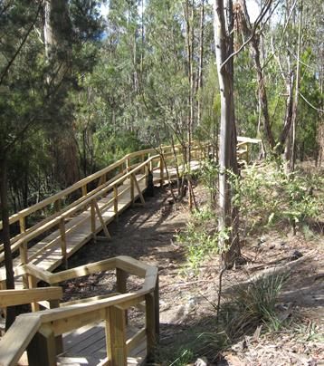
3.2 STATE-WIDE AND REGIONAL PLANS AND POLICIES
3.2.1 TRAILS TASMANIA STRATEGY
The Trails Tasmania Strategy (2007) aims to provide, in partnerships with the community and
stakeholders, a strategy for the planning, development and sustainable management of an
integrated recreational trails network in Tasmania (Trails Tasmania Strategy 2007).
The Strategy sets out a framework for state agencies, local councils and private land manager
to help guide coordinated decision-making, resource allocation, management and promotion
of a co-ordinated and diverse recreational trail network across the state. The Strategy
outlines specific strategies and associated actions aimed at achieving an integrated state-
wide trail network.
The key findings of the Trails Tasmania Strategy indicated that there are a range of identified
trail needs within the Tasmanian community. It identified that the highest priority needs are
for trails close to where people live.
3.2.2 TASMANIAN OPEN SPACE POLICY & PLANNING FRAMEWORK 2010
This policy was developed to provide sound policy guidance and establish a framework for
effective open space planning and provision at a state, regional and local level in Tasmania.
The Kingborough Tracks and Trails Strategic Action Plan aims to link public open space areas
through the development of a trail network. The Action Plan will assist Council staff in
identifying key linkage areas when sub-divisions come up for public open space opportunities
of acquisition.
3.2.3 TASMANIA’S CYCLE TOURISM STRATEGIC ACTON PLAN TO 2020 – DRAFT (released Sept
2016)
The 1st draft of this Action Plan was released in September 2016 for public comment calling
for industry stakeholders to provide submissions to further inform the strategy and
identify additional priority actions that will support the development of the cycle tourism
market.
The Tasmanian Government recognises the potential of cycling as a niche tourism drawcard
to visitors to Tasmania and is committed to developing a Cycling Tourism Strategic Action
Plan to identify what needs to be done to establish Tasmania as a leader in this exciting
market. (Tasmania’s Cycle Tourism Strategic Action Plan to 2020 - DRAFT).
Three priorities have been identified in the Action Plan to help support and grow cycling
tourism out to 2020:
Consolidating trails and routes;
Marketing what we already have to offer; and
Providing the supporting infrastructure and services to provide the best experience
once a cycling tourist arrives.
A key action in the draft strategy is to work with local councils to review the tracks and trails
available and used by visitors to the state and identify future possibilities.
Page | 7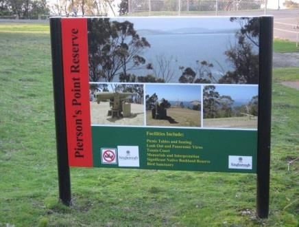
3.2.4   GREATER HOBART MOUNTAIN BIKE MASTERPLAN 2011

        The Greater Hobart Mountain Bike Plan aims to provide a regional approach to
        the consistent and high quality development and maintenance of mountain bike tracks and
        associated facilities and infrastructure. This planning identified some key areas and tracks for
        Kingborough Council to progress further for mountain bike opportunities. These tracks are
        captured in the Tracks and Trails Action Plan, Appendix B.

3.2.5   DEPARTMENT OF PRIMARY INDUSTRIES PARKS WATER ENVIRONMENT

        MOUNTAIN BIKING POLICY & PROCEDURES

        The 2016 Department of Primary Industries, Parks, Water and the Environment, Mountain
        Biking Policy & Procedures was prepared to provide a consistent, organisation-wide approach
        to managing mountain biking on Parks and Wildlife managed land. This includes providing
        management policy and guidelines relating to the planning, development and management
        of mountain biking opportunities and experiences.

        Parks & Wildlife acknowledges mountain biking as a legitimate recreational activity and will,
        subject to resource constraints, actively provide for and manage a diversity of riding
        opportunities, where they can be:

        a)    Safely provided;

        b)    Consistent with the conservation of natural and cultural resources;

        c)    Demonstrated to be sustainable; and

        d)    Consistent with land and reserve management objectives and zoning.

        The policy highlights as new opportunities, that Parks & Wildlife will consider shared use trail
        opportunities as a first priority. Shared use trails will be appropriately signed, including a
        classification of difficulty for each main user group, and directional trail information where
        appropriate.

3.2.6   DEPARTMENT OF STATE GROWTH

        TASMANIAN WALKING AND CYCLING FOR ACTIVE TRANSPORT STRATEGY

        The State Government’s Walking and Cycling for Active Transport Strategy aims to promote
        walking and cycling as viable and desirable forms of transport, through improved
        infrastructure, land use planning and behavioural change. It looks more at guiding
        development of walking and cycling as transport options in urban areas by creating a more
        supportive transport system for pedestrians and cyclists. Local Government plays an
        important role in facilitating cycling and walking through local road network, footpaths and
        local parks, along with land use planning.

                                                                                          Page | 8
3.3 KINGBOROUGH COUNCIL’S STRATEGIES AND PLANS
3.3.1 KINGBOROUGH COUNCIL’S STRATEGIC PLAN 2015 – 2025
Strategic Outcomes
Kingborough Council’s Strategic Plan (2015-2025) includes the following relevant strategies in
relation to the development of the Strategic Action Plan.
Key Priority Area: Strategies:
A safe, healthy and o Support increased participation in physical activities, through the
supportive planning, delivery and advocacy of appropriate recreation and sporting
community services and facilities
o Enhance the use of existing public spaces through initiative that
improve safety and enjoyment experienced by all ages
Sustainable land use o Ensure sound strategic land use planning and asset management
and infrastructure provides the basis for sustainable future development and
management infrastructure investments
o Provide pathways that improve safety and accessibility for pedestrians,
cyclists and other users to make it easier to choose active transport for
local trips and recreation
o Review future needs, plus maintain and develop recreational and
sporting facilities
A healthy natural o Protect and enhance important biodiversity and coastal values of
environment Council owned and managed properties
o Promote opportunities for the responsible enjoyment of publicly
accessible natural areas
A vibrant local o Identify and promote the tourism, lifestyle and investment
economy opportunities within Kingborough
o Identify and upgrade critical tourism infrastructure
Community o Engage with the community and keep it informed about Council
Leadership activities and proposals
o Seek the views of the community and ensure engagement in the
decision making process of Council
A well administered o Provide strategic plans, policies and particular programs that assist
organisation Council plan for the future
o Sustainably manage all Council owned properties in the best interest of
the broader community
3.3.2 KINGBOROUGH SPORT & RECREATION FACILITIES STRATEGY 2013
The Kingborough Sport and Recreation Facilities Strategy was developed to provide a clear,
planned and pragmatic approach to the development of new sport and recreation facilities as
well as the upgrading of existing facilities. The strategy aims to progressively improve
facilities that provide recreation, social and sporting opportunities to the Kingborough
community.
The key issues from consultation at the time of developing the strategy, in relation to tracks
and trails were:
The need to continue to link existing networks of tracks for walking, cycling and
mountain biking;
Page | 9 The need for the improvement of existing trails; and
Continued concerns about the condition of trails especially during winter months.
The key findings in regards to tracks in Kingborough were:
The importance of providing quality, connected recreational trails close to where
people live.
The need to research the needs of the growing informal sport and recreation activities
in Kingborough.
3.3.3 KINGBOROUGH COUNCIL TRACKS & TRAILS ACTION PLAN 2009
The objective of the 2009 Action Plan was to co-ordinate the planning, development,
maintenance and marketing of a municipality wide network of trails. At the time this was
developed there was funding from Sport and Recreation to help contribute to numerous trail
projects identified in this plan as well as track upgrades. This Action Plan provided Council
staff with a basic framework for decision making, but was not supported by an overarching
policy framework or strategic direction.
3.3.4 OTHER RELEVANT COUNCIL DOCUMENTS
Other relevant Council documents include:
Positive Aging Policy 2008
Access Policy 2016
Kingborough Youth Policy 2016
Public Open Space Contribution Policy
Dog Management Policy
Parks, Recreation and Natural Areas By-Laws 2011
Reserve Management Plans
Bushfire Management Plans
Brickfields Track, Alum Cliffs
P a g e | 103.4 PARTICIPATION TRENDS
The Exercise, Recreation and Sport Survey (ERASS)
The Exercise Recreation and Sport Survey is a joint initiative between the Australian Sports
Commission and the State and Territory Governments. The ERASS collects information on the
frequency, duration, nature and type of activities that are participated in by persons aged 15 years
and over for exercise, recreation and sport during the 12 months prior to interview.
The top 10 physical activities in Tasmania from the 2010 survey are shown as follows:
100
90 Top 10 physical activities in Tasmania 2010
80
70
60
Participation
50
% 38.4
40
30
17.7
20 11.5 11.1 9 8 6
10 4.6 4.4 4.1
0
Walking (other than bushwalking)
Aerobics/Fitness
Swimming
Cycling
Walking (bushwalking)
Running
Golf
Cricket (Outdoors)
Australian Rules Football
Tennis and Fishing
Participation by activity
COMMUNITY CONSULTATION - PARTICIPATION ANALYSIS
Online surveys with Kingborough residents were undertaken in late 2011 as part of Kingborough
Council’s Sport & Recreation Facilities Strategy. Questions asked that related to participation trends
included:
What sport and recreational activity do you currently participate in?
Do you belong to a sport/recreational club or organisation?
Are the recreational and sporting facilities currently available in Kingborough meeting the
needs of you and your family?
Although the survey did not reach the whole community, the results show that the activities that
Kingborough residents are involved in are similar to those at both the state and national level.
P a g e | 11The table below shows the main sport and recreation participation activity results of the community
consultation:
Activity undertaken by Kingborough Percentage % participation
residents
Walking 76%
Cycling (including MTB) 39%
Running 19%
Aerobics/Gym activities 13%
The main difference between the survey figures and the state figures represented in the chart above
are the popularity of walking as a recreational activity in Kingborough. This might be due to a
number of reasons including that Kingborough has an ageing population and according to the ERASS
(Exercise Recreation and Sport Survey 2010) figures, Tasmanians in the 45 plus age groups are more
likely to participate in informal only activities than those in younger age groups. Kingborough also
has a significant network of existing tracks and trails and a beautiful coastal environment that lends
itself to this kind of informal recreational activity.
(Kingborough Sport and Recreation Facilities Strategy 2013)
Kaoota Tramway Track
P a g e | 124.0 STRATEGIC DIRECTIONS
4.1 VISION AND GUIDING PRINCIPLES
Kingborough Council’s Vision:
A vibrant, diverse and connected community, with well managed natural and physical assets and a
wide range of economic and lifestyle opportunities.
Trails Tasmania Vision (2007)
Tasmania will be recognised for its diverse and sustainable recreational trails that are amongst the
best in the world.
Council’s Tracks & Trails Vision:
Kingborough tracks will meet the needs of residents, visitors and tourists by providing increased
physical activity, enjoyment, and an increased environmental and cultural awareness.
The ensuing guiding principles are aimed as a guide for decision-making to assist the realisation of
these visions.
Guiding Principle 1: Planning
Develop a strategic, comprehensive and co-ordinated approach to the planning of a municipality
wide, connected and diverse network of tracks and trails
Guiding Principle 2: Design and construction
Ensure design and construction for tracks is sustainable – environmentally, socially and economically
Guiding Principle 3: Communication
Adhere to a consistent method of communicating a track rating difficulty system that is consistent
with regional, state and national classification systems for multiple user groups
Guiding Principle 4: Maintenance
Commit to a maintenance program for track upgrade planning to relevant standards, that new tracks
are sustainable to maintain and implement an on-going cross municipal maintenance program
Guiding Principle 5: Information
Effectively promote the Kingborough tracks and trails network to local residents, visitors, tourists,
media and business interests through appropriate signage, accessible information and promotion
Guiding Principle 6: Resourcing
To integrate resources across relevant Council Departments for track planning, management and
maintenance. Seek external funding where appropriate and commit to including funding in annual
capital works programs towards new track development, upgrades to existing tracks, and on-going
maintenance.
Guiding Principle 7: Community engagement, involvement and partnerships
Work in partnership with other land management agencies, recreational clubs, community groups
and volunteers and facilitate their involvement in the development, management and maintenance
of a sustainable network of tracks in Kingborough.
P a g e | 134.2 PROTOCOLS
The following protocols will aid in guiding a consistent approach to the planning, development and
management of Kingborough’s Municipal Track network. These protocols relate to the guiding
principles and vision statements:
Provide and promote multi-use/shared tracks options (walking, cycling, horse riding or
combination of any) where it is feasible and environmentally sustainable for accessibility to the
broadest range of users;
Implement universal and recognised track classification systems to direct design, classify tracks
and describe level of difficulty, (Appendix C);
Co-ordinate a consistent approach in relation to track signage across the municipality,
following the Councils Tracks and Reserves Sign Guide (2016) for design guidance,
specifications and information to include;
Promote and educate on the Tracks User Code of Conduct;
Continue to update and develop the Kingborough Tracks booklet and on-line information as
well as updates to the Greater Hobart Trails website and associated maps; and
Undertake sustainable management practices for both existing and new tracks; implementing
best practice standards and guidelines, and take into consideration unique environmental
conditions. Resources and funding must be sufficient to ensure ongoing repairs and
maintenance into the future.
Guided Nature Walk, North West Bay River Track
P a g e | 144.3 GUIDING PRINCIPLES – KINGBOROUGH’S TRACKS AND TRAILS KEY STRATEGIES
4.3.1 GUIDING PRINCIPLE 1: EXTENSIVE AND INTEGRATED TRACK PLANNING
Develop a strategic, comprehensive and co-ordinated approach to the planning of a
municipality wide, connected and diverse network of tracks and trails.
Well planned and designed track networks for walking and cycling routes, allow people to
travel safely and with ease.
Proposed new track development and any track renovations and improvements should be
regarded in context with Council’s Tracks and Trails Strategic Action Plan and the broader
statewide directions and planning approaches to avoid ad hoc track development.
Council has recently been focussing on developing a coordinated program of upgrading the
existing public tracks and trails network, and extending tracks where necessary (eg Alum
Cliffs Track). These tracks usually provide connections to larger areas of public open space
and greatly assist in encouraging local residents and visitors to enjoy an outdoor experience.
Future development proposals should also provide for these connections and linkages within
their design and ultimate construction. This needs to be incorporated into the assessment of
future development applications where relevant.
Under the Land Acquisitions Act 1993, Council has the authority to compulsorily purchase
land for public purposes. Whilst this mechanism to gain desired land is available, this method
is as a last resort, and is not a desirable choice by Council due the high costs involved and
angst it can cause to those involved. Council’s preferred option is negotiation with
landowners over a formal right of way access for public recreational purposes.
RECOMMENDED ACTIONS:
Ensure that any new track planning is consistent within the state-wide and regional
recreational planning contexts and strategies.
Prioritise the development of a Public Open Space Strategy in 2017 - in progress.
Cross department communication in the planning, design and management of new
and existing tracks to strengthen Council internal mechanisms in facilitating roles and
responsibilities, and an integrated approach to planning.
For any new tracks to be constructed, a clear identification of the intended user group
to be established and where terrain is feasible to take into consideration accessibility
for use by diverse groups.
That community support and involvement be demonstrated for any new track
development.
Identify existing opportunities for the development of strategic fire breaks and tracks
in the near future.
Investigate the opportunities through a track audit to make modifications to existing
tracks where possible to allow multi-purpose use including recreational use as well as
fire protection purposes.
Identify strategic missing links in the fire road and tracks network and make
recommendations for the development and maintenance of these links as a fire
protection priority.
P a g e | 154.3.2 GUIDING PRINCIPLE 2: DESIGN AND CONSTRUCTION
Ensure design and construction for tracks is sustainable – environmentally, socially and
economically.
This guiding principle identifies the desire for sustainable design and trail construction. It is
fundamentally important that recreational tracks and associated infrastructure and facilities,
both new and existing, should be environmentally, economically, and socially sustainable
with regard to specific environmental and cultural values and follow ‘best practice’ principles.
It is also important in providing safe and enjoyable tracks for multi and shared use purposes.
The conservation and enhancement of natural areas, protection of Kingborough’s abundant
biodiversity, cultural values, and raising environmental awareness should underpin the
development of an environmentally sustainable track network. This can be achieved through
appropriate track design, location, construction and ongoing management.
It should be clearly determined who the targeted intended user group is to be for any newly
constructed or upgraded track. If a track is planned for shared use, then considered track
design, construction and problem solving strategies taken on board to separate users in areas
of potential risk or conflict such as steep descents or poor sight lines.
RECOMMENDED ACTIONS:
Tracks and associated infrastructure should meet approved and recognised Australian
Standards for Walking Track Classification and Signage (AS2156.1-2001, Appendix H)
and associated infrastructure conforms with the Australian Standards for
Infrastructure Design on Walking Tracks (AS 2156.2-2001). This second standard
specifies requirements for structural design such as boardwalks, barriers, stairways,
pedestrian bridges etc. It provides a comprehensive approach to assessing the type of
barriers required within the context of the track classification system.
New tracks or upgrades to cater for multi-use and accessibility wherever possible to
maximise the effort and use of resources depending on constraints such as
topographic, environmental or risk factors due to conflicting use.
Aboriginal Heritage Desktop Assessment surveys are to be completed for any new
track to be constructed and if required, a full Aboriginal Cultural Heritage Assessment
to be undertaken.
Ensure that environmental concerns and impacts of any proposed new tracks or
upgrades are effectively assessed, evaluated and minimised.
4.3.3 GUIDING PRINCIPLE 3: COMMUNICATION OF A CONSISTENT TRACK CLASSIFICATION
SYSTEM
Adhere to a consistent method of communicating a track rating difficulty system that is
consistent with regional, state and national classification systems for multiple user groups.
This guiding principle relates to the need for standardised and consistency (at local regional,
State & National level) with signage on tracks, and how the level of difficulty of tracks are
conveyed. Consistency in how the type of track experience and difficulty is conveyed to the
public, allows users to make informed decisions on the suitability of that track for their
ability.
Consistency with signage across all Council tracks not only assists with safety and
risk management but allows users to build on their experiences of the municipal
P a g e | 16track network, and an expectation of what that track will provide in terms of a positive
experience.
Communication and signage on track ratings should also strive to be consistent with an
Australian Standard for greater consistency and connectivity (Appendix H).
The Derwent Estuary Program in cooperation with Local and State Government facilitated a
regional trails website in 2013 which involved a regional approach to trail promotion across
six council areas. Part of this project involved developing track difficulty ratings to use across
the region which are based on the Australian Walking Track Rating system and International
Mountain Bike Association (IMBA) Guidelines.
These ratings have been incorporated in some publications and on the Greater Hobart Trails
Website.
TRACK DIFFICULTY RATINGS
Very easy Concrete or hotmix pathway suitable for wheelchairs and people pushing
prams, families with young children and learner riders. Mostly flat.
Easy Well-formed gravel tracks or fire trails. Suitable for wheelchairs with
assistance, people pushing prams, families with young children, gentle hills.
Moderate Gravel or earthen track with undulating terrain. May have short steep hills.
Recommended for people with some walking, cycling, MTB riding and horse
riding experience.
Difficult Likely to be a single trail with moderate gradients, variable surface and
obstacles. May have arduous climbs and steep sections. Recommended for
experienced bushwalkers, MTB riders.
Very difficult Steep and strenuous. Recommended for very experienced bushwalkers and
highly skilled MTB riders.
The International Mountain Bicycling Association (IMBA) has a trail rating system that is used
regionally, nationally and internationally for guiding trail design criteria, ratings and signage
for mountain bike specific tracks.
At this stage, Kingborough doesn’t have a mountain bike specific track like other local
Councils, other than the cross country tracks at the Mountain Bike Park which are signed
according to IMBA guidelines.
For any purpose built mountain bike tracks the following international
symbols are to be incorporated into the signage and promotion.
The categories used for trail difficulty rating system for mountain biking
are:
Easy Intermediate Difficult Extreme Direction
P a g e | 17RECOMMENDED ACTIONS:
Future signage and publications to include the Track Difficulty Ratings adopted by the
Greater Hobart Trails Program.
Future editions of the Kingborough Tracks Brochure are to include these track difficulty
ratings to maintain consistency between signage and documentation and across
greater Hobart Councils.
Where a track allows mountain biking, to include the International Mountain Bike
(IMBA) Trail Difficulty Rating System incorporated into signage and communication
(Appendix F).
Continued liaison with southern councils to develop a consistent rating system across
the region.
4.3.4 GUIDING PRINCIPLE 4: MAINTENANCE
Commit to a maintenance program for track upgrade planning to relevant standards, that
new tracks are sustainable to maintain, and implement an on-going cross municipal
maintenance program.
Regular maintenance of tracks and trails is critical in terms of providing a safe and
enjoyable experience for walkers and cyclists and to retain assets in optimal condition
so that they do not deteriorate unnecessarily or do not post an unnecessary or avoidable
risk.
Kingborough Council needs to continue to allocate an annual budget to ensure there are
sufficient funds to carry out maintenance to an agreed standard as required. Due to some
tracks being in higher use areas or more vulnerable environmental conditions and there is a
variance in different tracks usage and design, a maintenance plan should be developed to
take these factors into account.
Construction of new tracks or modifications and upgrades to existing ones need to be
undertaken by suitably experienced and skilled staff/professional track building contractors
to ensure tracks are well constructed and sustainable.
As tracks increase over time in the municipality, then the appropriate budget needs to be
adjusted accordingly to accommodate new track infrastructure.
Implementing an annual maintenance program including track inspections and maintenance
works will assist in keeping tracks at a good standard. Being pro-active about this is more
economical than the costs associated with more major repairs and rehabilitation for
neglected tracks.
For new tracks, as a guide allow 5-10% of capital costs for the first year of maintenance, and
2% - 5% for ongoing annual maintenance. Freshly constructed new tracks typically take a
while to bed in and there are undoubtedly water and subsequent erosion issues that may not
be foreseen during construction. There is also a higher chance of windfalls and other
vegetation falling across a new track due to corridor clearing.
As well as inspecting for hazards, suitable response times needs to be identified, as well as a
suitable method for reporting of hazards, inspection of hazards and the completion of works
required.
The following maintenance plan details maintenance tasks according to a track hierarchy.
P a g e | 18High Usage Medium Low Usage
Track Usage Track Track
Full inspection of track: Every eight Every eight Quarterly
weeks weeks
Check all directional and warning signage.
Repair or replace as required
Check vegetation adjoining track and cut
back as necessary
Check surface of track for weeds, broken
glass, branches etc. and clear as required
Check surface of track for erosion, repair
or grade as required
Check vegetation surrounding track and
reduce any potential fire hazards
Check any culverts, bollards, and drains
Check bridges Every six Every six Every six
months months months
Check structural integrity and stability of any As required As required As required
infrastructure on track (seats, picnic tables etc.)
Undertake major repairs and replacements As required As required As required
SEE APPENDIX D FOR KINGBOROUGH TRACK USAGE HIERARCHY CHART
TRACK CARE VOLUNTEER PROGRAM
From 2010 – 2014 Kingborough Council ran a Track Care Volunteer program. This was
designed to help Council monitor the condition of Council owned and maintained tracks.
Volunteers regularly walked or rode a specific track and would report back to Council staff
regarding any concerns or issues they observe. Due to work commitment and the large
distances required, Councils track maintenance staff are unable to walk every track within
Kingborough as often as they would like, therefore the Track Care Volunteer Program helps
provide Council with regular observations of the condition of tracks.
A recommendation as part of the Track Strategic Action Plan is to re-instate the Track Care
Volunteer Program in the near future with a streamlined and simple to use monitoring and
reporting system. Involving Landcare and Coastcare type groups would be beneficial as well
and would assist Council’s Track Workers on both the reporting aspects and potential access
to volunteers for working bees on tracks. By adopting a Track Care Volunteer system for
monitoring tracks in people’s local community, issues such as fallen tree branches, drainage
issues, overgrown vegetation or erosion from heavy rains can be reported. If a volunteer
considers maintenance or minor repairs required, a process needs to be in place to
determine a course of action, including assessment of risk to public safety and level of
priority and urgency.
P a g e | 19USAGE MONITORING
A track counting program is valuable for understanding the usage on tracks and measuring
impacts of track improvements. It helps to identify and prioritise track maintenance, and
upgrade improvements in higher usage areas.
Track counters are also useful for monitoring the most popular access points into tracks
which have multiple entry and exit points.
RECOMMENDED ACTIONS:
Design and instigate a user friendly template for a maintenance task plan for all
current tracks for Council staff when doing track inspections and audits.
Prioritise current existing tracks for any maintenance upgrades.
Ensure that tracks (new or upgrades), are designed and constructed by suitably skilled
and experienced staff to the appropriate standard using suitable materials and with
good drainage to prevent track damage through erosion and to minimise future
maintenance expense.
Perform regular and annual inspections and document maintenance.
Investigate re-instating the Track Care Volunteer Program to utilise skills and energy of
local track users and community groups/volunteers to assist in minimising ongoing
maintenance costs.
Develop a user friendly electronic/smart-phone tool that Track Care Volunteers can
use to input data on their specific track that can then be forwarded to relevant Council
staff for attention.
4.3.5 GUIDING PRINCIPLE 5: INFORMATION, SIGNAGE & PROMOTION
Effectively promote the Kingborough tracks and trails network to local residents, visitors,
tourists, media and business interests through appropriate signage, accessible information
and promotion.
This guiding proposal identifies the importance of available information about Kingborough
Tracks and opportunities that are easily accessible to both the general public and visitors to
the region.
Council has developed a booklet called Kingborough’s Tracks for walkers, cyclists and horse
riders. This guide currently presents 40 walking tracks and associated basic maps in
Kingborough and is also available as an on-line version on the Council website. These printed
booklets (currently 5th edition) are available from the Civic Centre in Kingston and are due to
be updated in 2017.
Kingborough’s current Tracks Brochures and website information includes descriptors on the
following:
Walking Time;
Walking Distance;
Gradient/presence of steps;
Level of difficulty/classification (easy, moderate, difficult);
Symbols for permitted/prohibited use;
P a g e | 20 A written description including any information on natural, heritage or cultural values;
Warnings – information about potential dangers; and
Availability of parking and toilets.
These descriptors enhance public information and allow the user to clarify personal decision
making on their ability for that particular track.
WEBSITE
The Kingborough Council website www.kingborough.tas.gov.au currently has a Tracks and
Trails section on it which includes all details from the recently produced Kingborough’s Tracks
brochure. This site will continually undergo upgrades and changes as required.
A regional tracks website was developed in 2013 by the Derwent Estuary Program in
partnership with six local Councils which is intended as an on-line resource for tracks and
trails information in the Greater Hobart area. Information on the website includes maps, GPS
links, and elevation profiles and searchable based on user groups (eg walking, mountain
biking, horse riding etc.). Many of Kingborough’s popular tracks are listed on this website:
http://www.greaterhobarttrails.com.au/
In 2016/2017 Council implemented the online ‘Local Links’ website with mapping and the
installation of on ground signage. This project was to highlight over 140 ‘hidden’ urban links
(footways and cut-throughs) that are not highlighted on other sources such as Google Maps
and to encourage and assist local residents to choose walking as part of their daily journey
for travel or recreation.
http://emaps.kingborough.tas.gov.au/connect/analyst/mobile/#/main?mapcfg=local_links
SIGNAGE
Signage comprises the main form of information to track users on the ground, but many
tracks are better signed than others, and some are very minimal or with older style signage
that need upgrading to a lower maintenance version.
In order to achieve a consistent approach to recreational signage in Kingborough’s
municipality, Council has prepared a signs guide for the tracks and reserves (2006, updated
2016). As the number of walking/riding tracks increases throughout the municipality it is
vital that Council signage is of high quality that communicates a clear and concise message to
users providing all the necessary information to ensure a safe and well-informed experience.
Kingborough’s main track signs at popular trail heads include the following information:
Brief written description;
Walking Time;
Walking Distance;
Description of terrain and the presence of any steps;
Classification (easy, moderate, difficult);
Permitted Uses – both written and symbols;
Warnings; and
Trail User Code.
P a g e | 21MAP BOARD SIGNAGE
Map board signs are installed at the trail heads and accesses of the more major tracks in
Kingborough to provide comprehensive information on the track.
DIRECTIONAL ROAD BLADE SIGNAGE
Directional road blade signs are located at intersections directing to the track.
SEE APPENDIX F
P a g e | 22RECOMMENDED ACTIONS:
Continue to update tracks and current information both online, on the Greater Hobart
Trails website and in written publications.
Update the Kingborough Tracks brochure to reflect the development of new track
experiences, upgrades, changes etc.
Prepare a signage implementation plan for individual tracks that identify the location
and type of signage required based on the Kingborough Council’s Signage Guide (2016)
and gradually replace older style signage to the newer and better quality, low
maintenance version.
Cross-department consultation regarding appropriate locations for more detailed
interpretation signage at suitably identified locations of significant value
(environmental, cultural or heritage).
4.3.6 GUIDING PRINCIPLE 6: RESOURCING
To integrate resources across relevant Council Departments for track planning,
management and maintenance. Seek external funding where appropriate and commit to
including funding in annual capital works programs towards new track development,
upgrades to existing tracks, and on-going maintenance.
The guiding principle recommends providing advice to Council’s planning staff during the
assessment of new subdivisions to ensure desired track linkages occur. Council will develop
an Open Space Strategy and in conjunction with this strategy, public open space
contributions will be identified where there are missing links in the network or there are
options to increase the current track network on suitable terrain.
It is considered that when acquiring new land as public open space that the terrain allocated
is to be useable and feasible to develop a suitable track to recommended standards, rather
than isolated pockets of unusable land that creates a maintenance issue for Council. Having
an Open Space Strategy for Kingborough to guide this decision making will allow for better
future planning and a consistent approach and guidelines to aid trail development, public
open space land and funds.
Where there is Crown Land involved in a potential new track, it is often the case that Crown
Land Services will require Council to take out a licence over the whole section of land and not
just the track itself. The associated issues to be taken into account in relation to this include
re-vegetation, weed control, fire management, compliance, and coastal erosion measures (if
in a foreshore area). This will have an impact on Council staff resources across numerous
departments to manage and needs to be considered when resourcing a new project.
The Strategic Action Plan does not itself pose any financial commitments on Council. It will be
used as a basis for making future funding or resource allocation decisions and to assist in
securing external funding through grant funding. Feasibility Reports on individual new track
projects will be prepared for Council’s consideration if any matching funds are required to
secure external grants – either from Public Open Space funds or Capital Works bids.
External funding programs (State or Federal grants) or other programs such as the Tasmanian
Community Fund provide opportunities at times for targeted grant rounds for specific
initiatives and project based funding. Tracks and trails are often listed as suitable projects for
eligibility and hopefully this continues into the future to encourage passive recreation
opportunities for residents and visitors.
P a g e | 23You can also read