Hydroelectric Development in Northern Manitoba - A History of the Development of the Churchill, Burntwood and Nelson Rivers, 1960-2015
←
→
Page content transcription
If your browser does not render page correctly, please read the page content below
Hydroelectric Development in
Northern Manitoba
A History of the Development of the Churchill, Burntwood and
Nelson Rivers, 1960–2015

Prepared By
This report is submitted by Know History Inc. to the Manitoba Clean Environment Commission,
305-155 Carlton St., Winnipeg, MB, R3C 3H8, Canada.

© Know History Inc. 2016
The information presented here is the work of independent consultants and in no way represents the
opinions or findings of the Manitoba Clean Environment Commission. Any inquiries about the contents of
this report should be directed to: Ryan Shackleton, Know History Inc., 10 Blackburn Ave., Suite A, Ottawa,
ON, K1N 8A3, Canada (www.knowhistory.ca). This report (including any enclosures and attachments) has
been prepared for the exclusive use and benefit of the Manitoba Clean Environment Commission and solely
for the purpose for which it is provided. Unless Know History Inc. provides express prior written consent, no
part of this report should be reproduced except by the Manitoba Clean Environment Commission.

Cover credits, clockwise starting in top left corner: “Signing an agreement on Nelson River: Gordon Churchill, Duff Roblin, Walter
Dinsdale and Sterling Lyon,” University of Manitoba Archives & Special Collections, Winnipeg Tribune fonds, PC18/4436/18-4436-015;
“Gillam, Kettle Rapids, Long Spruce,” March 10, 1975, University of Manitoba Archives & Special Collections, Winnipeg Tribune/Dobooy,
PC 89-553-003neg; “Mrs. Moose stands with her two grandchildren outside their prefabricated dream home in South Indian Lake,”
December 3, 1980, University of Manitoba Archives & Special Collections, Winnipeg Tribune fonds/Peter Levick, PC18/4340/18-3559-
005; “Dr. JL Gray, Leonard Bateman, and Premier Ed Schreyer at the opening of the Long Spruce Nelson River power plant,” June 16,
1973, University of Manitoba Archives & Special Collections, Winnipeg Tribune fonds/Jeff Debooy, PC18/4436/18-4436-028; “Signing
Churchill River diversion for Indian Lands and Money, Warren Allmand & Thomas Beardy Chief York Landing,” University of Manitoba
Archives & Special Collections, Winnipeg Tribune fonds, PC 18 (A81-12); “Pisew Falls – south of Thompson,” May 7, 1975, University of
Manitoba Archives & Special Collections, Winnipeg Tribune fonds, PC18/4340/18-3559-001; “Kelsey Generating Station on the Nelson
River,” University of Winnipeg Archives: WCPI 43474; “Whaling – Churchill River,” July 26, 1969, University of Manitoba Archives &
Special Collections, Winnipeg Tribune fonds, PC18/7067/18-6131-071.

                                                Hydroelectric Development in Northern Manitoba                               Page | 2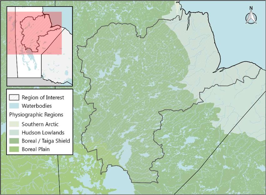
T ABLE OF CONTENTS
INTRODUCTION..............................................................................................................................5
PART 1: DEVELOPMENT.................................................................................................................6
   NORTHERN MANITOBA ............................................................................................................................... 7
      Geography ............................................................................................................................................................................. 7
      People and History ............................................................................................................................................................... 8
      The Need for Hydroelectricity ............................................................................................................................................. 9
      Northern Development ...................................................................................................................................................... 10
      Amalgamation of Hydro Companies ................................................................................................................................ 12
      Mining and Hydroelectricity .............................................................................................................................................. 13

   PLANNING FOR NELSON RIVER DEVELOPMENT .......................................................................................... 14
      Nelson River Programming Board .................................................................................................................................... 15
      The High-Level Diversion ................................................................................................................................................... 18
      Opposition to the Licence.................................................................................................................................................. 22
      A Change of Government .................................................................................................................................................. 23
      The Province Denies the Licence....................................................................................................................................... 24
      New Management, New Diversion ................................................................................................................................... 25
      Long Spruce and Limestone Generating Stations, 1972–1978 ...................................................................................... 26
      Lake Winnipeg Regulation or Churchill River Diversion? ............................................................................................... 26

   LAKE WINNIPEG REGULATION ................................................................................................................... 27
   CHURCHILL RIVER DIVERSION .................................................................................................................... 28
      1972–1973: The Licence is Granted and Construction Begins ....................................................................................... 29
      Opposition to the Project .................................................................................................................................................. 31

   THE NORTHERN FLOOD COMMITTEE ......................................................................................................... 32
   THE TRITSCHLER COMMISSION OF INQUIRY, 1977–1979 .......................................................................... 35
PART 2: IMPACTS, PROGRAMS AND COMPENSATION ........................................................... 37
   IMPACTS AND AGREEMENTS: THE NORTHERN FLOOD AGREEMENT ............................................................ 38
      Implementation of the Northern Flood Agreement ....................................................................................................... 41
      Supplemental Agreements with NFA Communities ....................................................................................................... 43

   IMPACTS AND AGREEMENTS: NON-NFA COMMUNITIES ............................................................................ 45
   MANITOBA HYDRO PROGRAMS TO ADDRESS ENVIRONMENTAL, ECONOMIC AND SOCIAL IMPACTS ............ 52
CONCLUSION ................................................................................................................................ 55
ENDNOTES .................................................................................................................................... 56
BIBLIOGRAPHY ............................................................................................................................. 74

                                                                   Hydroelectric Development in Northern Manitoba                                                                  Page | 3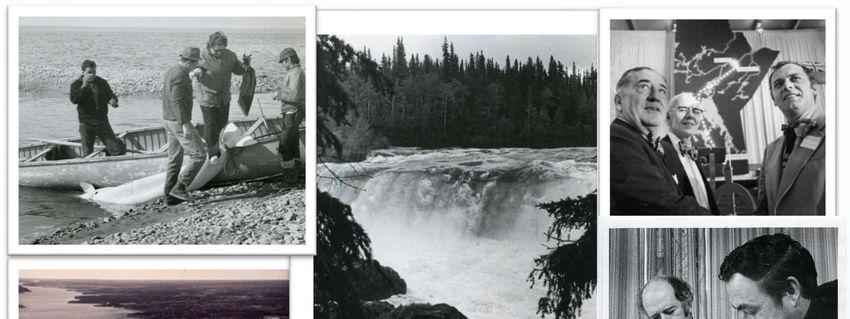
Hydroelectric Development in Northern Manitoba Page | 4
INTRODUCTION
When hydroelectric power was introduced to North Americans in the late 19th century, it marked the
beginning of a rapid increase in the demand for electricity by industries and the public. By 1910,
hydroelectric sites across Canada were harnessing the power of rushing water to spin turbines and rotate
generators to create electricity. Between 1920 and 1950, more than 90% of the country’s total generating
capacity came from hydroelectric stations. 1 In Manitoba, hydroelectric development took off in the late
1950s. The province’s distinctive system of lakes and rivers 2 had long played an integral role in its growth;
these routes were used by Indigenous peoples, European explorers, fur traders and settlers alike for travel
and sustenance. Water took on a new significance, however, when the provincial government began to
explore the hydroelectric potential of the Churchill, Burntwood and Nelson River systems.

The Churchill River flows through Manitoba, dropping in elevation just below Southern Indian Lake by more
than 240 metres, and then flows out to Hudson Bay. 3 In the early 1960s, the province realized that by
diverting the mighty Churchill, via the Rat and Burntwood Rivers, into the Nelson River, and using the
increased flow for generating stations along the Lower Nelson, the hydroelectric power generated would
fulfill much of Southern Manitoba’s electricity needs. In 1966, Manitoba and the federal government entered
an agreement to construct a series of massive projects that included the Churchill River Diversion, Lake
Winnipeg Regulation and generating stations along the Lower Nelson River.

What neither the provincial nor federal governments understood at the time was the impact that these
projects would have on the surrounding environment and the people who called northern Manitoba home.
Communities across the north felt the effects of hydroelectric development—everything from erosion along
once-pristine shorelines and damage to traplines and fisheries, to the flooding of vast tracts of land that
forced part of a community to be relocated and forever changed their way of life.

This report examines the recorded historic policy decisions behind the licensing and implementation of
hydroelectric works on the Churchill, Burntwood and Nelson River systems, and the actions and programs
that ensued to address the impacts on the surrounding communities and landscapes. Part 1 explores the
history of hydroelectric development in Manitoba, planning for hydroelectric generation, the politics and
debates surrounding the projects and the objections of Manitoba’s citizens. Part 2 discusses the
environmental, economic and social impacts of hydroelectric development on communities in the region,
as well as the compensation, mitigation and programs that were adopted to ameliorate some of the
damage.

                                       Hydroelectric Development in Northern Manitoba                  Page | 5
PART 1: DEVELOPMENT

   Hydroelectric Development in Northern Manitoba   Page | 6
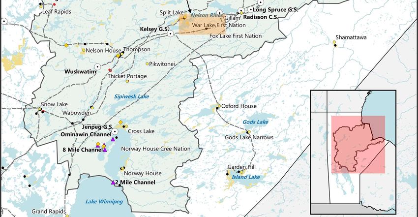
NORTHERN MANITOBA
GEOGRAPHY
Northern Manitoba comprises approximately two-thirds of the province’s total area. It is made up of two
major physiographic regions, the Precambrian Upland and the Hudson Bay Lowlands (Map 1). The former
is composed of granite and other crystalline rock that was scoured by glaciers during the Ice Age, leaving
thin soil inhospitable to agriculture, but mineral deposits perfect for mining and lakes and rivers ideal for
fishing and conducive to
hydroelectric development. The
Hudson Bay Lowlands sit on flat
sedimentary rock, experience cold
temperatures in winter and are
sparsely inhabited.4
Northern Manitoba is primarily
boreal forest (white and black
spruce, jack pine, larch, aspen and
birch trees) almost to the shores of
Hudson Bay, where stunted spruce,
willow and tundra mosses and
lichens grow. The area’s spruce, fir
and pine have been harvested and
processed for many years for lumber
and pulp and paper products. 5 Map 1: Hudson Bay Lowlands and Canadian Shield in Northern Manitoba.
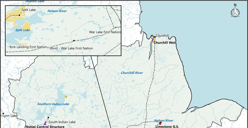
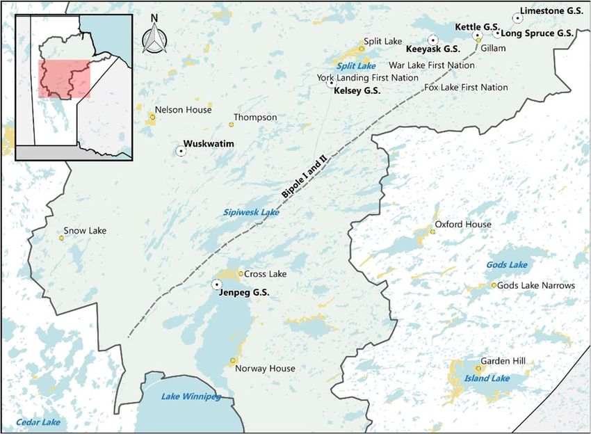
Running across Manitoba is the Churchill River, which begins in Alberta and meanders for 1,600 kilometres
before emptying into Hudson Bay at the town of Churchill. The 283,350-square-kilometre Churchill River
drainage basin lies to the north of the Nelson and Saskatchewan River basins, and connects with the
Athabasca River drainage basin on the north and west. The river’s water flows east across Saskatchewan; in
its lower reaches through Manitoba, it runs northeast, roughly parallel to the Nelson River (Map 2). 6 The
Nelson River flows a distance of almost 650 kilometres from the northern end of Lake Winnipeg to its outlet
on Hudson Bay near York Factory.7 From the Churchill River, Southern Indian Lake empties into the Rat
River, which flows east and south through Wapisu and Threepoint Lakes to the Burntwood River, which in
turn flows generally east and northeast through a series of lakes to Split Lake, where it joins the Nelson
River.8 The Burntwood River passes over the Thompson Nickel Belt, one of the richest nickel deposits in the
world.9 This entire waterway served as an important artery for inland transportation during the fur trade.
Hydroelectric Development in Northern Manitoba Page | 7
Map 2: River and waterflow of the Churchill, Nelson and Burntwood Rivers.

PEOPLE AND HISTORY
The study area has been inhabited by Indigenous peoples since the beginning of time. Cree people lived
on a vast territory stretching from the plains in the southern part of the province to the Hudson Bay
Lowlands, generally timing their movements to follow the seasonal cycle of the area’s natural resources,
while Chipewyan Dene people inhabited the far north. 10 In the late 1600s, European fur traders arrived, and
the posts they built on the shores of Hudson Bay and at lakes along the Nelson and Burntwood Rivers
became busy hubs in a business that dominated western development for nearly 200 years. 11

Beginning in the early 19th century, the First Nations way of life was challenged by illnesses brought over
by Europeans, a decline in traditional food resources and a growing dependence on fur trade posts for
employment and sustenance. Indigenous people once accustomed to travelling between seasonal camps
for traditional resources were forced to settle permanently near forts, earning wages as wood cutters,
longshoremen or paddlemen.12

In 1870, the Dominion of Canada created the small province of Manitoba, which was not much larger than
the Red River Valley, leaving the remainder of present-day Manitoba as the Northwest Territories, which
was administered by the government of Canada. 13

Within five years, the Indigenous people living just north of and adjacent to Lake Winnipeg and along the
Lower Saskatchewan River, including the people of Norway House and Cross Lake, surrendered their title

                                                 Hydroelectric Development in Northern Manitoba      Page | 8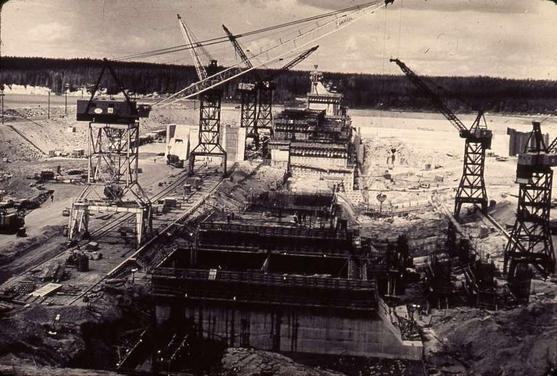
to the land in a series of numbered treaties, for which they were offered reserve land to be administered
under Canada’s Indian Act.14 This opened the area to railway development, which in turn extended the
boundaries of Manitoba’s farming, commercial fishing and lumber opportunities. 15 Between 1876 and 1881,
thousands of people settled just north of the small province and so, in 1881, its boundaries were extended
yet again to give Manitoba legislative authority over the settlers. 16 Between 1908 and 1910, Indigenous
communities north of Lake Winnipeg, including Nelson House, Split Lake, Churchill and York Factory, along
with the Métis residents of these communities, signed adhesions to Treaty 5 that gave the government even
more access to northern lands and resources. 17 Rail lines were built to give central- and southern-Manitoba
farmers the opportunity to sell their livestock, produce and animal feed to railway construction camps, and
northern fishing and lumber towns.18 Gypsum, limestone, gravel and sand quarries also provided settlers
who lived on land unsuitable for farming with wage labour. 19

THE NEED FOR HYDROELECTRICITY
Manitoba’s population quadrupled between 1891 and 1921, from 150,000 to 610,000 people. 20 This
enormous growth, combined with an increase in industry in Winnipeg, the province’s largest city,
accelerated the need for electrical energy in Manitoba. Until the turn of the century, the province primarily
imported coal from the United States, which was used to heat water to create steam, or thermal power, for
industries and trains. Hydroelectric generation, however, promised a cheaper way to produce energy, using
fast-flowing water to turn turbines that would make electrical generators spin fast enough to produce
power. Hydroelectric-generating stations were more expensive to build than thermal stations, though, so
early projects were built where demand was highest and fast-moving, large volumes of water were easily
accessible.21 Manitoba’s first hydroelectric-generating station was built on the Minnedosa River just outside
of Brandon in 1900.22

In the 1890s, new technology allowed for greater loads of electricity to be transmitted over longer
distances.23 This ultimately made the process of getting electricity to people more complex, as the
infrastructure required to supply communities with power for things like street lamps and streetcars was
expensive and needed to be carefully planned. Local governments granted private companies licences to
build the necessary infrastructure to generate and transmit electrical power. These companies charged
prices for construction that were lower than their usual fees in exchange for the right to have exclusive
contracts to supply electricity for an entire community’s lighting and transportation needs. 24 This situation,
however, soon led to the creation of corporate monopolies that charged their customers high rates for
power. In Winnipeg, for example, the Winnipeg Electric Street Railway Company (WESR) won a 35-year
franchise in 1892 to build and operate the city’s electrically powered streetcars. The company also bought
the Manitoba Electric & Gas Light Company in 1898, which gave it control over the construction, operation
and distribution of electric light, power, gas and transit services in Winnipeg. 25 In 1904, WESR amalgamated
with the Winnipeg General Power Company to complete the construction of a hydroelectric station about
100 kilometres northeast of Winnipeg, on the Winnipeg River. The new company, called the Winnipeg
Electric Railway Company (WERC), completed construction on the Pinawa Hydroelectric Generating Station
in 1906. Pinawa was the first station of its kind to be built on the Winnipeg River, and the first to operate
year-round; it remained in operation until 1951. 26

                                        Hydroelectric Development in Northern Manitoba                  Page | 9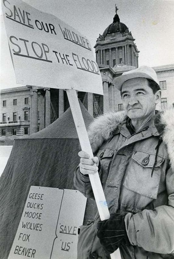
In 1906, Winnipeg created the City of Winnipeg Hydro Electric System, or City Hydro, which gave the City
greater control over the expansion and distribution of residential electricity. Blocking WERC’s monopoly on
hydroelectricity, City Hydro paved the way for lower power rates for private citizens, as WERC was forced to
cut its rates by 10 cents per kilowatt hour.27 City Hydro built the Pointe du Bois Generating Station on the
Winnipeg River in 1911, and then reduced electricity rates once again to less than 3 cents per kilowatt
hour.28
Crew at Pinawa Generating Station, 1907. (Source: https://www.ieee.ca/history/milestones/photos/pinawa/1907Crew.jpg)
NORTHERN DEVELOPMENT
In 1912, the territories north of Manitoba, which were part of the Northwest Territories at the time, were
transferred from the federal government to the province, giving it jurisdiction over much of the Churchill
and Nelson River water basins.29 Studies undertaken in the region between 1913 and 1916 showed the
potential for mineral and resource development, and confirmed that the Churchill and Nelson Rivers held
the promise of significant hydroelectric power generation. Neither the demand nor the technology were
available at that time, however, to warrant large-scale hydroelectric development of these northern rivers.
Until they could be developed, City Hydro and Winnipeg Electric Company (formerly WERC) continued to
utilize the power of the Winnipeg River, constructing five more hydroelectric stations between 1920 and
1955.30
The extension of Manitoba’s boundaries northwards captured the imagination of many politicians,
businesses and prospectors, who envisioned a “boundless northern resource frontier to complement the
agricultural economy of the south.” 31 Construction of the Hudson Bay Railway (HBR) started at The Pas, with
the intent to run all the way to Port Nelson, where a related harbour project to facilitate the export of grain
kept both Indigenous and non-Indigenous people employed between 1913 and 1915. The railway pushed
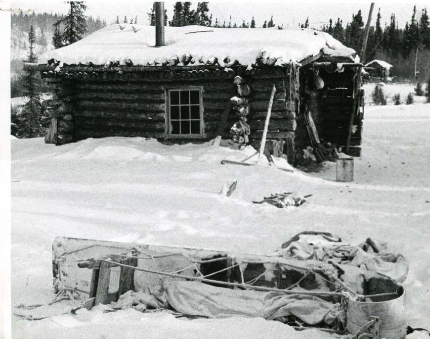
Hydroelectric Development in Northern Manitoba Page | 10commercial trappers further north.32 In 1919, the Hudson’s Bay Company (HBC) re-established a post at
South Indian Lake to take advantage of the increased number of trappers moving into the area. 33 The
following year, the HBC aggressively targeted independent traders by offering high prices for furs,
essentially pushing any independent trappers (many of whom were of Indigenous descent) out of business.
Although many of the trappers turned to fishing, northern lakes were not large enough to support the
demand, and fish prices dropped dramatically during the decade. 34 Rail lines also brought gold, diamond
and copper prospectors into the region, to places like Herb Lake and Snow Lake. 35
In 1926, construction of the HBR was taken over by Canadian National Rail, with one important change: The
line from The Pas would now go to
Churchill, as Port Nelson was deemed
to be unsuitable. The line was
completed in 1929, 36
further extending
access into northern Manitoba. The
HBC established a permanent post at
Southern Indian Lake to accommodate
new business generated by the line,37
and thriving “Bayline” communities
sprang up along the route, including
Gillam, Ilford, and Churchill.38 Other
communities that were off the HBR line
did not fare as well. York Factory, once
Hudson Bay Railway surveyors at the Kettle Rapids crossing of the Nelson River, just
a busy HBC post, was replaced by downstream of the present site of the Kettle Dam, 1913. (Source: University of
Churchill as a main port and storage Winnipeg Archives, WCPI 12583, Major L.J. Charles Collection)
headquarters. In 1957, the York Factory
post was closed and the Indigenous people who lived there were relocated by the federal government to
York Landing.39
In 1930, Manitoba “finally won beneficial control of its remaining natural resources” from the Dominion,
and the Manitoba Department of Mines and Natural Resources (MNR) was established. The province’s
victory was short-lived, however: The Great Depression in the 1930s had a profound impact on Manitoba’s
economy as the demand for fish, fur, timber and farm goods dropped.40 As well, after decades of little to
no regulation or protection, northern resources were dangerously depleted. 41 A growing population of
hunters and fishers, along with large lumber companies and mining concerns, had wreaked havoc on the
province’s once-promising timber, fish and fur industries. When Hudson Bay Mining and Smelting, for
example, began operations in Flin Flon in 1928, the company’s director told the Department of the Interior
that he was not concerned that the tailings they were dumping into Flin Flon Lake would pollute the
connected waterways, because the fish in these lakes, “although a valuable asset, [are] of small value as
compared with the mine.”42 In 1940, the MNR decided to intervene, developing a Registered Trapline (RTL)
system that “placed defined geographic boundaries on the hunting, trapping and fishing areas of individual
harvesters.”43
Hydroelectric Development in Northern Manitoba Page | 11In a further effort to regulate unrestrained northern growth, the provincial legislature passed The Local
Government Districts Act (LGD Act) in
1944.44 The LGD Act was primarily
concerned with community organization
and planning in northern Manitoba. It
granted wide powers to the province’s
Lieutenant-Governor to incorporate
unorganized communities into LGDs,
which would have similar rights to
incorporated municipalities but with
more restraints on their financial powers.
The Lieutenant-Governor could also
authorize surveys “with a view to
determining the best methods of
economically developing any part of the
“Progress and uncertainty go hand in hand in this photograph of Churchill's Hudson
Square illuminated for the first time in the town's history by electric street lights,” territory and the best utilization of lands
August 5, 1960. (Source: University of Manitoba Archives & Special Collections, or other natural resources of the
Winnipeg Tribune fonds (PC 18/1607/18-1607-004))
territory.” 45
AMALGAMATION OF HYDRO COMPANIES
In 1945, the Manitoba Power Commission (MPC, created in 1919 to provide services to communities and
businesses outside of Winnipeg) launched an initiative to bring labour-saving electrical technology to farms
in southern rural Manitoba. The MPC installed transmission poles and lines, and individual farmers took on
the job of wiring homes and barns. By the time the program ended nine years later, nearly 75% of the
province’s farms had joined the electrical grid. 46
This expansion of electrical power into rural Manitoba, along with a proliferation of household electrical
appliances and a steady increase in agricultural and manufacturing production, forestry and construction,
contributed to an exponential rise in the post-war demand for power in the province. 47 To determine how
to meet current and predicted needs, Manitoba established the Manitoba Water Power Commission
(MWPC) in the late 1940s. The MWPC released a report in 1948 that recommended the province assert
greater control over electrical energy development by consolidating generation, transmission and delivery
of services under a single, provincially owned monopoly. The report also argued that the more uniform
electrical services were across the province, and the more reasonable the power rates, the more the province
could attract new industry and foreign investment. 48 Further, a provincially owned monopoly would be able
to use public funds in the coming years to construct the larger and more complex projects that would be
needed to meet future power demands. 49
Fearing that a monopoly would lead to higher rates, Premier Douglas Campbell opted to leave the City of
Winnipeg in charge of its own operations while the province took over power generation, transmission and
distribution throughout the rest of Manitoba. The result was the creation of The Manitoba Hydro-Electric
Board (the Board) in 1949, under the direction of the MNR. 50 In 1952, the Board purchased the generation
and distribution assets of the privately owned Winnipeg Electric Company (WEC, formerly WERC), and in
1953, the two corporations amalgamated, with WEC now under the control of the Board. 51 In 1955, City
Hydro sold its suburban distribution properties to MPC, making MPC the sole distributor of power to
Hydroelectric Development in Northern Manitoba Page | 12suburban Winnipeg and the rest of the province and allowing City Hydro to be the sole electricity distributor
in Winnipeg.52 In 1961, The Manitoba Hydro Act amalgamated the Board and MPC to form Manitoba Hydro.
City Hydro still supplied power to Winnipeg, while Manitoba Hydro supplied it to the rest of the province. 53
MINING AND HYDROELECTRICITY
The Manitoba Water Power
Commission’s 1948 report also noted
that the province should expect
mining power loads to “increase
substantially if new ore-bodies are
discovered and developed within
reasonable transmission distance” of
waterways that could provide
hydroelectricity.54 Indeed, Sherritt
Gordon Mines Limited and Inco
Limited (Inco) had begun exploring
nickel bodies in the Lynn Lake and
Moak Lake areas as early as 1941. 55
Mineral prices were high in the post-
war period because the United States
was stockpiling the metal for strategic
“Cat train moves supplies for the new town” (Thompson), 1957. (Source: Provincial
defence projects.56 Over the next
Archives of Manitoba, 1987/363-T-41 Thompson, Manitoba)
seven years, Inco would identify 20
potential sites for development in the area and, in December 1956, the company signed an agreement with
the MNR to mine an ore body at Cook Lake. 57 Inco’s decision to set up mining operations in northern
Manitoba was motivated in part by the province’s willingness to subsidize construction of a hydroelectric
generating station on the Nelson River. 58 The ready availability of cheap power, combined with the remote
location of the mineral deposits, encouraged the company to build a fully integrated facility designed to
accommodate all stages of nickel production, including mining, refining and smelting.
The agreement between Inco and the province also included the establishment of a town site for 8,000
people and all the related infrastructure the new community of Thompson would require (including roads,
sewers and water, electric power, parks, schools and a hospital). 59 The province drew upon the LGD Act to
create the Mystery Lake Government District, an approximately 1,500-square-kilometre-tract of land that
would encompass both the community of Thompson and Inco’s industrial plant. The Mystery Lake
Government District ensured against unwanted or unsolicited development around Inco, and enabled the
local administration to impose tax levies on Inco’s operations. 60
Thompson was planned by the province’s Planning Service and the engineering firm of Underwood
McLellan and Associates.61 Construction began in the spring of 1958, and by that autumn, people were
already living at the town site.62 The Manitoba Hydro-Electric Board built the Kelsey Generating Station
approximately 85 kilometres northeast of Thompson, on the Upper Nelson River close to where it enters
Split Lake.63 The station went into service in 1960.
Hydroelectric Development in Northern Manitoba Page | 13PLANNING FOR NELSON RIVER DEVELOPMENT
Although the Kelsey Generating Station was only a local station, it was an important first step in the
development of the Nelson River system. Geological surveys of the Nelson River in 1913, 1914 and 1916
had already identified it as a practical source
of power generation, but it had not yet been
developed due to lack of demand for power,
and lack of technology to enable power to be
transmitted over long distances. By the 1960s,
however, Manitoba’s economy was strong in
manufacturing, construction and resource
industries. The province’s population had
increased by 26% since 1941.64 The demand
predicted in the Water Power Commission’s
1948 report was slowly being realized, and
now the technology was available to transmit
electricity over long distances. As well, the
Nelson River’s potential was significant
enough to provide “a very large amount of
“Manitoba Hydro, Kelsey, 1961.” (Source: University of Manitoba Archives
power” for sale to other provinces or the & Special Collections, Winnipeg Tribune fonds, PC 18 (A81-12))
United States.65 From a government
perspective, the Nelson River was an ideal location for hydroelectric development (see “A National Energy
Policy” on page 16).66
In its natural state, the Nelson River’s water volume tends to be highest during the spring and early summer
due to melting snow and spring rain, and lowest during the winter, when its tributaries freeze. This
fluctuation runs contrary to consumer demand, which is higher during the cold, dark winter, and lower
during the long, hot summer. Electricity, however, cannot be stored after it has been generated—but water
can. Manitoba Hydro needed to create a reservoir in which to store excess water, and from which to release
that water when it was required. The province and Manitoba Hydro therefore began planning to increase
and stabilize the flow of water down the Nelson River. The corporation identified two storage options: It
could restrict and regulate the outflow of water from Lake Winnipeg, turning the lake into a massive
reservoir; or it could divert water from the Churchill River and regulate its flow down the Rat and Burntwood
Rivers into the Nelson River.
Hydroelectric Development in Northern Manitoba Page | 14Government researchers began exploring how the water levels of Lake Winnipeg could be controlled to
prevent property and crop damage that could result from high water levels and recreational inconvenience
that could result from low levels. The government also considered the suitability of Lakes Winnipeg and
Manitoba for hydroelectric development. 67 In 1958, a
study of the issues found that regulation of Lake
A National Energy Policy Winnipeg would only be cost-effective if it was
undertaken as part of a broader plan to generate power
Prime Minister John Diefenbaker began
from the Nelson River.68
talking about a national power grid in the
late 1950s, believing it would strengthen
NELSON RIVER PROGRAMMING BOARD
Canadian industry if energy-rich provinces
shared their power, and that this would also
Between 1955 and the beginning of 1963, the Water
reduce the tax burden on individual Control and Conservation Branch of the provincial
provinces. In March 1962, Diefenbaker Department of Agriculture and Conservation conducted
introduced his national power grid plans to numerous power investigations on the Nelson River and
the provincial premiers, who were divided Lake Winnipeg, including topographic and hydraulic
in their support. Some raised concerns surveys and water-diversion options from the Churchill
about federal intervention into provincial River into the Burntwood and Rat River systems. 69 It was
resource management, while others were in not until January 1963, however, that Manitoba Hydro
favour of increasing the supply of electrical itself commissioned the engineering firm G.E. Crippen &
energy and reducing the cost of generation, Associates to explore the lower Nelson’s hydroelectric
but still worried about jurisdictions. potential, from Split Lake to Hudson Bay.70 One month
Manitoba Premier Duff Roblin, however, later, the federal and provincial governments entered
was an advocate of Diefenbaker’s plan; in into an agreement to share the costs of this investigation.
fact, The Manitoba Hydro-Electric Board
The agreement created the Nelson River Programming
had completed interprovincial transmission
Board, which comprised both federal and provincial
lines from the Seven Sisters Generating
members.71
Station in southeastern Manitoba to Kenora
in northwestern Ontario in 1956, and from Crippen released its report in March 1964. It stated that
Brandon in southwestern Manitoba to the Nelson River, if regulated by Lake Winnipeg, could
Estevan in southeastern Saskatchewan in handle at least six generating stations. It recommended
1960. These lines allowed the three that the first station be built at Kettle Rapids, followed by
provinces to exchange surplus energy and stations at Limestone and Long Spruce. It also noted that
better meet the demands of their respective if the water from the Churchill River could be diverted at
customers. In 1963, Diefenbaker’s
Southern Indian Lake into the Nelson River system, water
Conservatives lost the federal election to
supply to the six proposed stations could be increased
the Liberal Party, which advocated for a
by 30%.72 Further, if the Kettle Generating Station, the
more continental approach to the sale of
Lake Winnipeg Regulation (LWR), and Churchill River
power; nonetheless, developing the power
Diversion (CRD) were built at the same time, the project
of the Nelson River would make any type of
could be finished in just under four years. 73 The report
export or exchange even simpler.
was tabled in Parliament and in the Manitoba Legislature.
Sources: Karl Froschauer, White Gold: Hydroelectric On May 27, 1964, the federal–provincial cost-sharing
Power in Canada (Vancouver: UBC Press, 1999), 31- agreement was renewed and the Nelson River
39; Manitoba Hydro, A History of Electric Power in
Manitoba (Winnipeg: Manitoba Hydro, 2010), 26 Programming Board was given $3 million and more time
and 29. to study the hydroelectric potential of the river system. 74
Hydroelectric Development in Northern Manitoba Page | 15In August, the engineering firm of Gibb, Underwood & McLellan was commissioned to determine the
feasibility of diverting water from the Churchill River to the Burntwood River, and the estimated cost. Its
report, released more than a year later in October 1965, confirmed that the CRD would not only increase
the output from power stations located along the lower Nelson River, but would also reduce the cost of
power per kilowatt hour.75
In December 1965, the Nelson River Programming Board released a follow-up to the Crippen and the Gibb,
Underwood & McLellan reports, stating that a “decision by Manitoba on its next source of new generating
capacity is an urgent requirement.”76 The Board’s interim report noted that if Manitoba wanted to make
power from the Nelson River available by 1970, construction must start in early 1966. 77 It outlined a proposal
for hydroelectric development, which included construction of:
a generating station at Kettle Rapids on the lower Nelson River;
a dam at the outlet of Southern Indian Lake, and other works, to divert water
from the Churchill River to the Nelson via the Rat and Burntwood Rivers, and
create a storage reservoir on Southern Indian Lake;
a control dam, spillway and pumping station at the outlet of Lake Winnipeg to
“lift water” from the lake into the Nelson River; and
a high-voltage transmission system that would carry power to southern
Manitoba.78
The report also pointed out that the development would “make available a large source of low cost energy
in a region of mineral deposits and forest resources,” and allow for the export of power outside of
Manitoba’s borders.79
Following meetings in early February 1966 to discuss the Board’s proposal, 80 Manitoba and Canada
accepted the $305 million project, and signed an agreement on February 15 to cooperate in the
development of the Nelson River’s hydro-electric potential. 81 D.M. (Donald) Stephens, Chair of Manitoba
Hydro, presented the proposal to the Standing Committee on Public Utilities and Natural Resources of the
Manitoba Legislature on March 8, 1966.82
The 1966 agreement enabled Manitoba to acquire all lands not owned by the Crown that were, “in the
opinion of Canada and Manitoba, necessary for or necessarily incidental to the construction and operation”
of facilities.83 This coincided with the provincial government’s introduction of The Commissioner of Northern
Manitoba Affairs Act (NMAA), designed to oversee the planning, organization, and administration of
northern communities.84 The NMAA created the position of Commissioner of Northern Affairs, who was not
only responsible for building and maintaining basic municipal services for small, non-reserve communities
that were not governed by The Municipal Act, but also had the power to acquire property in the pursuance
of his duties.85
Hydroelectric Development in Northern Manitoba Page | 16The NMAA was put to use almost immediately: Before the end of the year, contracts for the construction of
Kettle Generating Station were signed and work had commenced. Six kilometres away from the Kettle site,
the community of Gillam was suddenly inundated by Manitoba Hydro operations and administrative staff
and construction workers. Up
until that point, Gillam had
remained relatively small, with a
population of about 300 people
comprising primarily Cree
families. 86
Construction on the
Kettle Generating Station quickly
transformed Gillam into a
modern town site, with Manitoba
Hydro as “the primary landlord
and economic contributor.” The
town’s demographics changed
with the increased number of
young families from the south
that moved north to work for
Manitoba Hydro.87 The
corporation paid for portable
“Manitoba Hydro Trip to Gillam,” August 1968. (Source: University of Manitoba Archives &
classrooms, school equipment Special Collections, Nan Shipley fonds (Mss 21, Pc 21 (A.79-14, A.05-82))
and housing, and contributed to
the cost of a permanent school structure and a hospital. 88 Manitoba Hydro also built a new airstrip, a road
to the site and work camps to provide housing for over 1,000 migrant workers during the busiest
construction periods.89
Kettle Generating Station began operating in December 1970. This resulted in a 30-metre rise in upstream
water levels from the station back to Gull Rapids, which tripled the size of Moose Nose Lake, turning it into
a reservoir that was renamed Stephens Lake. 90 Water was diverted from the Butnau River into the Kettle
River, which increased flows between Cache Lake and Butnau River. 91 Kettle Generating Station became fully
operational in November of 1974 and cost $240 million to build—almost double the amount originally
estimated.92
Hydroelectric Development in Northern Manitoba Page | 17A major component of the Nelson River
project was the transmitting of power
from the generating stations to
ratepayers. The Radisson Converter
Station was built two kilometres south of
Kettle Generating Station to convert
alternating current (AC) electricity
produced at Kettle into direct current
(DC) electricity, which was then carried via
transmission lines to southern Manitoba
(Map 3).93 Construction on these
transmission lines, known as Bipole I and
Bipole II, was managed by Atomic Energy
Canada, with financing from the federal
Map 3: Bipoles I and II from Radisson and Henday Converter Stations to Dorsey
government.94 Atomic Energy Canada
Converter Station.
constructed more than 4,000
transmission towers across over 900 kilometres of land from the Lower Nelson River to southern Manitoba.
Bipole I and Bipole II were completed in June 1972 and October 1978, respectively. 95
THE HIGH-LEVEL DIVERSION
As construction on Kettle Generating Station commenced, both Manitoba Hydro and the province
commissioned investigations into the CRD at Southern Indian Lake that was proposed by the Nelson River
Programming Board. The diversion was to include a 30-metre control structure at Missi Falls, at the north
end of the lake where it drains into the lower Churchill River. This dam would raise the lake by more than
10 metres, essentially turning Southern Indian Lake into a giant reservoir. Water would then be diverted to
the headwaters of the Rat River, where a 25-metre control dam at the Notigi Rapids would regulate and
redirect the flow from Southern Indian Lake down the Rat River, into the Burntwood River, and then into
the Nelson River at Split Lake. The storage reservoir at Southern Indian Lake could then be regulated in
accordance with consumer demand.96
The problem with this proposed “high-level” diversion, as it came to be known, was that the shores of the
lake would be flooded, causing significant damage to forestry, wildlife, fishing, mining and recreation. As
well, a community called South Indian Lake on the shores of Southern Indian Lake, which comprised about
500 primarily Indigenous people, would have to be relocated. 97
With these potential outcomes in mind, the MNR hired Professor H.E. Duckworth, vice-president of the
University of Manitoba, to study the Southern Indian Lake area and the proposed diversion route.
Duckworth’s group, comprising geologists, engineers, anthropologists, social workers and zoologists from
the university, released a draft report in January 1967. After considering the effects of flooding, they
recommended that Manitoba Hydro try to achieve the required diversion without raising the water levels
of Southern Indian Lake.98 The report described the community of South Indian Lake as an autonomous
community whose members made a living from fishing and trapping, which flooding would largely destroy.
Relocation, the report stated, “would be unjust to the present inhabitants and unworthy of the Province,
although it might be in keeping with much past treatment of the Indians.” 99
Hydroelectric Development in Northern Manitoba Page | 18Premier Duff Roblin forwarded the report to Stephens and asked for a meeting to discuss the diversion. He
noted that if South Indian Lake was as self-sufficient as Duckworth believed, any compensation for
relocating the community would have to be quite high. 100 Stephens, however, objected to the report, calling
it subjective, and chastised Duckworth for his group’s failure to rigorously evaluate quantifiable and non-
quantifiable data.101 Manitoba Hydro looked instead to numerous hydraulic and generation computer
simulations that were conducted throughout 1966 and 1967 to assess Southern Indian Lake storage
requirements. These simulations
demonstrated that a higher storage level on
Southern Indian Lake, created by increasing
the capacity of the channel to be
constructed between South Bay on Southern
Indian Lake and Issett Lake on the Rat River,
would be “much more economical than early
Lake Winnipeg Regulation.”102
By early 1967, news and rumours about
Manitoba Hydro’s high-level diversion plans
were causing considerable confusion and
anxiety among the people of South Indian
“Construction of the Kettle Generating Station on the Nelson River,” 1968-01- Lake.103 The community elected a five-
01. (Source: University of Winnipeg Archives: WCPI 43472)
person Relocation Committee, responsible
for keeping the rest of the residents informed of Manitoba Hydro’s plans. 104 Even at this stage, their
understanding was that compensation would likely never “meet the standard requirement that those
affected come out whole.”105 In a letter to Stephens in February 1967, Baldur Kristjanson, the Deputy
Minister of the Manitoba Development Authority, wrote that compensation should be “in excess of” that
paid to non-Indigenous people, and that the province and Manitoba Hydro should determine the exact
amount to be paid before expropriating the community’s property. He also noted that people of Indigenous
descent could be assimilated in the same way people of other ethnicities were assimilated when they
immigrated to Canada around the turn of the century: “through work on construction projects, work in the
service industries, etc.”106 Stephens replied that while some of the “more adventuresome” community
members might participate in training courses, “evidence” showed that Indigenous people lacked the
necessary “entrepreneurial instincts and skills.” Furthermore, he wrote, the term “come out whole” required
careful consideration: just because a community worked very hard to produce a “precarious income” from
a soon-to-be-compromised “skinny resource base” (e.g., fishing), did not mean they were entitled to the
same level of income (i.e., compensation) for not doing any work at all. 107 A few months later, Stephens
declared that Manitoba Hydro would be willing to allocate a minimum of one million dollars “toward the
costs of ‘unsettling’ the community” if the high-level diversion was authorized. 108 In October of 1967, to
alleviate some of the stress the people of South Indian Lake were feeling “because of those effects which
seem inevitable,” Manitoba Hydro gave South Indian Lake $100,000. Part of this money was left with the
Commissioner of Northern Affairs to be distributed as necessary by the Nelson Agency. 109
Hydroelectric Development in Northern Manitoba Page | 19Kristjanson’s views on helping the Indigenous people at South Indian Lake to assimilate into Canadian
society were echoed in a May 1967 report commissioned by the Manitoba Development Authority. The firm
of van Ginkel Associates was retained to conduct an “exhaustive examination of the settlement and the
problems at South Indian Lake,” and concluded that flooding the settlement would do “nothing more than
move forward in time the breakup of this community and way of life.” Community members should receive
training, the report stated, both for future employment and to help them adjust to new social patterns that
would result from relocation, thereby
giving them the chance to make a
“substantial contribution” to Manitoba’s
growth.110
In June 1967, Manitoba Hydro engaged
Underwood McLellan & Associates to
obtain engineering design information
that would enable the corporation to
make a final decision on the most
economic level of elevation for Southern
Indian Lake. When the report was
released in January 1968, Manitoba
Hydro felt confident that detailed
engineering could commence on the
project, and that a licence could officially
be applied for.111 The province was not
“Manitoba Power Missi Falls on Churchill River (dam for South Indian Lake),”
finished looking into LWR, however, and 1969-01-25. (Source: University of Manitoba Archives & Special Collections,
asked the Manitoba Water Commission Winnipeg Tribune fonds, PC 18 (A81-12))
in March 1968 to look into “the most acceptable and practicable range of regulation within which the levels
of Lake Winnipeg might be controlled.” 112 The Commission’s report was released one month later, and
warned that a high-level diversion at Southern Indian Lake would cause both environmental and social
damage. However, it also reiterated that the high-level diversion “would increase the dependable flow on
the lower Nelson River to such an extent that additional Lake Winnipeg storage would hardly be needed
any more,” as it would certainly yield “practically all of the potential storage benefits” needed by the
province.113 By now, Manitoba Hydro did not need much more convincing. Even before the Water
Commission’s report was released, Manitoba Hydro’s General Manager W.D. Fallis stated unequivocally that
the corporation would not “in any event require Lake Winnipeg regulation for power purposes prior to
1978.”114 Manitoba Hydro decided to defer further studies on the best method of regulating Lake
Winnipeg.115
Hydroelectric Development in Northern Manitoba Page | 20Neither Fallis’s nor Manitoba Hydro’s determination to proceed were communicated very effectively to the
people of South Indian Lake, however, much to the consternation of George S. Bowman. Bowman was in
charge of the Nelson Agency, an arm of the Manitoba Development Authority that was established in 1966.
The van Ginkel report was given in confidence to the counsels of the affected communities, but neither it
nor the Underwood McLellan report were made public; later, the Minister of Mines and Natural Resources
insisted this was because the reports were “hastily done” and therefore “necessarily not in depth.” 116
Bowman was the consulting engineer to the Authority and the Premier on matters of economic
development relating to hydroelectric projects on the Nelson River, and coordinator for the government
with regard to anticipated relocation problems. 117 Bowman wrote to Stephens on February 22, 1968, to say
that “as a matter of common courtesy the
people of South Indian Lake should be told
of Hydro’s plans for the area at least as soon
as any announcement was made to the rest
of the province.”118 At the beginning of
April, Bowman visited South Indian Lake
with Stewart McLean, the province’s
Minister of Public Utilities, and heard that
community members were anxious for
more information about Manitoba Hydro’s
progress toward obtaining a licence for the
diversion.119 Bowman scheduled meetings
Northern Manitoba – 1954. (Source: University of Manitoba Archives & Special in South Indian Lake for April 22. Manitoba
Collections, Winnipeg Tribune fonds – Fishing 1942-1957 (PC 18/3039/18-2330-
053)) Hydro’s Assistant General Manager, Kris
Kristjanson,120 heard community members
say that if the lake was raised by 35 feet (10 metres), it would decimate commercial fishing in the area: “all
the whitefish is caught in between 10 and 30 feet of water whereas if we put another 30 feet of water on
that it spoils all the fishing, spoils the spawning grounds.” Others noted that nothing would hurt the people
of South Indian Lake more than moving them from where they were born and raised. 121 Kristjanson’s main
point, in reply, was that the community would be “making a sacrifice for the rest of the people of Manitoba.”
He told them that Manitoba Hydro expected to apply for the licence within the week. 122
True to his word, Manitoba Hydro delivered its application to the Water Control Branch (WCB) on April 25,
1968.123 On April 28, Tom Weber, the WCB’s Director, attended a second meeting in South Indian Lake. He
told the 45 community members present that it was now the Branch’s job to decide, after more research
and public hearings, whether the project would benefit “the total development of the province of
Manitoba.”124
Hydroelectric Development in Northern Manitoba Page | 21OPPOSITION TO THE LICENCE
With the threat of the high-level diversion looming larger, in the summer of 1968 the people of South Indian
Lake retained legal counsel, paid for by the Nelson Agency, to represent their interests. The Relocation
Committee travelled with the lawyers to Winnipeg in October to present their views to members of Cabinet.
They made it clear that if the WCB could not prove there was a suitable technical and economical alternative
to Manitoba Hydro’s plans that would not force the relocation of South Indian Lake, then the community
wanted to discuss compensation as soon as possible.125 Residents expressed their concerns through their
lawyers at a public hearing in South Indian Lake on January 7, 1969, at which MNR and Manitoba Hydro
were represented.126 South Indian Lake’s counsel, Harold Buchwald, questioned Manitoba Hydro intensely,
noting that the community believed “that fishing will be effectively destroyed as a commercial basis of
earning a livelihood at least for a generation and maybe for ever [sic] directly as a result of the flooding.” 127
At the meeting, a Manitoba Hydro engineer confessed that the corporation had not officially studied the
impact of flooding on wildlife, trapping or commercial fishing in the area. He went on to say that one reason
Manitoba Hydro was pursuing the high-level diversion was because the alternative would “increase the
flooding which occurs at the South end of Lake Winnipeg
[and] the people of Manitoba would want us to keep the
lake level from flooding.”128 Despite the concerns
expressed at the public hearing, the Minister of Natural
Resources formally announced on January 20, 1969, that
the government was going to issue Manitoba Hydro an
interim licence to proceed with the high-level
diversion. 129
At this point, newspapers began to pick up the story of
South Indian Lake.130 When two more public hearings
were subsequently held in Winnipeg on January 27 and
29, so many people turned up to them that the room Excerpt from The Thompson Citizen, Thursday, January 9,
reserved by the Department was too small to allow 1969.
everyone to participate.131 Briefs were presented by
academics, churches, the Manitoba Wildlife Federation, the Manitoba Indian Brotherhood, the Natural
History Society and many others on the effect that flooding would have on everything from the natural
landscape, to the people who lived in the area, to the lake’s commercial fishing industry. Representatives
from Churchill, who worried how a decrease in the flow of the Churchill River might affect their community,
complained that they were not even advised about the hearing. 132 People from Thompson expressed
concern about what an increase in water to the Burntwood River would do to their drinking water. 133 Others
noted that a report released by the MNR in November had not yet been made public, making it difficult for
citizens to inform themselves on the issues at hand. 134 Gordon Beard of Thompson stated: “Manitoba Hydro
have taken years to arrive at their decision. They have spent money on studies which allows them to bargain
from strength. Surely they do not really expect the people to come to a decision with anything less?” 135
Even after the public hearings in Winnipeg, people continued to write to their members of the Legislative
Assembly to express their concern and learn more about the flooding of Southern Indian Lake and the CRD
project. Manitoba Hydro’s chairman, W.D. Fallis, drafted a letter that members of government could use to
reply to their constituents. In it, he pointed out that public concern and controversy had accompanied each
Hydroelectric Development in Northern Manitoba Page | 22You can also read