Gateway View SHD, Ballinure, Blackrock, Cork
←
→
Page content transcription
If your browser does not render page correctly, please read the page content below

Architectural Heritage Impact Assessment
Gateway View SHD, Ballinure, Blackrock, Cork

 Prepared by
 John Cronin BA MRUP MUBC
 John Cronin & Associates
 3a Westpoint Trade Centre
 Ballincollig
 Co. Cork

 For
 MWB Two Ltd
 c/o HW Planning
 5 Joyce House
 Barrack Square
 Ballincollig
 Co. Cork

 November 2020
Contents

1. Introduction .................................................................................................................................................................... 1

2. Context ............................................................................................................................................................................. 2

3. Description of subject site .......................................................................................................................................... 6

4. Assessment of impacts ................................................................................................................................................ 8

5. Conclusions ..................................................................................................................................................................... 9

6. References ..................................................................................................................................................................... 10

Appendix: Photographic Record..................................................................................................................................... 11
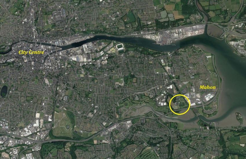
1. Introduction
John Cronin & Associates have been commissioned by MWB Two Ltd., to carry out an architectural a creche is proposed. Zoning differences across the site have necessitated a dual approach be adopted to
heritage impact assessment of a proposed development in lands at Ballinure, Mahon, Cork City. The applying for planning permission.
subject site is located approximately 5km to the southeast of Cork City Centre. The site is bound by
Bessboro House and grounds to the west, Bessboro Day Care and Sacred Heart Convent to the north, This report deals with the SHD application to An Bord Pleanála for permission for the construction of a
Passage West Greenway and Mahon Retail Park to the east, and the N40 road corridor and Douglas River strategic housing development of 179 no. residential units, a creche and step-down facilities over 3 no.
Estuary to the south. apartment blocks ranging in height from 5 to 7 storeys and all ancillary site works at Ballinure, Blackrock,
 Cork. The proposed development includes the construction of 88 no. 1-bedroom apartments, 85 no. 2
 bedroom apartments and 6 no. 3-bedroom apartments. The development will include a creche at ground
 floor level in Block B and building management facilities including plant and storage areas across all 3
 no. apartment blocks. Ancillary site works to include provision of a substation and switch room and an
 upgrade of the existing sewer line.

 The proposed development will provide for new pedestrian entrances onto the Passage West Greenway
 and vehicular access will be via an existing access road off the Bessboro Road. The proposed development
 also includes communal open space areas, landscaping, 67 no. under-podium and on-street car parking
 spaces, 370 no. bicycle parking spaces, bin stores, public lighting and all ancillary site development
 works.

 This report was prepared by John Cronin BA MRUP MUBC, a conservation consultant with over twenty-
 years’ postgraduate experience in building and heritage conservation. Mr Cronin has prepared numerous
 appraisals and assessments of architectural heritage impacts associated with both public- and private-
 sector development projects. It should be noted that this report deals with the evolution of the subject
 land parcel and potential built heritage impacts. The document should be read in the “Landscape and
 Visual Impact Assessment” prepared by AECOM (November 2020) and “Architect’s Design Statement”
 prepared by Wilson Architecture (November 2020). Furthermore, Colm Chambers of John Cronin &
 Associates has compiled a separate archaeological impact assessment of the proposed development and
 John Cronin & Associates have also prepared a report that addresses the legacy issues associated with
 the Former Mother and Baby House at Bessboro.

 Figure 1: Site location encircled in yellow (© Google) (Note on place name: “Bessboro” is the most common version of the name of the historic estate. Other
 variants include “Bessborough”, “Besborough” and “Bisboro”. For consistency, Bessboro is used
 throughout this report.)
MWB Ltd is to seek for planning permission for two phases of development at this site. One application
under the Strategic Housing Development (SHD) legislation is to be made to An Bord Pleanála and the
second application is to be made to Cork City Council. Collectively, the lands form the Proposed Strategic
Housing Development of Gateway View, where the construction of a total of 246 no residential units and

 Gateway View SHD, Ballinure, Blackrock, County Cork
 Architectural Heritage Impact Assessment 1
2. Context

Environmental Context to identify; record and evaluate the architectural heritage of the country. The function of the National
 Inventory of Architectural Heritage (“NIAH”) is to record built heritage structures within the Republic
The subject site is set in a generally level landscape at Mahon, within the southern suburbs of Cork City.
 of Ireland and to advise local authorities in relation to structures of interest within their areas. There are
The site is situated within the townland of Ballinure to the north of the South Ring Road and to the west
 eleven NIAH structures within c.1km of the subject site.
of the former Cork, Blackrock and Passage Railway line. The lands formed part of the former demesne
associated with Bessboro House. The subject site (see the red-shading on Figure 2 below) is irregular in
 The Local Government (Planning and Development) Act, 2000, requires all Planning Authorities to keep
plan and is located to the north and east of a folly and graveyard. Bisected by a service road, the lands
 a “Record of Protected Structures” (“RPS”) of special architectural, historical, archaeological, artistic,
are heavily disturbed and there are a number of burnt out vehicles strewn across the site.
 cultural, scientific, social or technical interest. As of the 1st January 2000, all structures listed for protection
 in current Development Plans, have become ‘protected structures’. Since the introduction of this
 legislation, planning permission is required for any works to a protected structure that would affect its
 character. There is a total of three structures included on the lists of protected structures for Cork City
 and County Cork within c.1km of the site. These include Bessborough House (PS490), which is both
 a RMP and a protected structure and is located directly adjacent to the subject lands. These sites are
 listed in Table 3 below.

 Architectural heritage context
 The National Inventory of Architectural Heritage (NIAH) lists three structures within 250 metres of the
 subject site. There is a total of three structures included on the list of protected structures for Cork City
 and County Cork within c.1km of the site. These include Bessborough House, which is both an RMP
 and a protected structure and is outside the subject area but surrounded by the subject lands. Listed
 below are the protected structures within 1km of the subject site (Table 3):

 Table 3: Record of Protected Structures within c.1km of the subject site
 RPS No. Name/Type Location
 00478 Windsor House (Rochestown Park Hotel) Monfieldstown, Rochestown, Co. Cork
 00476 Bloomfield House Monfieldstown, Rochestown, Co. Cork
 PS490 Bessboro Convent (Central Block) Bessborough, Ballinure, Mahon, Cork City

 History of Bessborough Demesne and cartographic evidence
 Bessborough House is believed to have been built in 1760 as a residence for the Allens, a prominent Cork
 Quaker family. In 1814 the house and lands were acquired by a Mr J. Spence and changed hands again
 Figure 2: Proposed development area (shaded in red) – the three NIAH-designated sites are labelled: Country house shortly after to the Bousefield family. In about 1820 the property was bought by Joseph Pike. of
 (20872005), Farmyard complex (20872006) and Folly (20872007). Cromwellian planter origin, the Pikes became a prosperous Quaker family whose business interests
 included the Cork Steamship Company, Pike’s Bank, a drapery store and railway development.
 Bessborough remained in the Pike family until 1920 when the last of two spinster sisters, Ann Emily Pike,
Legal Context died. The property was sold to the Sisters of the Sacred Hearts of Jesus and Mary in 1922.
Protection of the architectural/built heritage resource is provided through a range of legal and policy
instruments. The Heritage Act, (1995) protects all heritage buildings owned by a local authority from
damage and destruction. The Architectural Heritage Act, 1999, requires the Minister to establish a survey

 Gateway View SHD, Ballinure, Blackrock, County Cork
 Architectural Heritage Impact Assessment 2
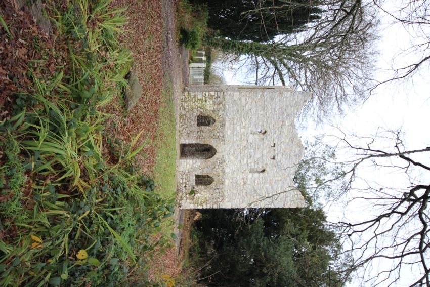
Figure 3: Cork City and eastern suburbs as depicted by George Taylor and Alexander Skinner’s Maps of the roads of Ireland
 in 1778. Bessborough is indicated as “Bisboro” and the proprietor as Allen Esq.

 Figure 4: First edition Ordnance Survey map (Surveyed 1841, published 1845)

Development of the demesne
1760-1841: Historic maps indicate that the demesne and house have undergone considerable modification
 The demesne lands appear to have consisted in the main of informal parkland with scattered trees and
in the course of the last 150 years. The first edition indicates that at that time the house consisted of a
 denser tree belts around the perimeter. More formal, walled gardens are indicated to the east, north east
central squarish block with a projecting wing to either side (Figure 4). The western wing terminated in
 and north of the house and rectangular structures depicted within them probably correspond to glass
what appears to be a pavilion. The eastern wing extended to the north forming a long range of buildings,
 houses and potting sheds. There were several pathways within the demesne: three lead southwards to
possibly a service wing, which defined the east side of a yard to the rear of the house. The north side of
 the southern boundary where extensive mudflats bordered the estuary; a path also appears to have
the yard was enclosed by a further range of buildings, presumably out-offices, stables and/or coach-house
 followed the demesne perimeter for much of its length inside the demesne wall; a further path lead
(at the time, the house lacked a separate farmyard complex). The demesne surrounding the house was
 westwards from the house to a wooded area on the western boundary. This latter path terminated in a
compact and well defined with a gate lodge indicated to the west of the main gateway in the northern
 triangular area which, although not clearly indicated on the map, is likely to have been the site of the
boundary. An avenue led southwards from the gateway to the main house much as it does today.
 icehouse which is still extant. Another feature of interest clearly indicated on the first edition map is a
 demi-hexagonal pond located in the south western quadrant of the demesne, abutting the demesne
 boundary. Five, regularly arranged islands are indicated in the lake. This was an artificially created
 feature which originally also included a number of stone bridges, and was used by the Pike family for
 small paddle boats. To the east of the house, outside the shaded area indicating the demesne, a small
 rectangular structure is shown. This may well be the folly tower which is still extant.

 Gateway View SHD, Ballinure, Blackrock, County Cork
 Architectural Heritage Impact Assessment 3
three storeys the height of the range of buildings defining the eastern side of the yard behind the house.
 How much of the original fabric of this range was retained is not known at this stage of our investigations.
 In 1931 a new chapel was constructed to the west of the main house: it is of red brick and is connected to
 the main house by a linking corridor. Also around this time (1920s-1940s) a detached, two-storey hospital
 building was constructed to the northwest of the main house. Many of the outbuildings defining the
 north side of the yard to the rear of the house have been heavily modified since 1922 but at this stage it
 has not been possible to determine how much of the original fabric survives.

 Figure 5: 25” Ordnance Survey Map (Surveyed 1899/1900, published 1901)

1841-1922: By the time of the 25” inch Ordnance Survey in 1899 (Figure 5) the house had been extended
and a large number of additional out buildings had been constructed. As regards the house, it can be seen
that two returns had been added to the rear elevation, one to the main house and one to the west wing,
and the side wings had been modified: the west wing had a semi-circular bay added to its west elevation
and the conservatory was constructed; the south elevation of the east wing also appears to have been
altered and may in fact have been glazed. The other main area of construction was the creation of a
complex of farm buildings, indicated as “Besboro’ Farm” to the north northeast of the house. These
buildings were arranged around two courtyards, a square one to the south and a triangular one adjacent
to the north. The layout and composition of the lands remained much the same as on the earlier Ordnance Figure 6: 25” Ordnance Survey Map (probably surveyed in the late 1930; published 1942). Note the changes wrought by the
Survey map but a windmill (used to pump water up to the house), a summerhouse and a well had been establishment of the convent by the Sacred Hear Order. The original Bessboro House has been greatly extended with the addition of
constructed adjacent to the southern boundary (no longer extant due to recent road construction) and a a hospital and chapel. A children’s burial ground within the enclosure of the folly is named on this map edition

planted area had been created around the folly to the east of the house, accessed via a tree lined path. A
major addition to the immediate landscape, although not within the actual demesne, was the construction
of the Cork to Blackrock railway in 1850 the line of which is clearly indicated to the east of the demesne. 1950-present: In the latter half of the twentieth century, extensive, single storey flat-roofed additions gave
 been added to the complex. These include structures to the east of the main house and between the west
 wing and the hospital building. Since 1990 many of the outbuildings comprising “Bessboro’ Farm” have
1922-1950: Following the acquisition of the property by the Sisters of the Sacred Hearts of Jesus and Mary been renovated for use as a heritage centre (now defunct) and as office/educational units. In addition, a
in 1922 a number of further alterations were made. A dormitory was created, apparently by raising to number of new structures, including a crèche and a meditation centre, have been constructed in the area

 Gateway View SHD, Ballinure, Blackrock, County Cork
 Architectural Heritage Impact Assessment 4
which originally comprised the walled gardens. As part of the Heritage Park development the former windows are rectangular having prominent limestone keystones, and decrease in size with height: The
parkland to the north of the house was fenced off and replanted. It is also noteworthy the isolated mature ground floor windows contain plate-glass timber sash frames but otherwise windows are uPVC
trees within the parkland to the south of the house have been lost or removed since the 1950s. replacements. The roof is hipped with several valleys to the rear. The walls are rendered with cut-stone
 plinth, quoins, band course and heavy cornice. Flanking the main house are two side wings. These have
 been significantly modified since the mid nineteenth century: the eastern wing has probably been
Character of the former demesne lands substantially rebuilt to accommodate a three-storey dormitory (c.1920s). The western wing is partially
Bessborough demesne remains legible by virtue of the fact that it retains much of its demesne wall to the masked by a fine, cast iron, Victorian conservatory.
west, north and east boundaries: the southern edge of the demesne has been truncated by the construction
of the South Ring Road which necessitated the removal of the boundary wall in this area. The main gate A number of ancillary structures have been added to the rear and sides of the house since it was taken
features cut-stone piers surmounted by carved finials and linked by curvilinear flanking walls which in over by the Sisters of the Sacred Hearts of Jesus and Mary in 1922. These are generally unremarkable and
turn are surmounted by cast iron railings. The gate itself is also of cast iron. A secondary gate in the not of architectural significance.
boundary wall to the east of the main gate is an insert and the cut-stone surround clearly reused from
elsewhere. Two of the key components of the historic landscape are:
 • The band of woodland along the western and northern boundaries that relates back to the original
 demesne plan ng. This richness of this area is enriched by the presence of the icehouse, the
 entrance gates and surviving sections of the boundary wall
 • The open parkland to the south of Bessboro House. Whilst the historic house has undergone an
 enormous amount of change to the rear and and sides, but the one constant is the open landscape
 to the front (south) of the house. The development of the South Ring Road has severed the former
 relationship between Bessboro and the estuary to the south. Nevertheless, the parkland is still of
 vital cultural significance.

The demesne lands retain some of their original grassland character but scattered parkland trees and tree
stands have been largely removed apart from the tree belts inside the boundary wall. The area forming
the north eastern quadrant of the demesne, originally also parkland, has been replanted in recent decades
and a number of stone-built features added as part of a heritage park display. The main avenue remains
as do much of the perimeter walks and part of a pathway leading southwards from the main house. The
icehouse which survives in the western part of the demesne is an interesting and relatively rare feature:
Although the interior has been in-filled, it remains instantly recognisable with its circular form and
domed roof. The artificial lake in the south western corner of the demesne is sadly neglected and no
longer easily recognisable as a formal garden feature: It is, however, an interesting survival. The walled
gardens to the north and east of the house are still legible for the most part but some areas have been
built upon and paved over in recent years thus compromising their integrity. They nonetheless retain
some interesting features, particularly a number of sunken glass houses which retain their original
nineteenth century footings but appear to have been re-glazed. Another striking feature of the demesne
lands is the folly which is located to the south east of the house. It takes the form of a roofless two-to-
three storey tower, resembling a castle keep, with pointed, brick-lined openings. The area within the
tower and immediately adjacent to the north has been used as a burial ground, for children and nuns,
since the Sisters of the Sacred Hearts of Jesus and Mary took over the property in the 1920s. It is not
known whether the burial ground tradition predates the twentieth century but the historic maps suggest
that it does not.

Bessborough House: The core of Bessborough House is still legible as a three-storey over basement
Georgian country house, roughly square in plan. The front (south) elevation is of seven bays and has a
central three-bay breakfront with a pediment. At ground floor level there is a central pedimented
doorway with fanlight; centrally placed on the first floor is a Venetian window while above this, on the
second floor, is a Diocletian window. All of these three openings have fine cut-stone surrounds. The other

 Gateway View SHD, Ballinure, Blackrock, County Cork
 Architectural Heritage Impact Assessment 5
3. Description of subject site
The proposed development site is located in the townland of Ballinure, to the south of Mahon, a suburb Bessboro Castle Folly is located west and adjacent to the proposed development site. The structure has
of Cork City with a variety of established and emerging land uses. The site is located approximately 5km been recorded by the NIAH (NIAH Reference 20872007) and appraised to be of regional significance. The
to the southeast of the city centure. The site is bound by Bessboro House and grounds to the west, NIAH have described the structure as follows:
Bessboro Day Care and Sacred Heart Convent to the north, Passage West Greenway and Mahon Retail Detached three-bay two-storey stone folly, built c.1880, now in ruinous condition. Roof gone.
Park to the east, and the N40 road corridor and Douglas River Estuary to the south. The south, east and Coursed limestone rubble walls with some traces of lime render remaining. Pointed arch window
west of the development boundary is characterised by existing stands of mature tree planting. Their openings with stone voussoirs to arch. Lancet windows to upper floor. Pointed arch door
canopy defines the character of the site. The lands are located on a gently sloping hillside that falls openings with stone voussoirs to arch. Burial ground associated with Sacred Heart convent,
towards the Douglas River and Cork Harbour estuary. located in the adjacent Bessborough House, situated to the immediate north.

Bessboro House is a protected structure and has evaluated by the National Inventory of Architectural The structure is nestled to the east of a cluster of mature trees, which separate Bessboro House and the
Heritage (NIAH) as a building of regional importance by virtue of its architectural, artistic historical and folly. The folly is a local landmark and can be seen from a pedestrian bridge and footpath to the southeast
social interest. The NIAH describe the building (NIAH Reference 20872005) as follows: where there is a gap in the mature tree boundary; it was substantially reconstructed in 2019. The structure
 Detached seven-bay three-storey house, built c.1760, having pedimented breakfront to the is consistent with the category of tower follies as categorised by Howley (1993, 48) who states that of “all
 central bay and two-storey additions to rear c.1860. Originally flanked by single-storey wings the different types of follies in Ireland, towers are the most common and easiest to identify.” The example
 with bow-ended room added to west wing c.1860 and first floor added to east wing 1922. at Bessboro is somewhat similar to that at Coolmore near Carrigaline, County Cork (ibid, 52).
 Converted to use as convent, 1922, with hospital added to east, c.1930, chapel dated 1931 to
 west, and single-storey multiple-bay structure adjoining to the east, c.1960. Range of single- The proposed development site itself is open grassland, which appears to have been evened out in the
 storey structures attached to north. Now in use as a health centre. Hipped slate roofs with past and contains overgrown soil heaps or other materials and emerging scrub vegetation. It also contains
 rendered corbelled chimneystacks and carved limestone eaves course. Pitched slate roofs to chapel a closed off and unmaintained access road with footpaths and streetlights ending in grassland to the
 and some additions with later rooflights. Lined-and-ruled rendered walls having cut limestone southeast of the folly. Some sections of the site are littered. Apart from the tree canopy there are no
 quoins, platband and plinth course to main building, smooth-rendered walls to remaining apparent designed landscape features visible or remaining apart from the folly. The site appears to be as
 buildings. Cut limestone cornice to west wing. Square-headed window openings with limestone a place prepared for future development in the past which did not materialise. In a broad context, the site
 keystones and sills, one-over-one timber sash windows to ground floor and some two-over-two is situated in an area of Mahon with contrasting adjacent land uses ranging from historical demesne to
 sash windows to wings. Replacement windows to remaining openings. Cut limestone surrounds the west, light industrial/retail to the east, residential to the north and the N40 dual carriageway (i.e.
 to Diocletian and Venetian windows with replacement windows. Blind elliptical oculus in South Link Road) to the south and the Douglas River estuary into Lough Mahon further south.
 breakfront pediment with cut limestone surround. Limestone doorcase, c.1870, comprising
 rusticated pilasters surmounted by console brackets supporting broken bed pediment framing The subject site was found to be overgrown by scrubby growth during field inspection. The northern
 round-headed window opening with fanlight and timber panelled door approached by limestone portion of this area appeared to containing dumps of construction rubble, especially at the northeast, and
 steps with replacement metal railings of c.1960. Glass and cast-iron conservatory to west wing sub-soil was exposed in places. Some recently dumped topsoil was noted along the southern margin and
 having Corinthian capitals to pilasters. Quadrant gateway, c.1880, comprising four cylindrical some refuse and a burnt out car were also noted here. A modern road cut into the natural level,
 limestone piers with carved finials and cast-iron railings and gates. constructed in the mid-2000s, bisects this area, with the former Cork, Blackrock and Passage Railway line
 forming the eastern boundary.
The NIAH appraised the significance of the building as follows:
 This complex comprises buildings of several phases of development since the original Georgian
 country house was constructed in the mid eighteenth century. Despite interventions over the
 course of two centuries, many important original features are retained including the proportions
 of the front façade and the finely cut limestone architectural details of the main house. Later
 nineteenth century additions to the building are of a high standard of construction and also
 include the very fine conservatory, added by Richard Turner c.1860, which has survived almost
 completely in its original form. The conversion of the house to a convent in 1922 resulted in
 further buildings being added to the complex. The Sacred Heart Sisters are still in residence
 today in the main house, while the remaining buildings provide important community and
 healthcare functions.

 Gateway View SHD, Ballinure, Blackrock, County Cork
 Architectural Heritage Impact Assessment 6
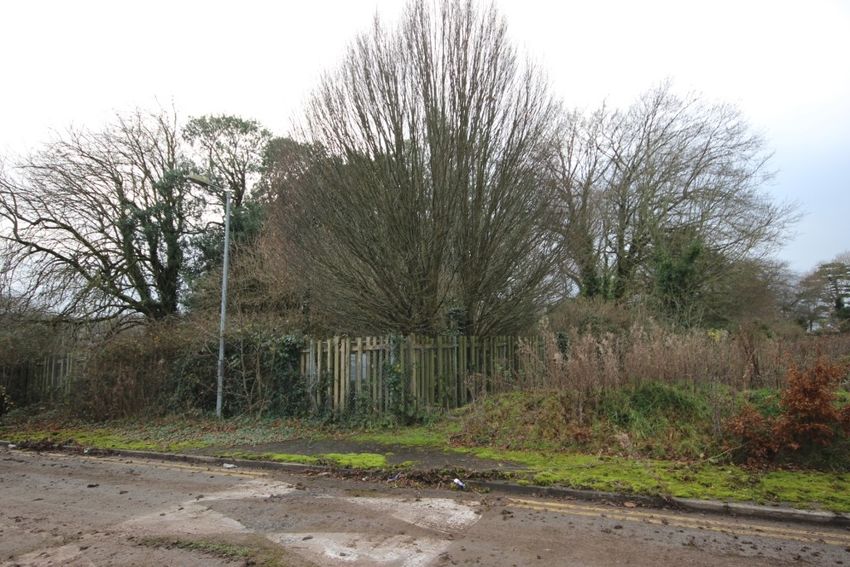
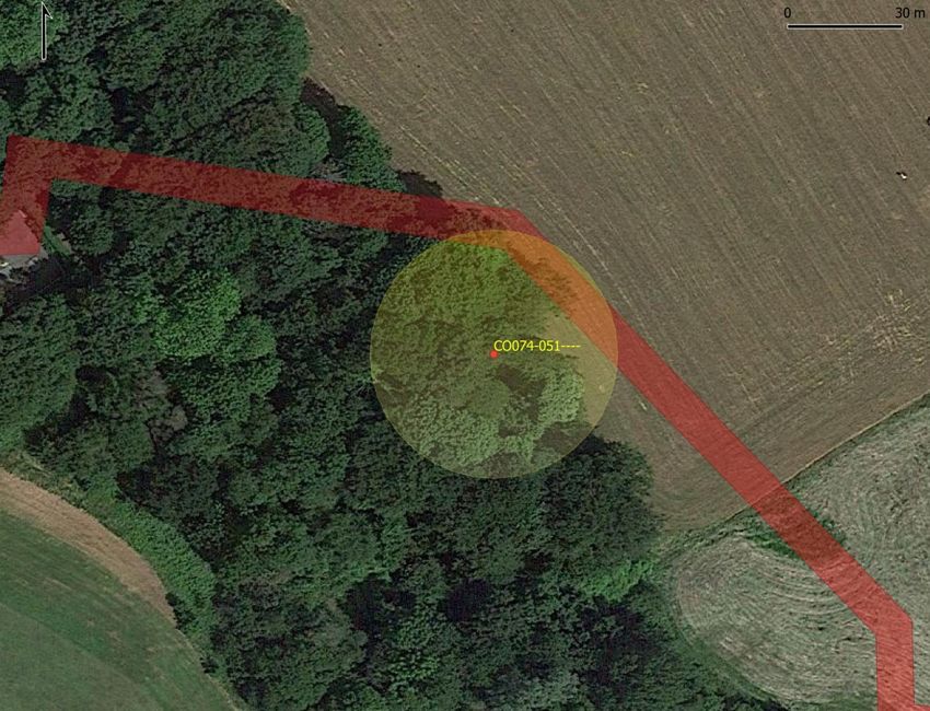
Figure 7: 2006 aerial image showing extent of ground disturbance across the entire site
 Figure 8: Location of icehouse (RMP no. CO074-051----) in relation to proposed sewer upgrade (red) with Zone of
A proposed upgrade to an existing sewer pipe runs for c.650m from the south of the proposed Notification in yellow
development site to the west. This generally follows the line of an existing wayleave, and ground
disturbance associated with this earlier wayleave is evident in aerial images (see Figure 7 above). The
proposed sewer upgrade comes within c.10m of the location of an icehouse (a recorded monument
(CO074-051----) at the west of the Bessboro estate lands (see Figure 8). The Archaeological Survey of
Ireland have described the icehouse as follows:
 In woodland; built into SW-facing slope in demesne of Besborough House (CO074-077---).
 Interior circular (diam. 3.7m); pit infilled to ground floor level; walls constructed of mortared
 rough limestone. Domed roof (H 2.55m). Door ope (Wth 1.4m) to SW with remains of splayed
 retaining walls for former earthen covering mound on either side of entry. Exterior composed of
 very rough stone surface; no remains of covering mound.

According to Buxbaum (1998), icehouses allowed for the storage of ice collected in winter and facilitated
the storage of food (fish, game, poultry, butter, etc). Buxbaum notes that only the very wealthy would
have supplemented their fare with the luxury of an icehouse. The proposed sewer upgrade works will
not impact the icehouse.

 Gateway View SHD, Ballinure, Blackrock, County Cork
 Architectural Heritage Impact Assessment 7

4. Assessment of impacts
The proposed development consists of 4 blocks varying in height from five storeys (17.35m) to eight Having regard to the Architectural Heritage Protection Guidelines for Planning Authorities (Department of
storeys (26.80m), These blocks are arranged axially about the historic folly located adjacent to the subject the Arts, Heritage and the Gaeltacht 2004, 2011) and the relevant planning policies of Cork City Council,
site. The project architects explored a number of difference development options for this site and have it is possible to state that the proposed development will not give rise to any significant impacts on built
consulted with Cork City Council on the emerging designs. heritage resources within the vicinity and will not give rise to negative impacts on principal views to and
 from Bessboro House, a protected structure located to the west. The original-eighteenth-century house is
The design proposal seeks to respond to its context and, in particular, the adjacent folly. The design uses located over 100 metres from the nearest apartment block (later extensions to the house are closer). Views
the folly as a centre point or hub for a formal axial plan which responds to the historic context whilst also towards the subject site from the original eighteenth-century house are fully screened by a later tall multi-
delivering contemporary quality housing. The design seeks to be a contemporary evolution and response bay block (to the east) and the proposed development will not give rise to negative impacts on the historic
to its context and the historic landscape. It should be noted that the folly and the axial pathway that leads entrance avenue and traditional approach to the protected structure (from north-north-west) .
back to Bessboro House is not original to the eighteenth-century landscape design. The overall proposed
Gateway View development maintains visual corridors which highlight views onto this folly. In this Furthermore, the proposed development will be arrayed around the grounds of a historic folly that is
regard the proposed development is placed into the historic landscape rather than seeking to dominate or linked to the house by a tree-lined avenue. The folly and associated avenue were not part of the
reconfigure the morphology of this setting. It is important to stress that whilst the subject site is eighteenth-century setting out of the Bessboro estate (indeed the development area was agricultural in
undeveloped, it has been altered during extensive infrastructural and road works in the early 2000s. nature up to the mid-nineteenth century). The development will alter the setting of the folly but it must
 be borne in mind that the structure is well-screened by mature trees and vegetation and the subject site
The architects have been cognisant of the wider environs and emerging pattern of development. The has been heavily disturbed and altered during infrastructural works in the mid-2000s. There will a
overall proposed Gateway View development is divided into four separate blocks, the heights of these moderate, neutral, indirect impact on the setting of the folly.
increase from five storeys at Block A to eight storeys at Block D, in this way the mass of the development
increases at it moves from west to east culminating in Block D which serves as the terminus of the The proposed development will have a slight, negative, indirect impact on the historic parkland and its
development when viewed from across the estuary. As the “Architect’s Design Statement” stresses the attendant features. This will occur as a result from slight visual changes to a few peripheral aspects of the
subject acts “as somewhat of a bridge between the lower level buildings of Bessboro House to the taller historic landscape of the estate. On balance there will be limited change to historic landscape character
more contemporary urban fabric of Mahon business park and Jacobs Island beyond”. This approach does as the subject site has been substantially altered in the recent past and is of no amenity value in its current
not challenge the visual primacy of the main façade of Bessboro House and its parkland setting to the state.
south.
 Finally, the proposed sewer upgrade will come within c.10m of the location of an icehouse, a recorded
The design proposal also responds to its wider setting and amenity context, primarily the Blackrock monument at the west side of the Bessboro estate lands. The proposed sewer upgrade works will not
Greenway which bounds the site to the east. This long stretch of previous railway links the Atlantic Pond impact the icehouse itself or its setting.
near the city to Passage West in the harbour and for this reason is a popular cycling and walkway route
in the city.

 Figure 9: Extended longitudinal elevation showing the proposed development in relation to the Bessboro House (Wilson Architecture)

 Gateway View SHD, Ballinure, Blackrock, County Cork
 Architectural Heritage Impact Assessment 8
5. Conclusions
John Cronin and Associates have concluded that the proposals detailed on plan and elevational drawings The overall proposed Gateway View development will not rise to any significant direct negative impacts
for the subject site represents a very good integration of new high-quality high-density accommodation on any designated architectural heritage buildings or on any of the architectural conservation areas
within the historic landscape setting. (ACAs) within the surrounding area. The proposed development will have a slight, negative, indirect
 impact on the historic parkland and its attendant features. There will a moderate, neutral, indirect impact
The development will be viewed in the context of an evolving urban area that has largely engulfed the on the setting of the folly (which is well-screened by mature trees and vegetation).
historic demesne of Bessboro. It is noteworthy that the original Bessboro estate consisted of a total area
of 200 acres; this has reduced over time to approximately 60 acres. The high density approach adopted There will be little or no visual impacts on principal available views to and from Bessboro House. On
by the design team is wholly appropriate in a historic parkland setting within a wider urban area. balance there will be limited change to historic landscape character as the subject site has been
 substantially altered in the recent past and is, in itself, of no amenity value in its current state.
 .

 Gateway View SHD, Ballinure, Blackrock, County Cork
 Architectural Heritage Impact Assessment 9
6. References
Buxbaum, Tim (2002) Icehouses (Shire Album 278). Buckinghamshire: Shire Publications.
Cork City Council (2015) Cork City Development Plan 2015-2021. Cork: Cork City Council.
Department of Arts, Heritage, and the Gaeltacht (2004, 2011) Architectural Heritage Protection: Guidelines for Planning Authorities. Dublin: The Stationery Office
Howley, James (2004) The Follies and Garden Buildings of Ireland. New Haven and London: Yale University Press.
Lewis, S. (1837) Topographical Dictionary of Ireland. 2 Volumes, Lewis & Company, London

Websites consulted
http://map.geohive.ie/mapviewer.html
http://maps.osi.ie/publicviewer/#V2,591271,743300,1,10 (Maps)
http://spatial.dcenr.gov.ie/imf/imf.jsp?site=GSI_Simple (Bedrock)
https://maps.archaeology.ie/HistoricEnvironment/
https://www.logainm.ie

 Gateway View SHD, Ballinure, Blackrock, County Cork
 Architectural Heritage Impact Assessment 10
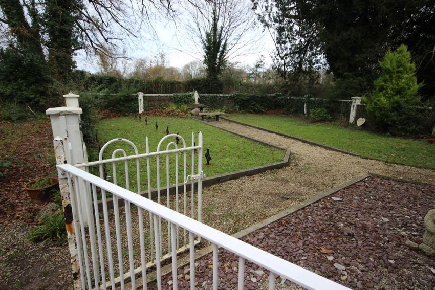
Appendix: Photographic Record

 Plate 1 Aerial view of folly, looking northwest –the subject land parcel is located to the right of the area of the folly Plate 3: Icehouse (recorded monument CO074-051----) which is located c. 10m from the public sewer that is to be upgraded

Plate 3: Open parkland in front of Bessboro House – this area accommodates a public sewer that will need to be renewed and
 upgraded as part of the development proposal

 Plate 4: Looking north across parkland towards Bessboro House – the proposed development will not impinge on principal
 views from and to the protected structure

 Gateway View SHD, Ballinure, Blackrock, County Cork
 Architectural Heritage Impact Assessment 11
Plate 5: Looking west towards Bessboro House – the original eighteenth-century house is screened to the east by a later tall
 multi-bay block.
 Plate 7: Looking west along the avenue that leads to the folly – looking back towards Bessboro House

 Plate 6: Looking east towards the entrance to the avenue leading to the folly and graveyard

 Gateway View SHD, Ballinure, Blackrock, County Cork
 Architectural Heritage Impact Assessment 12
Plate 9: Graveyard to the north of the folly

Plate 8: View of the folly from south – the uppermost of the structure has been recently re-built

 Plate 10: Looking west along lands to the south of the folly

 Gateway View SHD, Ballinure, Blackrock, County Cork
 Architectural Heritage Impact Assessment 13
Plate 11: View west (from 2m elevation and southern portion of the proposed development site) towards the folly Plate 13: View of disturbed nature of the eastern portion of the land parcel (Mahon Retail Park in background)

 Plate 12: View of southern area of the proposed development site Plate 14: An internal service road bisects the land parcel and placed in a significant cut across the generally flat ground

 Gateway View SHD, Ballinure, Blackrock, County Cork
 Architectural Heritage Impact Assessment 14
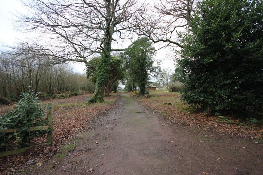
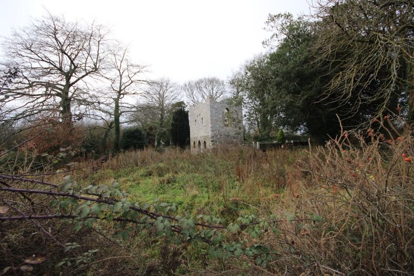
Plate 15: View towards folly from the proposed development site – the folly and graveyard are well-screened by planting Plate 17: Proposed development site, north of graveyard, looking west

 Plate 16: View, from south, of entrance road to the lands

 Gateway View SHD, Ballinure, Blackrock, County Cork
 Architectural Heritage Impact Assessment 15
You can also read