Foundation Document Colonial National Historical Park Virginia - May 2018
←
→
Page content transcription
If your browser does not render page correctly, please read the page content below

NATIONAL PARK SERVICE • U.S. DEPARTMENT OF THE INTERIOR

Foundation Document
Colonial National Historical Park
Virginia                                                                  May 2018

                                                                                     Turn over for map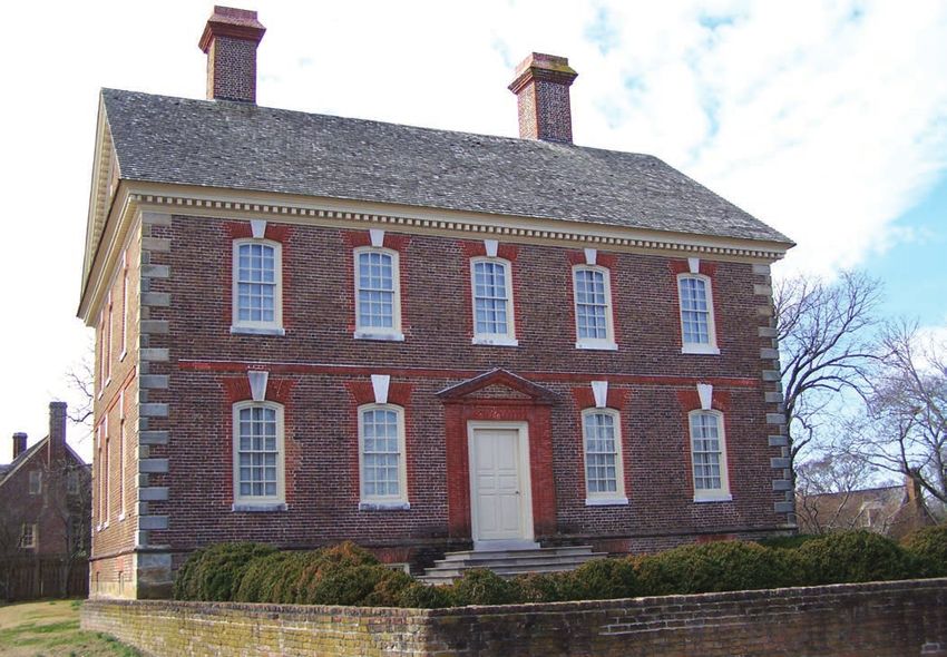
Foundation Document
To 64 To Exit 238 To
Richmond C r e ek Fredericksburg
Creek
n
ee
Waller Mill 143
Qu
ck
Colonial NHP (park Picnic area Reservoir
rn e
boundaries are Cheatham
be
Pond
approximate) Queens Lake
m
Campground
Ti
11 mi Distance Wheelchair- 60
16 km indicator US NAVAL SUPPLY CENTER
accessible
132 CHEATHAM ANNEX
YO
615 NIAL PARKWA
Roadside marker LO Y RK
CO Penniman Spit
ad
0 1 Kilometer 2 Colonial 60 RI
Ro
199 Williamsburg 163
Jones Mill
Pond 13 mi VE
nd
0 1 Mile 2
Information 21 km
CO L O N IA L R 17
I ro n bou
Center
F elg
eek
ate's Creek
Sandy Point
64
Cr
North 321 716
PA
Governor’s The
Palace Capitol K in
g KW
R
College Wren AY
Matoaka of Building 143
William Indian Field
ek
Lake e
616 and Mary Creek Cr
199
Strawberry rah
WILLIAMSBURG Water Sa
Plains Road 60 Country
615 Black Swamp
Mo n t i c e l l o A v Exit 242
enu e
d
Roosevelt
Ro a
5 Pond Yorktown Virginia Institute
Victory Center of Marine Science
132
nd
(Commonwealth of Virginia) Gloucester Point
Ironbou
GREEN SPRING
US NAVAL WEAPONS STATION Toll Bridge
Po
wh
Joh n Tyler Highwa at 5 Creek
y YORKTOWN
ad
d
an
199
Ro
lar
Bal
Virginia Byway to
wn
Gr
Sa
James River Plantations
to Victory Monument
nd
een
es
Exit 243
y Bay Road
Visitor Center
Jam
spr
Creek
Co
ing
lle Busch Gardens
31 ge Moore
Ro Amusement Park 238
s
ad Creek G re
at House
ay R un
Blows
238
Lake H alf w
Cr
Pasbehegh 614
ee
Mill Creek
Lake Powell
k
238
Wormley
YORKTOWN Pond
Gro
Jamestown
e 704
Beach Campsites BATTLEFIELD
v
Cr
e e
t ist Run
Ba p
M
k
ad
ill
64
Jamestown
Ro
Creek
BATTLEFIELD
Information Station
wn
Jamestown Settlement 143 ALLIED TOUR
(seasonal) S kif Endview
Yorkto
(Commonwealth of Virginia) fes Exit ENCAMPMENT
Cre Plantation TOUR Surrender
e
WAY k 247
Field
Jamestown PARK
Glasshouse AL
Sandy C O L O NI 11 mi 60
Bay Visitor Center 16 km General
ek
The Washington’s
Cre
Thor Headquarters
ofar
e
Voorhees Archaearium JAMESTOWN
JAMES Lee Hall
Mansion
Preservation Virginia RI Newport News 17
ISLAND VE Park
HISTORIC Is l a
nd R
Swanns JAMESTOWNE m
Point D r i ve ve r d a
Bea
Creek
Free
Pas
sm or
e Creek 60 C it
y
ferry
R e s e r v oi r
es
JA S kif
f
Visitor Information Center 105
ME Newport News Park
S
RIVER Hog Island
To Army Exit 250
Transportation
Museum 143
Scotland Wharf FORT EUSTIS MILITARY RESERVATION
To Newport News and Norfolk
Colonial National Historical Park

Contents
Mission of the National Park Service  .  .  .  .  .  .  .  .  .  .  .  .  .  .  .  .  .  .  .  .  .  . 1

Introduction  .  .  .  .  .  .  .  .  .  .  .  .  .  .  .  .  .  .  .  .  .  .  .  .  .  .  .  .  .  .  .  .  .  .  . 2

Part 1: Core Components  .  .  .  .  .  .  .  .  .  .  .  .  .  .  .  .  .  .  .  .  .  .  .  .  .  .  .  . 3
           Description and History of the Park  .  .  .  .  .  .  .  .  .  .  .  .  .  .  .  .  .  .  .  .  . 3
                       Jamestown Island  .  .  .  .  .  .  .  .  .  .  .  .  .  .  .  .  .  .  .  .  .  .  .  .  .  .  .  .  .      3
                       Introduction of Slavery in the Colony  .  .  .  .  .  .  .  .  .  .  .  .  .  .  .  .  .  .  .  .            5
                       Jamestown Today  .  .  .  .  .  .  .  .  .  .  .  .  .  .  .  .  .  .  .  .  .  .  .  .  .  .  .  .  .       5
                       Port of Yorktown  .  .  .  .  .  .  .  .  .  .  .  .  .  .  .  .  .  .  .  .  .  .  .  .  .  .  .  .  .  .   5
                       Siege of Yorktown . . . . . . . . . . . . . . . . . . . . . . . . . . . . .                                  6
                       Yorktown Today  .  .  .  .  .  .  .  .  .  .  .  .  .  .  .  .  .  .  .  .  .  .  .  .  .  .  .  .  .  .     7
                       Other Park Units .  .  .  .  .  .  .  .  .  .  .  .  .  .  .  .  .  .  .  .  .  .  .  .  .  .  .  .  .  .    8
                       Colonial Parkway   .  .  .  .  .  .  .  .  .  .  .  .  .  .  .  .  .  .  .  .  .  .  .  .  .  .  .  .  .     8
           Park Purpose  .  .  .  .  .  .  .  .  .  .  .  .  .  .  .  .  .  .  .  .  .  .  .  .  .  .  .  .  .  .  .  .  9
           Park Significance  .  .  .  .  .  .  .  .  .  .  .  .  .  .  .  .  .  .  .  .  .  .  .  .  .  .  .  .  .  . 10
           Fundamental Resources and Values  .  .  .  .  .  .  .  .  .  .  .  .  .  .  .  .  .  .  .  . 12
           Other Important Resources and Values  .  .  .  .  .  .  .  .  .  .  .  .  .  .  .  .  .  .  . 16
           Related Resources   .  .  .  .  .  .  .  .  .  .  .  .  .  .  .  .  .  .  .  .  .  .  .  .  .  .  .  .  . 17
           Interpretive Themes   .  .  .  .  .  .  .  .  .  .  .  .  .  .  .  .  .  .  .  .  .  .  .  .  .  .  .  . 20

Part 2: Dynamic Components  .  .  .  .  .  .  .  .  .  .  .  .  .  .  .  .  .  .  .  .  .  .  .  .  . 21
           Special Mandates and Administrative Commitments  .  .  .  .  .  .  .  .  .  .  .  . 21
           Assessment of Planning and Data Needs  .  .  .  .  .  .  .  .  .  .  .  .  .  .  .  .  .  . 21
                       Analysis of Fundamental Resources and Values  .  .  .  .  .  .  .  .  .  .  .  .  .  . 21
                       Analysis of Other Important Resources and Values  .  .  .  .  .  .  .  .  .  .  .  .  .43
                       Identification of Key Issues and Associated Planning and Data Needs   .  .  .52
                       Planning and Data Needs   .  .  .  .  .  .  .  .  .  .  .  .  .  .  .  .  .  .  .  .  .  .  .  .  .57

Part 3: Contributors  .  .  .  .  .  .  .  .  .  .  .  .  .  .  .  .  .  .  .  .  .  .  .  .  .  .  .  .  .  . 65
           Colonial National Historical Park  .  .  .  .  .  .  .  .  .  .  .  .  .  .  .  .  .  .  .  .  .  . 65
           NPS Northeast Region   .  .  .  .  .  .  .  .  .  .  .  .  .  .  .  .  .  .  .  .  .  .  .  .  .  .  . 65
           Other NPS Staff  .  .  .  .  .  .  .  .  .  .  .  .  .  .  .  .  .  .  .  .  .  .  .  .  .  .  .  .  .  . 65
           Denver Service Center, Planning Division  .  .  .  .  .  .  .  .  .  .  .  .  .  .  .  .  .  . 65
           Park Partners .  .  .  .  .  .  .  .  .  .  .  .  .  .  .  .  .  .  .  .  .  .  .  .  .  .  .  .  .  .  .  . 65

Appendixes  .  .  .  .  .  .  .  .  .  .  .  .  .  .  .  .  .  .  .  .  .  .  .  .  .  .  .  .  .  .  .  .  .  .  . 66
           Appendix A: Enabling Legislation and Legislative Acts for
                        Colonial National Historical Park  .  .  .  .  .  .  .  .  .  .  .  .  .  .  . 66
           Appendix B: Inventory of Special Mandates and
                       Administrative Commitments  .  .  .  .  .  .  .  .  .  .  .  .  .  .  .  .  . 69
           Appendix C: Past and Ongoing Park Planning and
                        Data Collection Efforts   .  .  .  .  .  .  .  .  .  .  .  .  .  .  .  .  .  .  .  . 76
           Appendix D: Traditionally Associated Tribes  .  .  .  .  .  .  .  .  .  .  .  .  .  .  .  .  . 84
           Appendix E: Management Actions  .  .  .  .  .  .  .  .  .  .  .  .  .  .  .  .  .  .  .  .  . 84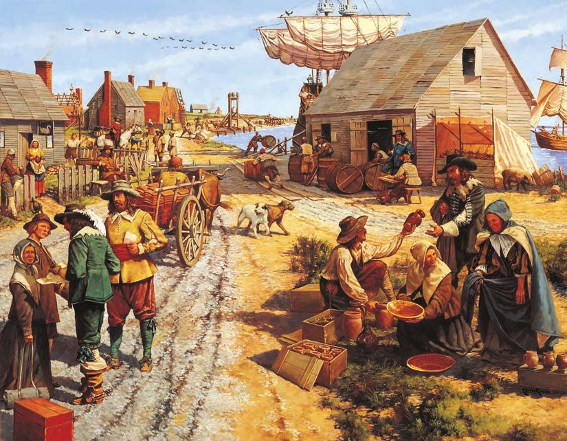
Foundation Document
Colonial National Historical Park

Mission of the National Park Service
The National Park Service (NPS) preserves unimpaired the natural and cultural resources
and values of the national park system for the enjoyment, education, and inspiration of this
and future generations. The National Park Service cooperates with partners to extend the
benefits of natural and cultural resource conservation and outdoor recreation throughout this
country and the world.

The NPS core values are a framework in which the National Park Service accomplishes its
mission. They express the manner in which, both individually and collectively, the National
Park Service pursues its mission. The NPS core values are:

    ·· Shared stewardship: We share a commitment to resource stewardship with the global
       preservation community.

    ·· Excellence: We strive continually to learn and improve so that we may achieve the
       highest ideals of public service.

    ·· Integrity: We deal honestly and fairly with the public and one another.

    ·· Tradition: We are proud of it; we learn from it; we are not bound by it.

    ·· Respect: We embrace each other’s differences so that we may enrich the well-being
       of everyone.

The National Park Service is a bureau within the Department of the Interior. While numerous
national park system units were created prior to 1916, it was not until August 25, 1916, that
President Woodrow Wilson signed the National Park Service Organic Act formally establishing
the National Park Service.

The national park system continues to grow and comprises more than 400 park units covering
more than 84 million acres in every state, the District of Columbia, American Samoa, Guam,
Puerto Rico, and the Virgin Islands. These units include, but are not limited to, national parks,
monuments, battlefields, military parks, historical parks, historic sites, lakeshores, seashores,
recreation areas, scenic rivers and trails, and the White House. The variety and diversity
of park units throughout the nation require a strong commitment to resource stewardship
and management to ensure both the protection and enjoyment of these resources for
future generations.

                                                       The arrowhead was authorized as the
                                                       official National Park Service emblem
                                                          by the Secretary of the Interior on
                                                         July 20, 1951. The sequoia tree and
                                                       bison represent vegetation and wildlife,
                                                         the mountains and water represent
                                                       scenic and recreational values, and the
                                                        arrowhead represents historical and
                                                                 archeological values.

                                                                                                                                   1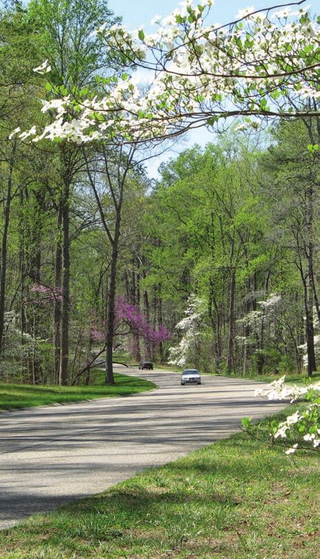
Foundation Document

                      Introduction
                      Every unit of the national park system will have a foundational document to provide
                      basic guidance for planning and management decisions—a foundation for planning and
                      management. The core components of a foundation document include a brief description
                      of the park as well as the park’s purpose, significance, fundamental resources and values,
                      other important resources and values, and interpretive themes. The foundation document
                      also includes special mandates and administrative commitments, an assessment of planning
                      and data needs that identifies planning issues, planning products to be developed, and the
                      associated studies and data required for park planning. Along with the core components, the
                      assessment provides a focus for park planning activities and establishes a baseline from which
                      planning documents are developed.

                      A primary benefit of developing a foundation document is the opportunity to integrate and
                      coordinate all kinds and levels of planning from a single, shared understanding of what is
                      most important about the park. The process of developing a foundation document begins
                      with gathering and integrating information about the park. Next, this information is refined
                      and focused to determine what the most important attributes of the park are. The process
                      of preparing a foundation document aids park managers, staff, and the public in identifying
                      and clearly stating in one document the essential information that is necessary for park
                      management to consider when determining future planning efforts, outlining key planning
                      issues, and protecting resources and values that are integral to park purpose and identity.

                      While not included in this document, a park atlas is also part of a foundation project.
                      The atlas is a series of maps compiled from available geographic information system
                      (GIS) data on natural and cultural resources, visitor use patterns, facilities, and other
                      topics. It serves as a GIS-based support tool for planning and park operations. The atlas is
                      published as a (hard copy) paper product and as geospatial data for use in a web mapping
                      environment. The park atlas for Colonial National Historical Park can be accessed online at:
                      http://insideparkatlas.nps.gov/.

2
Colonial National Historical Park

Part 1: Core Components
The core components of a foundation document include a brief description of the park, park
purpose, significance statements, fundamental resources and values, other important resources
and values, and interpretive themes. These components are core because they typically do
not change over time. Core components are expected to be used in future planning and
management efforts.

Description and History of the Park
Colonial National Historical Park protects key sites that span the history of the entire British
colonial period in North America, from the first permanent English settlement on Jamestown
Island to the battlefield where the colonies ultimately secured their independence from Great
Britain at Yorktown. The park is located on the Virginia Peninsula between the York and James
Rivers, part of the Tidewater region of southeastern Virginia. This region is a fertile coastal
plain carved into long peninsulas by rivers that broaden as they flow to the southeast and
eventually empty into Chesapeake Bay. These rivers allow navigation deep into the interior of
Virginia, and their depth fluctuates with the tides, which gives the region its name. The site of
significant human habitation for more than 11,000 years prior to the first English contact, the
park protects resources and evokes stories of the interaction and conflict between the English
colonists and the American Indians of the Powhatan Paramount Chiefdom; the economic,
political, and social evolution of the colonies; and the development of the institution of lifelong
African American slavery.

The park was first established on July 3, 1930 (Public Law 71-510, 46 Stat. 855, HR12235), and
initially included most of Jamestown Island, the battlefield grounds at Yorktown and several
Yorktown structures, and a corridor for the planned Colonial Parkway. In the years since its
establishment, the park has added several properties, notably the site of Governor Sir William
Berkeley’s Green Spring Plantation, Cape Henry, and the Thomas Nelson House in Yorktown.
The park contains 8,677 acres of which 8,049 acres are federally owned. (Note: This is the total
authorized boundary acreage and NPS fee acreage.)

Jamestown Island
Jamestown Island is the site of the first permanent English settlement in North America
and was the capital of the Virginia Colony until 1699. Established as a private venture by the
Virginia Company of London, a joint stock company established under a royal charter, the
colony included many adventurers seeking quick profits from gold and other resources. A
disappointing lack of such resources, poor leadership, drought, disease, and dependence on
the local Powhatan tribes for food supplies left the colony on the edge of disaster for the first
several years of its existence. Jamestown suffered from an astounding mortality rate, with
only 38 of the first 104 colonists surviving the first nine months. Able leadership from the
highly resourceful Captain John Smith improved the situation after he took over as president
of the colony in 1608. However, after his return to England in 1609, a famine known as the
“Starving Time” during the winter of 1609–1610 led to the near collapse of the colony. The
situation was so severe that nearly two-thirds of the colonists perished, and as indicated by
recently discovered archeological evidence on Jamestown Island, some colonists resorted to
cannibalism to survive.

Relations with the local American Indian tribes were tenuous. Wahunsenacawh, a paramount
chief also known as Powhatan, ruled over a chiefdom of subordinate tribes in the area from
his nearby seat of power at Werowocomoco. He initially tried to incorporate the new colony
as a subordinate “tribe” under his rule. Unsuccessful in this effort, he attempted to contain the
colony rather than destroy it. A key area of conflict with the colonists was the demand by the
latter for food supplies that the tribes could not spare, due to a prolonged period of drought-
induced crop failures (an observation recently deduced from NPS-sponsored cypress tree-ring
analyses conducted on Jamestown Island).

                                                                                                                                     3
Foundation Document
Raids by tribal warriors on the Jamestown Colony and reprisals by colonists were frequent.
Two major attacks were launched by Powhatan’s brother and successor Opechancanough in
1622 and 1644, although by this point the power of the confederacy was declining due to the
effects of foreign disease and English attacks, and that of the Jamestown Colony was growing.
Opechancanough was eventually captured and killed in 1646, and his successor signed a peace
treaty with the English. The treaty designated the tribes of the confederacy as tributaries to the
King of England and formally established a boundary between Powhatan and English lands,
opening a large new land area to settlement by English colonists. The treaty also established
one of the earliest Indian reservations in what was to become the United States.
The development of tobacco cultivation dramatically improved the economic prospects of the
Jamestown Colony. Varieties of West Indian tobacco were brought to Jamestown by John Rolfe,
and thrived in the hot, humid Virginia climate. The high profit margins offered by tobacco
and a change in policy that encouraged private land ownership by colonists, known as the
headright system, led to a dramatic expansion of the colony in later decades. Land ownership
allowed colonists to reap the rewards of their labor, an incentive that dramatically improved
productivity. Another reform gave the colonists a say in their governance, with the creation of
an elected representative legislature known as the House of Burgesses. The House of Burgesses
first met at the church at Jamestown in 1619, making it the first such legislative assembly in the
western hemisphere. Initially a unicameral body, the House of Burgesses was allowed to sit
separately from the governor’s council under royal Governor Sir William Berkeley, resulting in
a bicameral assembly similar in many ways to England’s Parliament.
As the land in the immediate vicinity of Jamestown was occupied and consolidated into
larger plantations, new arrivals and indentured servants completing their terms of service
were consigned to work as tenant farmers or seek lands ever farther into the Virginia interior.
Frustrated by government favoritism and corruption related to land allocation, as well as
inattention to the security needs of the frontier colonists against the Indians, a number of
colonists led by Nathaniel Bacon led a revolt against the Virginia government in 1676. The
rebellion initiated attacks against frontier Indian tribes, forced Governor Berkeley to flee
Jamestown, and burned the city to the ground. The rebellion ultimately failed due to Bacon’s
death from dysentery.
0 0.1 Kilometer Recreation of 1600s
brick foundation
0 0.1 Mile North
JAMES RIVER Site of 1600s
archaeological remains
Walkway
John Smith
Restrooms
Bland
Statue 1607 James Fort
Warehouse Picnic area
Marable House/
Merchant Workshop
Highway Rowhouse Along River Dale House Café Food service
t he Historic
Tower
Memorial Wheelchair-accessible
Jackson Church
House
NEW TOWNE OLD TOWNE
Pocahontas
Statue Statehouse
stree
te Swann’s
Back a y) Tavern
al k w
ss w
(gr a Tercentenary
Ambler
May-Hartwell Mansion New
Monument Voorhees Archaearium
House Ruins Towne Archaeology Museum
Viewer
Kemp, Sherwood,
and Peirce Properties Rowhouse
Governor Research Center
Harvey (private)
House
Foo tbr idg e
Governor (later, Gov.
Harvey Berkeley)
Property
dary
(Industrial ia boun
Virgin
Area) vation undary
Preser
NPS bo
Governor
Yeardley Visitor Center
PITCH Property
AND
Co l o n i a l P a r k w a y
TAR
SWAMP To Glasshouse, ferry,
and Williamsburg
N
OW Parking
E ST D
M N
JA SLA To Island Drive
I
BACK RIVER
4
r i v e
D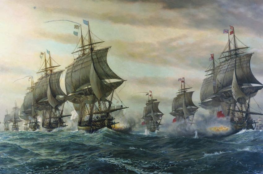
Colonial National Historical Park

As a result of the turmoil, Governor Berkeley was recalled to England, and the Virginia
government reinvigorated the headright system and intensified the campaign against frontier
Indians. Another important effect was the imposition of legal restrictions on Africans living
in the colony, which formalized the somewhat ill-defined institution of slavery. As many black
indentured servants took part in the rebellion, these restrictions were intended to divide poor
whites and blacks in order to prevent future rebellions against the colony’s ruling class. Bacon’s
Rebellion also led to the Treaty of Middle Plantation in 1677, which expanded the number
of tribes classified as tributaries to the English crown and formalized a reservation for the
Pamunkey and Mattaponi Tribes, and is still in effect today.

Introduction of Slavery in the Colony
Africans first arrived in Jamestown in 1619, as slave ships occasionally stopped in the Tidewater
region. With a very short life expectancy for those living in Jamestown in the early years,
the cost of slaves was high in comparison to that of indentured servants. Over time, as life
expectancy rose and an improved economy in England made indentured labor more expensive,
slavery became more prevalent. Between 1650 and 1700, the number of African slaves in
Virginia increased from 300 to 13,000. The laws and norms of slavery evolved as well. Early
slaves faced conditions more similar to indentured servants from Europe and had the ability to
purchase their freedom and become planters themselves. Over the following decades, as the
African population continued to grow and with the experience of Bacon’s Rebellion, slavery
became both a lifelong and inherited status, as it would be for the rest of the colonial era and in
the independent United States until the end of the Civil War.

Jamestown Today
Visitors to Jamestown Island can experience the archeological remnants of Old Towne, the site
of initial settlement that is managed by Preservation Virginia, including the reconstructed James
Fort on the site of the original structure, and view artifacts documenting the origin and history
of the colony in the Voorhees Archaearium. Located on park property are the archeological
remnants of New Towne, the expanded ‘James Cittie’ that reflected its growing importance as a
colonial capital. First investigated and documented by NPS researchers in the 1930s, 1950s, and
2000s, visitors can experience the settlement site through a seamless walking tour between Old
Towne and New Towne, as well as view archeological excavations in progress. Visitors can also
experience the natural landscape of the island through the Island Drive, a 5-mile road system
with two loops that spans the island.

Port of Yorktown
Yorktown was established as a port on the York River in 1691 by an act of the House of
Burgesses. Situated on a deep, narrow bend in the river, Yorktown became the largest
deepwater port between Philadelphia and Charleston and played a key role in supporting
the tobacco-based economy of the Tidewater region. The port collected customs duties and
connected tobacco growers to the complex system of trade that existed between Britain and
its colonies around the world, sometimes referred to as “Triangle Trade.” In general, this
trading network involved the shipment of English manufactured goods to western Africa
where they were bartered for slaves. These slaves were then sold to plantation owners in the
American colonies, and colonial commodities such as tobacco were exported to England
to complete the triangle. This system allowed for trade among multiple groups where there
was a mismatch between the desired imports and exports between any two groups, and
resulted in balanced payments among the participants. At its peak in the middle of the 18th
century, Yorktown had a population of approximately 1,800 people and between 200 and 250
buildings. Many of these structures would be damaged or destroyed by the Allied siege of
British forces at the Battle of Yorktown.

                                                                                                                                     5
Foundation Document
Siege of Yorktown
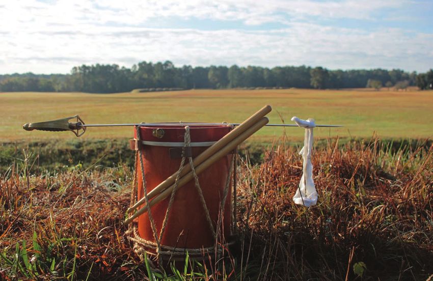
Yorktown is best known today as the site of the last major battle of the American Revolution.
After months in the Carolinas pursuing American forces commanded by General Nathanial
Greene, British General Charles Cornwallis moved his forces into Virginia in May 1781, in
an attempt to force a more decisive engagement against the Americans. Cornwallis moved his
forces to Yorktown in July after receiving orders to locate near a deepwater port. Yorktown
offered the British a superior defensive position against land forces, but left them vulnerable to
a naval blockade or attack.
At the same time, American forces under the command of General George Washington
joined with a French expeditionary force under the command of General Jean-Baptiste
Donatien de Vimeur, Comte de Rochambeau in New York in July. When word arrived that the
French Admiral François-Joseph Paul, Comte de Grasse would bring his entire fleet from the
Caribbean to Chesapeake Bay, it was clear that the French naval force would outmatch any
force the British could muster; more so if the French fleet at Newport under the command
of Jacques-Melchior Saint-Laurent, Comte de Barras joined de Grasse. Presented with
an opportunity to trap Cornwallis, American and French troops accelerated their march
southward toward Yorktown, while feigning movements toward New York City to conceal their
destination from the British.
The French fleet under de Grasse arrived at the mouth of Chesapeake Bay on August 30.
Thousands of French Marines were offloaded to help a small American force on the peninsula
to keep the British confined to Yorktown, and the fleet waited to block any British vessels
attempting to support Cornwallis. On September 5, a British fleet under the command of
Admiral Sir Thomas Graves arrived at Chesapeake Bay, and an engagement between the
British and French fleets followed, which became known as the Battle of the Capes. The battle
was tactically indecisive, but proved to be a key point in the campaign as Cornwallis was cut
off from reinforcement or evacuation. Moreover, the decision by de Grasse to engage the
British in battle allowed Barras to enter the bay with a cargo of siege weaponry in support of
allied land forces.
6Colonial National Historical Park
The American and French armies arrived in Williamsburg on September 14, and began siege
operations against the British position in Yorktown two weeks later. Construction on the first
parallel siege line began on October 5, with Washington ceremonially breaking ground for the
excavation. On October 9, the initial bombardment began, with dozens of siege guns landing
shells on the British fortifications. The siege line steadily crept closer to the British defenses,
and a second siege line was begun on October 11. The second line was completed all the way to
the York River with a night attack on British redoubts 9 and 10, the former captured by French
forces, and the latter taken by American forces under the command of a young Alexander
Hamilton. Once this second siege line was completely closed, the outcome was inevitable,
leading Cornwallis to request negotiations.
Officers from each side met at nearby Moore House to discuss surrender terms, which were
settled on October 19. The British garrison left their fortifications that afternoon, laid down
their arms and marched out with their colors cased. Recognizing the futility of continued
military operations in the colonies, this battle led the British government to enter into peace
negotiations. The Treaty of Paris, signed by both sides in 1783, resulted in formal British
recognition of the independent United States of America, with a western boundary extending
to the Mississippi River.
During the Civil War, Yorktown was once again the site of a military siege, this time involving
Union forces commanded by General George B. McClellan in the Peninsula Campaign of
1862. McClellan’s objective for the campaign was the capture of the Confederate capital
of Richmond, Virginia. After moving inland from Fort Monroe, Union forces encountered
Confederate resistance at Yorktown. Using some of the remaining British earthworks dating
to the American Revolution, the small Confederate force under the command of General John
B. Magruder used clever deception tactics to appear much larger in number to the Union
forces. Believing that he had encountered a large, well-entrenched force, McClellan chose to
begin siege operations, which delayed his advance inland by a month. Significant damage was
inflicted on Yorktown during this period. The delay allowed other Confederate forces to arrive
in the Richmond area to bolster its defenses, and ultimately rendered the Union campaign a
failure. Richmond would not fall to Union forces until April 3, 1865.
Yorktown Today
The park preserves several significant structures
from pre-Revolutionary Yorktown, and a
number of key sites related to the battle including
the French Encampment, Washington’s
Headquarters, French and American artillery
parks, the Allied siege lines and British inner
defensive line, which includes Redoubts 9 and
10, Surrender Field, and Moore House, the site
of the surrender negotiations. This site also
includes the Yorktown Victory Monument,
the French Cemetery, and Memorial Wall,
which commemorates French casualties in the
Yorktown campaign. Located near the second
siege line is Yorktown National Cemetery, where
Union veterans of the Peninsula Campaign
of 1862 are interred. Two loop roads provide
access to these sites, one covering key battlefield
sites and the other covering encampment sites.
Walking paths allow visitors to explore battlefield
resources in more detail and connect the
battlefield to Yorktown itself, offering visitors an
opportunity to experience the atmosphere of a
colonial-era port city.
7Foundation Document
Other Park Units
In addition to the two main park units of Jamestown Island and
Yorktown, Colonial National Historical Park includes several smaller
units with significant roles in the establishment and growth of the
Jamestown Colony and the siege at Yorktown. Swanns Point is across
the James River from Jamestown Island and was the site of early trade
between colonists and American Indians and a cemetery with multiple
graves dating to the 17th century. Gloucester Point lies across the
York River from Yorktown and was the site of British fortifications
that guarded the river narrows. Cornwallis attempted to escape from
his camp at Yorktown to Gloucester Point the day before the British
surrendered, but severe weather thwarted the attempt. Cape Henry
forms the southern boundary of the entrance to Chesapeake Bay and is
the site of a memorial that commemorates the first landfall on April 26,
1607, by the initial 104 colonists who eventually settled on Jamestown
Island. Cape Henry is within the currently operating Joint Expeditionary
Base East, formerly known as Fort Story, which was once the site of an
army coastal artillery battery guarding the bay entrance.
Green Spring is an especially important unit as it recounts the
development of the plantation system in America as well as the legacy
of royal Governor Sir William Berkeley, one of the longest-serving
governors in American history, whose plantation occupied this site.
Berkeley recognized the vulnerability of a single commodity economy
and started efforts to diversify the range of goods the colony produced
for export to England. At his manor at Green Spring he experimented
with a variety of crops and manufactured goods, hoping to lead other
planters by his example. Economic diversification was a key goal for
Governor Berkeley during his administration, which lasted from 1641
to 1652 and from 1660 to 1677. All that persists of his manor house
(subsequently occupied, altered, expanded, and razed by the Ludwell
and Lee families) are the archeological remains, which were investigated
and documented by NPS researchers in the 1950s and 2000s. The site is
not currently open to the public.
Colonial Parkway
Connecting Jamestown Island, Yorktown, and Colonial Williamsburg
is the Colonial Parkway, a designed 23-mile-long road and associated
landscape that physically links the three components of the “Historic
Triangle.” The pavement, a unique concrete poured in jointed slabs and
brushed to reveal a locally sourced aggregate, is intended to mimic the
appearance of the roads of the colonial era. Portions of the parkway are
carefully sited along the James and York Rivers, and the relatively small
amount of visible development throughout the route contributes to a
pleasant driving experience.
8Colonial National Historical Park
Park Purpose
The purpose statement identifies the specific reason(s) for establishment of a particular
park. The purpose statement for Colonial National Historical Park was drafted through
a careful analysis of its enabling legislation and the legislative history that influenced its
development. The park was established when the enabling legislation adopted by Congress
was signed into law on July 3, 1930 (see appendix A for enabling legislation and subsequent
amendments). The purpose statement lays the foundation for understanding what is most
important about the park.
Colonial National Historical Park
preserves and interprets sites and stories
central to the origin and establishment
of the United States of America and the
evolution of American institutions and
identity, including the first permanent
English settlement in North America
at Jamestown Island and the American
victory in the last major battle of the
American Revolution at Yorktown, which
are linked by the historic Colonial Parkway.
9Foundation Document
Park Significance
Significance statements express why a park’s resources and values are important enough
to merit designation as a unit of the national park system. These statements are linked to
the purpose of Colonial National Historical Park, and are supported by data, research, and
consensus. Statements of significance describe the distinctive nature of the park and why an
area is important within a global, national, regional, and systemwide context. They focus on the
most important resources and values that will assist in park planning and management.
The following significance statements have been identified for Colonial National Historical
Park. (Please note that the sequence of the statements does not reflect the level of significance.)
1. American Indians occupied southeast Virginia for more than 11,000 years prior to the
arrival of the first English settlers at Jamestown, provided the new settlers with the
resources necessary to survive, and made lasting contributions to the economy and
society of the region.
2. The founding of the Jamestown Colony as a private venture, the cultivation of
tobacco and evolution of the plantation system at Jamestown, and the development
of Yorktown as the principal commercial port of colonial Virginia reflect the central
role of economics in the establishment and growth of the British colonies of North
America, and highlight their connection to a complex trans-Atlantic trade network that
developed in the 17th century among Britain, its American colonies, and Africa.
3. The labor-intensive plantation system that evolved in Jamestown initially relied on the
forced labor of American Indians and indentured servants, and led to the introduction
of African slaves into the English colonies and the development and growth of the
institution of lifelong, chattel slavery in the United States.
4. As the first permanent English settlement in North America, a new cultural, social,
and political identity emerged at Jamestown as the result of a blending of people
and cultures including American Indians, Africans, and the English. Jamestown is
the birthplace of representative government in English North America, with the first
legislative assembly meeting in the church building in 1619, and served as Virginia’s
capital until 1699.
5. The Green Spring site contains the grounds and archeological remains of the plantation
of 17th-century Virginia royal governor Sir William Berkeley, who strove to diversify
the economy of colonial Virginia through the development of new agricultural and
industrial projects. Berkeley was a key figure in the evolution of American law and the
system of government through the adaptation of English law and institutions, including
the bicameral legislative assembly, to a frontier setting.
10Colonial National Historical Park
6. Strategically located at a narrow, defensible point on the York River, the Village of
Yorktown supported one of the largest deepwater ports in colonial America and
secured a critical navigable connection to the Chesapeake Bay and the Atlantic Ocean.
7. Yorktown is the site of the last major battle of the American Revolution, where French
and American forces under the command of General George Washington laid siege to
and captured the forces of British General Charles Cornwallis on October 19, 1781,
accounting for one-third of the British forces in North America. This victory led to the
Treaty of Paris in 1783, which secured independence for the 13 colonies from Great
Britain and inspired and influenced revolutionary movements around the world.
8. As part of the Virginia Peninsula Campaign of the
U.S. Civil War during March-July 1862, Union
forces under the command of General George B.
McClellan laid siege to a Confederate front that
incorporated British fortifications built at Yorktown
during the Revolutionary War. An elaborate
deception operation conducted by Confederate
General John B. Magruder led to the siege and
delayed the Union advance up the peninsula,
which ultimately forced McClellan to abandon
the campaign and kept the Confederate capital of
Richmond out of Union hands until April 1865.
9. The 23-mile Colonial Parkway is a preeminent
example of American parkway design of the 1930s,
a scenic corridor with views and vistas of the
James and York Rivers that connects Jamestown,
Williamsburg, and Yorktown into an entity known
as the Historic Triangle. Free of modern intrusions,
the Colonial Parkway is intended to evoke
the appearance of roadways of early America,
and influenced the designs of other significant
parkways such as the Blue Ridge Parkway and the
Natchez Trace Parkway.
10. The development of the methodology of modern
historical archeology by NPS archeologists
J. C. Harrington and John Cotter originated from
their work at Jamestown, which was critical to the
discovery, preservation, and interpretation of the
park’s archeological resources. Methodologies
developed within the park are still used in the
United States by archeologists studying historic-
period archeological sites.
11. The reconstructed Swan Tavern in the Village
of Yorktown is the first National Park Service
reconstruction of a historic structure based on an
analysis of the existing original foundation, and was
the model for future NPS reconstruction efforts.
11Foundation Document
Fundamental Resources and Values
Fundamental resources and values (FRVs) are those features, systems, processes, experiences,
stories, scenes, sounds, smells, or other attributes determined to warrant primary consideration
during planning and management processes because they are essential to achieving the purpose
of the park and maintaining its significance. Fundamental resources and values are closely
related to a park’s legislative purpose and are more specific than significance statements.
Fundamental resources and values help focus planning and management efforts on what is
truly significant about the park. One of the most important responsibilities of NPS managers
is to ensure the conservation and public enjoyment of those qualities that are essential
(fundamental) to achieving the purpose of the park and maintaining its significance. If
fundamental resources and values are allowed to deteriorate, the park purpose and/or
significance could be jeopardized.
The following fundamental resources and values have been identified for Colonial National
Historical Park:
·· Jamestown Island. A small, 1500-acre island on the north bank of the James River,
Jamestown was the site of the first permanent English settlement of North America
and served as the capital of the Virginia colony for the first 92 years of its existence.
The island includes the town site, composed of Old Towne and New Towne, which
contains the densest concentration of archeological remains on Jamestown Island. Old
Towne is the 22-acre site of the initial Jamestown settlement and fortification, and is
owned and maintained by Preservation Virginia. This site includes the tower of the Old
Church, the last remaining 17th-century structure on the island. New Towne is the site
of the expanded, platted colonial capital and trading hub that began in the 1620s and
is included in park lands, along with the remainder of Jamestown Island, Glasshouse
Point, and the Neck of Land, which form a combined land area of 1,451 acres.
Jamestown Island was listed in the National Register of Historic Places in 1966.
12Colonial National Historical Park
·· Colonial Parkway. Included as part of Colonial
National Historical Park from its inception, Colonial
Parkway links the key historic sites of Jamestown,
Williamsburg, and Yorktown. The parkway was
designed and constructed between 1931 and
1957, taking inspiration from east coast suburban
parkways and roads built by the National Park
Service in western parks and features curving
alignments, limited access, and careful landscaping
with designed plantings to provide a pleasurable
driving experience. The parkway is 23 miles in
length, 22 miles of which feature a unique poured
concrete pavement that uses local marl (a lime-
rich mudstone) as aggregate, laid down as jointed
slabs. The concrete was brushed to expose the
aggregate, providing an appearance reminiscent of
the roads typical of the colonial era. The parkway
infrastructure includes 21 bridges and overpasses,
some of which are clad in brick veneer evocative of
the colonial revival style, a tunnel nearly 0.25 mile
in length that runs beneath Williamsburg, and an
extensive network of culverts and other drainage
features. The parkway has an overall high degree of
integrity, in part because it has been exempted from
contemporary U.S. Department of Transportation
requirements for lane markers and street lighting.
It is listed in the National Register of Historic
Places, is designated an “All American Road” by
the Federal Highway Administration National
Scenic Byway Program, and awarded a Centennial
Medallion from the American Society of Landscape
Architects, as “…one of the finest parkway
archetypes in the country.”
·· Green Spring. The Green Spring plantation was the home of 17th century Virginia
Governor Sir William Berkeley and the 18th and 19th century residence of the
prominent Ludwell and Lee families. Located 3 miles north of Jamestown, the once-
expansive plantation hosted a number of experimental efforts to diversify the colonial
economy through the cultivation of crops such as rice, flax, and hemp. Many of the
agriculture-related landscape features, such as terraces and drainage structures, are
still present. The current area incorporated into Colonial National Historical Park is
196 acres in size. This parcel contains the archeological and architectural remnants of
two manor houses and a “Gentleman’s House.” The first and second houses were built
by Governor Berkeley, and the second house was inherited by the Ludwell-Lee family
who in 1797 demolished it and constructed a “Gentleman’s House” 300 feet north of
the manor houses. The Green Spring site is also the location of the July 6, 1781 Battle of
Green Spring, where a small American force under the Marquis de Lafayette narrowly
escaped defeat by a superior British force commanded by Banastre Tarleton. The site
is listed in the National Register of Historic Places, and though it has a low level of
integrity as a cultural landscape, it is one of the few 17th-century plantation sites in the
United States with any surviving features. The spring from which the plantation derives
its name still flows freely, just to the southeast of the mansion sites.
13Foundation Document
·· Yorktown Battlefield and Associated Earthworks. The
4,161-acre Yorktown Battlefield site protects significant
resources associated with the battle and siege between
British and Allied forces that ended on October 19, 1781,
and assured American independence from Britain. The
battlefield landscape includes the original and reconstructed
earthworks and redoubts of the British defense lines and
Allied siege lines, numerous artillery pieces, headquarters
and encampment sites of French and American forces, and
Surrender Field, the site where the British surrendered their
forces at the end of the siege. On the eastern edge of the
battlefield is Moore House, built in the 1760s by Augustine
Moore, where British, French, and American officers
negotiated the Articles of Capitulation that ended the siege
and formulated the terms of surrender for the British Forces.
·· Village of Yorktown. The village of Yorktown was first established on the south bank
of the York River through the Port Act of 1691, and served as one of several ports along
the Virginia coast for the regulation of commerce and collection of customs duties.
At its peak, Yorktown was the most important commercial port in Virginia, and in the
present day, the village of Yorktown is a small, active community that maintains much of
its historical integrity. A majority of the structures in the village were destroyed during
the siege of Yorktown in 1781. Many of those structures that survived are included
within the park boundary, including the Nelson House, Dudley Digges House, Cole
Digges House, Somerwell House, Sessions House, Edmund Smith House, and Ballard
House, all of which were built prior to 1760. The Nelson house is particularly notable
as the home of Thomas Nelson Jr., a signatory of the Declaration of Independence,
governor of Virginia, and commander of the Virginia Militia during the Siege of
Yorktown. It is considered one of the finest examples of Georgian architecture in the
state of Virginia. The village of Yorktown also contains the archeological remnants of
the Poor Potter site, the largest industrial pottery of the colonial era in North America,
and the reconstructed Swan Tavern. The village of Yorktown was listed in the National
Register of Historic Places in 1966.
·· Archeological Resources. Colonial National Historical Park protects a vast array of
archeological resources that provide insight into significant historical events and the
daily lives of local inhabitants, spanning a time line of more than 11,000 years from pre-
contact American Indians to the Civil War and beyond. Park lands have already yielded
extensive collections of artifacts that have expanded understanding of the Jamestown
settlement, the development of English colonies in North America, the climactic battle
of the American Revolution at Yorktown, and the Peninsula Campaign of the Civil
War. Important archeological resources include sites and collections associated with
the New Towne settlement on Jamestown Island (ca. 1621–1699); several possible
“Ancient Planter” sites associated with early 17th-century life on the island following
the occupation of the fort; the archeological remnants of Captain William Pierce’s
household dating to the 1620s, which included an African woman named Angela who
was one of the first Africans brought to Virginia; Green Spring, the site of Governor
William Berkeley’s estate dating to the mid-17th century; the Poor Potter archeological
site, which comprises the archeological remains of the largest industrial pottery in
North America of the colonial period; Yorktown Battlefield and Civil War fortifications
and features; and pre-contact and contact period American Indian sites along the York
and James Rivers and their tributaries. Past and ongoing archeological research at the
park results in a substantial and important archeological artifact collection and provides
significant research potential to scholars. This ongoing research in the park allows
the public to experience the archeological process and engage with these important
resources, improving the interpretation of historic events that occurred at key park
sites. It is highly probable that significant in situ resources remain to be discovered.
14Colonial National Historical Park
·· Museum Collections and Archives. The extensive
museum and archival collections of Colonial National
Historical Park preserve items recovered from Jamestown,
Yorktown, and other park lands that are critical to
understanding and interpreting both the key historic
events associated with the park as well as daily life in the
pre-contact and colonial eras. The Jamestown museum
collection includes 17th and 18th century artifacts
recovered from Jamestown and Green Spring sites and their
associated field records. Examples include the Copeland
spoon, a reconstructed bread oven, examples of one of
the world’s largest collections of complete North Devon
slipware, household utensils, ornamental plaster, other
architectural elements, tools, and a ceramic working hole
frame used in the manufacture of glass. The Jamestown
museum collection also includes artifacts that document
the daily lives of pre-contact native populations, including
some of the earliest American ceramics, Clovis points,
and other stone tools. The Yorktown museum collection
includes 17th, 18th, and 19th century artifacts recovered
from Yorktown and surrounding battlefield sites and their
associated field records. Several items are significant in
relation to the American Revolution, including George
Washington’s sleeping and dining tents, Lord Cornwallis’s
campaign table, the Lafayette cannon, and furnishings
exhibited in the 18th century Moore and Nelson houses.
The Yorktown museum collection also contains artifacts
documenting pre-contact American Indian occupation of
the area. The collection also contains a significant amount
of commemorative material. This extensive and important
artifact collection provides ongoing research possibilities
for scholars and other students and supports the park’s
interpretive programs. The park archives include field notes
from the archeological work of J. C. Harrington and John
Cotter, of particular value because these notes support the
current academic study of historical archeology and aid
ongoing archeology research programs in the park.
·· Memorials and Monuments. Several notable memorial
and monument features in the park commemorate
key historic events that occurred on park lands.
These features include the Tercentenary Monument
at Jamestown, completed in 1907 to commemorate
the 300th anniversary of the first permanent English
settlement in North America; the Monument to Alliance
and Victory on the eastern edge of the village of Yorktown
that commemorates the Allied victory over the British;
the French Memorial at the “French Trench” that
commemorates the French soldiers and sailors who
died during the Yorktown campaign; a granite cross at
Cape Henry that commemorates the first landing of the
colonists who established the Jamestown settlement;
and a statue of French admiral Comte de Grasse at Cape
Henry that commemorates the French victory in the
Battle of the Capes.
15Foundation Document
Other Important Resources and Values
Colonial National Historical Park contains other resources and values that are not fundamental
to the purpose of the park and may be unrelated to its significance, but are important to
consider in planning processes. These are referred to as “other important resources and
values” (OIRV). These resources and values have been selected because they are important in
the operation and management of the park and warrant special consideration in park planning.
The following other important resources and values have been identified for Colonial National
Historical Park:
·· Rolling Coastal Plains and Lowlands Ecosystems. Colonial National Historical
Park protects numerous tidal and nontidal wetlands, waterways, grasslands, and
mixed pine and hardwood forests typical of the Tidewater region of Virginia. With 40
distinct vegetation assemblages, these areas provide habitat for a large variety of birds,
fish, mammals, and aquatic and terrestrial invertebrates. The park contains 55 miles
of streams that are part of the James and York River watersheds, both of which drain
into the Chesapeake Bay. The tidal systems found along the shores of these rivers and
tributaries support significant brackish aquatic habitats. Complex geology in these areas
includes karst formations that result in underground aquifers, sinkholes, and perched
water tables, supplying freshwater streams and ponds that provide habitat for diverse
freshwater aquatic species.
·· Civil War Resources Including Yorktown Cemetery. Yorktown played a significant
role in the Peninsula Campaign of the Civil War in 1862, when Confederate forces
fortified the town area, in many cases reusing and expanding the old British earthworks
dating to the siege of 1781, and slowed the advance of a large Union army under
the command of General George McClellan. Confederate forces also constructed
earthworks at four strategic sites on Jamestown Island: Fort Pocahontas, the Sand
Battery, the Point of Island Battery, and the Square Redoubt to guard the approach to
Richmond via the James River. These forces also constructed a causeway connecting the
island to the Neck of Land, which permanently altered the main entrance and exit to
Jamestown Island. Yorktown is the site of a National Cemetery, established in 1866 after
the end of the Civil War, where Union soldiers killed during the Peninsula Campaign
were reinterred from other nearby sites. There are a total of 2,204 burials at the
cemetery, 1,596 of them in marked graves, and of those, only 747 are of known persons.
Yorktown also contains the archeological resources of Slabtown, a village constructed
by and for the large number of refugee slaves who sought the protection of Union forces
during the Peninsula Campaign.
·· Cape Henry. Located on the south side of the entrance to Chesapeake Bay, Cape
Henry is the site where the first Jamestown colonists made landfall on April 26, 1607.
The site also commemorates the Battle of the Capes, a major naval battle between
the British and French fleets that occurred just offshore on September 5, 1781. The
French victory assured Allied control of the entrance to Chesapeake Bay and trapped
the British forces at Yorktown. The site is a small, sandy 0.23-acre area within the
boundaries of the Joint Expeditionary Base Little Creek-Fort Story.
·· Passive Visitor Experience. Colonial National Historical Park offers visitors the
opportunity to create their own desired experiences. The park provides accessible
green space in an area that is experiencing significant growth and development,
placing the park in high demand for individual and organized activities. The park
offers outstanding opportunities for individual recreational activities such as running,
cycling, birding, and fishing. Many special events take place each year, such as organized
runs, bike rides, church events, and retirement ceremonies. These activities provide
alternate ways to experience the varied landscapes of the park as well as opportunities
for engagement with members of the local community, but must be managed so that the
resources and contemplative atmosphere of the park are protected and respected.
16Colonial National Historical Park
Related Resources
Related resources are not owned by the park. They may be part of the broader context or
setting in which park resources exist; represent a thematic connection that would enhance
the experience of visitors; or have close associations with park fundamental resources and
the purpose of the park. The related resource represents a connection with the park that
often reflects an area of mutual benefit or interest, and collaboration, between the park and
owner/stakeholder.
The following related resources have been identified for Colonial National Historical Park:
·· Werowocomoco. Werowocomoco was the home of Wahunsenacawh, also known as
Powhatan, the paramount chief of a network of Algonquian villages that paid tribute
to him in exchange for food, protection, and spiritual support. The first English settlers
who arrived at Jamestown in 1607 encountered members of this chiefdom, engaged in
trade, and ultimately conflict. The 264-acre town site has been purchased by the National
Park Service and will be managed as part of the Captain John Smith National Historic
Trail. Werowocomoco offers significant opportunities for collaborative archeological
exploration and research, which will improve the understanding of American Indians in
the region both before and after contact with the Jamestown colonists.
·· Captain John Smith Chesapeake National Historic Trail. This national historic
water trail follows the route of the historic exploration of Chesapeake Bay by Captain
John Smith, who mapped and documented nearly 3,000 miles of the bay and its rivers
between 1607 and 1609.
·· Washington-Rochambeau Revolutionary Route National Historic Trail. This
national historic trail is a 680-mile-long series of land and water trails used by French
and American forces as they marched from Rhode Island and New York to Yorktown,
Virginia, where they defeated the British forces commanded by Charles Cornwallis and
secured American independence.
·· Chesapeake Bay Watershed. The Chesapeake Bay watershed
is the largest estuary in the United States, with nearly 12,000
miles of shoreline and 100,000 rivers and streams for a total of
64,000 square miles. It is an enormously productive ecosystem,
nurturing 3,600 plant and animal species. The lands of Colonial
National Historical Park border two of the five largest tributaries
of the bay.
·· Historic Fort at Jamestown. Built in 1610 at the initial site
of the English settlement of Jamestown, the remains of the
triangle-shaped James Fort were rediscovered in the 1990s
after having been thought lost to erosion along the bank of the
James River. This discovery unearthed military features of the
fort, its buildings, wells, cellars, ditches, and trash pits. The fort
provides important contextual integrity for more than 2 million
associated objects discovered at the site, with comparison
against surviving historical documents helping to establish
accurate dating for many of the artifacts. The fort and several of
the structures it once contained have been reconstructed and is
part of the area owned by Preservation Virginia and managed
by the Jamestown Rediscovery Foundation, a nonprofit
organization affiliated with Preservation Virginia and the
National Park Service.
17Foundation Document
·· Preservation Virginia Archeology Collection. The Jamestown Rediscovery
Foundation curates a collection of more than 2 million artifacts in the Historic
Jamestown Research Center, which are available for outside research by students and
scholars. These artifacts tell the story of the early settlement and include those related
to early industry, medicine, agriculture, military, and household and personal items. The
center contains a laboratory that processes and preserves newly discovered artifacts
before being stored in a climate-controlled room. Some of the artifacts discovered on
the islands are displayed and interpreted at the Voorhees Archaearium Archaeology
Museum, documenting the early struggles of the first colonists at Jamestown.
·· Jamestown Settlement. Operated by the Jamestown-Yorktown Foundation, which
is part of the Commonwealth of Virginia, the Jamestown Settlement site interprets
life in the early colonial era of Virginia through gallery exhibits, outdoor living history
programs, and replicas of the three ships that transported the first colonists from
England to Virginia in 1607.
·· Fort Monroe National Monument. Fort Monroe National Monument is an NPS
unit. Located at Point Comfort, the southern tip of the Virginia Peninsula, Fort Monroe
was the site of fortifications from the early years of the Jamestown Colony to guard
the channel connecting Chesapeake Bay to the Atlantic Ocean. Fort Monroe remained
under Union control throughout the Civil War and was a place of refuge for escaped
slaves during the war.
·· Colonial Williamsburg. Colonial Williamsburg is a private foundation that preserves
and interprets the historic district of Williamsburg, Virginia, to provide understanding
of daily life in an 18th-century colonial city through a combination of restored and
reconstructed historic structures. Colonial Williamsburg also highlights the era when
the city was the capital of colonial Virginia between 1699 and 1780. A key regional
tourist attraction, Colonial Williamsburg is part of the Historic Triangle, along with
the Jamestown and Yorktown sites of Colonial National Historical Park, which are
connected by the Colonial Parkway.
18You can also read