Celtic Interconnector - Volume 3A Non Technical Summary June 2021
←
→
Page content transcription
If your browser does not render page correctly, please read the page content below

Celtic Interconnector
Volume 3A
Non Technical Summary
June 2021
Mott MacDonald
South Block
Rockfield
Dundrum
Dublin 16
D16 R6V0
Ireland

T +353 (0)1 2916 700
mottmac.com

                                          Volume 3A
                                          Non Technical Summary
                                          Celtic Interconnector
                                          June 2021

Directors: J T Murphy BE HDipMM CEng
FIEI FConsEI FIAE (Managing), D Herlihy
BE MSc CEng, R Jefferson BSC MSCS
MRICS MCIArb DipConLaw, J Shinkwin
BE DipMechEng CEng MIEI, M D Haigh
BSc CEng FICE MCIWEM (British)
Innealtoirí Comhairleach (Consulting
Engineers)
Company Secretary: Michael Cremin CPA
Registered in Ireland no. 53280.
Mott MacDonald Ireland Limited is a
member of the Mott MacDonald Group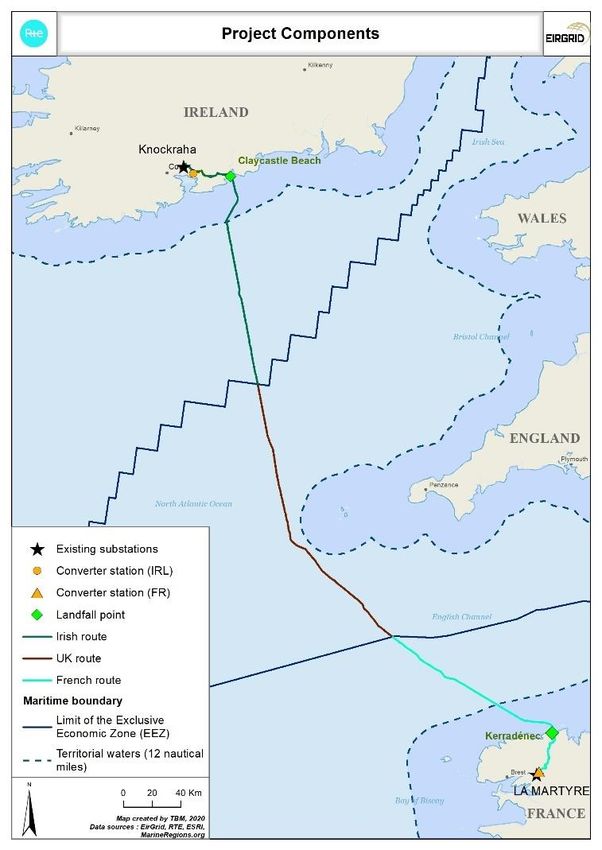
Mott MacDonald | Volume 3A Non Technical Summary                                                                               i
Celtic Interconnector

Document reference: 229100428 | 510 | C

The contents of this publication are the sole responsibility of the author and do not necessarily reflect the opinion of the
European Union

Information class: Standard

 This document is issued for the party which commissioned it and for specific purposes connected with the above-
 captioned project only. It should not be relied upon by any other party or used for any other purpose.

 We accept no responsibility for the consequences of this document being relied upon by any other party, or being
 used for any other purpose, or containing any error or omission which is due to an error or omission in data supplied
 to us by other parties.

 This document contains confidential information and proprietary intellectual property. It should not be shown to other
 parties without consent from us and from the party which commissioned it.
Mott MacDonald | Volume 3A Non Technical Summary        ii
Celtic Interconnector

Contents

        Introduction                                1
        Alternatives Considered                     3
        Project Overview                            7
        Project Need                               16
        Population and Human Health                16
        Air Quality and Climate                    17
        Land, Soils and Hydrogeology               18
        Surface Water, including Flood Risk        18
        Biodiversity                               20
        The Landscape                              25
        Archaeology and Cultural Heritage          25
        Roads and Traffic                          30
        Material Assets                            33
        Noise and Vibration                        33
        Major Accidents and / or Disasters         34
        Interaction of Effects                     34
        Decommissioning Phase                      37
        Cumulative Effects                         37
        Transboundary Effects                      45
        Mitigation and Monitoring Measures         45
Mott MacDonald | Volume 3A Non Technical Summary 1
Celtic Interconnector
Introduction
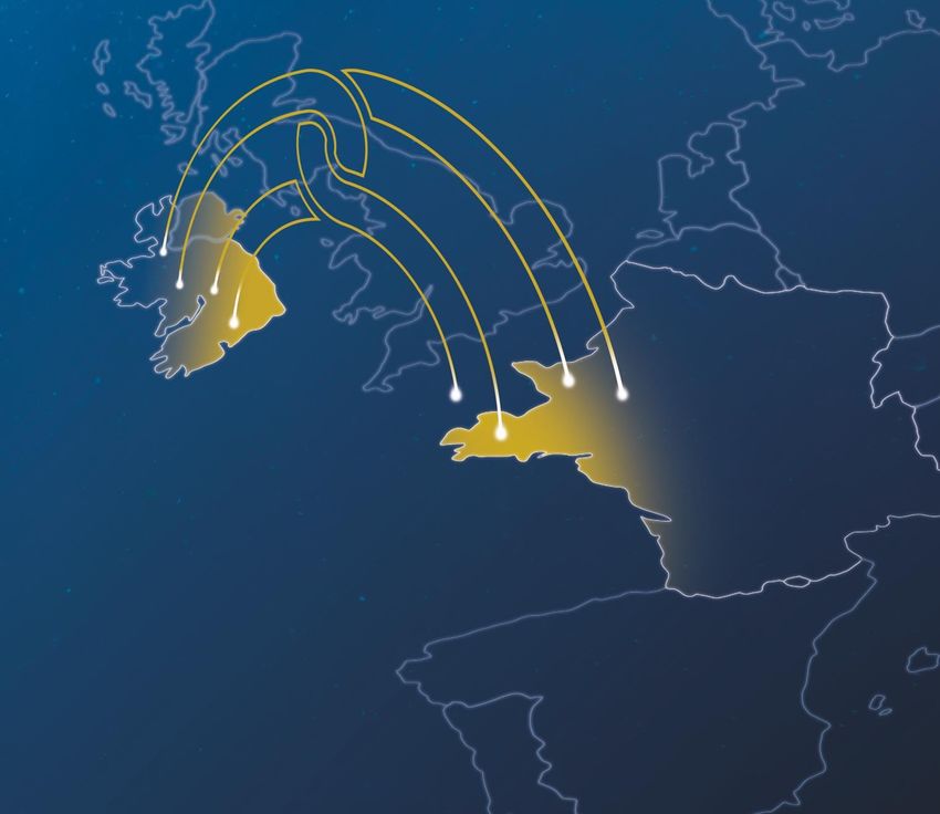
The Celtic Interconnector1 project will create an electrical interconnection between Ireland and
France to allow the exchange of electricity between the two countries. It is being jointly
developed by EirGrid, the electricity Transmission System Operator (TSO) in Ireland, and its
French counterpart, RTE (Réseau de Transport d’Électricité).
Designated as a Project of Common Interest (PCI) by the European Union, the Celtic
Interconnector project responds to European challenges by facilitating progress towards a low-
carbon electricity mix and contributing to more secure, more sustainable and better priced
electricity.
The main elements of the overall Celtic Interconnector project are:
● A High Voltage Direct Current (HVDC) submarine cable of approximately 500km in length
laid between the coast in Brittany France, and the Cork coast in Ireland. The submarine
cable will be either buried beneath the seabed or laid on the seabed and covered for
protection;
● A landfall location in Ireland and France, where the HVDC submarine circuit will come
onshore and terminate at a Transition Joint Bay (TJB);
● A HVDC underground cable (UGC) in both countries between the landfall location and a
converter station compound;
● A converter station in both countries to convert the electricity from HVDC to High Voltage
Alternating Current (HVAC) and vice versa;
● A HVAC UGC in both countries between the converter station compound and the connection
point to the National Grid;
● A connection to the National grid; and,
● A fibre optic link, with associated power supply, will also be laid along the route for
operational control, communication and telemetry purposes.
The key elements of the project are illustrated in Figure 0.1 and Figure 0.2.
Following pre-application consultation between EirGrid and the Irish Competent Authorities for
the onshore element (An Bord Pleanála) and the offshore element (the Foreshore Unit of the
Department of Housing, Local Government and Heritage) of the project, it has been agreed that
Environmental Impact Assessment Reports (EIARs) will accompany the separate consent
applications to assist the Irish Competent Authorities in carrying out EIA for these project
elements.
Volume 3C (EIAR for Ireland Onshore) addresses the proposed development (Ireland Onshore
element of the overall Celtic Interconnector project) between the grid connection point at
Knockraha substation and the area of the High Water Mark (HWM) at Claycastle Beach in
Youghal, both in County Cork.
Volume 3D (EIAR for Ireland Offshore) addresses the proposed development (Ireland Offshore
element of the overall Celtic Interconnector project), between the area of the HWM at Claycastle
Beach and the outermost limit of the Irish Exclusive Economic Zone (EEZ).
This document is a non-technical summary to Volume 3C providing a brief overview of the
associated impacts and mitigation of the onshore elements of the Celtic Interconnector within for
the Irish planning jurisdiction i.e. land–based elements. It is recommended that the planning
drawings (Volume 1B) and the main EIAR document (Volume 3C) are reviewed in order to
1
An interconnector is an electrical transmission connection which crosses or spans a border between countries connecting the
transmission systems of those countries.
229100428 | 508 | C | | June 2021Mott MacDonald | Volume 3A Non Technical Summary 2 Celtic Interconnector obtain detailed information. A Construction Environmental Management Plan, a Construction Waste Management Plan and a Traffic Management Plan are included in Appendix 3.1 of Volume 3C Part 2 (3C2). Information on associated impacts and mitigation of the elements of the Celtic Interconnector within the Irish jurisdiction for the foreshore and offshore elements is available in Volume 3B (the Non Technical Summary to Volume 3D) and Volume 3D (EIAR for Ireland Offshore). Figure 0.1: Celtic Interconnector (Project Overview) Source: EirGrid 229100428 | 508 | C | | June 2021
Mott MacDonald | Volume 3A Non Technical Summary                                             3
Celtic Interconnector

Figure 0.2: The Celtic Interconnector

Source: TBM Consulting Group

Alternatives Considered
The Irish onshore elements of the Celtic interconnector project have been developed in
accordance with EirGrid’s bespoke six-step Framework for Grid Development, as presented in
Figure 0.3.

Figure 0.3: EirGrid Six-Step Framework for Grid Development

Source: EirGrid

229100428 | 508 | C | | June 2021
Mott MacDonald | Volume 3A Non Technical Summary                                                                       4
Celtic Interconnector

In accordance with EirGrid’s Framework, a comprehensive and consistent multi criteria analysis
was applied to decision making at various stages of project development, including in
considering a variety of alternatives. The multi criteria analysis facilitated a balanced
consideration of the following criteria relating to project development.

● Environmental;
● Socio-Economic;
● Technical;
● Deliverability; and
● Economic.
The alternatives considered for the onshore (land) elements of the project are presented in the
reports below which are appended to Appendix 1 of EIAR Volume 3C Part 2. The reports are
also available to view on EirGrid’s project website 2.

● (Marine) Route Investigation Report (Intertek, 2015)
● Feasibility Study - Converter Station Site & Route Identification in Ireland (ESBI, 2016)
● Network Analysis Celtic Interconnector Feasibility Study (EirGrid, November 2016)
● Step 3 Onshore Constraints Report (Mott MacDonald, April 2019)
● Offshore Constraints Report (Wood, April 2019)
● Step 3 Performance Matrix Assessments (EirGrid, Spring 2019)
● Step 3 Preferred Options Report (Mott MacDonald, August 2019)
● Step 4A Consultant’s Development Options Report (Mott MacDonald, November 2019)
● Step 4B Consultant’s Development Options Report (Mott MacDonald, November 2020)
● Route Options Review in the Vicinity of Churchtown (EirGrid, March 2021)
Do Nothing Scenario

Non-implementation of the Celtic Interconnector project would mean foregoing its benefits and
slowing down the development of renewable energy required to combat climate change.

Alternative proposals would likely be developed at the proposed site of the converter station
compound within IDA owned lands zoned for Industrial use at Ballyadam in County Cork.

Connection to the Irish Transmission Network

A Step 2 feasibility study carried out by EirGrid in 2016 considered the substations at Knockraha
in County Cork and Great Island in County Wexford as potential connection points for the Celtic
Interconnector project to the Irish national grid. The analysis undertaken concluded that the
transmission system can accommodate the potential power flows from the Celtic Interconnector
significantly better by way of the connection point at Knockraha rather than a connection point
at Great Island. Knockraha 220 kV substation was subsequently identified as the connection
point for the Celtic Interconnector project to the Irish national grid.

Landfall Options

Following identification of Knockraha substation as the connection point, the following landfall
options in the East Cork area were further considered:

● Inch Beach
● Ballycroneen Beach

2
 Related Documents (eirgridgroup.com) (https://www.eirgridgroup.com/the-grid/projects/celtic-interconnector/related-
documents/index.xml)

229100428 | 508 | C | | June 2021
Mott MacDonald | Volume 3A Non Technical Summary                                                      5
Celtic Interconnector

● Ballinwilling Strand (Western Approach) (BW2)
● Ballinwilling Strand (Eastern Approach) (BW1)
● Redbarn Beach
● Claycastle Beach
Ballinwilling Strand 2, Redbarn Beach and Claycastle Beach landfall location options were
shortlisted for further assessment. Claycastle Beach was chosen as the proposed Irish landfall
for the submarine cable, primarily due to its offshore approach which follows a sediment
channel with sufficient depth to bury the cable and protect it against fishing and shipping without
the requirement for rock cutting or external protection (by way of rock placement).

Converter Station Site Options

Ten general location area options (Converter Station Location Areas) for the siting of the
converter station were initially identified in 2016. A further four general location area options
were identified and considered in 2019. The following seven Converter Station Site (CSS)
options within six shortlisted converter station site zones were identified.

● CSS 1 Ballyadam;
● CSS 6 Leamlara;
● CSS 9A Knockraha;
● CSS 9B Knockraha;
● CSS 10 Pigeon Hill;
● CSS 12 Kilquane (Meeleen); and
● CSS 14 Ballyvatta.
In 2020, having reviewed and considered the outcomes of the assessment process from a multi-
criteria perspective, as well as considering public and stakeholder feedback in respect of the
options, and having undertaken technical, environmental and other analysis of the site options
under consideration, the Ballyadam site was identified for the siting of the converter station.

In presenting this decision, the report cited social and deliverability aspects and management of
challenges through technical and site design. This demonstrates the relevance and importance
of undertaking a multi-criteria approach to project decision-making, as per EirGrid’s Framework
for Grid Development.

Onshore HVAC Route Selection

A HVAC connection is required between the proposed CSS at Ballyadam and the identified
connection point at Knockraha. Given the length of any UGC route along relatively narrow local
roads, and the need for the UGC to cross under the existing live railway line, there are a number
of challenges associated with this HVAC connection. A number of options were therefore
considered, as outlined below:
● A 220 kV UGC in a two cables per phase arrangement.
● A 400 kV UGC.
● A 220 kV double circuit overhead line (OHL) ‘loop in’ plus a 220 kV single cable per phase
  UGC.
The 220 kV “loop-in” was not considered further due to its performance against environmental,
social, technical, deliverability and economic criteria, when compared with the 220 kV and 400
kV UGC options.

The 220 kV UGC option would require a trench width of approximately 2m while the 400 kV
UGC option would require a trench width of approximately 1m.

229100428 | 508 | C | | June 2021
Mott MacDonald | Volume 3A Non Technical Summary                                                      6
Celtic Interconnector

Due to cross-country routing requirements, more hedgerow removal and more drain crossings
would be required to facilitate the 220 kV option when compared with the 400 kV option. As the
majority of the 400 kV option would be constructed in the road it is also preferred from a cultural
heritage perspective. The 400 kV HVAC tail option was subsequently identified for the HVAC
land circuit connection.

Onshore HVDC Route Selection

From an early stage, following identification of Claycastle Beach as the Best Performing landfall
option, it was considered preferable to construct the UGC for the most part on the N25 Cork-
Waterford National Primary Route, given its wide carriageway width and presence of hard
verges, however, there are two key areas where the N25 is constrained and where local road,
or local off-road options were considered. These are:-

● The area west of Churchtown / Two Mile Inn, comprising the built up area of Midleton, and
  further west on the N25 between Midleton and Carrigtwohill for which a significant road
  improvement scheme is planned; and
● The villages of Killeagh and Castlemartyr through which the N25 passes.
Also, from an early stage, the existing disused railway corridor between Midleton and Youghal
was identified as a potential option, in part, for the HVDC route.

The N25 National Road between Carrigtwohilll and Midleton is planned for major upgrading,
including widening to full dual carriageway status, and provision of a new or modified
interchange in the vicinity of the IDA site at Ballyadam. The laying of the cable within the
existing N25 between Midleton and Carrigtwohill would present very significant challenges, as
there is no assurance of how the existing corridor relates to the planned future road corridor in
terms of alignment, design and levels, all of which are critical to the operation of the Celtic
Interconnector. Transport Infrastructure Ireland, Cork Road Design Office, and the Industrial
Development Authority have all raised reasonable concern with regard to the scenario of the
HVDC cables being laid within the N25 corridor west of Midleton.

Bringing the UGC off the N25 through the core built-up area of Midleton would also unduly
impact on this town; particularly in terms of traffic disruption, disturbance and nuisance, and
conflict with existing services.

Routing the UGC through Killeagh and Castlemartyr presents particular issues, summarised
below:

● Castlemartyr is an Architectural Conservation Area. The route would need to cross the Kiltha
  River at the Kiltha River Bridge in Castlemartyr which is a stone bridge listed on the National
  Inventory of Architectural Heritage. The road surface on the bridge is too shallow to install
  the cable route with sufficient cover over the bridge. Navigating the bridge is also difficult
  given the parallel underground utilities at Castlemartyr as well as crossings of underground
  services;
● The Castlemartyr Forest Bridge is also a stone bridge on the N25 with insufficient cover for
  installation of the trench. In this situation, crossing the Kiltha River would require Horizontal
  Directional Drilling (HDD) which may be complex given the density of vegetation and
  apparent depth and width of the water crossing.
● Killeagh is a medieval village and conservation area with a high archaeological potential;
  bridge crossings are listed on the National Inventory of Architectural Heritage;
● The route would need to cross the Dissour River at the Killeagh River Bridge in Killeagh. The
  road surface on the bridge is too shallow to install the cable route with sufficient cover over
  the bridge. Further, the height of the bridge and road surface above the river combined with
  the bend of the N25 at this point means that HDD at this point would be challenging;

229100428 | 508 | C | | June 2021
Mott MacDonald | Volume 3A Non Technical Summary                                                     7
Celtic Interconnector

● There are numerous parallel underground utilities at Killeagh as well as crossings of
  underground services;
● The road in Killeagh has recently been re-surfaced;
● The Killeagh Railway bridge would need to be crossed but it has insufficient cover to install
  the cable to the appropriate depth; and
● The Ballymakeagh More Bridge has insufficient cover to accommodate the trench, and as
  such, an off road crossing of the water course would be required. The width of the water
  course may allow for a culvert, failing which, HDD would likely be required).
In addition to new off-road bridge crossings being required in Killeagh and Castlemartyr, it is
also noted that both villages have undergone urban improvement works over the last number of
years, with resulting construction impacts for the receiving communities, and the provision of a
considerable number of services and utilities in the public road.

The Greenway along the disused Midleton to Youghal railway line is being developed by Cork
County Council. This is occurring under licence, with the ownership of the alignment remaining
with Iarnród Éireann. The infrastructure of the Celtic Interconnector project has an envisaged
lifespan of at least 40-60 years. Over this time, and indeed beyond should that infrastructure be
replaced, the integrity of the infrastructure is of paramount importance. It would be of
considerable significance should the UGC require to be removed to facilitate the future
operation of the corridor as a railway. This scenario cannot be ruled out by Iarnród Eireann, and
this would continue to present a significant future risk to the proposed development should the
HVDC UGC be laid and operated within the existing corridor of the disused railway corridor.
Moreover, it has been confirmed by CCC that the integrity of the corridor is technically
challenging in places for the laying of the HVDC UGC, in terms of its topography, constrained
width, and the presence of natural drainage channels. This has implications for the complexity
of construction methodology for the HVDC UGC, including its design and also the use of what
will be an operational Greenway as the only means of access to the construction corridor. It
must be anticipated that the Greenway would require to be taken out of operation of the
duration of the construction of the HVDC UGC. The Greenway will comprise a tourism and
amenity project for the County; its closure has the potential to have a significant socio-economic
impact. Once laid in the ground and operational, the HVDC UGC cannot be relocated without
significant challenges to the operation of the proposed development. The potential reopening of
this currently disused railway line over the next decades cannot be discounted, as patterns of
settlement, commuting and public transport evolve over this period.

Ballyvergan Marsh

Due to structural constraints associated with the railway bridge to the north of Claycastle Beach,
it is necessary to divert the UGC off road under the proposed Mildleton to Youghal Greenway
(currently under construction).

Approximately 65 metres of the 241 metres of land cable will be installed within Ballyvergan
Marsh pNHA (site code 000078) to the west of the railway bridge. Installation of the cable to the
east of the railway bridge was considered, however, there is insufficient space in the verge to
facilitate the required works.

Project Overview
The Celtic interconnector will connect to the Irish electricity transmission system at Knockraha
substation in County Cork via a High Voltage Alternating Current (HVAC) underground cable of
approximately 11km in length. Alternating current (AC) is the technology utilised on the Irish
electricity transmission network.

229100428 | 508 | C | | June 2021
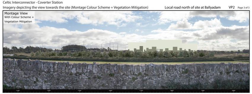
Mott MacDonald | Volume 3A Non Technical Summary                                                     8
Celtic Interconnector

Electricity is best carried over long distances by means of HVDC technology. As such, a HVDC
submarine cable will connect to a HVDC onshore underground cable at a Transmission Joint
Bay (TJB) north of the car park at Claycastle Beach near Youghal in County Cork. The HVDC
onshore UGC is approximately 32km in length.

The majority of the HVAC and HVDC underground cables (UGCs) will be installed within the
existing public road network. Off-road (cross-country) routes are proposed at particular locations
to avoid constraints. In particular, these include:-

● The villages of Killeagh and Castlemartyr will be avoided by means of cross-country routing;
  this will minimise disruption and nuisance for these villages, their residents and communities,
  and for traffic passing through the villages which are both located on the N25 Cork-
  Waterford-Wexford / Rosslare National route.
● North of Claycastle Beach where, due to structural constraints associated with an existing
  narrow railway bridge, it is necessary to divert the UGC off road in the area of, and under,
  the planned Midleton to Youghal Greenway (currently under construction). Approximately 65
  metres of the 241 metres of land cable for this off-road section will be installed within
  Ballyvergan Marsh proposed Natural Heritage Area (pNHA) (site code 000078).
The HVAC and the HVDC UGCs will terminate at a proposed converter station compound on a
brownfield site within the Industrial Development Authority (IDA) development landholding at
Ballyadam, between Carrigtwohill and Midleton, East Cork.

As the name suggests, the converter station will convert HVDC electricity to HVAC, and vice
versa. The converter station compound and ESB substation will measure approximately 3.5
hectares. The converter station compound will measure approximately 250m x 150m and
include three main buildings, the tallest element being up to 25m in height. The compound will
also include associated and ancillary development such as electrical equipment and apparatus,
stores and other buildings, drainage, road and landscaping infrastructure.

Figure 0.4 below illustrates the main elements of the proposals. A representation of what the
structures may look like is presented in Figure 0.5. Detailed mapping is included in Volume 1B
(Planning Drawings) of the SID planning application.

229100428 | 508 | C | | June 2021
Mott MacDonald | Volume 3A Non Technical Summary                                                     9
Celtic Interconnector

Figure 0.4: The Proposed Development

Source: Mott MacDonald

Figure 0.5: Representation of Converter Station Compound at Ballyadam

Source: Macroworks

Laying of Underground Cable

Cable trenches will be excavated (as noted above these will primarily be within or at the verge
of public roads), and ducts will be installed, with the road reinstated. The UGC will be delivered
to site on drums and will be pulled through the cable ducts. Fibre optic cables will also be laid
along with the electricity cables.

229100428 | 508 | C | | June 2021
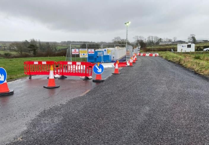
Mott MacDonald | Volume 3A Non Technical Summary                                                    10
Celtic Interconnector

Joint bays (underground chambers) will also be constructed along the cable routes, and are
used to join together (‘joint’) consecutive lengths of cable and to facilitate the cable pulling.
Typically, joint bay separation is between 500m and 850m, depending on the cable supplier,
with all joint bays being located with the cable corridor.

To facilitate traffic management at locations where joint bays are to be located within the
carriageway, the use of temporary passing bays is proposed. These are off-road strips of land
on one side of a joint bay (approximately 50-80m in length), that are cleared and can facilitate
vehicle movements around the joint bay, thereby avoiding or minimising the need for road
closures. The creation of a passing bay is carried out prior to the commencement of joint bay
construction. This will entail removing the top layer of ground to the side of the carriageway
(including hedges where present) and temporarily storing it local to the site for reinstatement
following the works.

The presence of trees on cable routes requires also careful management. The cable route and
joint bays (and by proxy the adjacent passing bays), were, wherever possible, identified in
places which minimised removal of hedgerows and mature trees. For instance by going off-road
to avoid a double line of mature trees over a distance of approximately 0.6 km, between the
R627 and the Greenway, at Roxborough. During periods of low or no rainfall, increased drying
of the soil due to root capillary action may affect the thermal capability of the cable system.

Tree root systems may also cause damage to the ducting system. As a result, it is
recommended (and sometimes imposed by local authorities) that sufficient distance be adopted
between the cable system and trees. For narrow roads, the cable systems may need to be
installed in the centre or may need to switch from one side of the road to another to reduce the
impact on trees and also to accommodate the trench excavation works. If cables have to be laid
in close proximity to trees (within approximately 10m) excavation by hand may need to be
employed which is typically slower than mechanical excavation techniques.

The removal of hedgerows, treelines, scrub vegetation and other vegetation in which birds nest
will not take place from March to August inclusive having regard to the Wildlife Act 1976, as
amended (unless a suitably experienced ecologist has determined that nesting birds are absent
or are otherwise protected from injury or disturbance).

Unless trees and hedgerows pose a health and safety risk or a risk to cable integrity, they will
be replaced post construction with suitable native species, unless otherwise agreed with the
local authority and/or third party landowners.

While the specifics of any cable laying schedule are dependent upon the nature and location of
the project, it is generally the case that cable ducts can be laid in a road at a rate of
approximately 20m - 50m per day. Joint bays, generally located at intervals of 750 metres along
the UGC route of the proposed development (shorter intervals occur where the route alignment
is more complex), are typically installed in 1 – 2 days with the road fully reinstated post
installation. Figure 0.5 illustrates a typical passing bay and operational joint bay.

229100428 | 508 | C | | June 2021
Mott MacDonald | Volume 3A Non Technical Summary                                                     11
Celtic Interconnector

Figure 0.6: Operational Joint Bay with Passing Bay (on the Kilpaddoge Knockanure
220kV UGC Project, Co. Kerry – refer to Section 2.2.3 of the Volume 2A Planning Report)

Source: EirGrid

Cable Crossings

A number of crossings of watercourses, drainage ditches, utilities, railway lines and the Midleton
to Youghal Greenway will also be required along the cable route. These crossings will be
facilitated by either open cut trenching or by use of Horizontal Directional Drilling (HDD) as and
when appropriate.

Open cut water crossings have the potential to generate silt and suspended solids. In order to
reduce the risk of discharging sediment it is proposed to carry out all of these works in a dry
works area. The dry works area will be isolated by installing an impermeable barrier between
the watercourse and the works area. The impermeable barrier will be tailored to the watercourse
in question. Potential techniques include the use of inflatable dams, frame dams or, in smaller
watercourses, sandbags (double-bagged and underfilled; containing only clean washed sand).
Water pumped from the dry works area will be treated using settlement tanks to remove
sediment prior to discharge back to the watercourse. In more sensitive watercourses and in
consultation with Inland Fisheries Ireland, greater filtration of silt may be achieved prior to
discharge, e.g. through use of silt de-watering bags which trap silt and expel only clean water,
and can be left to biodegrade on riverbanks as a habitat enhancement measure.

Water will be conveyed over the isolated section of channel by pumping or the use of a
temporary diversion. Where sufficient capacity is available, and there is no risk of excessive
scour, the diversion will be within the footprint of the existing channel.

229100428 | 508 | C | | June 2021
Mott MacDonald | Volume 3A Non Technical Summary                                                         12
Celtic Interconnector

Where open trenching is proposed, site restoration works will be carried out following
completion of the crossing, in agreement with IFI. These works may include riverbank
stabilization, gravel replacements etc. In all cases, the site will be restored post installation.

Works will not be carried out during extreme rainfall or high flow events. Met Éireann provides a
5-day weather forecast via its website (www.met.ie). The Contractor will monitor this and other
appropriate weather forecasts on a regular basis, at least daily.

Except in exceptional circumstances and with the agreement of Inland Fisheries Ireland (IFI),
any element of the scheme requiring instream works will be restricted to the fisheries open
season (i.e. restricted to July to September inclusive). At a number of specific crossing locations
electrofishing may be required to remove fish under licence from IFI.

HDD technology has been widely used in the oil and gas industries for several decades. It has
become more commonplace in recent times in municipal engineering projects, such as for the
installation of electrical cables, optical cables and potable water pipes. Competent specialist
contractors will be appointed to undertake the work.

The HDD Contractor will conduct the drilling works in a safe and controlled manner with due
regard for site constraints including environmental issues. The Contractor will be required to
ensure that their proposed works do not adversely affect, existing services / utilities,
groundwater / aquifers.

For HDD, the launch and reception pits for the drilling rig requires the temporary installation of a
level hardstanding area on a geotextile base. A pilot hole will be drilled from one side of the
crossing to the other side while supporting the bored hole with bentonite. A comprehensive
closed-loop drilling fluid mixing and circulation system with recycling capability will be utilised to
minimise the volume of fluids required on site. Constant monitoring by the specialist drilling will
be carried out. The volume of cuttings produced will also be monitored to ensure that no over
cutting takes place and that hole cleaning is maintained. The mud returns will be pumped to the
circulation system trailer by means of a bunded centrifugal pump. The nature of the cuttings will
also be monitored to understand the ground conditions as the drilling progresses.

After the initial pilot hole is completed, it will be reamed in a number of passes to reach the
required bore size to enable the cable ducts to be pulled through. To ensure that the prevailing
geological conditions have suitable cohesion that can maintain the bore during the drilling and
reaming process, close attention will be paid by the specialist drilling team to modelled drag
forces during pullback with constant monitoring of load stress undertaken to ensure that
modelled tensile stress, collapse pressures, hoop stress and buckling stress are not exceeded.
In addition to the above measures, the rate of drilling progress will be monitored to assist with
the identification of any voids or changes in strata.

On completion of the works, the stone and geotextile will be carefully removed using a back-hoe
or 3600 excavator and removed off-site to an appropriately permitted waste facility. The site will
then be reinstated to its original condition. Reinstatement will comprise a suitable grass mix on
agricultural land, hedge planting where it has been removed (to be native species-rich of 5
woody species per 30m section), native species-rich wildflower mix on verges or earth banks, or
to the requirements of the relevant authority at that location should these be different.

There are limitations in entry angle and radius of curvature for drilling and often accommodating
these to match favoured ground conditions can be challenging. The advantage with this method
is that a number of standalone cable ducts can be provided as required with suitable separation
to meet the preferred requirement. Unlike other installation techniques, a key advantage of HDD
is that shafts are not required, but only entry / exit transition pits.

229100428 | 508 | C | | June 2021
Mott MacDonald | Volume 3A Non Technical Summary                                                         13
Celtic Interconnector

Where directional drilling takes place within limestone bedrock beneath a watercourse ,
settlement will be monitored at the surface to provide an early warning of any unexpected
stability issues. The Contractor will record the results of such monitoring, and provide these to
EirGrid and the local authority and in accordance with any conditions. If visible settlement
occurs the directional drilling contractor will cease boring, although drilling fluid may still be
circulated if required to maintain the stability of the drilled hole, until remedial measures can be
put in place to stabilise the ground. The remedial measures used will vary depending on the
exact situation encountered but may include switching to an alternative drilling fluid or the
injection of grout.

In addition, the Contractor will monitor river / stream flows upstream and downstream of any
directional drilling of watercourse crossings. The flow monitoring will be undertaken on a daily
basis for five working days prior to the directional drilling, during the directional drilling and for
five working days following completion of the directional drilling. The Contractor will record the
results of such monitoring, and provide these to EirGrid and the local authority and in
accordance with any conditions. If a measurable increase in losses from the watercourse to
ground is observed in the reach where the directional drilling took place, bed lining will be
undertaken if required by IFI.

Laydown areas, where construction materials can be temporarily stored, and construction
compounds, where welfare facilities can be provided, will also be provided along the route.

Connection Point

The connection point is the point at which the proposed development will connect to the HVAC
national transmission grid. The location for this connection point will be the existing 220 kV
Knockraha substation in County Cork.

New Air Insulated Switchgear (AIS) equipment, similar to other bays in the substation., will be
required to be installed. AIS is high voltage electrical equipment which uses the open air as its
insulating medium.

This AIS equipment will consist of busbar disconnectors, circuit breakers, instrument
transformers, transformer disconnectors, surge arresters, post insulators and tubular aluminium
busbar. Three bunded transformers will be installed, while a spare transformer will be retained
within the substation to facilitate immediate replacement should one of the operational
transformers malfunction. The equipment will be installed within the existing footprint of the
substation.

The proposed development at the connection point will be accommodated within the existing
fence line of Knockraha substation.

The existing 220 kV Knockraha substation is in the ownership and management of the
Transmission System Owner, ESB Networks (ESBN). The specific detailed design of equipment
and apparatus at the substation will therefore be agreed with ESBN. A letter of consent to the
making of the application for Approval of the proposed development dated 13 April 2021, insofar
as it includes lands within the ownership and control of ESBN, has been included with the
application particulars.

Converter Station Compound

The proposed converter station will be located in the townland of Ballyadam in the north eastern
section of an overall landholding in the ownership of the IDA.

The overall IDA landholding is approximately 54 hectares and is located between the
settlements of Carrigtwohill and Midleton County Cork. The overall landholding is bounded to

229100428 | 508 | C | | June 2021
Mott MacDonald | Volume 3A Non Technical Summary                                                       14
Celtic Interconnector

the south by the N25 national road and bounded to the north by the Cork to Midleton commuter
rail line.

The site is zoned for industrial use and was formerly intended for the location of the Amgen
biotechnology manufacturing facility. Planning consent for the Amgen facility was granted by An
Bord Pleanála in July 2007 (Refer to Volume 2A of the application).

Prior to 2007, the site was in agricultural use and was largely improved grassland. Following
grant of consent, the site was prepared for development. Extensive clearance of surface
vegetation was carried out (with the exception of the woodland on a knoll to the south of the
site) and substantial earthworks were undertaken. Stone / gravel was imported for roads and
hardstand areas. The preparatory site works were abandoned in ca. 2009 / 2010, and since
then, revegetation has been taking place with grassland vegetation / habitat developing on
calcareous soils in recent years.

The proposed development site now includes Near Threatened plants, and European protected
habitat parcels. Prior to enabling works (and in the appropriate season), these will be moved to
a temporary storage area to be located within a proposed construction compound. Post-
construction, these features will be moved from the temporary storage area to their new
permanent location south of the converter station compound (refer to Planning Drawing
229100428-MMD-00-XX-DR-E-2998).

The site is low lying and is located within an area of known karst (soluble rock) features. Karst
regions typically contain un-mapped underground draining systems with sinkholes and caves.

There are two depressions within the proposed converter station footprint. It is understood that
these were excavated as part of previously permitted ground improvement works and were
subsequently abandoned between approximately 2007 and 2009 / 2010. These depressions
currently collect rainwater and will be infilled to facilitate development of the converter station.
An area of compensation rainwater storage will be developed to replace this storage capacity.
This proposed ‘cut’ could potentially be used to ‘fill’ the existing depressions, subject to
geotechnical and ground investigation studies.

An existing small building will be removed to facilitate the proposed converter station. It is
understood that it was constructed to facilitate the previously permitted development but works
were not completed. The building has an unremarkable interior which over time has suffered
from vandalism.

Due to the ground conditions on the Ballyadam site, it is likely that rotary bored cast-in-place
reinforced concrete piles socketed into rock will be adopted for all foundations on this site.

Specialist and experienced piling Contractors will be employed to carry out any such piling
works. The Contractor will conduct the works safely, in accordance with acceptable industry
practices taking due consideration to constraints specific to the area where the drilling is to take
place. The Contractor will take due consideration to mitigation measures aimed at preventing
adverse effects of the piling regime for example, groundwater / aquifer protection and the
implementation of robust monitoring of the works and an emergency response plan.

The presence of voids would be recognised by an experienced piling operator during the boring
of the piles, prior to concrete placement. In such cases, the piling Contractor will install a
permanent casing (likely a thin steel sleeve) to retain concrete within the pile bore / shaft. This
requirement will be clearly stated in the piling performance specification and contractual
agreements.

As with all construction works proposed, no drilling works will be allowed to commence until the
relevant Risk Assessment Method Statements (RAMS) and pertinent Health and Safety
documents are received from the specialist Contractor and are reviewed and agreed by the

229100428 | 508 | C | | June 2021
Mott MacDonald | Volume 3A Non Technical Summary                                                        15
Celtic Interconnector

Client’s representative. These Contractor documents will include method statements, drilling risk
assessments and environmental management plans specific to the area where the drilling is to
take place.
Additional measures to be outlined in contracts will include, but will not be limited to:

● A minimum of one Geotechnical Engineer and one Resident Engineer will supervise the
  piling works. Supervision of each piling rig will be required.
● The piling operator will be experienced in successful piling within Karst regions.
● Clear lines of communication with defined roles and responsibilities will be maintained
  between the site team, the Contractors and the Design Engineers throughout the works.
● Monitoring of the concrete volumes poured into the pile against the estimated volume that
  the pile requires will be carried out, to ensure that concrete is not being lost into voids in the
  ground.
● Monitoring of piles for potential vertical settlement of fresh concrete; an indicator of potential
  concrete loss.
Outline Construction Schedule and Timing of Works

Subject to the grant of statutory approvals, it is anticipated that the construction phase will
commence in Q4 2022 and construction works will commence in Q1 2023 with the Celtic
Interconnector becoming fully operational by the end of 2026.

Construction activities will gradually phase out from pre-construction to predominantly civil
activities followed by commissioning and testing.

In general, it is anticipated that construction will occur during normal working hours i.e. Monday
to Friday 7 am to 7 pm and Saturday from 7 am to 2 pm. There may be instances where
extended hours / days are required however should working outside these hours / days be
required they will only be undertaken with prior agreement with the statutory authorities.

The following seasonal restrictions will apply:

● Any element of the scheme requiring instream works in watercourses with fisheries value will
  be restricted to the fisheries open season [i.e. will only take place during the period July to
  September), unless with the agreement of IFI]
● For duct installation, restrictions will apply to works in Ballyvergan Marsh pNHA (and
  additionally to vegetation clearance in particular).
● The removal of hedgerows, treelines, scrub vegetation and other vegetation in which birds
  nest will not take place from March to August inclusive having regard to the Wildlife Act
  1976, as amended (unless a suitably experienced ecologist has determined that nesting
  birds are absent or are otherwise protected from injury or disturbance).
The number of construction workers required during the construction phase is expected to peak
at approximately 100 persons for the converter station. Crew sizes for the installation of the
cable routes are estimated at approximately 10 persons per crew.

Subject to the grant of statutory approvals, it is anticipated that the construction phase, including
finalisation of management plans and discharge of conditions, will commence in Q4 2022. The
construction of the converter station, including enabling works and equipment installation, will
take approximately 36 months, commencing in Q4 2022. Installation of the land cables is
anticipated to take approximately 24 months. Overall, construction of the Celtic Interconnector
project is currently anticipated to be complete by 2026. Thereafter, there will be a lengthy period
of testing and commissioning prior to full energisation of the Interconnector. Safety
requirements for the installation operations / procedures and weather condition will however
ultimately dictate the final programme.

229100428 | 508 | C | | June 2021
Mott MacDonald | Volume 3A Non Technical Summary                                                    16
Celtic Interconnector

Construction works will be carried out in line with the Construction Environmental management
plan and the Traffic Management Plan appended to Appendix 3.1 of Volume 3C Part 2.

The following sections provide a summary of the impact assessments presented in Volume 3C
for each topic in turn. Mitigation and monitoring measures are presented separately below.

Project Need
As a Project of Common Interest, the Celtic Interconnector project has been identified as
meeting the criteria detailed in Article 4 of the EU Regulation 347/2013 on guidelines for trans-
European energy infrastructure i.e. the project contributes significantly to at least one of the
following specific criteria:

● Market integration, inter alia through lifting the isolation of at least one Member State and
  reducing energy infrastructure bottlenecks; competition and system flexibility;
● Sustainability, inter alia through the integration of renewable energy into the grid and the
  transmission of renewable generation to major consumption centres and storage sites; and,
● Security of supply, inter alia through interoperability, appropriate connections and secure and
  reliable system operation.
The Celtic Interconnector will:

● Facilitate an increase in the use of renewable energy: an interconnection between
  Ireland and the continent will increase the integration of renewable energy at the European
  level and enable France and Ireland to move forward in terms of the energy transition (in line
  with national policies in respect of the development of renewables);
● Provide security of supply: pooling resources will enable both countries to better cope with
  contingencies and spikes in electricity consumption. Interconnection will promote mutual
  assistance between both countries and will work in both directions;
● Improve European solidarity on energy: the Celtic Interconnector project will be a
  benchmark project in terms of European Solidarity on energy. It will enable Ireland to benefit
  directly from the European integrated electricity market. The Celtic Interconnector will be
  Ireland’s only direct transmission link with another Member State of the European Union;
● Promote the movement of electricity flows at a European level: by promoting the
  movement of electricity in Ireland, in France and throughout all of continental Europe, the
  Celtic Interconnector will enable European consumers to benefit from a more open electricity
  market; and
● Support the development of a more sustainable electricity mix in France and in
  Ireland: The Celtic Interconnector will contribute to European objectives of a low-carbon
  energy future, promoting the development of other renewable energy sources and their
  integration into the European electricity system.
In this context, the project enjoys strong support from both the French and Irish governments,
as well as from the European Commission. Of particular note in this regard, the completion of
the project is specifically included in the current Programme for Government.

Population and Human Health
Electric and magnetic fields, often referred to as EMFs, are produced both naturally and as a
result of human activity. Natural sources of EMFs include the earth’s geomagnetic field and
electric fields from storm clouds. When electric current flows, both electric and magnetic fields
are produced and are present wherever electricity is used, such as in the home, office or farm,
and in the vicinity of equipment that makes up the electricity supply system.

229100428 | 508 | C | | June 2021
Mott MacDonald | Volume 3A Non Technical Summary                                                          17
Celtic Interconnector

A field is defined by the force it exerts on an object placed in it, for example, a gravitational field
is used to describe the force of attraction that the Earth exerts on living beings and objects
situated within its influence.

Electric and magnetic fields can be considered as the regions around electrical equipment in
which these effects can be felt or measured. Electric fields are produced by voltages,
irrespective of how much current is flowing and indeed whether any current is flowing at all.
Magnetic fields are produced by currents, irrespective of the voltage.

EirGrid designs, develops and operates the transmission grid in accordance with stringent safety
recommendations which are made by national and international agencies. Several of these
recommendations come from the International Commission for Non-Ionizing Radiation Protection
(ICNIRP). This is an independent body, funded by public health authorities around the world.
ICNIRP has investigated the safety of EMFs, and provides guidance on safe levels of exposure.
This is addressed in more detail further in this section.

Independent and authoritative international panels of scientific experts have reviewed studies
on possible health effects from EMFs. These have concluded, based on the weight of the
evidence available, that the power frequency electric and magnetic fields encountered in normal
living and working conditions do not cause adverse health effects in humans when properly
designed and constructed. These form the basis for guidelines published by the International
Council on Non-Ionising Radiation Protection (ICNIRP) with regard to EMF, to which EirGrid and
ESB Networks have strict regard in the design and operation of the transmission system.

The proposed development has been assessed as having no significant adverse effects arising
from EMF.

Given the nature of the proposals, the potential for impacts on population and human health are
for the most part associated with the construction phase. Significant adverse impacts during the
operational phase are not likely. There will however be benefits for communities impacted by
the proposals due to the proposed community benefit scheme.

Due to the width of the joint bays and nature of the road network in the area mans that road
closures may be required along the route during the construction phase. Accessibility to private
properties and lands will be maintained at all times during construction, however there may be
potential temporary disruptions. There will be a permanent change in land use due to
construction of the converter station site. There will also be increased traffic in the area
surrounding the site due to construction vehicles and alteration of access tracks. There will be a
temporary negative impact on housing, land use and facilities during the construction phase of
the development as the majority of the HVAC / HVDC cable routes follow the existing road
alignment. Temporary disruption will be transient in nature and impacts will be brief / temporary
in nature.

Construction works at the landfall at Claycastle will result in temporary nuisance in relation to
traffic, dust and noise and restricted movements along Claycastle Beach and the car park
during the construction phase. There will be temporary to short-term negative impacts on
tourism recreation and amenities (such as at Claycastle Beach, and the Midleton – Youghal
Greenway) as a result of the proposals due to severance of access and disturbance.

Air Quality and Climate
A qualitative assessment of construction dust effects has been undertaken for the different
construction activities associated with the proposed development. Across the different
construction activities, the level of risk of dust creating nuisance and/or loss of amenity and
particulate matter (PM10) leading to adverse health effects (without mitigation) is predicted to
range from ‘negligible’ to ‘medium risk’. Following the appropriate implementation of the

229100428 | 508 | C | | June 2021
Mott MacDonald | Volume 3A Non Technical Summary                                                                                 18
Celtic Interconnector

mitigation measures the air quality impacts associated with dust are predicted to be not
significant. As the air quality impacts associated with the proposed development are not
significant and ambient pollutant concentrations are well below the relevant air quality
standards, no exceedances of air quality standards are anticipated.

The greenhouse gases (GHG) assessment considered the embodied carbon of materials used
for construction, transport of materials to site, construction plant emissions, and emissions of
sulphur hexafluoride (SF6). through operation. The total emissions associated with the proposed
development are estimated to be 39,650tCO2e.Implementation of the measures outlined in this
application will contribute towards reducing construction emissions. Considering the Irish
Government’s commitment to net zero by 2050 and the impact all GHG emissions have upon
the climate, any increase or decrease in GHG emissions can be considered to be significant
based on their effect on the global climate 3. Considering the overall benefit of the project to
facilitate development and use of renewable energy sources, lifetime savings of GHG emissions
are anticipated to outweigh the calculated embodied emissions during construction and
anticipated SF6 emissions during operation.

Land, Soils and Hydrogeology
During the construction phase, impacts to land and land use are anticipated to be moderate
adverse but localised and temporary in duration, with land use reinstated where practicable after
the works are completed. Operational phase impacts are anticipated to be minimal due to the
infrequency of maintenance required. Maintenance activities will be carried out predominantly
through manholes where embedded mitigation will ensure that access will result in minimal
impacts. The residual risk to land and land use is therefore considered to be insignificant.

Impacts to soils and geology are anticipated to be adequately mitigated through the
replacement of vegetation and use of compensation storage. The risk to these receiving
environments, once mitigation measures have been implemented, is therefore considered to be
insignificant.

For the majority of receptors within the hydrogeological receiving environment, impacts are
mitigated by design, and therefore the residual risk is considered to be insignificant. Several
boreholes/water wells are in close proximity to the proposed construction works. However, it is
anticipated that the residual risk to these receptors will be insignificant. With the implementation
of the embedded and additional mitigation measures proposed, the proposed development will
not result in a change in status of any Water Framework Directive quality elements or prevent
any groundwater bodies from reaching good status in the future.

A robust Construction and Environmental Management Plan (CEMP) will be in place during
construction to ensure that there are no impacts to groundwater quality during construction.

Surface Water, including Flood Risk
Excavation works, the storage of excavated material, vegetation clearance, crossing of
watercourses and infilling of trenches can pose a risk to surface water quality through surface
water run-off and the release of sediment to watercourses. Ground damage from construction
vehicles and machinery can also cause rutting and increased erosion of soils. Access tracks
used during construction may affect surface run-off patterns, creating alternative flow paths,
promoting erosion and localised flooding. The sensitivity of the receiving surface water
environment ranges from low to very high. The magnitude of adverse surface water quality
impacts in the absence of additional mitigation is expected to be Small to Moderate resulting in

3
    IEMA, 2017, Environmental Impact Assessment Guide to: Assessing Greenhouse Gas Emissions and Evaluating their Significance

229100428 | 508 | C | | June 2021
Mott MacDonald | Volume 3A Non Technical Summary 19 Celtic Interconnector Moderate to Significant adverse impacts of temporary to short-term duration prior to the implementation of additional mitigation measures. A number of unnamed watercourses are required to be crossed within the road network. The drainage patterns associated with watercourses confined to existing culverts will not be impacted significantly as a result of the proposals. Open cut trenching will be carried out in a dry works area. The existence of a temporary impermeable barrier to facilitate open cut trenching will have a direct impact on the cross section of the channel and is expected to give rise to localised but temporary changes in water depth, velocities and sediment erosion/deposition. The proposed activities could result in localised changes to surface water drainage patterns and restrictions to infiltration of rainfall in soils. Given the largely rural locations of the proposed works existing drainage networks are available and any disturbance would be localised and temporary in duration. Surface water contributions would remain unchanged and would likely discharge to the same catchment. Significant construction phase impacts on surface water drainage patterns are not likely. The sensitivity of the receiving surface water environment ranges from low to very high. The magnitude of adverse impacts in the absence of additional mitigation is expected to be Negligible to Small. There could be some localised temporary Imperceptible to Moderate adverse impacts prior to the implementation of additional mitigation measures. All reasonable measures will be taken to avoid unplanned disruptions to water services during the proposed works. This will include thorough investigations to identify and reconfirm the location of all utility infrastructure within the works areas, and the implementation of robust procedures when undertaking works around known infrastructure services. Service disruptions impacting the surrounding residential, social and commercial properties will be kept to a minimum, only occurring where unavoidable. Prior notification of disruptions will be given to all impacted properties. This will include information on when disruptions are scheduled to occur and the duration of the disruption. Consultation with relevant neighbouring parties will be undertaken prior to any proposed disruptions. During the construction phase temporary construction compounds will be required in proximity to the connection point (Knockraha substation), at the converter station (Ballyadam) and at the landfall (the area of the car park at Claycastle Beach). Welfare facilities will be provided at these locations and any discharges will be connected to a sealed holding tank to be emptied and disposed of off-site by a licenced contractor to an approved licenced facility. Water will be tankered onto site as required. Consequently, significant adverse impacts on water services during the construction phase are not likely. The converter station will be unmanned and so foul wastewater will only be generated on days that maintenance crews are present on site. Foul water will be collected in proprietary holding tanks which will be periodically emptied by a licensed waste disposal contractor. A storm water drainage system incorporating SuDS (Sustainable Drainage Systems) features will be constructed to manage the quantity and quality of runoff during rainfall events. Runoff is proposed to be discharged to an existing 600mm diameter storm water drainage pipe which has been laid in the south-west corner of the existing IDA site. A compensation storage area is required and will consist of a below ground and covered storage tank, which will be emptied at a controlled rate via a pumped connection to the storm water drainage system for the proposed converter station access road. It is expected that adverse impacts on surface water quality during operation will be imperceptible. As the cables are solid insulation type there are no sources of pollution and as they are buried, they will not offer a pathway to any surface water receptors. Site restoration works will be carried out following completion of water crossings, in agreement with Inland Fisheries Ireland. These works may include riverbank stabilization, gravel replacements etc. In all cases, the site 229100428 | 508 | C | | June 2021
You can also read