ADVANCES IN GEOPHYSICAL TECHNOLOGY - EXPLORATION TRENDS & DEVELOPMENTS - The ...
←
→
Page content transcription
If your browser does not render page correctly, please read the page content below
EXPLORATION TRENDS & DEVELOPMENTS
                            March 2022

               ADVANCES IN
               GEOPHYSICAL
               TECHNOLOGY

                                         Complimentary
                                         PM #40069240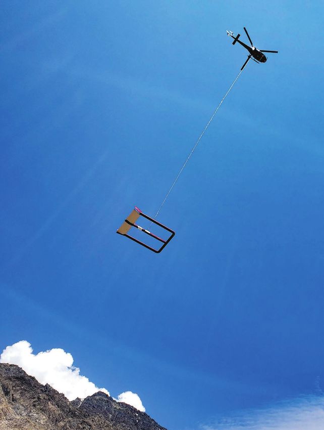
With over 100 years of history,
  Xcalibur Multiphysics is the largest and most capable
               airborne geophysics group
ELECTROMAGNETIC, GRAVITY, MAGNETIC AND RADIOMETRIC
          DATA TO EXPLORE YOUR WORLD

   Xcalibur Multiphysics                     Exploring the world
   www.xcaliburmp.com                  Safer, Clearer, Better
EXPLORATION TRENDS & DEVELOPMENTS
     EXPLORATION TRENDS & DEVELOPMENTS

                                         MINERAL EXPLORATION TRENDS
     EXPLORATION TRENDS & DEVELOPMENTS   AND DEVELOPMENTS IN 2021
      is an annual publication
                                         By Patrick G. Killeen Ph.D., Geophysical Consultant and
   prepared by Patrick G. Killeen
                                         retired Research Scientist, Geological Survey of Canada, Ottawa 2021
          9759 Highway 509
             Ompah, ON
           Canada K0H 2J0
        Phone: (613) 479-2478
   E-mail: pkilleen@xplornet.ca
                                                          T      his is the sixth year that Decennial Mineral Exploration
                                                                 Conferences (DMEC) has served as the patron for
                                                             Exploration Trends & Developments. DMEC organized the very
  Published in co-operation with                             successful Exploration ‘17 conference, held in Toronto in 2017,
        The Northern Miner                                   the sixth in the series of conferences which began in 1967. This
   225 Duncan Mill Rd. Ste 320                               year DMEC support came from the sponsoring companies listed
            Toronto, ON                                      on pages 14 and 15.
             M3B 3K9
                                                               The ETD review originated with the Geological Survey of
      Phone: (416) 510-6789
 E-mail: tnm@northernminer.com           Canada (GSC), where for more than 50 years GSC scientists prepared an unbiased
                                         annual publication on trends and new developments in geophysical exploration
                Editor:                  for minerals. This marks the 30th year that Patrick Killeen has written the
             Trish Saywell               review, originally as a GSC research scientist.
               Writer:                     The Canadian Exploration Geophysical Society (KEGS) was the patron of ETD
          Patrick G. Killeen             between 2007 and 2016. DMEC and KEGS are committed to the promotion of
           Art Director:                 geophysics, especially as it is applied to the exploration for minerals other than
          Barbara Burrows                oil; to fostering the scientific interests of geophysicists; and to promoting high
       Production Manager:               professional standards, fellowship and co-operation among persons interested in
           Jessica Jubb                  this industry.
        Advertising Sales:
           Joe Crofts
        Robert Hertzman
         Michael Winter                   CONTEN TS
            Publisher:
          Anthony Vaccaro
         Printed in Canada.
                                          4 EXPLORATION TECHNOLOGY IN 2021:
         All rights reserved.                 THE REBOUND — ARE WE THERE YET?
  The contents of this publication
 may only be reproduced with the
                                          5 CORPORATE HIGHLIGHTS
written consent of Patrick G. Killeen.
                                          8 AIRBORNE GEOPHYSICAL SURVEYING
                                              Airborne Data Acquisition & Processing
                                              Aeromagnetic Surveying
                                              Airborne Electromagnetic Surveying
                                              Airborne Gamma-ray Spectrometric Surveying
                                              Airborne Gravity Surveying

                                         19 GROUND SURVEY TECHNIQUES
                                              Physical Rock Properties and Elemental Analysis
                                              Ground Data Acquisition and Processing
                                              Drillhole Methods
                                              Ground Electromagnetic Methods
                                              Induced Polarization
                                              Ground Magnetic Surveying
                                              Magnetotelluric

              Cover photo:               26 Companies and Websites
   Geotech’s ZTEM system on survey
           in Peruvian Andes.            26 Abbreviations and Acronyms
             Credit: Geotech

                                         15 Sponsors

                                                                      MARCH 2022 | EXPLORATION TRENDS & DEVELOPMENTS       3
EXPLORATION TRENDS& &DEVELOPMENTS
EXPLORATION TRENDS DEVELOPMENTS
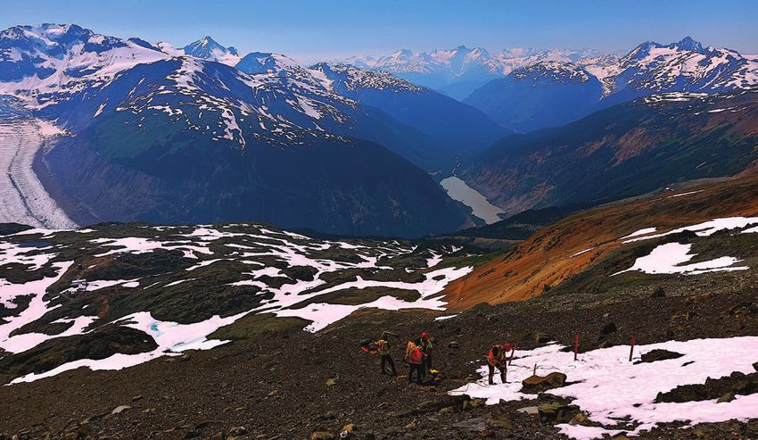
n Terraquest’s newest addition to its fleet, a Piper-Navajo outfitted for magnetic gradient surveys.. CREDIT: TERRAQUEST
EXPLORATION
TECHNOLOGY IN 2021:
THE REBOUND — ARE WE THERE YET?
I n 2021 the level of exploration activity is reported to have
returned to “normal” despite the continued Covid-19 interfer-
ence with field operations. Companies developed procedures
ma-ray spectrometers, and new magnetometers, both onboard
and in towed birds. A new potassium mag was developed for
fixed wing aircraft and a version for drones is in development.
to cope and safely conduct surveys worldwide although opera- A newly developed SQUID Full Tensor Magnetic Gradiometer
tions were somewhat hindered by the shortage of manpower. In became available in its helicopter-borne version. In AEM, new
part, exploration activity was stimulated by increased demand developments included a TDEM system and a passive EM sys-
for “battery metals” used in electric vehicles and other climate tem using LT SQUIDs. In air mag, there is a new horizontal mag-
change inspired innovations. It was also a year of increased netic gradiometer, and a newly developed hybrid gas/electric
mergers and acquisitions, partnerships, strategic alliances drone, aimed at drape flying TEM and MMR surveys. Two com-
and collaboration. Formation of a rejuvenated global airborne panies developed airborne gravity equipment including two
geophysical survey contractor was achieved by combining new versions of strap-down gravimeters, one for fixed wing
capabilities of two companies, one from Africa and one from and the other for UAVs.
Europe. Numerous companies expanded their home offices, For physical rock properties, a new high throughput gam-
others expanded regional offices and some opened new offices ma-ray core logger was developed using a new type of scintilla-
in other countries. Membership in the Canadian industry-led tion detector with twice the density of NaI(Tl). For data acquisi-
research consortium for development of advanced geophysical tion and processing, several companies upgraded their receivers
software grew and is now sustained by nine major mining com- in the field adding more Wi-Fi interfaces and wireless data
panies. Increased exploration activity is evidenced by a survey transfer capabilities including improved and enhanced remote
company reporting a record year and at least three companies processing. One company reported use of new computing
adding new aircraft to their fleet. power that increased their data processing speed by a factor of
Just about all aspects of geophysical exploration technol- 165. New drillhole logging technology includes use of an atomic
ogy saw improvements, upgrades, updates, added features, or clock to eliminate use of synchronization cables in PEM and
enhancements, as well as some completely new developments MMR surveys, a gyro tool, a video camera tool operated with a
in hardware and software. Although R&D continues, several cellphone and Wi-Fi for 360 degree side views, and two IP tools,
developments started in 2020 were lowered in priority as com- one combined with mag and slim enough to log below the drill
panies redirected resources to the increased demand for explo- rods. New ground survey technology includes development of
ration services. R&D in 2020 also led to field testing of prototypes NSEM equipment, field testing of a high-accuracy atomic clock
in 2021 and a few projects were postponed to 2022. Several air- in ground EM surveys, an EM Tx with increased power and effi-
borne data acquisition and processing systems were developed ciency, a 3D resistivity mapping technology for rapid surveys,
with at least two including navigation and there are light-weight improved wireless communication equipment, an IP system
systems for UAVs. Other R&D was reported on spectral IP, on IP that shortens data acquisition time and a combined VLF and
effects in AEM data, on extracting CSEM data from IP surveys and mag instrument for making measurements while walking with-
on improving software and calibration for ground EM. out stopping. New for MT surveys were added features and
Airborne survey contractors added new equipment to their improvements to UMT instruments and software including for
survey fleets including four new MT systems, and a VLF EM remote connectivity and real time data uploading and remote
EXPLORATION TRENDS & DEVELOPMENTS
system. Instrumentation for drones/UAVs included new gam- management of MT surveys. EXPLORATION TRENDS & DEVELOPMENTS
4 EXPLORATION TRENDS & DEVELOPMENTS | MARCH 2022
CORPORATE HIGHLIGHTS                       n   EXPLORATION TRENDS & DEVELOPMENTS

                                           n NSGdrones’s quadcopter with stinger-mounted magnetometer.. CREDIT: NEW-SENSE GEOPHYSICS

CORPORATE HIGHLIGHTS
I n 2021 Aerogeophysica (AGP), a Moscow-based, full service
  airborne geophysics survey contractor completed several
R&D projects and carried out surveys across Russia for resource
                                                                     and gold. Dias moved into their new corporate headquarters in
                                                                     Saskatoon, Sask., expanded their offices in Vancouver and also
                                                                     established a new office in Mexico. Dias Airborne, also based in
exploration, petroleum and government mapping projects.              Saskatoon, reported a busy year with survey activity in Europe
Services include high-resolution magnetic, gamma-ray spectro-        and Canada primarily in exploration for nickel and iron ore.
metric, gravity, EM, LiDAR and aerial photography, which may            Saskatoon, Sask.-based Discovery International Geophysics
be flown in helicopters, fixed-wing and UAVs.                        expanded operations in 2021 with multiple new hires of geo-
   ClearView Geophysics of Brampton, Ont. provides a wide            physicists and senior technical staff and by moving into a new
range of ground geophysical surveys and value-added geophys-         larger facility in Saskatoon to organize and deploy multiple
ical reports that incorporate other pertinent auxiliary geologic     ground and airborne, IP and EM crews to all parts of Canada
and historic (or new) geophysical data provided by the client.       and the U.S. Low-frequency B-field TEM surveying using the
When other datasets such as spectral IP/resistivity, cesium mag-     Supracon (Jena, Germany) Jessy Deep LT (low temperature,
netics, airborne and borehole survey results are combined            liquid helium) and HT (high temperature, liquid nitrogen)
they provide more reliable targeting. Quality control and tar-       SQUIDs, was a sought-after technology, especially to explore
get selection confidence is also improved when, for example,         for new sources of battery metals. Discovery continued to offer
results from different surveys agree. The complete original and      the DIAS32 CVR technology for its Multipole IP surveying tech-
reprocessed auxiliary datasets are provided to the client for dig-   nique, which combines forward and reverse pole-dipole and
ital download from a secure server for up to six months.             pole-pole data acquisition in one pass down a survey line.
   Crone Geophysics & Exploration of Mississauga, Ont.               The company also provides the HeliSAM technology in North
reported a revival of their international borehole and ground        America as an alternative method for rapid airborne reconnais-
geophysical survey work in 2021 as Covid-19 travel and bor-          sance surveying but with the depth of penetration of ground
der restrictions loosened. Advances in software, synchroniza-        techniques because of the large surface transmitter used. To
tion, automation and QA/QC controls during the year resulted         facilitate rapid and safe installation of large transmitter loops,
in increased survey production, better discretization of tar-        its new improved HeliWinder is used.
gets at depth and improved confidence in data quality and               EON Geosciences of Montreal continued to provide airborne
interpretation.                                                      high-resolution magnetic, gamma-ray spectrometric, gravity,
   Dias Geophysical carried out ground surveys in 2021 in            and EM surveys using fixed-wing aircraft and helicopters. In
Canada, the Dominican Republic, Mali, Mexico, Peru, and the          2021, the company again added a Piper Navajo aircraft to its
United States with the main exploration targets being copper         Continued on page 6

                                                                              MARCH 2022 | EXPLORATION TRENDS & DEVELOPMENTS         5
EXPLORATION TRENDS & DEVELOPMENTS

fleet of fixed-wing aircraft.                                           Town, South Africa, continued flying helicopters and fixed-wing
   Airborne geophysical survey company Expert Geophysics                magnetics, radiometrics, gravity and helicopter time domain
Ltd. (EGL), based in Newmarket, Ont., reported a busy 2021.             EM throughout Africa, the Middle East, Australasia and Europe.
To meet the growing demand for MobileMT surveys world-                  The company opened a European headquarters in Spain, to
wide, EGL built four additional MobileMT systems, for a total           become a regional provider of airborne geophysical services
of eight operational units. The company is now operating                for mineral exploration, environmental, groundwater and geo-
two MobileMTm systems, a compact version of the original                technical applications. NRG also added an AS350 B helicopter
MobileMT system, outfitted with two magnetic sensors, config-           and an Airtractor AT504; increasing its fleet of dedicated survey
ured to measure the horizontal gradient of the magnetic field,          aircraft to a total of ten helicopters and four fixed wing.
and one mTEM, time-domain system designed for high-resolu-                 NSGdrones, based in Markham, Ont. was founded in 2019
tion near surface exploration. In 2021, EGL established a subsid-       in a collaboration between the principals of New-Sense
iary in Australia to support exploration projects in that region.       Geophysics (also from Markham) and Tundra Airborne
   Montreal-based Mira Geoscience expanded its integrated               Surveys of St. Catharines, Ont. It offers drone magnetic surveys
interpretation software and consulting services for mineral             using a quadcopter with a stinger-based magnetometer mount
exploration. Its Geophysical R&D Consortium, an industry-led            and a flight time of 50 minutes. The company provides service
geophysical research collaboration following the model of               in both North and South America. In 2021, New-Sense carried
UBC’s Geophysical Inversion Facility, increased its member-             out magnetic and radiometric helicopter and fixed-wing sur-
ship. It is now sustained by nine major mining companies,               veys in Peru, Chile, Argentina, Canada and the U.S.
numerous mid-tiers, juniors, geological surveys, and univer-               Toronto-based Quantec Geoscience has partnered with
sities. The consortium is focused on delivering software and            Australian Geophysical Services (AGS) to provide its deep
methods that make the use of advanced geophysics a day-to-              imaging technologies in Australia. AGS is a new full service geo-
day, practical reality for the industry. Membership provides            physical provider in Australia founded by a former Quantec
corporate licenses to the Geoscience ANALYST Pro Geophysics             manager. AGS will provide TITAN 24, SPARTAN MT and ORION
software platform, which has modelling and inversion capabil-           3D DCIP & MT services. The company has also established
ity, formal interfaces to UBC-GIF and SimPEG codes and inver-           Quantec Brasil Geosciences, based in Brasilia to deliver a
sion of potential fields, resistivity, IP and EM data.                  range of shallow and deep geophysical services for the Brazilian
   New Resolution Geophysics (NRG) headquartered in Cape                market. It continues to provide for download educational webi-
                                                                        nars, on various IP and MT methods.
                                                                           Sander Geophysics Ltd. (SGL) based in Ottawa, provides
                                                                        worldwide airborne geophysical surveys for petroleum and
                                                                        mineral exploration, and geological and environmental map-
                                                                        ping. Its services include high resolution airborne gravity, mag-
                                                                        netic, EM, radiometric, and methane sensing surveys, using
                                                                        fixed-wing aircraft and helicopters. The company reported a
         geophysical solutions, leading technologies                    busy year despite the Covid-19 pandemic, which caused a few
                                                                        projects to be delayed due to local restrictions. The company
                                                                        flew numerous combined gravity and magnetic surveys, com-
                                                                        bined radiometric and magnetic surveys, and combined EM,
     DIAS32 3D IP AND RESISTIVITY                                       radiometric and magnetic surveys, as well as standalone mag-
                                                                        netic surveys for mineral exploration and a radiometric sur-

     QMAGT AIRBORNE FTMG MAG                                            vey for soil mapping. In 2021 SGL was awarded another large
                                                                        survey consisting of over 270,000 line-km of horizontal gradi-
                                                                        ent magnetic and radiometric data to be flown in India for the
     QAMT AIRBORNE PASSIVE EM                                           Geological Survey of India (GSI). This project also includes
                                                                        training and interpretation.
                                                                           Scintrex, based in Concord, Ont., designer and manufacturer
     DIASMT MT/AMT/CSAMT                                                of precision gravity meters and high sensitivity cesium magne-
                                                                        tometers, reported that its CG-6 Autograv gravity meter contin-
                                                                        ued to receive very positive customer feedback and favorable
                                                                        independent technical reviews. Product refinements are con-
                                                                        tinually being added to ensure the highest quality and reliabil-
                                                                        ity. The Sea III Marine Gravimeter System, manufactured by
                                                                        sister company Micro-g LaCoste of Lafayette, Colo., and intro-
                                                                        duced in 2020, is now in operation in many parts of the world.
                                                                        Sea trials have shown that the system performs well in higher
                                                                        sea states. Recent sea trials and surveys in the U.S., France and
                                                                        China have demonstrated that the Sea III can deliver
CORPORATE HIGHLIGHTS                     n   EXPLORATION TRENDS & DEVELOPMENTS

                                                                       and data acquisition (Field Services) parts of the business.
                                                                          Terraquest, of Markham, Ont., has provided high resolution
                                                                       airborne geophysical surveys to government organizations, and
                                                                       the mining and oil and gas exploration sectors for almost 40
                                                                       years. The company flies gravimetric, total field magnetic, hor-
                                                                       izontal gradient, radiometric, proprietary Matrix VLF-EM sur-
                                                                       veys and recently added VLF-EM Resistivity methods. In 2021,
                                                                       a multi-year survey for the USGS was completed. Company-
                                                                       owned aircraft include Cessna 206, Piper Navajo, and a twin
                                                                       turbine King Air C90 with additional fixed wing and helicopters
                                                                       leased as required.
                                                                          On June 30, 2021, Xcalibur Multiphysics completed the acqui-
n Aerogeophysica’s strapdown airborne gravimeter in thermal case       sition of all businesses and assets of CGG Multiphysics from the
ready to install on UAV. CREDIT: AEROGEOPHYSICA                        CGG group. The new combined group, Xcalibur Multiphysics,
                                                                       headquartered in Madrid, Spain, is now a worldwide provider of
                                                                       specialized airborne and marine geophysical services in the min-
sition expanded the portfolios of Bentley and Seequent solu-           eral, petroleum, and environmental sectors. The company offers
tions, enabling their teams to work together to provide more           these services globally from offices in North and South America,
innovative software and services. The group continued                  Europe, Africa, and Australia. Its services portfolio is arguably
its growth trajectory in 2021 with Seequent also acquiring             the largest available in the market for magnetics and radiomet-
Aarhaus GeoSoftware (Aarhus, Denmark) in July. The merger              rics, gravity gradiometry, conventional gravity, and EM, all sup-
has extended Seequent’s product offering by adding AGS                 ported on fixed-wing and helicopter platforms. In addition, the
Workbench, SPIA, Res2DInv, and Res3DInv providing new geo-             company offers marine gravity and magnetics, specialized mod-
physical data processing capabilities to workflows and helping         elling software for the oil and gas industry, remote sensing, and
advance subsurface investigation and modelling.                        data interpretation services. The company is currently undertak-
   2021 was a very active year for Simcoe Geoscience of                ing a number of large airborne mapping projects in Africa, the
                                                                                                        EXPLORATION TRENDS & DEVELOPMENTS

Stouffville, Ont. It started with the launch of a new Calgary office   Middle East, and South America.  EXPLORATION TRENDS & DEVELOPMENTS

and ended in a merger with Hamilton, Ont.-based Geophysics
HM, a well-known geophysical provider for environmental, geo-
technical, geological engineering and mining applications. The
company has developed several strategic partnerships including
with More Core Diamond Drilling Services of Stewart, B.C., giv-
ing Simcoe access to 18 drill rigs; and also with an airborne geo-
physical group. New airborne services include helicopter-borne
triaxial magnetics and TDEM surveys. Complete integrated geo-
physical services with ground, airborne, and borehole capabili-
ties are now offered. By the end of 2021, Simcoe had expanded its
geographic area of coverage adding clients in Africa, the Middle
East and North America. It also conducted R&D to enhance its
processing and interpretation options based on spectral analysis
of Alpha IP time series data.
   SJ Geophysics, based in Vancouver, reported that 2021 was
an exceptionally busy year with surveys completed across the
globe. The company provides ground-based geophysical data
acquisition and consulting services, specializing in 2D/3D DCIP,
EM (surface and borehole), MT, gravity, and magnetic surveys.
R&D has been focused on development of the next generation
Volterra Acquisition System and IP transmitter.
   SkyTEM Surveys headquartered in Denmark, and with
offices in Canada, Africa and Australia, reported a huge rebound
in the airborne geophysics market. Although Covid-19 contin-
ued to create barriers to travel, the company took the opportu-
nity to grow its offices in each region to meet the demand.
   Southern Geoscience Consultants (SGC) is headquartered
in Perth, Western Australia, with consultants based in Toronto,
Vancouver, and Canberra. SGC offers integrated geophysical
exploration and data solutions across the entire resource indus-
try including environmental, geotechnical, and groundwater
applications. Despite the global impact of Covid, the company
reported that 2021 was a record year for both the consulting

                                                                              MARCH 2022 | EXPLORATION TRENDS & DEVELOPMENTS                7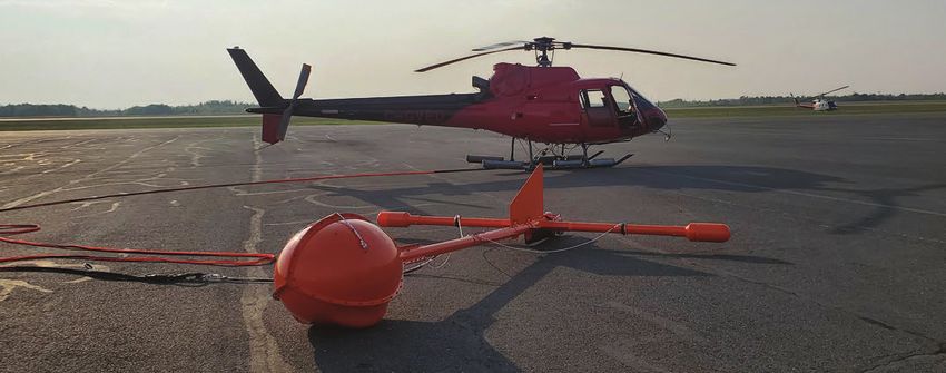
EXPLORATION TRENDS & DEVELOPMENTS

 AIRBORNE
 GEOPHYSICAL
 SURVEYING

                                n NRG’s Xplorer magnetic and radiometric system in Australia. CREDIT: NRG

E   ON Geosciences reported its busiest
    year to date, with multiple crews oper-
ating for the majority of the year flying
                                              data processing, data inversion includ-
                                              ing inverted resistivity-depth models and
                                              interpretation services.
                                                                                              of Atomic Energy.
                                                                                                 Precision GeoSurveys, based in Van-
                                                                                              couver, B.C., specializes in low level air-
several large aeromagnetic, gamma-ray            Worldwide airborne geophysical sur-          borne geophysical surveys in remote
spectrometric, and VLF-EM surveys in          veys and consulting services are offered        and mountainous terrain using a combi-
Quebec for the Ministry of Energy and         by Aurora, Ont.-based Geotech, and its          nation of owned and chartered helicop-
Natural Resources (MERN), in Alberta          subsidiaries Geotech Airborne (Johan-           ters and fixed wing aircraft. High-resolu-
for the Alberta Energy Regulator (AER),       nesburg, SA) and UTS Geophysics                 tion magnetic, radiometric, and EM data
in several U.S. states for the United         (Perth, WA) using its VTEM helicopter           have been collected for clients in Africa,
States Geological Survey (USGS), and          time-domain EM and ZTEM natural field           Asia, Europe, South America, and across
in Norway for the Geological Survey of        EM systems. Also offered are fixed wing         North America in a wide variety of geolog-
Norway (NGU).                                 and helicopter-borne magnetic, radio-           ical environments. In 2021, Precision flew
   In 2021 EGL completed numerous heli-       metric and gravity surveys. In 2021 sur-        EM, magnetic, and radiometric surveys
copter-borne surveys using its MobileMT       veys included a large (>4,800 line-km)          across Canada, in the western U.S., and in
natural field (25 - 20,000 Hz) EM system,     VTEM time domain EM and magnetic                Europe. The company also reported it has
which combines the latest advances            survey for the Ontario Geological Sur-          reduced magnetic noise using new soft-
in electronics, airborne survey sys-          vey and the Ministry of Energy, North-          ware and hardware as well as improve-
tem design, and signal processing tech-       ern Development and Mines (MENDM)               ments to its EM technologies.
niques to produce high quality data. Over     in the Saganash Lake area, near Kapus-             The following projects were completed
50,000 line-km of MobileMT data were          kasing, Ont. A ZTEM natural field EM            by SGL in 2021: another season of com-
collected in Australia, North America,        survey was also commissioned by the             bined magnetic, radiometric and SGFEM
South America, and Asia in exploration        Geological Survey of Sweden (SGU) in            surveys in Ireland, as part of continuing
for gold, porphyry copper, silver, and        northern Sweden. The company contin-            involvement in the Geological Survey of
uranium. Eight MobileMT systems, and          ued a multi-year VTEM survey in parts           Ireland’s Tellus project; and in Canada:
two lightweight MobileMTm systems are         of Rajasthan and Madya states for the           fixed-wing gravity and magnetic sur-
now available for commercial operations       Government of India’s Atomic Minerals           veys for mineral exploration, fixed-wing
worldwide. The company also offers            Directorate (AMD), in the Department            radiometric survey for soil mapping,

8   EXPLORATION TRENDS & DEVELOPMENTS | MARCH 2022
AIRBORNE GEOPHYSICAL SURVEYING                                n   EXPLORATION TRENDS & DEVELOPMENTS

helicopter gravity and magnetic gradi-         by SHA. GT-Grid mapping system takes          wave that provides good resolution of
ent survey for mineral exploration and         full advantage of the measured magnetic       shallow targets; and full streaming of the
a government-funded magnetic gradi-            gradient information. It has been used to     raw data enabling user selection of time
ent, radiometric and VLF survey. Several       process or re-process more than one mil-      gates to optimize processing and interpre-
high resolution helicopter and fixed-wing      lion line-km of gradient data collected       tation. Spectrem has carried out TEM sur-
magnetic and radiometric surveys were          by various airborne survey companies          veys for the Council of Geoscience in the
flown for the USGS to assist in explora-       around the world.                             Northern Cape province of South Africa
tion for critical minerals. In addition,          As a result of SkyTEM’s R&D, a fully       as part of their strategic regional map-
SGL started flying a very large (>800,000      digital version of SkyTEM306 HP with          ping projects, as well as surveys for min-
line-km) magnetic gradient and radio-          several new features was introduced in        eral exploration clients in South Africa.
metric survey in Saudi Arabia.                 2021. The MultiMoment mode combined           The company also began large regional
   In 2021 the Heli-GT georeferenced           with a dipole-moment of 500,000 Am2           and infill surveys for Anglo American in
3-axis    magnetic     gradiometer      sys-   enables the system to deliver high resolu-    southern Angola for mineral exploration.
tem, developed by Toronto-based SHA            tion from surface to large depths of inves-      Terraquest continued to provide fixed
Geophysics, carried out several surveys        tigation in one operation. In addition, the   wing and helicopter geophysical surveys
across North America. Some notable sur-        integrated B-field is particularly useful     in 2021 while dealing with the challenge
veys include: a survey in Nova Scotia to       for mining applications. These new fea-       of providing safe operations during the
identify new gold trends and essential         tures have made SkyTEM306 HP useful           Covid pandemic. Almost 160,000 line-km
structural controls on known regional          for both groundwater and mineral explo-       of data were acquired in North, Central
gold mineralization; a survey in central       ration applications. The company flew         and South America for both mineral
Newfoundland in the Corridor of Gold           globally at capacity in 2021 with a roughly   exploration and government regional
district to map structural lineaments,         equal split between mineral exploration       mapping programs. Two fixed wing air-
key to the placement of high-grade gold        and groundwater programs. SkyTEM              craft acquired almost 60,000 line-km
deposits in the area; and a survey in          officially began a multi-year program in      high resolution horizontal gradiometer
the Timmins mining district of north-          the U.S. in partnership with Ramboll,         and Matrix VLF-EM data traversing the
ern Ontario to map continuity of geol-         based in Emeryville, CA, for groundwater      main strike of the Newfoundland Gold
ogy along strike and identify drill tar-       mapping for the California Department         Rush and an AS350 helicopter equipped
gets. The Heli-GT’s unique combination         of Water Resources (DWR) based in             with a fixed mag boom flew about 25,000
of four high sensitivity cesium sensors        Sacramento.                                   line-km in south-west NL. In South
in a towed bird and accurate pitch, roll          The SpectremPLUS system of Spectrem        America, a record number of high-reso-
and yaw determination allows the mea-          Air (Lanseria, South Africa), was deployed    lution horizontal gradiometer magnetic
surement of total field as well as mag-        on numerous projects in South and south-      and radiometric surveys were flown
netic gradients in the true east, north and    ern Africa during 2021 for geological and     with the King Air C90. In Mexico, about
vertical directions, fully independent of      hydrogeological mapping as well as min-       10,000 line-km were flown with a Bell
the bird orientation. The Heli-GT data         eral exploration. The system has a large      206L4 outfitted with fixed boom magnet-
are collected by the DAQNAV airborne           transmitter dipole moment, allowing the       ics, radiometrics and VLF-EM. In the U.S.,
data acquisition, navigation and mag-          detection of deep targets in conductive       about 65,000 line-km of magnetic and
netic compensation system developed            terrains, a full duty transmitter square      Continued on page 10

                                                                                         www.condorconsult.com

                                                                              MARCH 2022 | EXPLORATION TRENDS & DEVELOPMENTS         9
EXPLORATION TRENDS & DEVELOPMENTS

                                                                                            data (seismic, geologic and drill-hole) can
                                                                                            be used as constraints. The newest mod-
                                                                                            ule uses supervised machine learning
                                                                                            algorithms to predict structural horizons
                                                                                            based on seismic and airborne gravity
                                                                                            and magnetic data.
                                                                                               Geotech further developed its AIIP
                                                                                            (Airborne Inductively Induced Polariza-
                                                                                            tion) Mapping code for its VTEM helicop-
                                                                                            ter-borne time-domain EM data. The new
                                                                                            version of the AIIP code solves for all four
                                                                                            Cole-Cole parameters (ρ0, m, τ, c) (=rho
                                                                                            subscript zero, m, tau, c) based on a half-
                                                                                            space (non-layered) 1D model assump-
                                                                                            tion. The previous version solved for only
                                                                                            three independent parameters (ρ0, m, t)
                                                                                            based on a fixed frequency factor (c). The
                                                                                            new AIIP code provides better curve-fits
                                                                                            of the EM decays, resulting in better accu-
                                                                                            racy of the Cole-Cole parameters.
                                                                                               Mira has added more geophysical
                                                                                            online content to its YouTube channel.
                                                                                            There are now over 50 new how-to and
                                                                                            tutorial videos highlighting the compa-
                                                                                            ny’s earth modelling, interpretation, and
n SkyTEM Surveys’ helicopter and EM loop on survey. CREDIT: SKYTEM CANADA                   data management software.
                                                                                               The launch of Seequent’s Leapfrog
                                                                                            2021.1 (geological modelling application)
radiometric surveys were flown for the         ration. Elsewhere in South America, the      introduced the Geophysics extension, a
USGS. The company added another Piper          company’s Colombian team continued to        powerful new capability supporting the
Navajo to its fleet, for horizontal gradient   map the Andes with magnetic and radio-       import of SEG-Y data, Magnetotelluric
magnetic, radiometric and digital Matrix       metric data. In Africa, there was signifi-   grids and inverse distance-weighted
VLF-EM surveys.                                cant demand for regional aeromagnetic,       interpolation of geophysical data. The
   Xcalibur Multiphysics did significant       radiometric, and gravity surveys for         company’s Oasis montaj core product
airborne survey work in mineral explo-         government clients. Interestingly, these     was updated with new gridding, pro-
ration for battery metals and gold using       were carried out with line spacings nor-     jections and performance improve-
its fleet of magnetic and radiometric air-     mally used for high-resolution surveys.      ments. Extensions have also been
craft, as well as gravity gradient and EM      This is recognition of the value of high     updated, including IP and Resistivity
systems deployed on fixed wing or heli-        quality data and that these surveys will     for better visualization and QC and pro-
copter aircraft. In Australia, despite the     form the framework for future explora-       cessing workflows were updated for
logistical challenges of Covid-19, demand      tion. To meet the exceptional demand in      increased functionality and usability.
for airborne geophysical surveys was           the African region, Xcalibur Multiphysics    Processing speed and quality of air-
very high from government groups and           acquired three additional aircraft to        borne geophysical data were improved
exploration companies. The company             bring its total fleet to twelve.             with the new Airborne QC extension
reported high activity levels for most of                                                   update. Improvements were also made
the year with two Falcon, one HeliFalcon,      AIRBORNE DATA ACQUISITION                    to the Gravity and Terrain Correction
one Tempest, one Magnetic-Radiometric          AND PROcESSING                               Extension algorithms for a more intuitive
and two Helitem systems. In Canada,            Aerogeophysica completed develop-            user interface.
demand for airborne geophysical services       ment and testing of AGDAS, a new data           Spectrem has implemented an
was high in the gold and battery metals        acquisition and navigation system. The       improved sferics filtering routine, which
sectors despite the need for quarantine to     acquisition module logs and displays data    significantly improves data in areas
enter northern communities. The Falcon,        from all devices via the major commu-        where sferics are a problem. This rou-
HeliFalcon, Helitem, and Resolve systems       nication interfaces, including Ethernet/     tine is performed on the raw streamed
were almost continuously deployed,             Wi-Fi and Serial/USB. In real-time, a user   data, as is the reselection of data chan-
with the Tempest system arriving later         can view the flight plan, background         nel times and widths, which allows the
in the year for government work in the         maps and data quality indicators. The        reprocessing of historical data as well.
U.S. Airborne EM dominated activity in         company continued to develop an inte-        Collaboration with Aarhus Geophysics
Brazil with Resolve being used for a large     grated interpretation system with geo-       of Denmark to detect and interpret IP
engineering project, and several Helitem       physical inversions of airborne EM, mag      effects in Spectrem data is ongoing.
surveys being flown for mineral explo-         and gravity data. Additional available          TechnoImaging (TI), based in Salt

10   EXPLORATION TRENDS & DEVELOPMENTS | MARCH 2022
AIRBORNE GEOPHYSICAL SURVEYING n EXPLORATION TRENDS & DEVELOPMENTS
Lake City, Utah, reported a very active released a new version of their ModelVi- acquired in the early nineties. The rock
2021 applying its 3D inversion and imag- sion magnetic and gravity interpretation property information was used to eval-
ing technology to ground (Gradient Array system with improvements to its map- uate targets and prioritize follow up in-
IP, MT, and Magnetic) and airborne ping and imaging system, synchronous vestigations. This AI technique provides
(VTEM, HeliTEM, SkyTEM, HeliFalcon, map zoom and pan, magnetic property, a productivity tool that focuses on the
and Magnetic) survey data. The multi- demagnetization, labelling, anisotropy shallowest magnetic unconformity and
physics data can be interpreted sepa- and vector relationships, QuickDepth supplies information on depth of cover,
rately, and jointly inverted, generating and RockMod. A new suite of CET per- magnetic susceptibility, the presence of
3D conductivity, chargeability, density, ceptually Uniform Colour tables provide remanence, possible magnetite destruc-
magnetic susceptibility, and magnetiza- alternative colour scales for geoscien- tion zones and quality ratings for the
tion vector (which considers remanence) tists who have difficulty perceiving co- property estimates. The results can be vi-
shared earth models. Examples of appli- lour contrast in standard LUTs. LUTs can sualised in 2D and 3D as point cloud data-
cations include mapping Banded Iron be designed conveniently with the Co- sets or converted to a 3D solid model of
Formations containing gold in Brazil, lour Table Editor, which produces LUTs the interpreted surface. RPD Mapping is
porphyry copper and tar sands in the compatible with PA Explorer, ER Map- applied to magnetic tensor data, which
U.S., gold and base metals in Canada, cop- per and Oasis montaj. In 2022 the import is computed from conventional mag-
per, gold, and silver in Australia, gold in tool will be extended to include spheres, netic survey data. The magnetic tensor
Ghana and geothermal sources in Japan. circular pipes and elliptic pipes. An au- provides 3D information that makes it
Technolmaging has extended its method to-recognition system has been designed possible to apply AI techniques for the
of IP data inversion based on the gen- to take a large dataset generated by the direct recovery of high-resolution geolog-
eralized effective-medium theory of IP Tensor Research-developed rock prop- ical models of the basement surface over
effect, to airborne EM, making it possible erty and depth mapping system known large survey areas. It has been applied
to simultaneously invert airborne data as RPD Mapping. The mapping system to full tensor magnetic data acquired by
for 3D distributions for both conductivity results from the Cloncurry district in Spectrem Air using the Supracon full
and chargeability in areas where there is Queensland Australia, recovered com- tensor magnetometer system and may
an IP effect. pact rock property and depth informa- now be applied to data acquired by the
In 2021, Sydney-based Tensor Research tion from 67,000 line-km of survey data Continued on page 12
The Gravity Specialists
222 Snidercroft Rd Concord ON Canada L4K 2K1 1 888 219-9566 www.scintrexltd.com
scintrex@scintrexltd.com
MARCH 2022 | EXPLORATION TRENDS & DEVELOPMENTS 11EXPLORATION TRENDS & DEVELOPMENTS
n Expert Geophysics’ newly developed MobileMTm system with horizontal magnetic gradiometer. CREDIT: EXPERTGEOPHYSICS
Dias Airborne, QMAGT full tensor mag- Unimaster, an ultra-lightweight mag- Supergrad GSMP-20S3 which presently
netometer. netometer system with high-sensitivity has a sensitivity of 0.01pT. Also cur-
rubidium vapour sensors. Four chan- rently in development is DRONEmag, a
AEROMAGNETIC SURVEYING nels allow measurement of magnetic gra- miniaturized mag sensor that will weigh
Aerogeophysica (AGP) completed a dients and a fluxgate sensor is used for 500 g. At less than half the weight of the
number of combined magnetic and real-time compensation. The magnetom- already proven GSMP-35U(B) AirBIRD,
radiometric surveys targeting gold using eter can be used with UAVs, fixed wing the soon to be released 1.5 kg Cardinal
a new light aircraft. It has a 32 L gam- aircraft and helicopters. bird has 1pT sensitivity, +\-500pT head-
ma-ray detector and a magnetometer in Dias Airborne’s QMAGT SQUID-based ing error and 0.1nT absolute accuracy.
a stinger to perform low-flying surveys full-tensor magnetic gradiometer (FTMG) All of GEM’s Potassium systems are capa-
for high-resolution data. In 2021 AGP system surveyed over 12,000 line-km ble of sampling at up to 20 Hz (standard)
flew customized octocopters in low-level across Canada in 2021. The signal to noise and can now be upgraded to 100 Hz by
combined UAV surveys using a UAV- level of the system was reduced by a fac- software and to 1000 Hz using software
borne spectrometer with a CsI detector tor of two through improvements to the combined with supporting hardware.
and a towed-bird magnetometer. To cre- mechanical damping system. In 2021 RMS Instruments of Missis-
ate the survey plan, a detailed DTM was Markham, Ont.-based GEM Systems sauga, Ont., introduced a new, low-cost
first made from an aerial photography is developing an optically pumped data acquisition system for high-reso-
survey. The company also released the Potassium magnetometer system for its lution magnetometry, aimed at appli-
cations that do not require real-time
compensation of platform effects. The
➠ DAS52 Aeromagnetic Data Acquisition
For fixed wing & Logging System features the interface
gradient or and processor for two Cs magnetometer
Heli mag airborne inputs, an embedded dual-frequency GPS
survey, we provide receiver supporting L-band corrections,
our services on a: embedded barometric pressure and tem-
perature sensors, and ancillary data cap-
➠
➠ Daily basis ture via high-resolution differential ana-
➠ Partial contract basis log inputs and high-speed Ethernet with
• Petrophysical data acquisition and analysis multiple independent logical connec-
• Geological review andforward modelling
➠ Full contract basis
tions. Proprietary electronics and firm-
Try Us!
• Specialty 2D and 3Dsurvey planning
• Supervision and QA/QC of data acquisition ware ensure perfect synchronization of
the magnetometer inputs, critical in gra-
• 2D and 3D modelling and imagery
Flux Geophysics Limited
• Geological integration and interpretation
3-304 Stone Road W, Box 416 diometer applications. The light, com-
• Target generation and prioritization
Guelph Ontario pact and low-power package is designed
• Drillhole database management
Canada N1G 4W4 to meet the strict requirements of UAV
www.terraresources.com.au
(519) 362-5307 - (519) 767-1767 installations. Continuing R&D by RMS on
Barry Bourne the DAARC500-family of aeromagnetic
BSc (Hons), FAIG, MSEG, MAICD
Principal Consultant Info@fluxgeo.com systems includes proprietary hardware
+61 409 493 485 | b.bourne@terraresources.com.au
www.fluxgeo.com interfaces, improved tools for analysis of
5/51 Forsyth Street, O’Connor, Western Australia, 6163
12 EXPLORATION TRENDS & DEVELOPMENTS | MARCH 2022AIRBORNE GEOPHYSICAL SURVEYING n EXPLORATION TRENDS & DEVELOPMENTS
calibration data sets, and flexible connec- signal to noise and the navigation sys- East, demand for the XMAG system was
tivity to ancillary sensors and instrumen- tem permits extremely accurate flying. strong with surveys being carried out
tation. For magnetic anomaly detection Spatial resolution and signal-to-noise in Uganda, Togo, DRC, Benin, Zambia,
(MAD) new algorithms were developed ratios improve dramatically when fly- Zimbabwe and South Africa in 2021.
for efficient real-time estimation of a ing height is reduced. Low-level data pro-
target’s location and magnetic moment vides significantly more detailed infor- AIRBORNE ELECTROMAGNETIC
based on multiple triggers (or “passes” mation for kimberlite detection, base and SURVEYING
near the target). The technology is being precious metal exploration, litho-struc- Aerogeophysica launched its new-
developed in prototype form for the com- tural and geo-hydrological mapping, and est time-domain EM helicopter system
pany’s UAV-targeted aeromagnetic com- mine planning. In Africa and the Middle Continued on page 14
pensation systems. This RMS technology
for UAV aeromagnetics was used success-
fully in Autonomous Underwater Vehicle
applications.
SGC has been following the develop-
ments in UAV-acquired magnetics over
the past few years and has now assessed
and processed magnetic data from more
than ten UAV systems globally. The com- Discovery Geophysics, known as the leader in innovation for geophysical
pany reported that demand for its aero- exploration, is evolving into the drone market to assist clients to collect data
magnetic interpretation training is high in the “ missing zone” between the ground surveys and airborne surveys.
with seven two-day short courses sched-
uled for delivery by mid-2022. S k yf ront P erim eter 8 H yb rid Drone
At Spectrem Air, development of the
SQUID Full Tensor Magnetic Gradiometer
is ongoing. The system developed with - Hybrid battery + gas engine drone
IPHT and Supracon is now available - 17 kg drone weight
for helicopter boom and bird surveys. - 7 kg payload capable
The project to fully implement the hor- - 4 hour flight time
izontal cryostat system on a fixed wing - Stable flight
platform continues. Data processing - Long telemetry range
and interpretation using routines from - Manufactured in SIllicon V alley
Tensor Research as well as the SimPEG
inversion routine implemented by MIRA
Geoscience, showed very good correla-
tion with drilling results. These routines - UAS Deployable Magnetometer
Geom etric s M a g Arrow
allow mapping of complex magnetic fea- - Weighs only 1 kg
tures, even in terrains where magnetic
- Can be easily attached to Skyfront
remanence is prevalent.
- GP S, storage and WIFI on board
In 2021 Terraquest acquired an RMS-
- Fly faster, up to 10 m/ s with samples
AARC510 Adaptive Aeromagnetic Real-
every 1 cm
Time Compensator system and a new
AS350 Survey (TRI) Boom Array from
- Filters out drone motor noise
Lake Central Air Services based in - 2 hours of battery life, hot swappable
Gravenhurst, Ont. The system flew 17,000 - Superior Data Quality
line-km of high-resolution magnetic sur-
vey in southwest Newfoundland at 25m
altitude and 30m line spacing. Drilling W ing tra One P hotog ra m m etry Drone
has confirmed gold mineralization using
geological and structural mapping based
on the system data. - take
V ertical take-off and landing for
The Xcalibur Multiphysics XMAG dense spaces
system, comprised of wing-tip mounted - Fully Automatic – Safely collects
magnetometers combined with state- user
hundreds of acres with simple, user-
of-the-art spectrometers, is flown with friendly inputs
a customized Air Tractor aircraft at a - Immediate access to georeferenced
very low survey altitude. This combina- High-R
High esolution Images
tion allows high-resolution data acquisi- - DSM data output for other drone
tion in a variety of survey environments. surveys
The aircraft are degaussed to improve
MARCH 2022 | EXPLORATION TRENDS & DEVELOPMENTS 13EXPLORATION TRENDS & DEVELOPMENTS PATRON SPONSOR GOLD SPONSORS
AIRBORNE GEOPHYSICAL SURVEYING                                n   EXPLORATION TRENDS & DEVELOPMENTS

named HoriZOND. It is equipped with a          the magnetic field. The MobileMTm bird        borne time-domain EM system which uses
high power transmitter and a fully digital     is towed on a 55 m longline below a heli-     a controlled source primary field. It is used
three-channel receiver, which has a new        copter. It is designed to provide apparent    for detailed near surface (0 - 50 m) investi-
suspension system increasing the signal-       resistivities from near surface to depths     gations and is believed to be the only sys-
to-noise ratio. The transmitter base fre-      of several hundred metres, together with      tem in the industry able to record clear
quency is 12.5/25 Hz. The system can be        total field and horizontal gradient mag-      data in industrial areas with EM noise.
easily reconfigured to suit different geo-     netic data. The MobileMTm system was             The exploration come-back in 2021
logical environments. The first commer-        successfully tested over known kimber-        kept Geotech’s crews fully engaged in
cial survey with the HoriZOND system           lites in Ontario. In 2021, the company flew   surveying and limited its time for field
was completed in 2021. The company             surveys with mTEM, its innovative air-        Continued on page 16
also continued to improve its frequen-
cy-domain EM system, which is effective
for mineral exploration in resistive envi-
ronments due to its high sensitivity to
small variations in resistivity. The latest
version may be towed beneath any heli-
copter, however the most common con-
figurations are fixed to a specific helicop-
ter or fixed-wing aircraft.
   Dias Airborne introduced QAMT (air-
borne MT), a passive EM system that uses                           EXPLORATION TRENDS & DEVELOPMENTS
LT SQUID sensors to measure the x, y, and
z B-field components. The ability to use
these three low-noise components indi-
vidually in the processing provides higher
resolution results. Full base rotation data                 SILVER SPONSORS
including three-component B-field and
two-component E-field datasets can be
combined to produce a range of imaging                            Condor North                 Planetary Geophysics
products that have industry-leading reso-                          Consulting
lution and depth search capability.                                                              Radiation Solutions
   Discovery offers the HeliSAM (Heli-                          DGI Geoscience
                                                                                                      RockBottom
borne sub-audio magnetics) technology
for hybrid ground/airborne TEM and
                                                             Instrumentation GDD                      Geosciences
MMR surveys in North America in an                              Mira Geoscience                           Scintrex
agreement with Brisbane-based Gap
Geophysics Australia. Discovery’s pat-                          Nuvia Dynamics                       SJ Geophysics
ented HeliWinder is used to deploy
transmitter wire 90% faster than tradi-
                                                                              Paterson, Grant and
tional ground wire deployment meth-
ods with corresponding added safety. A
                                                                              Phoenix Geosphysics
new improved lightweight HeliWinder is
50% lighter and can handle up to 750 kg
of wire from a large helicopter or a light
load if operated from a smaller helicop-                 BRONZE SPONSORS
ter. The HeliWinder is particularly use-
ful in mountainous and heavily forested
terrain. Working with Saskatoon-based
                                                                       AGCOS                     Precision Geosurveys
Dragonfly, an established drone manu-                         ClearView Geophysics                  RMS Instruments
facturer, the company has developed a
                                                                        EMIT                       Sander Geophysics
state-of-the-art hybrid gas/electric drone,
with the ultimate objective of drape fly-                        Eon Geosciences                     SkyTEM Canada
ing low speed, low frequency, TEM and                                 Geonics                        Technoimaging
MMR HeliSAM surveys.
   EGL initiated commercial surveys with                     Ideon Technologies Inc.                 Tensor Research
its newly developed MobileMTm system,                            MPX Geophysics                    Zonge International
which is a lighter version of the MobileMT
bird with two Geometrics 822A magne-                                                New Resolution
tometers, separated by 4 m, configured                                               Geophysics
to measure the horizontal gradient of

                                                                             MARCH 2022 | EXPLORATION TRENDS & DEVELOPMENTS            15
EXPLORATION TRENDS & DEVELOPMENTS
cal features and deployment options,
Tempest, Helitem and Resolve. The
Tempest fixed wing time domain EM sys-
tem, combines high quality, fully cali-
brated EM mapping with the efficiency of
a fixed wing aircraft. To meet the grow-
ing global demand for Tempest surveys,
Xcalibur Multiphysics is building two
additional Tempest systems, with fab-
rication and construction started in the
third quarter of 2021 with systems to
be operational in 2022. In Australia, the
Tempest system continued to work on the
regional coverage of the AusAEM series
of surveys for Geoscience Australia. To
date it has been contracted to fly over
210,000 line-km across six Australian
n AusAEM surveys from 2017 to 2021 showing over 210,000 line-kms of Xcalibur Multiphysics’ states. In 2021 two surveys flew over
Tempest data over six states in Australia. CREDIT: XCALIBUR 40,000 line-km in the Goldfields region
of Western Australia and the Eastern
testing R&D projects, which are now underground surveys. To meet increas- Resources region bordering QLD, NSW,
rescheduled for release in 2022. These ing demand for near-surface environ- VIC and SA. These projects illustrate the
developments include a new high speed, mental and hydrogeological applica- suitability of Tempest for large regional
full waveform, Streamed Data Acquisition tions, SGC now has in-house electrical scale mapping. The system returned to
System for its VTEM TDEM systems, a resistivity imaging (ERI) capability with the U.S. in late 2021 to continue hydro-
new generation VTEM TDEM transmitter, the acquisition of an ABEM Terrameter geological mapping along the Mississippi
and its next generation Blackbird TDEM system. floodplain of various southern U.S. states.
system prototype. In terms of natural Spectrem Air upgraded its EM receiver The Helitem2 system uses a square trans-
field EM systems, the company contin- system to include full tracking of the mitter wave which enables early off-time
ued development and testing of its new receiver sensor position and orientation, measurement and effective energizing
ZTEM Lite receiver with modular aero- as well as new enhanced data acquisition. of deep conductive targets. It can oper-
dynamic design and its next generation The upgrades include a revised suspen- ate at base frequencies as low as 6.25
ZTEM 3D system that combines its AirMT sion to lower noise levels caused by sen- Hz due to an upgraded receiver system.
prototype and full 3-axis AFMAG tipper sor movement and improved electronics Currently Helitem2 is the only helicopter
measurements in the 22 to 30,000 Hz fre- to reduce electronic noise of the system. time-domain EM system operating com-
quency band. Based on increased demand for VLF mercially at this low base frequency. In
SGC’s Field Services now include data acquisition, Terraquest commis- Australia in 2021, two Helitem2 systems
four crews offering surface and down- sioned the design and production of a completed surveys in four states includ-
hole EM, passive seismic, and ground second generation, proprietary digital ing in the Julimar region for nickel-cop-
magnetic data acquisition. Demand for Matrix VLF-EM system using circuitry per-platinum group elements (PGE), in
field crews, particularly EM, in Western and techniques adapted from current the Pilbara Region for iron ore, in the
Australia has been very high due to both EM signal research. It is fully tuneable Paterson region for copper-gold and in
increased exploration and Covid-related and can monitor up to four frequen- South Australia, Queensland and New
interstate travel limitations. Downhole cies, recording full parameterization of South Wales for base metals. Helitem
EM crews are operating from both sur- the VLF-EM signal including total field surveys were conducted in several prov-
face exploration and active underground amplitude, vertical ellipticity (proxy for inces and territories of Canada mostly
mining operations. Additional high-pow- quadrature), planar ellipticity, tilt angle for mineral exploration, nickel being the
ered transmitters and DigiAtlantis DHEM ellipse (proxy for in-phase), Tipper coef- most common target due to the very low
probes have been purchased to meet ficient and azimuth to VLF transmitter. base frequencies of the Helitem and some
demand. SGC was an early investor in the These data have now been successfully hydrogeological mapping. In Brazil, sev-
development of LoupeTEM, a state-of- inverted to produce well defined and eral Helitem surveys were completed for
the-art moving-loop EM profiling system coherent resistivity products, corrobo- mineral exploration in the states of Mato
for high-efficiency surveys of electrical rated by IP and drilling. Final products Grosso and Para. The Resolve frequency
conductivity. It has many applications in include resistivity maps, depth slices, domain airborne EM system provides
geotechnical investigations such as dam vertical sections, 3D databases and vox- accurate near-surface resistivity infor-
and tailings storage facility seepage map- els in Geosoft format, allowing user mation, which is particularly important
ping and monitoring, water quality and selected visualization of the 3D model for for engineering applications and water
depth to groundwater assessments, shal- enhanced interpretation. exploration, as well as gold exploration
low conductor mineral exploration and Xcalibur Multiphysics offers three in resistive environments. It is well suited
geological mapping, grade control and EM technologies with unique techni- to operations in very rough terrain due
16 EXPLORATION TRENDS & DEVELOPMENTS | MARCH 2022AIRBORNE GEOPHYSICAL SURVEYING n EXPLORATION TRENDS & DEVELOPMENTS
to its low weight and geometry. A large
engineering project was flown with
Resolve in Brazil and it was also deployed
in Canada, and the U.S.
AIRBORNE GAMMA-RAY
SPECTROMETRIC SURVEYING
In 2021, Radiation Solutions Inc. (RSI) of
Mississauga, Ont., continued to develop
and manufacture the most widely-used
gamma ray spectrometers worldwide.
Successful investigations using the
RS-530 (formerly known as DDS-3) UAV-
mounted spectrometer, have resulted in
increased interest in this technology for
numerous applications. The RS-530 uses
a 3”x3” (0.39L) NaI(Tl) detector and spec-
trometer assembly weighing only three
kg. It offers enhanced GPS configurations,
records K, U, Th, TC and full spectrum
(2048 channels) data, allows numerous
data file formats, and supplies altitude
corrections embedded in the data analy- n Conducting mag sensor pre-survey QC check with SHA Geophysics’ wireless DAQNAV 3D
sis software. During the summer of 2021, system. CREDIT: SHA GEOPHYSICS
the British Columbia Geological Survey
(BCGS) successfully conducted numer- Carolina Piedmont across the coastal plain For the first time in Russia, a multi-pa-
ous geological mapping surveys using the and flood plains to the Atlantic Ocean. The rameter commercial survey was carried
RS-530. The BCGS will present the results radiometric surveys were used to deter- out combining airborne gravity with EM,
at the 2022 AME Roundup in Vancouver. mine the source of critical minerals and radiometric and magnetic sensors. The
In 2021 Terraquest completed its final their transport routes, depositional sites, newest strapdown gravimeter makes it
year of horizontal magnetic gradient and plus reworking and re-deposition along possible to fly with full drape for EM and
radiometric surveys for the USGS in sup- the Atlantic (details are in Geological gamma-ray spectrometric surveys. AGP
port of its multiyear “GAP” mapping proj- Society of America 2021 publication GSA has also upgraded its GT airborne gravi-
ect. Merged with previous surveys to the Today, Vol. 31 No.11). meter by updating the sensitive gravity
west and east, encompassing parts of element, built-in program, gyros and elec-
Missouri, Illinois, Indiana and Kentucky, AIRBORNE GRAVITY SURVEYING tronics in a gyroscopic stabilization plat-
the data are part of ongoing scientific At the beginning of 2021, Aerogeophysica form. This modification is named GT-3A.
studies for crustal plate tectonics, earth- tested performance of its new strapdown NRG announced a major new devel-
quakes, environmental and critical min- gravimeter by test flights with the well- opment; the NxT generation airborne
eral assessment. On the east coast, the known GT gravimeter. The new device gravimeter. A new laser ring gyro strap-
USGS released results and interpretation showed comparable accuracy and toler- down Inertial Measurement Unit (IMU)
of two, contiguous radiometric and hori- ance of disturbing accelerations. Due to its gravimeter has been commissioned,
zontal magnetic gradient surveys flown by compact size and relatively light weight, after an extensive test program, by NRG
Terraquest, totalling about 94,000 line-km the strapdown gravimeter was installed Exploration in South Africa. The NxT
stretching from the foothills of the South on a heavy UAV for the first test flights. Continued on page 18
EXPLORING OR MINING ORE?
BE MORE PROFITABLE USING GDD INSTRUMENTS TO FIND, EXTEND and EXPLOIT IT!
IP Transmitter Tx4 IP Receivers Determine physical properties with GDD portables
Up to 10kW-9600Vpp in Master/Slave Up to 32 channels. Upgrade to
mode for high quality readings even Multi-Rx for higher definition SCIP Tester MPP Probe
in highly resistive environments. at greater depth.
gdd@gdd.ca www.gdd.ca +1 418 - 877 4249
MARCH 2022 | EXPLORATION TRENDS & DEVELOPMENTS 17You can also read