15 Blackrock Merrion Core Bus Corridor Emerging Preferred Route Public Consultation February 2019
←
→
Page content transcription
If your browser does not render page correctly, please read the page content below
Blackrock              Merrion
Core Bus Corridor
Emerging Preferred Route
Public Consultation February 2019

                                    15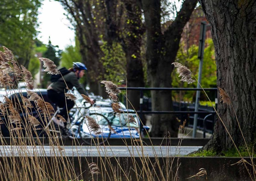
BusConnects Core Bus Corridors
1
15: Blackrock > Merrion
Contents
1. Introduction 2
1.1 Background 2
1.2 Why does Dublin need a core bus corridor network? 3
1.3 What is BusConnects Dublin? 5
1.4 What are the benefits of this project? 6
1.5 What does the core bus corridor project entail? 8
2. Emerging Preferred Route 10
2.1 The Emerging Preferred Route for Blackrock to Merrion 10
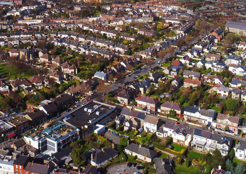
2.2 Blackrock to Merrion 10
2.3 Key Facts 11
3. Challenges and Mitigations 12
3.1 The Challenges 12
3.2 Potential Impacts 12
3.3 How we will address those challenges 12
4. The Process for the Acquisition of Land 16
4.1 How the project will progress 18
5. How to take part in the public consultation 20
5.1 Potential impacted lands 20
5.2 General queries 20
5.3 How to Engage 20
6. Appendices 22
6.1 Index map 23
6.2 Route maps 24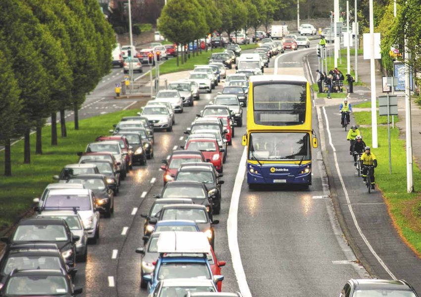
BusConnects Core Bus Corridors
            2
                15: Blackrock > Merrion

                1. Introduction
SECTION 1

                1.1    Background                                           Separately in July 2018 the Dublin Area Bus Network Redesign, which
                                                                            is the redesign of bus services, started its first public consultation
                In June 2018 the National Transport Authority (NTA)         phase. Around 30,000 submissions including signed petitions and
                                                                            online survey responses were received by the end of September.
                published the Core Bus Corridors Project Report. The        Over the coming months all of these submissions will be reviewed
                report was a discussion document outlining proposals        and assessed. Following that process a revised network design will be
                for the delivery of a core bus corridor network across      published during 2019 for a second public consultation. It is envisaged
                Dublin. It set out the vision for the provision of 230kms   that the implementation of the final network will take place in 2020.
                of dedicated bus lanes and 200km of cycle lanes/tracks      The network redesign can be implemented on the existing road
                                                                            network with some enhancements at key interchange locations.
                on sixteen key bus corridors.
                                                                            The public consultation for the sixteen radial core bus corridors will
                            Continuous bus lanes and cycle tracks           now take place on a phased basis from November 2018 until May
                                                                            2019. Each phase will be for a set number of corridors to be consulted
                                                                            on over a period of months. These public consultations phases will be
                                                                            the start of a detailed process of engagement and communication. All
                                                                            of which will take place prior to detailed designs being finalised and
                                                                            planning permissions sought.

                                                                            This document is one of a series of sixteen, each dedicated to a single
                             230kms                  200kms                 core bus corridor. The document provides a written description of
                                                                            the emerging preferred route from start to finish with supporting
                          of continuous           of cycle tracks/          route maps. It explains the step by step process for engagement
                           bus priority            lanes provided           and consultation for potentially impacted property owners and
                                                                            the general public. It also outlines the process for planning and
                                                                            construction of the core bus corridor network including expected
                                                                            timelines.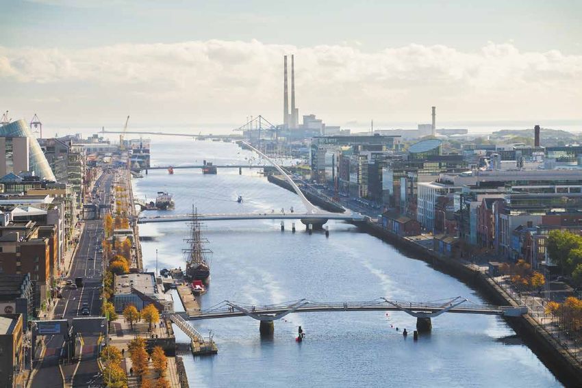
BusConnects Core Bus Corridors
                                                                                                                                                        3
                                                                                                                              15: Blackrock > Merrion

                                                                                                                                                            SECTION 1
1.2 Why does Dublin need a core                                           ĤĤ The bus system can deliver – We need to invest in the bus
                                                                            system because the bus system is the main component to meet
    bus corridor network?                                                   our future transport needs. A good bus system has the reach and
ĤĤ Congestion – Congestion is one of the most significant                   flexibility to service all the new housing developments, business
   challenges facing the Dublin region and needs to be addressed            parks, hospitals, colleges and retail shops across Dublin. It is a
   to safeguard the growth of the Dublin region and keep people             proven solution and is the main form of public transport across
   moving. Ireland’s economic recovery from the recession is                Dublin with 67% of public transport journeys each day made by
   seeing significant increases in the number of people working             bus. The bus system carries three and four times the number of
   and travelling across Dublin. The number of commercial vehicles          people who travel on Luas or Dart and commuter rail.
   continues to rise as does the number of tourists. The commuter
   areas surrounding Dublin continue to spread and grow in a low
                                                                                         Forecast Population Growth in Dublin Region
   density manner. Growth areas can only be served in the short and
   medium term by the bus as opposed to long-term projects such as
   rail and Luas.                                                                                      1.5
                                                                                                                           25%
   At present bus lanes are in place for less than one third of a bus                                                    increase
   journey on the busy corridors. This means buses are competing                                       1.2

                                                                               Population (millions)
   for space with general traffic and so are affected by the increasing
   levels of congestion.
                                                                                                       0.9
ĤĤ Growing Population – It is predicted that the population for                                               1.2          1.5
   the Dublin region will grow 25% by 2040, bringing it to almost                                            million      million
   1.5m for the region. This huge growth in population has to be                                       0.6
   accommodated with a quality public transport system.

                                                                                                       0.3

                                                                                                        0
                                                                                                              2016         2040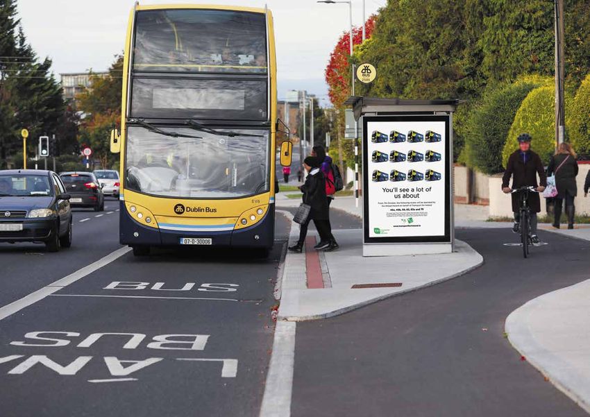
BusConnects Core Bus Corridors
            4
                15: Blackrock > Merrion
SECTION 1

                ĤĤ People want to cycle – The core bus corridor project is not              Dublin Canal Cordon 2017 Statistics - 7am to 10am
                   just about the provision of bus lanes. Under this project we will
                   also deliver 200km of segregated cycling infrastructure to make
                                                                                                     211,416
                   cycling safer and more attractive than ever before. This initiative is            people crossed the canal inbound between 7.00am and 10.00am.
                   the foundation of the overall cycle network for the Greater Dublin
                   Area.
                   Commuting to work by bicycle has increased by 43% since 2011.                     Over half                                         107,160
                                                                                                     of all journeys into the                          people came into
                   Again this growth represents a clear choice that people are                       city in the morning are                           the city centre by
                                                                                                     now made on public                                using bus, train or
                   making to cycle. This project will support that trend and is a                    transport.                                        Luas.
                   vital component of creating a sustainable transport system for
                   people across Dublin. Safe cycling facilities across the 16 key bus
                   corridors will provide people, families and their children a suitable
                   environment to cycle where they want and when they want                           12,447                                            25,000
                ĤĤ People want to use public transport – The need to build                           people cycled in.
                                                                                                     The highest number
                                                                                                                                                       people walked in.
                                                                                                                                                       Mode share for
                   a core bus network is being driven by increases in congestion                     ever.                                             walking is 11.8%.

                   and also by the significant shift of people choosing to use public
                   transport. People want to use it and should have a reliable and
                   efficient bus system to travel on. Based on 2017 canal cordon
                   figures over 70% of people travelling into the city each morning                  70%                                               Private cars carried

                   do so by sustainable transport modes and mostly by bus. Cars                      used sustainable                                  under
                   only account for 30% of travel into the city centre each day and
                                                                                                     modes.
                                                                                                                                                       30%
                                                                                                                                                       of people for the
                   therefore the amount of road space allocated to sustainable                                                                         first time.
                   transport needs to reflect that position.

                                                                                                     The more people use                               Public transport also
                                                                                                     sustainable modes of                              reduces the amount
                                                                                                     transport, the less                               of greenhouse gases
                                                                                                     congestion.                                       and other emissions.
BusConnects Core Bus Corridors
5
15: Blackrock > Merrion
1.3 What is
SECTION 1
BusConnects
Dublin?
E XECUTIVE SUM MARY
er Service Strategy 2: Simplify Radial Figure 8: Existing Network. Multiple routes from each
corridor cross the city centre in different directions.
P&R
Services UsingDublin
BusConnects Spines
to Airport
of service categories to Figures 8 and 9 show a schematic of the existing and proposed
ons in usefulness. For is Ina themajor investment
radial networks.
Ballymun
existing system, most radial corridors are served by to
m all-day services. These programme to
ent services from infre- a pile of overlapping routes, each of which goes to a different Bla
nc
ha
Artane
rd
corridor on the opposite side of the city. This provides direct sto
wn
Finglas
work, and can form the service between many places, but each of the individual routes is
rmation.
er frequency services
improve public
not very frequent, so wait times are long.
The proposed strategy would put just a single line, called a
Phoenix
Park
transport in Dublin.
to Lucan /
be easy to identify, spine, on each radial corridor, but would run this service very Liffey Valley
frequently. Service would come every 4 to 8 minutes all day,
Ringsend
a diversity of purposes.
so that the next bus is coming whenever you need it. This also ĤĤ Building a network of newCrumlin
ĤĤ Develop a state-of-the-art ĤĤ New bus stops and shelters
means you could change from any spine to any other with little
It aims to overhaul the delay, so that trips across the city would still be easy. Again, total bus corridors to make Harold’s
Cross
ticketing system. with better signage and
travel times are faster because the waiting time saved by the high
current bus system in Dublin journey's faster and more information.
ĤĤ Implementation of a
to
frequency is greater than the time spent on the interchange.
Bla
to
ck
De
reliable.
ro
Rathgar UCD
c
an
k
ĤĤ Provision of bus based
sg
through a 10 year programme cashless payment system.
ran
ge
of integrated actions to
simple map of just its high frequency services, so that people can see ĤĤ New network of cycle lanes/ Park and Ride sites in key
g Figure 9: Proposed Network. Each corridor has a single ĤĤ Simpler fare structure.
deliver a more efficient, tracks.
frequent line crossing the city centre on a single path.
TO AIRPORT
& SWORDS
TO
MALAHIDE
locations.
GOUIN PERRAS 49
-BAPTISTE
reliable and better bus system
71e AVENUE
RODOLPHE-FORGET
33 48
ARMAND-BOMBARDIE
PERRAS
SAINT-JEAN
LÉGER
MAURICE-DUPLESSIS
48
LANGELIER
48
53
MAURICE-DUPLESSIS
R
42
e
49
e
AV
69
AV
.
.
ER
LÉG
44 187
for more people.
HENRI-BOUR Y
ASSA MARIE-VICTORIN IGN
69 BALLYMUN
MONTMORENCY NT
URASSA
BLANCHARDSTOWN
HENRI-BO MO
DE LA CONCORDE
69 139 33 DE
LACORDAIRE
49 CLONGRIFFIN
48 CLARE
REY
LAR
HALL
PIE-IX
DU
67 33
TR
ICE
132
BOMBARDIER
HOWTH
NT
EN
BEAUMONT
RIES
AIR
JUNCTION
CARTIER RAI E
FINGLAS
S-P
E
NDE TUR
32
44
GRA COU UE A L L
A L L
DES SQ
LAN
121 -LÉ
VE
E D
GELI
69 NÉ
TO
LACORDAIRE
DE
VIAU
VÉ
MA
SAU RE
ER
141
L'AC
RIE
69 193
DU
DART
N
A L L
HOWTH
RO
ADI
139 B
SAIN
CH
E
ER
BROOMSBRIDGE
HENRI-BOURASSA
45
T-M
GOUIN N
ALO
DES
KE
ICHE
N-T OO
JEA
DES
BR
GA
L
PAP
WHITEHALL
ER
LER
SH
ORM
SA
INEA
RAS
IES
OU
141
GRENE
EAU
187
-D'
I-B
U
NR
33
AN
X
HE SAUVÉ
L.-
RY
JOU
JAR
T
A L L
H.-
171 TOLKA
LA
136 A
FO
64 67
NT
18 VALLEY
A L L
AIN
N
PIE-
55
BIE
F
E
AU
LAN
121
BE
193
IX
JUL
EL N
44
ALO
GEL
AN
ES
AB N-T HONORÉ-BEAUGRAND
JEA
-PO
CH
IER
CRÉMAZIE
RAD
VÉ
ITR
CLA
SAU
141
AS
ISS
SA
RK
ON
INT
SAINT-MICHEL
RADISSON
ZIE
-LA
IN
139
CAVEN
MA
197 ERT
UR
18
NE
80
CRÉ
JEA
EN LANGELIER UB
EN
E CO
JARRY
NN
NS TUR
DISH
T
171 DE LA CÔTE-VERTU
THIME E-D
E-M
RY D’IBERVILLE RR
LUCAN
NT
121
JAR EMO PIE
AN
CÔTE-VERTU CADILLAC
ROS
CE
FABRE
VIA
55
DE
U
33
CAD
45 O
ILL
BLO
JEAN-TALON N
AC
DE CASTELNAU UBIE
OM
32
DU COLLÈGE BEA
HA
ASSOMPTION
FIE
IG
A L L
LD
136
SAI
C
PIE
NT-
PARC BEAUBIEN
-IX
MIC
165 18
YAL
HE
T-RO
L
DU
MON
HEUSTON
ACADIE
197
NT DU VIAU
97
PAR
EMO A L L
ROS
C
C
PAP
PIE-IX
INEA
ROSEMONT
80 67
DE LA SAVANE NE
U
A L L
HOR
NIC
G
VAN OUTREMONT
FR
YAL
HEL
E
OLE
ON
T-RO RIN
RAC
MON
BALLYFERMOT
TEN
T
DU JOLIETTE THE
-CA
51
AC
24
LAURIER NTE
161 51
SAI
CH.
PRÉFONTAINE
A L L
97 139
DE
D
NAMUR RIER
IT LAU
LA
KE
PET OO
CÔT
ONT MONT-ROYAL BR
D-M
UAR ER
E-D
PLAMONDON ÉDOUARD-MONTPETIT
ÉDO SH
SAIN
ES-
NE
SAIN
O
UNIVERSITÉ-DE-MONTRÉAL FRONTENAC
HOR
T-LA
NEIG
VAN
T-UR
CÔTE-DES-NEIGES
URE
ES
CÔTE-SAINTE-CATHERINE
BAIN
NT
24
CA
45
A L L
VE
55 F
ND
SHERBROOKE
161
A L L
ISH
SNOWDON 51 PAPINEAU
CLONDALKIN CRUMLIN A A L L
DU
Y
165 B
PAR
MAR BERRI-UQAM BEAUDRY
HOSPITAL
E EN- CH.
DE
C
DAR C QUE
KIMMAGE
KIL LPH T-LU CH. LA
SAIN CÔT
GUE E-D
PLACE-DES-ARTS
CH. CÔTE ES- SAINT-LAURENT
WEN
NEI
G GES
103
TWO
24
DIN VILLA-MARIA LONGUEUIL –
80
FIEL McGILL
UNIVERSITÉ-DE-SHERBROOKE
RTH
CHAMP-DE-MARS
ND PEEL
GRA
KLA
51
MON
ND
PLACE-D’ARMES
DÉC
103
GUY-CONCORDIA
Légende
KE
BROO
UCD
ARIE
SHER
GU
DART
ATWATER SQUARE-VICTORIA—OACI
WE
24 165
JEAN-DRAPEAU
Y
ST
90
E BONAVENTURE
BRO
HERIN
SHERBROOKE
105 E-CAT LUCIEN-L’ALLIER
ADW
SAINT
105
105 Réseau 6 h à 21 h
AY
GEORGES-VANIER
90 CH. UPPER
LACHINE VENDÔME
LIONEL-GROULX
90 TERENURE
PLACE-SAINT-HENRI
Réseau 6 h à 14 h A L L
DUN
CHARLEVOIX
E LAOGHAIRE
Réseau 14 h à 21 h
ANG
LASALLE
RIGN
ON
UR NEWMAN
LA
FLE
SAGGART SANDYFORD
TALLAGHT
106-406
ANGRIGNON JOLICŒUR
MONK
DE L’ÉGLISE
VERDUN
DEANSGRANGE
LASAL
|9
LE
Dublin AreaTOBus Network Redesign TO BRAY &
BRIDESGLEN GREYSTONES
Public Consultation Report
ĤĤ Redesign of the Dublin area ĤĤ New bus livery providing ĤĤ Transitioning to a
bus network to provide a more a common style across new bus fleet with
efficient network with high different operators. low emission vehicle
frequency spines, new orbital technologies.
routes and increased bus
services.
BusConnects Core Bus Corridors
            6
                15: Blackrock > Merrion
SECTION 1

                1.4 What are the benefits of this project?                                                 Journey Time Savings
                ĤĤ Journey Time Savings – The core bus corridor project will
                   deliver journey time savings of up to 40-50% on each corridor.
                   Dedicated bus lanes can significantly increase bus travel speeds
                   and reliability. Improved journey times and reducing the amount of
                   time people spend commuting will make bus travel more attractive
                   and reduce our reliance on car travel. The more convenient the bus
                   system is, the faster the modal shift will be for people from the car
                                                                                           Current Journey Times
                   to the bus. Not only will current bus users and cyclists benefit but
                   future commuters will be able to avail of a better system as the
                   improved bus and cycle lanes are built.
                                                                                                  up to 40-50%
                ĤĤ Accessibility for all – Accessibility is about people’s ability             journey time savings
                   to reach the destinations and services they want to get to. This
                   means both people's level of mobility and the costs of travelling.
                   There are many tens of thousands of people across Dublin who
                   cannot drive a car, do not have a car and are completely reliant
                   on the bus service. The bus lane improvements will enhance
                   accessibility for the elderly and mobility impaired because all
                   buses are accessible and bus stops, bus shelters and footpaths will
                   support easy boarding and disembarking of the buses.
                                                                                                   BusConnects          Future Journey Times
                ĤĤ Better cycling facilities – This project will see the provision of              Journey Times        without BusConnects
                   much needed cycling facilities around the city region. Across the
                   16 radial bus corridors there will be over 200kms of high quality
                   cycling facilities provided. These new or improved cycle lanes will
                   be segregated from bus lanes and general traffic where feasible.
BusConnects Core Bus Corridors
                                                                                                             7
                                                                                   15: Blackrock > Merrion

                                                                                                                 SECTION 1
ĤĤ Pedestrians and Local Urban Centres – In addition to bus
   lanes and cycling facilities this project is an opportunity to enhance
   and improve local areas. This project is focused on making things
   better for commuters and communities around the bus corridors.
   Along each route, improvements and enhancements will be made
   to footpaths, walkways and pedestrian crossings. Funding and
   investment for local urban centres with additional landscaping and
   outdoor amenities will be provided.
ĤĤ Building a sustainable city and addressing climate
   change – By providing a better bus system for Dublin we can
   make it a more attractive place to live, work and visit. A good
   public transport system is vital to support the economic activity of
   any city and can also address the need to improve air quality and
   reduce CO2 emissions. Tackling the challenges of climate change is
   a priority for the Government and moving more people to public
   transport is a key component of the solution.
BusConnects Core Bus Corridors
8
15: Blackrock > Merrion
SECTION 1
1.5 What does the core bus corridor Bus lanes are needed to make the current and future bus system
operate efficiently, reliably and punctually. Our intention is to develop
project entail? these bus corridors so that each will have continuous bus priority
– in other words, a continuous bus lane in each direction as well as
The core bus corridor project proposes the provision of 230
maintaining two general traffic lanes. In addition we also want to
kilometres of bus lanes on sixteen of the busiest bus corridors
provide safe cycling facilities, segregated where possible from other
and 200 kilometres of cycle lanes and tracks as published in the
vehicular traffic. This will remove the delays currently experienced
discussion document, Core Bus Corridor Project Report June 2018.
which will grow worse as congestion increases.
The layout below shows the arrangement that we are seeking to
achieve on each corridor. However, this optimal layout is difficult to
achieve in practice and we have proposed alternative solutions in
various places to deliver the required bus and cycling lanes.
Optimum Road Layout
CYCLE CYCLE
FOOTPATH TRACK BUS LANE TRAFFIC LANE TRAFFIC LANE BUS LANE TRACK FOOTPATHSeafield
Lissenhall
Farm Lane Newtown Cross Demesne
Kilcoscan Mount Nevinstown
Ambrose
Cullen
Lauristown
BusConnects Core Bus Corridors
Cluthe
Coolquay Surgalstown Swords
9
Tyrellstown
Knocksedan
15: Blackrock > Merrion
Kilbride Killeek Demesne
St Margaret’s Golf
& Country Club
2
Malahide
Kilbrook
The Ward Cross
Sea Mount
Forrest Great
The Ward
St Margaret’s
Cloghran Feltrim
Radial Core
Bus Corridors
Dublin Airport
SECTION 1
Kinsealy
Emerging
Portmarnock
Seabrook Manor
St Doolagh’s
Tyrrelstown Williamsville Dardistown
Littlepace Mulhuddart
Ballycorden
3
Woodlands Belcamp
Balgriffin
Belmayne Clongriffin
Preferred Routes
Grattan Lodge 1
1. Clongriffin to City Centre
Cappoge
Whitestown Santry Donaghmede
Ongar
Village Abbotstown Ballymun Baldoyle
5 4
Finglas Coolock Bayside
Sutton
Howth 2. Swords to City Centre
Clonsilla Kilbarrack
Blanchardstown Beaumont
Dunsink
3. Ballymun to City Centre
Artane
Whitehall
Glasnevin Raheny
4. Finglas to Phibsborough
Luttrellstown Donnycarney
Castleknock Killester
Drumcondra Marino Dollymount
Cabra
Phibsborough Baily
Strawberry Beds
Lucan
6
Fairview
Clontarf 5. Blanchardstown
to City Centre
Phoenix Park
Palmerstown
7
East Wall
Stoneybatter
Islandbridge Smithfield
Chapelizod Docklands
6. Lucan to City Centre
Ballyfermot
Kilmainham
The Liberties Ringsend
16
7. Liffey Valley to City Centre
Inchicore Rialto
Irishtown
Sandymount
Bluebell Portobello
8. Clondalkin to Drimnagh
Dolphin’s Barn
8 Rathmines Ranelagh
Ballsbridge
Drimnagh Harold’s Cross
Donnybrook
Walkinstown
9. Greenhills to City Centre
Clondalkin
Crumlin
Ballymount
Kimmage Rathgar Milltown
14
10. Tallaght to Terenure
Booterstown
11 Terenure
Perrystown
Clonskeagh
Belgard Blackrock
11. Kimmage to City Centre
Kingswood Windy Arbour
Rathfarnham
15
Templeogue Churchtown
Goatstown Mount Merrion
Monkstown
12
Tallaght
10
Ballyroan
Dundrum
Stillorgan
Dún Laoghaire
12. Rathfarnham to City Centre
Knocklyon
9 Firhouse Ballyboden Galloping Green
Kill Of The Grange
Dalkey
13. Bray to City Centre
Leopardstown Deansgrange
Aylesbury Ballinteer Sallynoggin
14. UCD Ballsbridge
Whitechurch
Marlfield Sandyford
Cornelscourt
to City Centre
Foxrock
Bohernabreena Woodtown
Mount Seskin Killiney
Rockbrook
Cabinteely
The Line Ballyogan
Knockannavea
Stepaside
15. Blackrock to Merrion
Carrickmines Loughlinstown
16. Ringsend to City Centre
Kilmashogue Forest Ballybrack
Ballinascorney
Glenasmole
Kilternan
Shankill
Scalp
Glencullen
Manor Kilbride
Carneystown
Old Conna
13
Countybrook
Glencree
Ballinagee BrayBusConnects Core Bus Corridors
10
15: Blackrock > Merrion
2. Emerging Preferred Route
2.1 Emerging Preferred Route for cycle tracks. The Blackrock to Merrion Core Bus Corridor connects to
the route of the UCD to City Centre Core Bus Corridor at the junction
Blackrock to Merrion
SECTION 2
of Merrion Road and Nutley Lane, providing a continuous route from
Blackrock to the City Centre.
The Emerging Preferred Route set out in this consultation document
was identified following an assessment of various alternatives.
2.2.1 Nutley Lane to Booterstown Avenue
The route selection process involved identification and consideration – Merrion Road, Rock Road
of possible options taking account of criteria including local impacts Between the Merrion Road / Nutley Lane junction and the Rock Road
on property frontage, existing traffic patterns and broad assessment / Booterstown Avenue junction, it is proposed to provide a single bus
of environmental impacts. A Feasibility Report setting out details of lane, a single general traffic lane and segregated cycle tracks in each
the assessment work undertaken is available on www.BusConnects.ie. direction. It is intended to undertake some safety improvement works
at the junction of Merrion Road and Strand Road. Between Strand
Arising from that work an Emerging Preferred Route has been Road and Booterstown Avenue a 2-way cycle track is proposed on
identified for this corridor and public feedback on that proposal is the eastern side of the route. To facilitate this layout, landtake from
now sought. It is important to know that this option is not adopted the following areas may be required:
yet. Only following this public consultation and the review of the
submissions received will a decision on the final Preferred Route be ĤĤ Properties at the junction of Merrion Road / Nutley Lane;
made. ĤĤ Portion of green space from St. Vincent’s Hospital Campus;
ĤĤ Properties between Herbert Avenue and Estate Avenue;
ĤĤ Properties between Estate Avenue and Strand Road; and
2.2 Blackrock to Merrion Overview
ĤĤ Properties between the entrance road to Elmpark Apartments
The Blackrock to Merrion Core Bus Corridor commences on the R118 and Booterstown Avenue.
Merrion Road at its junction with Nutley Lane. Buses are proposed The indicative extents of this land take are shown on the maps included
to be routed along Rock Road joining the N31 at the Mount Merrion in the Appendix to this brochure.
Avenue junction. The proposed scheme terminates at the junction of
Temple Hill/ Monkstown Road and Stradbrook Road. Priority for buses
and cyclists is provided along the entire route, consisting primarily
of dedicated bus lanes in each direction, and continuous segregatedBusConnects Core Bus Corridors
11
15: Blackrock > Merrion
2.2.2 Booterstown Avenue and Stradbrook Road – 2.3 Key Facts
Rock Road, Frascati Road, Temple Road, Temple Hill,
SECTION 2
Stradbrook Road ĤĤ Approximate number of properties that may be impacted: 51
Between the Booterstown Avenue and Stradbrook Road junctions,
ĤĤ Approximate number of on-street parking spaces that
may be removed: 33
it is proposed to provide a single bus lane, a single general traffic
lane and segregated cycle track arrangement in each direction. To ĤĤ Approximate number of roadside trees that may be removed: 25
accommodate this proposed layout, landtake from the following areas
ĤĤ Approximate route length: 4kms
may be required:
ĤĤ Approximate new cycle lane length: 4kms
ĤĤ - Blackrock College;
ĤĤ Current bus journey time: up to 30 mins
ĤĤ - Car parking area adjacent to Blackrock Park;
ĤĤ BusConnects journey time: 13-15 mins
ĤĤ - Green space in Blackrock Clinic lands; and
ĤĤ Future Bus journey time without BusConnects: 40 mins +
ĤĤ - Boundary lands of Blackrock Park.
The indicative extents of this land take are shown on the maps
included in the Appendix of this brochure.BusConnects Core Bus Corridors
12
15: Blackrock > Merrion
3. Challenges and Mitigations
3.1 The Challenges If we don’t decide to make these changes now, then we need to accept
that Dublin will become increasingly congested and a less attractive
It’s important to acknowledge that the choices required to deliver place to live and work, both for us now and for future generations.
this step-change in the performance of the bus system will be
difficult. However, the decision-making needs to be done now and 3.2 Potential Impacts
not postponed until the problem is far greater. Some of the decisions
may be hard but they are being made because we believe that these 3.2.1 Traffic changes
plans have the potential to fundamentally transform the way public
SECTION 3
By creating more priority for buses and cycling there will be changes
transport works in Dublin. to how traffic currently moves around the streets. On some corridors,
certain roads may become one-way, new bus-only sections will be
Our challenge now is to respond to the needs of a modern city by
introduced and in some places general traffic will have to take new
providing a fit-for-purpose bus system, built on a streetscape that
routes in and out of the city. Additional cycle routes will be built,
dates back centuries. Needless to say the streets were not designed
generally segregated from vehicular traffic, and pedestrian crossings
to move the number of people that now need to travel in and out
will be added and moved in some areas.
of the city each day. Some of the city’s inner suburbs date back to
Victorian times, with road layouts suited to more modest levels of
3.2.2 Land take
traffic than we see today.
Because there is so little unused space along these busy roads, it will
ĤĤ We will need to widen roads; often not be possible to accommodate the bus lanes and cycle lanes
ĤĤ We will have to convert current traffic lanes to bus lanes; in the width available. In order to achieve the required space it will
be necessary, in places, to acquire parts of front gardens, driveways
ĤĤ We will need to restrict on-street parking; and land in front of commercial properties to allow the bus and cycle
ĤĤ We will need to remove trees or parts of front gardens. lanes to be provided. This would require rebuilding new garden walls
and driveways a short distance back from the existing road boundary.
Not all the impacts will be felt equally and some locations will require
more changes than others. Over the years those modifications that 3.2.3 Reduction of On-Street Parking and Loading
were easier to implement - the ones that caused little or no disruption
Facilities
- have been made. This means that there are no longer any simple
changes which we can make that would generate meaningful benefits. Because the roads that need widening travel through residential and
business areas there will be a need to reduce the amount of on-street
parking and loading facilities to accommodate the new layout.BusConnects Core Bus Corridors
13
15: Blackrock > Merrion
3.2.4 Removal of Trees There are principles for mitigation, statutory compensation and
reparation which will be adhered to by the NTA as part of the
As with the need to remove some parts of front gardens and
statutory planning process. However, below are some of the measures
footpaths there will be also be a need to remove trees along some of
that we envisage will be included. This list is not exhaustive and we
the corridors.
anticipate that there will be other measures that will need to be put in
place.
3.2.5 Road Works and Construction Sites
Widening roads, and building bus and cycle lanes, requires 3.3.1 Traffic Changes
SECTION 3
construction work. There will be excavation of the existing roads,
Where general traffic is diverted and re-routed, adequate signage
plus parts of gardens and footpaths where needed. There will be
and road markings will be provided for people to find their way.
resurfacing, kerbing, replanting and landscaping. As with any work
Measures will be implemented to ensure that “rat-runs” do not emerge
site and road works, there will be a certain level of noise, dust and
as a consequence of the re-routed traffic. Also, local access will be
temporary traffic diversions.
maintained where new bus-only sections or one-way systems are
brought in for residents and commercial properties.
3.3 How we will address those challenges
3.3.2 Land take
Obviously these challenges and impacts are significant. Every feasible
option is being looked at to minimise the disruption to people, their Where lands, such as parts of gardens and driveways, are being acquired
property and the wider local community. Where there is simply no for widening we will purchase the portion of front gardens and driveways
viable alternative, and where we know we have to remove trees, from property owners; ensure new landscaping and replanting of the
portions of gardens, driveways or parking, we will ensure appropriate gardens, reinstatement of driveways as well as providing compensation
mitigation measures are put in place, wherever practicable. for the garden and driveway portion loss and disruption.
As part of this public consultation potentially impacted property Where private and public walls or fencing are removed we will rebuild
owners will be contacted directly by the NTA and a direct dialogue new garden walls and replace fencing where gardens have been
will commence. As each individual property owner will have specific affected and shortened. Also, where public or commercial walls and
and personal issues there will be a dedicated liaison team to engage fencing have been taken they will be rebuilt and replaced.
with this group on an individual basis.BusConnects Core Bus Corridors
14
15: Blackrock > Merrion
3.3.3 On street parking and Loading Facilities
Where there is a loss of on-street parking and loading facilities we will
seek to provide, where feasible, alternative arrangements close by for
residents and businesses.
3.3.4 Trees
Where trees are removed from roadsides and footpaths we will put
SECTION 3
in place a comprehensive replanting programme. This programme
will use mature or semi-mature ready-grown trees where appropriate
and, where it is feasible, plant them as close as possible to the original
locations.
3.3.5 Urban Centre Improvements
We will look for areas along the busy corridors where it is possible to
improve the existing local spaces and the existing landscaping. It is
important to use this opportunity to not only replace what is removed
but to enhance the local areas. To do so, we will consult with the local
authorities on such urban centre improvements and collectively seek
to create attractive local environments.
3.3.6 Road Works and Construction Sites
During the construction stages the construction sites will be localised
and managed on a road by road basis. The size of each work site
and the hours of working will have to take into consideration the
residential nature of many of the roads. Traffic management will be
very important to keep the traffic moving and ensuring local access
for people and deliveries is always maintained.BusConnects Core Bus Corridors
15
15: Blackrock > Merrion
SECTION 3BusConnects Core Bus Corridors
16
15: Blackrock > Merrion
4. The Process for the Acquisition of Land
Where the potential for impacts on private lands have been identified, During 2020 An Bord Pleanála will consider the planning
the following process applies: application. There will be a period of statutory public consultation to
allow those notified as being subject to CPO, and the public at large,
Q4 2018 – Q2 2019 NTA will issue information letters (not formal to make submissions and/or objections to An Bord Pleanála. This
compulsory purchase order (CPO) notifications) to potentially will be followed by an Oral Hearing by An Bord Pleanála if deemed
impacted land owners and/or occupiers along each Core Bus necessary. The statutory process will conclude with a decision by An
Corridor. Potentially impacted includes for example, the acquisition Bord Pleanála on whether to:
of parts of front gardens, walls, fences, gates, driveways and the
rebuilding of same to make way for street widening. The intention 1. approve the application, approve with conditions, or refuse the
of this is to start a direct dialogue between NTA and the potentially application; and
impacted parties. 2. confirm, amend, or reject the CPO.
During 2019 to prepare the statutory planning documentation, From 2021 onwards if An Bord Pleanála grants approval NTA will
the project design and environmental impact assessment will be commence valuations and negotiations to acquire the lands in the
SECTION 4
progressed. During this time NTA will endeavour to minimise impacts CPO, and progress construction of the project. The construction of
on private lands. Direct dialogue between NTA and potentially each core bus corridor will take up to two years to complete. The
impacted parties will continue to understand the likely impact of construction start dates for each of the 16 corridors will be managed
the proposed development and what arrangements can be made to over the period 2021 through 2027.
minimise and where possible avoid those impacts.
End of 2019 / start of 2020 NTA will finalise the statutory
planning documentation and will serve formal notice on the actual
impacted owners of land proposed to be compulsorily purchased for
the project. It will make a formal application to An Bord Pleanála for
confirmation to compulsorily purchase necessary lands for purposes
of constructing upgraded bus-lanes and bike-lanes.BusConnects Core Bus Corridors
17
15: Blackrock > Merrion
SECTION 4BusConnects Core Bus Corridors
18
15: Blackrock > Merrion
4.1
How the project will progress
How & when to get involved
2018 2019 2020
SECTION 4
ENGAGEMENT STATUTORY PROCESS
Confirmation of Emerging Preferred Route An Bord Pleánala Application
Consultation on Emerging Preferred Route (Q4 2018-Q2 2019) Submission of Statutory Planning
Finalisation of Emerging Preferred Route (Q2 2019) Application to An Bord Pleanála
Statutory Consultation in accordance
with the legislative requirements
An Bord Pleanála deliberations including
Preparation of Statutory Application
an Oral Hearing where required
Optimise Engineering Design An Bord Pleanála to:
Prepare Environmental Impact 1. approve the application, approve with
Assessment Report conditions, or refuse the application; and
Define property requirements and prepare 2. confirm, amend, or reject the CPO.
CPO.BusConnects Core Bus Corridors
19
15: Blackrock > Merrion
2021 2027
SECTION 4
ACQUISITION
Construction Commences on a Phased Basis - Each corridor upgrade will take up to 2 years to complete
Start of Property Acquisition and Construction
NTA formally requests a compensations claim from the CPO affected parties and discussions commence about valuation
Affected party appoints professional valuer to prepare and submit a compensation claim to NTA
On reaching agreement, compensation is paid, otherwise the matter may be referred by either party to the property arbitrator to assess compensation
Acquisition is finalised
In parallel NTA will progress the construction of the Core Bus Corridors.BusConnects Core Bus Corridors
20
15: Blackrock > Merrion
5. How to take part in the public consultation
Please remember that the plans that we are publishing are proposals 5.3 How to engage
and that no final decision has been made on these matters in advance
of the public consultation. We welcome all of your views. We are inviting submissions in relation to the proposals set out in this
Public Consultation Document.
Where you do not like a proposal, please consider suggesting an
alternative solution or other option for consideration. But do bear in Written submissions and observations may be made by:
mind that bus transport is, and will continue to be, the main form of
public transport for most areas of the Dublin region and an alternative Online:
of providing an underground rail system is simply not a viable option
Through the online form in the ”Public Consultation” section of the
for most parts of Dublin.
Core Bus Corridor page on our website: www.busconnects.ie
5.1 Potential impacted lands Or by email to:
If your property is potentially impacted by the proposals, a letter cbc@busconnects.ie
will have been hand delivered to the property and details of how to
engage with the NTA are detailed in that letter. A dedicated property Or by post to:
liaison representative will be available to meet with individual Core Bus Corridor Project
property owners and provide regular updates on the project. National Transport Authority
Dún Scéine
5.2 General queries Harcourt Lane
SECTION 5
Dublin 2
The project website www.busconnects.ie has a dedicated section D02 WT20
for the Core Bus Corridor project. Users can access the site to find
out more about the project and download copies of the key studies
that have been carried out.
General queries can be directed to a dedicated Freephone -
1800 303 653 or by email to cbc@busconnects.ieBusConnects Core Bus Corridors
21
15: Blackrock > Merrion
SECTION 5BusConnects Core Bus Corridors
22
15: Blackrock > Merrion
6. Appendices
Index map
Route mapsSa
Angle
onnybrook Blackrock Merrion BusConnects Core Bus Corridors
15: Blackrock > Merrion
23
Index Map
Par
M
er
kA
rio
ve
n
Rd
d
Do
aR
nn
lese
yb
Strand Rd
ro
Ang
ok
Rd
Rd
Ailesbury
Rd
on
lint
1
ow
rR
ve
ea
B
St
ill
or
ne
2
ga
La
n
Rd
y
Rd
le
ut
ch Hill
N
3
Ro
ck
Rd
4
Booterstown
St
ill
or
ga
5
n
Rd
6
gh
Ave
7
n
Ro
tow
ck
Ro
ters Rd
eb
uc
Boo
kR
8
d
St
ill
or
ga
Blackrock
Cro
n
ss
Rd
e Av
Av e
r’s
ste
Ro
Fo
9
eb
uc
k
Ne
Rd
wto
wn
N3 Ave
No
Te
1
rth
m
pl
Av
e
Call
1
Rd
N3
ary
e
Rd
10
11
Go
N3
Carysfort Ave
Avoca Av
ats
e
1
SECTION 6
tow
Mon
nR
ksto
Mount Merrion
wn
Rd
d
Goatstown
Monkstown
Ave
le Rd
Mount Anvil
South
Stradbro
Grove Ave
d
yR
ne
Kil
Carrickbrennan Rd
Ta e
ma
Av
N1
ok Rd
k
cu
ar
1
e
dR
np
an
D
w
So
sL
dL
rk to
ut
n Pa ew
che
wr
rga
hA
Stillorgan
lo N
NOTE: The Emerging Preferred Route shown on the following drawings is indicative only
Stil and is subject to change following consultation and as part of the design development process.
Bir
ve
St
ra
Fleurville Rd
db
Kilmacud Rd Lwr Lwr Moun
ttown
Rd
ro
R
okBusConnects Core Bus Corridors
15: Blackrock > Merrion
MAP 1: Emerging Preferred Route
MERRION
AVENUE
BUS
STOP
LÁNA
BUS
EXCEPT
BUSES
BUS
LÁNA
LÁNA
BUS
PROPOSED SCHEME
LÁNA
BUS
to City Centre CBC
BUS
UCD, Ballsbridge
BUS
LÁNA
BUS
LÁNA
BUS
MERRION
STOP
LÁNA
BUS
STOP
ROAD
LÁNA
BUS
LÁNA
BUS
BUS
BUS
ESTATE
AVENUE
HERBERT
AVENUE
ST. VINCENTS
HOSPITAL
LÁN
BUS A
BUS
LEGEND:
BUS
BUS LANE
CYCLE TRACK
SECTION 6
FOOTPATH
CARRIAGEWAY
GRASS AREA / VERGE
SHARED AREA
BUS STOP LOCATIONS
EXISTING BOUNDARY
0 5.0 10.0 20.0 30.0 40.0 50.0m
PROPOSED NEW BOUNDARY
(POSSIBLE LAND ACQUISITION) © Ordnance Survey Ireland Government of Ireland. All rights reserved.
BAR SCALE
Licence Number EN 0082119 National Transport Authority.BusConnects Core Bus Corridors
15: Blackrock > Merrion
MAP 2: Emerging Preferred Route
TYPICAL CROSS SECTION
City Centre
An Lár 00
00 18 D ---
18 D ---
(Varies) 1.50m 3.00m 3.00m 3.00m 3.00m 1.50m (Varies)
ST
FOOTPATH CYCLE TRACK BUS LANE TRAFFIC LANE TRAFFIC LANE BUS LANE CYCLE TRACK FOOTPATH
RA
ND
0.30m
RO
ROAD MARKING
AD
LÁNA
BUS
BUS
BUS
LÁNA
BUS
LÁNA
LÁNA
LÁNA
BUS
BUS
BUS
BUS
BUS
BUS
LÁNA
STOP
STOP
LÁNA
BUS
BUS
LÁNA
BUS
ESTATE
AVENUE
BUS
BUS
BUS
LÁNA
BUS
ME
RR
RO ION
AD
LÁNA
BUS
BUS
LÁNA
LÁNA
BUS
LEGEND:
BUS LANE
CYCLE TRACK
SECTION 6
FOOTPATH
CARRIAGEWAY
GRASS AREA / VERGE
SHARED AREA
BUS STOP LOCATIONS
EXISTING BOUNDARY
0 5.0 10.0 20.0 30.0 40.0 50.0m
PROPOSED NEW BOUNDARY
(POSSIBLE LAND ACQUISITION) BAR SCALE © Ordnance Survey Ireland Government of Ireland. All rights reserved.
Licence Number EN 0082119 National Transport Authority.BusConnects Core Bus Corridors
15: Blackrock > Merrion
MAP 3: Emerging Preferred Route
TYPICAL CROSS SECTION
City Centre
An Lár 00
00 18 D ---
18 D ---
3.50m
2.00m TWO WAY 3.00m 3.00m (Varies) 3.00m 3.00m 2.00m (Varies)
FOOTPATH CYCLE TRACK BUS LANE TRAFFIC LANE MEDIAN TRAFFIC LANE BUS LANE CYCLE TRACK FOOTPATH
BUS
LÁNA
MERRION
ROAD
NOTE:
LÁNA
WAYFINDING SIGNAGE
BUS
LÁNA
BUS
FOR CYCLISTS REQUIRED
BUS
LÁNA
BUS
LÁNA
LÁNA
BUS
BUS
LÁNA
MERR
LÁNA
BUS
ION
ROAD
BUS
LÁNA
LÁNA
BUS
LÁNA
BUS
BUS
BUS
BUS
BUS
BUS
LÁNA
LÁNA
BUS
STOP
AV VIEW
BE
EN
L
UE
LEGEND:
BUS LANE
CYCLE TRACK
SECTION 6
FOOTPATH
CARRIAGEWAY
GRASS AREA / VERGE
SHARED AREA
BUS STOP LOCATIONS
EXISTING BOUNDARY
0 5.0 10.0 20.0 30.0 40.0 50.0m
PROPOSED NEW BOUNDARY
(POSSIBLE LAND ACQUISITION) BAR SCALE © Ordnance Survey Ireland Government of Ireland. All rights reserved.
Licence Number EN 0082119 National Transport Authority.BusConnects Core Bus Corridors
15: Blackrock > Merrion
MAP 4: Emerging Preferred Route
LEGEND:
0 5.0 10.0 20.0 30.0 40.0 50.0m
TYPICAL CROSS SECTION
BUS LANE
BAR SCALE
CYCLE TRACK
00
City Centre
An Lár
00
FOOTPATH
18 D ---
CARRIAGEWAY
18 D ---
GRASS AREA / VERGE 3.50m
(Varies) TWO WAY 3.00m 3.00m 3.00m 3.00m 2.00m (Varies)
SHARED AREA FOOTPATH CYCLE TRACK BUS LANE TRAFFIC LANE TRAFFIC LANE BUS LANE CYCLE TRACK FOOTPATH
BUS STOP LOCATIONS
EXISTING BOUNDARY
PROPOSED NEW BOUNDARY
(POSSIBLE LAND ACQUISITION)
LÁNA
BUS
LÁNA
BUS
BUS
LÁNA
ROCK
BUS
LÁNA
ROAD
BUS
BUS
LÁNA
BUS
LÁNA
LÁNA
BUS
BUS
LÁNA
BUS
BUS
LÁNA
BUS
LÁNA
BUS
BUS
LÁNA
LÁNA
BUS
LÁNA
STOP
BUS
BUS
STOP
BUS
EXCEPT
BUSES
LÁNA
BUS
LANA
BUS
AV VIEW
BE
EN
L
STOP
UE
ST RO
HE AD
TRIMLESTON
LE
ST HELE
AVENUE
N'
ROAD
S
N'S
SECTION 6
© Ordnance Survey Ireland Government of Ireland. All rights reserved.
Licence Number EN 0082119 National Transport Authority.BusConnects Core Bus Corridors
15: Blackrock > Merrion
MAP 5: Emerging Preferred Route
FUTURE 2-WAY
CYCLE TRACK
STOP
LÁNA
BUS
BUS
LÁNA
LÁNA
BUS
LÁNA
BUS
BUS
LÁNA
BUS
BUS
ROCK
ROAD
LÁNA
LÁNA
BUS
LÁNA
BUS
LÁNA
BUS
BUS
BUS
BUS
BUS
LÁNA
BUS
BUS
STOP
STOP
BO AV
OT EN
ER UE
ST
OW
N
LEGEND:
BUS LANE
CYCLE TRACK
SECTION 6
FOOTPATH
CARRIAGEWAY
GRASS AREA / VERGE
SHARED AREA
BUS STOP LOCATIONS
EXISTING BOUNDARY
0 5.0 10.0 20.0 30.0 40.0 50.0m
PROPOSED NEW BOUNDARY
(POSSIBLE LAND ACQUISITION) BAR SCALE © Ordnance Survey Ireland Government of Ireland. All rights reserved.
Licence Number EN 0082119 National Transport Authority.BusConnects Core Bus Corridors
15: Blackrock > Merrion
MAP 6: Emerging Preferred Route
LEGEND:
0 5.0 10.0 20.0 30.0 40.0 50.0m
TYPICAL CROSS SECTION
BUS LANE
BAR SCALE
CYCLE TRACK
00
City Centre
An Lár
FOOTPATH 00 18 D ---
CARRIAGEWAY
18 D ---
GRASS AREA / VERGE
(Varies) 2.00m 3.00m 3.00m 3.00m 3.00m 2.00m (Varies)
SHARED AREA FOOTPATH CYCLE TRACK BUS LANE TRAFFIC LANE TRAFFIC LANE BUS LANE CYCLE TRACK FOOTPATH
BUS STOP LOCATIONS
EXISTING BOUNDARY
PROPOSED NEW BOUNDARY
(POSSIBLE LAND ACQUISITION)
BUS
LANA
BUS
BUS
LANA
BUS
BUS
LANA
BUS
BUS
LANA
BUS
LANA
BUS
STOP
CK
STOP
RO D
BUS
LANA
A
RO
STOP
LANA
BUS
BUS
LANA
LÁNA
BUS
ROCK
ROAD
BUS
LÁNA
BLACKROCK
BUS
STOP
SECTION 6
COLLEGE
© Ordnance Survey Ireland Government of Ireland. All rights reserved.
Licence Number EN 0082119 National Transport Authority.BusConnects Core Bus Corridors
15: Blackrock > Merrion
MAP 7: Emerging Preferred Route
SEAFORT
PARADE
PHOENIX TE
RRACE
STOP
BUS
LANA
NO ENTRY
LÁNA
BUS
LANA
LÁNA
BUS
BUS
ROCK STOP
BUS
LANA
ROAD
BUS
BUS
LANA
BUS
LANA
BUS
LANA
BUS
BUS
BUS
LÁNA
BUS
LANA
BUS
LANA
BUS
STOP
LANA
BUS
LANA
BUS
STOP
STOP
LEGEND:
BUS LANE
CYCLE TRACK
CA
ST VENU
FOOTPATH
SECTION 6
LE
A
DA E
CARRIAGEWAY
WS
GRASS AREA / VERGE
N O
SHARED AREA
BUS STOP LOCATIONS
EXISTING BOUNDARY
0 5.0 10.0 20.0 30.0 40.0 50.0m
PROPOSED NEW BOUNDARY
(POSSIBLE LAND ACQUISITION) BAR SCALE © Ordnance Survey Ireland Government of Ireland. All rights reserved.
Licence Number EN 0082119 National Transport Authority.BusConnects Core Bus Corridors
15: Blackrock > Merrion
MAP 8: Emerging Preferred Route
TYPICAL CROSS SECTION
City Centre
An Lár 00
00 18 D ---
18 D ---
(Varies) 2.00m 3.00m 3.00m 3.00m 3.00m 2.00m (Varies)
FOOTPATH CYCLE TRACK BUS LANE TRAFFIC LANE TRAFFIC LANE BUS LANE CYCLE TRACK FOOTPATH
LÁNA
BUS
LÁNA
LÁNA
BUS
BUS
ROCK
BUS
LÁNA
LÁNA
BUS
ROAD
LÁNA
BUS
BUS
LÁNA
BUS
LÁNA
LÁNA
BUS
LÁNA
BUS
LÁNA
BUS
LÁNA
BUS
LÁNA
BUS
LÁNA
BUS
BUS
LÁNA
BUS
BUS
STOP
STOP
LÁNA
BUS
LEGEND:
BUS LANE
CYCLE TRACK
SECTION 6
FOOTPATH
EN N
AV RIO
UE
CARRIAGEWAY
R
ME
GRASS AREA / VERGE
SHARED AREA
BUS STOP LOCATIONS
EXISTING BOUNDARY
0 5.0 10.0 20.0 30.0 40.0 50.0m
PROPOSED NEW BOUNDARY
(POSSIBLE LAND ACQUISITION) BAR SCALE © Ordnance Survey Ireland Government of Ireland. All rights reserved.
Licence Number EN 0082119 National Transport Authority.BusConnects Core Bus Corridors
15: Blackrock > Merrion
MAP 9: Emerging Preferred Route
TYPICAL CROSS SECTION
(Varies) (Varies) City Centre
An Lár 00
00 18 D --- ROAD ROAD
MARKING MARKING
18 D ---
(Varies) 2.00m 3.00m 3.00m 3.00m 3.00m 2.00m (Varies)
FOOTPATH CYCLE TRACK BUS LANE TRAFFIC LANE TRAFFIC LANE BUS LANE CYCLE TRACK FOOTPATH
L
HIL
CAR
CK
AVE ORT
RO
YSF
NUE
GEORGES
AVENUE
BUS
LÁNA
LÁNA
BUS
BUS
LÁNA
FRA
SCA
BUS
LÁNA
LÁNA
ROA TI
BUS
LÁNA
BUS
D
BUS
LÁNA
BUS
STOP
LÁNA
LÁNA
BUS
LÁNA
BUS
LÁNA
BUS
LÁNA
BUS
LÁNA
BUS
LÁNA
BUS
LEGEND:
BUS LANE
CYCLE TRACK
SECTION 6
FOOTPATH
CARRIAGEWAY
GRASS AREA / VERGE
SHARED AREA
BUS STOP LOCATIONS
EXISTING BOUNDARY
0 5.0 10.0 20.0 30.0 40.0 50.0m
PROPOSED NEW BOUNDARY
(POSSIBLE LAND ACQUISITION) BAR SCALE © Ordnance Survey Ireland Government of Ireland. All rights reserved.
Licence Number EN 0082119 National Transport Authority.BusConnects Core Bus Corridors
15: Blackrock > Merrion
MAP 10: Emerging Preferred Route
LEGEND:
0 5.0 10.0 20.0 30.0 40.0 50.0m
BUS LANE
BAR SCALE
CYCLE TRACK
FOOTPATH
CARRIAGEWAY
GRASS AREA / VERGE
SHARED AREA
BUS STOP LOCATIONS
EXISTING BOUNDARY
PROPOSED NEW BOUNDARY
(POSSIBLE LAND ACQUISITION)
TEMPLE
ROAD
STOP
BUS
LÁNA
STOP
LÁNA
BUS
TEMPLE
ROAD
LÁNA
BUS
BUS
LÁNA
BUS
BUS
BUS
LÁNA
BUS
BUS
BUS
LÁNA
LÁNA
SW VENU
BUS
EE
A
TM E
BUS
LÁNA
AN
TI
CA
S
AS
FR OAD
R
LÁNA
BUS
STOP
BUS
LÁNA
STOP
SECTION 6
© Ordnance Survey Ireland Government of Ireland. All rights reserved.
Licence Number EN 0082119 National Transport Authority.BusConnects Core Bus Corridors
15: Blackrock > Merrion
MAP 11: Emerging Preferred Route
© Ordnance Survey Ireland Government of Ireland. All rights reserved.
TYPICAL CROSS SECTION Licence Number EN 0082119 National Transport Authority.
City Centre
An Lár 00
00 18 D ---
18 D ---
(Varies) 2.00m 3.00m 3.00m (Varies) 3.00m 3.00m 2.0m (Varies)
FOOTPATH CYCLE TRACK BUS LANE TRAFFIC LANE MEDIAN TRAFFIC LANE BUS LANE CYCLE TRACK FOOTPATH
AVE PARK
NUE
PLE
TEM
STOP
LÁNA
BUS
TEMPLE
ROAD
LÁNA
BUS
LÁNA
BUS
BUS
LÁNA
D
LÁNA
OA
BUS
TEM NR
STOP
OW
PL
HIL E N KST
L MO
LÁNA
BUS
ST
RA
DB
RO
OK
LÁNA
RO
BUS
AD
BUS
BUS
LEGEND:
BUS
BUS LANE
BUS
CYCLE TRACK P
STO
SECTION 6
FOOTPATH
ME
CARRIAGEWAY
HE
ing
GRASS AREA / VERGE
SC
ist
D
SHARED AREA
ex
E
OS
to
BUS STOP LOCATIONS
OP
in
EXISTING BOUNDARY
PR
Tie
0 5.0 10.0 20.0 30.0 40.0 50.0m
PROPOSED NEW BOUNDARY
(POSSIBLE LAND ACQUISITION) BAR SCALENational Transport Authority Dún Scéine Harcourt Lane Dublin 2 D02 WT20 www.busconnects.ie
You can also read