WILLOW LAKE AREA STRUCTURE PLAN - www.woodbuffalo.ab.ca
←
→
Page content transcription
If your browser does not render page correctly, please read the page content below
WILLOW LAKE
     AREA STRUCTURE PLAN

www.woodbuffalo.ab.ca
                        Bylaw No. 15/006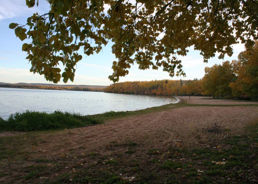
ACKNOWLEDGEMENTS
The Willow Lake Area Structure Plan was developed by the Regional Municipality of Wood Buffalo in collaboration with
residents of the Willow Lake area and other stakeholders. As a guide for future land use in the Willow Lake area, the Plan
interprets residents’ desires for the future while promoting sustainable principles that balance economic, social, environmental
and cultural goals.

The Regional Municipality of Wood Buffalo thanks those residents and stakeholders who kindly gave their time to participate
in the preparation of this plan.

                                      Bylaw No. 15/006                                                                         1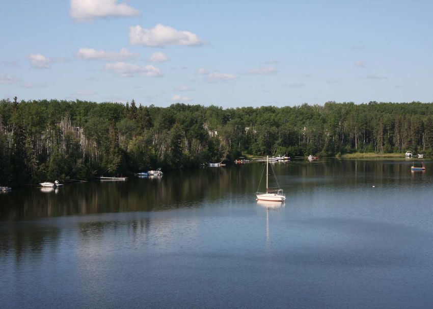
PLAN PURPOSE
The Willow Lake Area Structure Plan (the “Willow Lake ASP”) is the principle document guiding land use in the Willow Lake area. The Willow Lake
ASP is a statutory document prepared in accordance with the Municipal Government Act R.S.A. 2000 c. M-26.

The Willow Lake ASP intends to:

    •   establish policies that promote orderly and sustainable land use in the area, and
    •   integrate existing and future infrastructure requirements with proposed generalized land use classifications.

Although the plan is designed for the long-term, it will be reviewed periodically and be updated as needed to ensure the plan remains relevant to
existing conditions.

                                                           Bylaw No. 15/006                                                                         2
TABLE OF CONTENTS
Acknowledgements����������������������������������������������������������������������������������������������������������������������������������������������������������������1
Plan Purpose��������������������������������������������������������������������������������������������������������������������������������������������������������������������������2
Table of Contents�������������������������������������������������������������������������������������������������������������������������������������������������������������������3
List of Maps����������������������������������������������������������������������������������������������������������������������������������������������������������������������������4
		 Setting the Stage���������������������������������������������������������������������������������������������������������������������������������������������������������5
Willow Lake����������������������������������������������������������������������������������������������������������������������������������������������������������������������������6
Existing Conditions��������������������������������������������������������������������������������������������������������������������������������������������������������������10
Planning and Policy Framework�������������������������������������������������������������������������������������������������������������������������������������������19
Vision������������������������������������������������������������������������������������������������������������������������������������������������������������������������������������21
Guiding Principles����������������������������������������������������������������������������������������������������������������������������������������������������������������22
		 Achieving the Vision��������������������������������������������������������������������������������������������������������������������������������������������������23
Generalized Land Use Classifications�������������������������������������������������������������������������������������������������������������������������������������24
		 PRINCIPLE 1: PROTECT AND PRESERVE THE NATURAL ENVIRONMENT���������������������������������������������������������������27
		 PRINCIPLE 2: PRESERVE EXISTING CHARACTER OF WILLOW LAKE AREA������������������������������������������������������������30
		 PRINCIPLE 3: ENHANCE LOCAL RECREATIONAL OPPORTUNITIES�����������������������������������������������������������������������32
		 PRINCIPLE 4: PROVIDE SAFE TRANSPORTATION NETWORKS AND COORDINATE
		 MUNICIPAL SERVICES AND PUBLIC INFRASTRUCTURE������������������������������������������������������������������������������������������33
		 PRINCIPLE 5: PROMOTE COMMUNITY HEALTH AND SAFETY�������������������������������������������������������������������������������35
		 Making it Work������������������������������������������������������������������������������������������������������������������������������������������������������������36
Implementation Strategy / Plan Interpretation / Proposed Development Sequencing��������������������������������������������������������37
Glossary of Terms�������������������������������������������������������������������������������������������������������������������������������������������������������������������38
References������������������������������������������������������������������������������������������������������������������������������������������������������������������������������41

                                                                           Bylaw No. 15/006                                                                                                 3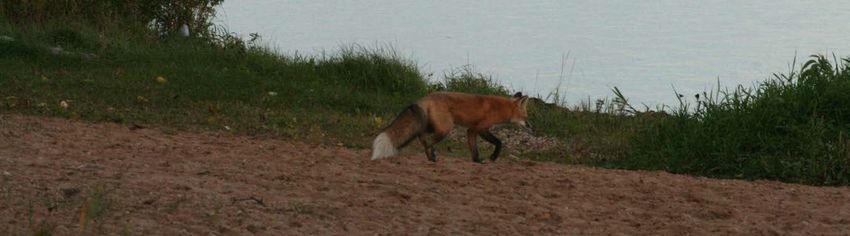
LIST OF MAPS
#1 WILLOW LAKE REGIONAL CONTEXT����������������������������������������������������������������������������������������������������������������������7
#2 PLAN AREA�������������������������������������������������������������������������������������������������������������������������������������������������������������8
#3 EXISTING LAND USE�����������������������������������������������������������������������������������������������������������������������������������������������9
#4 DEVELOPMENT CONSTRAINTS MAP��������������������������������������������������������������������������������������������������������������������11
#5 HISTORICAL RESOURCES��������������������������������������������������������������������������������������������������������������������������������������13
#6 LAND OWNERSHIP������������������������������������������������������������������������������������������������������������������������������������������������14
#7 INFRASTRUCTURE�������������������������������������������������������������������������������������������������������������������������������������������������18
#8 CONCEPT PLAN OF GENERALIZED LAND USE CLASSIFICATIONS����������������������������������������������������������������������26
#9 DEVELOPMENT CONSTRAINTS OVERLAY������������������������������������������������������������������������������������������������������������28

                                                                    Bylaw No. 15/006                                                                                          4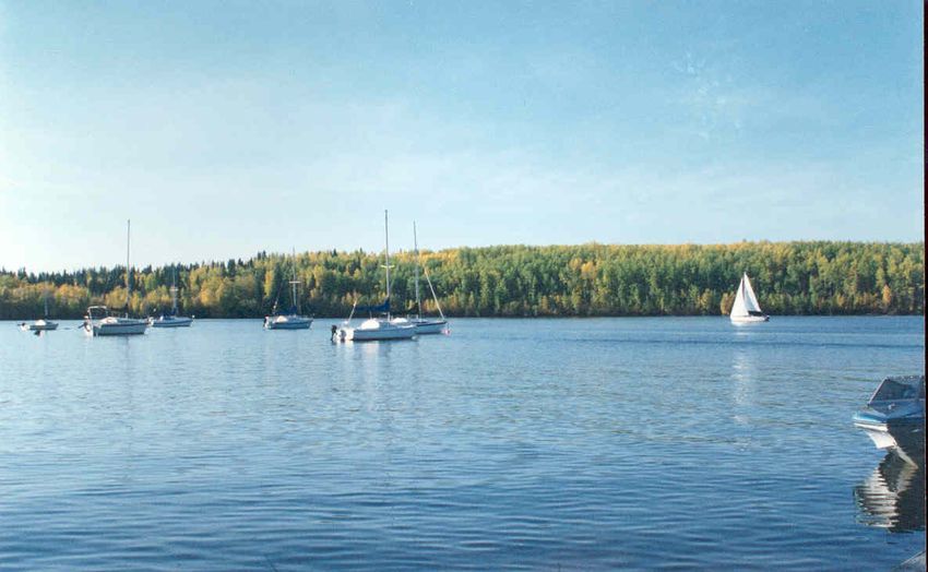
PART 1
SETTING THE STAGE

              Bylaw No. 15/006   5
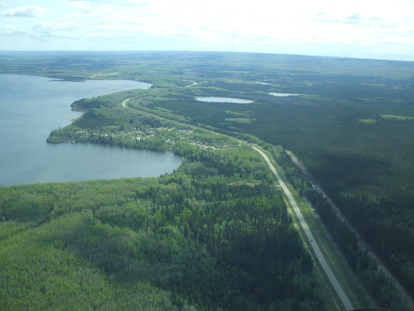
WILLOW LAKE
Willow Lake is located approximately 30 kilometres south of the Urban Service Area of Fort McMurray (see Map #1), it is one
of the few accessible recreational lakes in the region and an important amenity for residents of the Regional Municipality.
Willow Lake is the most widely used recreational lake in the Regional Municipality of Wood Buffalo. Recreational uses
on Willow Lake during warm months include boating, rowing, canoeing, kayaking, seadooing, waterskiing, fishing,
swimming, camping, hiking, picnics and other gatherings; in winter Willow Lake is used for hockey, skating, skidooing
and cross country skiing. The area is the site of some events for the Western Canada Summer Games in 2015. Gregoire
Lake Provincial Park is found on the northwestern side of the lake and is a popular recreational destination.

Inhabited by both the Cree and the Dené people for hundreds or even thousands of years, the wider Willow Lake area
has long been a site for hunting, trapping and berry picking by First Nation peoples. Fur trading amongst the Cree and
Europeans in the area dates back some 300 years.

Today, the majority of the land around Willow Lake is Crown land administered by the Government of Alberta (the
Province).
                                                                                                                                   Willow or Gregoire?
                                                                                                                              Willow Lake became known as
Willow Lake Area Structure Plan
                                                                                                                              Gregoire Lake in the 1940s to
The Plan Area is shown on Map #2 and includes Gregoire Lake Estates, a residential community of around 275 residents          reflect the name of the lake’s
located on the western shore of Willow Lake, it is the only Hamlet within the Plan Area. Outside of Gregoire Lake Estates,    only outlet, Gregoire River,
there are three recreational leases along the eastern and southern shores of Willow Lake. Gregoire Lake Provincial Park       which was itself named after an
as established in the Provincial Parks Act is located in the northwestern corner of the Plan Area. Private holdings and       early settler to the area. In 1992,
residences, including a commercial campground, can be found on large parcels of land along Surmont Creek. The Plan            at the request of local residents,
Area is also bordered by the reserve lands of the Fort McMurray First Nation ( FN 176, FN 176A and FN 176B), home to          the lake’s name was officially
approximately 200 residents. Fort McMurray #468 First Nation is currently negotiating land claims within the Plan Area        changed back to Willow Lake.
which could result in a change to the ASP boundary.                                                                           It is still commonly known as
                                                                                                                              Gregoire Lake and neither
Regional Influences                                                                                                           Gregoire Lake Provincial Park
Willow Lake is in close proximity to major oilsands projects. There are oilsands leases within and adjoining the ASP area,    or the Hamlet of Gregoire Lake
which may have direct and indirect impacts on the Plan Area in the future. Impacts may include activities such as: oil        Estates have changed names to
exploration, demand for housing and recreational facilities and consequentially increased traffic volumes. The Willow         reflect the lake’s official name
Lake Plan Area has seen relatively little development since the original subdivision of just over 80 lots in Gregoire Lake    change.
Estates. At the same time, the Regional Municipality as a whole has experienced significant growth in recent years, a
trend that is projected to continue in the decades to come. As a result, the Willow Lake ASP must address the increasing
pressure to provide recreational opportunities for the Regional Municipality’s residents.
Anzac
The Hamlet of Anzac, which lies on the eastern shores of Willow Lake, forms the eastern boundary of the Plan Area.
Currently, Anzac is a primarily residential community of approximately 800 people; however ,the Hamlet has the capacity
to become a regional growth centre offering important services to both the wider Willow Lake area as well as the
southern communities of Conklin and Janvier. An ASP for Anzac was adopted in 2012.

                                                                Bylaw No. 15/006                                                                                6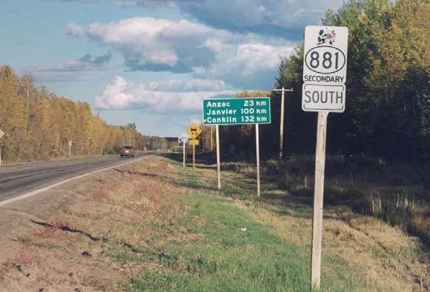
MAP 1: WILLOW LAKE REGIONAL CONTEXT

                                                                                                                                                                                                       ±
                                                                                                                                            Willow Lake ASP           Railway
                                                                                                                                            Hamlet                    Water
                                                                                                                                            Hwy 881                   Stream
                                                                                                                                            Local Road                Gregoire Lake Provincial Park
                                                                                                                                            Survey Parcels            First Nation Reserve
      Alberta
                                                                                                                                     0               1            2                           4
       Regional Municipality of Wood Buffalo                                                                                                                                                   Kilometers

                 To Fort Smith

                            Fort Fitzgerald

                                                                                                                                GREGOIRE
                                                                                                                                LAKE 176B

                                          Lake
                                          Athabasca
                          Fort
                                                             GREGOIRE
                          Chipewyan                          LAKE ESTATES                                                                                                       ANZAC
                                                                                                                     Willow
                                                                                                                     Lake
                                    W
                                     int
                                         e
                                        r R o ad

 Regional Municipality
 of Wood Buffalo
                       £
                       ¤
                       63                                                   GREGOIRE
                                                                            LAKE 176A
                 Fort MacKay

                                                                                                                                                              G
                                                                                                                                                                r eg
                                                                                                    H IG             GREGOIRE                                 Riv oir
                                                                                                           HW                                                     er

                                                                                                                                                                        e
                                                                                                                     LAKE 176
                   Fort McMurray                                                                             AY
                                                                                                                8   81
                                  Draper
                                                                                                t Creek

                                 Saprae Creek
                           Gregoire
                           Lake     Anzac
                                                                                        Sur m on

                                                   Janvier

                                     Conklin

                                 £
                                 ¤
                                 881

                                                                             Bylaw No. 15/006                                                                                                               7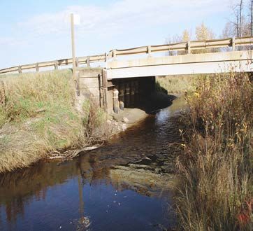
MAP 2: WILLOW LAKE PLAN AREA

                                                                                                                                        ±
                                                                               Willow Lake ASP        Stream
                                                                               Hwy 881                Gregoire Lake Provincial Park
                                                                               Local Road             First Nation Reserve
                                                                               Railway                Hamlet
                                                                               Water

                                                               GREGOIRE
                                                               LAKE 176B

 GREGOIRE
 LAKE ESTATES                                                                                    ANZAC
                                                 Willow
                                                 Lake

                GREGOIRE
                LAKE 176A

                            HIG
                               HW               GREGOIRE
                                 AY
                                    8  81       LAKE 176
                                   Surmont Cr

                                                                                           G
                                                                                             re
                                                                                         Rive goi
                                      ee                                                     r

                                                                                                 re
                                                                           0      1                   2                               4
                                                                                                                                       Kilometers
                                         k

                                                  Bylaw No. 15/006                                                                                  8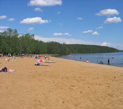
MAP 3: EXISTING LAND USE
Willow Lake ASP Railway Parks and Recreation
î CULTURE AND RELIGION Water Residential
±
Gregoire Lake Provincial Park
¹½ SCHOOL Stream Vacant Lot
|
¹
8 SPORT FACILITY
Hwy 881
Hamlet
First Nation Reserve
Local Road Existing Land Use
Road Right of Way Open Space
GREGOIRE
LAKE 176B
GREGOIRE
LAKE ESTATES ANZAC
Willow
Recreation Lease
Lake
Po
lly
|
¹
8
Re
Pa
tM ½¹î
|
¹
8
cr ar
Natural Area ea in
Re a
tio
GREGOIRE cr n
ea Le
LAKE 176A tio as
n e
Le
H IG
as
e
|
¹
8
î
HW
AY GREGOIRE
8 81 LAKE 176
Business
Industrial Surmont Creek
Surmont Cr
Subdivision Campground
î G
re
Rive goi
ee r
re
k 0 1 2 4
Kilometers
Bylaw No. 15/006 9EXISTING CONDITIONS
Natural Environment
The Clearwater and Athabasca river valleys that form the distinct landscape surrounding Willow Lake
resulted from melting glaciers around 10,000 years ago. The Willow Lake area is characterized by generally
flat topography and a mix of well-drained soils and muskeg. Wetlands, streams and the lake itself are
environmentally important features to the Plan Area.
Willow Lake is a large and shallow lake, covering a surface area of approximately 25.7 square kilometers.
The mean depth of the lake is 3.9 metres and the maximum depth is 7.2 metres. The deepest water is
located in the western portion of the lake. The lake also features an island of almost 600 square metres.
The Willow Lake shoreline is composed mainly of gravel, with the exception of three large sandy beaches.
The lake has seven inlets, the largest of which is Surmont Creek, and only one outlet, Gregoire River. The
drainage basin is mainly to the south and southwest of the lake and spans an area of 232 square kilometres.
Surmont Creek
Vegetation Surmont Creek is the major inflow into
The Willow Lake ASP area is located in the Boreal Central Mixed Wood Ecoregion. The predominant tree Willow Lake. Six other creeks flow into the
cover includes trembling aspen, balsam poplar, and white birch. Stands of jack pine are present in the lake, while the only outflow is Gregoire River
sandy areas and black spruce stands in the poorly drained areas. There are several spruce/tamarack bogs on the southeastern side of Willow Lake.
on the southern shore of the lake. Aquatic vegetation is abundant along the shores of Willow Lake and Surmont Creek flows through First Nation
there is thriving riparian vegetation along the banks of Surmont Creek. Aquatic vegetation in the eastern Reserve Land (FN 176) and large privately-
bay and western shore of the lake includes dense beds of swamp horsetail, yellow pond lily, bulrushes and held lots along Highway 881 before entering
common cattail; the list of submergent plants is dominated by pondweed. Willow Lake.
Fish and Wildlife
A variety of fish species are known to inhabit Willow Lake, including: walleye, northern pike, yellow perch,
lake whitefish, cisco, burbot, spottail shiner, and longnose sucker. Gregoire River is an important migration
route and spawning area for the northern pike, longnose sucker, and white sucker. Willow Lake is also used
for bald eagle nesting and as a staging area for migrating waterfowl. Wildlife found along the Gregoire
River includes Northern Goshawk, red-tailed hawk, beaver, fox and moose. The Willow Lake area is located
within the current range of the black bear, and is home to Woodland Caribou, which is an endangered
species under the Province of Alberta’s Wildlife Regulation.
Environmental Development Constraints
The overall environmental development constraints related to planning future developments within the plan
area are summarized on Map #4. Lands identified as developmentally Constrained Area are highlighted in
red are not recommended for development. Setbacks from riparian areas in the plan have been informed
by a Biophysical Impact Assessment and Alberta Sustainable Resource Development Guidelines.
Bylaw No. 15/006 10MAP 4: DEVELOPMENT CONSTRAINTS MAP
Willow Lake ASP First Nation Reserve
Hwy 881 Development Constraints
±
Local Road Constrained Area
Water Stream, Creek, Water Body Setback
Stream Sewage Lagoon Buffer (300m)
Hamlet Non Operating Landfill Buffer (300m)
GREGOIRE
LAKE 176B
GREGOIRE
LAKE ESTATES ANZAC
Willow
Lake
GREGOIRE
LAKE 176A
HIG
HW
AY
8 81 GREGOIRE
LAKE 176
Surmont Cr
G
re
Rive goi
ee r
re
0 1 2 4
Kilometers
k
Bylaw No. 15/006 11Historical Resources
The Listing of Historic Resources identifies lands that contain or are believed to contain historic resources, primarily archaeological and palaeontological
sites, Aboriginal traditional use sites of a historic resource nature, and historic structures. Issued twice a year, it provides industry and other developers
with advance notification of possible historic resource concerns. The Listing does not include all lands that may contain historic resources. When
previously unknown historic resources are discovered, their locations are added to the Listing. In accordance with the Alberta Historical Resources
Act, the Minister of Alberta Culture may require that any proposed activity likely to threaten the integrity of a historic resource, whether or not its
location is on the Listing, be preceded by a Historic Resources Impact Assessment (HRIA). The Plan Area is considered to have high potential to
contain archaeological, paleoontological and Aboriginal traditional use resources. The most likely locations of historical resources in the Plan Area
are shown on Map #5.
Early History
Inhabited by both the Cree (who came from the south) and the Dené (who came from the north) for hundreds or even thousands of years, the Willow
Lake area has long been a site for hunting, trapping and berry picking by First Nations peoples. Fur trading among Cree and Europeans in the area
dates back some 300 years.
Recent History
The Stony Mountain Royal Canadian Air Force radar station (known as “Site 800”) was built in the Anzac area in 1957 as part of the mid-Canada early
defense line set up to detect incoming Soviet bombers during the Cold War and provide early warning for a land based invasion. As a result, a 17-
mile road was built from Anzac (which connected to the railway at the time) to the top of Stony Mountain near Willow Lake.
Built Environment
Land Ownership
Land ownership within the Plan Area is shown on Map #6. The majority of land is owned by the Province and includes Gregoire Lake Provincial Park.
The Hamlet of Gregoire Lake Estates is currently at full build-out with each of the privately held lots developed. The Regional Municipality holds a
small amount of undeveloped land within the Hamlet boundary. There are privately-held lots covering two quarter sections along Surmont Creek.
Existing Land Use (see Map #3)
Once a cottage community, Gregoire Lake Estates is now a community of single-family detached homes. Residents live in the community year-round
and over 90% of residents are homeowners. Nearly each of the 84 lots in Gregoire Lake Estates is developed with a single-family detached home.
There is an average of 3.2 residents per household in the community and 3 people per acre is the current gross population density. In 2030 gross
population density is expected to increase to 3.275 people per acre.
The Surmont Creek Campground, with a planned capacity for 96 sites, is a campground in the Plan Area. This year-round campground was opened in
2010 and operates on privately held land along Surmont Creek south of Willow Lake. Additionally, the Willow Lake Marina, formerly called Polly Pat
Marina, is a privately-operated facility on the southeast shore of Willow Lake. It is located on leased Crown land and is used as a seasonal camping
site, wharf, and boat launch.
There are no commercial developments in Gregoire Lake Estates. Gas stations exist in both Anzac and on First Nation Reserve 176A, while other
services such as a restaurant, variety store and liquor store exist in Anzac.
Bylaw No. 15/006 12MAP 5: HISTORICAL RESOURCES
±
Historic Resource Categories Hwy 881 Hamlet
Archaelogical Local Road Gregoire Lake Provincial Park
Cultural Railway First Nation Reserve
Historic Period Stream
Willow Lake ASP Water
GREGOIRE
LAKE 176B
GREGOIRE ANZAC
LAKE ESTATES Willow
Canoe
Lake
Lake
GREGOIRE
LAKE 176A
HIG
H WA
Y8 GREGOIRE Gr
81 ego
LAKE 176 R ive
ire
Surmont Cr e
r
ek
0 1 2 4
Kilometers
Bylaw No. 15/006 13MAP 6: LAND OWNERSHIP
Willow Lake ASP Stream
±
Hwy 881 Hamlet
Local Road Provincially Owned Land
Road Right of Way Municipally Owned Land
Railway Privately Owned Land
Water First Nation Reserve
GREGOIRE
LAKE 176B
GREGOIRE
LAKE ESTATES ANZAC
Willow
Lake
GREGOIRE
LAKE 176A
HIG
HW
AY
8 81 GREGOIRE Gre
LAKE 176 g
R ive
oir
e
r
Surmont C r
ee
0 1 2 4
k
Kilometers
Bylaw No. 15/006 14Recreation
Parks
The 650-hectare Gregoire Lake Provincial Park was opened in the early 1970s. Access to the park
is located on Highway 881, 30 kilometres south of Fort McMurray and 12 kilometres west of Anzac.
The park is particularly busy during summer months as it offers a 140-site campground, day use
area, beach, and hiking trails. There are two main trails at the park: a 5-kilomtetre loop along the
north shore of the lake and a 1.2-kilometre woodland interpretive trail. In the winter, the park is
used for cross-country skiing and snowmobiling.
Based on the Lower Athabasca Regional Plan, future expansion of the boundary and upgrades of
Gregoire Lake Provincial Park are part of the planning process by Alberta Parks Division of ESRD.
Improvements to the campsites including added power sites and a south shore boat launch have
already occurred.
Camp Many Trees is located on the west shore of Willow Lake, just north of FN 176A. The land is
owned by the Province and leased by the YMCA of Wood Buffalo. In the late 1990s, the YMCA Willow Lake
made use of the land for day camps, but the camp is no longer operational. There are no utilities
or sanitary facilities set up at the camp. The YMCA plans to refurbish the facility in the future. Willow Lake is the most widely used recreational
lake in the Regional Municipality of Wood Buffalo,
Two day use areas are found on the southern shore of the lake: the South Shore Campground and with most visitors accessing the lake through
Windsurfer Beach. These recreation destinations are located on Crown land that has been leased Gregoire Lake Provincial Park. The lake permits
to the Municipality in the past, and is currently leased to the Province. Both the South Shore both motorized boats and fishing. In the winter, it
Campground and Windsurfer Beach are open to the public, although they are not currently being is used for ice fishing, snowmobiling and skating.
maintained regularly as conversations around future responsibility for the facilities are ongoing.
The community of Gregoire Lake Estates has one playground. This playground was completed in
2009 using a community grant and funding provided to the Hamlet by the Regional Municipality,
the Anzac Recreation and Social Society and the Province.
Trails
The Regional Municipality does not currently operate any trails within the Plan Area. Informal trails
exist along the lake but are not maintained by the Regional Municipality and are located on Crown
land.
Sports Facilities
Residents have access to a new facility opened in Anzac, which includes a number of sports fields,
trails, a covered ice rink and a multi-use recreation facility.
Bylaw No. 15/006 15Institutional and Services
Schools
There are no schools in the Plan Area. Anzac currently has an elementary school and high school. Both of these schools can accommodate the
current and projected population of youth in the Willow Lake Plan area. Alternatively, youth in the Plan Area can also attend school in Fort McMurray.
Health Facilities
There are no health services in the Plan Area and residents depend on health services provided in Anzac and Fort McMurray. The nearest clinic and
family doctor are available in Fort McMurray, which also provides ambulance services to the Plan Area.
Religious Institutions
There are no religious institutions in the Plan Area, however Anzac has one Baptist church and Fort McMurray offers a wide range of religious
institutions.
Emergency Services
Fire protection for the Plan Area is provided by the Anzac volunteer fire department, a strong group of volunteer fire fighters serving Anzac and the
surrounding area.
Infrastructure and Servicing
Transportation
Highway 881 travels along the southern shore of Willow Lake and provides two access points to Gregoire Lake Estates and the only road access to
Gregoire Lake Provincial Park. This two-lane highway has an approximate volume of 4,800 Annual Average Daily Traffic (AADT) and is the primary
highway linking Fort McMurray and the southern Hamlets in the Regional Municipality. In 2006/2007, the Highway was paved from Anzac to Lac La
Biche providing a viable alternative to Highway 63 for north-south travel in the region. Alberta Transportation recommends twinning highways when
they reach a volume of 15,000 AADT. Stony Mountain road connects Highway 63 to Highway 881 near FN 176A.
Alberta Transportation currently has plans to upgrade Highway 881 between Anzac and Gregoire Lake Estates. Improvements consist of road
resurfacing completed in 2014, the addition of a service road through FN176, as seen on Map #7, and the elimination of access points to the highway
by removing the northwestern access to Gregoire Lake Estates.
Bylaw No. 15/006 16Stormwater Management
Stormwater management in the Plan Area, including the Hamlet of Gregoire Lake Estates, is managed using natural drainage courses and surface
ditches along Highway 881.
Potable Water
Residents in the Plan Area currently receive potable water via truck haul from the Anzac truck fill station. The construction of the Southeast Regional
Water Supply Line from Fort McMurray to Anzac has brought piped water through the Plan Area, as seen on Map #7.
The Southeast Regional Water Supply Line was built to a capacity of 4,500 residents assuming future populations of 300 residents in Gregoire Lake
Estates, 3,000 residents in Anzac, and 1,000 residents on the First Nation reserves. The Regional Municipality is currently designing a secondary
water supply line to Anzac that will follow the alignment of Highway 881. The Regional Municipality has plans for installation of a full pressure piped
water service to Gregoire Lake Estates. There is the possibility that development along Surmont Creek will be able to tie into the new water supply
line in the future.
Wastewater Treatment
Residents in Gregoire Lake Estates use pump out tanks and vacuum truck service to dispose of their domestic wastewater. Wastewater is then
dumped at the sewage lagoon in Anzac, as seen on Map #7. The 1991 Gregoire Lake Area Structure Plan identified that the use of septic mounds
contributed to increased aquatic vegetation growth in Willow Lake. A Municipal-grant in the mid-1990s helped residents move to pump out tanks
from septic mounds.
The Regional Municipality has plans for installation of a gravity sewer system in Gregoire Lake Estates that will tie into the new wastewater treatment
plant in Anzac.
Property owners on large lots along Surmont Creek use septic fields to handle wastewater currently. There may be opportunity for these areas to tie
into the new proposed piped service as well.
Franchised Utilities
Buried and overhead utilities are provided by ATCO Gas, ATCO Electric and Telus. Residents have access to 3-phase power running along Highway
881 provided by the Hangingstone substation.
Bylaw No. 15/006 17MAP 7: INFRASTRUCTURE
±
Willow Lake ASP Sanitary Line
Hwy 881 Water Line
Local Road Pipeline
Railway Powerline
Stream
Water
First Nation Reserve
Hamlet
Anzac Sewage Lagoon
Gregoire Lake Provincial Park
GREGOIRE
LAKE ESTATES ANZAC
Willow
Lake
HIG
HW
AY
8 81
Surmont Cr
Potential Transportation Corridor
Highway 881 Re Alignment re
Rive goi
G
ee r
re
k
0 0.75 1.5 3
Kilometers
Bylaw No. 15/006 18PLANNING AND POLICY FRAMEWORK
Municipal Government Act
The Municipal Government Act (the “MGA”) enables municipalities to prepare statutory plans, such as area structure plans.
The requirements for area structure plans are outlined in Section 633(3) of the MGA. An area structure plan must describe:
• the sequence of development proposed for the area,
• the land uses proposed for the area, either generally or with respect to specific parts of the area,
• the density of population proposed for the area either generally or with respect to specific parts of the area,
• the general location of major transportation routes and public utilities,
and may contain any other matters the council considers necessary.
As outlined in Section 638 of the MGA- all statutory plans adopted by a municipality must be consistent with each other.
Section 638.1 states: In the event of a conflict or inconsistency between (a) a statutory plan or land use bylaw, and (b) an ALSA regional plan, the
ALSA regional plan prevails to the extent of the conflict or inconsistency.
Lower Athabasca Regional Plan (2012-2022)
The Lower Athabasca Regional Plan (“LARP”) identifies a strategic 10 year direction for a large region including the Regional Municipality. It is a
statutory plan based on Alberta’s Land Use Framework, which was released in 2008 and sets out an approach to managing land and natural resources.
Most importantly, it sets out seven planning regions and requires that regional plans be developed for each of those regions. The LARP is the result
of that provincial direction and applies to all persons, including the Crown and local government bodies. The Regulatory Details Plan requires local
government bodies to consider the Strategic Plan and Implementation Plan found within the LARP.
Under the LARP, Willow Lake, referred to as Gregoire Lake, has been identified as a Provincial Recreation/Tourism area. Provincial Recreation areas
will be managed to minimize industrial land disturbance and to ensure quality recreational experience. Petroleum and natural gas tenure and
recreational leases will be honoured consistent with existing policy. Such leases include all subsurface activities needed to explore, develop and
extract resources. The LARP specially designates a large area around the shorelines of Willow Lake as a potential provincial park expansion.
Recreation/Tourism areas are intended to provide diverse, enjoyable, outdoor recreation opportunities that contribute to healthy lifestyles and will
be managed to minimize industrial disturbance and ensure quality recreational experience.
Municipal Development Plan (Bylaw No. 11/027)
The Regional Municipality adopted a municipal development plan in 2011. The Municipal Development Plan (the “MDP”) is a regional, urban and
rural plan combined into one comprehensive document. As a result, the MDP addresses issues at a variety of scales, providing integrated direction
to the urban area, the distinct rural communities and vast tracts of hinterland.
Bylaw No. 15/006 19The MDP outlines a strategic path forward to manage growth. It does not directly identify capital projects or infrastructure spending, nor does it
provide specific zoning requirements. Rather, it will be used to guide both short and long term decision making at the Regional Municipality over
the next few decades until the year 2030.
The 2011 MDP provides statutory direction for the Willow Lake ASP with a vision to make the region “a global model for sustainable living in the
north.” The MDP provides direction on regional and rural community growth management, as well as building sustainable communities, to which
this plan aligns.
The MDP designates the Hamlet of Gregoire Lake Estates as an area of stability. The Regional Municipality will work to protect the existing pattern
of development characterized by single family housing, (MDP strategy C.3.3). Along with this, no physical expansion of the community will be
accommodated. Community access to Willow Lake will be enhanced while ensuring minimal impact on the lake environment and other natural
features.
Anzac has been designated as a priority growth area in the MDP. Anzac is not within the Willow Lake ASP; it is however, directly adjacent to the
eastern boundary. It is expected that most development can be accommodated within Anzac as opposed to within the Willow Lake ASP boundaries.
Adjacent Plans
Other plans in the vicinity of the Willow Lake ASP include:
• Anzac Area Structure Plan (Bylaw 12/018), 2012. The planning process involved close cooperation to ensure compatibility.
• Highway 63/881 Corridor ASP (Bylaw no. 07/050), 2007.
Bylaw No. 15/006 20VISION
A vision for Gregoire Lake Estates was developed through community Vision for Gregoire Lake Estates
engagement. The vision reflects how area residents would like to describe
their community 20 years in the future. In this case, the vision identifies a Gregoire Lake Estates is a quiet and safe community where our
community that is close-knit and has plenty of opportunity to enjoy the rich residents value the rich natural setting and close relationships
natural surroundings. Much of what is desired by the community currently with neighbours. Set on the shores of beautiful Willow Lake,
exists. we take tremendous pride in an ongoing commitment to
preserve the natural landscape that surrounds us and is
In 2010, the Regional Municipality adopted an Integrated Community integral to our active rural lifestyle. The foundation of our
Sustainability Plan, Envision Wood Buffalo. Contained within this plan small residential community is built on strong friendships,
is a region-wide vision for sustainable development. The Statement of community pride and neighbours that look out for one
Sustainability is a declaration by the Regional Municipality that it will work another. Trails and community access to the lake provide us
to ensure a healthy future not only for current residents, but for future with excellent recreational opportunities throughout the year.
residents as well, paying specific attention to the economic, environmental, The level of residential servicing in Gregoire Lake Estates
social and cultural pillars that form the fabric of the region. meets the needs of the community. We maintain access to the
amenities in neighbouring Anzac and Fort McMurray while
From here, Generalized Land Use Classifications have been created as well retaining the privacy and high quality of life that we enjoy so
as Principles, Objectives and Policies for the Willow Lake Plan Area. much.
The Regional Municipality’s commitment to sustainability is emphasized in
the Willow Lake ASP. The Willow Lake ASP presented here makes an effort
to protect and repair riparian zones and address environmentally sensitive Statement of Sustainability
areas. It also ensures that the impact of future development on the natural
We value living in a region that is safe, healthy, inclusive of
environment is addressed through the appropriate studies. These measures
all residents and provides local opportunities. We have a
are aimed at preserving the health of Willow Lake and ensuring its value as
strong economy, a healthy environment, a rich culture and an
a recreational amenity for residents of this region for many years to come.
abundance of social capital that together form the pillars of
sustainability and contribute to quality of life and well being.
We strive to find balance in our economic, environmental,
cultural and social systems and to live within their natural
limits. We make decisions that reflect an understanding of the
interdependence of these systems and consider residents long-
term needs to ensure the resources of today are sustainable into
the future.
Bylaw No. 15/006 21GUIDING PRINCIPLES
The vision for Gregoire Lake Estates, the direction of the MDP, and the input of residents and stakeholders during the planning process, form the
foundation of the Willow Lake ASP.
The Willow Lake ASP will be guided by the following five principles:
1. Protect and Preserve the Natural Environment
2. Preserve Existing Character of Willow Lake Area
3. Enhance Local Recreational Opportunities
4. Provide Safe Transportation Networks and Coordinate Municipal Services and Public Infrastructure
5. Promote Community Health and Safety
These principles act as a guide for future development in the area and form the basis of the Generalized Land Use Classifications as well as Objectives
and Policies.
Bylaw No. 15/006 22PART 2
ACHIEVING THE VISION
Bylaw No. 15/006 23GENERALIZED LAND USE CONCEPT
Generalized Land Use Concept and Policies for the Willow Lake ASP promote the potential of the Plan Area as an important natural and recreational
amenity, while minimizing the impact of human activity on the natural environment. For the most part, development in the area should be focused
on recreational uses, while other uses such as recreation with commercial elements or industrial development can be considered if this activity does
not adversely affect water quality of lakes or streams, or limit the recreational potential of the surrounding area.
Map #8 shows the generalized land use concept for Willow Lake. This is a conceptual map that provides general description and approximate
location of proposed future land uses. The following are the descriptions of the land use classifications:
Established Neighbourhood
The intent of the Established Neighbourhood Land Use classification, is to maintain the existing development pattern and prevailing density in the
form of a single detached house on an individual lot.
Business Industrial
The Business Industrial classification is intended to accommodate a range of commercial businesses and general industrial uses compatible with
surrounding areas, which may include general office buildings, light manufacturing, lay-down yards and service uses that support nearby development
and industrial activity.
Bylaw No. 15/006 24GENERALIZED LAND USE CONCEPT
The Willow Lake ASP endeavors to address the significance of the lake as a key feature of this region and one that will provide recreational
opportunities for residents for years to come. In doing so, the Willow Lake ASP strives to maximize the recreational potential of the Willow Lake area
while minimizing impacts on the natural environment. The Willow Lake ASP will also ensure the protection of the areas many historical resources. As
such, it is anticipated that the area will retain much of its natural character and future development will be limited.
Open Space
The intent of the Open Space classification is that land will remain in its natural state and allow for the protection of environmental features and
wildlife. A major portion of this area has some or significant constraints to development. These constraints include low lying wet terrain, shallow to
deep muskeg coverage or areas prone to flooding. Development within the Open Space area will be restricted to uses, such as walking trails that
have low impact on the environment.
Environmental Preservation
The intent of the Environmental Preservation classification is the preservation and the protection of environmentally sensitive areas. The area in its
natural state may be used as a park or walking trails.
Parks and Recreation
The Parks and Recreation classification is intended to allow for parks and recreation facilities. Parks, trails, outdoor recreation facilities, and playgrounds
are examples of uses considered.
Recreation and Tourism
The Recreation and Tourism classification influenced by the LARP is intended to allow for outdoor recreation facilities that also include commercial
elements for tourism purposes, such as boat launches and recreational campgrounds. The classification applies to a large part of the Plan Area, much
of which is undeveloped Crown land.
Bylaw No. 15/006 25MAP 8: WILLOW LAKE GENERALIZED LAND USE CONCEPT MAP
The following map represents the Generalized Land Use Concept for the Willow Lake Area Structure Plan.
Willow Lake ASP
Gregoire Lake Estates
Hwy 881
Local Road
Road Right of Way
First Nation Reserve
Hamlet
Development Concept
OPEN SPACE
ENVIRONMENTAL PRESERVATION
±
Railway RECREATION AND TOURISM
Water BUSINESS INDUSTRIAL
Stream ESTABLISHED NEIGHBOURHOOD
Gregoire Lake Provincial Park PARKS AND RECREATION
Potential Provincial Park Expansion
GREGOIRE
LAKE ESTATES ANZAC
Willow
Lake Canoe
Lake
HIG
H WA
Y8 Gr
81 eg
Riv
oir
er
e
Surmont C r ee
Potential Transportation Corridor
Highway 881 Re Alignment
k
0 1 2 4
Kilometers
Bylaw No. 15/006 26PRINCIPLE 1:
PROTECT AND PRESERVE THE NATURAL ENVIRONMENT
Ecological integrity and protection of environmental features are fundamental components of the Willow Lake ASP vision. There is a strong desire
within the community to ensure environmental features are preserved, protected and enhanced for future generations to enjoy. The community
shares a special bond with the surrounding water and land based environment and prides itself in the relationship community members share with
natural areas.
Willow Lake is of fundamental importance to the immediate adjacent land uses within the Willow Lake ASP area, including the Hamlet of Gregoire
Lake Estates, Gregoire Lake Provincial Park, day use areas and camp grounds, as well as land uses outside the Plan Area, including the First Nation’s
Reserves and the Hamlet of Anzac. The lake provides habitat for fish and wildlife. Willow Lake also provides a desirable setting for the adjoining uses
and opportunities for recreational uses including day use facilities, camping and fishing.
The Gregoire River, that flows from the Lake, eventually flows into the Athabasca River. Surmont Creek is the major inflow into Willow Lake.
Environmental protection of Willow Lake and the riparian areas adjoining the lake, Gregoire River, Surmont Creek, other streams and creeks and the
lake’s drainage basin together with responsible land use management will ensure that the lake’s amenities are protected for the enjoyment of future
generations.
Objective 1.1 Protect Willow Lake, Gregoire River and 1.1.5 An application for development within areas identified as
all associated tributaries and watercourses Constrained Area will require an environmental assessment to
ensure measures are taken to mitigate any potential adverse
In the Hamlet of Gregoire Lake Estates:
environmental impacts.
1.1.1 A 30 metre development setback will be required as a a) An environmental assessment may include but is not limited
minimum from the top of bank of Willow Lake and all other to:
water bodies. i) biophysical impact assessment,
ii) geotechnical study,
In the Plan Area outside of the Hamlet of Gregoire Lake Estates: iii) any other assessment required by the
development authority.
1.1.2 A 100 metre development setback will be required as a
minimum from the top of bank of Willow Lake and all smaller b) The environmental assessment studies and analysis must be
lakes. prepared by an accredited professional.
1.1.3 A 30 metre development setback will be required as a 1.1.6 The Regional Municipality will endeavor to encourage
minimum from the top of bank of Gregoire River, Surmont Alberta Environment and Sustainable Resource Development
Creek and all other streams and creeks. to maintain and restore vegetation in riparian areas of the
rivers, streams and creeks within the drainage basin of Willow
1.1.4 Land within the development setback is to remain in its natural Lake.
state. Low impact development such as walking trails and
equipment associated with day use activities (picnic tables,
boat launches and viewing platforms) may be allowed.
Bylaw No. 15/006 27MAP 9: DEVELOPMENT CONSTRAINTS OVERLAY
Willow Lake ASP Stream
Gregoire Lake Estates Development Constraints
Hwy 881 Constrained Area
Local Road Stream, Creek, Water Body Setback
Road Right of Way Sewage Lagoon Buffer (300m)
±
Railway Non Operating Landfill Buffer (300m)
First Nation Reserve
Hamlet
Potential Provincial Park Expansion
GREGOIRE
LAKE 176B
Water
GREGOIRE
LAKE ESTATES ANZAC
Willow
Lake Canoe
Lake
GREGOIRE
LAKE 176A
HIG
H WA
Y8 Gr
81 eg
Riv
oir
Sur ont C re e
er
e
m
GREGOIRE
Potential Transportation Corridor
LAKE 176
Highway 881 Re Alignment
k
0 1 2 4
Kilometers
Bylaw No. 15/006 28Objective 1.2 Promote stewardship of the environment Objective 1.3 Preserve and protect wildlife habitats
Within the Plan Area: and corridors along with native vegetation
Within the Plan Area:
1.2.1 The Regional Municipality will endeavor to work closely
with the community, Alberta Environment and Sustainable 1.3.1 The Regional Municipality will encourage the community and
Resource Development, and other stakeholders to protect other stakeholders to work with Alberta Environment and
lakes, streams, natural vegetation, fish and wildlife habitats. Sustainable Resource Development to preserve intact habitat
types (i.e. riparian areas, wetlands, and forests) and maintain
1.2.2 The Regional Municipality will endeavor to encourage wildlife corridors.
Alberta Environment and Sustainable Resource Development
and other interest groups to monitor: 1.3.2 Landowners will be required to manage invasive, weedy and/
i) water quality in Willow Lake; and or non-native species of plants on their lands to prevent their
ii) fish habitat in Willow Lake and Gregoire River. establishment and to minimize their spread. The planting of
non-native species is discouraged.
1.2.3 The Regional Municipality will endeavor to encourage the
Province to complete a Lake Management Plan for Willow 1.3.3 Developers will be required to dedicate Environmental
Lake, based on the principles of Integrated Land Management. Reserve, in accordance with section 664 of the MGA, at the
The Plan may address the following: time of any future subdivision.
i) shoreline management;
ii) water quality; In the Environmental Preservation Area:
iii) fisheries management;
iv) wildlife management; and 1.3.4 Only development that has a low impact on the natural
v) public access environment will be allowed. Appropriate land uses include
parks and walking trails.
1.2.4 To safeguard the natural drainage pattern and reduce soil
erosion and nutrient runoff into Willow Lake and all other
Objective 1.4 Enhance environmental protection of
water bodies, the Regional Municipality will:
water features flowing into Willow Lake
a) Discourage the removal of vegetation and any Within the Plan Area:
alterations to the drainage pattern in areas adjacent to
riparian zones; and 1.4.1 Developers must demonstrate that the development will not
detrimentally impact the water quality and riparian areas of all
b) Encourage lot clearing to be kept to a minimum streams, creeks, rivers and Willow Lake. Factors that will be
taken into consideration when determining a development
1.2.5 The use of environmentally friendly technologies and practices application include, but are not limited to:
will be encouraged. These may include the use of Low Impact
Development standards for storm water management and i) type of land use and potential for contamination of the
energy conservation. site and groundwater
ii) on-site stormwater management
iii) site layout
Bylaw No. 15/006 29PRINCIPLE 2:
PRESERVE EXISTING CHARACTER OF WILLOW LAKE AREA
A specific function of the Willow Lake ASP is to recognize and protect the qualities of rural living enjoyed by area residents. Willow Lake and its
associated water courses are important features of the environment and frame the desired lifestyle of its residents. The shoreline of Willow Lake
has seen minimal disturbance by residential development, although currently some recreation and tourism activity is located along the lakeshore.
The Plan Area is considered to have high potential to contain archaeological, paleoontological and Aboriginal traditional use resources. Given this
potential any future development could result in impact to undisturbed, significant historic resource sites.
Since the adoption of the 1991 ASP (Ministerial Order #477/91), development in the Plan Area has been limited by development restrictions and
public ownership of large parcels of land. The 1991 ASP restricted all development in areas south of the Willow Lake and limited redevelopment
within Gregoire Lake Estates by not allowing new residential lot subdivisions. A change in the pattern of development occurred when approximately
16 hectares of privately owned land west of Surmont Creek received subdivision (2008) and redesignation (Bylaw 08/042) approvals that allowed
industrial uses.
The MDP designates the Hamlet of Gregoire Lake Estates as an area of stability. The Regional Municipality will work to protect the existing pattern
of development characterized by single family housing. Along with this, no physical expansion of the community will be accommodated. Community
access to Willow Lake will be enhanced while ensuring minimal impact on the lake environment and other natural features. In the MDP, Anzac has
been designated as a priority growth area. Anzac is not within the Willow Lake ASP; it is however, directly adjacent to the eastern boundary. It is
expected that most development can be accommodated within Anzac as opposed to within the Plan Area.
Objective 2.1 Provide for appropriate development in 2.1.3 An outline plan may be required for all subdivision applications
the Plan Area where two or more lots are contemplated. Outline plans must
include, but are not limited to a future land-use scenario,
Within the Plan Area:
servicing strategy and open space connections, development
phasing, development constraints analysis and proposed
2.1.1 The development of project accommodations and
strategy to deal with identified actions, consistent with this
structures intended to be used for such purposes will not be
plan.
accommodated.
In areas identified as Established Neighbourhood:
2.1.2 The redesignation of land for the expansion of or the
development of residential, commercial or industrial uses
2.1.4 The redevelopment of a residential building will be required
shall not be accommodated.
to be in keeping with the character, housing form and density
of the area.
2.1.5 The subdivision of existing lots will not be allowed.
Bylaw No. 15/006 30In areas identified as Business Industrial:
Photo Courtesy of Travis Cramer Whalen
2.1.6 Business and industrial uses will be allowed that are deemed
compatible with the rural character and have minimal impact
on the environment. These may include general office
buildings, light manufacturing, lay-down yards and service
uses that support nearby development and industrial activity.
a) Development may be considered incompatible for reasons
such as those listed below unless appropriate mitigation
measures are adopted, to the satisfaction of the development
authority:
i) emissions of fumes and odor;
ii) continuous and excessive noise;
iii) emission of air or water pollution and other
contaminants;
iv) creation of dust;
v) light pollution; and
vi) inappropriate volume or type of traffic
In areas identified as Open Space:
2.1.7 Only development that has low impact on the natural Objective 2.2 Protect culturally and historically
environment, such as walking trails will be allowed. significant areas
Within the Plan Area:
In areas identified as Parks and Recreation:
2.2.1 The Municipality will promote the preservation and
2.1.8 Recreational facilities for use by the community will be
enhancement of cultural and historical resources.
allowed. Such uses include parks and playgrounds, trails and
outdoor recreation facilities, which may include tennis courts,
a) At the time of application for development or subdivision,
bowling greens, ice surfaces or rinks. developers will be required to demonstrate compliance with
the provisions of the Historic Resources Act.
In areas identified as Recreation and Tourism:
2.1.9 Outdoor recreation facilities that also include commercial
elements for tourism purposes, such as boat launches, parks
and recreational campgrounds, will be allowed.
Bylaw No. 15/006 31PRINCIPLE 3:
ENHANCE LOCAL RECREATIONAL OPPORTUNITIES
Willow Lake is an important recreational amenity in the region. The Lake and surrounding areas provides recreational activities year-round including
fishing, boating, swimming, day use facilities, camping, cross country skiing, ice fishing and snowmobiling. Residents from the wider region, especially
Fort McMurray, which is located a short driving distance of 30 kilometres to the northwest of the Willow Lake area, are frequent visitors and make
use of the recreational amenities.
Gregoire Lake Provincial Park, one of the region’s major parks and recreation destination for Fort McMurray residents forms a greenbelt around
the Lake. There are plans to expand the Provincial Park around the north and south shore of Willow Lake and provide low impact recreational uses
through trail development.
There is also potential for a trail system connecting the Provincial Park with the Hamlet of Gregoire Lake Estates and other areas within the Willow
Lake ASP. This trail would provide greater access to the Willow Lake shoreline. There is a need to work within the community to determine where
trails should be located.
There is an opportunity for new recreational uses to provide more recreation facilities for the growing population of the region. New recreational uses
and redevelopment of existing recreational uses will need to respect the carrying capacity of the lake and be mindful not to detrimentally impact on
the natural environment.
Objective 3.1 Support and enhance recreational uses Objective 3.2 Enhance trail linkages and access to the
that complement the natural environment Willow Lake waterfront
In areas classified as Recreation and Tourism: In the Plan Area:
3.1.1 The Regional Municipality will support Provincial plans to 3.2.1 The Regional Municipality will work with the Province and the
extend the area of Gregoire Lake Provincial Park and expand community to identify potential locations for future trails that
the range of facilities available with the Provincial Park. will provide access to the Willow Lake waterfront.
3.1.2 The development of new recreational uses and facilities or the 3.2.2 Trails must be compatible with the protection and preservation
development or expansion of existing recreational uses and of natural areas and with adjacent land uses.
facilities must not have a detrimental impact on the natural
environment. a) In Constrained Areas, riparian areas or areas of cultural or
historic significance, only walking trails will be allowed.
3.2.3 The use of Off-Highway Vehicles must be only on designated
trails. Trails may be designated based on considerations such
as impact on riparian areas, cultural and historic sites and
adjacent land uses.
Bylaw No. 15/006 32PRINCIPLE 4:
PROVIDE SAFE TRANSPORTATION NETWORKS AND COORDINATE
MUNICIPAL SERVICES AND PUBLIC INFRASTRUCTURE
The ability of residents and visitors to use various means of transportation to move around the Plan Area has important consequences for the social
well-being, environmental health and economic prosperity of the ASP area. Transportation related issues include safe highway access, the condition
of local roads, pedestrian safety and provision for cyclists and off highway vehicles.
The vehicular traffic on the section of Highway 881 within the Plan Area will increase as a result of the projected population growth in the Hamlet of
Anzac and the projected increase in recreational use of Willow Lake.
There are opportunities to provide walking trails in Gregoire Lake Estates and as part of recreational development. A key consideration must be given
to the development of a safe non-vehicular network of trails, paths and sidewalks throughout the Plan Area.
To be sustainable, municipal services and infrastructure must be efficient and durable, while creating minimal impacts on the environment and
meeting both the present and future needs. Willow Lake is in close proximity to major oilsands projects, which will have direct and indirect impacts
on the Plan Area in the future. This will include increased traffic volumes.
The Regional Municipality has plans for the installation of a full pressure piped water service to Gregoire Lake Estates. There is the possibility that
development along Surmont Creek will be able to tie into the new water supply line in the future. The Regional Municipality has plans for installation
of a gravity sewer system in Gregoire Lake Estates that will tie into the new wastewater treatment plant in Anzac. Property owners on large lots along
Surmont Creek use septic fields to handle wastewater currently. There may be opportunity for these areas to tie into the new proposed piped service
as well.
Objective 4.1 Encourage Highway 881 upgrades and Objective 4.2 Require road improvement as a result of
improvements development
In the Plan Area: In the Plan Area:
4.1.1 The Regional Municipality will endeavor to work with Alberta 4.2.1 A developer may be required to provide a Traffic Impact
Transportation and the community to Assessment (TIA) based on the criteria set out in the Regional
Municipality’s Engineering Traffic Impact Assessment
a) help facilitate future upgrades and improvements to Guidelines.
highway 881;
a) The TIA must be carried out by an accredited professional.
b) ensure provision for additional safety measures and
improvement to the access points to Gregoire Lake Estates b) The developer will be required to implement the
and areas of development along Surmont Creek. improvements in accordance with the Traffic Impact
Assessment, and align as well with Engineering Servicing
Standards.
Bylaw No. 15/006 33You can also read