SOCIO-ECONOMIC ASSESSMENT - BATPROJECT
←
→
Page content transcription
If your browser does not render page correctly, please read the page content below
BaT project
Chapter 14
Socio-economic assessment
Contents
14.   Socio-economic assessment .............................................................................................. 14-1
      14.1       Introduction ............................................................................................................... 14-1
                 14.1.1          Methodology........................................................................................................ 14-1
      14.2       Legislative and social policy context......................................................................... 14-4
                 14.2.1          Australian Government ....................................................................................... 14-4
                 14.2.2          Queensland Government .................................................................................... 14-4
                 14.2.3          Brisbane City Council .......................................................................................... 14-6
      14.3       Existing environment ................................................................................................ 14-6
                 14.3.1          Socio-economic context ...................................................................................... 14-6
                 14.3.2          Community profile ............................................................................................... 14-7
                 14.3.3          Economic profile................................................................................................ 14-13
                 14.3.4          Social infrastructure .......................................................................................... 14-20
                 14.3.5          Access and connectivity .................................................................................... 14-30
                 14.3.6          Community values and lifestyles ....................................................................... 14-33
      14.4       Summary of issues raised during consultation ....................................................... 14-38
                 14.4.1          Project need and operation ............................................................................... 14-39
                 14.4.2          Southern Connection ........................................................................................ 14-39
                 14.4.3          Northern Connection ......................................................................................... 14-40
                 14.4.4          Construction impacts......................................................................................... 14-40
                 14.4.5          Local access and connectivity........................................................................... 14-41
                 14.4.6          Property impacts ............................................................................................... 14-42
      14.5       Impact assessment ................................................................................................. 14-42
                 14.5.1          Property impacts ............................................................................................... 14-43
                 14.5.2          Housing and accommodation ............................................................................ 14-45
                 14.5.3          Equity ................................................................................................................ 14-46
                 14.5.4          Economic impacts ............................................................................................. 14-46
                 14.5.5          Social infrastructure .......................................................................................... 14-54
                 14.5.6          Access and connectivity .................................................................................... 14-55
                 14.5.7          Community values............................................................................................. 14-57
                 14.5.8          Local area impacts ............................................................................................ 14-61
      14.6       Impact management ............................................................................................... 14-78
                 14.6.1          Management of socio-economic impacts .......................................................... 14-78
                 14.6.2          Community engagement ................................................................................... 14-79
      14.7       Evaluation of impact significance ........................................................................... 14-80
      14.8       Summary ................................................................................................................ 14-88

                                                                                                                                                     Page i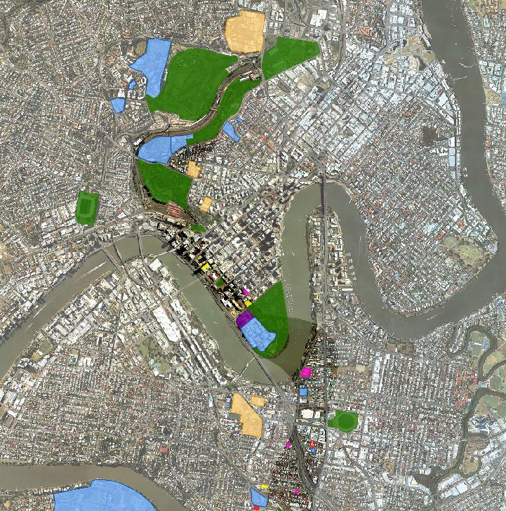
List of Figures
Figure 14-1   SIA study area – statistical areas level 2................................................................................. 14-2
Figure 14-2   Social infrastructure in the study corridor - minor .................................................................. 14-21
Figure 14-3   Existing social infrastructure – South .................................................................................... 14-26
Figure 14-4   Existing social infrastructure – Central .................................................................................. 14-27
Figure 14-5   Existing social infrastructure – North ..................................................................................... 14-28
Figure 14-6   Roma Street Parkland ........................................................................................................... 14-36
Figure 14-7   Victoria Park features ............................................................................................................ 14-37

List of Tables
Table 14-1    Components considered in social impact assessment ............................................................ 14-5
Table 14-2    Population growth 2002-2012 ................................................................................................. 14-8
Table 14-3    Projected population growth, 2011-2036................................................................................. 14-8
Table 14-4    Age profile, 2012 ..................................................................................................................... 14-9
Table 14-5    Cultural diversity, 2011............................................................................................................ 14-9
Table 14-6    Household composition, 2011 ............................................................................................... 14-10
Table 14-7    Dwelling type, 2011 ............................................................................................................... 14-11
Table 14-8    Housing ownership, 2011...................................................................................................... 14-11
Table 14-9    Level of disadvantage, 2011 ................................................................................................. 14-12
Table 14-10   Journey to work, 2011 (per cent) .......................................................................................... 14-13
Table 14-11   Annual personal income, 2011.............................................................................................. 14-14
Table 14-12   Social infrastructure near the Project .................................................................................... 14-29
Table 14-13   Property requirements........................................................................................................... 14-43
Table 14-14   Economic evaluation inputs and assumptions ...................................................................... 14-47
Table 14-15   Cost benefit analysis results* ................................................................................................ 14-48
Table 14-16   Summary of sensitivity testing ............................................................................................... 14-49
Table 14-17   Outcomes of computable general equilibrium modelling ....................................................... 14-49
Table 14-18   Summary of wider economic impacts.................................................................................... 14-50
Table 14-19   Construction workforce per worksite ..................................................................................... 14-53
Table 14-20   Evaluation of impacts ............................................................................................................ 14-81

Page ii
14.      Socio-economic assessment
14.1     Introduction
The purpose of this chapter is to assess the expected social and economic impacts (positive and
negative) of the Project. It provides an overview of existing socio-economic conditions and values for
local and regional communities and assesses the potential impacts of the Project on these values.
Strategies to manage potential impacts are also recommended, where required.

This chapter addresses sections 10.30 and 10.31 of the Terms of Reference (ToR).

14.1.1 Methodology

The study corridor for the socio-economic assessment is displayed in Figure 14-1. It includes the
Australian Bureau of Statistics (ABS) Statistical Areas Level 2 (SA2) locations of:
•   Fairfield-Dutton Park; Annerley; Woolloongabba; and Kangaroo Point, south of the Brisbane River
•   Brisbane City (i.e. Brisbane Central Business District (CBD)); and Spring Hill, north of the
    Brisbane River.

The Herston-Kelvin Grove SA2 is also intersected by the Project. Works in this SA2 are mainly located
in Victoria Park, adjacent to the northern side of the Inner City Bypass (ICB), and are not expected to
directly impact residential areas in Herston-Kelvin Grove. Population and demographic statistics for
Herston-Kelvin Grove have not been included in this assessment, although impacts on local
businesses, social infrastructure and community values in this area have been considered, where
relevant.

Benefits and impacts from the Project’s construction and operation may also be experienced in other
areas of Brisbane and South East Queensland, such as through improved public transport access
during operation or temporary disruptions from the haulage of spoil, materials and equipment during
construction. These impacts are also considered in this assessment.

Socio-economic assessment involves the process of analysing, monitoring and managing the intended
and unintended social and economic impacts, both positive and negative, of a development. It
involves identifying and evaluating changes to or impacts on, communities, business and industry that
are likely to occur as a result of a proposed development, in order to mitigate or manage impacts and
maximise benefits.

This socio-economic assessment was developed in accordance with the Queensland Government’s
Social Impact Assessment Guideline (July 2013). The guideline outlines those components to be
considered and the matters to be addressed by social impact assessment. The initial step in the
assessment process involved scoping the likely range of potential socio-economic impacts and
identifying communities likely to be affected by the Project. This was informed by:
•   the Environmental Impact Statement (EIS) ToR for the Project
•   the Queensland Government’s Social Impact Assessment Guidelines (June 2013)
•   social and economic assessments undertaken for other rail and transport infrastructure projects,
    including those assessments for the Cross River Rail project (SKM Aurecon CRR JV, 2010)
•   literature relating to the assessment of social and economic impacts, including the International
    Principles for Social Impact Assessment (IAIA, 2003)
•   outcomes of consultation undertaken for the Project as well as consultation that has occurred in
    the study corridor for other similar projects.

                                                                                                   Page 14-1
WINDSOR
ASHGROVE J
"
BOWEN HILLS
NEWSTEAD
HERSTON
KELVIN GROVE J
" BULIMBA
RED HILL
J
" TENERIFFE
FORTITUDE VALLEY BALMORAL
PADDINGTON
Spring Hill
HAWTHORNE
J
" J
"
MILTON
NEW FARM
J
" Brisbane City
MORNINGSIDE
AUCHENFLOWER
J
"
J
"
SOUTH BRISBANE Kangaroo Point NORMAN PARK
J
"
J
"
TOOWONG WEST END EAST BRISBANE
HIGHGATE HILL
E:\QENV2\Projects\QE06863\Spatial\ArcGIS\Figures\Final_EIS_Figures\14_Social_Impact\Social_Figure14-1_SIA_StudyArea_SA2_Boundaries.mxd Date: 12/08/2014
J
" CAMP HILL
J
" Woolloongabba
J
" COORPAROO
ST LUCIA
J
"
Fairfield - Dutton Park GREENSLOPES
J
"
Annerley
YERONGA
HOLLAND PARK
J
"
INDOOROOPILLY
TARRAGINDI
YEERONGPILLY HOLLAND PARK WEST
J
" J
"
MOOROOKA
TENNYSON
LEGEND BUS AND TRAIN PROJECT
ENVIRONMENTAL IMPACT STATEMENT
J
" Existing rail station Study area
Existing rail line SA2 block (Census 2011) FIGURE 14-1
Study corridor SIA study area - statistical areas level 2
±
0 0.5 1
Kilometres
1:40,000 (at A4)
Aerial Photo: Brisbane City Council 2012 Projection: GDA 1994 MGA56
The second step of the assessment involved describing the existing socio-economic conditions. This
provides a baseline of the social and economic characteristics and values in the study corridor, from
which potential benefits and impacts of the Project can be assessed. The description of the existing
socio-economic conditions involved both qualitative and quantitative analysis, including:
•   reviewing existing State and local government policies and strategies relevant to the socio-
    economic environment of the study corridor
•   analysing population and demographic data for communities in the study corridor, such as
    population size and growth, diversity, socio-economic disadvantage and housing
•   analysing economic information, including data on employment and income, workers and visitors
    to the study corridor, and business and industry near the Project
•   reviewing existing social infrastructure in the study corridor such as education facilities, health
    and emergency services, recreation uses and transport facilities
•   identifying existing community values relating to factors such as amenity and sense of place,
    access and connectivity, and community health and safety.

The description of the existing socio-economic conditions principally draws on information from the
ABS Census of Population and Housing 2011, supplemented with information and data from:
•   government agencies such as the ABS, Queensland Government Statistician and Brisbane City
    Council
•   Queensland Government and Brisbane City Council publications, reports, guidelines and
    websites
•   a visual survey of local businesses near to Project infrastructure and construction works
•   observations made during a site visit to the study corridor
•   community consultation undertaken for the Project, including on the draft ToR and draft reference
    design.

The next step for the socio-economic assessment involved identifying and evaluating changes to the
existing social and economic conditions and values in the study corridor from the Project’s
construction and operation. This included the assessment of direct and indirect benefits and impacts
as well as consideration of cumulative impacts due to the Project’s interaction with impacts of other
projects.

A framework was used to evaluate the significance of the Project’s socio-economic effects, based on
an assessment of the likely extent, duration and severity of each impact, and the consequence and
probability of the impact occurring. Further information on the evaluation framework is provided in
Appendix I.

The final step for the socio-economic assessment involved identifying measures to avoid, minimise or
mitigate socio-economic impacts arising from the Project. These measures were informed by feedback
from community consultation and consideration of measures used to manage socio-economic impacts
of other major transport projects.

Community and stakeholder consultation

Community and stakeholder consultation has formed an integral part of the Project development and
preparation of the EIS. This included engagement with affected property owners, local communities,
business and industry organisations, State Government agencies and Brisbane City Council. A
summary of community and stakeholder consultation undertaken for the Project is provided in
Chapter 1 – Introduction while a detailed consultation report is provided in Appendix D.

                                                                                                  Page 14-3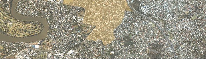
This socio-economic assessment has been informed by feedback from community and stakeholder
consultation. This included:
•    identifying community features, values and issues that are important to communities in the study
     corridor
•    understanding how people live, visit and work in the study corridor
•    identifying potential benefits and impacts of the Project’s construction and operation.

Consultation was also undertaken with the Office of the Coordinator-General regarding the socio-
economic assessment.

A summary of the key issues raised during community and stakeholder consultation are provided in
section 14.4.

14.2        Legislative and social policy context

This section provides an overview of the broader social and economic policies and strategies relevant
to the Project and the study corridor.

14.2.1 Australian Government

Disability Discrimination Act 1992

The Disability Discrimination Act 1992 (DDA) provides protection against discrimination based on
disability. The DDA requires areas and facilities open to the public to be accessible to people with a
disability. This includes areas and facilities such as public footpaths and walkways; public transport;
public buildings (i.e. libraries, sporting venues, shops and government offices); and parks, public
swimming pools and pedestrian malls. The DDA applies to both existing places as well as places
under construction.

Project stations at Woolloongabba, George Street and Roma Street would be designed to comply with
the DDA. During construction, temporary access changes required to public areas and facilities would
need to consider the needs of people with a disability.

14.2.2 Queensland Government

State Development and Public Works Organisation Act 1971

The EIS has been prepared under the State Development and Public Works Organisation Act 1971
(SDPWO Act). The SDPWO Act defines ‘environment’ as including:
     a)     ‘ecosystems and their constituent parts, including people and communities; and
     b)     all natural and physical resources; and
     c)     the qualities and characteristics of locations, places and areas, however large or small, that
            contribute to their biological diversity and integrity, intrinsic or attributed scientific value or
            interest, amenity, harmony and sense of community; and
     d)     the social, economic, aesthetic and cultural conditions that affect, or are affected by, things
            mentioned in paragraphs (a) to (c)’.

Page 14-4
The ToR for the Project requires the assessment of the likely social and economic impacts (positive
and negative) on affected communities and economies. In particular, the ToR identifies that the
construction and operation of the Project should aim to avoid or mitigate adverse social and economic
impacts arising from the Project and to capitalise on opportunities potentially available to affected
communities.

Social impact assessment guideline

The Social Impact Assessment Guideline (July 2013) provides guidance on the assessment of social
aspects of projects and provides direction on the roles and responsibilities of project stakeholders in
the development and implementation of social impact assessments.

The guideline identifies five components to be considered in preparing a social impact assessment.
These are outlined in Table 14-1 along with a description on each component’s relevant to the Project.
Reference is also provided to where the component is addressed in the EIS.

Table 14-1      Components considered in social impact assessment

Component                  Relevance to the Project                                Section(s) addressed in
                                                                                   the EIS
Community and              Community and stakeholder engagement                    Chapter 1 – Introduction
stakeholder engagement     undertaken for the Project informed the development     Section 14.1.1
                           of the reference design and EIS, including the socio-   Section 14.4
                           economic assessment.
                                                                                   Appendix D
                           Community and stakeholder engagement would be
                           ongoing during the construction and operation of the
                           Project and would be important in managing the
                           Project’s socio-economic impacts.
Workforce management       Construction would not result in an influx of workers   Section 14.5.4
                           at a scale that would impact on population size,        Section 14.5.7
                           demography or housing in the study corridor.
                           The presence of a construction workforce may
                           impact on community values and amenity for some
                           residents closest to construction worksites.
Housing and                Construction would not result in an influx of workers   Section 14.5.2
accommodation              at a scale that would impact on housing in the study
                           corridor.
                           Impacts on housing and accommodation would
                           mainly result from volumetric acquisition or changes
                           in residential amenity.
Local business and         Construction and operation of the Project may have      Section 14.5.4
industry content           effects for some local businesses closest to the
                           Project.
Health and community       Changes to health and community well-being would        Section 14.5.7
well-being                 generally result from temporary changes to amenity
                           during construction.

                                                                                                    Page 14-5
14.2.3 Brisbane City Council

Brisbane Vision 2031 is Brisbane City Council’s long-term community plan. It details the aspirations for
the city’s future and outlines ideas for achieving this vision. The main priorities for Brisbane Vision
2031 are to maintain or improve quality of life for the Brisbane community and ensure that Brisbane
has the services and infrastructure to meet the liveability and sustainability challenges of the future.

Land use and development within the Brisbane Local Government Area (LGA) is guided by the
Brisbane City Plan 2014 (City Plan). The City Plan outlines several strategic outcomes for the City.
Those relating to the socio-economic environment for the Project include:
•    Brisbane is served by appropriate infrastructure – the land, facilities and services that support
     economic growth and meet environmental and social needs
•    Brisbane's healthy and safe communities are ensured through development which is designed to
     minimise environmental risks, contribute to crime prevention and promote active travel and
     recreation.

The City Plan includes neighbourhood plans which provide detailed guidance on planning and land
use in specific localities. The City Centre Neighbourhood Plan encourages development of high
density commercial and residential areas, complemented by a vibrant retail core and high level
recreational and entertainment uses.

The intention of the Woolloongabba Centre Neighbourhood Plan is to encourage development to
create an urban community with easy access to opportunities for living, working and playing, providing
affordable accommodation for workers. The West End-Woolloongabba District Neighbourhood Plan
encourages the continued co-existence of the area’s diverse mix of residential, industrial, commercial,
retail and community uses to provide social and built form diversity. The major institutions located in or
adjoining the neighbourhood plan area will remain focal points and are to be enhanced by better
access by all transport modes.

Further information on land use and development planning in the study corridor is provided in
Chapter 5 – Land use and tenure.

14.3        Existing environment

This section describes the existing social and economic conditions and values in the study corridor,
including population and housing, employment, local business and industry, and social infrastructure.

14.3.1 Socio-economic context

The Project is located in Brisbane’s inner city suburbs, extending from Dutton Park in the south to
Spring Hill in the north. The study corridor comprises a mix of land uses including residential, major
commercial developments, small scale industrial uses and local and regional level community
facilities.

The study corridor has a residential population of 44,532 people (Queensland Treasury and Trade,
2014). Residential development within the study corridor offers a range of housing choice including
medium to high density apartments in the Brisbane CBD, Spring Hill and Kangaroo Point and lower
density character housing at Annerley, Dutton Park, and Woolloongabba.

The study corridor also has a worker population of about 150,400 people, of which about 75 per cent
work in Brisbane City (i.e. the Brisbane CBD) (Queensland Treasury and Trade, 2014).

Page 14-6
There were about 16,709 registered businesses in the study corridor in 2012, of which about 95 per
cent were small businesses with less than 20 employees (Queensland Treasury and Trade, 2014).
Commercial development within the study corridor is mainly focussed in the Brisbane CBD and
includes office accommodation, shopping and entertainment uses. Smaller scale commercial centres
are also located at Stanley Street and Ipswich Road in Woolloongabba and Boundary Street in Spring
Hill with these mainly comprising a mix of retail, shopping and café/ restaurant uses.
The study corridor is well serviced by a broad range of community services and facilities, including
education, medical, community support services, shopping, entertainment, recreation and open space
areas. These include services and facilities that cater for communities in the study corridor as well as
communities across greater Brisbane and South East Queensland. Major community facilities near the
Project include:
• the Princess Alexandra Hospital (PA Hospital) at Woolloongabba and Royal Brisbane and
Women’s Hospital (RBWH) at Herston
• Queensland University of Technology (QUT) in Brisbane City and Brisbane Girls Grammar
School, Brisbane Grammar School and St Joseph’s College at Spring Hill
• open space, parkland and sporting facilities, including the Gabba Stadium at Woolloongabba, City
Botanic Gardens and Roma Street Parkland in Brisbane City, and Victoria Park at Spring Hill.
The study corridor is also serviced by a range of transport services and facilities, including passenger
and freight rail services, busways and surface bus routes, major roads and freeways, and pedestrian
and cycle networks. These provide a high level of access for residents in the study corridor as well as
access for communities across South East Queensland to major community facilities and employment
opportunities located in the study corridor.
14.3.2 Community profile
This section provides an overview of the population, demography and housing characteristics of
communities in the study corridor. Information is presented for the study corridor as well as for the
Brisbane LGA and Queensland. Further information on population and demographic characteristics is
provided in Appendix I.
Population size and growth
In 2012, the study corridor had a residential population of 44,532 people (refer to Table 14-2).
Annerley had the largest residential population, reflecting the predominantly residential nature of this
area. This was followed by Brisbane City, which comprised about 21 per cent of the study corridor’s
population. Fairfield-Dutton Park had the smallest residential population, with about 10 per cent of the
study corridor population living in this area.
Over the 10 years to 2012, the study corridor experienced relatively high population growth, with
population growing at a faster rate than both the Brisbane LGA and Queensland. This was driven by
relatively high growth in Brisbane City, reflecting the development of high density residential
apartments in the city centre in the early 2000s.
Page 14-7Table 14-2 Population growth 2002-2012
Location Population (number) Average annual growth
rate (%)
2002 2012 2002-2012
Study corridor 29,627 44,532 4.2
Brisbane LGA 908,289 1,110,473 2.0
Queensland 3,653,123 4,565,529 2.3
Source: Queensland Treasury and Trade, 2014
The population of the study corridor is expected to grow to about 64,831 people by 2036, or about
1.6 per cent annually from 2011 (refer to Table 14-3). This is below the rate of growth for Queensland,
although above the predicted rate of growth for the Brisbane LGA.
Woolloongabba is projected to have the highest rate of population growth in the study corridor, at an
average of 4.9 per cent annually. This would give Woolloongabba a population of about 16,930 people
in 2036, making it the largest residential population in the study corridor. Woolloongabba includes a
priority development area and is proposed to be developed as a mixed use precinct, with high density
residential development.
Table 14-3 Projected population growth, 2011-2036
Location 2011 2016 2026 2036 Average
annual growth
rate (2011-
2036) (%)
Study corridor 43,512 49,356 57,911 64,831 1.6
Brisbane LGA 1,089,879 1,176,418 1,310,033 1,440,223 1.1
Queensland 4,476,778 4,946,319 6,007,578 7,095,177 1.9
Source: Queensland Government population projections, 2013 edition; ABS, Population by Age and Sex, Regions of Australia, 2012 (Cat no.
3235.0)
Age profile
The study corridor has a relatively young population. In 2012, the study corridor had a median age of
31.3 years, compared to 34.6 years in the Brisbane LGA and 36.6 years in Queensland. Kangaroo
Point had the highest median age in the study corridor at 34.6 years.
The study corridor has a high proportion of working aged people and relatively low proportions of older
people and children. In 2012, over 82 per cent of people in the study corridor were aged 15-64 years.
This is compared to about 71 per cent and 67 per cent of people in the Brisbane LGA and Queensland
respectively (refer to Table 14-4). This reflects the study corridor’s proximity to the Brisbane CBD and
the major hospitals and universities, which are typically attractors for young professionals and
students.
Within the study corridor, Fairfield-Dutton Park and Annerley had high proportions of children aged
14 years or younger, although these were below the average for the Brisbane LGA and Queensland.
Kangaroo Point had the highest proportion of older people (at 13.1 per cent), which was above the
Brisbane LGA. This is likely to reflect uses such as St Vincent’s Care Services in this area.
Page 14-8Table 14-4 Age profile, 2012
Location 0-14 years (%) 15-64 years (%) 65 years or Total Median age
over (%) population (years)
Study corridor 9.2 82.7 8.1 44,532 31.3
Brisbane LGA 17.5 70.9 11.6 1,111,217 34.6
Queensland 19.9 66.8 13.3 4,565,529 36.6
Source: Queensland Treasury and Trade, 2014
Cultural diversity
Communities in the study corridor are culturally diverse with high proportions of people born overseas,
people who speak a language other than English and who do not speak English well, or at all (refer to
Table 14-5). At the 2011 Census, each of the study corridor SA2s had proportions above the Brisbane
LGA and Queensland averages of people born overseas and who spoke a language other than
English at home.
Brisbane City and Spring Hill particularly had more than double the Queensland average proportions
of overseas born people. The top five countries of birth for residents in the study corridor were the
United Kingdom, New Zealand, South Korea, China and India. The most common non-English
languages were Chinese, Indo Aryan, Korean, Spanish and Greek.
The study corridor had relatively high proportions of people with low levels of English proficiency, with
about 9.3 per cent of people not speaking English well or at all. This is compared to 8.1 per cent in the
Brisbane LGA and 5.2 per cent in Queensland. Woolloongabba had the highest levels of people who
did not speak English well or at all, followed by Brisbane City and Spring Hill. People with lower levels
of English proficiency represent a stakeholder group with particular communication needs and a group
who may be more vulnerable to changes from the Project.
At the 2011 Census, about 0.9 per cent of the study corridor’s population identified as Indigenous,
which was below the proportion of Indigenous people in both the Brisbane LGA and Queensland.
However, the levels of Indigenous people varied across the study corridor with Woolloongabba and
Fairfield-Dutton Park recording levels of Indigenous people similar to Brisbane as a whole.
Table 14-5 Cultural diversity, 2011
Location Indigenous Overseas born Speaks Speaks Total
persons (%) (%) language other English not population
than English at well or not at
home (%) all (%)
Study corridor 0.9 36.7 21.7 9.3 40,809
Brisbane LGA 1.4 28.3 14.6 8.1 1,041,841
Queensland 3.6 20.5 7.4 5.2 4,332,738
Source: Queensland Treasury and Trade, 2014 and ABS, Census of Population and Housing, 2011
Population mobility
Communities in the study corridor are relatively mobile, with proportions of people who lived at a
different address both 12 months and five years prior to the 2011 Census, above the averages for
both the Brisbane LGA and Queensland.
Page 14-9Spring Hill had the highest levels of population mobility in the study corridor, over both 12 months and
five years. This was followed by Brisbane City and Kangaroo Point. The higher levels of population
mobility in these areas may reflect the relatively high levels of rental accommodation as well as
residential development that has occurred in Spring Hill and Brisbane City in recent years.
Annerley, Fairfield-Dutton Park and Woolloongabba had the lowest levels of population mobility,
although the levels of population mobility in these areas were above the averages for both the
Brisbane LGA and Queensland. This lower level of mobility is consistent with the more established,
residential nature of these areas.
Households and families
There were about 16,231 households in the study corridor at the 2011 Census, of which more than
one quarter were in Annerley, reflecting the more residential nature of this area.
In 2011, the study corridor had high proportions of lone person and group households and low
proportions of family households compared to both the Brisbane LGA and Queensland (refer to
Table 14-6).
This household composition generally reflects the high levels of rental accommodation within the study
corridor and proximity to the Brisbane CBD and major hospitals and universities, which make the
study corridor attractive to students and young professionals who are more likely to live in share
households.
The higher proportion of lone person households is also likely to reflect the housing types (i.e. high
density apartments and units) in areas such as Brisbane City and Kangaroo Point. Spring Hill and
Woolloongabba had the highest proportion of group households, while Fairfield-Dutton Park and
Annerley had the highest proportions of family households, which is likely to reflect the lower density
and more residential nature of these two areas.
Table 14-6 Household composition, 2011
Location Family households Lone person Group households Total households
(%) households (%) (%) (number)
Study corridor 51.3 33.8 14.9 16,231
Brisbane LGA 68.8 24.0 7.2 380,777
Queensland 72.4 22.8 4.7 1,547,304
Source: ABS, Census of Population and Housing, 2011
The study corridor generally had lower proportions of families with children and higher proportions of
couple only families compared to the Brisbane LGA and Queensland. In 2011, couple only families
were the predominant family type in all SA2s apart from Fairfield-Dutton Park.
The study corridor also had a lower proportion of one-parent families compared to the Brisbane LGA
and Queensland. However, levels of one parent families in Fairfield-Dutton Park were above or
comparable to the Brisbane LGA and Queensland averages.
Housing
The study corridor had 16,233 occupied private dwellings at the 2011 Census. Overall, dwelling types
were typical of the study corridor’s inner city location, with higher proportions of apartments and lower
proportions of separate houses (refer to Table 14-7).
Page 14-10However, dwelling types varied across the study corridor with:
• Fairfield-Dutton Park, comprising predominantly low density detached dwellings
• Annerley and Woolloongabba, comprising a mix of separate houses and apartments
• Kangaroo Point, Brisbane City and Spring Hill characterised by high density residential
apartments.
Table 14-7 Dwelling type, 2011
Location Separate house Semi-detached (%) Apartment (%) Total dwellings
(%)
Study corridor 31.4 8.1 60.0 16,233
Brisbane LGA 70.9 9.7 18.8 380,774
Queensland 78.5 8.4 11.7 1,547,303
Source: Queensland Treasury and Trade, 2014 and ABS, Census of Population and Housing, 2011
The study corridor generally had lower proportions of owner occupiers and higher proportions of rental
housing compared to the Brisbane LGA and Queensland (refer to Table 14-8).
In 2011, more than half of dwellings in the study corridor were rented. In particular, Spring Hill had
very high levels of rental housing with almost 70 per cent of dwellings being rented. Kangaroo Point
and Woolloongabba also had high levels of rental housing.
The high level of rental households reflects the higher levels of population mobility and group
households and the availability of short term accommodation within the study corridor. Fairfield-Dutton
Park and Annerley had the highest proportion of owner occupied houses, with about 46.9 per cent and
44.6 per cent of houses respectively, that were either fully owned or being purchased. This reflects the
more established, residential nature of these areas.
Table 14-8 Housing ownership, 2011
Location Fully owned (%) Being purchased Rented (%) Total
(%)
Study corridor 17.0 21.3 58.1 16,231
Brisbane LGA 27.7 33.8 35.7 380,774
Queensland 29.0 34.5 33.2 1,547,304
Source: Queensland Treasury and Trade, 2014 and, Census of Population and Housing, 2011
There were approximately 840 households renting public housing in the study corridor at the 2011
Census. This represented about five per cent of dwellings in the study corridor, which was above both
the average for the Brisbane LGA (at around 3.9 per cent) and Queensland (at 3.5 per cent). Fairfield-
Dutton Park and Annerley had the highest proportion of public rental dwellings, including flats,
apartments and units. In addition, about 165 households, or about one per cent of households in the
study corridor, lived in housing delivered by community organisations.
Education
People in the study corridor had higher levels of education attainment and qualifications compared to
the Brisbane LGA and Queensland. In 2011, about 73 per cent of people in the study corridor had
completed Year 11 or 12, compared to about 69.4 per cent in the Brisbane LGA and 55.3 per cent in
Queensland. The study corridor also had a lower proportion of people who did not go to school or who
had only completed Year 8 or below.
Page 14-11However, this varied across the study corridor, with Woolloongabba, Fairfield-Dutton Park and
Annerley having proportions of people in this group above the study corridor average.
The study corridor had higher proportions of people who had achieved a bachelor degree or higher
and lower proportions of people with a certificate qualification compared to the Brisbane LGA and
Queensland. Spring Hill had the highest proportion of people who had completed a bachelor degree or
higher, with 38.2 per cent of the population achieving this qualification level.
Levels of disadvantage
The ABS produces a range of indices that provide a summary measure of socio-economic conditions
(Socio-economic Indexes for Areas (SEIFA)) based on information from the ABS Census. The SEIFA
index of relative socio-economic disadvantage is derived from Census variables such as income,
education attainment, unemployment and motor vehicle access. Low index values represent areas of
most disadvantage and high values represent areas of least disadvantage.
A community’s level of disadvantage may influence the ability of that community to cope with or
respond to changes from a project. In particular, communities that display levels of relative
disadvantage may be more vulnerable to the impacts of large infrastructure projects than those that
display levels of relative advantage. However, improved access to employment opportunities would
also provide benefits for those communities that display levels of relative disadvantage.
In 2011, communities in the study corridor generally displayed relatively low levels of disadvantage
compared to Queensland, with lower proportions of people in the bottom quintiles and higher
proportions of the population in the highest quintile (which demonstrate low levels of relative
disadvantage). However, compared to the Brisbane LGA, the study corridor had a lower proportion of
the population in the bottom quintile (displaying the highest levels of disadvantage), but also lower
proportions of people in the highest quintile (displaying the lowest level of disadvantage) (refer to
Table 14-9).
Table 14-9 Level of disadvantage, 2011
Location Quintile 1 (most Quintile 2 Quintile 3 Quintile 4 Quintile 5 (least
disadvantaged) disadvantaged)
Study corridor 5.3 14.3 26.5 27.0 26.9
Brisbane LGA 6.6 9.7 19.1 24.2 40.4
Queensland 20.0 20.0 20.0 20.0 20.0
Source: Queensland Treasury and Trade, 2014
Levels of disadvantage varied across the study corridor, with residents in Kangaroo Point and
Brisbane City generally displaying relatively low levels of disadvantage, with about 50 per cent of the
population in these areas in the least disadvantaged quintile. At the same time, communities in
Woolloongabba and Spring Hill had proportions of people displaying the highest levels of
disadvantage above the Brisbane LGA, although below Queensland as a whole.
Page 14-12Need for assistance
At the 2011 Census, the study corridor had relatively low levels of people in need of assistance in one
or more of the three core activity areas of self-care, mobility or communication because of a long-term
disability, health condition or old age. This was largely driven by a very low proportion of people
needing assistance in Brisbane City (i.e. less than one per cent), with many of the study corridor SA2s
recording need for assistance comparable to, or slightly above, the Brisbane LGA. Each SA2 in the
study corridor had lower levels of people who needed assistance compared to Queensland.
Travel to work
Travel patterns of residents in the study corridor generally reflect the study corridor’s high level of
access to public transport, pedestrian and cycle networks and proximity to the Brisbane CBD and
other major employment and activity centres.
While private vehicle was the most predominant mode of travel, compared to the Brisbane LGA and
Queensland, residents in the study corridor were more likely to use public transport, walk or cycle to
work (refer to Table 14-10).
Travel by bus or train formed a part of travel to work for about 17 per cent of people in the study
corridor. This was similar to the Brisbane LGA as a whole, but considerably higher than bus or train
travel in Queensland (at 7.3 per cent). Fairfield-Dutton Park and Annerley had the highest proportion
of people who caught the train to work, which reflects the proximity to train stations for these residents.
Woolloongabba had the highest proportion of bus commuters, followed by Annerley and Fairfield-
Dutton Park.
About 23.7 per cent of workers in the study corridor walked or cycled to work. Spring Hill and Brisbane
City had particularly high proportions of people who walked or cycled, at about 45 per cent, which
reflects the proximity of residents in these areas to employment in the Brisbane CBD.
Table 14-10 Journey to work, 2011 (per cent)
Location
methods (excl train)
Train and one other
Train and two other
method (excl train)
Bus and one other
Bus and two other
method (excl bus)
Walked or cycled
Worked at home
Car (as driver or
Train and bus
passenger)
methods
Train
Bus
Study corridor 4.1 10.3 40.1 23.7 1.0 0.3 0.9 0.2 0.1 3.7
Brisbane LGA 5.0 8.1 58.7 5.9 0.9 1.3 1.0 0.3 0.1 4.1
Queensland 2.1 3.3 67.4 4.8 0.4 0.8 0.5 0.2 0.1 4.9
Source: ABS, Census of Population and Housing, 2011.
14.3.3 Economic profile
This section describes economic characteristics of residents and workers in the study corridor. It also
includes an overview of economic conditions relating to such things as local business and industry.
Page 14-13Income
Residents in the study corridor generally had a higher median income compared to the Brisbane LGA
and Queensland. Incomes varied across the study corridor with the high median income for the study
corridor, largely driven by particularly high incomes in Kangaroo Point and Brisbane City (refer to
Table 14-11).
In 2011, all SA2s in the study corridor had above average proportions of high income earners
compared with Queensland. Brisbane City, Kangaroo Point and Spring Hill also had proportions of
high income earners above the Brisbane LGA average. Fairfield-Dutton Park had relatively high
proportions of low income earners (i.e. on less than $20,800 per year), with this above the averages
for both the Brisbane LGA and Queensland.
Table 14-11 Annual personal income, 2011
Study corridor Less than $20,800 per $104,000 or more per Median annual income
year (per cent) year (per cent) ($)
Study corridor 28.3 10.3 38,985
Brisbane LGA 31.5 8.8 36,237
Queensland 34.6 5.5 30,524
Source: Queensland Treasury and Trade, 2014 and ABS, Census of Population and Housing, 2011
Employment
Labour force participation measures the number of people currently employed or actively looking for
work. The unemployment rate measures the total unemployment relative to workforce participation.
There were 26,286 people in the study corridor who were either employed or looking for work in
December 2013. The study corridor had a relatively high level of unemployment, at about 6.8 per cent
in December 2013. This is compared to around 5.4 per cent in the Brisbane LGA.
Unemployment levels varied across the study corridor. Woolloongabba had the highest unemployment
rate at 11.4 per cent, followed by Fairfield-Dutton Park at 8.7 per cent. Kangaroo Point had the lowest
level of unemployment, with about 5.0 per cent of the labour force looking for work (Australian
Government Department of Employment, Small Area Labour Markets 2013).
The main industries of employment for residents in the study corridor at the 2011 Census included:
• professional, scientific and technical services (14.7 per cent)
• health care and social assistance (12.3 per cent)
• accommodation and food services (9.8 per cent)
• education and training (8.4 per cent)
• retail trade (7.3 per cent).
In 2011, there were about 36,310 people in the Brisbane LGA employed in the construction industry,
representing about 6.7 per cent of workers. This was below the proportion of people employed in
construction in Queensland as a whole, at about 9.0 per cent.
Page 14-14In 2011, the main occupation groups of employment in the study corridor were professionals, clerical
and administrative workers and managers. This was consistent with the main occupation groups in the
Brisbane LGA. The study corridor had lower than average proportions of technicians and trade
workers, labourers and machinery operators and drivers compared to Queensland.
Business and industry
The study corridor includes a wide range of business and commercial uses that serve communities
across South East Queensland as well as communities in the study corridor.
In 2012, there were 16,709 registered businesses in the study corridor, of which 11,412 businesses, or
about 68 per cent, are located in Brisbane City. Spring Hill had the next largest concentration of
businesses (at 2,150 businesses), followed by Woolloongabba (at 1,114 businesses). About 95 per
cent of businesses in the study corridor are small businesses, employing less than 20 employees. This
is consistent with the proportion of small businesses in Brisbane and Queensland as a whole
(Queensland Treasury and Trade, 2014).
The largest industry sector in the study corridor was financial and insurance services, followed by
professional, scientific and technical services; and rental, hiring and real estate services. Combined,
these three sectors account for about 53 per cent of registered businesses in the study corridor. Retail
trade accounted for about four per cent each of businesses in the study corridor, which was below the
Brisbane and Queensland averages. (Queensland Treasury and Trade, 2014).
Tourism is an important industry for the study corridor. Accommodation and food services accounted
for about four per cent of registered businesses in the study corridor (Queensland Treasury and
Trade, 2014) and employed about 7,979 workers, or about 5.3 per cent of people working in the study
corridor (ABS Census, 2011).
In 2013, there were about 70 short-term accommodation providers in the study corridor with 15 or
more rooms. These included hotels, motels, guest houses and serviced apartments. About half of the
short-term accommodation providers were located in Brisbane City, with these providing more than
70 per cent of hotel, motel and serviced apartment rooms within the study corridor.
The average room occupancy in the study corridor for the June quarter 2013 was 72.4 per cent,
although this was driven by higher occupancy rates in Brisbane City, which were at about 80 per cent.
This is compared to about 60 per cent for Queensland as a whole. Visitors to the study corridor
generally stayed an average of about 2.4 nights, which was slightly below the Queensland average (at
2.6 nights).
Further information on hotels, motels and serviced apartments near to the Project are described in the
following sections.
Local context
A wide range of business and commercial uses are located near to the proposed surface works that
serve communities in the study corridor as well as communities across the South East Queensland
region. These include such things as:
• government administration and office uses, including high rise office accommodation in Brisbane
City
• retail uses ranging from smaller scale specialty retail uses to larger scale supermarkets and car
yards, including at George Street and Roma Street in Brisbane City, Woolloongabba and Dutton
Park
Page 14-15• accommodation, food and entertainment uses, including at Dutton Park, Woolloongabba, and
George Street and Roma Street in Brisbane City
• health and medical support services, particularly at Dutton Park and Spring Hill/ Herston
• community and educational uses, including at Dutton Park, George Street and Roma Street in
Brisbane City, and Spring Hill.
The following provides an overview of business and commercial uses near the Project surface works.
Dutton Park
Business and commercial at Dutton Park comprise a mix of uses, ranging from tertiary level health
and medical support services associated with the PA Hospital, office and scientific research services
at Boggo Road Urban Village, and smaller scale retail uses catering for the needs of local residents at
Annerley Road. Business and commercial uses near the Project include:
• office uses including architectural and advertising services at Railway Terrace, engineering
services at Pound Street, and government administration and scientific research uses within the
Ecosciences Precinct at Boggo Road Urban Village
• allied health and medical support services associated with the PA Hospital, including at Cornwall
Street, Ipswich Road and Kent Street
• education facilities, including the Aboriginal and Torres Strait Islander Corporation for Health and
Education and Training at Railway Terrace and the University of Queensland (UQ) Pharmacy
Australia Centre of Excellence (PACE) at Cornwall Street
• café, restaurant and takeaway services, including cafés at the UQ PACE and Ecosciences
Precinct, and fresh fish shop at Annerley Road
• accommodation uses at Cornwall Street and Tottenham Court
• a service station at Annerley Road and automotive repair workshop at Pound Street.
Weekly fresh produce and craft markets are also held at the Boggo Road Urban Village on Sunday
mornings. The Buranda Village and PA Central are located at Ipswich Road. These comprise a mix of
retail uses with about 15-30 individual businesses in each. Apart from the major uses such as the
PA Hospital, Ecosciences Precinct and UQ PACE, the majority of businesses in Dutton Park are small
businesses, employing less than about 20 people.
Most businesses near the Project have access to off-street parking for staff and customers. These
parking areas also provide access for service vehicles. On-street parking is also available. However,
consultation for the Project identified that on-street parking in the study corridor was subject to a high
level of demand from major uses such as the PA Hospital, Ecosciences Precinct, rail stations and UQ.
Woolloongabba
Business and commercial uses at Woolloongabba comprise a mix of offices, cafés, restaurants and
takeaway services, retail uses and short-term visitor accommodation. These are mainly small
businesses, employing less than 20 people. Most businesses near the Project cater for local and
district communities, including passing pedestrian traffic from the local area.
Page 14-16Business and commercial uses near the Project include:
• offices that provide for a range of services such as accounting and legal, rental and real estate,
digital media, and government administration and support services, including the Land Centre
• cafés, restaurants and takeaway uses at Stanley Street and Logan Road, including cafés and
restaurants with outdoor dining areas
• car yards and retail showrooms at Ipswich Road
• supermarket at the intersection of Main Street and Stanley Street, and small scale retail uses at
Stanley Street, Vulture Street and Ipswich Road, offering a range of goods and services such as
recreation, food and convenience goods, clothing, footwear and personal accessories, that cater
for local and wider district communities
• short-term visitor accommodation such as motels and rental apartments (e.g. intersection of Main
Street and Vulture Street, Allen Street), that provide accommodation for staff and patients visiting
the Mater Hospital, visitors to major sporting events and tourists.
Businesses at Woolloongabba generally have access to off-street parking, mainly accessed from local
roads at the rear or side of properties. On-street parking is provided within the service lane on Stanley
Road and on local roads. Limited on-street parking is also provided on the eastern side of Ipswich
Road, south of Stanley Street. Access for service vehicles is generally provided from local roads at the
rear or side of properties. On street loading zones are also located at Stanley Street. Pedestrian
access to businesses is at the street frontage.
George Street
Businesses near the Project at George Street mainly include medium to large scale mixed-use
developments, comprising commercial offices or residential uses on upper floors with, cafés/
restaurants and/ or small scale retail uses at street level. A number of allied health services are also
located in the area.
In particular, business and commercial uses include:
• office uses that provide for government administration and private sector services, including at
George Street and Alice Street, Margaret Street, Mary Street, Charlotte Street and Elizabeth
Street
• short-term accommodation uses, such as the Rendezvous Hotel, Casino Towers and Treasury
Hotel at George Street, and the Queensland Club at the corner of George Street and Alice Street
• cafés, restaurants and takeaway uses within larger mixed-use developments at George and Mary
streets, that generally cater for workers and residents of nearby buildings as well as passing
pedestrians
• retail and service uses such as newsagencies, convenience stores and banking services, within
larger mixed-use developments, mainly located at George Street, which generally serve office
workers, residents of nearby buildings and passing pedestrians.
The main government and administrative functions near the Project at George Street include:
• Mineral House at 41 George Street, which accommodates staff from the Department of Natural
Resources and Mines and Department of Local Government, Community Recovery and
Resilience
• Department of State Development, Infrastructure and Planning at 63 George Street
• Department of Housing and Public Works, at 80 George Street
Page 14-17You can also read