Northeast Aquatic Research - Lincoln Pond Aquatic Plant Management Plan - Lincoln Pond Association
←
→
Page content transcription
If your browser does not render page correctly, please read the page content below
Northeast Aquatic Research

Lincoln Pond Aquatic Plant Management Plan
Prepared for the Lincoln Pond Association and the Lake Champlain Basin Program
December 11, 2019

 Northeast Aquatic Research, LLC ⁘ 74 Higgins Highway, Mansfield, CT 06250 ⁘ 860-456-3179

                                                                                        1
Contents
EXECUTIVE SUMMARY ......................................................................................................................................................................... 4
HISTORICAL INFORMATION .............................................................................................................................................................. 5
AQUATIC PLANT SURVEY .................................................................................................................................................................... 6
    SITE DESCRIPTION ......................................................................................................................................................................................................... 6
    PLANT SURVEY METHODS............................................................................................................................................................................................ 7
    RESULTS AND DISCUSSION ........................................................................................................................................................................................... 9
INVASIVE AQUATIC PLANT BIOLOGY AND ECOLOGY ............................................................................................................ 18
AQUATIC PLANT MANAGEMENT TECHNIQUES ........................................................................................................................ 19
    PHYSICAL METHODS ...................................................................................................................................................................................................19
      Hand Harvesting ................................................................................................................................................................................................. 19
      Benthic Barriers .................................................................................................................................................................................................. 21
      Mechanical Harvesting/Cutting ................................................................................................................................................................... 21
    BIOLOGICAL METHODS ...............................................................................................................................................................................................22
      Grass Carp ............................................................................................................................................................................................................. 22
      Herbivorous Insects ........................................................................................................................................................................................... 23
    CHEMICAL METHODS ..................................................................................................................................................................................................23
RECOMMENDATIONS ......................................................................................................................................................................... 25
    PREVENTION .................................................................................................................................................................................................................25
    EARLY DETECTION ......................................................................................................................................................................................................28
    ACTIVE MANAGEMENT ...............................................................................................................................................................................................30
      Selection of Management Techniques ........................................................................................................................................................ 31
      Recommended Approach to DASH Harvesting ....................................................................................................................................... 31
      Benthic Barriers .................................................................................................................................................................................................. 32
      Herbicide Management .................................................................................................................................................................................... 33
PROPOSED TIMELINE FOR FUTURE MANAGEMENT .............................................................................................................. 34
    2020 - SPRING .............................................................................................................................................................................................................34
    2020 - SUMMER ..........................................................................................................................................................................................................34
    2020 - FALL/WINTER ...............................................................................................................................................................................................34
    2021 - WINTER/SPRING ...........................................................................................................................................................................................35
    2021- SUMMER ...........................................................................................................................................................................................................35
    2021 - FALL/WINTER ...............................................................................................................................................................................................35
    2022 - WINTER/SPRING ...........................................................................................................................................................................................36
    2022 - SUMMER ..........................................................................................................................................................................................................36
    2022 - FALL/WINTER ...............................................................................................................................................................................................36
CONCLUSIONS ....................................................................................................................................................................................... 37
ACKNOWLEDGEMENTS ..................................................................................................................................................................... 38
LITERATURE CITED............................................................................................................................................................................ 38
APPENDIX A .......................................................................................................................................................................................... 41
    LAKE MANAGEMENT TRACKER MAPS......................................................................................................................................................................41

                                                                                                                                                                                                                               2
Report Figures
Figure 1. Lincoln pond, Essex county NY. .............................................................................................. 7
Figure 2. Down-imaging SONAR showing eurasian watermilfoil. ......................................................... 8
Figure 3. Aquatic plant sampling waypoints. ......................................................................................... 10
Figure 4. Estimated littoral and pelagic zones in Lincoln pond. ............................................................ 12
Figure 5. Eurasian watermilfoil distribution and percent cover lake-wide. ........................................... 14
Figure 6. Estimated EWM acreage for Lincoln pond. ............................................................................ 15
Figure 7. Map of north basin from APIPP survey work in 2015 (APIPP 2016). ................................... 16
Figure 8. Southern naiad distribution and percent cover lake-wide. ...................................................... 17
Figure 9. Examples of mechanical harvesting equipment. .................................................................... 22
Figure 10. Invasion curve showing the progression of an invasive species through introduction, local
populations, rapid population size increase and resource protection. .................................................... 26
Figure 11. Diagram illustrating the areas where invasive species can cling to on a boat/trailer. ........... 27

Report Tables
Table 1. Select morphometric and watershed characteristics of Lincoln pond ........................................ 6
Table 2. Aquatic plant taxa identified in the 2019 NEAR survey. ......................................................... 10
Table 3. Breakdown of milfoil density ................................................................................................... 13
Table 4.Aquatic herbicides with known activity on eurasian watermilfoil. ........................................... 24

                                                                                                                                          3
Executive Summary
The Lincoln Pond association, with funding from the Lake Champlain Basin Program, contracted
Northeast Aquatic Research to conduct a full-lake aquatic plant survey and to develop an aquatic plant
management plan. The focus of the plan is to control invasive Eurasian watermilfoil (Myriophyllum
spicatum).
Key Findings from Aquatic Plant Survey:
The 2019 survey found 34 aquatic plant species, including two invasive species Eurasian
watermilfoil and Brittle naiad (Najas minor).
Eurasian milfoil was widespread in the lake, covering 367 acres. This species poses a
significant threat to the lake’s recreational, economic, and ecological value.
The potential new invasive species, Brittle naiad, was found as only a single small piece at one
location. Confirmation of this species needs to be verified in 2020.
The 2019 survey found 218 more acres of Eurasian milfoil than was documented in the 2015
Adirondack Park Invasive Plant Program (APIPP) survey. This increase in coverage area is
attributed to the current survey including deeper, more open water areas that were not surveyed
in 2015.
Dense milfoil growth typically extended to 10ft, but sparse to medium growth was common in
12-14ft of water. At some locations milfoil extended to 16ft deep. The sparse growths in deeper
water may reach higher densities in future years as plants become established.
The most common native plant was Southern naiad (Najas guadalupensis), which was
exceedingly dense
Summary of Management Recommendations:
Eurasian watermilfoil present in shallow shoreline areas with high recreation can be controlled
with diver-assisted suction harvesting and benthic matting.
The Lincoln Pond community should pursue a public information program that gauges
community support for future large-scale herbicide treatments targeting Eurasian milfoil.
Incorporation of invasive species prevention and early detection into future management
actions is highly recommended.
The timeline presented will evolve, but recommended steps towards milfoil control are
attributable towards an extended timeline.
4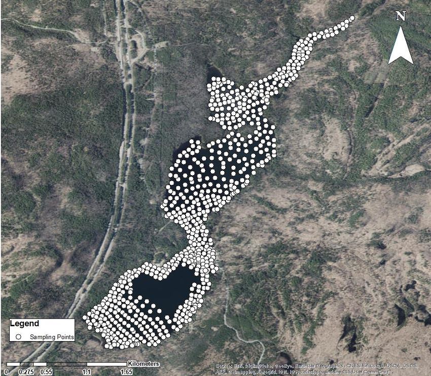
Historical Information
Northeast Aquatic Research compiled historical information related to the aquatic plant management
on Lincoln Pond. The purpose of this compilation was to understand successes and or failures of past
aquatic plant management techniques as well as develop a time line of changing aquatic plant
distribution and abundances in the lake. Earliest documentation comes from the Lincoln Pond
Technical Report that stated aquatic vegetation had been a nuisance to residents for a number of years
(Baker 1979).

An aquatic macrophyte survey of Lincoln Pond was conducted by Adirondack Ecologists in 1997
(LaMere 1997) because of repeated sightings of Eurasian milfoil in the lake. A total of 23 species of
aquatic plants and macroalgae were observed during that survey. The results of the mapping at that
time indicated that there was approximately 120 acres of Eurasian milfoil in the lake.

In 2000, the Lincoln Pond Association spearheaded a project for use of the milfoil moth (Acentria
ephemerella), an insect that reportedly can eat milfoil. Approximately 20,000 second and third instar
moth caterpillars were stocked at a rate of two caterpillars per stem (NYSFOLA 2009). Study
conclusions state that milfoil weevils (Euhrychiopsis lecontei) were naturally present in higher
densities and that they occupied the milfoil stems prior to the augmentation of the moths (NYSFOLA
2009). None of these introductions appeared to have significantly changed moth total numbers.
Predation by sunfish might have been a limiting factor for moth herbivory success.

The Adirondack Park Invasive Plant Program (APIPP) conducted an Aquatic Invasive Species (AIS)
survey of Lincoln Pond in 2015 (Adirondack Aquatic Regional Response Team 2015). A total of 17
plant beds were mapped, covering 125 acres. The most abundant aquatic plant species were Eurasian
watermilfoil, Large-leaf pondweed (Potamogeton amplifolius), and Stonewort (Nitella sp). The exact
acreage of milfoil is not explicitly stated, but the polygons contained within the report infer that all 125
acres contained milfoil.

To aid lake associations in monitoring invasive plant populations, the APA and APIPP have developed
a volunteer plant monitoring program called the Lake Management tracker. The first year of the
program (2019) for Lincoln pond collected 273 points in total. Of that total, 182 points had Eurasian
watermilfoil (Appendix A). Abundance categories from the tracker program are not analogous to the
2019 survey definitions of density class, but the distribution of milfoil is consistent.

                                                                                                          5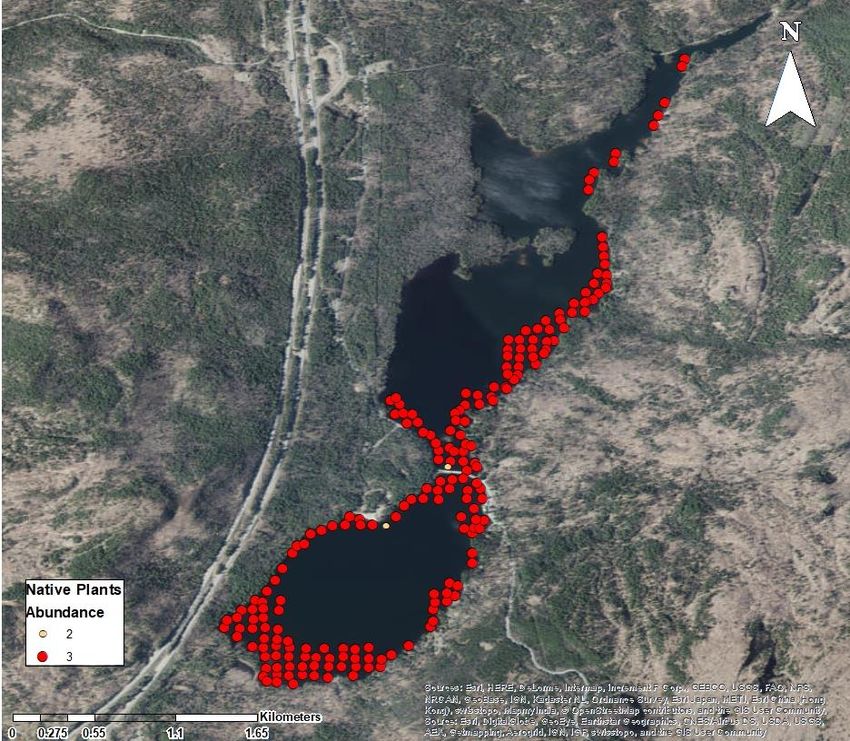
Aquatic Plant Survey
Site Description

Lincoln Pond (44.144625, -73.573757), is a 292 ha lake in Essex County, NY. The lake is located in
the eastern Adirondacks region. The lake has a mean depth of 3 meters and a maximum depth of 8
meters (Table 1). Specific morphometric information is available in Table 1.

Table 1. Select morphometric and watershed characteristics of Lincoln pond. All parameters except for surface area, littoral
                zone area and shoreline length come from CSLAP (2018). Standard units are in parenthesis.

                 Surface Area                                               261 hectares (647 acres)
              Littoral Zone Area                                            222 hectares (548 acres)
                  Mean depth                                                   3 meters (9.8 feet)
                Maximum depth                                                 8 meters (26.2 feet)
                 Retention time                                                    0.7 years
                Watershed area                                            4,000 hectares (9,884 acres)
           Watershed to lake area ratio                                             13.6:1
               Shoreline Length                                                15.89 km (9.9 mi)

                                                                                                                          6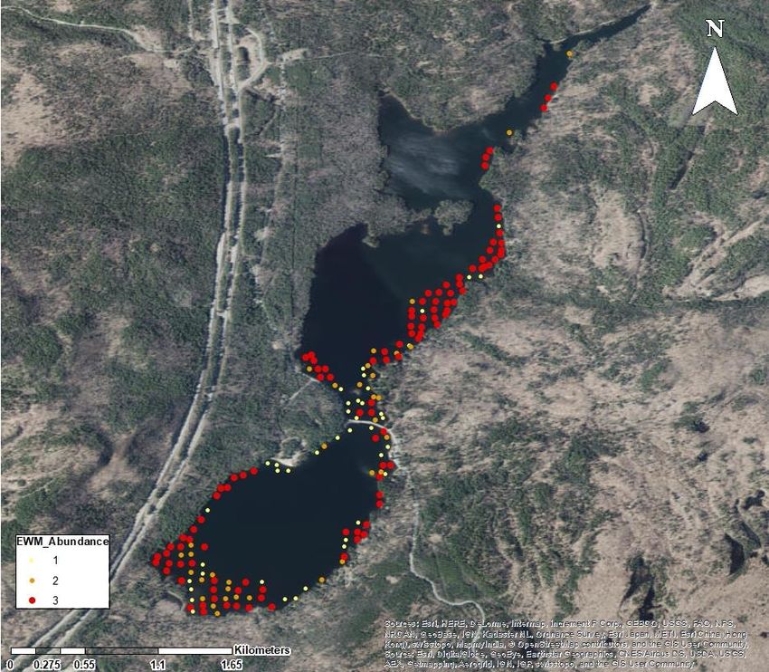
Figure 1. Lincoln pond, Essex county NY.

Plant Survey Methods

The survey was conducted using a 12ft Jon-boat transfixed with one high-resolution down-imaging
SONAR device (Garmin Echo Map 74cv). The SONAR has imaging power of 455 and 800 kHz, and
target separation of 6 cm. The depth-sounder provides scrolling images of bottom features as well as
water depth and plant features (Figure 2).

                                                                                                  7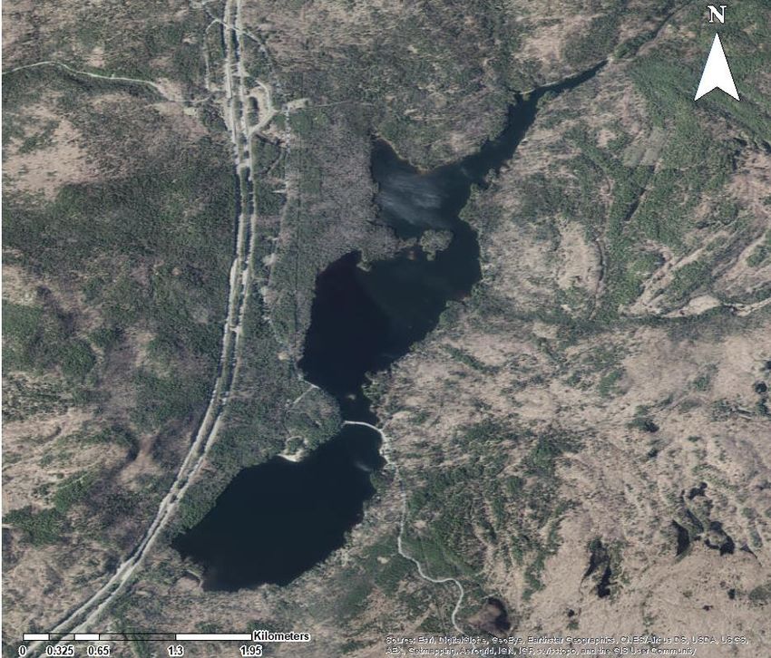
Figure 2. Down-imaging SONAR showing Eurasian watermilfoil (blue box).

The most effective survey method to map Eurasian milfoil area of coverage is a meander survey.
Meander survey methods are also the best technique for searching for sparse native and new invasive
species. This method involves traveling along the shoreline at slow speeds of between 0.1 and 0.4
miles/hour, in search of all plants that inhabit the littoral zone of the lake. Unlike a point-intercept style
survey method where all waypoints are predetermined at fixed intervals throughout the littoral zone,
the meander survey method allows for waypoint creation at exact locations where invasive species are
found. Accurate area mapping of target species uses a combination of GPS tracks, waypoints, and field
notes. During the survey, waypoints were made approximately 50-200ft feet apart along aquatic plant
beds. When the topography or plant composition changed rapidly over small distances, GPS waypoints
were made closer together. If plant composition remained constant, waypoints were made a maximum
of 200ft apart.

In the case of Eurasian watermilfoil beds, GPS waypoints were made along the inner and outer edges
of the bed to adequately map acreage. Waypoints are also made to indicate the beginning and end of
milfoil beds when they occurred. The continuous GPS track, waypoints, and additional field notes
allow for accurate post-survey polygon creation in a Geographic Information Systems (GIS) software.
Examples of field notes critical to mapping are: “Milfoil continuous band approximately 5ft wide from
waypoints 50-70” or “Milfoil band wider (2x) between waypoints 55-58.” Quick shorthand notes in the
field add more data and diminish the amount of interpolation between waypoints.

                                                                                                            8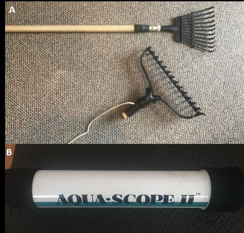
At each waypoint, either a long-handled (16ft) rake, or a 14-tine double-sided garden rake attached to a
10m rope, was used to collect specimens of all species present at that point. The water depth and plant
density were recorded at each waypoint. Plant density was determined using a combination of three
methods. The visual density determination method is based solely on what is visible from the surface.
This method involves using a hypothetical quadrat. In this method, one visually assesses an estimate of
how much area is covered by the plant in question. The use of actual survey quadrats in the field is not
appropriate for the large scale of most aquatic plant surveys. For that reason, surveyors visualized a
hypothetical quadrat, approximately 10-15ft in length, then estimated coverage accordingly. Surveyors
used the long-handled rake to assist in delineating the hypothetical quadrat, as the rake is marked at 10
and 16 feet. The rake was positioned perpendicular to the boat, giving the surveyors a visual guide as
to the extent of the sampling quadrat.

The second way to estimate the percent coverage of vegetation is to use the down-imaging SONAR,
which shows a detailed image of the plants as the boat passes above. The SONAR image is used to
corroborate the visual percent cover estimate in areas where plants can be seen from the surface. In
areas where plants cannot be seen from the surface, the SONAR image becomes extremely useful for
percent coverage estimations, along with weed-rake tosses. Rake tosses involve stopping the boat and
throwing a 10m tow line and rake through the plant bed. Percent cover of collected plants are estimated
semi-quantitatively. When possible, all three ways of estimating the percent cover are used at each
waypoint, with the resulting estimate recorded on the datasheet.

Mapping of plant locations and percent cover was done using ArcGIS and R. Percent cover values
were organized into five different, but equal categories (see figure legends in the results section).

Results and Discussion

The survey was conducted between September 4th and 6th, 2019. A total of 737 waypoints were made
throughout the lake (Figure 3). Thirty six points were made as “depth checks” indicating the edge of
the littoral zone, leaving 701 true plant survey waypoints. The edge of the littoral zone was on average
14 feet.

                                                                                                       9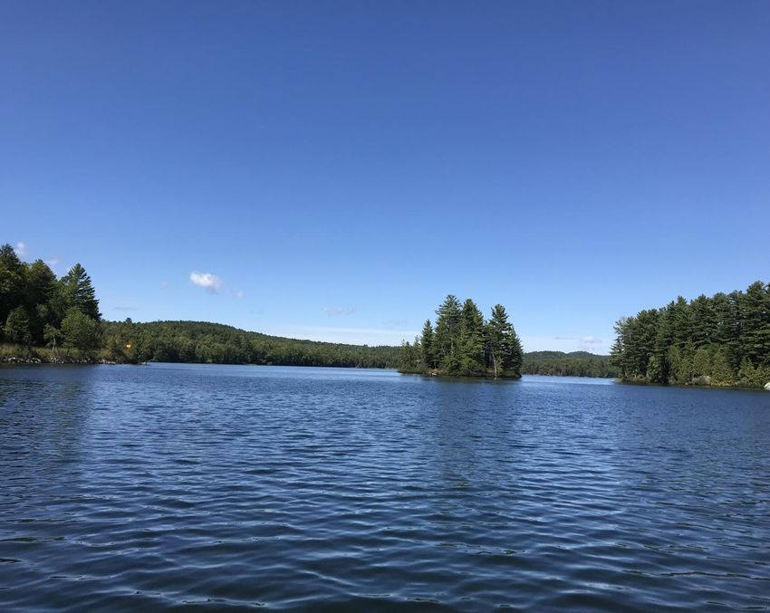
Figure 3. Aquatic plant sampling waypoints.

A total of 34 different plant species were collected. Eurasian watermilfoil and Brittle naiad were the
two invasive species found. Brittle naiad was only found at one location in the lake, and only a small
fragment of the plant was recovered. The most common species observed was southern naiad (Najas
guadalupensis) observed at 73.9% of waypoint sites. Eurasian watermilfoil and Large-leaf pondweed
were the next most widespread species, observed at 62.6% and 37.7% of all sites, respectively.
Southern naiad had the highest mean percent coverage, a density value, at 81%. Watershield (Brasenia
schreberi) and Stonewort mean lake-wide densities were 68% and 56% respectively.
Table 2. Aquatic plant taxa identified in the 2019 NEAR survey. Common names with an asterisk indicate an invasive
species.

                                                                          Number of
                                                                                                Mean Percent
        Common Name                        Scientific Name              Waypoints (% of
                                                                                                   Cover
                                                                             total)
Watershield                           Brasenia schreberi                   78 (11.1)                  68
Sedge                                 Carex sp.                             16 (2.3)                  17

                                                                                                               10
Muskgrass Chara sp. 6 (0.9) 48
Small waterwort Elatine minima 11 (1.6) 13
Spikerush Eleocharis sp. 17 (2.4) 24
Nuttallii's waterweed Elodea nuttallii 17 (2.4) 23
Pipewort Eriocaulon 5 (0.7) 19
Eurasian watermilfoil * Myriophyllum spicatum 439 (62.6) 39
Slender watermilfoil Myriophyllum tenellum 55 (7.8) 55
Filamentous Algae NA 29 (4.1) 25
Nodding waternymph Najas flexilis 14 (2.0) 10
Southern naiad Najas guadalupensis 518 (73.9) 81
Brittle naiad * Najas minor 1 (0.1) 5
Stonewort Nitella sp. 116 (16.5) 56
Yellow-pond lily Nuphar variegata 46 (6.6) 16
White-water lily Nymphaea odorata 1 (0.1) 10
Smartweed Polygonum sp. 4 (0.6) 50
Large-leaf pondweed Potamogeton amplifolius 264 (37.7) 31
Ribbon-leaf pondweed Potamogeton epihydrus 8 (1.1) 15
Grassy pondweed Potamogeton gramineus 122 (17.4) 30
Potamogeton natans Potamogeton natans 2 (0.3) 35
Clasping-leaf pondweed Potamogeton perfoliatus 134 (19.1) 29
Small pondweed Potamogeton pusillus 9 (1.3) 33
Robbins' pondweed Potamogeton robbinsii 4 (0.6) 21
Unidentified pondweed Potamogeton sp. 2 (0.3) 23
Grassy arrowhead Sagittaria graminea 15 (2.1) 19
Floating bur-reed Sparganium fluctuans 19 (2.7) 30
Cattail Typha sp. 3 (0.4) 35
Common bladderwort Utricularia macrorhiza 1 (0.1) 30
Lesser bladderwort Utricularia minor 7 (1.0) 6
Purple-flowered bladderwort Utricularia purpurea 12 (1.7) 18
Little floating bladderwort Utricularia radiata 1 (0.1) 5
Unidentified bladderwort Utricularia sp. 1 (0.1) 5
Tape grass Vallisneria americana 161 (23.0) 29
Except for the small riverine section before the dam, the entire lake north of the Route 7 causeway was
covered in aquatic plants outside of a 4 acres an 18ft section. South of the Route 7 causeway, there is
an open water area approximately 95 acres in size (Figure 4.)
11Figure 4. Estimated littoral (584 acres) and pelagic zones in Lincoln Pond.
Estimates are based on both plant survey data and bathymetric data.
Eurasian watermilfoil was common throughout the entire lake, with the highest percent coverage
observed in the central basin (Figure 5). The northern arm of the lake had sporadic milfoil plants mixed
with Large-leaf pondweed and Watershield. The center open water lake section consisted mostly of a
combination of Southern naiad, Grassy pondweed, Large-leaf pondweed, and Eurasian watermilfoil.
Our estimate of Eurasian watermilfoil acreage was 367 acres or about 63% of the entire littoral zone of
584 acres. The waypoint percent frequencies for each density class are shown in Table 3 below.
12Table 3. Breakdown of milfoil density. Note: 36 points were subtracted from the non-milfoil points because they were used
as depth check points and were outside the littoral zone.
EWM Density Class Points Percentage
Less than 25 % (Sparse) 164 23.0 %
25 to 50 % (Moderate) 107 15.0 %
50 to 75 % (Dense) 108 15.0 %
75 to 100 % (Very Dense) 60 9.0 %
Non-EWM points (No EWM) 262 37.0 %
Maps for the two most widespread species, Eurasian milfoil and Southern naiad, are included in the
figures below. Additional plant maps for less common species are included at the end of this report in
the Appendices.
13Figure 5. Eurasian watermilfoil distribution and percent cover lake-wide.
14Figure 6. Estimated Eurasian watermilfoil acreage for Lincoln pond.
Our survey documented 218 more acres of Eurasian watermilfoil than the APIPP survey from 2015
that reported 125 acres (Figure 7). Because the APIPP survey was restricted to cove and shoreline
areas the two cover estimates are not comparable.
15Figure 7. Map of north basin from APIPP survey work in 2015 (APIPP 2016).
16Figure 8. Southern naiad distribution and percent cover lake-wide.
17Native Southern naiad can grow to exceedingly high nuisance levels. In Lincoln Pond this species
forms thick, impenetrable mats in certain areas of the southern basin of Lincoln Pond. Such dense
naiad growth negatively impacts the lake's water quality by preventing oxygen diffusion into waters
beneath the matted plants. Decaying plant growth will also cause a substantial oxygen demand, which
could increase nutrient loading from bottom waters and negatively impact benthic fauna. Three CT
lakes that had dense Southern naiad growth observed temporary measurable water quality declines
(NEAR personal observations).
As previously mentioned, only one singular small plant of invasive Brittle naiad was found. A
thorough search of the area could not locate another specimen to use as secondary confirmation of the
species presence. For this reason, we recommend continued monitoring in this location. Brittle naiad is
a difficult plant to rake up because it breaks into small pieces. In-water snorkel surveys are the best
way detect any small, very sparse, and low growing patches if they exist in this area. Confirmation of
the presence of invasive Brittle naiad should be a priority for 2020, as this would be considered a new
infestation.
Invasive Aquatic Plant Biology and Ecology
Aquatic plants serve a variety of ecological functions within lake systems. They provide habitat for
aquatic organisms such as fish, invertebrates, amphibians, and waterfowl to forage and reproduce.
Plants also play a critical role in maintaining good water quality by holding sediment in place and
limiting particulate and nutrient re-suspension from winds and bottom-feeding fish (Madsen et al.
2001). Dense stands may also help dampen wave action, reducing the amount of shoreline erosion in
highly windswept areas.
While a certain amount of aquatic plants are beneficial, an overabundance can have detrimental
impacts on the lake. Invasive plant species are often responsible for negative impacts to lakes because
they are ecological engineers that change the environment and disrupt lake functions. In high
abundance, invasive plants create dense canopies that shade out native species and interfere with fish
habitat, dissolved oxygen levels, and nutrient concentrations. Invasive species are also a detriment to
human uses, including boating, swimming, and angling. A large portion of this aquatic plant
management plan focuses on Eurasian watermilfoil since it is the most widespread invasive aquatic
plant in the northeast and is one of the greatest threats to both ecological functions and recreational
uses of lakes.
Eurasian watermilfoil is a submersed, perennial aquatic plant native to Europe, Asia, and northern
Africa (Couch and Nelson 1985). It was first introduced to North America around 1950, and by 1985
that plant was found in 33 US states and parts of Canada (Couch and Nelson 1985). Eurasian milfoil
has whorls of 4 leaves per node with 14-20 pairs of thin leaflets (Borman et al. 1997). It can occur
from 1 to 10 m water depth in clear waters but is more often found in the 1 to 4 m water depth zone
(Smith and Barko 1990). Growth from shoots begins in spring when water temperatures reach
18approximately 15 °C (Smith and Barko 1990). Maximum biomass often occurs in late July/early
August in northeastern lakes. Canopies of EWM can alter the ecology of a lake system by reducing
native plant diversity (Madsen et al. 1991; Boylen et al. 1999) and influencing water chemistry
(Unmuth et al. 2000).
There are a few different ways milfoil gains a competitive advantage over native plants. The vegetative
spread of milfoil via root structures and fragments is thought to be the major mechanism for in-lake
dispersal (Smith and Barko 1990). Milfoil spreads over short distances via root structures, usually less
than a few meters. Auto-fragmentation, which involves the natural detachment of shoots and the
induced breakage of shoots from disturbance is the primary method of long-range dispersals (Madsen
1988). These detached shoots grow roots at stem nodes, called adventitious roots, and can start new
colonies of plants if they land on a suitable substrate. Madsen et al. (1997) found that 46% of
fragments that settled on substrates in outdoor ponds successfully established. Considering there can be
hundreds of fragments floating on lakes at any one time (Reyes, personal observation), this is a
significant source of population colony establishment in lakes.
EWM’s varied growth form also allows it to have a competitive advantage. The plant can grow rapidly
to the surface and branch horizontally (Titus and Adams 1979), shading out competitors that grow near
the bottom. EWM can retain a significant portion of its biomass overwinter as root crowns and shoots
allowing for accelerated growth in spring before other plants (Smith and Barko 1990). Part of this
advantage is due to the fact that EWM can photosynthesize at temperatures as low as 10°C (Stanley
and Naylor 1972).
Aquatic Plant Management Techniques
There are a few management techniques for controlling aquatic plants. These fall into physical,
biological, and chemical methods. No panacea for aquatic plant management exists, so the integration
of strategies is key to long-term success.
Physical Methods
Hand Harvesting
Hand harvesting is a very common plant management technique in New York State, and particularly
the Adirondacks (NYSFOLA 2009). Hand harvesting can be performed through a variety of methods,
such as by boat, snorkeling, SCUBA, or wading. Generally, harvesters fill dive bags with pulled plants.
One of the more common hand-harvesting techniques is diver assisted suction harvesting (DASH). In
DASH, divers hand-pull aquatic plants, including the root system, then insert the plants into a suction
hose suspended above the lake bottom. The hose then pulls the plants up to a catchment area on a boat
(Eichler et al. 1993). Suction hoses allow divers to spend less time traveling to and from the boat with
19traditional dive bags filled with plants. The hose also pulls away some of the sediment that is disturbed
during the hand-removal process, making it easier for divers to continue working in an area because
visibility is not completely obstructed.
The main advantage of this aquatic plant management technique is its selectiveness, as divers can
target small invasive plant clumps, resulting in less collateral damage to native plants in the same area.
DASH is best suited for areas where EWM reaches moderate to high-density infestation levels and
plant density is too high for hand harvesting using individual diver bags (Eichler et al. 1993). In 1990
on Lake George, DASH was used as the primary management technique to control EWM at seven sites
(Eichler et al. 1993). This method reduced both the biomass and the percent cover of EWM in the lake
(Eichler et al. 1993). Approximately 93% of the dry weight of EWM, on average, was removed from
each site by suction harvesting (Eichler et al. 1993). One year after the harvest, the impact of
harvesting on the native plant community included a greater number of species per unit area, but
reduced biomass and percent cover at those sites (Eichler et al. 1993). With a substantial investment of
time and money the hand-harvesting technique can be effective on large water bodies, such as Lincoln
Pond.
Intensive hand-harvesting was undertaken to achieve whole-lake control of milfoil in Upper Saranac
Lake (Kelting et al. 2010). For three consecutive years, beginning in 2004, six crews of divers hand
harvested the entire littoral zone (~ 485 hectares) of the lake twice per summer. Milfoil coverage was
reduced to less than 5% from more than 90% of the littoral zone, and plant biomass in need of removal
decreased from 16,640 kg in 2004 to 460 kg in 2006. The cost/kg of milfoil removal increased with
each year of management, starting at $23/kg during the first year and eventually reaching $485/kg in
2008, in which the harvesting effort was scaled down to a maintenance configuration.
Upper Saranac Lake is a great example of both the strengths and weaknesses of DASH. The lake was
able to achieve control of milfoil over a large littoral zone, but the cost was nearly $1.5 million, spent
from 1999 to 2008, plus over $100,000 spent annually from 2009 to 2017. A conservative total cost
estimate is roughly $2.4 million dollars since 1999. This estimate does not include monitoring costs by
the Adirondack Watershed Institute and salary for the Upper Saranac lake manager. While DASH can
be an effective management technique for milfoil, it is very expensive, especially when used for lake-
wide control.
The cost of DASH efforts varies based on numbers of divers in the water, site terrain, and density of
the target plants. Some contractors wrap the entire cost into one hourly rate, while others separate
mobilization and housing costs from actual on the water labor. Typically, for all-included pricing,
DASH contractors charge anywhere from $250-350 per hour for two divers. The amount of area a
DASH crew can get done in one day also varies. In our experience, two divers can removal an acre of
sparse milfoil in two days, while it takes an average of four days to clear a moderately dense acre of
milfoil, and up to six days to clear an acre of dense milfoil. There is also some amount of hourly cost
reduction possible for large DASH projects, where contractors may bill at the lower end of expected
hourly rates in return for a greater number of days of work.
20Benthic Barriers
Benthic barriers are mats that prevent plant growth by blocking out light (Wittmann et al. 2012).
Barriers are most often used around docks, in swimming areas, or to open and maintain boat-access
channels (NYSFOLA 2009). A permit is required in New York State to install benthic barriers (APA
General Permit 2015G-2). The advantage of using benthic barriers is that they can be installed from the
shore in shallow water, particularly in those areas of recreational activities. However, in waters deeper
than six feet, divers are needed. The use of divers increases labor costs. Costs of material and labor
vary depending on screening material and whether the application involves an initial or repeat
installation (NYSFOLA 2009).
Barriers are most effective when installed early in the growing season and maintenance is critical in
order to minimize plant regrowth due to sediment or silt deposits on top of the mats (CT DEP 1996).
Benthic barriers require relatively flat bottom with no obstructions such as rocks or stumps for best
results. There are many types of benthic barriers; most are comprised of synthetic fabrics like
polypropylene, polyethylene terephthalate (PET), Typar, Hypalon, or polyvinyl chloride (PVC) coated
fiberglass, (Wittmann et al. 2012). Most barriers used in macrophyte control are made of gas-
permeable materials to prevent the buildup of decomposition gases underneath the barriers. Barriers
that are not permeable or properly vented cause billowing and may rise to the surface negating its use.
Mechanical Harvesting/Cutting
Aquatic plant control with power-driven (mechanical) equipment has been used for decades in aquatic
plant management. Mechanical control is most commonly used to clear high-use areas such as beaches
and navigation channels. There are two main types of mechanical harvesters used in plant
management: cutting-based harvesters and hydro-rakes (Figure 8). Cutting harvesters cut and rip plant
stems at between 3 and 6 feet below the water surface. A conveyor belt then brings cut plant fragments
from the water to the harvester for collection. Periodically plants are off-loaded on shore. Hydro-rakes,
on the other hand use metal prongs to dig into the mud. Hydro-rakes are not suitable for milfoil control
and are best used for waterlilies and plants with thick rhizomes instead of very fine root structures.
Mechanical weed-harvesting/cutting has been used at for milfoil management at many lakes, but it is
not a sustainable option. Weed-harvesters create huge numbers of fragments and increase the spread of
milfoil to new areas of the lake. Similarly cutting of plants can stimulate re-growth (Crowell et al.
1994) and may cause milfoil to grow more densely, similar to trimming bushes. Mechanical harvesting
is not at all species selective, and there have been many case studies where mechanical weed-
harvesting caused increases it lake turbidity as operation in shallow areas will consequently disturb
sediments.
21Figure 9. Examples of mechanical harvesting equipment. A) cutting-harvester, B) Hydro-rake
Biological Methods
Biological strategies for aquatic vegetation control involve the use of organisms that consume plant
matter to reduce abundance and growth. Biological techniques generally are received favorably in
communities because these techniques are marketed as organic practices, rather than chemical
applications. Yet, the effectiveness and unintended consequences of certain biological control methods
are not nearly as well researched as other techniques. Particularly in NY, there seems to be less
government oversight in the use of biological aquatic plant control methods.
Grass Carp
Sterile grass carp (Ctenopharyngodon idella) are herbivorous fish that provide relatively inexpensive
control of aquatic plants. Carp will selectively feed on particular plants, but their choice of plants is
unpredictable and varies from lake to lake. Grass carp prefer certain aquatic plants species and are
known for selecting native species over milfoil (Pine et al. 1991). Many emergent and floating-leaved
plants are not considered palatable to grass carp because they have fibrous or woody tissue (Hanlon et
al. 2000). Grass carp most often prefer soft and succulent submersed plants (Hanlon et al. 2000), such
as waterweed (Elodea nuttallii) and longleaf pondweed (Potamogeton nodosus) (Pine et al. 1991).
Because the carp have a moderate to low feeding preference for milfoil, they may only begin to
consume milfoil after other plants in the lake are gone (Pine et al. 1991).
In Lincoln Pond, while there are a few monoculture beds of dense milfoil, this species is also mixed in
with many native plants. Grass carp would likely eat the native plants and there would be little milfoil
control mixed plant communities. There is also no way to control where the Grass carp feed in the
lake. Carp are often seen feeding in calm uninhabited locations, away from human activity, which is
counter-productive to attempts to manage milfoil in places of recreational importance.
22There are many unknowns with grass carp stocking that also affect success. The principal among these
unknowns is the fish stocking rate. Aquatic plant management should never set out to eliminate all
aquatic plants from a waterbody. Instead, the goal is to manage the unwanted invasive species while
maintaining beneficial native plants at non-nuisance levels. Based on case studies in NY and other
southern states, it is near impossible to achieve a stocking rate of grass carp that is high enough to
affect milfoil without negatively impacting native plants. This issue is confounded by the fact that
crucial information regarding grass carp population dynamics (mortality rate, growth estimates,
feeding preferences) are either absent or poorly understood in northeastern lakes.
Herbivorous Insects
Insects that have been found to feed on milfoil include the aquatic macrophyte moth (Acentria
ephemerella) and the milfoil weevil (Eurychiopsis lecontei). The weevil is endemic to North America
and has been associated with a reduction of milfoil in a number of states (Newman et al. 2001).
Shoreline habitat for overwintering may be one important factor in sustaining high milfoil weevil
populations (Thorstenson et al. 2013). Higher elevation sites closer to shore are likely to result in larger
weevil populations (Thorstenson et al. 2013). In-lake factors such as fish predation also heavily limit
weevil populations (Newman et al. 2001). More studies on population limiting factors are needed to
consider this technique adequate for plant control (Newman et al. 2001). Previous studies on Lincoln
Pond have not shown success in milfoil reduction with either the moth or weevil use. Therefore, we do
not recommend use of herbivorous insects for milfoil control.
Chemical Methods
Chemical management involves the use of EPA-registered aquatic herbicides to control invasive and/or
nuisance aquatic plants. Herbicides must be applied by licensed applicators and permits must be issued
before a treatment can be conducted. There are two main categories of aquatic herbicides, based on the
chemical activity on the plant:
Contact Herbicides Systemic Herbicides
• Generally only affect the area of the • Affect the plant’s metabolic or
plant where the chemical is applied growing processes
• Not formulated to kill plant root • Products move through plant tissues
systems to affect the entire plant
• Regrowth in following seasons can • Longer control times and better
be expected chances of eradication.
23Table 4.Aquatic herbicides with known activity on Eurasian Watermilfoil.
Trade name Chemical Name Activity on Plant
Tribune/Reward Diquat Dibromide Contact
Aquathol K/Hydrothol 191 Endothall Contact
Clipper Flumioxazin Contact
Stingray Carfentrazone Contact
Sonar Fluridone Systemic
Navigate 2,4-D Systemic
Renovate Triclopyr Systemic
ProcellaCOR Florpyrauxifen-benzyl Systemic
The Adirondack Park Agency (APA) has stringent guidelines for the use of herbicides (Martino 2014).
Aquatic herbicides that contain triclopyr can be used to manage milfoil in Adirondack waterbodies
when there are minimal impacts to freshwater wetlands (Martino 2014). Florpyrauxifen-benzyl (trade
name: ProcellaCOR) and fluridone (trade name: SONAR) are two EPA-registered herbicides that are
very effective in controlling Eurasian milfoil. Fluridone is a systemic herbicide that inhibits the
formation of carotenoids in plants (NH DES 2019). Low-dose fluridone applications have depressed
large amounts of submerged vegetation and reduced milfoil coverage (Valley et al. 2006). Fluridone
has been widely used in lakes across the country for over 30 years. Fluridone is also very useful in
controlling excessive Southern Naiad populations, such as those in the southern Lincoln Pond basin. In
2018, ProcellaCOR, a new aquatic formulation was labeled and licensed for use (NH DES 2019). It is
a systemic herbicide that works exceptionally well on milfoil species and also degrades quickly in the
water column (NH DES 2019, Richardson et al. 2016).
Costs of herbicides are based on a variety of factors such as treatment area and volume, product,
formulation, and permitting. Usually there is a base cost associated with permitting, herbicide
treatment equipment mobilization, and required public notifications. Base costs vary from ~$600 to
$1,200 per acre, with herbicide product and application costs varying from ~$200 to $900 per acre.
24Recommendations
All invasive species management begins with the prevention of new introductions and the monitoring
of in-lake populations. These two steps are crucial to increasing the success of any control or
eradication effort on water bodies, as it is much more cost-effective to 1) prevent the invasive species
from entering the lake, and 2) detecting the invasive species prior to its population reaching a nuisance
level.
Prevention
Aquatic invasive species (AIS) follow a stepwise pattern in their geographic spread. General steps of
any biological invasion are as follows:
1. Removal from the native basin or source population
2. Re-location to new basin or waterbody
3. Survival and reproduction in that new environment
4. Population growth to a size that negatively impacts ecological and recreational desired uses
There is a financial incentive to intervening in the invasion earlier in the process rather than later
(Leung et al. 2002; Keller et al. 2008, Figure 9). Management techniques aimed at control or
eradication cost a significant amount of money and need to continue for decades in some instances to
achieve control (see Upper Saranac Lake Example, in Physical methods section). Because of this
benefit, preventing invasive species from entering water bodies has become the main focus of invasive
species management strategies (Ruesink et al. 1995; Simberloff 2003). Furthermore, an emphasis on
the early detection and rapid response of AIS in concert with prevention strategies can improve the
ultimate success of a program (Vander Zanden et al. 2010).
25Figure 10. Invasion curve showing the progression of an invasive species through introduction, local populations, rapid
population size increase and resource protection (Harvey and Mazzotti, 2014).
Invasive species can enter lakes through a number of pathways, such as disposing of aquarium
material, intentional or unintentional release of fishing bait, waterfowl transport, and boat hitchhiking.
Boat hitchhiking is often considered to be one of the most significant vectors for transport.
Furthermore, this is the only vector that can be managed at boat entry locations. Aquarium and bait
bucket introductions are best managed at the regulatory and educational levels.
Preventing the spread of invasive species via boat motors and trailers requires inspection and washing
of boats as they enter and leave Lincoln Pond. Boats can carry invasive species on all parts of the
vessel, including the live well and engine propeller (Figure 10). Trailers also pose a significant threat
of transporting aquatic plants because of their structure and proximity to the lake bottom when
launching/retrieving. Kayaks, small sailboats, and canoes are often overlooked but can also transport
invasive species.
26Figure 11. Diagram illustrating the areas where invasive species can cling to on a boat/trailer. Source:
https://csktnomussels.org/Prevention/
The best way to curb invasive species introductions via boats is the use of boat stewards at public
launches. These stewards are common in the Adirondacks and large public lakes in NY. The job of a
boat steward is to inspect watercraft before lake entry, as well as when boats are removed from the
water. Stewards also educate the public on the dangers of invasive species, increasing public awareness
and concern.
A multitude of organizations offer training of boat stewards and educational hand-out materials:
NYSDEC: (https://www.dec.ny.gov/outdoor/85939.html)
New York Invasive Species Information: (http://nyis.info/additional-resources/)
Adirondack Park Invasive Plant Program: (http://adkinvasives.com/brochures-handouts/)
There are also regulations that help prevent the spread of invasive species. Regulation 6 NYCRR Part
567 dictates that reasonable steps must be taken to clean, drain, treat, and dry watercraft or floating
docks prior to placing them into public water bodies (State of New York 2016). This applies to both
public and private launches on public water bodies. Violation of this regulation can incur a fine of up
to $1,000 for a fourth offense.
Boat stewards should be employed at public launches and campgrounds around Lincoln Pond.
o Staffing hours should prioritize weekends and holidays, and daily high use times of the early
mornings and after-work hours. Coverage hours should be increased during peak summer months
and dates of fishing tournaments. The goal is to capture the most boat traffic.
o Stewards should be equipped with educational materials to hand out to boaters and easy directions
to the nearest boat washing station (Port Henry, North Hudson, and Willsboro Point).
Continue to host educational seminars with lake homeowners to inform the public on the
impacts of invasive species, and how they can take steps to prevent their introduction.
27Early Detection
While prevention is considered to be one of the best ways to reduce potential economic and ecological
problems related to invasive species populations, it is not a fail-proof strategy (Vander Zanden et al.
2010). Invasive species introduction is an ongoing concern despite best prevention efforts. Financial
constraints prohibit all-day and night-time coverage of most boat launches during open water months.
Similarly, not all private launches can be staffed by personnel. Invasive species can also be introduced
into a tributary of the lake and flow downstream. When a species is introduced, it will take time to
establish populations that impact desired uses. That time period is critical for early detection and rapid
management response, before a new invasive species becomes overly abundant. Unfortunately, aquatic
plant surveys in large lakes are often infrequent, meaning that new infestations often escape detection
until the species has grown to large and dense stands scattered across multiple areas of a lake.
An early detection plan is essential to find new invasive species at low abundance, when eradication is
possible. Our firm oversees many early detection plans across CT and New York that have, on five
separate occasions located and eradicated invasive water chestnut (Trapa natans) and Fanwort
(Cabomba caroliniana) before the species were able to establish larger populations. In each case, swift
management prevented the takeover of new invasive species. Alternatively, there are many case studies
where infrequent surveying of aquatic plants in lakes has led to unchecked invasive species population
growth.
The monitoring provided from this study and the APA provides a solid basis for both detecting
invasive species. Every year, the entire lake should be checked for invasive plants by the APIPP
volunteer tracker survey and additional volunteer efforts. The Lincoln Pond association can organize
an invasive species search day with organized volunteer search crews assigned to different areas of the
lake. The good water clarity at Lincoln Pond aids tremendously in search efforts, by reducing the
number of times crews need to rake-up plants. Volunteer crews could also note milfoil presence and a
simple scale of abundance (1-4 trace to dense). Volunteer crews should be equipped with survey rakes
and underwater view scopes (Figure 9). There are also mobile phone applications that can aid in data
collection for volunteers and are easy to use.
When volunteers find unknown species, there should be a streamlined process for the collection and
subsequent identification of such species by qualified individuals.
28Figure 10. Tools used for invasive plant monitoring and detection.
A) hand and throw rakes, B) view scope for underwater surveillance.
In addition to volunteer monitoring, professional monitoring in the form of a lake-wide aquatic plant
survey should be completed every 2 years. If any large-scale plant management treatment or removal
efforts are employed professional surveying is recommended to gauge management success and make
recommendations for changes in technique. This process is called Adaptive Management. Regular full-
lake surveys allow for comparisons of native species over time and quantify the impacts of milfoil
spread or management-related reductions. Professional survey can also include drone fly-overs, which
are useful for detecting floating aquatic invasive species such as Water Chestnut, Yellow Floating
heart (Nymphoides peltata) and European frog-bit (Hydrocharis morsus-ranae). Drone fly-overs are
most appropriate for densely vegetated wetland areas that are more time-intensive to access via boat.
29Active Management
Management on Lincoln Pond should be focused on Eurasian watermilfoil control, aiming to control
the populations in areas that are both high use and high density. With the amount of milfoil in Lincoln
pond and considering financial and regulatory constraints, long term eradication is not likely feasible.
Control in areas of high public use should be the top priority. These are areas where dense milfoil will
directly impact homeowners and lake users. High use areas are also subject to excessive fragmentation,
which leads to milfoil spread and re-infestation in managed areas. Milfoil management in high use
areas is also positive for long term public support, as milfoil can be visibly reduced in target areas.
Residents desire visible results as confirmation that project funds are spent in a cost-effective way.
This makes communities more inclined to support sustained management, both vocally and financially.
Milfoil management in isolated parts of the lake, where recreation is at a minimum has ecological
value, but these areas it is impractical for these areas to be as high on the priority list as areas of
economic and recreational importance.
We suggest a tiered approach for prioritizing management areas:
Tier 1 High Boating Use Locations
• Tier 1 should consist of milfoil within 100 feet of docks where motorized
boat use is high. These areas have milfoil that is or will be impacting
recreation and ecology negatively, and are at high risk for increased
fragmentation. Motorized boat launches are included in this first tier.
Tier 2 Swimming Areas
• Tier 2 should be areas where swimming may be impacted such as
beaches on campgrounds or properties with beaches, but no motorized
boats.
Tier 3 Open Water Littoral Areas
• Tier 3 involves the middle of the lake areas that are subject to some boat
traffic as users go from one basin to the other. Examples of this are areas
on either side of the causeway, the section between the center basin and
upper basin, and parts of the central basin likely in the path of
recreational boaters.
Tier 4 Low Human Activity / Higher Ecological Benefits
• Tier four is the backwater areas, where milfoil is present, but not near
areas with high human activity. Examples of this are the coves on the
northwestern section of the center and north basin, along with sections in
the south-western part of the southern lake.
30Selection of Management Techniques
Based on the target plant to be controlled, current Adirondack regulations and potential non-target
impacts, we believe that DASH harvesting and strategic placement of benthic mats make the most
sense for initial management of Tier 1 and 2 areas. DASH harvesting is widely used in Adirondack
lakes, offers the highest degree of selectivity and is effective on milfoil because of its shallow roots.
The permit process is not overly onerous and small to moderate-sized areas can be managed effectively
without a significant capital investment.
Recommended Approach to DASH Harvesting
The pricing for DASH, as mentioned in the Aquatic Plant Management Options section varies greatly
with the density of milfoil and the type of terrain. Soft sediments are problematic due to the propensity
to be disturbed and interfere with clarity, while roots in rocky sediments are difficult to pull. Potential
contractors should be given detailed site descriptions and if possible, volunteer-facilitated site visits to
determine the most accurate cost estimate prior to any contract initiation. It is common that divers set
out to remove plants over a given acreage, but fall short due to logistical difficulties that consume
available budget. Divers are paid hourly, not by acreage.
After an initial clearing of a site, divers should allow the sediment to settle and move onto another
area. Only after sediment settles from the water column should divers revisit the same sites. At least
two "passes" should be required for each site to ensure adequate milfoil root removal.
While DASH does not produce the same amount of fragmentation as mechanical harvesting, steps
should be taken to minimize excess plant material from leaving the site work. Volunteers with pool
skimmers can trail the harvesters in kayaks or canoes, or the contracting company can provide
additional staff to collect fragments. Similarly, cove areas may require the use of a plant fragment or
sediment curtain. There should also be a clear plan as to how to dispose of milfoil biomass once
harvested.
Reporting harvesting effort should be consistent as well. There is considerable variation in how
progress is reported with DASH operations, which hinders the ability to compare results over time and
between lakes. This becomes especially problematic if the lake association has to switch contractors in
the middle of management, potentially losing critical data collection consistency.
Reports of harvesting effort should include the following:
Amount of milfoil removed via wet weight
o Extrapolations based on the standard weight of milfoil-full bags or buckets are
sufficient due to logistical problems with weighing each bag.
Area harvested or searched
31You can also read