NAVIGATE SPACE SPACE COMMUNICATIONS AND NAVIGATION (SCAN) WORKBOOK - NATIONAL AERONAUTICS AND SPACE ADMINISTRATION
←
→
Page content transcription
If your browser does not render page correctly, please read the page content below
National Aeronautics and
                                        Space Administration

  NAVIGATE SPACE
SPACE COMMUNICATIONS AND NAVIGATION (SCaN) WORKBOOK

                        -1-
INTRODUCTION
                                                                                                        NASA
                                                                                                navigates throughout the solar
                                                                                              system and beyond, revealing
                                                                                           the mysteries of the universe. In this
                                                                                          workbook, you’ll use basic mathematic
                                                                                         concepts to explore space navigation.
                                                                                         We’ll use simplified, real-world examples
                                                                                         supplied by navigation engineers to delve
                                                                                          deep into the exciting world of space

                        TEACHERS                                                           exploration. As NASA goes forward
                                                                                             to the Moon and journeys on to
                                                                                                Mars, maybe you could be the
               This workbook can be used in                                                        one to plan our next big
               parallel with courses in algebra,                                                           mission!
               geometry or trigonometry to apply
               abstract mathematical skills to the
               practical    engineering     challenges
               presented by space navigation. This
               text includes basic space navigation
               concepts alongside practice problems
               developed by NASA navigation                 NASA’s Space Communications and Navigation (SCaN) program office oversees much of
               engineers. The complex mathematics           NASA’s work in navigation, particularly in the areas of technology development and navigation policy.
               of space navigation have been                Additionally, SCaN provides strategic oversight to NASA communications infrastructure and innovation.
                simplified for use as a teaching tool.            NASA’s two major networks are the Near Space Network and the Deep Space Network.

               Please note that, per NASA guidelines,
               we have used imperial units in the                     NASA's Near Space Network provides communications and navigation
               text to describe distances from Earth.                 services to user missions from the launch pad to two million kilometers away
               However, we have elected to use                        through a combination of commercial and government space communications
               the metric system when teaching                        infrastructure worldwide and in orbit. As a single, end-to-end network, they serve
               mathematical concepts, as most NASA                    missions throughout their entire lifecycle. Users confidently rely on the expertise
               engineers use the metric system when                   of NASA’s Goddard Space Flight Center, which has a legacy of excellence in
                         doing calculations.                                              managing NASA communications services.

                                                                      NASA's Deep Space Network uses antennas up to 230 feet in diameter to
                                                                      communicate with missions as far away as Voyager 1, over 13 billion miles from
  EXPLORATION AND SPACE COMMUNICATIONS PROJECTS DIVISION              Earth. The Jet Propulsion Laboratory manages the network and its ground stations
                  Goddard Space Flight Center                                                 in California, Spain, and Australia.

SPACE COMMUNICATIONS AND NAVIGATION (SCaN) PROGRAM OFFICE            As you make your way through the workbook, visit https://go.nasa.gov/30ke8KB
           National Aeronautics and Space Administration                    for further explanation of topics and answers to practice problems!

                                -2-                                                                          -3-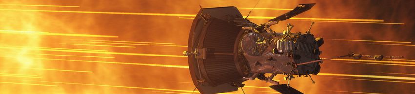
NASA’S Gateway in Lunar Orbit. CREDIT: NASA

KEEPING TIME                                                                                                                                             USING DISTANCE
& FINDING DISTANCE                                                                                                                                     TO GATHER SPEED
Distance equals velocity multiplied by time.                                                                        Let’s say we calculate two distances for another             Since acceleration is the change in velocity over time:
                                                                ELECTROMAGNETIC RADIATION                           spacecraft, one after another, 5 minutes apart.
                                                                 USED IN COMMUNICATIONS                             For the first distance, we get 1,500,000 meters.
This equation is the foundation of space navigation.
                                                                                                                    For the second distance, we get 1,800,000 meters.
Waves of energy, or electromagnetic radiation, can
                                                                                   RADIO                            That means the spacecraft moved 300,000 meters in 5
communicate data from spacecraft. They propagate
                                                               Radio, the tried and true method of space                                                                         The more distances we calculate, the more we know
through the universe at a constant speed regardless of                                                              minutes.
                                                               communications, has supported NASA missions                                                                       about the spacecraft’s position and movement. If we
frequency. This speed, the speed of light, is 299,272,458                                                           Since 5 minutes is 300 seconds, we know our spacecraft
                                                               since the inception of the agency. To this day,                                                                   gather distances from multiple sources and apply a little
meters per second, (to simplify, we’ll use the value                                                                is moving at 1,000 meters per second away from Earth.
                                                               many spacecraft rely on radio antennas for                                                                        geometry, we can accurately determine the spacecraft’s
300,000,000 meters per second in this workbook).                                                                    Using only the speed of light and the time it takes for
                                                                           communications services.                                                                              location.
The speed of light is represented by the letter “c” in                                                              spacecraft communications to reach earth, we’ve
mathematical formulas.                                                                                                                                                           In the next lesson, we’ll learn about one way to determine
                                                                                                                    managed to calculate the velocity of our spacecraft
                                                                              MICROWAVE                             relative to Earth!
                                                                                                                                                                                 location, a process called “trilateration.”

Since the velocity of electromagnetic radiation is always      Microwave communications is very similar to          Let’s say we calculate another distance, another five
the speed of light:                                            radio, but occurs at a higher frequency on the       minutes later. We get 2,400,000 meters.                        FIRST DISTANCE CALCULATION
                                                               electromagnetic spectrum. A higher frequency                                                                                                                                 DISTANCE TRAVELLED

                                                               waveform allows communications equipment to                                                                                                  FIVE MINUTES LATER

Say a spacecraft communicates through a Near Space                     transmit more data per second.
Network ground station in McMurdo, Antarctica. A                                                                                                                                   SECOND DISTANCE CALCULATION
ground antenna sends a signal to the spacecraft and                              OPTICAL
the spacecraft returns the signal. That time, divided by
two, is the time it takes for electromagnetic radiation to     Optical communications uses infrared lasers,                                                 IT’S ALL IN THE TIMING
travel from the spacecraft to the antenna.                     which can offer even higher data rates than radio
                                                               or microwave. Additionally, optical telescopes can     When calculating distances using the speed of light,       like the Deep Space Atomic Clock (DSAC), which is
Let’s say the time elapsed was 10/6 of a second. Half          have lower size, weight and power requirements         accurate timekeeping is enormously important. A small      about the size of a four-slice toaster.
of that is 5/6 of a second.                                                  than radio antennas.                     inaccuracy in time can lead to a huge inaccuracy in
                                                                                                                      the distance calculated. To ensure correct calculations,   Additionally, spacecraft can look to the stars for
                                                                                                                      we can derive time from atomic clocks, which use the       accurate time measurements. Pulsars, rotating neutron
                                                                                  X-RAYS                              ultra-regular oscillations of atoms and atomic particles   stars, emit X-ray radiation at intervals regular enough
                                                               NASA is also experimenting with X-ray                  to tick away the seconds.                                  to provide timekeeping with accuracy similar to atomic
                                                               communications, which will offer even higher                                                                      clocks. Instruments like NASA’s Neutron star Interior
                                                               data rates than infrared lasers! Because of their      These atomic clocks can be located on the ground or        Composition Explorer (NICER) are testing the use of
The spacecraft is 250,000,000 meters from the antenna!         high-energy nature, X-ray communications can           in space, like the ones on GPS satellites. Space-bound     pulsars for navigation purposes with investigations like
                                                               only be used between two assets in space, and          atomic clocks can be prohibitively large (as large as      the Station Explorer for X-ray Timing and Navigation
Using this basic equation, NASA can find out a lot about
                                                                    not in communications with the ground.            a refrigerator), but NASA is developing smaller ones       (SEXTANT), which uses NICER instruments.
our spacecraft.

                                                         -4-                                                                                                                 -5-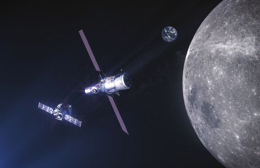
A PLANE CRASH IN ALASKA. CREDIT: U.S. National TransportATION SAFETY BOARD

FINDING YOURSELF                                                                                                                                                        TERRESTRIAL
IN THE GREAT UNKNOWN                                                                                                                                                  TRILATERATION
                                                                                                                    On this page, we'll walk you through how to do some                      and you measure distances (rounded to the nearest
When we calculate distances using the time it takes                                                                 of the math related to trilateration. Performing the math                1000 km),
signals to travel between objects, we have only                                                                     can be exceedingly complex, so just practice setting up
determined an area where our spacecraft could be.                                                                   the equations for now.
The spacecraft could be on a sphere with a radius from                               A
the antenna equal to the distance we measured. We                                                                   Imagine you are at some unknown position on Earth.                       then which city are you in? Try plugging the coordinates
                                                                                                       B
don’t yet know where the spacecraft is specifically. If we                                                          Your position is defined by coordinates ux, uy and uz in                 below into the equations to find out!
gather multiple spheres from different signal sources, we                                                           a coordinate system with three dimensions: x, y and z.
can narrow potential positions down to a solitary point.                                                                                                                                     Portland, Oregon:
                                                                                                                                                             If you're not familiar with
The math you need to get to that point is called                                                                                                             this format, look up matrix
                                                                                                                                                             and vector notation.
trilateration.
                                                                                                           C                                                                                 Greenbelt, Maryland:
                                                                                                                    If you know the position of GPS satellite a,

                                B
                                                                                                                                                                                             Chicago, Illinois:
   A
                                                                                                                    Then your measurement of distance can be written:                        Turns out you're in Greenbelt, Maryland!
                                          C                    In the example to the right, we use GPS satellites                                                                            The puzzle formed by these equations can be treated as
                                                               to trilaterate our location on the ground. Since                                                                              a non-linear least squares problem by a GPS reciever.
                                                               we know the exact position of GPS satellites in      Now, imagine you have measured the distance to three
                                                                                                                    GPS satellites:                                                          These receivers use a variety of mathematical methods to
                                                               their orbits, we can draw imaginary spheres                                                                                   solve this problem, finding the location that best agrees
                                                               extending from each that indicate the satellites                                                                              with the distance measurements.
                                                               distance from us. The spheres only intersect at
                                                               one spot - Goddard Space Flight Center, home
                                                                      of NASA’s Search and Rescue office!
                                                                                                                                                         →
                                                                                                                    You must find the coordinates of u that make these
                                              DID YOU KNOW?                                                         equations true. Remember: you know the GPS satellite
                                                                                                                              → →      →
   NASA’s Search and Rescue (SAR) office has served as the technology development arm of the international          positions a, b and c as well as the distance measurements
   satellite-aided search and rescue program since its inception in the 1970s. The SAR office has developed         from those satellites: da, db and dc. If the GPS satellite
   second-generation emergency beacons that take full advantage of a new constellation of satellite-based           positions in kilometers are,
   search and rescue instruments. These beacons will offer greatly improved location accuracy and detection
            times for users worldwide. For more information about their work, visit esc.gsfc.nasa.gov/sar.

                                                         -6-                                                                                                                               -7-
EARTH FROM SPACE. CREDIT: NASA
VENUS. CREDIT: NASA
ADVANCED INVESTIGATIONS
A FEW
DOPPLER SHIFT LINK BUDGETS
Navigation engineers can also determine velocity A link budget is a formula for calculating the power
using a phenomenon called the Doppler effect (further received from a transmitter such as a GPS satellite. The
explanation on pg 21). When the distance between power of the signal at the receiver depends on a number
COMPLICATIONS
a ground station and a satellite is decreasing, the of factors, including the transmitted power, the distance
wavelengths of a signal received from the satellite between the transmitter and receiver, and the hardware
compress, increasing the frequency. When the distance used by both. Here is a simple link budget, where PR is
between a ground station and a satellite is increasing, total power recieved.
the wavelengths of the signal received from a satellite
stretch, decreasing the frequency. By analyzing
the change in frequency between transmission and The signal is transmitted with a power PT . This power is
Of course, GPS trilateration is much more complicated reception, navigation engineers can determine a typically focused in a desired direction by an antenna
than we make it seem here. Accurately locating satellite’s velocity. (such as toward the Earth, in the case of GPS satellites).
something using GPS signals requires advanced, This focusing has the effect of increasing the power
college-level math. There are a number of challenges The frequency and wavelength of a wave are related by
that engineers must overcome when using GPS signals: Did you know? the speed of light, where frequency equals the speed of
light divided by the wavelength, λ.
the receiver sees by GT, a quantity known as transmit
antenna gain. The signal must then travel across the
space between the transmitter and receiver. Signals
Gladys West, a “hidden figure” of the weaken with distance traveled, decreasing according
EARTH IS NOT FLAT space program, developed much of to the free space path loss, Ad, defined as:
Rather than finding a location on a flat plane, the math behind the Global Positioning The frequency, measured in Hertz (Hz), observed by the
you must find a location on an irregular spheroid System in the 1970s and 80s. West ground station is equal to the initial frequency times the
with hills, valleys, mountains and trenches. used her expertise in satellite geodesy speed of light, divided by the speed of light minus the
— the measurement of Earth's form and velocity of the satellite. where f is the frequency of the signal and d is the distance
dimensions from space — to improve
it travels. This free space path loss is proportional to the
the accuracy of location calculations.
REFRACTION inverse square of the distance between the transmitter
Since then, many mathematicians and
As GPS signals move through parts of the and receiver. Finally, the signal is received by an antenna
physicists have lent their knowledge
atmosphere with different densities, the signals Let’s say a satellite sends us a signal of 100 MHz, but whose design adds some receive antenna gain, GR.
and expertise to further refine GPS
refract, changing direction slightly. If you don’t we receive that signal at 100.000333 MHz. Since the
calculations and overcome the The exact values for these parameters vary, but the
adjust for these subtle changes in direction, your frequency increased, we know the satellite is moving
challenges mentioned on this page! signal leaving a GPS satellite (including transmit power
solutions can be inaccurate. towards us. Now, let’s calculate how fast:
and antenna gain) may be approximately 14 decibel
watts, dBW (further explanation of decibal watts may
RELATIVITY be found on pg 19). This loses 125 dB as it travels
Einstein’s theories describe how time flows to the surface of Earth from the satellite. With a 7 dB
slightly faster where there is less gravity. receive antenna gain, the GPS signal is only -104 dBW
Therefore, navigation engineers must adjust for — weaker than the power you would see from a car tail
the subtle change in the speed of time between light 3,000 kilometers away!
Earth and the satellites’ orbits. GPS ACE
Members of NASA’s navigation team used link
budget analysis to reverse-engineer characteristics
of GPS satellite antennas in a project called the GPS
Antenna Characterization Experiment (GPS ACE).
Therefore, the spacecraft is travelling towards the
They documented how well these satellites could
ground station at a velocity of 9,900 meters per second.
support spacecraft that fly well above the GPS satellites
GLADYS WEST. CREDIT: U.S. AIR FORCE themselves. In fact, the team determined that GPS
signals are strong enough to be used in lunar orbit!
-8- -9-
NASA’S Gateway in Lunar Orbit. CREDIT: NASA

THE SPACE
SERVICE VOLUME
Many spacecraft close to Earth rely on the global
navigation satellite system (GNSS), the collection of six                EARTH’s OBSTRUCTION
international GPS constellations, for navigation. GNSS            The area of coverage eclipsed by Earth.
signals provide these spacecraft with timing data crucial
to determining their orbits and trajectories, just as they
would a user on Earth.
The area of space supported by GNSS is called the                                                                                                                                          MAGNETOSPHERIC MULTISCALE. CREDIT: NASA
Space Service Volume (SSV). The formal outer limit
of the SSV is an altitude of about 22,000 miles, or
                                                                                                                   SPACE SERVICE VOLUME
geosynchronous orbit.                                                                                         Considered to be from about 1,800
                                                                                                              miles up to geosynchronous orbit,                             DID YOU KNOW?
Spacecraft with higher altitudes can also use GNSS                                                            22,000 miles up. However, NASA                   After navigation maneuvers conducted in February
signals, but they do not use the coverage traditionally             Terrestrial Service VOLUME                has reliably used GPS far above
                                                                                                                                                               2019, the four Magnetospheric Multiscale (MMS)
                                                                                                              this altitude and is considering
documented by GNSS service providers. Rather, they                From Earth’s surface to the edge of           applications of GPS in lunar orbit.            mission spacecraft now reach over 116,300
                                                                  low-Earth orbit, about 1,800 miles up.                                                       miles from Earth at their highest point. That’s
rely on signals from GNSS antenna side lobes.
                                                                                                                                                               about halfway to the Moon! At this altitude, MMS
Communications engineers usually consider these side                                                                                                           continued to receive strong enough GPS signals to
lobes wasted energy, signals sent out in unwanted                                                                                                              determine its position, shattering previous records
directions. However, because GNSS side lobe signals                                                                                                            it set in October 2016 in February 2017. This
extend past Earth, satellites at higher altitudes on the                                                                                                       demonstrates that GPS signals extend farther than
opposite side of the globe can utilize their signals.                                                                                                          expected and that future missions can reliably use
Documenting these side lobes can help extend GNSS                                                                                                              GPS at extreme altitudes.
services to spacecraft outside the current SSV. NASA                                                                                                           MMS studies a fundamental process that occurs
                                                                                                                    Side lobe coverage
simulations show GNSS services could even be used at                                                                                                           throughout the universe, called magnetic
lunar orbit. Engineers are considering applications of                   Main LOBE COVERAGE                   The area of coverage provided by
                                                                                                              the GPS antenna signals outside the              reconnection. This is when magnetic fields collide
GNSS in developing Gateway, a lunar-orbiting platform             The area of coverage provided by the
                                                                  main, terrestrial GPS signal. This signal
                                                                                                              main beam. These signals provide                 and explosively release particles in all directions.
that will enable sustained surface exploration of the                                                         a large portion of the coverage in               Near Earth, reconnection is a key driver of
                                                                  provides coverage on the ground, for
Moon.                                                             low-Earth orbiting satellites and limited
                                                                                                              the SSV, especially for spacecraft
                                                                                                                                                               space weather, the dynamic system of energy,
                                                                                                              in   geosynchronous       orbit and
                                                                  coverage in the SSV. This signal is fully                                                    particles and magnetic fields around Earth. They
Currently, NASA navigation experts and international                 specified and well-documented.
                                                                                                              beyond. They are documented for
service providers are advocating for better GNSS                                                              some GPS satellites and have been                can adversely impact communications networks,
                                                                                                              characterized by NASA for others.                electrical grids and GPS navigation. Physicists
documentation to make innovations like lunar GPS a                                                            NASA is working to better document
possibility.                                                                                                                                                   predicted magnetic reconnection for years, but
                                                                                                                          these signals.
                                                                                                                                                               never directly observed it until the MMS mission.

                                                         - 10 -                                                                                       - 11 -
PLANET COLLAGE. CREDIT: NASA
ORBIT ORBIT
TYPES DETERMINATION
Different orbits provide different views of Earth and deep with a stable speed and no apogees or perigees are Calculating the velocity a spacecraft needs to maintain circular orbit around a planet is the square root of
space. Navigation experts at NASA must determine one of the rarest kind of orbits. Earth’s orbit around the a stable, circular orbit requires the force of gravity to the gravitational constant times the mass of the planet
which type of orbit a spacecraft needs to complete its Sun, compared to other planets in our solar system, is equal the centripetal force of the spacecraft orbiting the divided by the distance between the spacecraft and the
science mission. almost circular, which is a factor that makes it habitable. planet. Centripetal force is a force that keeps something center of the planet.
moving along a curved path. Below, calculate the velocity necessary to maintain orbits
The planets of our solar system orbit around the Sun in Though completely circular orbits rarely occur naturally,
various elliptical orbits. Elliptical orbits resemble a long NASA places satellites in circular orbits all the time! Below are the equations to calculate both the force of 2,000,000,000 meters away from each of the planets.
oval with an extreme high point called the apogee and gravity (Fg) and the centripetal force (Fc).
Many of NASA’s weather and communications satellites MERCURY Mass: 0.330 x 1024 kg
low point called the perigee. Fg = gravitational force of attraction (Newtons)
are in a circular orbit called geosynchronous orbit – about VENUS Mass: 4.87 x 1024 kg
The United States launched its first satellite, Explorer-1, 22,000 miles above Earth’s surface. Geosynchronous
on January 31, 1958, as a part of the International orbits match Earth’s rotation on its axis, so it seems as EARTH Mass: 5.97 x 1024 kg
Geophysical Year. This was a period of intense though they remain in the same place relative to a fixed m1 = mass of planet (kilograms) MARS Mass: 0.642 x 1024 kg
technological invention during the Cold War. Explorer-1 point on the ground at all times.
used an elliptical orbit to detect charged particle radiation
m2 = mass of orbiting spacecraft (kilograms) JUPITER Mass: 1898 x 1024 kg
trapped by Earth’s magnetic field. The radiation belts NASA’s fleet of Tracking and Data Relay Satellites (TDRS) r = distance between the spacecraft and the center of SATURN Mass: 568 x 1024 kg
discovered around Earth are known as the Van Allen are in geosynchronous orbit, using radio frequency to the planet (meters)
transmit data to Earth from spacecraft located in low- URANUS Mass: 86.8 x 1024 kg
Belts, named after James Van Allen, the engineer behind G = universal gravitational constant
the Explorer series instruments. Today, NASA studies Earth orbit, including the International Space Station. NEPTUNE Mass: 102 x 1024 kg
these regions with more advanced probes, but still uses Beyond elliptical and circular, there are other ways dELVING FURTHER
elliptical orbits. to describe an orbit: equatorial, polar and more. For Fc = centripetal force
There are a number of factors that can make orbit
You might think that a circular orbit would be more example, many of NASA’s Earth science spacecraft
determination challenging:
common than an elliptical one, but that couldn’t be orbit around the poles, earning the name “polar orbiting
• In an elliptical orbit, the velocity of the orbiting
further from the truth! Circular orbits at a fixed distance satellites.” m2 = mass of orbiting spacecraft (kilograms)
body changes, becoming faster as it approaches
v = spacecraft velocity tangent to its orbit the planet and slower as it moves away. This is
because as the distance between two objects
When Fc = Fg,
LAGRANGE POINTS changes, the force of gravity between them does
as well.
Lagrange points, or libration points, are points in • When two large bodies orbit one another, the math
space near two large bodies where a small object This equation can be reduced to something much simpler. becomes a little more complicated. In a binary
can be “parked” stationary relative to the large Multiply both sides by r/m2, then take the square root of system, the center of the orbit lies in between the
bodies. There, the combined gravitational forces both sides. The equation that remains is: two bodies, rather than at the center of one.
equal the centripetal force felt by a smaller body. We won’t address these calculations in this workbook,
Sun-Earth Lagrange points are useful for NASA but you can find further information on orbit calculation
science spacecraft! from a teacher or online.
TRACKING AND DATA RELAY SATELLITE. CREDIT: NASA
It turns out that the velocity needed to maintain a stable,
- 12 - - 13 -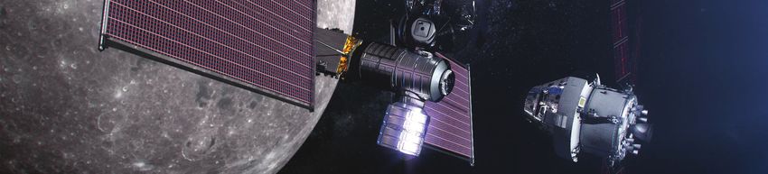
PARKER SOLAR PROBE. CREDIT: NASA

EXPLORING                                                                                                                                                                                                                            STAR
DEEP SPACE                                                                                                                                                                                                                       TRACKERS
Some NASA missions venturing deep into space use             a top priority to the agency. 60 years of technology                           Most navigation experts consider the near-Earth region               determine the orientation and attitude of a spacecraft.
the gravitational pull of other planets to speed up, slow    development led to the Parker Solar Probe, which                               to be within two million kilometers of Earth. Deep                   A star tracker is an optical device that acts as the eyes
down or change direction. These gravitational assists        launched toward the Sun in 2018. Parker will use seven                         space navigation does not typically benefit from near-               of the spacecraft. The device captures star field images,
are often planned years in advance and require a             Venus flybys to gradually shrink its orbit, coming as                          Earth systems like GNSS, but over the years, NASA                    measures their position in relation to the spacecraft and
specific launch window.                                      close as 3.83 million miles from the Sun – seven times                         has developed a number of ways to navigate the solar                 identifies particular stars so that they can be logged and
                                                             closer than any previous mission.                                              system safely — techniques that go beyond ranging the                entered into a star catalog.
In the 1970s, the twin Voyager missions took advantage                                                                                      satellites with ground stations to judge their distances.
of a rare alignment of Jupiter, Saturn, Uranus and                                                                                                                                                               Typically, a star tracker will include a processor to
Neptune that takes place only once every 175 years.                                                                                         The concept of a star tracker can be traced back to                  compare the star field pattern it observes to previously
This arrangement allowed the two spacecraft to swing                                                                                        mariners navigating the oceans in a time before GPS.                 logged star field patterns. NASA's Lunar Reconnaissance
from one planet to the next without the need for large,                                                                                     They used bright and commonly known star patterns to                 Orbiter (LRO) and Solar Dynamics Observatory (SDO)
onboard propulsion systems. Each flyby bent the                                                                                             determine their position and the direction they faced.               host two star trackers each. Having two star trackers
spacecraft’s path and increased their velocity enough to                                                                                                                                                         increases position accuracy and provides redundancy –
deliver them to the next planet. Using these gravitational                                                                                  Today’s star trackers are vastly more complex but use                if one fails, the second one can take over.
assists and the unique four-planet arrangement, the                                                                                         the same concept, searching for familiar star patterns to
flight to Neptune was reduced from 30 years to 12.
Now, both Voyager spacecraft are in interstellar space,                                                                                                                                  LRO. CREDIT: NASA            SDO. CREDIT: NASA
over 11 billion miles from Earth, outside the influence
of our Sun.
Another flagship mission that utilized gravitational                              GOPEX at JPL’s TAble Mountain Observatory. CREDIT: NASA
assists was NASA’s Galileo mission, which launched in
1989. The Galileo spacecraft, bound for Jupiter, was
named after the Italian Renaissance scientist Galileo
Galilei. Galileo discovered Jupiter’s major moons
                                                                                                                                                  ADVANCED INVESTIGATION                                         has ways of adjusting for this.

in 1610 with the first astronomical telescope. Three                                                                                          Delta-Differential One-Way Ranging (DDOR) is                       DDOR corrects the error by looking for a quasar
gravity assists were needed for the Galileo spacecraft                                                                                        a navigation technique that relies on two widely                   – a galactic nucleus – in a direction close to the
to reach Jupiter. In February 1990, the spacecraft used                                                                                       separated ground stations receiving signals from                   spacecraft. Since the quasar’s direction is known,
Venus’ gravitational pull to increase the spacecraft’s                                                                                        the same spacecraft. The difference in time between                the delay time of the quasar can be subtracted
speed, followed by two additional gravity assist flybys                                                                                       the arrival of the signal at the ground stations can               from the delay time of the spacecraft to account
of Earth. The spacecraft reached Jupiter in 1995. The                                                                                         be used to calculate a satellite’s position.                       for the atmosphere.
Galileo mission also played an important role in early
demonstrations of optical communications technology                                                                                           These times are affected by several factors.                       DDOR, alongside other navigation techniques,
with the Galileo Optical Experiment (GOPEX), which                                                                                            Particularly, when radio waves travel through the                  offers increased spacecraft targeting accuracy,
demonstrated a laser “uplink” from Earth to a spacecraft.                                                                                     atmosphere, the different densities of air cause                   improved mission reliability, reduced tracking time
                                                                                                                    GALILEO. CREDIT: NASA
                                                                                                                                              disturbances that must be accounted for. NASA                      and reduced cost.
Since NASA’s inception, the study of our Sun has been

                                                         - 14 -                                                                                                                                              - 15 -
JOSH LYZHOFT
OPTICAL NAVIGATION THE MOON. CREDIT: NASA
A MINNESOTAN BATTLING ASTEROIDS
In 2016, Joshua Lyzhoft drove over 17 hours from Minnesota, his home state, to
NASA can also navigate spacecraft relative to a target Θ = the angular size of the target, the angle between
1 Maryland to begin his career at Goddard Space Flight Center with a Pathways
using images taken from the spacecraft. In optical the focal point and the height of the target. Program internship. Josh came to NASA with a doctorate in aerospace
navigation, a camera takes images of a target, producing engineering focused on planetary defense, a rapidly advancing field that
The focal length (F) and field of view (Θ) are generally examines the risks of near-Earth asteroids and develops technologies to alleviate
measurements that can be used to estimate distance and
known variables for a camera — they are designed with their danger.
trajectory. Optical navigation works similarly to human
those specifications in mind. Once the camera takes a
eyes, collecting light from a target and processing the At NASA, he works on the Double Asteroid Redirection Test (DART) spacecraft,
picture, we can easily measure the height of the target
information in the spacecraft’s ‘brain.’ which will slam into the smaller of two asteroids in a binary system. In the
on the sensor array, the number of pixels on the y-axis
of the sensor array times the pixel height. aftermath, NASA will study how the spacecraft changed the relationship
Cameras, like eyes, have lenses. Generally, these lenses
between the two asteroids. The mission will serve as a proof of concept for
take the subject in view and magnify it, like a telescope.
Drawing a right triangle using the height of the target future planetary defense efforts. In addition to DART, Josh lends his talents in
Complex lenses can distort images, like a fisheye lens.
on the sensor array (S1), and a perpendicular line from optical navigation and orbit determination to other missions.
A camera collects the light at its lens and focuses the the focal point to the lens with the known focal length When not hunting down asteroids, Josh enjoys hunting for mushrooms. A true
light on the sensor array creating a picture out of (f), we can use the tangent function to determine the Midwesterner, he loves the outdoors: fishing, foraging and chopping wood.
individual pixels on a grid. The size of the image we see angular size of the target.
is directly related to the size of the target, the distance to
the object, focal length of the camera and the pixel size,
otherwise known as the pixel pitch. Imagine that NASA launches a rover to the Moon to PROBLEMS
Drawing a right triangle using the distance from the prospect for resources like water. Missions like this are Commanding the Rover
In optical navigation, we use geometry and trigonometry target to the camera lens (D) and the height of the target becoming more common as NASA expands human and
alongside known characteristics of a camera's lens and robotic presence on the lunar surface with the Artemis a. What is the distance from the boulder to the rover’s
(S), we can use the tangent function again. lens in meters?
sensor to calculate distances. Below is a diagram of a missions.
simple pinhole camera looking at a tree. The rover needs to navigate from its original location
S = height of the target. to a deep crater. Scientists believe that water ice might
Combining these equations, we see that: exist in the extremely cold, permanently shadowed
D = the distance from the Target to the camera lens. regions at the bottoms of craters like the one our rover
is exploring. b. If the rover drives at a speed of .08 m/s, how long
f = the focal length, the distance between the sensor
should mission control instruct the rover to move in order
array and the camera lens. A large boulder in our rover’s field of view marks the
Because S1 and f are known variables, if we have a to reach the boulder?
spot right at the edge of the crater where our rover must
S1 = the height of the target on the sensor array. value for either S or D, we can easily calculate the other. park. Mission controllers on Earth need to command
Θ = the field of view for the camera, the angle between Optical navigation calculations like this can be used for the rover to move the exact distance to place it on the
the focal point and the edge of the sensor array. a wide variety of applications in space. spot. Move too far and the rover may fall into the crater.
Move too little and scientists will lose valuable science Learning More About the Rover
data. c. Given that the height of the sensor array (h) is 2000
pixels, what is the field of view (Θ) in degrees?
Advanced Investigation: Thinking Critically
d. If we do not have the size of the object, how might an
individual determine the distance? (Hint: There might
We know the focal length of the rover’s camera is .5 need to be more than one camera.)
m. Based on observations from previous missions, we
know the boulder is 10 m tall. The boulder appears to
be .01 m in the sensor array. Each pixel is 1x10⁻⁵ m tall.
- 16 - - 17 -
JENNY DONALDSON                                                                                                                    JOEL PARKER
                                     DANCING AMONG THE STARS.                                                                Prague. Munich. Sochi. Bremen. Vienna. Kyoto.
                                     In 2016, two teams of engineers combined two technologies to create a                   Maps neatly frame Joel Parker’s desk. Each creased leaflet marks a meeting
                                     powerful navigation tool, NavCube, that could demonstrate advanced X-ray                conducted - a milestone crossed. He collects one for every city he visits while
                                     communications technologies in space. For their profound creativity, the teams          representing NASA as a navigation expert.
                                     won a NASA Innovators of the Year award.                                                Joel’s work occupies the intersection of engineering and policy. He leads
                                     Jenny Donaldson led the development of NavCube. Previously, she worked on               the effort to extend the Space Service Volume, working with domestic and
                                     the team that developed one of the contributing technologies, the Navigator GPS,        international GNSS providers. Joel’s goal is to ensure that GNSS navigation
                                     an instrument uniquely suited to “hearing” GPS signals at ultra-high altitudes. In      signals are a robust option for high-altitude NASA missions. He also serves as
                                     addition to helping adapt the Navigator into NavCube, Jenny used the Navigator          the Flight Dynamics Lead for the Plankton, Aerosol, Cloud, ocean Ecosystem
                                     to perform the GPS Antenna Characterization Experiments (ACE), which helped             (PACE) mission, which will launch in 2022 into polar orbit. PACE will advance
                                     define the characteristics of GPS antennas.                                             the assessment of ocean health by measuring the distribution of phytoplankton,
                                     As a child and young adult, Jenny pursued a career as a ballerina. In fact, she         tiny plants that sustain the marine food chain.
                                     continues to dance in her spare time! She didn’t become interested in engineering       When not at work, Joel finds creative outlets by cooking for his family and
                                     until she read a piece about Mars rovers, falling in love with space exploration.       working with his wife to restore their 1930s, Craftsman-style home in Hyattsville,
                                     She then pursued a degree in engineering, eventually coming to NASA as an               Maryland. Raising a young daughter, Madeline, and taking care of two dogs
                                     intern and then a full-fledged employee.                                                takes up the rest of his time.

Orbital mechanics is the study of the motion of spacecraft                            PROBLEMS                               How do we know if a navigation signal is strong enough                                   PROBLEMS
moving under the influence of forces such as gravity.            Earth’s elliptical orbit around the Sun has a semi-major    to be received by our spacecraft?                            a. GPS satellites orbit about 20,200 km above Earth. The
Most orbits around a large central gravitational body,           axis of 1.496 x 10¹¹ meters and the mass of the Sun is      Link budget calculations use known features of a signal—     International Space Station flies at about 400 km. What
such as Earth, are elliptical, which means they follow a         1.989 × 1030 kilograms.                                     like transmit power and the distance to the receiver—        is the path loss in dBW as the signal travels between
repeating path in the shape of an ellipse, as seen in the                                                                    to determine unknown features, such as how large an          the two, assuming the GPS signal has a frequency of
diagram below. A special case of the ellipse, when the           a. Calculate the period of Earth’s orbit around the Sun
                                                                 in seconds.                                                 antenna is needed to receive a signal. The largest source    1575.42 MHz?
major and minor axes are the same, is called a circle.                                                                       of loss in signal strength is path loss, which happens as
                                                                                                                             signals travel vast distances, becoming weaker.
                                                                                                                                                                                          b. What is this path loss in Watts?
                                                                                                                                                                                                 (Hint: Reverse the decibel equation.)
                                                                 b. Calculate the period of Earth’s orbit around the Sun
                                                                 in days.
                                                                                                                                                                                          c. GPS signals are transmitted at about 13 dBW, using
                                                                                                                             To perform a link budget calculation, we use units of        an antenna with a gain of about 15 dBW. Assuming the
                                                                                                                             decibels (dB), which express common numbers in               space station has a receive antenna with a gain of 10
                                                                 The orbit of the International Space Station around Earth   exponential form. This is useful for expressing very large   dBW, what is the signal power it receives?
In the 17th century, Johannes Kepler described elliptical        has a semi-major axis of 6.7981 x 10⁶ meters. Earth's       or very small numbers. To convert watts (PW) to decibel-
orbits when studying the patterned motion of planets             mass is 5.97 x 1024 kg.                                     watts (PdBW), use a logarithm, like so:
orbiting the Sun. Kepler’s third law of planetary motion                                                                                                                                  d. Now consider that receiver and antenna are mounted
states that the square of the orbital period of a satellite is   a. Calculate the orbital period of the space station in                                                                  on a spacecraft going to the Moon. The Moon is about
directly proportional to the cube of the semi-major axis         minutes.                                                                                                                 400,000 km from the center of the Earth, which has a
of its orbit. In other words, how long it takes to complete                                                                  Given the .001 watts, we get:                                radius of 6,378 km. What is the path loss in dBW?
one revolution of an orbit (period, T), is directly related
to size of the orbit (semi-major axis, a) and can be
                                                                                                                             Here we express the quantity 0.001W in terms of              e. What is the signal power received by this lunar
calculated with the following formula:
                                                                                                                             decibels relative to 1 Watt. The benefit of working in       spacecraft in dBW?
                                                                 b. How many times does the space station orbit Earth
                                                                 in one day?                                                 decibels is that complex equations can be expressed
                                                                                                                             using simple additions and subtractions. The equations
                                                                                                                                                                                          f. What is this received signal power in Watts?
                                                                                                                             for the signal power at the receiver ( PR ) and the path
G is the universal gravitational constant, and m is the                                                                      loss ( Ad ) — found on page nine of this workbook —
mass of the object the satellite is orbiting.                                                                                take advantage of this.

                                                             - 18 -                                                                                                                   - 19 -
BEN ASHMAN Cheryl Gramling
PINBALL WIZARD. GPS PIONEER. Earth? Moon? Jupiter? Swing on by!
One Sunday, Ben Ashman drove a cherry-red moped from his home in the Cheryl Gramling is a practical person, so her innovative spirit comes from the
nation’s capital to the Visitor Center at Goddard Space Flight Center. He spoke need for practical, economical solutions to problems. This spirit led her to create
with a group of children and their parents about an issue that plagues most on robust navigation tools and adapt those tools to the needs of new missions.
a daily basis: Cheryl creates complex trajectory designs for missions like the Wind mission,
How do we get where we need to go? which launched in 1994 and studied plasma in the solar wind and the Earth’s
Today, mobile devices with continuous access to GPS technology make navigation magnetosphere. The spacecraft flew a trajectory of double-lunar swingbys,
easy. However, Ben isn’t concerned with GPS on Earth; he runs simulations to where engineers used the Moon’s gravity to change a satellite’s orbit. In order
show that GPS signals could be used in lunar orbit, guiding astronauts around to visualize the myriad trajectories of Wind, she developed Swingby, a software
the Moon! tool that helps flight dynamics engineers plan their missions.
In addition to this work, Ben serves on the navigation team for the Origins Spectral Cheryl currently serves as head of the Navigation and Mission Design Branch at
Interpretation Resource Identification Security – Regolith Explorer (OSIRIS-REx), a Goddard Space Flight Center. A key thrust of Cheryl’s career and the branch’s
spacecraft designed to return a sample from Bennu, a distant asteroid. Outside work is the development of autonomous navigation, guidance and control
work, Ben plays keys in local bands and enjoys pinball. systems. These allow spacecraft — especially those at libration points or further
out in the solar system — to perform time-critical maneuvers without the time
delay involved in receiving commands from Earth.
In the Bryce Canyon National Park, wildlife biologists Have you ever heard a car pass you while blowing its PROBLEMS
track bears using GPS collars. For this problem, imagine horn? The sound of the horn changes as the car comes a. A ground station in Hawaii sends a signal to a
a bear’s location is tracked using distance measurements closer and moves away from you. spacecraft with a frequency of 2x10⁹ Hertz. After
from terrestrial navigation beacons rather than GPS That change in sound comes from a shift in the frequency traveling at the speed of light, the signal that the
satellites. Two beacons are indicated above: beacon A, of the sound wave the horn makes. This Doppler Effect spacecraft receives has been Doppler shifted up by 600
a blue circle, and B, a red square. The distance between — named after Christian Doppler who described the Hz. What is the velocity of the spacecraft?
grid lines is 1 kilometer (km). phenomenon in 1842 — is a change in the frequency
and wavelength of a wave, in this case a sound wave.
PROBLEMS This is caused by the change in distance between the
creator of the wave (the car horn) and the observer that
a. If the reading from the bear’s collar indicates a hears the wave.
distance of 5 km from beacon A and 7 km from beacon
B, write the equations showing the relationship between
these distances and the bear’s location, [x, y]. Assume
b. When a spacecraft is almost done sending its climate
altitude variation is negligible and write the beacon
change data to a ground station in Svalbard, Norway,
coordinates in km relative to an origin at the bottom left
it has passed over the ground station and is nearing
corner. (The math for this is complicated, so just write
the horizon. The spacecraft transmits to Svalbard at a
out the equations —don't try and solve them.)
frequency of 15 x109 Hz, and Svalbard receives that
What can you learn about a spacecraft using the signal at 14.9998 x10⁹ Hz. What is the spacecraft's
Doppler Effect? When a spacecraft passes over a velocity as observed by Svalbard?
ground station, it communicates with the station using a
b. How many possible solutions are there to the radio signal at a certain frequency. This is like the sound
Bryce Canyon equations in part a?
National Park wave produced by the car horn.
N As the spacecraft comes closer to the ground station,
the speed of the spacecraft appears to change at the
c. Where is the bear? Assume that the bear’s location falls ground station, and the frequency of that signal increases
solely within the map’s presented area. The equations because of the Doppler effect. The spacecraft’s speed
are difficult to solve analytically or numerically, so draw and direction, together known as velocity, can be
1 kilometer circles on the map to pinpoint the bear’s location. computed from the Doppler shift of the signal. You can
find the equations for this on page nine.
- 20 - - 21 -SIP INTERNS SUMMER 2019. CREDIT: NASA
NAVIGATE TO NASA
NASA is expanding our reach among the stars, a ham radio? As the station orbits overhead, you can
establishing a sustained presence at the Moon, send messages to it! Amateur Radio on the International
journeying to Mars and studying the cosmos. The Artemis Space Station (ARISS) is a program that connects
missions to the Moon, bold inquiry into the origins of the students worldwide with astronauts on the orbiting
CONGRATULATIONS
universe and continued examination of our changing laboratory over ham frequencies.
planet require the hard work and expertise of humanity's
brightest. NASA looks to you, the Artemis generation, To learn more about ARISS, visit: ariss.org.
for the innovations and breakthroughs we need.
You've completed this workbook. Presumably, you're a APPLY FOR AN INTERNSHIP
student interested in science, technology, engineering or
NASA offers internship opportunities to students from You’ve completed the workbook!
mathematics.
high school through doctoral research. These internships
How do you navigate your way to NASA? are paid opportunities that give you real world For more information about the work of
experience in aerospace. NASA's Space Communications and
Navigation (SCaN) program office, visit:
BECOME A CITIZEN SCIENTIST To learn more about internships, visit intern.nasa.gov.
nasa.gov/SCaN
There are many ways to get involved. You can become If you're specifically interested in navigation, the Space
a citizen scientist, joining NASA investigations into Communications and Navigation (SCaN) Internship For information the role Goddard Space
the world around us and the stars above. This doesn't Project (SIP) might be a great option for you. SCaN Flight Center plays in communications
always require fancy equipment. Many citizen science offers internships to prospective students through and navigation, visit:
opportunities can be done by anyone, anywhere, with Goddard Space Flight Center in Greenbelt, Maryland,
just a cellphone or laptop. Glenn Research Center in Cleveland, Ohio, and NASA esc.gsfc.nasa.gov
Headquarters in Washington, D.C.
To learn more about citizen science, visit: science.nasa.
gov/citizenscience. To learn more about SIP, visit: go.nasa.gov/37PQpD4.
EXPLORE ON YOUR OWN PURSUE A DEGREE IN STEM
Interested in communications technologies? Study A college degree in science, technology, engineering
for your ham radio license! Ham, or amateur, radio or mathematics is a great way to advance your
hobbyists build and operate their own radios and understanding of key aerospace disciplines. A STEM Check your answers to the practice problems at
communicate with other ham operators recreationally. degree can prepare you to work with NASA or anywhere https://go.nasa.gov/30ke8KB
else your interest in aerospace takes you!
Did you know that the International Space Station has
- 22 - - 23 -EXPLORATION AND SPACE COMMUNICATIONS PROJECTS DIVISION
Goddard Space Flight Center
SPACE COMMUNICATIONS AND NAVIGATION (SCaN) PROGRAM OFFICE
National Aeronautics and Space Administration
National Aeronautics and Space Administration
Goddard Space Flight Center
8800 Greenbelt Road
Greenbelt, MD 20771
esc.gsfc.nasa.gov
www.nasa.gov
NP-2020-9-586-GSFC
- 24 -You can also read