HYDROSPACE-GEOGLOWS 2021 - SUMMARY AND RECOMMENDATIONS - eo science for society
←
→
Page content transcription
If your browser does not render page correctly, please read the page content below
4. SESSION SUMMARIES

   HYDROSPACE-GEOGLOWS 2021
         SUMMARY AND RECOMMENDATIONS

                                    1
HYDROSPACE-GEOGloWS 2021 Workshop        Summary and Recomendations
4. SESSION SUMMARIES

   HYDROSPACE-GEOGLOWS 2021
            SUMMARY AND RECOMMENDATIONS

   Jérôme Benveniste | ESA | Largo Galileo Galilei, 1,          Philippa Berry | Roch Remote Sensing, UK
   Frascati, 00044 (RM), Italy,
   Email: Jerome.Benveniste@esa.int
                                                                Cédric H. David | Jet Propulsion Laboratory, California
                                                                Institute of Technology, USA
   Alice Andral | CNES | 31 Ave E. Belin, 31400 Toulouse,
   France, Email: aandral@groupcls.com
                                                                Ayan Fleischmann | IPH/UFRGS, BR

   Angelica Gutierrez | NOAA/NWS/OWP-GEOGloWS,
   Silver Spring, Maryland, USA,                                Huilin Gao | Texas A&M University, USA
   E-mail: Angelica.Gutierrez@noaa.gov
                                                                Andreas Güntner | GFZ German Research Centre for
   Paul Bates | University of Bristol, UK                       Geosciences, DE

   Peter Bauer-Gottwein | Technical University of               George Huffman | NASA, USA
   Denmark, DK
                                                                Hyongki Lee | University of Houston, USA
   Christophe Brachet | International Office for Water
   (OiEau), FR                                                  Karina Nielsen | DTU Space, DK

   Jean-François Crétaux | CNES/LEGOS, FR                       Fabrice Papa | IRD/LEGOS, FR

   Cesar Ignacio Garay Bohórquez | U. Javeriana –               Catherine Prigent | CNRS, LERMA,
   GEOGloWS, CO                                                 Observatoire de Paris, FR

   Rodrigo Cauduro Dias de Paiva | U. Federal do Rio            Christian Schwatke | DGFI-TUM, DE
   Grande do Sul, BR

                                                                Angelica Tarpanelli | IRPI-CNR, IT
   Philippe Maisongrande | CNES, FR

                                                                Mohammad Tourian | University of Stuttgart, DE
   Tidiane Ouattara | African Union Commission

                                                                Arjumand Z. Zaidi | USPCASW-MUET, PK
   Sushel Unninayar | NASA, USA

                                                            2
Hydrospace-Geoglows 2021 Workshop                                                          Summary and Recomendations
TABLE OF CONTENT

   ABSTRACT                                                                                      4

   1. OBJECTIVES OF HYDROSPACE                                                                   4

   2. THE HYDROSPACE MANIFESTO                                                                   6

   3. HYDROSPACE-GEOGLOWS 2021                                                                  10

   4. SESSION SUMMARIES                                                                         11

    4.1. Space techniques to measure hydrological surface variables                             11

      4.1.1. Block 1 - Space techniques to measure hydrological surface variables               11

      4.1.2. Block 2 - Space techniques to measure hydrological surface variables               12

      4.1.3. Block 3 - Space techniques to measure hydrological surface variables               13

      4.1.4. Block 4 - Space techniques to measure hydrological surface variable                14

      4.1.5. Block 5 - Space techniques to measure hydrological surface variable                15

    4.2. Modelling and Assimilation                                                             16

      4.2.1. Block 1 - Modelling and Assimilation                                               16

      4.2.2. Block 2 - Modelling and Assimilation                                               17

    4.3. From Products to Applications                                                          19

      4.3.1. Block 1 - From Products to Applications                                            19

      4.3.2. Block 2 - From Products to Applications                                            19

      4.3.3. Block 3 - From Products to Applications                                            20

   5. ACRONYMS                                                                                  22

   6. URLs                                                                                      23

   7. ACKNOWLEDGEMENTS                                                                          24

                                                       3
HYDROSPACE-GEOGloWS 2021 Workshop                                            Summary and Recomendations
ABSTRACT

   This report summarises the main results, conclusions               community discussion focused on the future challenges
   and recommendations of the “HYDROSPACE-GEOGLOWS                    of Inland Water monitoring and prediction and the future
   2021” Workshop organised by the European Space Agency              observational requirements. A “Manifesto” was drawn up
   (ESA), in collaboration with the French Space Agency               from the discussion nourished by the participants. This
   (CNES) and the GEO Global Water Sustainability Initiative          report presents this “Manifesto”, highlights the state of the
   (GEOGloWS) (Fig. 1). This Workshop is a sequel to the              art presented in the sessions, summarises the discussions
   ones held in Toulouse (F) in 2003, in Geneva (CH) in               and provides recommendations and guidance for future
   2007 and in Frascati (I) in 2015. Nearly 300 scientists,           mission design, research activities for enhancing processing
   engineers and managers registered to this virtual event            algorithms and developing new ones, calibration and
   from 41 countries, submitting 123 papers with more than            validation, sustainable data exploitation, dissemination,
   500 co-authors. The inclusion in the programme of large            outreach, capacity building and co-designing applications
   time slots for discussion and the advance preparation              and operational services.
   of “Seed Questions” offered the opportunity to have a

                                                                                       Figure 1
                                                                                       The “HYDROSPACE-GEOGloWS 2021” Workshop
                                                                                       was held on-line from 7 to 11 June 2021,
                                                                                       hosted by ESA-ESRIN.
                                                                                       Within the framework of this Workshop,
                                                                                       three Sessions were scheduled over 8
                                                                                       half- days: 1) Space techniques to measure
                                                                                       hydrological surface variables, 2) Modelling and
                                                                                       Assimilation, 3) From products to applications.

   1. OBJECTIVES OF HYDROSPACE
   Water on Earth’s continents is continuously recycled               Satellites are an essential component of the observational
   through precipitation, evapotranspiration, discharge               network, providing an understanding of the relations
   and runoff, vertical and horizontal diffusion and transfer         among the regional, continental, and global scales. For
   in soils. An improved description of the global water              instance, the monitoring of water level of lakes, reservoirs,
   cycle, especially the continental branch, is of significant        rivers, and floodplains has been made possible thanks to
   importance for inventory and better management of water            the constant efforts and dedicated programs set up by
   resources available for human consumption and activities           several space agencies. The current and future generations
   (agriculture, urbanisation, hydroelectric energy resources,        of higher resolution radar-altimetry instruments, such
   tourism, domestic use), as well as for biodiversity                as along-track Delay-Doppler (synthetic aperture radar)
   preservation and predictions to address disaster risk              altimetry (CryoSat, Sentinel-3&6) and interferometric
   reduction. Both satellite and in situ observations are vital       altimetry (SWOT, CRISTAL), are transforming the
   for understanding and creating solutions to the issues             monitoring of surface hydrological parameters. With a new
   related to hydrology. HYDROSPACE2021 focused on inland             generation of instruments, images of higher resolution are
   water storage and runoff using in situ and remote sensing          obtained, requiring the development of new algorithms
   data, and modelling.                                               and the training of a new generation of scientists. It is

                                                                  4
HYDROSPACE-GEOGloWS 2021 Workshop                                                                 Summary and Recomendations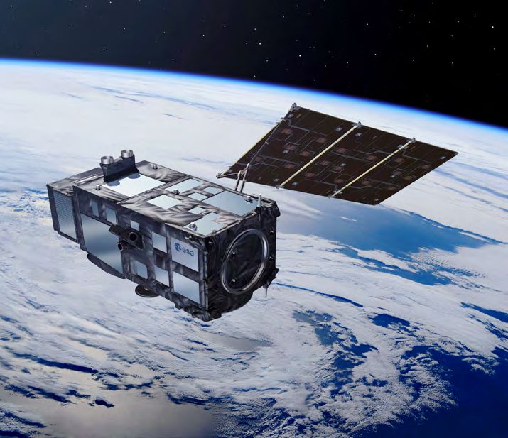
1. OBJECTIVES OF HYDROSPACE

   also imperative to work towards analysis-ready satellite               · What aspects of surface water observations and modelling
   and in situ data and develop the technical skills needed                  are sufficiently mature for use in operational services?
   to integrate and interpret the data and translate them
                                                                          · Do we need new types of instruments? How can we
   into meaningful information that conforms to essential
                                                                             extract new knowledge from the new missions ahead
   requirements of accuracy and utility to support policies
                                                                             (Sentinel-6A, SWOT, Sentinel-3C/-3D, Sentinel-3 Next
   and programs.
                                                                             Generation Topography Mission [S3NG-T], CRISTAL, etc.)?
                                                                             How do we take advantage of all available data and give
   The Hydrospace conferences (2003 in Toulouse, 2007 in
                                                                             access for hydrologists to develop useful products?
   Geneva, and 2015 in Frascati) have traditionally focused
   on continental water monitoring using satellite techniques             · Could we improve the spatial and temporal coverage by
   (altimetry, radar and optical imaging sensors, variable                   altering scanning strategies (i.e., wider swaths of data)
   gravimetry) and hydrologic or hydrodynamic models. Since                  or by employing the satellite constellation concept
   the last Hydrospace conference in 2015, some products,                    rather than live with long repeat intervals?
   such as water level in lakes, reservoirs and rivers, flood             ·
                                                                           How do we fill the gap between Research and
   extent and volume, river discharge, floodplain deltas, and              Development and Operational Use of remote sensing
   estuaries have been promoted to operational delivery;                   information in hydrological applications, forecasting
   others need further development, and some are just                      operational system, and water resources management?
   emerging as new products.
                                                                          · How do we strengthen the collaboration between the
                                                                             four critical water communities: in situ, modelling,
   The Group on Earth Observations Global Water
                                                                             space observations and “non-scientist” users? Who the
   Sustainability (GEOGloWS) Initiative (www.geoglows.org)
                                                                             “non-scientist” users are and what they need is still an
   works to provide relevant, actionable water information
                                                                             issue only partially addressed. Can we collectively do
   to promote the use of earth observations in the decision-
                                                                             better? What are the new capabilities of space-based
   making process. Through partnerships, GEOGloWS
                                                                             data for the application community?
   leverages organisations’ capabilities for projects that
   complement national efforts and provide information
   where little or none exists to achieve its mission. One              The planned outcome of the workshop is to define an action
   of these collaborations includes ECMWF, NASA, NOAA,                  plan for the future and converge on recommendations from
   Brigham Young University, Esri, Aquaveo, the World                   the scientific, engineering and management communities.
   Bank, and many National water organisations that have                Several round table discussions were planned to
   fuelled the streamflow forecasting services’ technological           cover the aforementioned seed-questions, detailed in
   development. These activities facilitate scientists’                 https://hydrospace2021.org/seed-questions.
   collaboration across disciplines to promote resource and
   project sharing while responding to user requirements in
   operational environments.

   Considering the complementarity of GEOGloWS and the
   Hydrospace activities, this joint conference represents an
   opportunity to explore co-designed solutions with a broader
   view, and to address key issues including:

     · What are the new key science questions? What are
        the new challenges and how should we address them?
     · What are the new algorithms and the new advancements
        allowing the use of satellite data with the most advanced
        models, in particular for ungauged basin? How can we
        benefit from the new processing solutions offered by
        online super-computers?

                                                                    5
HYDROSPACE-GEOGloWS 2021 Workshop                                                                  Summary and Recomendations
2. THE HYDROSPACE MANIFESTO

   On-line to Frascati (I), 11 June 2021 - We, the “Inland             reservoir, wetland water levels and volume variations,
   Water Storage and Runoff: Modelling, In Situ Data and               river levels and discharge, groundwater, etc.) that may be
   Remote Sensing” community (Fig. 1 and 2), are proud                 derived from satellite datasets, as well as river basin and
   to celebrate the astounding progress in this domain                 floodplain water dynamic models. Satellites now provide
   since the beginning of the space era. Although there                an essential component for the observation of continental
   is no spaceborne mission currently dedicated to open                water from local to regional to global scales. Indeed, since
   surface water on Earth’s continents, yet, the community             the launch of Topex/Poseidon, ERS-1 and other radar and
   has been working ardently, assiduously, enthusiastically            optical imaging sensors in the early nineties, long term
   and with forethought on exploiting space missions and               monitoring of water level and extent on lakes, reservoirs,
   in situ networks, and blending them in hydrologic and               rivers, wetlands, and floodplains has been made possible
   hydrodynamic models, developing dedicated products and              thanks to the constant efforts and dedicated programmes
   applications. This happened also thanks to the visionary            set up by several space agencies and national and
   initiatives of space agencies and national and international        international funding organisations. It is evident that the
   funding organisations to further exploit Earth observation          next generation of inland water observing systems will
   measurements through the now famous and fulfilling                  continue to depend upon in situ networks together with
   “secondary” mission objectives.                                     satellite missions or constellation of missions.

   Continental waters have a crucial impact on terrestrial             The current generation of high-resolution radar altimetry
   life and human needs, and play a major role in climate              instruments exploiting new techniques such as along-track
   variability. Without taking into account the ice caps, fresh        Delay-Doppler, also known as Synthetic Aperture Radar
   continental waters are stored in various reservoirs: the            Altimetry (as in the CryoSat, Sentinel-3 and Sentinel-6
   snow pack, underground reservoirs, the root zone (first             missions), interferometric altimetry (as in the CryoSat
   few meters of the soil) and vegetation, and surface                 mission, enhanced for the future SWOT and CRISTAL
   waters (rivers, lakes, man-made reservoirs, wetlands and            missions) and laser altimetry (as is ICESat and ICESat-2
   inundated areas).                                                   missions) leads to a breakthrough in the monitoring of
                                                                       surface hydrological parameters. With nearly three decades
   An improved description of the global water cycle,                  of exploitation of Radar and Laser Altimetry missions
   especially in the continental domain, is of major importance        (ERS-1/2, Topex/Poseidon, Envisat, ICESat, Jason-1/2/3,
   for improved assessment and better management of                    CryoSat-2, SARAL/AltiKa, Sentinel-3A/B, ICESat-2,
   water resources available for human consumption and                 Sentinel-6 Michael Freilich) the development and validation
   other water uses, as well as for short-term predictions             of river and lake level measurements has matured and will
   and climate projections. Global monitoring of inland                be further supported by a future generation of sensors
   waters requires data products for Essential Water                   (SWOT, CRISTAL, S3NG-T), for which the community is
   Variables (EWVs, i.e., in the context of this workshop, lake,       preparing, along with the systematic of use of optical, radar

                                                  Figure 2
            The audience in the virtual conference room of
             the HYDROSPACE-GEOGloWS 2021 Workshop

                                                                   6
HYDROSPACE-GEOGloWS 2021 Workshop                                                                 Summary and Recomendations
2. THE HYDROSPACE MANIFESTO

   and microwave passive imagers data for volume variation,           system is fragile and at risk of observational gaps, particularly
   river width and river discharge, in conjunction with in situ       due to the diminishing in situ networks. This situation must
   observations, assimilation in models and the exploitation          be considered seriously in view of the dramatic and costly
   of variable gravity missions (GRACE, GRACE-FO) and the             impact that flooding and associated extreme events will
   future Next Generation Gravity Mission - Mass-change and           have on many worldwide floodplain, hinterland coastal,
   Geosciences International Constellation (NGGM-MAGIC),              estuary and delta areas and their inhabitants.
   to improve our understanding of hydrological processes
   that affect river basins in response to climate variability        We, the “Inland Water Storage and Runoff: Modelling,
   and the management of water resources.                             In Situ Data and Remote Sensing” community gathered
                                                                      on-line in the HYDROSPACE-GEOGloWS 2021 Workshop
   To meet the science, application and societal benefit              hosted virtually by ESA-ESRIN in Frascati (I) on 7 to 11
   objectives, the next challenges are to significantly improve       June 2021, wish to express our collective will to ensure
   modelling and forecasting skills through assimilation              the continuity of the historical Inland Water Storage and
   of observations, as well as operational production.                Runoff long-term monitoring and prepare for the next
   Additionally, the new generation of instruments allows             generation of missions dedicated to or exploitable for
   higher spatio-temporal resolutions that will require               hydrology, which will continue the success and expansion
   new and improved processing algorithms, designing                  of inland water monitoring and prediction.
   new products and services, training a new generation
   of scientists and augmenting the user base for societal            The purpose of this Manifesto is to express the
   benefits, such as the GEO Societal Benefit Areas.                  following recommendations that are addressed to
                                                                      the relevant scientific and application communities,
   The HYDROSPACE Workshop series was initiated under the             to space agencies and to intergovernmental entities,
   leadership of Anny Cazenave (CNES-LEGOS) in September              national governments and the European Union.
   2003 in Toulouse, France (http://gos.legos.free.fr/
   HydroSpa2003.htm). The summary and recommendations,                The “Inland Water Storage and Runoff: Modelling, In
   published in AGU’s EOS, insisted on the organisation               Situ Data and Remote Sensing” community commits
   of a sequel meeting, which was sponsored by ESA and                itself to:
   CNES and held in Geneva, Switzerland, in November
   2007 (https://earth.esa.int/workshops/hydrospace07). A             uncertainty
   third workshop was held from 15 to 17 September 2015,
   convened at ESA-ESRIN, Frascati (Rome), Italy (http://               · Working to reduce the present uncertainties affecting
   altimetry.esa.int/hydrospace2015). It was again urgent                  the monitoring of Inland Water Storage and Runoff
   to gather the community around this workshop-style                      and its interannual, seasonal, global, regional and local
   brainstorming event, so we scheduled it in June 2021,                   variability;
   even if with the less optimal physically distant format.
                                                                        ·
                                                                         Investigating means to alleviate the spatiotemporal
   Despite being a virtual gathering, a typical feedback
                                                                         and accuracy limitations of remote sensing to extract
   comment from participants is “I found this workshop
                                                                         the most information from satellites and improve the
   dynamic with very good discussions, great presentations
                                                                         return on investment from space agencies;
   and informative feedback”. Obviously, the success of
   HYDROSPACE-GEOGloWS-2021 is due to the participants,                 · Including discussions on data quality and algorithms in
   with 277 registered from 41 countries, although not all                 scientific workshops such as the HYDROSPACE series;
   connected simultaneously due to the different time zones.
   Inland water storage and runoff monitoring contributes to
                                                                      services
   a large number of societal needs, from climate monitoring
   to weather forecasting, with subsequent applications in a
                                                                        ·D
                                                                          eveloping Earth observation products and services for
   range of activities of socioeconomic importance, including
                                                                         use by a large fraction of the inland water science,
   water management. The nearly thirty years of progress
                                                                         application and management communities;
   cannot mask the fact that this complex Earth observation

                                                                  7
HYDROSPACE-GEOGloWS 2021 Workshop                                                                  Summary and Recomendations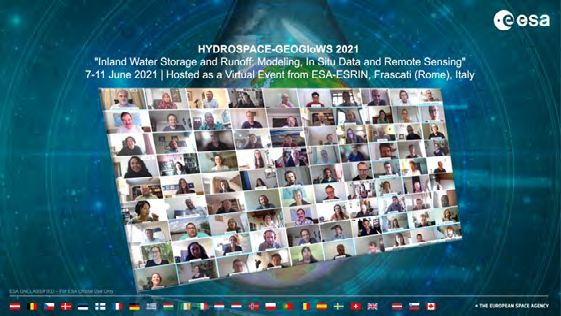
2. THE HYDROSPACE MANIFESTO

    ·A
      ccelerating workflows from data to knowledge and                 extending the data record
     information, with the use of interoperability standards
     (e.g., OGC, WaterML);
                                                                         · Maintain a long-term archive of all necessary raw and
    ·P
      articipating in public outreach, capacity building and
                                                                            processed data, and ensure regular reprocessing of
     providing information to decision and policy makers
                                                                            EWVs;
     highlighting the societal importance of Inland Water
     monitoring;                                                         ·
                                                                          Devote a substantial effort to cross-calibration and
                                                                          extensive validation campaigns for products derived
    · Supporting the development of global inland water
                                                                          from Earth Observation satellite missions all throughout
       storage and runoff systems that leverage remote
                                                                          their operational lifetime, as a key element of the
       sensing, in situ data, and models;
                                                                          success of exploiting EWVs, particularly calibrated river
                                                                          discharge, lake/reservoirs level, lake/reservoirs area and
                                                                          water volume variation;
   data
                                                                         ·
                                                                          Consolidate the use of existing EO data, to improve
                                                                          hydrological forecast, to create Climate Data Records
    · Calling for globally coordinated actions in new data               (CDRs), to gain expertise for the development of future
       acquisition and integration approaches between                     missions, in parallel to the development of future
       satellite and in situ communities;                                 missions;
    · Carrying out detailed measurement requirement                     · Ensure that consistency between satellite-derived water
       studies in support of justifying satellite missions for              products is checked and that the water budget closure is
       hydrology that quantify data needs in terms of latency,              preserved, before using the data. An ‘integration layer’ is
       spatial resolution, and temporal frequency;                          suggested in the processing to optimise and harmonise
    · Working towards satellite and in situ “analysis ready                the water related products before their distribution;
       data”, and developing the technical skills needed to
       integrate and interpret the data and translate it into
                                                                        extending the data record - planning
       meaningful information that conforms to essential
       requirements of accuracy and utility to support policies
       and programmes;
                                                                         · E ncourage further discussion on the EWVs that can be
                                                                            derived from remote sensing between the end-users
                                                                            and remote sensing community; some variables have
   community
                                                                            been under-considered so far (e.g., surface water extent,
                                                                            necessary with water height to calculate a volume) and
    · S triving to openly share our knowledge and methods                  need to be highlighted;
       for the advancement of science and the benefit of                 · Maintain the continuity of the Earth Observation record
       society, including open science practices and increased              of EWVs by ensuring an uninterrupted time series of
       interdisciplinary interactions with societal stakeholders;           global, high-accuracy space data and designing future
    ·G
      athering the HYDROSPACE community in a workshop                      space missions dedicated to inland water monitoring;
     at regular intervals, e.g., every two years.                        · Plan a tandem phase for all new missions, to accurately
                                                                            link successive EWV monitoring missions’ time series;

   We encourage and urge all space agencies, whether                     ·
                                                                          Include inland EWVs in future observational
   R&D or operational, and national and international                     requirements to cope with increasing impacts due to
   funding agencies, intergovernmental bodies and the                     climate change on river basin discharge to the coastal
   European Union to:                                                     ocean, inland flooding and coastal hazards, and launch
                                                                          initiatives to produce long inter-calibrated time series
                                                                          of river discharge, an Essential Climate Variable (ECV);

                                                                    8
HYDROSPACE-GEOGloWS 2021 Workshop                                                                  Summary and Recomendations
2. THE HYDROSPACE MANIFESTO

    · Invest in the development of satellite constellations              extract maximum knowledge from all space missions
       that enable more frequent temporal sampling and                    and in situ networks, whether research or operational;
       capture faster hydrologic variability than allowed
                                                                        · S ecure the funding necessary to pursue the invaluable
       by single or double-spacecraft approaches, further
                                                                           long-term time series of inland water monitoring data,
       facilitating adoption of remote sensing for decision
                                                                           bearing in mind that the costs involved are a fraction of
       making;
                                                                           the cost of damages that could be avoided or mitigated
                                                                           and the benefits that will be harvested;
   community
                                                                       services
    · Strengthen the relationships between space, in situ
       networks and modelling funding agencies, which
                                                                        · E nsure good and permanent cooperation between R&D
       has led to the successful merging of individual space
                                                                           and operational agencies to share expertise and to co-
       mission data sets, in situ data and assimilation in
                                                                           design the application tools and services necessary for
       hydrodynamical models;
                                                                           water managers and policy-makers;
    · S trengthen relations with GEO, in particular, leveraging
                                                                        · E nsure production and dissemination of altimetry, extent
       activities of the Water Initiatives (e.g., GEOGloWS,
                                                                           and temperature products, served by interoperable
       Aquawatch, BluePlanet) and the activities of the
                                                                           databases, for use by the inland water community,
       regional GEOs (e.g., AmeriGEO, AfriGEO, EuroGEO etc)
                                                                           including those who are not remote sensing scientists;
       to ensure continued feedback from the user community,
       and advance capacity building and advanced training              · S upport the move from data to applications (through
       of the new generation of inland water hydrology                     hydroinformatics, WebGIS), with lessons learned in
       scientists;                                                         the ocean and atmospheric communities.

    · Ensure continued capacity building and advanced
       training of the new generation of Inland water                  services – open science
       hydrology scientists, both in situ and remote sensing
       hydrologists;
                                                                        ·D
                                                                          istribute value-added science and application products
    ·M
      aintain the international scientific framework of User
                                                                         on a global free, timely and open access basis;
     Consultation Workshops such as HYDROSPACE and
     expand it to new partners and additional EWVs to                   · C ontinue support for the Data Democracy initiative which
     help define the observables that need to be monitored                 aims to build the capacity, particularly in developing
     through time to inform Water Cycle Indicators for                     countries for accessing satellite data sets free of
     water managers and policy-makers;                                     charge, enhanced data dissemination capabilities, the
                                                                           sharing of software tools, increased training, and the
    ·R
      ecognize the value and importance of the expertise
                                                                           transfer of technology to end users;
     needed to accomplish a transition between research
     and applications, together with end-users and                      · Encourage and support open science practices (open
     beneficiaries, such as transboundary river basin                      software, open data, open papers, and open methods)
     organisations.                                                        to accelerate development and facilitate broader
                                                                           adoption of remote sensing methods;

   community - funding

    · Sustain and strengthen the funding necessary to
       accomplish the scientific research and development to

                                                                   9
HYDROSPACE-GEOGloWS 2021 Workshop                                                                Summary and Recomendations
3. HYDROSPACE-GEOGLOWS 2021
Workshop Themes
The themes covered by the Workshop are: -
1. Space techniques to measure hydrological surface
variables.
1.1 Status of space techniques (improvements,
requirements): Gravimetry, altimeters (SAR and
SARIn modes and laser), radar and optical imagers
1.2
Hydrological surfaces variables and their spatio-
temporal monitoring: water surfaces, water elevations,
wetlands, floodplain, groundwater variations, Digital
elevation Models for hydrology, etc.
1.3 B
lending/fusion of large and diverse datasets. How
can we take advantage of the in situ network and
satellite-based product to better understand the
amount of water available in rivers and lakes?
1.4 F rom large-scale hydrology to small-scale hydrology:
Do hydrology requirements depend on scale? How
can space techniques answer these challenges? data for end-user’s needs. It includes the theme of
Downscaling? Precision vs. resolution? “Fitness for use”.
1.5 R
etrieval methods for other applications of space 3.1 Applications to water resources management.
observations in large river basins (e.g., sediments
transport, systematic mapping of wet areas, flood 3.2 M
onitoring and forecasting the extremes floods/
monitoring, use of altimetry for vertical referencing) droughts.
2. Modelling and Assimilation 3.3 Applications to climate research
2.1 R
iver discharge, lake water balance, basin-scale 3.3.1 long-term data records for climate: Essential Water
water cycle. variables.
2.2 G
lobal and regional hydrological modelling: 3.3.2 dedicated session on ESA Climate Change Initiative.
objectives, state of the art, improvement and data Concerning “Fitness for use”, the user community focuses
requirements (accuracy and space-time resolution). on the degree to which the products conform to essential
2.3 Expected potential of space and ground data in requirements and meet the user needs for which they are
hydraulic and hydrodynamic modelling: calibration, intended. How are the product developers addressing the
parameterisation, assimilation, validation and following requirements?
forecasting. 3.4 Data metrics (precision and accuracy).
2.4 Specific modelling of estuaries. 3.5 Error variation as a function of: scene, geography,
2.5 Lake/reservoir modelling for meteorological and climate zone etc.
climate issues, for exchanges with rivers and volume 3.6 D
ataset characteristics: latency, grid interval in
variations. space/time and length of record.
3. From products to applications 3.7 P
rotocols for applications-ready end-user products:
This part is linked with different initiatives, such as observations and modelling research to applications
AquaWatch, GEOFAST, AfriGEOSS and SWOT downstream to end-user/decision making information products.
programs which aim is to leverage the use of satellite 3.8 End-User applications products.
10
HYDROSPACE-GEOGloWS 2021 Workshop Summary and Recomendations4. SESSION SUMMARIES
4.1. Space techniques to measure hydrological surface empirical rating curve, 22-23% with the Bjerklie formula
variables and 15% for the physically-based algorithm. By using the
Co-chairs: Peter Bauer-Gottwein, Jérôme Benveniste, slope, the elevation and top width from 1D-hydrodynamic
Philippa Berry, Jean-Francois Crétaux, Karina Nielsen, Sobek/Deltares model runs, the error is about 6%. Further
Fabrice Papa, Rodrigo Paiva, Christian Schwatke, studies are planned with the observations of the next
Angelica Tarpanelli and Mohammad Tourian SWOT mission, through the simulator and further work
will be addressed for the ungauged river site.
4.1.1. Block 1 - Space techniques to measure
hydrological surface variables Benjamin Kitambo presented the joint use of in situ
Chairs: Jean-François Cretaux, Angelica Tarpanelli and earth observation datasets (radar altimetry water
surface elevation, WSE, and Global Inundation Extent from
This session block provided an overview of the use of Multi-Satellite, GIEMS-2) to improve our understanding of
remote sensing for the estimation of river discharge, river how waters flow in the Congo River Basin. Specifically, the
bathymetry and water storage over watershed. study focused on the use of the radar altimetry WSE time
series from several missions (ERS-2, ENVISAT, SARAL-
AltiKa, JASON 2&3 and SENTINEL 3A) with in situ water
Rodrigo Paiva presented a comprehensive study on level from gauges to observe the annual amplitude of
the hydrology of the Amazon River in which the satellite
the basin. The GIEMS-2 monthly time series underlying
remote sensing plays a major role in supporting research
agreements over five major sub-basins, and low
and findings. Particularly, the Amazon basin is considered
correlation over Lualaba sub-basin due to the presence of
as a remote sensing laboratory in which the variables
lakes and their connections with floodplains. At the basin
of the water cycle (precipitation, evapotranspiration,
scale, GIEMS reveals the flood propagation dynamics
surface water elevation and extent, water quality, water
and water residence time in flooded areas. Globally, both
storage, modelling the water cycle, aquatic ecosystems,
the satellite datasets, WSE and GIEMS, showed their
environmental changes) derived by space are extensively
suitability for monitoring the flows into the Congo River
reviewed focusing on scientific advances and future
Basin, potentially bridging the gap between past in situ
challenges. Specifically, the benefits of the lessons learnt
databases and current and future monitoring. Perspective
in the Amazon is useful to i) understand the hydrology
and discussion on: 1) the water level amplitude higher
of other large tropical river basins (Congo, Niger, Ganges,
over the tributaries and lower in the main river that is due
Brahmaputra, Mekong), ii) to provide recommendations for
to the topography of the basin; 2) the effect of the delay
observations, models algorithms and their integration, iii)
in the flood wave due to the main river floodplains (similar
for the characterization of hydrological processes with the
to the effect over the Amazon basin).
support of the remote sensing and finally iv) to understand
the changing due to anthropogenic effects and support the
sustainable science. Nicolas Le Moine showed how to combine in situ
measurements and spectral ratios of high-resolution
Discussion on: 1) the different initiatives from geological airborne imagery for an improved representation of river
survey of Brazil and research groups to forecast floods bathymetry. Differently from the standard practices based
(as the recent inundations in Manaus); 2) the orographic on the interpolation of in situ depth measurements from
issues of the satellite precipitation product, especially in differential GPS, total station survey, LiDAR or echo
Amazon in which a few ground rainfall observations are sounding, here, the high-resolution (20 to 50 cm) airborne
available and satellite measurements are highly variable imagery in 4 bands - red, green, blue and NIR – is used to
in space. estimate the bathymetry of the river, using spectral ratios
between adjacent bands. This passive method is already
used in coastal applications and it is extended at river
Luciana Fenoglio showed river discharge estimation applications. The method is applied in a 40-km reach of
by the satellite altimetry over the Rhine River, Germany.
the Garonne River with encouraging results.
As a first step, the comparison of different products of
water level from Sentinel-3 is presented: the Copernicus
Land Product (OCEAN and OCOG retrackers) and the ESA Fabrice Papa addressed the scientific questions about
product (SAMOSA+ retracker on the GPOD/SARvatore the spatial-temporal variation of the fluxes and storage of
processor). This latter outperforms the other products, continental freshwater and about their interactions with
if compared to the in situ measurements. The second the climate and the anthropogenic pressure by presenting
step concerns the estimation of river discharge by three a study over continental waters specially over the tropics,
different methods: empirical rating curve, Bjerklie formula and for the Amazon and Congo basin, often subject to
and traditional Manning formulas. Errors against the in situ large climate variability and prolonged extensive drought/
measurements of river discharge are around 3-7% with the floods. The study showed how to decompose the total
11
HYDROSPACE-GEOGloWS 2021 Workshop Summary and Recomendations4. SESSION SUMMARIES
water storage from GRACE into its components: surface Improvements are expected adding height variation from
water storage, soil moisture root zone storage and ground altimetry as inputs to the simulation.
water storage by the use of multi-mission satellite
observations. The combination of Global Inundation Discussion included: 1) the possibility of adapting the
Extent from Multi-Satellites, GIEMS and ENVISAT radar methodology at ungauged areas by the use of global
altimetry water elevation variations at hundreds of virtual hydrological model; 2) how precipitation, evapotranspiration
stations is used to estimate the surface water storage and runoff affect the mass conservation assumption; 3)
variations, demonstrating that the relative contribution of the flow law parameters are considered constant in order
the surface water storage to the total water storage of to not introduce bias and random errors.
the main rivers (Amazon, Congo and others, i.e., Ganges,
Brahmaputra, Mekong) is found highly variable among the
various basins and sub-basins in link with climatic and 4.1.2. Block 2 - Space techniques to measure hydrological
geological features. Removing from the total water storage surface variables
measured by GRACE, the surface water storage and the soil Chairs: Karina Nielsen, Fabrice Papa
moisture water storage derived by satellite observations
or models (WGHM, ISBA, GLDAS) the ground water
storage is estimated and compared with a few in situ well Jean-Francois Crétaux presented the recent
observations over the Negro and the Madeira basins with advances on estimations and databases regarding
fair agreement demonstrating that the method is robust. lake water levels, the various evolutions from Topex/
For the first time, maps of variability of the groundwater Poseidon to Sentinel-3 and how the discipline went
storage variations over the Amazon basin are showed in from R&D to operational products. Lakes are important
regards to their link to regional climate variability and the component of the regional and global water cycle and
2005 extreme drought. Some satellite perspectives of the a proxy and a sentinel of climate change. There is now
work: 1) improve the spatial resolution of the maps (90 m); a solid international framework around the science
2) merge the dataset to better understand flood dynamics and management of lakes world-wide. There are many
and hydrological processes of SW and GE exchanges and databases that provide now estimate of lake surface
the drivers during extreme events; 3) extent the temporal area, level and volume, especially from remote sensing.
series; 4) apply the methodology to other basins; 5) Jean-Francois Crétaux presented the activities at LEGOS,
support to the SWOT mission with a global inventory of France, and databases such as Hydroweb, the international
surface water and rivers and direct estimates of global Lakes_cci project and the Global Land Service. These
surface water storage variability. databases and projects have 3 main objectives regarding
the estimates of variable of lake: 1) provide multi-
Discussion included: 1) leakage effects in GRACE products; decadal intercalibrated estimates 2) with an error budget
2) the increasing of soil moisture storage occurring ahead 3) and improved data processing. For instance, currently
of surface water storage at basin scale. on Hydroweb, there are 166 operational virtual stations
for 166 and 124 classified as re-search (much less than
Mohammad Tourian showed how to estimate river rivers where >11000 VS are now available). Lake water
discharge using a mass-conserved Kalman filter approach levels are also combined to satellite imagery to monitor
relying on simulated SWOT observations over the Po River, lake volume (hypsometry technique). New missions but
Italy. The method is based on the Manning equation, in also past missions will ensure long term time series to
which the flow law parameters (roughness parameter and survey lakes and reservoirs water levels and volumes
the minimum flow area). are obtained by the definition of
a priori discharges estimated by the combination of SWOT Gennadii Donchyts presented an upcoming platform
observations (simulated using Landsat-derived river width “Global water watch” that will contain worldwide,
by the SWOT-CNES simulator) and the in situ historical data. high-resolution, near-real-time, water data. In the
For each reach and month, the prior discharge is obtained presentation, several examples demonstrating the
by a Kalman filter estimation with a spatial-temporal benefits of having a global real-time reservoir monitoring
process model and mass conservation condition as the system for various applications spanning agriculture,
observation equation. Using the obtained prior discharge, disaster management, and water diplomacy was shown.
flow law parameters are estimated through interior- Multiple methods of monitoring surface water changes
point optimization with inequality constraints. Posterior in reservoirs using a fusion of multispectral optical and
discharge estimates are obtained by adding discharge SAR sensors were shown as well as challenges when
observations derived from simulated measurements and building an automated monitoring system to quantify
estimated flow law parameters. The validation against water dynamics in tens of thousands and, potentially,
in situ data do not show satisfactory results mainly millions of reservoirs globally.
due to non-representative simulated measurements.
12
HYDROSPACE-GEOGloWS 2021 Workshop Summary and Recomendations4. SESSION SUMMARIES
Mathilde De Fleury et al., presented a study regarding both area and water levels were simulated. The RMSE of
the use of altimetry and optical imagery to monitor small the simulated level and area were, respectively, 9 cm and
water bodies in Sahel in Africa to better understand their ranged from 0.4 to 2 km2.
hydrological regime. They found that available algorithms
for water detection missed many lakes due to vegetation. The discussions and questions dealt with how water
By fixing a MNDWI threshold in Sentinel-2 images for under vegetation will be processed in the “Global Water
each lake and not with respect to time they were able Watch” database and how the results over the Lake Chad
to detect more lakes in the different seasons. To extract could be used to predict how many years it would take for
water level variables from Sentinel-3 they used the ALTIS the lake to fully recover.
V1.5 (LEGOS-CNRS) software. To identify measurement
related to the water surface a backscatter threshold of
40dB was selected. From time series of surface water 4.1.3. Block 3 - Space techniques to measure hydrological
extent and water level relation between these variables surface variables
could be formed. This was exploited to densify the water Chairs: Rodrigo Paiva, Philippa Berry
level time series.
This section block focused on surface water and soil
Jean Francois Crétaux presented recent results on moisture measurements, including techniques and
the hydrology of the Lake Chad under current climate applications.
change. Lake Chad is located at the southern edge of the
Sahara and was ranked as the world’s sixth largest inland Chi-hung Chang presented methods for forecasting
water body with an open water area of 25,000 km2 in the inundation extents using Rotated Empirical Orthogonal
1960s. Since then, it has shrunk dramatically and reached Function analysis (FIER). It was used to forecast inundation
less than 2000 km2 during the 1980s, decreasing by more over the Lower Mekong River. RS is useful in this is a
90% in area. Using a multi-satellite approach combined transboundary basin where upstream countries regulate
with ground-based observations, the study asses the discharge on hydropower reservoirs and there is no data
current status of the lake. It shows that Lake Chad sharing transparency. FIER is used based on SAR Sentinel
extent has remained stable during the last two decades, 1 imagery, and in situ water levels to predict spatial and
even slightly increasing. Combining several observations temporal patterns. Inundation maps present high accuracy
(GRACE, models, MODIS, altimetry) results show that since in validation. VIC model was forced with GPM near real time
the 2000s, groundwater which contributes to 70% of Lake satellite precipitation to forecast discharge and water levels
Chad’s annual water storage, is increasing due to water in lower Mekong. Discussion with the audience include:
supply provide by its two main tributaries of the Lake. possible errors coming from poor hydraulic connectivity in
The results indicate that in tandem with groundwater and the studies domain, comparison of flood forecasts from
tropical origin of water supply, over the last two decades, GLOFAS, next steps applying FIER using finer resolution
Lake Chad is not shrinking and that in the last two decades cloud-based imagery from Google Earth Engine.
it recovers seasonally its surface water extent and volume.
Simon Boitard presented New Upgrades of Open-
Claude Duguay presented a study investigating the Loop Tracking Command (OLTC) Tables of Nadir Altimeters.
impact of ice and snow when estimating lake ice thickness OLTC tables are used to center the reception window of
(LIT) from satellite altimetry. Lake ice thickness is an the radar altimetry sensor. Upgrades were performed in
important cli-mate indicator and is listed as an ECV 2020 based on input data from users (e.g., LEGOS) over
(essential climate variable). In situ observations of LIT are rivers and lakes. Validation shows that the acquisition
sparse and expensive to collect so satellite observations performance is now high (>95%). The OLTC Web Portal is
are an important supplement. The object of the study was open to users to contribute. Questions from the audience
to examine the backscatter and brightness temperature include discussions on the difficulties over wetland regions
under different snow and ice properties. Through several and highly dynamic water surfaces, e.g., new or highly
simulation experiment of backscatter and brightness managed reservoirs.
temperature if was found that snow and ice properties
may affect the quality of the LIT. Fernando Jaramillo presented InSAR analyses to
study Connectivity, and Barriers in Wetland Systems
Manon Delhoume presented a study where simulated Worldwide. Using InSAR applied to Sentinel-1 data,
SWOT data was used to estimate water volume of Canadian several examples were presented over different types of
lakes. In the study the large scale CNES simulator was wetlands. Coherence is used to detect flooded areas and
used. One of the objectives was to develop methods to the water elevation change signal is used to interpret on
test the SWOT performances on water storage changes on connectivity and barriers over wetlands. Discussion with
lakes. Examples from 3 Canadian lakes were shown where the audience included the challenges to make the InSAR
13
HYDROSPACE-GEOGloWS 2021 Workshop Summary and Recomendations4. SESSION SUMMARIES
approach operational to estimate water level changes
for dozens of wetlands, e.g., all Ramsar sites in South Overall, several themes recurred in these papers:
America, where for example a multi sensor could be
necessary for dense forest over the amazon, for example. 1. A focus on the interconnectivity of rivers, wetlands,
floodplains and taking a holistic approach to inland
Ayan Fleischmann presented the contrasting water monitoring including soil moisture;
behaviour of South American wetlands using multiple 2. The vital importance of multi-sensor synergy; this is
Remote Sensing data. These wetlands are 14% of south shown to be a rapidly advancing field, pushing the
America and fluvial and interfluvial wetlands may have boundaries of both sensors and models;
different sensitivities to human impacts. Fluvial wetlands 3. Novel uses of a range of existing sensors, and new
store more river water and shape river hydrographs. techniques being developed.
Interfluvial wetlands presented lower precipitation
flooding delay (< 2 months). Water level amplitude
is lower4. SESSION SUMMARIES
Nicolas Gasnier presented a method for water detection (∼25 km). Their comparisons with precipitation estimates
in SWOT HR interferometric SAR images. The baseline show good agreement, displaying expected patterns
SWOT water detection method uses an iterative approach related to surface conditions and precipitation regimes.
that iteratively detects water on the SWOT image using a The temporal variability of basin-averaged estimates has
parameter map and re-evaluates it based on the detected also been compared with altimeter river height, showing
water grid. The detection is done using a Markov random a reasonable agreement.
field approach that combines a data term based on the
image and parameter map and a regularization term that
mitigates the effect of noise by favoring a regular water 4.1.5. Block 5 - Space techniques to measure hydrological
map. He presented that the base method is suboptimal for surface variables
narrow rivers (less than 100m) because they are likely to Chairs: Jérôme Benveniste, Christian Schwatke
be cancelled out by the regularization term. He proposed
a new three-step process using an existing exogenous This session block focused on the driving of hydrological
database (Global Rivers Widths from Landsat) as input variables (Talk 1-4) and future missions (Talk 5-6) for a
along with SWOT imagery. He showed that in addition to better monitoring on inland waters.
the SWOT classification map (Pixel Cloud) of the processing
chain, a priori masks are needed to define which pixels can Omid Elmi presented a new approach for estimating
and cannot contain water. Such masks are used to identify global dynamic river masks from Landsat imagery to
areas to be included in the product and to set flags (“dark derive channel characteristics such as width and depth.
water”, “light land”, “overlay”, etc.). As input data was the Global Surface Water Dataset
(GSWD, Pekel et al, 2016) used. Because of existing data
Christian Schwatke presented DAHITI – Satellite- gaps in monthly masks caused by clouds or SLC failure
derived Hydrological Products for Monitoring the Global of Landsat-7, a new region-based classification algorithm
Water Cycle. He introduced the “Database for Hydrological for correcting the dynamic rivers masks is applied. This
Time Series of Inland Waters” (DAHITI, https://dahiti. algorithm considers temporal and spatial corrections
dgfi.tum.de) and its products. The main product of DAHITI between pixels. The resulting water masks were finally
is water level. Additionally, surface area time series and used to estimate river discharge and were validate with in
water occurrence masks derived from optical imagery are situ discharge stations.
available for almost 200 lakes and reservoirs. Moreover,
the combination of water levels and surface areas allows The second presentation of this block was given by Huilin
to derive further products such as time series of volume Gao about the new NASA`s MODIS/VIIRS Global Water
variations for lakes and reservoirs as well as discharge Reservoir product suite. It is based on data from Moderate
time series for rivers. Besides time series, also bathymetry Resolution Imaging Spectroradiometer (MODIS), and
and hypsometry models for lakes and rivers are available. the Visible Infrared Imaging Radiometer Suite (VIIRS).
Nicolas Taburet talked about operational lakes and rivers The presented product contains 8-day and monthly
water level monitoring using satellite altimetry data measurements for 164 large lakes. In the 8-day product
and highlighted the contributions of HydroWeb and are area, elevation and volume included which are then
Copernicus Global Land Services. He described both the aggregated to monthly products including evaporation rate.
processes yielding the definition of new targets and their The validation of these products shows high correlations
qualification for operation as well as the regular quality between 0.71 and 0.96 for elevation and water storage. It
assessment of the produced water level timeseries. Finally, was noted also that the evaporation model can be applied
planned evolutions of the services were also presented, in to other larger water bodies.
particular the integration of the Sentinel6-MF mission and
its benefits. Sarah Cooley presented the potential of using ICESat-2
for monitoring water level time series of inland waters. It
Catherine Prigent presented satellite-derived global was shown that ICESat-2 has the capability to quantify
surface water extent and dynamics over the Last 25 global variability in water level over 227,386 water bodies
Years (GIEMS-2). She presented a new methodology, from October 2018 to July 2020. The derived water levels
based on which GIEMS-2 provides monthly estimates of are very precise with a high accuracy. By using ICESat-2
surface water extent, including open water, wetlands, or water levels, the potential to monitor seasonal changes
rice paddies. It has been applied to the Special Sensor in reservoirs especially in human-managed areas was
Microwave/Imager and the Special Sensor Microwave demonstrated. Additionally, it was also shown that
Imager Sounder intercalibrated observations to produce ICESat-2 has the potential to derive area information of
a global data record of surface water extent from 1992, reservoirs. The availability of the dataset has been raised
on an equal area grid of 0.25° × 0.25° at the equator and is not yet decided. It was also mentioned that this
15
HYDROSPACE-GEOGloWS 2021 Workshop Summary and Recomendations4. SESSION SUMMARIES
dataset could help to update the OLTC for nadir altimeters This session block focused on river modelling at large
in the future. (Adrien Paris) and reach scales (Monica Frias), use of
satellite altimetry to estimate real-time water levels
In the talk of Eva Boergens, a new web portal “Gravity and discharges (Adrien Paris) and input/validation data
Information Service” (GravIS, http://gravis.gfz-potsdam.de) for model (ICESat-2 by Monica Frias, and roughness
has been introduced. It provides terrestrial water storage coefficients for the SWOT discharge algorithm by Charlotte
(TWS) variations and uncertainties derived from GRACE Emery), assimilation of EO data to improve flood estimates
(Gravity Recovery and Climate Experiment, 2002-2017) and (Renaud Hostache), and new approaches to quantify the
GRACE-FO (GRACE-Follow-On, since 2018) for river basins water cycle components (SAWC by Victor Pellet and DTE
or climatically similar regions on Earth. This data set is by Luca Brocca), with a focus on precipitation input data in
essential for hydrological applications since this is the only the case of Luca Brocca.
one which can measure the total water column.
Adrien Paris presented the monitoring of Congo River
This approach is not well suitable for smaller inland Basin river discharge from altimetry in near-real-time. He
water bodies because of the coarse resolution of GRACE/ used more than 700 satellite altimetry virtual stations
GRACE-FO. (S3 & J3) in the Congo Basin to complement in situ
network. The calibration of rating curves is first made by
The fifth presentation of this block was given by Denis combining altimetry, MGB model discharges, and in situ
Blumstein who presented the future mission SMASH (SMall measurements. The rating curves are then used in near-
Altimetry Satellites for Hydrology) which is dedicated real time to provide discharges to end users. The method
to monitor inland water bodies and estuaries. The is applicable to other ungauged basins. Questions were
development of this new mission was led by CNES with related to the bathymetry information provided by the
Thales Alenia Space (TAS) with the objective to design a method, to the use of the methodology for prediction of
satellite constellation with a daily revisit. The resulting discharge and flooding.
SMASH mission is a constellation of ten small satellites
flying on a Sun Synchronous Orbit in a single plane. They Monica Frias presented the intensive use of ICESat-2
are equipped with a nadir altimeter satellite which should data to provide input and validation data for the
provide an accuracy of about 10 cm, which is sufficient for hydrodynamic modelling of a complex river reach in Yellow
inland water applications but not for ocean applications. River, where high spatial resolution is required and is
There is a strong synergy between SMASH and swath not provided by the altimeter. The goal is to provide the
altimetry missions such as SWOT. required model parameters (including the rating curves)
for this reach. The question of the atmospheric correction
Discussion: It was mentioned that today’s altimeter on the lidar signal has been raised.
missions are “oversized” for inland applications since they
are mainly developed for Ocean applications which require
higher accuracies. Therefore, SMASH could provide also Victor Pellet presented a new approach to estimate
good altimeter measurements for inland waters using less river discharges across the Amazon Basin, combining
expensive small CubeSats. multiple RS-based evapotranspiration precipitation and
TWS (GRACE), and in situ river discharges along with flow
The last presentation was given by Craig Donlon about the accumulation information in a consistent way. The method
hydrology component of the Sentinel-3 Next Generation showed satisfactory validation with in situ river discharge.
Topography Mission (S3NG-T). This mission is dedicated to It stresses the capability to obtain pure observation-based
ensure the continuity of the existing Sentinel-3 constellation estimate for the river discharge in the framework of the
after 2030. The current status of the expert group was water budget closure. In addition, the method can help
presented which results in three potential scenarios (nadir calibration the models and infer pixel scale river parameter
altimeters, swath altimeter or hybrid approach). such as river height and river width. The model ability to
perform forecasts was discussed, considering the latency
of GRACE-FO data.
4.2. Modelling and Assimilation
C o-chairs: Alice Andral, Ayan Fleischmann, Angelica Renaud Hostache showed synthetic tests to assimilate
Gutierrez and Catherine Prigent. frequent soil moisture (SMOS) and flood extent (Sentinel-1
SAR) into a distributed conceptual hydrologic model in order
4.2.1. Block 1 - Modelling and Assimilation to improve the estimation of flooding in ungauged rivers.
Chairs: Ayan Fleischmann, Catherine Prigent The next step will be to perform real world case studies.
16
HYDROSPACE-GEOGloWS 2021 Workshop Summary and RecomendationsYou can also read