Hurricane Readiness Meeting 2022 - Greater Lafourche Port Commission
←
→
Page content transcription
If your browser does not render page correctly, please read the page content below
Hurricane Readiness
Meeting
2022
INTRODUCTION

Chett Chiasson

Executive Director
Greater Lafourche Port Commission
Welcome! We are

                                portfourchon.com

@PortFourchon   @PortFourchon       @FourchonPort   @PortFourchon   @PortFourchon
Ready Today, Ready for Tomorrow
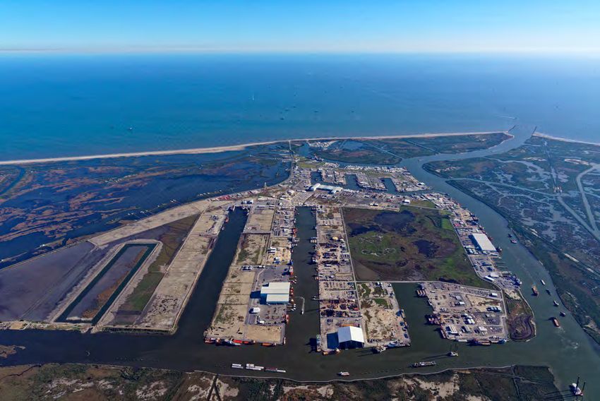
The location of Port Fourchon means we are in close proximity to the
energy infrastructure in the Gulf of Mexico, but that same location also
subjects the port to tropical storms and hurricanes. We have to be ready.
Gulf of Mexico
Port FourchonIt is the goal of the Port Commission
to address each storm in a manner that
strives for the continued safe operation
of port and airport facilities while
ensuring public safety.What we experienced last storm season in
HURRICANE SEASON
OUTLOOK & PREPAREDNESS

Lauren Nash / Megan Williams

Warning Coordination Meteorologist
National Weather Service
New Orleans/Baton Rouge
Hurricane Hazards
and
Communication
2022 Hurricane Season
 NWS New Orleans/Baton Rouge
Two quick polls before we begin…
How many NHC forecast cones have touched Southeast Louisiana/Southern
Mississippi in the last 24 months?

    A. 6           B. 9         C. 12 D. 15

How many of those storms resulted in watches/warnings issued for portions
of Southeast Louisiana/Southern Mississippi?

    A. 6           B. 7         C. 8          D. 9
3rd Most active season on record
Behind only 2020 and 2005
21 Named storms
Average is 14. Exhausted the list of names for
A Look Back the second year in a row
at 2021 7 Hurricanes & 4 Major Hurricanes
Average is 7 and 3
8 US landfalls
Including 2 local landfalls (TS Claudette and
Hurricane Ida)Any big tropical
product or service
changes for the
2022 season?
For the first
time in a long
time, NO!2022 Atlantic Hurricane Names
Alex Hermine Owen
Bonnie Ian Paula
Colin Julia Richard
Danielle Karl Shary
Earl Lisa Tobias
Fiona Martin Virginie
Gaston Nicole Walter
As was the case last year, if we run out of names on the main list, we will go to the
supplemental list of names, rather than the Greek alphabetNHC 2022 Seasonal Forecast
➔   We are in a La Nina and “could” stay in La Nina
     ◆   2020 and 2021 were strong La Nina while 2017-2019 were
         weak La Ninas
➔   58% chance La Nina stays through October, 61% chance it stays
    La Nina through Winter.

It only takes one                           storm to make it a bad season!
General Timeline: When do products become available?
>5 Days                                            60 Hours
       Out                                                Out*
● Tropical Weather Outlook                       ●    PSurge (for select, well-
● CPC Global Tropics                                 behaved storms)
 Outlook*

                                                                                  48 Hours
                             5 Days Out
                                                                                    Out
                             ● NHC Advisory Packages                        ● Watch/Warning Products
                              (cone, wind speed                             ● Hurricane Threats and Impacts
                              probabilities, TOA)                            Graphics (72 hours out at times)
                             ● SLOSH MOMs and                               ● PSurge/Inundation Forecasts
                              MEOWs*
What information can you find in this graphic?
A. Where the strongest winds are
expected
B. Where the center of the storm is most
likely to move
C. What areas will feel the greatest
impacts from the storm
D. When will the greatest threat be in a
specific area
E. All of the aboveReminder: The Cone Doesn’t Tell You
About Impacts!Then what is it?
● Represents the most likely path of
the CENTER of the storm
● Created by connecting imaginary
circles that represent 2/3 the
average track error over the past 5
years.
● Small changes in size every yearWhich model has the most skill in
forecasting tropical cyclones?
A. The GFS (American model)
B. The Euro (European model)
C. The ICON (German model)
D. The UKMET (UK model)
E. The HWRF (Hurricane model)
F. The HMON (different hurricane model)How good are the forecasts?
In 2021, no individual model
performed better than the
official NHC track forecasts.
A few consensus aids
(dashed lines) did slightly
outperform NHC at early lead
times.How good are the forecasts?
In 2021, no individual model
performed better than the official
NHC intensity forecasts.
NHC outperformed all of the
consensus aids (dashed lines) at
some lead times.Wind Hazard Products and Communication
The Saffir-Simpson WIND Scale
Wind Speed Probabilities

●   Available for 34kt, 50kt, 64kt wind speeds out 5 days
●   These are point probabilities based on the current NHC forecast as well as typical
    forecast errors, and to some extent the range of model guidance
●   Remember, low probabilities can be significant, especially at long lead times
●   There can be “jumps” in probabilities when forecast intensities are near the
    graphic thresholds (34kt, 50kt, 64kt)
Hurricane Threats and Impacts Graphics
(HTI)
● Probabilistic forecast based on the
current NHC advisory and accounting
for reasonable forecast errors
● Provides the POTENTIAL winds you
should prepare for, and in many cases
may indicate higher winds than the
official forecast
● Example from Hurricane Ida 10am
8/28.Why use HTIs?
Forecast Track
Actual Track
Jefferson, St.
Charles, St. John
all outside the
deterministic
Red shading is ~35mi
hurricane wind
deterministic swath
hurricane force
wind swath ~20mi
All graphics associated with the 10am CDT forecast 8/28 for Hurricane IdaTime of Arrival/Departure Graphics
● Provides probabilistic time of
arrival of 34kt winds
● Earliest reasonable is based on
10% threshold
● Most likely is based on 50%
thresholdStorm Surge Products and Communication
Storm Surge Flooding Map
                 ●   Based on probabilistic
                     surge forecasts

                 ●   Provides a reasonable
                     worst case inundation at
                     each location based on the
                     current NHC forecast track
                     and intensity

                 ●   Available on the NHC
                     website and through HVX
                     during the watch/warning
                     time frame, roughly 90
                     minutes after each advisory
Peak Storm Surge Forecast Graphic
● Provides potential peak inundation
values along the open coast
● Not everywhere will see these values
● Does NOT indicate potential depths
away from the open coast
● Available around advisory time when
watches/warnings are in effectFlooding Rain Hazards and Communication
Deterministic Rainfall Forecast (QPF)

                   ●   Rainfall forecast graphics for tropical
                       systems are created with a broader
                       color scale

                   ●   They are hosted on both the WPC and
                       NHC website and typically include 3 to
                       5 days of rainfall depending on the
                       storm
Flooding Rain HTI
● Generally matches the excessive rainfall
outlooks, but in a different color palette
to match the other HTI graphics
● When produced (generally after watches
are issued), the HTI graphics are
available on our website:
https://www.weather.gov/srh/tropical?office=lixIda Short Term Warnings Typically only see tornadoes ~ 100 miles from the center of the storm. Red- Tornado Warnings Purple- Special Marine Warnings Green- Flash Flood and River Warnings Black line- very approximate track of the eye The icons- reports we received
Situations
that drive us
all crazy…
“Social Mediarologists”
          ●   Just because a forecast goes
              “viral” doesn’t mean it’s likely to
              happen
          ●   Alarmism spreads quickly
          ●   Be sure to follow official sources
              and if you have questions, just call
              us!
          ●   We will never hide a hurricane
              from you!
The Skinny Black Line I think that line
shifted 5 miles
to the west!
● Remember, a hurricane is not a point on a map and
impacts can extend well away from the center
● Don’t focus too much on the “centerline” of the
cone or small nudges in one direction or another
● Sometimes the small adjustments are actually just
an artifact of the timing of the forecast points. And
many times they’re negligible compared to typical
forecast error.
● Focus on the impacts and whether the forecast
impacts are changingJust a couple more things before we wrap up…
Sending us reports
                        ●   The more information we have about
                            what happened or is currently
                            happening, the more accurate our
                            warnings can be
                        ●   These reports also make up the “official
                            record” and can help citizens with
                            insurance claims, etc
                        ●   Injuries and fatalities (both direct and
    We want YOU             indirect) are recorded in the official
                            database
to send us your storm
                        ●   Trees down, structural damage, roads
       reports!             closed by flooding, hail, funnel clouds,
                            tornadoes, etc. Send it all!
Resources and Questions?
Lauren.Nash@noaa.gov - > For other questions!
www.weather.gov/neworleans
www.weather.gov/srh/tropical?office=lix
www.nhc.noaa.gov
www.facebook.com/NWSNewOrleans
www.twitter.com/NWSNewOrleans
www.weather.gov/lix/embrief
(includes link to latest briefing slides and recording)
And last but not least… US! If you’re struggling to put
together the pieces, give us a call, 24/7. We’re here to
help!STORM PREPARATION & EVACUATION PROCEDURES Michael Kinler Chief, Port Fourchon Harbor Police Greater Lafourche Port Commission
Hurricane Season Preparedness During hurricane season (June 1-November 30), the Port Commission follows established protocols to prepare and respond to potential storm events, including: Updating contact information Meeting with employees to discuss responsibilities Preparing GLPC facilities and equipment to minimize potential storm damage Maintaining contact with state and local government officials, parish and state offices of emergency preparedness, National Weather Service, US Coast Guard, NOAA, and more Providing up-to-date storm information to port and airport tenants, businesses, and the public
Recommended Storm Preparations For
Facilities Located In Port Fourchon
PLAN: Take precautionary measures to reduce the potential
for loss of life, injury, or property damage from a storm.
UPDATE & COMMUNICATE: Make sure the Port Commission
has your current contact information, and vice versa, so that
we can stay in touch regarding storm events.
KEEP YOURSELF INFORMED: We send out updates via
email, text, and social media, and we post them on our Weather
& Storm Info webpage at www.portfourchon.com along with
storm-related information and resources.GLPC Storm Phases
Official evacuation orders come from the parish president, but the Port Commission
closely monitors Gulf weather activity that may affect Port Fourchon and the South
Lafourche Airport. GLPC reports on approaching storms using these storm phases:
Seasonal Alert
Phase I - Storm Watch
Phase II - Voluntary Evacuation
Phase III - Recommended Evacuation
Phase IV - Mandatory Evacuation
Phase V - Storm in Port
Recovery PhaseSeasonal Alert This alert indicates the beginning of hurricane season, which lasts from June 1 through November 30 of each year. This seasonal alert serves as a reminder that as storm season begins, it is time to review your facility’s plan for storm season and share any updates to your contact information with GLPC. There is no specific storm or weather condition associated with this phase.
Phase 1: Storm Watch
This phase indicates that GLPC is monitoring a weather condition in the
Gulf that is expected to affect the Gulf Coast. Port personnel will begin
sending weather updates to port facilities.
When you see a Phase 1 alert, there is a weather condition developing, and we are
watching it for potential effects to the port area.
Review your facility’s hurricane plan.
Be thoughtful of stockpiling any loose material or excess items that could fly or be
damaged if Port Fourchon is affected by a storm.
Make sure the Port Commission has your facility’s updated contact info so that you can
receive timely storm-related information.
At Phase 1, the Emergency Storm Harbor Marina just inside the South Lafourche Levee
System at the Golden Meadow lock will be activated for use by commercial fishing
vessels seeking refuge from an approaching storm on a first come, first served basis.Phase 2: Voluntary Evacuation
This phase indicates that tropical force winds are
expected to be in Port Fourchon within 72 hours.
Begin securing, fastening down, or moving equipment out of port.
Determine special needs and intentions of vessels moored at your facility.
Update your contact people and confirm evacuation plans.
NOTE: Evacuation times may vary dependent upon storm conditions, i.e., projected
path, storm strength and forward speed, pre-storm weather, and road conditions.Phase 3: Recommended Evacuation This phase indicates that tropical force winds are expected to be in Port Fourchon within 50 hours. Non-essential personnel should evacuate port. Secure hazards and clear nonessential equipment from facility grounds such as pallets, lumber, stone, etc. All small craft owned by the facility that can be hauled out or trailered should be removed from the water and secured well away from the effects of possible storm surge and high winds. Prepare office areas to minimize water intrusion damage. Secure your buildings to prevent storm damage by applying storm shutters or plywood over windows or doors. Secure fuel tanks and storage areas. Check regularly for up-to-date info from the Port Commission on the approaching storm. Note: No NEW mooring dolphin rentals will be accepted once Phase 3 is activated. All unleased mooring dolphins will be considered first come, first served until the storm has passed.
Phase 4: Mandatory Evacuation This phase indicates that tropical force winds are expected to be in Port Fourchon within 36 hours. All remaining personnel should evacuate port. Shut off your facility’s utilities (water, power, gas) to minimize damage. NOTE: Twelve hours after mandatory evacuation has been ordered, LA 1 will be closed to all vehicles south of the Leon Theriot Lock in Golden Meadow.
LA 1 Closure at Leon Theriot Lock in Golden Meadow
Gate

Checkpoint at Leon Theriot Lock
      in Golden Meadow

               www.portfourchon.com
Port Fourchon Harbor Police: Last Ones Out, First Ones In
Phase 5: Storm in Port This phase indicates that tropical force winds are expected to be in Port Fourchon within 24 hours. GLPC Ordinance No. 71 applies in Phase 5: No unattended vessels in the port area. Check regularly for updates from the Port Commission via email or social media. You can also visit the port’s Weather and Storm Info page at www.portfourchon.com to get up-to-date information on storms.
Recovery Phase
This phase indicates that the storm has passed and port personnel are
entering the area, assessing the damages to highways and facilities, and
clearing debris and power lines.
The purpose of the Recovery Phase is to ensure that
Port Fourchon is safe and operational as soon as
possible after a storm.
As soon as safety allows, a port re-entry team will
coordinate a damage assessment of all waterways and
roadways leading into and out of Port Fourchon.
Please stay out of the area until you are given
clearance. Your presence may hamper or delay
recovery efforts. Neither vessels nor aircraft shall enter
the port until port damage assessment has been
completed and the all clear is given.Clearing Roadways of Storm Debris
Bringing in Crews and Equipment
Surveying Roadways and Waterways
The Port Commission will notify you when limited or full access is given to tenants to return and assess any damages to their facilities.
Post-Storm Re-Entry Expect roadblocks on roadways leading to the port, including LA 1 & LA 3235. No one will be allowed through a checkpoint until the road is safe and has been cleared for re-entry. GLPC communications will be updated with the port’s post-storm status, and regular updates will be posted on our social media platforms and the Weather & Storm Info page at www.portfourchon.com along with relevant storm-related info and resources. When it is safe to re-enter, you will be notified. You may be expected to show identification upon re-entry. Bring your ID, TWIC, and parish re-entry credentials.
www.portfourchon.com
Potential checkpoint on LA 1
                            toward Grand Isle

www.portfourchon.com
Questions?
Greater Lafourche Port Commission
www.portfourchon.comCOAST GUARD WATERWAY SAFETY PROCEDURES Rachel Stryker, LCDR Acting Chief of Prevention MSU Houma United States Coast Guard
Hurricane
Readiness 2022
RACHEL STRYKER, LCDR
ACTING CHIEF OF PREVENTION
MSU HOUMA
UNITED STATES COAST GUARD
MSU Houma Captain of the Port
Zone
2022 Hurricane Seasonal Alert
Marine Safety Information Bulletin
General Vessel and Barge
Mooring Requirements for Heavy
Weather
Port Conditions:
Whiskey
X-Ray
Yankee
Zulu
Normal
Note: All of these conditions can
be set in MODIFIED formsSetting Port Conditions
Port Condition WHISKEY
Anticipated Gale Force Winds (34 kts/39 mph) within 72 Hours
Advisory focused condition
Recommendations for facilities
Recommendations for vessels
VTS Berwick Bay remain in port requirementsPort Condition X-RAY
Anticipated Gale Force Winds (34 kts/39 mph) within 48 Hours
Increased requirements based on storm track/intensity projections
Remaining in Port Checklist
Vessels 500 GT
Oceangoing Barges and tugsPort Condition YANKEE Anticipated Gale Force Winds (34 kts/39 mph) within 24 Hours Anticipate a system to affect the MSU Houma COTP Zone Final preparations prior to potential port closures Approval for Vessels Remaining in Port
Port Condition ZULU Anticipated Gale Force Winds (34 kts/39 mph) within 12 Hours Port Closures (Either the entire COTP Zone or Targeted) Waiver for Vessels trying to escape the Storm
Port Condition NORMAL/Post Storm
Activities
Search and Rescue
Assist Sector New Orleans
Post Storm Assessments
Port assessment teams
Vessel Assessment Teams
Aids To Navigation Assessment Teams
Overflights of the Marshes, Bays, and Offshore Platform
Underwater Surveys of the Affected Channels
Bridges
Coordination with State and Parish officials
Locks
Coordination with Army Corps of EngineersPort Condition NORMAL/Post Storm
Activities
All Port re-openings will be coordinated
through the MTSRU to the MSU Houma
Commanding Officer (with consultation
from port officials)
Priorities (In no particular order)
GIWW
LOOP
Port Fourchon
Atchafalaya River (Morgan City)
Houma Navigation Canal
Freshwater Bayou
Vessel Movement Waivers
Salvage Work
Pollution Clean-up EffortsMSU Houma Contacts CAPT Loan O’Brien, MSU Houma CDR Kevin Mccormack, MSU Houma Executive Officer CDR Lee Bacon, MSU Houma Chief of Prevention LCDR Rachel Stryker, MSU Houma Chief of Waterways Management CDR Ben Russell, MSU Morgan City LCDR Haley Gipson, MSU Morgan City Chief of Prevention OSCS Derrick Sullo, VTS Berwick Bay Supervisor LT Xiaoyuan Tian, MSD Lafayette WWM (msuhouma.waterways@uscg.mil / 985-665-2440) Sec NOLA Command Center 24/7 (504-365-2543) Vessel Traffic Service Berwick Bay 24/7 (985-380-5370) Homeport: https://homeport.uscg.mil/port-directory/houma
LAFOURCHE PARISH
POST-STORM RE-ENTRY

Eric Benoit

Office of Emergency Preparedness
Lafourche Parish Government
LAFOURCHE PARISH GOVERNMENT
RE-ENTRY PROGRAM UPDATES
NEEDS TO BE UPDATED EACH YEAR
• Go to
  www.parishreentry.com/lafourche
• Click on Company Administrator
  Login.
• Log in using your username and
  password.
• Once logged in, hit the gray
  button with red letters to update
  your status.
• Then, make sure your employees
  are correct. Delete and add if
  there is an employee change.
NEW COMPANIES MUST APPLY FOR
                               PARISH REENTRY
1. Go to the re‐entry website: www.parishreentry.com/lafourche
2. Go to bottom of page and click on Please Apply.
3. Fill out the application and hit the submit button.
4. Be sure to write down the username and password you provided in the application, as you will need
   it to log in to enter your employees.
5. After the approval email, go back to the website and log in as the Company Administrator. You will
   use the username and password you put down in the application.
6. Once logged in as the company administrator, click on View Entrants.
7. Once in View Entrants, click on Add Entrants to start to add your employees.

Note: If you are the primary contact and are also part of your company’s assessment team, you will still
need to add yourself as part of the entrants.

Once on the website there is an Online Help Documentation you can click on with more detailed
instructions.
TIER LEVEL COLORS
CONTACT INFO

            • ERIC BENOIT
    • ericb@lafourchegov.org
           • 985-532-8174
• www.parishreentry.com/lafourche
COMMUNICATIONS John Crochet Director of Information Technology Greater Lafourche Port Commission
Tenant Information We Request
We ask for updated contact information
from our tenants every year. Why?

To keep our port and airport users safe and
informed during emergencies.

You can find multiple options for
updating important contact information
on our Weather & Storm Info webpage
at www.portfourchon.com.
Emergency Notification/ FSO Contact Info Form This form is used to identify your facility’s Facility Security Officer (FSO), who is the person responsible for securing your facility. The FSO will be the first to receive facility- specific safety, security, and recovery updates from the Greater Lafourche Port Commission. Please use this form to update your FSO’s name and most current contact information.
Cybersecurity Contact Info Form This form is used to identify your facility’s Cybersecurity Contact, who is the person responsible for securing your facility’s cyber data and technology. The Cybersecurity/ CISO/ IT contact will be the first to receive facility-specific cybersecurity and data or technology-related updates from the Port Commission. Please use this form to update your Cybersecurity Contact’s name and most current contact information.
Directory Listing
Contact Info Form
This form is used to add or update your
facility’s most current directory listing
information.
The Port Commission’s website directory is
where the public looks for information to
contact companies and facilities in Port
Fourchon and at the South Lafourche Airport,
including:
Physical and mailing addresses
Phone and fax numbers
Company website, if desired
This information is published in our port and
airport directories at www.portfourchon.com
and is publicly accessible online.Public Information Update Signup Form This form is used for both tenants and the public to sign up to receive informational email updates from the Greater Lafourche Port Commission, including: Local Road & Bridge Updates Bayou, Floodgate, & Lock Updates *in conjunction with the South Lafourche Levee District Weather & Storm Season Updates Port Commission Meeting Notices Port Commission Press Releases Seaport & Airport Facilities Notices You can also subscribe online on our NOTIFY ME webpage.
Information We Share: Communications
To keep our tenants informed, the Port Commission has instituted numerous
ways for you to get up-to-date storm-related information as it pertains to Port
Fourchon.
Port Commission Website – www.portfourchon.com
Find the latest weather and storm-related information on our WEATHER & STORM INFO
page
Email Notifications
Sign up for notifications and manage your subscription preferences on our NOTIFY ME
webpage
Social Media
Follow us on Facebook, Twitter, or Instagram
Public Service Announcements
Broadcast updates on local radio and/or television stationsWebsite Feature: WEATHER & STORM INFO
Website Feature: WAVE & TIDE DATA
Website Feature: NOTIFY ME
Website Feature: SOCIAL MEDIA LINKS
THANK YOU for viewing the
2022 Hurricane Readiness Meeting
           Presentation
You can also read