DIGITAL MAPPING TECHNIQUES 2021
←
→
Page content transcription
If your browser does not render page correctly, please read the page content below
DMT 2021

DIGITAL MAPPING TECHNIQUES 2021
      The following was presented at DMT‘21
        (June 7 - 10, 2021 - A Virtual Event)

      The contents of this document are provisional

           See Presentations and Proceedings
          from the DMT Meetings (1997-2021)
           http://ngmdb.usgs.gov/info/dmt/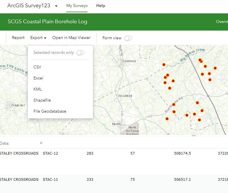
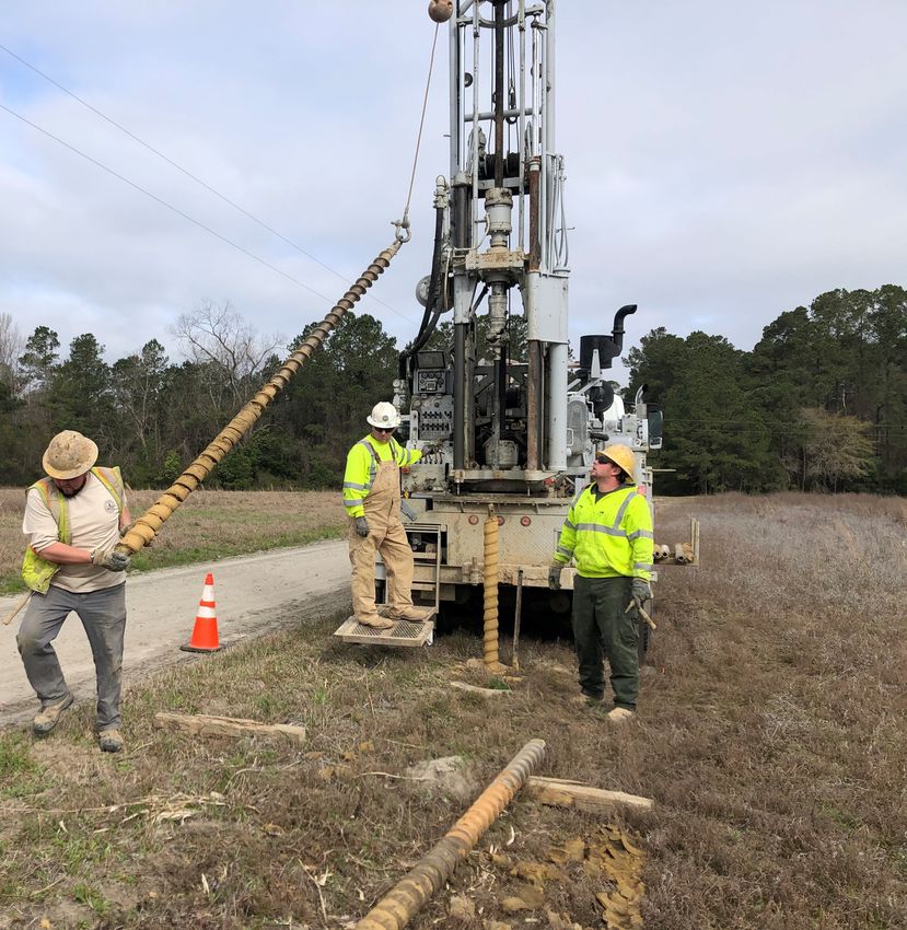
The following slide s we re pre se nte d by Kyle Ga winski
a t DMT ‘21. The y e xpla in the curre nt me thod the South
Ca rolina Ge ologica l Surve y is using to colle ct, displa y,
a nd store subsurfa ce da ta . Sta nda rdization a nd
consiste ncy a re two of the ma jor the me s of this
pre se nta tion. A me thod for inputting subsurfa ce da ta
into Ge MS da ta ba ses is a lso de scribe d.
Updates on Using
  Survey123 t o Log
Borehole Cut t ings and
Produce Geologic Maps
           Sout h Ca rolina De p a rt me nt of
      Na t ura l Re source s Ge ologica l Surve y
                    Kyle Ga winski
                     Me ga n Ja me s
                    Robby Morrow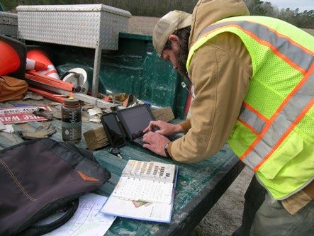
Subsurface Data
 Collection           Display            GeMS               3D
Using Surve y 123   Exporting from   Exporting from    Using ArcHydro
                     Survey 123 to   Survey 123 to a
                        Strater        Shapefile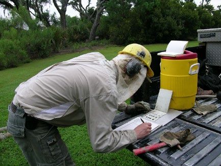
Borehole
Logging
 Using Surve y 123
Purpose
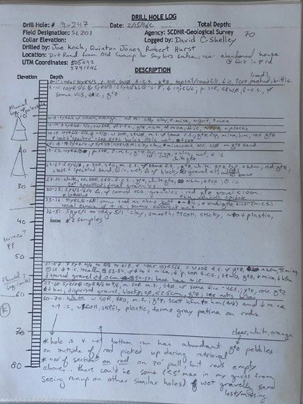
• Pa pe r Digita l Logs
• Sta nd a rd ize d Da ta Colle ction
• Surve y 123 ta ilore d to fit
ne e d s, e xporta ble , Ge MS
complia nt
Ma nua l Entry or Dropdown Se le ction Tra dit ion De scrip t ion
Surve y 123 Ge ne ra t e d De scrip t ion
clayey-sand (55-15-30), very dark gray (10YR 3/1), light brownish gray (10YR 6/2), yellowish
brown (10YR 5/8), light bluish gray (10B 8/1), stiff, dense, medium - coarse, moderately sorted,
sub angular - sub rounded, sub prismoidal - sub discoidal, clay matrix quartz with scattered, very
fine - fine, sub rounded, spherical opaques with rare, medium-coarse, sub angular, smoky
quartz, rutile, and very coarse - granule iron-stained quartz and quartz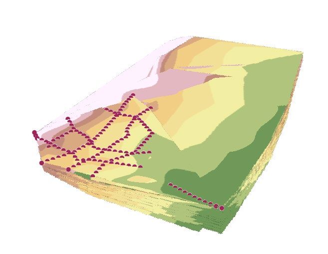
Picture References
Interactive Images Aut omat ic Descript ions
                                              Not es
                                      Field Unit / Confidence
                                       Sample/ Phot o Dat a

  Inte ra ctive Te rna ry Dia gra m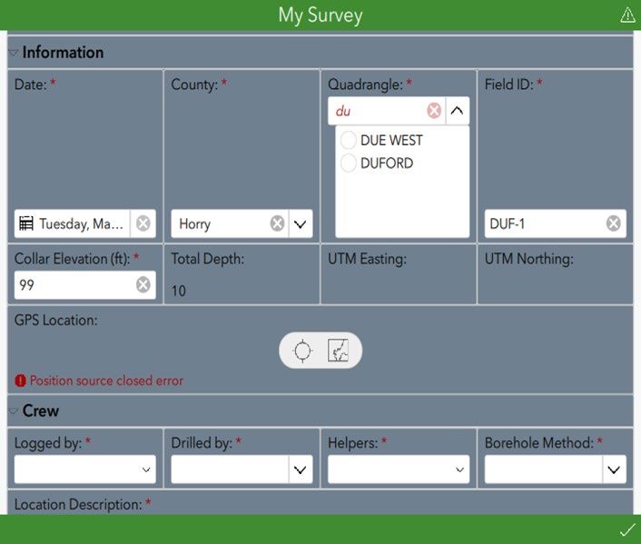
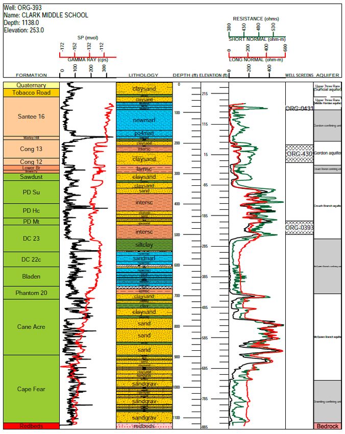
Borehole
 Logs
 Using Stra te r
PythonScript
Quinn Nisbe t & Ta nne r Arrington
   Collars / Coordinates

   Lithology
Strater Templat e
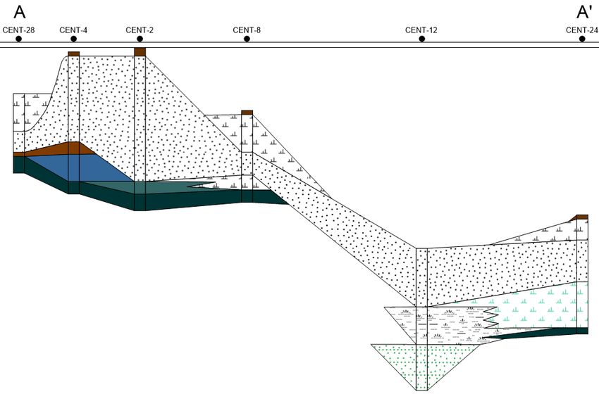
Cross Section
Boreholes
 in GeMS
Methods
• Export sha pe file from Surve y 123
• Script fill in “Sta tions” fe a ture
cla ss a nd “Sta tionsBore hole Logs”
ta bleSta tions (Ge MS Fe a ture Cla ss)
Fie ld ID
GeMSFeature
Classes and Tables
LocationConfid e nce Me te rs
Obse rve d MapUnit
MapUnit
Symbol
Labe l
PlotAtSca le
DataSource ID
Note s
Stations_ID Sta tionsBore hole Logs*
Time Date Fie ld ID
Obse rve r TopContactDe pth_ft
SignificantDime nsions Me te rs TopContactDe pth_m
LocationMe thod BottomContactDe pth_ft
GPSX BottomContactDe pth_m
GPSY TopContactEle vat ion_ft
PDOP TopContactEle vat ion_m
MapX* BottomContactEle vat ion_ft
MapY* BottomContactEle vat ion_m
Ele vationMe te rs* Bore hole UnitThickne ss_ft
LocationDe script ion* Bore hole UnitThickne ss_m
Logge d By* Bore hole Unit
County* De scription
Drille d By* Id e ntityConfid e nce
He lpe rs* DataSource ID
Sample ID* StationsBore hole Logs_ID
Photo*
Me thod * *Adde dDISCLAIM
“While it is important to re cognize
the importance of ge ologic
fe ature s for groundwate r analysis,
we did not atte mpt to cre ate a
3- D
compre he nsive ge ologic map
database in the groundwate r data
mode l de sign” (Stra ssbe rg e t a l.,
2011).
Geology
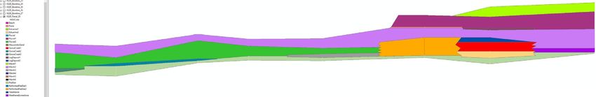
Using Archyd ro by Aq ua ve oCross Sections
Borehole Viewer
Fence DiagramsRaster Creation
Borehole
Visualization
SolidsThanks!
MorrowR@ d nr.sc.gov
https:/ / www.d nr.sc.gov/ ge ology/
CREDITS: This pre se nta tion te mpla te wa s
cre a te d by Slide sgo, including icons by Fla t icon,
a nd infogra phics & ima ge s by Fre e pikYou can also read