Central West Queensland - national parks Queensland National Parks

Page created by David Beck
 
CONTINUE READING
Central West Queensland - national parks Queensland National Parks
Queensland National Parks

Central West Queensland
      national parks
Central West Queensland - national parks Queensland National Parks
Contents
    Parks at a glance (facilities and activities)...................................2

    Welcome......................................................................................3

    Map of Central West Queensland.................................................4

    Choose your escape.....................................................................5

    Experience the Outback...............................................................6

    Discover a land of boom and bust................................................8

    Idalia National Park.................................................................... 10

    Welford National Park................................................................12

    Lochern National Park................................................................14

    Forest Den National Park............................................................15

    Bladensburg National Park......................................................... 16

    Combo Waterhole Conservation Park.........................................18

    Lark Quarry Conservation Park..................................................19

    Diamantina National Park..........................................................20

    Warracoota Circuit Drive............................................................22

    Elizabeth Springs Conservation Park.........................................23

    Munga-Thirri National Park........................................................24

    Travelling tips, packing checklist, Be prepared, Be safe.............26

    Further information....................................................................28

    Parks at a
                                                                                                                                                  (4WD essential)
                                                             (non-flushing)

                                                                                          Day-use area

                                                                                                         Ranger Base

                                                                                                                                                  Scenic drive
                                                                                                                       Short walks

                                                                                                                                     2WD access

                                                                                                                                                                               Kayaking /

                                                                                                                                                                                            viewpoint
                                                                                                                                                                    Mountain

                                                                                                                                                                               Canoeing
                                                                              Camping

    glance
                                                             Toilets

                                                                                                                                                                                            Scenic
                                                                                                                                                                    biking

     Bladensburg NP                                                                                                                           *

     Combo Waterhole CP

     Lark Quarry CP                                                                                                                           *

     Diamantina NP

     Elizabeth Springs CP

     Munga-Thirri NP (Simpson Desert)

     Lochern NP                                                                                                                               *

     Forest Den NP                                                                                                                            *

     Idalia NP

     Welford NP                                                                                                                               *

     Note: *2WD to park entry and/or specific campsite only, and only during dry weather. 4WD recommended.

    Photo: Diamantina National Park © Peter Scott

2
Central West Queensland - national parks Queensland National Parks
Welcome to Central West Queensland national parks
                                   Be adventurous!                                                                                                  Journey
                                                                                                                                          off the beaten track over dusty
                                                  Savour                                                                                    roads or desert dunes into
                                      sunlit plains extended, wildflowers                                                                 Queensland’s dry, but far from
                                     blossoming after rain and the freedom                                                                         lifeless, heart.
                                       of sleeping out under a blanket of          A
                                              never-ending stars.

                                                                                                     Follow
                                                                                         the footsteps of superbly adapted
                                                                                       arid-zone creatures and long-departed
                                                                                       dinosaurs. Traverse ancient Aboriginal
                                                                                       trading routes and the tracks of hardy
                                                                                          explorers and resilient stockmen.

                                                                                                                                      E
                                                                             B

                                                                                                                                                            Relax
                                                                                                                                               under a shady gum tree on the
                                                                                                                                            banks of a river. Boil a billy, throw in
                                                                                                                                             a line and watch for wildlife taking
                                                                                                                                                     refuge from the dry.

                                                                                   D

                                                                                                                                                    Revel
                                                                             C                                                         in the romance and stories of
                                                                                                                                        this wide brown land and its
                                                                                                                                         people. Catch a glimpse of
                                                              Capture
                                                                                                                                      hardships overcome to survive
                                                the essence of the real Australia—harsh
                                                                                                                                     vast distances and unpredictable
                                                      but fragile, vivid yet subtle,
                                                                                                                                          cycles of boom and bust!
                                                     as dangerous as it is beautiful.
                                                 Pen a poem, paint a sunset, capture it
                                                    on camera or simply spin a yarn!
                                                                                                                                      (A) Peter Scott © Qld Govt; (B) © Karen Smith;
                                                                                               F                                      (C) Chris Mitchell © Qld Govt; (D) © Robert Ashdown;
                                                                                                                                (E) © Qld Govt; (F) Karen Smith © Qld Govt.
Photo: Maxime Coquard © Qld Govt

                                                                                                                   Welcome to some of the most isolated national
                                                                                                                   parks in Queensland. Climb 30m high sand
                                                                                                                   dunes, explore rocky gorges, spot endangered
                                                                                                                   wildlife, travel to the one of the world’s most
                                                                                                                   famous dinosaur trackways. Remember to be
                                                                                                                   self-sufficient—supplies and help can often be
                                                                                                                   hundreds of kilometres away.

                                                                                                                   Gary Jorgensen, Senior Ranger
                                                                                                                   On behalf of rangers living and working in the west.

                                                                                                                                                                                             3
Central West Queensland - national parks Queensland National Parks
Photo: © John Augusteyn
            Discover shifting sand dunes stretching towards the horizon.

                                                                                             Kynuna
                                                                                             Combo Waterhole
                                                                                             Conservation Park
      Queensland                                                                                    d                                                                                                                    Forest Den
                                                                                                 Roa                                                                                                                    National Park
                                                                                             tal
                                                                                           en                                                          Winton
                                                                                                                     er

                                                                                         pm
                                                                                                                  Riv

                    Central West                                                      elo                                                                       La                   Muttaburra
                                                                                    ev                                                                            nd
                                                                                                               ina

                    Queensland                                                 yD                                                  Bladensburg                      sb
                                                                     Kenne d                                                                                               or
                                                                                                             nt

                                                                                                           a                                                                  ou
                                                Boulia                                                   am                        National Park
                                                                                                       Di
                                                                     Elizabeth Springs                                                                                         gh
                                                                     Conservation Park                                      Lark Quarry                                             Hi
                                                                                                                                                                                      gh                                Aramac
                                                                      Walking access                                      Conservation Park                                              wa
                                                                                                                                                                                           y
                                                                      only within park
                                                                                                                                                                           Longreach                                    Barcaldine      Jericho
                                                                                                                  iver                                                                                                                                        Alpha
                                                                                                     Mayne R                                                                                             IIfracombe
                                                                                                                                         Lochern
                                                               Diamantina                No                                            National Park                         ve
                                                                                                                                                                                r
                                                              National Park            access                                                                              Ri
                                                                                                                                                                       n
                                                                                                             Goneaway                                               so
                                                           Astrebla                                                                                                                     Isisford
                                                                                                                                                               m

                                                                                                            National Park
                                                                                                                                                                o
                                                                                                                                                             Th

                                                            Downs                                                No access
                      Bedourie                           National Park                                                                                                                           ee k                        Blackall
                                                                                                                                                             Stonehenge                        Cr
                                                          No access
               er

                                               Diam
                                                                                                                                                                                           o
            Riv

                                                                                                                                                                                       rc o

                                                   an
                                                     tin
                                                                                                                                                                                      Ba

                                                        a                                                                                                                                                                            La
         Mulligan

                            e Creek                       De                                                                                                                                                                           nd
                     E yr                                   vel                                                                                           Welford                                                                        s           Tambo
                                                               opm                                                        Jundah                                                           Yaraka                                            o ro
                                                                                                                                                        National Park                                       Idalia
                                                                                                                                                                                                                                         b
                                                                  ent                                                                                                                                                                            u
                                                                     al R                                                                                                                               National Park
                                                                         oa

                                                                                                                                                                                                                                                 gh
Munga-Thirri                                                               d
                                                                                                                   Windorah
                                                                                                                                                                                                                                                    Hig
National Park                                                                                                                                               Hell Hole Gorge
                                                                                                                                                                                                                                                       hw
(formerly known as Simpson
                                                                                                                                  Di                         National Park
                                                                                                                                                                                                                                                         ay
Desert National Park)
                                                                                                                                       am
                                                                 Betoota                                                                    an
                                                                                                                                                 tin
                                                                                                                                                       aD                                                                                                     Augathella
                    Birdsville                    Developm
                                            ville          e n t al Road                                    ek
                                      Birds
                                                                                                                                                        ev

                                                                                                          re                                                                             Adavale
                                                                                                                                                          elop

                                                                                                      C
                                                                                                 er

                                                                                                                                                                                                                Mariala
                                                                                                  p

                                                                                                                                                               me
                                                                                              Coo

                                                                                                                                                                                                             National Park
                                                                                                                                                              nta

                                                                                                                                                                                                                              Charleville
                                                                                                                                                                 lR

    South Australia                                                                                                                                                 oa
                                                                                     Scale                                                                               d            Quilpie                                                                         Morven
                                                                                     0          50               100        150              200km

              Some parks require a 4WD to access, please see
              individual park maps within this guide for more detail.

              Legend for publication
                      National park                                     State boundary                                       Visitor information                                               Sheltered picnic area                    4WD access
                                                                                                                             centre
                      Conservation park                                 Town with fuel and                                                                                                     Natural viewpoint with
                                                                        accommodation                                        Wi-Fi access (visitor                                             no built structure or                    Mountain biking
                                                                                                                             information centre)                                               handrails
                      Restricted access area                            Town with fuel,                                                                                                                                                 Canoeing/
                      do not enter                                      mechanical repairs,                                  Ranger station                                                    Refreshments                             kayaking
                      Creek/river                                       accommodation
                                                                        and a dump point for                                 Information                                                       Walking track                            Fishing
                      Waterway                                          chemical toilet waste
                                                                                                                                                                                               Self-guided                              Camping
                                                                                                                             Parking
                                                                 1      Point of interest                                                                                                      walking track
                      Highway                                                                                                                                                                                                           Caravan
                                                                                                                             Disabled access                                                   Wildlife spotting                        (high clearance)
                      Sealed road                           Drive Queensland Routes
                                                                                                                             Toilets/pit toilets                                                                                        Camper trailer
                                                                   Warrego Way                                                                                                                 Cultural heritage site                   (high clearance)
                      Unsealed road
                                                                   Matilda Way                                               Hospital or medical                                               Car access
                      4WD road                                                                                               services
                                                                   Capricorn Way
     4
Central West Queensland - national parks Queensland National Parks
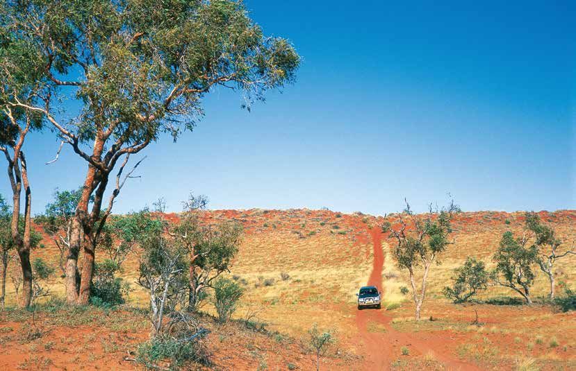
Choose your escape                                                                           Suggested itineries
Head west into the sunset, where distance travelled is measured in days or the number
                                                                                             Dinosaurs and drovers
of ‘roos, emus or flocks of wild budgies seen. Savour wide blue skies contrasting against    Radiate out from your overnight base
rich red earth and wildflowers blossoming in a kaleidoscope of colours amid spindly          at Winton or Bladensburg National
spinifex after rain. Like the dust that seeps into your boots, the vividness and spirit of   Park, venturing north-west along the
this timeless land will be forever etched in your memory.                                    highway across the Mitchell grass
                                                                                             plains to legendary Combo Waterhole,
Embrace vast horizons yet to be explored! Be sure to include a visit to some of
                                                                                             or south on rough unsealed roads
Queensland’s largest national parks in your itinerary.
                                                                                             into the eroded sandstone ranges of
                                                                                             Bladensburg and Lark Quarry. Take a
                                               Short trips from an                           series of day trips, visiting other local
                                                                                             heritage sites in and around Winton
                                               Outback town                                  using self-guided drive brochures
                                               (half to one day)                             available from the visitor information
                                               • Bladensburg National Park (follow           centre. 4WD vehicles are not essential,
                                                 The Route of the River Gum from             but are recommended. (Minimum
                                                 Winton or take Scrammy Drive)               600km if you visit all parks mentioned.)

                                               • Lark Quarry dinosaur trackways
                                                                                             Cooper catchment
                                               • Combo Waterhole near Kynuna                 Drive direct or make a week-long
                                               • Big Red west of Birdsville (on the way      loop (minimum 500km) starting from
                                                 to Munga-Thirri National Park)              Blackall, Windorah or Longreach along
                                                                                             minor byways and unsealed roads to
                                                                                             Idalia, Welford or Lochern national
                                               Taste of the Outback journeys                 parks. Discover waterholes of the
                                               (several days to a week)                      Thomson or Barcoo rivers at Lochern
                                                                                             and Welford, and on leisurely walks
                                               • Dinosaurs and Drovers (Bladensburg          and nature drives at towns of Jundah,
                                                 —Lark Quarry—Combo Waterhole)               Stonehenge, Longreach and Isisford.
                                               • Cooper Catchment (Idalia—Welford            Relax beside Cooper Creek at Windorah.
                                                 —Lochern; just one or a combination)        Stop for scenic views near Yaraka, and
                                                                                             between Jundah and Stonehenge where
                                               • Forest Den National Park
                                                                                             you can also see Aboriginal wells.
                                               • Diamantina National Park                    Step back in time at local museums
                                                                                             and heritage sites (Windorah, Jundah,
                                               Extended 4WD expeditions                      Isisford, Emmet) and learn about the
                                                                                             Outback’s pastoral history at major
      (Above): Enjoying the vivid
                                               (one to two weeks)
                                                                                             heritage tourism attractions at Blackall,
      colours and contours of the              • Dusty Diamantina (Bladensburg—
Spinifex circuit at Lark Quarry.                                                             Barcaldine and Longreach.
© Karen Smith                                    Combo Waterhole—Lark Quarry—
(Below): Savouring the sunset at
Welford National Park.                           Diamantina—Elizabeth Springs)               Dusty Diamantina
© Shane Hume                                                                                 Touch the upper reaches of this mighty
                                               • Munga-Thirri National Park (Simpson
                                                 Desert) (adds at least one week to          river system near its source when you
                                                 any itinerary)                              visit Combo Waterhole (just off the
                                                                                             highway near Kynuna) or seasonal
                                                                                             feeder creeks at Bladensburg National
                                                                                             Park or Lark Quarry south of Winton.
                                                                                             If well-prepared for a true 4WD
                                                                                             challenge, follow the river downstream
                                                                                             to Diamantina National Park along
                                                                                             dusty, rough roads, stopping for scenic
                                                                                             views across steep-sided plateau
                                                                                             (mesa) country and to relive the past
                                                                                             at remains of Old Cork Station and the
                                                                                             Mayne Hotel. After spending a few days
                                                                                             relaxing by waterholes and exploring
                                                                                             sandhill country, return home past
                                                                                             Elizabeth Springs and back to Winton
                                                                                             via Middleton (a minimum 1,000km
                                                                                             loop), or head west to Boulia and
                                                                                             Bedourie; or downstream to Birdsville.
                                                                                             Diamantina National Park can also be
                                                                                             accessed from Windorah.

                                                                                                                                         5
Central West Queensland - national parks Queensland National Parks
Photo: Alicia Whittington © Qld Govt
    Nomadic budgerigars are regularly on the move searching for grass seeds.

    Experience the Outback                                                                                     Guide yourself or
                                                                                                               go with a local
    In Central West Queensland you’ll visit some of the hottest and driest
                                                                                                               Plan your own epic tour from an
    places in Australia. You’ll get dust in your eyes, flies in your face, perhaps
                                                                                                               outback town into the mulga scrub,
    grit between your teeth—or even be stuck in some mud! Wear a grin as                                       down a river or into the desert. Seek
    wide as the landscape and capture memories lasting a lifetime.                                             nature, find solitude or let history
                                                                                                               fill you with wonder. If you prefer
    Best time to go                                             Stop along the way                             someone else to do the planning,
    The cooler months (April to September)                      Remote national parks might be your            driving or to supply the equipment,
    are the best time to visit Central West                     destination, but don’t just drive past local   you can join tours with experienced
    Queensland to avoid extreme summer                          towns. Stop in for fuel and food, see local    guides—for just a day or overnight.
    daytime temperatures of over 45°C and                       sights, have a meal at the pub or stay the     Visit outbackqueensland.com.au
    the risk of rainfall events and flooding.                   night. Even most small towns have the
                                                                basics and you’ll receive warm, country
    Rain can fall at any time of the year.
                                                                hospitality and helpful advice.
    Many outback roads are unsealed and
    impassable after even a small amount of
    rain. Flooding can occur suddenly—even                      Add local flavour
    weeks after rain in catchments upstream.                    Add one of the region’s fun-loving
    No park has all weather access. Munga-                      events or tourist attractions to your
    Thirri National Park (Simpson Desert) is                    journey. Whether at races for horses,
    closed from 1 December to 15 March.                         camels or yabbies; a showcase of
                                                                livestock or rural prowess; an annual
                                                                festival or a world-famous museum—
                                                                the Outback spirit is alive and well and
                                                                waiting for you to join in. Meet local
                                                                characters, try a new skill, spin a yarn
                                                                and savour the experience. Find out
                                                                more at outbackqueensland.com.au

          Experience heading off the
          beaten track.
    © Tourism & Events Qld
    (Above right): Enjoy spotting
    woodland birds in mulga scrub
    or among the eucalypts.
    Fiona Leverington © Qld Govt

6
Central West Queensland - national parks Queensland National Parks
Welford National              Best parks to...
                                     Park’s spinifex-clad           Walk on marked tracks—
                                                                    Idalia, Welford, Lark Quarry and
                                     sand dunes hint of
                                                                    Combo Waterhole.
                                     the Simpson Desert
                                                                    Camp by a waterhole—
                                    in Munga-Thirri, while
                                                                    Diamantina, Welford, Lochern
                                    its open mulga on red
                                                                    and Bladensburg.
                                     soil contrasts with
                                                                    Throw in a line, or take a quiet
                                     the dense mulga of
                                                                    paddle on a waterhole—
                                    Idalia’s rocky ranges.          Welford, Lochern, Bladensburg and
                                                                    Diamantina.

                                                                    Take a scenic drive—
   Many parks have Mitchell                                         Idalia, Welford, Lochern,
   grasslands. Walk through                                         Bladensburg and Diamantina.
    them at Lochern, Forest                                         Mountain bike on bush roads—
 Den, Diamantina and Combo                                          Idalia, Diamantina, Welford
 Waterhole or look over them                                        and Lochern.

from a higher vantage point at                                      Relive the past—
         Bladensburg.                                               Idalia, Welford, Lochern,
                                                                    Bladensburg, Combo Waterhole
                                                                    and Diamantina.
                                     Waterbirds and
                                                                    Discover dinosaurs—
                                 honeyeaters stay within            Lark Quarry.
                                    reach of the tree-
                                                                    Capture the magic of the last rays
                                   lined river channels             of sunset from a cliff overlooking
                                    and waterholes of               mulga at Idalia and Welford, across
                                 Diamantina, Lochern and            open plains at Diamantina or
                                                                    Bladensburg, or from the top of a
                                 Welford national parks.
                                                                    sand dune at Welford, Diamantina
                                                                    or Munga-Thirri.

                                         Channel country            Snap a picture-perfect scene
                                                                    where dinosaurs walked (Lark
                                           dominates at
                                                                    Quarry), under a coolabah tree
                                           Diamantina               (Combo Waterhole), or overlooking
                                          National Park             the mighty Diamantina Gates
                                            which has               (Diamantina).

                                            extensive
                                             wetlands               Encounter wildlife!
                                            of national             Tick kangaroos and wallabies off
                                                                    your list at Idalia, Welford, Lochern
                                           significance.
                                                                    and Bladensburg.

                                                                    Watch birds flock to watering holes
  Nestled amid                                                      at Diamantina, Welford, Idalia,
  Lark Quarry’s                                                     Combo Waterhole and Forest Den.

  spinifex-clad
 jump-ups, you’ll
find footprints left
by dinosaurs 100
                                                                   (Top to bottom):
                                                                   © John Augusteyn; © Qld Govt;
million years ago.                                           © Qld Govt; © Qld Govt;
                                                             Peter Lik © Tourism and Events Qld

                                                                                                            7
Central West Queensland - national parks Queensland National Parks
Photo: © Robert Ashdown
    Tiny thorny devils in Munga-Thirri wear fearsome camouflage.

    Discover a land of boom and bust                                                                            Arid environments
                                                                                                                Mitchell grass downs
    There’s much more happening in the Outback than evident at first glance.                                    Natural grasslands, named for the
    Be thrilled by discovering superbly camouflaged wildlife, a perfectly                                       dominant native Mitchell grass, support
    adapted plant, an anomaly in the landscape or relics of times long gone.                                    the region’s grazing industry. Unlike trees,
                                                                                                                grasses can anchor in dark clay soils that
                                                                                                                expand when moist and crack deeply
    Life in the dry                                                Landscapes worn by time                      when dry.
    Humans, plants and animals all depend on                       Craggy escarpments and deep gullies
    unpredictable flood cycles of the world’s                      tell of a land alternately shaped by, then   Mulga lands
    most variable watercourses—Cooper Creek                        starved of, water. Sea floors and lakebeds   Growing in almost pure stands, or
    and Diamantina River.                                          of 65–140 million years ago form the base    interspersed with grasslands and
                                                                   of the landscape, encasing fossils from      eucalypt-acacia woodlands, mulga trees
    First Nations people thrived on the secret
                                                                   shellfish to dinosaurs, now exposed by       dominate slightly moister, higher country
    bounty of these arid and semi-arid lands,
                                                                   the passage of time.                         in the east of the region. Each mulga tree
    trading along rivers and finding food
                                                                                                                (pictured below) directs rain to its deep
    in unlikely places. Artefacts, stories
                                                                                                                tap root, allowing survival in a dry climate.
    and connections remain and Aboriginal
    traditions and heritage are still alive today.

    Explorers, miners and pastoralists sought
    their fortunes. Many died, some barely
    survived, but others adapted to establish
    the towns, pastoral holdings and the parks
    and reserves of today.

           (Below): Rivers flood out
           over flat channel country.
    © Rob Murphy
    (Right): Scrammy Gorge.
    Rosemary Millward © Qld Govt
    (Far right): Mulga trees.
    © Robert Ashdown

                                                                                                                Channel country
                                                                                                                Mighty inland rivers disperse across
                                                                                                                gently sloping land into braided channels,
                                                                                                                creating waterholes, wetlands and
                                                                                                                floodplains tens of kilometres wide.
                                                                                                                Coolabah woodlands, sand plains and
                                                                                                                vast dunefields are adapted to infrequent
                                                                                                                rains that fall in short but massive deluges
                                                                                                                that flood watercourses then evaporate in
                                                                                                                the parching heat.

8
Central West Queensland - national parks Queensland National Parks
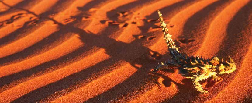
Memorable mammals                            Resilient reptiles
In the heat of the day mammals rest in       Encounter reptiles when it is warm or see           What wildlife where?
a shady spot, or hide in soil cracks and     tracks where they have been. Arid lands             Go birdwatching
crevices or down a burrow. Keep watch in     are home to a diverse range of superbly             Spot birds along creeks and
the late afternoon or at night.              adapted lizards, dragons, skinks, geckos            waterholes at Idalia, Forest Den,
                                             and snakes.                                         Combo Waterhole, Welford, and at
Brilliant birds                                                                                  Surprise Creek and in the spinifex
Be surprised by the variety and numbers      Fantastic fish, turtles and frogs                   grasslands at Bladensburg.
of birds in the dry inland. Admire soaring   Where there is water there is life. More            Hunters Gorge and Lake Constance
birds of prey and colourful parrots,         than a dozen fish are found in the region.          at Diamantina, Boomerang
babblers in the mulga and honeyeaters        Many, like the Cooper Creek catfish (at             Waterhole at Welford and
along creeklines. Waterbirds seek refuge     Lochern) and the unique Lake Eyre basin             Broadwater Lagoon at Lochern are
at waterholes or breed opportunistically     yellow-belly are not found anywhere                 great for watching waterbirds.
after floods.                                outside these catchments.
                                                                                                 Spot lizards and snakes
                                                                                                 See yellow-spotted monitors at
                                                                                                 Bladensburg, Idalia, Lochern and
                                                                                                 Diamantina. Ring-tailed dragons
                                                                                                 are found by day at Lark Quarry
                                                                                                 and spiny-tailed geckos hunt at
                                                                                                 night at Bladensburg. Gilbert’s
                                                                                                 dragons live in woodlands and
                                                                                                 river margins, waving their legs in
                                                                                                 turn to cool their feet.

                                                                                                 Discover mammals
                                                                                                 Both red and grey kangaroos
                                                                                                 graze open plains while common
                                                                                                 wallaroos prefer the slopes of
                                                                                                 ranges. Black-striped wallabies
                                                                                                 inhabit thicker vegetation, and
                                                                                                 at Idalia, swamp wallabies live
                                                                                                 along creek beds. Spot echidnas
                                                                                                 and possums at Idalia, Lochern,
                                                                                                 Bladensburg and Welford; gliders
                                                                                                 and insect-eating bats can be
                                                                                                 seen at Idalia and Forest Den. Of
                                                                                                 the ground-dwelling mammals,
                                                                                                 stripe-faced dunnarts and fat-
                                                                                                 tailed dunnarts are widespread;
                                                                       (Clockwise from top       unlike the endangered bilbies and
                                                                       left): Ornate             kowaris seen rarely at Diamantina.
                                                                 burrowing frogs (pictured)
                                                                 and water holding frogs are     In scrubby sand country you
                                                                 widespread, hidden away
                                                                 waiting until it rains again.   might spy a tiny kultarr bounding
                                                                 Robert Ashdown © Qld Govt
                                                                 Black-headed pythons            gracefully in search of cockroaches
                                                                 stretch out across roads at     and other bugs.
                                                                 night in a range of habitats.
                                                                 © Shane Hume
                                                                 Colourful mulga parrots
                                                                 favour a diet of seeds.
                                                                 © Shane Hume
                                                                 From huge wedge-tailed
                                                                 eagles (left) soaring high
                                                                 on upswept wings, to swift,     Watch wildlife, don’t hit it!
                                                                 streamlined falcons and
                                                                 kites that seem to hang in      Vehicles share the road with
                                                                 mid-air, birds of prey are
                                                                 always on the lookout for       wildlife. Minimise your chance of
                                                                 their next meal.                collision by travelling at or below
                                                                 © John Augusteyn
                                                                 Central netted dragons can      the speed limit, and avoid driving
                                                                 be seen at Lochern.
                                                                 © Shane Hume                    at dusk or dawn.

                                                                                                                                       9
Central West Queensland - national parks Queensland National Parks
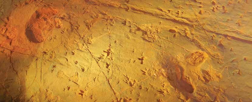
Photo: Fiona Leverington © Qld Govt
     Rugged ranges provide panoramic views.

     Idalia National Park
                                                 Emerge from thick mulga scrub to lofty escarpments and rocky gorges
        Must dos                                 where elusive yellow-footed rock-wallabies hide and views surprise.
        • Tick 6 species of kangaroos and        Be captivated by colourful sunsets over distant plains and explore
          wallabies off your ‘must see’ list.
                                                 heritage sites for an insight into the hardships faced by those living
        • Gaze from craggy escarpments
          over mulga-covered ridges to           here in years gone by.
          distant plains beyond. Trees
          line waterways that stretch from       Mulga scrub covers much of 144,000ha
          rocks to river channels.                                                                  Wildlife spotting
                                                 Idalia, and mature mulga has good leaf         Spot yellow-footed rock-wallabies at
        • Imagine stories behind the rusty
                                                 litter cover and fallen logs that make ideal   Emmett Pocket lookout and Bullock Gorge.
          iron and splintered bush timber
          of old stockyards, huts and            fauna habitat. Dawson gums and mountain        Discover red and grey kangaroos in open
          pastoral-era relics at Old Idalia.     yapunyah trees break the expanse of            areas, but on slopes and in the forest keep
        • Camp hidden in thick mulga             mulga green on upper slopes; while river       a lookout for wallaroos, swamp wallabies
          scrub near Monks Tank and              red gums and poplar box grow on sandy          and black-striped wallabies typical of
          awaken to the morning chorus           flats beside the usually dry Bulloo River.     inland areas.
          of outback birds.
                                                                                                Watch at night for kultarrs (tiny mammals)
                                                 Things to do                                   searching for cockroaches and bugs.
        Getting there
        Idalia National Park is 113km                    Driving and mountain biking            See Hall’s babbler, colourful Australian
        south-west of Blackall in the Gowan      Most driving tracks are suitable for keen      ring-necks, crested bellbirds and
        Ranges. To access the park, a 4WD        mountain bikers experienced in arid and
        is recommended. From Blackall,                                                          plum-headed finches. Keep an eye out
                                                 remote terrain. It’s 47km from the park        at the camping area for white-plumed
        head west along the Isisford Road for
        44km, then turn left onto Blackall–      entrance to Emmet Pocket lookout, with         honeyeaters and eastern yellow robins at
        Emmet Road. After 25km turn left         several side branches and walks along          the far western limit of their known habitat.
        again at the Idalia National Park sign   the way.
        and follow the road for 44km to the
        entrance of the park. It is a further
        33km to Monks Tank camping area.
        Fuel and supplies are available from
        Blackall (113km) and Isisford (120km).

        Did you know?
        Yellow-footed rock-wallabies
        Petrogale xanthopus celeris are
        well-camouflaged in the safety of
        the rocky outcrops, leaving only to
        drink and graze at the base of cliffs.                                                             (Above): Emmet Pocket lookout is
                                                                                                           a perfect spot to enjoy the view.
        They are vulnerable to extinction and                                                        Fiona Leverington © Qld Govt
        threatened by foxes and competitors                                                          (Left): Yellow-footed rock-wallabies
        such as goats and sheep. Please do                                                           inhabit high rocky escarpments.
                                                                                                     © Qld Govt
        not disturb them by climbing down
10      among the rocks.
Places to go
          Be up early to see the first
                                                                                                      Old Idalia
          rays of the sun creeping
                                                                                                  (Allow 30 minutes to explore).
          across the slopes and
                                                                                                  Grade: easy.
          plains; or end the day with
                                                                                                  Wander through remains of a musterers’
          a stunning sunset walk                                                                  hut. Pass a wagon and an old ship’s tank
          (remember to take a torch).                                                             where a natural spring supplied stock water.
          Ranger Peter
                                                                                                      Wave Rock walk
                                                                                                  1.2km return (30min).
                                                                                                  Grade: moderate.
                                                                                                  Walk from Old Idalia to a wave-shaped
                                                                                                  cliff where wind, sun and time are nature’s
                                                                                                  carving tool and sunset is the paintbrush.

                                                                                                      Stake stockyards
                                                                                                  Visit innovative stockyards constructed
                                                                                                  between the 1920s and 1950s. Lengths
                                                                                                  of saplings and twisted wire held up to
                                                                                                  300 cattle during muster.

                                                                                                      Junction Hole
                                                                                                  Watch for birds and kangaroos at this
                                                                                                  roadside waterhole.

                                                                                                      Rainbow Gorge walk
                                                                                                  200m return (15min).
                                                                                                  Grade: easy.
                                                                                                  Admire white, red and yellow-tinted
Places to camp                                                                                    sandstone 14km north of the Old Idalia
Monks Tank                                                                                        turn-off.

                                                                                                      Murphys Rockhole
4WD recommended.                                          (Top): Wave Rock                        See animals watering at a gorge shaded by
                                                          (Above left): Stake fenceline
Peaceful bush camp hidden in mulga                  John Augusteyn © Qld Govt                     river red gums. Look for koalas in eucalypt
woodlands 33km from the park entrance.              (Above): Native fuschia                       trees near water—you won’t find them
                                                    © Shane Hume
Not suitable for large caravans.                                                                  much further inland.

                                                                                                      Bullock Gorge walk
                                                                                                  2.7km return (1hr).
                                                                               To Blackall 85km   Grade: easy.
                                           Bullock Gorge                                          Rock markers show the way through bendee
                                              7                                                   shrubland along a ridge top. Take care here
                                                                                                  as there are steep gorges on either side.

                           8     9        5.7km
                                                                                                      Emmet Pocket lookout
              Emmet Pocket                                                                        Gaze from the escarpment over the park’s
                                2.9km                             Murphys                         northern end. If quiet you might spy
                                                              6
                                        3.8km     3.7km           Rockhole                        yellow-footed rock-wallabies hiding
                                                             Rainbow Gorge                        among the rocks below.
                                                   5
                                        9.4km
                           Monks Tank                                                                 Emmet Pocket walk
                                                           Old
                                                           Idalia Wave                            4.4km return (2–3hr).
                                                             1    Rock                            Grade: difficult.
                      Junction Hole 4
                                                    8.8               2                           A steep track leads into the gorge where
                                    Stake 3         km                                            plains lie before you like a map.
                               stockyards                     2.1km

                                                                                                  Take drinking water.
                                                          7.9km
                                                                      11.8km

  Scale                                                                                                       Take care near cliff edges.
  0             5          10            15            20km
                                                                                                              Supervise children closely.

                                                                                                                                                11
Photo: John Augusteyn © Qld Govt
     Admire patterns and animal tracks in shifting wind-blown sands.

     Welford National Park
                                                                 Enjoy almost every outback experience in one amazing park. Birdwatch,
        Must dos                                                 fish or camp at a billabong; see spinifex on red desert sand dunes; delve
        • Enjoy the ebb and flow of life on                      into the past at historical sites and 4WD to rugged rocky scarps where
          the Barcoo River. Camp, take it
          easy, paddle or throw in a line.                       secretive yellow-footed rock-wallabies hide.
        • Capture a sunset and the
          contrasting colours of ghost                           At Welford’s southern boundary, the           Things to do
          gums and wildflowers on red                            Barcoo River cuts a green and brown
          desert dunes.                                                                                            Wildlife spotting
                                                                 swathe west from rugged, rocky mulga-
        • Navigate along the river, through                      clad ranges towards Mitchell grass plains     See emus on grassy plains and Major
          the mulga scrub or across sand                                                                       Mitchell’s cockatoos, red-winged parrots
                                                                 and some of the most easterly red sand
          plains, taking in the stunning
                                                                 dunes in Australia. Seek contrasting          and mulga parrots in mulga woodlands
          scenery and spotting wildlife.
                                                                 landscapes, varied wildlife and the shade     and along the river. Look for brushtail
        • Delve into the past at heritage
                                                                 and tranquility of majestic river red gums    possums in eucalypt trees at night.
          sites that reveal how the
          landscape has sustained people                         and coolabahs along river channels that       Birding is brilliant around waterholes—
          for generations.                                       bring life-giving water to thirsty country.   glimpse pelicans, brolgas, black swans,
                                                                                                               whistling kites and freckled ducks.
                                                                 Aboriginal cultural sites are scattered
        Getting there                                                                                          Water rats hunt for fish and frogs and
        Welford is 260km south-west of                           across the 124,000ha park. Welford’s          gather mussels along the river, while
        Longreach and 50km south of                              pisé (rammed earth) homestead built in        spangled perch, yellow-belly and
        Jundah. You enter the park via                           1882 is one of only a few still occupied in   Cooper Creek catfish are found in
        unsealed Jundah-Quilpie Road.                            Queensland—but is not open to                 permanent waterholes.
        From Blackall (257km) drive south-                       the public.
        west to Yaraka then continue on the
        Yaraka-Retreat Road, or from Quilpie
        (270km) and Windorah (110km) take
        the Diamantina Development Road,
        connecting with the Jundah-Quilpie
        Road and entering the park from
        the south.
        4WDs are recommended. All roads
        within the park are impassable in
        wet weather. The nearest fuel and
        supplies are at Jundah (50km) and
        Windorah (110km).

            (Right): Rugged rocky escarpments are a
            contrast to sandy plains.
     John Augusteyn © Qld Govt
     (Far right): Lily-covered Trafalgar Waterhole.
     © Peter Hogan

12
Fishing and canoeing                                     Did you know?                                          Places to camp
    Although its banks are steep and slippery,                         Cattle find mulga Acacia aneura tasty
                                                                                                                                           Little Boomerang Waterhole
    Little Boomerang Waterhole is a great                              but ignore gidgee Acacia cambagei trees.               10km west of Jundah–Quilpie Road.
    spot for fishing, canoeing and kayaking.                           Welford National Park and others are                   4WD recommended.
                                                                       now destocked of cattle and protect such               Camp near shady river red gums and tea-
              Driving and mountain biking                              mulga woodlands.                                       trees on the banks of the Barcoo River.
    Follow a bush track exploring dunes,
    rocky outcrops, plains, channels                                                                                          Places to go
    and billabongs. Early morning or late
    afternoon is best for wildlife. Travel                                                                                         Desert Drive
                                                                                                                              22km one way (allow at least 3hr).
    slowly and be careful of other road users
                                                                               Mulga                                          4WD only.
    and wildlife.                                                                                           Gidgee            North-west of Little Boomerang Waterhole
                                                                                                                              is thirsty country of colourful sand
                                                                                                                              plains and dunes. Visit a life-sustaining
                                                                                                                              waterhole       . Climb soft sand to the
                                                                                                                              dune and capture desert colours on
                                                                                                                              camera (take care not to disturb fragile
                                                                                                                              plants)      . See a bore drilled to bring oil
                                                                                                                              from 1,800m below ground            and where
                                                                                                                              a windmill once pumped precious water to
                                                                                                                              troughs for stock      .

                                                                                                                                   River Drive
                                                                                                                              12.3km one way (allow 1.5hr).
                                                                                                                              4WD recommended.
                                                                                                                              Travel along the banks of the river where
                                                                                                                              river red gums line steep-banked channels.
                                                                                                                              Usually dry with the occasional billabong,
                                                                                                                              debris high in trees is a reminder that
                                                                                                                              swirling floodwaters can sweep down
                                                                                                                              the river washing away vegetation and
        Go birdwatching along the river and in the ranges.                                                                    wildlife. Birdwatch at ‘The Jetty’   ,a
        © John Augusteyn                                                                                                      natural rock bar protruding into the water.

                                                                                                                                   Mulga Drive
            Our little-known sand                                                                                             71km return (allow 4hr).
            dune is Welford’s most                                                                                            4WD only.
            photographed feature and                                                                                          Venture east past the stockyards,
                                                                                                                              (stopping for glimpses of the old rammed
            is magic to visit at sunset.
                                                                                                                              earth homestead) then onto scenic
            Ranger Sophia
                                                                                                                              waterholes 6 and 7 . Journey over
                                                                                                                              river flats and up into rough mulga
                                                                                                                              country dissected by stony escarpments
                                                                                                                              and gullies towards a viewpoint 8 and
                                                                                                                              Sawyers Creek 9 .

                                                                         Sawyers Creek                                         7   Trafalgar Waterhole
                 To Jundah 50km
                                                                         viewpoint                   Sawyers Creek            18km east of Jundah-Quilpie Road.
                                                                                    8                                         4WD required.
  16 Mile Bore                                                                                        9
                                                                                                                              Perfect picnic spot beneath
 Southern 4                Ju
                              nd                                                                                              coolabah trees.
                                ah
                 Deser t

Cross Bore                        -
                                                                                                                                   Sawyers Creek viewpoint
                                     Q

                      Dri                                                                                                      8
                                       ui

 Oil Bore 3
                                         lp

                                                                                                                              1.2km return walk (allow 30min).
                           ve

                                           ie

                 2                                                                                            r
                                             Ro

  Desert                                                                                                  Rive                Grade: moderate.
                                                                                                  coo
                                               ad

Waterhole                                             Frances                     rive         Bar
                                                                          Mulga D                                             Enjoy panoramic views of exposed rocky
        1                  R iv                       Waterhole 6
                                  er Drive                                                                                    outcrops, slopes and spidery networks
                                                                                                                              of channel country below.
                                      5                                                7             Trafalgar
    Little Boomerang                                                                                 Waterhole                Watch for mulga parrots and at dusk
    Waterhole        The
                     Jetty                                                     Scale                                          for yellow-footed rock-wallabies.
                                                    To Quilpie 270km           0           5         10           15   20km

                                                                                                                                                                               13
Photo: © Peter Scott
     The mighty Thomson River is a ribbon of life in the dry.

     Lochern National Park
                                                                Travel to the heart of ‘boom and bust’ country where devastating
        Must dos                                                droughts are followed by flooding rains that nourish the plains and
        • Admire Australian bustards                            transform parched channels into wetlands teeming with life.
          strutting across rolling Mitchell
          grass plains.                                         With a 20km frontage to the Thomson                             Walking and mountain biking
        • See flood marks on tree trunks                        River, 24,300ha Lochern National Park’s                Wander around the river and waterholes,
          where floodwaters of the                              many lagoons and waterholes provide                    or along the habitat drive. The park has no
          Thomson River have reached.                           refuge for birds and other wildlife. Wander            walking tracks but it is quiet with gentle
                                                                through gidgee or mulga woodlands and                  terrain. Watch for vehicles.
        • Take Lochern tourist drive and
                                                                drive across rolling Mitchell grass plains
          contemplate how wildlife and
                                                                trying to distinguish between the four                     Lochern tourist drive
          people adapt to cycles of wet
                                                                different species of Mitchell grass—hoop,              40km return (2–4hr). 4WD only.
          and dry.
                                                                curl, barley and bull. See pastoral-era
        • Relax at Broadwater Lagoon,                                                                                  Drive through the woodlands       , past
                                                                relics including winged dams (known
                                                                                                                       gidgee swamps        and gaze across open
          keeping an eye out for Emmott’s                       locally as tanks).
                                                                                                                       plains    . Visit Robertsons Dam      . See
          short-neck turtles, pelicans,
                                                                                                                       where gidgee logs were stacked in 1910 to
          spoonbills, black swans,
                                                                Places to camp                                         form yards      and an old netting fence
          sandpipers and stints.
                                                                         Broadwater Waterhole                              was constructed to protect sheep
                                                                4WD recommended.                                       from dingoes. Walk 100m to the edge of
        Getting there                                                                                                  shallow Bluebush Lagoon        to spy
                                                                Camp by a permanent waterhole in the
        Turn off the Longreach-Jundah Road                                                                             waterbirds. Wander around the old
                                                                shade of coolabah trees.
        at the Lochern signpost 100km                                                                                  homestead complex        on the flood-
        south of Longreach or 45km north of                     Accessible by conventional vehicle                     prone banks of the Thomson River.
        Stonehenge, and take the unsealed                       only in dry weather.
        road for 40km to the Thomson River                      There are no facilities.
        and the park boundary.

        The road from Winton (330km) via                        Things to do
        Lark Quarry can be very rough and                                Fishing and                                            Broadwater
        takes 4–5 hours to drive. Watch for                     		       canoeing                                               Waterhole
        bulldust—very fine dust—and for                         Throw a line in at
        road trains.                                            any waterhole.                       To Winton        Old homestead 8
                                                                                                     330km
                                                                Canoe or kayak at
        4WDs are recommended. Roads                                                                                  Tonkoro Road          3
                                                                                                                                                                    i v er

                                                                Broadwater Waterhole.                                                                                        To
        are impassable in wet weather.                                                                           1                                                           Longreach
                                                                                                                            Shearing
                                                                                                                                                                  R

                                                                                                                                                                             131km
                                                                                                                                                              son

        The nearest fuel and supplies are                                                                    2              complex
                                                                                                                                               Road loo

                                                                                                                                                                             to
                                                                                                                                                             om

        at Longreach (140km) and                                                                                                                                             Stonehenge
                                                                                                                                               Water

                                                                                                                                                           Th

                                                                                                                                                                             77km
        Stonehenge (85km).                                                                       Robertsons
                                                                                                       Dam 4                     5     6
                                                                                                                        Shepherds                         Bluebush
                                                                                                                                                   7
14
                                                                                             Scale
                                                                                             0        5    10km             yards                         Lagoon
Photo: © John Augusteyn

                          Torrens Creek is a shady wildlife haven.

                          Forest Den National Park
                                                                                                      Immerse yourself in a bird-watcher’s paradise where creek channels
                             Must dos                                                                 lined with magnificent river red gums meander across grassy plains and
                             • Spy squatter pigeons hiding                                            intermittent waterholes provide refuge for humans and wildlife alike.
                               in the grass and blue-winged
                               kookaburras nesting by                                                 Established to conserve black gidgee           Places to camp
                               waterholes.                                                            woodlands at their western limit, this
                             • Spot sugar gliders and brushtail                                       5,890ha park has a diverse range of plants               Four Mile Waterhole
                               possums in river-side trees                                            and fascinating wildlife. Reid River box,      4WD recommended.
                               at night.                                                              ironwood, beefwood, bauhinia and other         Camp in solitude near the banks of
                                                                                                      woodland trees occur on the sandy ‘patchy      Torrens Creek under the shade of
                                                                                                      plains’ in the park’s western sections.        coolabah trees and river red gums.
                             Getting there
                                                                                                      Although used as grazing land for more         There are no facilities.
                             Forest Den is 100km north of
                                                                                                      than 100 years, little remains of this era
                             Aramac, via Torrens Creek Road.
                                                                                                      apart from a few pastoral relics—fences,            (Below): Brown falcon keeping watch for
                             Turn east at the ‘Corinda’ signpost                                                                                          unsuspecting prey.
                                                                                                      gateways and a derelict round timber           © John Augusteyn
                             and travel 5km before heading
                                                                                                      bridge over Torrens Creek.                     (Bottom): Acacia woodlands are great for birdwatching.
                             4.5km north to Four Mile Waterhole                                                                                      © John Augusteyn

                             camping area.
                                                                                                      Things to do
                             Although accessible in a
                             conventional vehicle in dry weather,
                                                                                                           Wildlife spotting
                             a 4WD vehicle is recommended as                                          Watch birds and other animals coming to
                             small amounts of rain can make                                           drink from waterholes at dawn and dusk.
                                                                                                      See whistling kites, white ibis, spoonbills
                             roads impassable. Fuel and supplies
                                                                                                      and egrets. Rufous-throated honeyeaters
                             are available at Aramac (100km).
                                                                                                      nest by the waterholes. Look at night for
                                                                                                      Beccari’s freetail bats skimming over water.

                                                                                            Four Mile
                                                                                            Waterhole
                                                        Torrens Creek

                                                                              se Creek
                                                                        Paradi

                                                                                    Corin
                                                                                         da R
                                                                                               oad

                                                                                              Scale
                                                                                              0       1      2     3     4km
                            To Aramac
                           100km
                                                                                                                                                                                                          15
Photo: Michael O’Connor © Qld Govt
     Hard, rocky ranges rise above open grassy plains.

     Bladensburg National Park
                                                         Leave open plains behind to refresh at unexpected waterholes, delve into
        Must dos                                         the park’s rich history and venture up impressive flat-topped plateaus to
        • Picnic or camp at a waterhole not              Scrammy Gorge and views over vast expanses of grasslands.
          far from an outback town.
        • Ponder life, and death, on a
          station in this harsh, hot land.
                                                         Sense the significance of a cultural        Things to do
                                                         landscape and aging reminders of the
        • Admire gnarled ghost gums on                   past. Bladensburg is the traditional            Scenic driving
          rugged tablelands and the curly                                                            Route of the River Gum
                                                         country of the Koa People and was once a
          red bark of mineritchie (red                                                               72km return (half day) from Winton.
                                                         busy outback station.
          mulga) in dry creek beds.                                                                  Pick up a self-guided drive brochure at
        • Take a rough track up a ‘jump                  See river red gums along watercourses,      Winton’s visitor information centre,
          up’ to gaze over almost tree-less              drive past scattered patches of gidgee      set your trip meter to 0km and head
          plains stretching toward the                   trees then grassy spinifex and termite      off to discover 15 places of interest
          horizon.                                       mounds on higher sandy slopes. Erosion-     including waterholes along mostly-dry
                                                         resistant mesa (plateau) tops are hard      Surprise Creek.
        Getting there                                    and dry with a sparse covering of stunted
        From Winton head south towards                   vegetation—mostly acacias such as               Scrammy Drive
        Jundah, turning left after 8km along             lancewood, bendee and mulga.                40km return (2–4 hr).
        the Route of the River Gum. At the                                                           At Scrammy Lookout 8 at the edge of
        junction 7km further on, turn left to                                                        an impressive flat-topped mesa you see
        Bladensburg homestead (5km) and
                                                                                                     amazing views over the grassy plains and
        Scrammy Drive, or right to Bough
                                                                                                     river flats—especially at sunset.
        Shed Hole camping area (12km).
                                                                                                     Only accessible to high-clearance vehicles
        Conventional vehicles can access
        the Route of the River Gum, the                                                              in dry weather. 4WD recommended.
        camping area and homestead in
        dry weather.

                                                                                                                              (Top): Take a self-guided
                                                                                                                              walk through the original
                                                                                                                       homestead complex and visit
                                                                                                                       other heritage sites on this
                                                                                                                       former grazing property.
                                                                                                                       © Qld Govt
                                                                                                                       (Left): You can get great photos
                                                                                                                       of local wildlife at Scrammy
                                                                                                                       Waterhole and, if the weather
                                                                                                                       is warm enough, you can swim.
                                                                                                                       © Dan Witten
                                                                                                                       (Far left): Red kangaroos are
                                                                                                                       seen on the plains.
                                                                                                                       © Qld Govt

16
Places to camp
  Did you know?                                                                                                                                                         Bough Shed Hole
  Scrammy Jack was a boundary rider
  who lived alone in a simple, remote
                                                                                                                                                                        4WD recommended.
  hut. After his hand was crushed by
                                                                                                                                                                        See wallaroos and red kangaroos from
  a wagon wheel he gained the name
                                                                                                                                                                        your camp beside Surprise Creek, 12km
  ‘scrammy’—an old English term                                                                                                                                         south of the park boundary along the
  meaning ‘left-handed’.                                                                                                                                                Route of the River Gum tourist drive. 4WD
                                                                                                                                                                        recommended, but accessible to high
                                                                                                                                                                        clearance 2WD vehicles in dry weather.
Wildlife spotting
Mitchell grass plains are a great spot to                                                                                                                               Places to go
see red kangaroos. They are also ideal
                                                                                                                                                                             Bladensburg homestead
habitat for the largest known population
                                                                                                                                                                        Imagine outback station life on a visit
of endangered Julia Creek dunnarts, as
                                                                                                                                                                        to the restored homestead (now an
well as planigales (native marsupial mice)                                                                                                                              information centre and ranger office)
that sleep by day in the cracks of heavy                                                                                                                                and nearby staff quarters, meat house
black soil but are active at night.                                                                                                                                     and store.
Bladensburg is home to a wonderful                                                                                                                                           Engine Hole
diversity of birds, including emus,                                                                                                                                     Picnic or swim at a horseshoe-shaped
Australian bustards, Hall’s babblers,                                                                                                                                   waterhole lined with stunning, white river
spotted bowerbirds and singing                                                                                                                                          red gums.
bushlarks. Discover painted firetails and
                                                                                                      (Above): The greatest threats to this tiny Julia
rufous-crowned emu-wrens flitting among                                                              Creek dunnart Sminthopsis douglasi are feral                            Skull Hole
                                                                                               cats (which prey on them) and prickly acacia trees—a                     Sense the significance of a dry-country
the spinifex, and painted honeyeaters                                                          weed that alters the plain habitat.
                                                                                               Greg Mifsud © Qld Govt                                                   waterhole filled by a waterfall in the wet
or black honeyeaters in trees along
                                                                                               (Top): Spinifix pigeon                                                   season. This is believed to be the site
creek lines.                                                                                   Rosemary Millward © Qld Govt
                                                                                                                                                                        of a tragic and violent massacre of
                                     To Winton
                                                                                                                                                                        Aboriginal people in the late 1800s.
                                         14km
                                                             R oute of the Ri

                                                                                              Ca                                                                             Racetrack remnants
                                                        S ur p

                                                                                                mp
                                                                                                   be                                                                   White stakes one furlong (200m) apart
                                                                                                     ll C
                                      ad
                                                          r i se

                                                                                                            re                                                          mark the Old Bladensburg racetrack,
                                    Ro                                                                        ek
                                h                                                                                                                                       where race carnivals were once held
                                                                          Cre

                            a
      W in t o n –   Ju n d                                                                          Shearing shed
                                                                              ver Gum
                                                                              ek

                                                                                                                                                                        to raise funds for returning WWII
                                      Opalton Road

                                                     Engine                                               1          Homestead                                          servicemen.
                                                     Hole 2
                                                                                                                                   Scrammy C r

                                                                                                                                                                             Grave of baby Delia Dalrymple
                                                                                                         Scr

                                                                                                                                                              Scrammy   Imagine the hardships of a time before
                                                                                                            am m

                                                                                                                                                     8        Lookout   antibiotics, when babies sometimes died
                                                                 3                                                                      ee
                                                                                                                                                 k
                                                                                                                                                                        of simple infections.
                                                                                                                 y

              Bough                                    Skull Hole
                                                                                                                 Dr

                                                                                          4                          e
              Shed Hole
                                                                                                                 iv

                                            Top                                Racetrack                                                                 7 Scrammy           Scrammy Gorge
                                                                                                                                                           Waterhole
                                            Crossing                                                 5                                                                  Water coursing through cracks and
                                                                                          Baby Delia                           6 Scrammy                                crevices of the hard-topped plateau
                                                                                                                                         Gorge
                                                                                            grave
                                                                                                                         M

                                                                                                                                                                        undermines the softer sandstone layer
                                                                                                                         ist

                                                             Surp
                                                                                                                             ak

                                                                                                                                   Cr                                   beneath, until eventually large blocks
                                                                                                                               e

                                               Logan                                                                                    ee
                                                                       ri s

                                                                              eC                                                                 k
                                               Falls                            r                                        Scale                                          tumble into the gorge. Admire the gnarled
                                                                                        ee

                                                                                                                         0                           5          10km
                                                                                                                                                                        ‘Octopus Tree’ (a ghost gum), rock figs
                                                                                          k

                                                                                                                                                                        and lancewood clinging to life in rugged
                                                                                                                                                                        conditions. Stay well back, cliff edges
                                                                                                                                                                        are unstable.
           Gaze over vast plains from
           Scrammy Lookout.
      © Karen Smith                                                                                                                                                          Scrammy Waterhole
                                                                                                                                                                        This rock-bottomed waterhole is 2m deep
                                                                                                                                                                        and rarely dries up.

                                                                                                                                                                                     Cliff edges are unstable.
                                                                                                                                                                                     Keep well back from
                                                                                                                                                                                     the edge and supervise
                                                                                                                                                                                     children closely.

                                                                                                                                                                                                                     17
Photo: © Jodie Kurpershoek
     Carefully constructed overshots help hold water between infrequent storms.

     Combo Waterhole Conservation Park
                                                                 Did the jolly swagman camp by Combo Waterhole? It’s easy to imagine
        Must dos                                                 this infamous spot might have inspired Waltzing Matilda. Feel history
        • Picnic in the shade of a coolabah                      come alive at coolabah-lined waterholes near a station visited by
          tree, pondering tales of the past.                     renowned Australian poet AB ‘Banjo’ Paterson.
        • Birdwatch along the river—a
          ribbon of life in the dry.                             Rivers provide both life-force and            Places to stay
                                                                 connections across the dry inland. Explore
                                                                                                                    Camping is not permitted.
        Getting there                                            a series of waterholes surrounded by vast
                                                                                                               Stay overnight in Kynuna nearby.
        Turn off the Landsborough Highway                        Mitchell grass plains.
        132km north-west of Winton (13km
                                                                 The Koa People were the first to follow       Places to go
        south of Kynuna) and drive 8km to
                                                                 the Diamantina River, pioneering paths
        the picnic area. The access is sealed                                                                      Combo Waterhole walk
                                                                 of trade and travel along its braided
        and suitable for 2WD vehicles.                                                                         2.6km return (1hr).
                                                                 channels. Explorers followed, settlers
                                                                                                               Grade: easy.
                                                                 then brought sheep and cattle and
                                                                                                               Discover the story of Waltzing Matilda on
                                                                 established a stock route. Cobb and
                                                                                                               a self-guided walk to Combo Waterhole.
                                                                 Co teams trotted close behind and it is
                                                                 believed that there was a changing station    The track floods after rain—never attempt
                                                                 at Combo Waterhole. See historic stone-       to cross the flooded creek.
                                                                 pitched overshots (crossings) along the
                                                                                                                                     To Kynuna 13km
                                                                 coach route traversing the Diamantina
                                                                 River’s braided channels.

                                                                 Things to do
                                                                      Picnic at a small day-use area near
                                                                 the car park, or near the waterhole.

                                                                       Wildlife spotting
                                                                 Birdwatching is particularly good here.
                                                                 Admire the colours of rainbow bee-eaters
                                                                 and sacred kingfishers, and the low-
                                                                 gliding flight of spotted harriers. Listen
                                                                 for the far-carrying call of a tiny weebill
                                                                 and glimpse long-legged Australian
                                                                 pratincoles in open country where they
                                                                                                                         Combo
                                                                 feed and nest.
                                                                                                                         Waterhole
          Rainbow bee-eater.
          © Alistair Hartley

                                                                                                                 Scale
                                                                                                                 0          200       400m

18
Photo: © John Augusteyn

                          Dinosaur trackways.

                          Lark Quarry Conservation Park
                                                                         Wonder wide-eyed at more than 4,000 muddy footprints left by
                             Must dos                                    pre-historic creatures on the shores of a lake 100 million years ago.
                             • Step back into the age of
                               dinosaurs on a guided tour of the
                                                                         In a striking landscape of ancient mesas,                  Jump Up loop
                               dinosaur trackways      .
                                                                         gullies and broken escarpments rising
                             • Stroll through spinifex and climb                                                       3.5km return (1.5hr).
                                                                         above the spinifex, one of the world’s
                               broken escarpments to gaze east           most important dinosaur sites has been        Grade: difficult.
                               over Mitchell grass plains and            uncovered. Preserved in rock formed           Experienced, well-prepared walkers will
                               west to the channel country in            from mud, these footprints from the past      enjoy this unformed cross-country track.
                               the distance.                             were discovered in the early 1960s and        It skirts several gullies, climbs along the
                                                                         are now protected inside an ecologically-     western escarpment then re-joins the
                             • Spy ring-tailed dragons,
                                                                         sustainable, climate-controlled building      Spinifex circuit.
                               lizards or snakes basking on
                               sun-baked rocks.                          with information centre.

                             Getting there                               Things to do
                             Stop in Winton for directions, fuel              Wildlife spotting
                             and the latest road conditions,             Spot spinifex pigeons, painted firetails,
                                                                                                                                                                  Dinosaur
                             before making the drive 110km               crimson chats, singing honeyeaters                                               1       trackways
                             south-west via rough, partially             and little woodswallows. Watch for                                 2
                             sealed roads. A 4WD is not                  wallaroos snoozing under cliffs, look                            Spinifex
                                                                                                                         3
                             essential, but is recommended.              for lizards and see snakes (including               Ju           circuit
                                                                                                                                  mp U
                                                                         death adders) in sunny spots.                                p l oo
                             Entry to the park, its walking tracks                                                                          p
                             and the orientation centre is free.                                                                                                   To Winton
                             But access to Lark Quarry’s dinosaur        Places to go                                                                              110km
                             trackways is by guided tour only and                                                                 Scale
                             fees apply. For details of tours and
                                                                                  Spinifex circuit                                0       100     200m

                             bookings visit dinosaurtrackways.           500m return (30min).
                             com.au or the Winton Visitor                Grade: easy-moderate.
                             Information Centre.                         Walk from the trackways building to a
                                                                         lookout for amazing views both east and            Light refreshments and guided tours
                                   Camping is not permitted.                                                                are available in the wheelchair-
                                                                         west. The track is steep in places and care   accessible trackways building.
                                                                         must be taken at the lookout’s edges.         © John Augusteyn

                                   It’s not just the trackways that
                                   amaze. Take a walk to enjoy
                                   spectacular views and wildlife of
                                   the rugged spinifex-clad landscape.
                                   Be sure to carry drinking water.
                                   Ranger Sue

                                                                                                                                                                       19
Welcome to Maiawali Country
              Maiawali People have lived on this land for
              thousands of years, with Dreaming stories being
              shared by Maiawali Elders for many generations.
              We cherish our connection to country and ask that
              you also respect and care for our traditional land.

                                                                                                                                                                 Photo: © Qld Govt
     Mitchell grass plains stretch to the horizon.

     Diamantina National Park
                                                             Stretch your gaze across vast, treeless plains, over sand dunes and along
         Must dos                                            river channels towards eroded low ranges on the horizon. Camp in the
         • Visit Janets Leap for a bird’s-eye                shade of a coolabah tree, dreaming at night under endless starry skies
           view of Diamantina Gates where                    of the Maiawali People and travellers along the mighty Diamantina River
           converging channels of the                        long ago.
           Diamantina River push through
           a narrow gap in the Goyder and
                                                             Captured in song and spoken about with              According to Maiawali tradition ‘Dust stirred
           Hamilton ranges.                                                                                      by the winds is the Spirit of the Old People:
                                                             reverence, Diamantina is the subject          to remember them’—Legend of the sandhill.
         • Relax, canoe or birdwatch at                                                                    © John Augusteyn
                                                             of folklore and a spectacularly variable
           beautiful seasonal lakes or
                                                             landscape offering a unique near-desert
           permanent waterholes.
                                                             experience. At 500,700ha Diamantina is
         • Follow the Warracoota Circuit                     one of Queensland’s largest national parks.
           Drive to explore pastoral relics
                                                             First Nations people understood this
           and learn about the landscapes of
                                                             landscape—using the Diamantina River
           the channel country.
                                                             as a trading route and finding food in its
         • Get your camera snapping to
                                                             grasslands, sand dunes and sandstone
           capture desert colours, amazing
                                                             ranges. Then came explorers ahead of
           wildflowers, diverse wildlife and
                                                             pastoralists, stockmen and drovers
           stunning sunsets across the
                                                             grazing livestock in good seasons on
           plains.
                                                             Diamantina’s Mitchell grass plains.
                                                             See tracks and traces of mammals and
         Getting there                                       reptiles that have stood the test of time
         Head south from Winton (306km)                      in this harsh environment. Experience its
         or south-east from Boulia (183km),                  infinite beauty, replenishing waters and
         north from Windorah (350km) or east                 shimmering mirages for yourself.
         from Bedourie (275km) and follow
         the signs. Fill up before leaving town
         and take extra fuel. The drive is slow
         and dusty, and a 4WD vehicle is
         needed because roads are unsealed
         for 200–300km and wheel ruts can
         be deep. Even small amounts of rain
         make roads impassable.

         Visit in the cooler months between
         April and September.

                                          Maxime Coquard
                                  © Tourism and Events Qld

20
Walk up onto the plateau or
          sand dunes near Gum Hole
          to see the grasslands and
          sandhills at closer range.
          Ranger Chris

Things to do
     Wildlife spotting
Birdwatch at waterholes and wetlands.
See flocks of waterbirds and screeching
bands of budgerigars, corellas and galahs
wheeling in unison. Look for resident
and migratory birds breeding at Lake
Constance and Hunters Gorge. Out on the
plains enjoy spotting bushlarks, chats,
emus and bustards, ground-dwelling
Australian pratincoles and birds of prey.
                                                                                                                      Places to camp
                                                                  (Above): Australian bustards walk slowly, picking
Get caught up in a population boom of                             at seeds, leaves, fruit, lizards and insects.
native long-haired rats in channel country                  © Karen Smith                                                              Hunters Gorge
after good rains or floods. In response, the                (Right): At Janets Leap.                                  4WD only.
                                                            Fiona Leverington © Qld Govt
rat’s predators, such as inland taipans,                                                                              Although shade trees are few and it can be
kites, falcons and barn owls also increase                                                                            windy here, the scenery and sunsets are
dramatically in numbers.                                            Take a scenic drive                               stunning. Camp in an open area beside
                                                                                                                      Mundewerra Waterhole, 13.5km from the
                                                            4WD only.
          Fishing and canoeing                                                                                        ranger base via Springvale Road.
                                                            Take 90km Warracoota Circuit Drive
Throw a line into the river at Hunters                      to marvel at permanent lakes, parallel
Gorge, or paddle peacefully on permanent                                                                                       Gum Hole (Nandibargoola)
                                                            sand dunes, claypans that appear as
waterholes and seasonal lakes.                              shimmering lakes in the heat and vast                     4WD only.
                                                            plains clothed in gibbers or grass.                       Relax in the shade of coolabah and
     Discover cultural heritage                                                                                       bauhinia trees at separate sites along
Immerse yourself in heritage at the                                                                                   Whistling Duck Creek 19.5km from the
                                                                         Walk or ride to be closer
visitor information room at the ranger                                                                                ranger base.
                                                                         to nature
base, Mayne Hotel ruins at the park’s                       Ride a mountain bike along the park’s                     Note: Hunters Gorge provides higher
northern boundary, ruins at Warracoota                      roads and vehicle tracks to experience                    ground, but both camping areas are
Waterhole and at several grave sites.                       the wild—and often windy—nature                           subject to flooding in wet weather.
Diamantina National Park is particularly                    of Diamantina, but be sure to have
rich in evidence of First Nations people’s                  emergency contacts organised and
life here.                                                  carry water. Watch for vehicles.
                                                                                                                      Places to go
                                                                                                                          Janets Leap
                                                                                                                      Look out over river channels that constrict
                                                                                               To Winton              together to pass through a narrow gap in
                                                                                              225km
                                                                                                                      the ranges. See Mount Mary (an island in
                                                                                                                      the middle) and Moses Cone.
                                                 Hunters Gorge
                             Gum Hole                                        Mayne Hotel                                            Plan well ahead
                                                                             (heritage site)
                                                                                                                                     Isolation, hot weather,
                                                                                                                                     unexpected rain and the
 To Boulia 183km,                                          Janets Leap                                                   potential for vehicle breakdowns
 Bedourie 275km
                                                                          Restricted                                     require you to carry extra fuel,
                                                                          access area                                    communication equipment, vehicle
             Wa
               r ra

                    co                                       Diamantina                                                  spares and sufficient food, water
                         ota
                             Ci
                               rcu                           ranger base                                                 and medical supplies to last an
                                  it   Dr i ve
                                                                                                                         extra 2 weeks. Pack for hot and cold
                                                                                                                         conditions and ALWAYS carry plenty
                                          To Windorah                                                                    of drinking water.
                                               350km
                                                                 Scale
                                                                 0               20                 40km
                                                                                                                                                                    21
Warracoota Circuit Drive
             Diamantina National Park

             90km return (allow 4–5hr).                                             Grasslands (19km) of Flinders
                                                                                    grass and 4 species of Mitchell
             Set your trip meter to 0km near Gum Hole.
                                                                                    grass grow across vast plains.
             Ensure you have enough fuel and drinking
                                                                                    See wildflowers here after early
             water, keep to the track and leave all sites
                                                                                    spring rain.
             as you find them.
                                                                                    Bronco yards (21.5km) were designed                    Maxime Coquard © Tourism and Events Qld
                    These steel yards (0km) built in the
                                                                                    to withstand restless cattle that
                    1980s by previous owners are still
                                                                                    were branded, tagged, castrated or
                    used by drovers moving stock along
                                                                                    dehorned here.                                     Turn left at the T intersection
                    the Springvale Road stock route.
                                                                                    Lake Constance (24km)                                  Warracoota Waterhole (44km)
                    Admire sand dunes (1.5km) formed
                                                                                    See waterbirds at this semi-                           Linger at an especially deep, long and
                    parallel to prevailing winds during the
                                                                                    permanent wetland of national                          narrow waterhole that has never been
                    last 30,000 years.
                                                                                    significance, as well as budgerigars,                  known to run dry. A special place for the
                    Claypans (7.5km) appear as                                      corellas and honeyeaters in the                        Maiawalia, its importance to stockmen
                    shimmering lakes in the heat. Lake                              surrounding coolabah trees.                            as a base camp resulted in conflict over
                    Constance further on is one of the                                                                                     competing use. Leave artefacts as you
                                                                                    Flinders grass (29.5km) is common in
                    largest on the park.                                                                                                   find them.
                                                                                    low-lying areas where floods occur.
                    Gibber plains (15.5km) are covered                                                                                     Warracoota Ruins (47km)
                                                                                    Floodout (33km) areas on heavy clay
                    by small stones (gibbers) polished                                                                                     Several stone-walled structures atop
                                                                                    soils between sand dunes become
                    smooth by windblown sand.                                                                                              a ridge (pictured above) are thought
                                                                                    swampy in wet years. Bluebush,
                    Maiawalia people used them for                                                                                         to have been built by early pioneers.
                                                                                    spindly-looking lignum and sesbania
                    chipping flakes to make stone tools.                                                                                   Access is via an easy 400m return walk.
                                                                                    pea grow here.

                                                                                                                                                                                          To Winton
                                                                                                                                                                                          (306km)

                                                                                                                             Goyder
                                                                                                                             Range

                  Map not to scale                                                                Gum Hole
                                                                                                                                        Mundawerra
                                                                                    W ck C

                                                                                                  Nandibargoola
                                                                                     Du
                                                                                     his re

                                Boundary                                                                                                Waterhole
                                                                                        tlin ek

       To Boulia                Bore
                                                                                            g

       (183km)
                                                                           13                                       Hunters             Janets
                                Sp
                                     r in g                                                                         Gorge               Leap
                                              vale Road
                                                                     Gum Hole yards 14
                                                                                         1
                                                                                  15                                                  Moses
                                                                     12                Steel                                                                Hamilton
                                                                                 Stock yards                               Mount      Cone
                                                                                                           2                                                Range
                                                                                 camp                                      Mary

                                                                                                            3                                       Di
                  Warracoota                                                                                                                          am                            eek
Spr                                                                                                                                                        an                 rie Cr
      ing
            Cre   Waterhole                                                                            4                Diamantina                           ti           Cooy
               ek                                                                                                          River
                                                                                                                                                              na

                           10
                                                                                                                                                                  Ri

                                                                                                                                                                     rR
                                                                                                                                                                     ve

                      11                                                                                                                   Diamantina                   oad
                    Ruins Bronco                                                                                                           ranger base
                                                  W
                          yards                                9
                                                   ar
                                                     ra

                                                                                                           5
                                                       co

                                                          ta
                                                          o

                                                               Cir
                                                                  cuit                 Little Lake                      Bronco
                                                                       Driv                                         6
                                                                           e           Constance                        yards
                                                                       8                       Lake                                                                                        To Windorah
                                                                                            7 Constance                                                                                     (350km)

                  Legend
                        4WD road                               Permanent waterhole                         Sandstone range
                        Camping                                Claypan subject to flooding                 Mitchell grass downs
                        Information                            Sand dunes                                  Ironstone gidgee country
                        Lookout                                Intermediary claypan country
       22
Return to main track
    A series of parallel sand dunes                          Did you know?
    (69km) reach up from the lower                           The Diamantina River provided
    country along the floodplain and up                      a natural route for Aboriginal
    onto higher plains.                                      trade—a network of tracks running
                                                             north–south that became their
    Mitchell grass plateau (72km)
                                                             commerce road. Maiawali People
    Named after explorer Sir Thomas
                                                             traded boomerangs, shields, pituri
    Mitchell, Mitchell grasses are
    invaluable to the cattle and sheep                       (a plant with stimulant properties),
                                                             and later government blankets, in

                                                                                                                                                    Photo: © Qld Govt
    industry of western Queensland.
    National parks are some of the few                       exchange for yellow ochre, rocks for
    places you can see ungrazed                              tools, flat-tipped single-piece
    Mitchell grass.                                          spears, white shells and shirts.       Elizabeth Springs Conservation Park
                                                                                                    protects fragile mound springs.
Turn right at Springvale Road (74.2km)
Turn right onto side-track at sign (82km)
    Gum Hole yards (84km) were made
    entirely of post and rails from
                                                                                                      Elizabeth
    durable gidgee and coolabah timber
    by skilled Aboriginal people and                                                                  Springs
                                                                                                      Conservation
    pastoralists working side-by-side.
    Stock camp (85km)
    An old shed and discarded items are
    all that remain of a makeshift camp                                                               Park
    where stockmen ate and slept after
    a hard day mustering and yarding                                                                  Venture north-west of Diamantina
    livestock.                                                                                        to a small (101ha) park protecting
Return to Springvale Road                                                                             endangered mound spring habitats.
                                                                                                      The endangered Elizabeth Springs
                                                                                                      goby fish and companion aquatic
                                                                                                      snails live exclusively in this small,
                                                                                                      restricted and very fragile ecosystem.

                                                                                                      Explore Elizabeth Springs from a
                                                                                                      signed 700m walk off Springvale
                                                                                                      Road (103km south-east of Boulia).
                                                                                                      You cannot drive into the park.

                                                                                                            Camping is not permitted.

                                                                                                           Did you know?
                                                                                                           The Elizabeth Springs goby
                                                                                                           (fish) and aquatic snails living
                                                                                                           here can tolerate water that is
                                                                                                           17 times saltier than seawater
                                                                                                           and at temperatures reaching
                                                                                                           41.5°C.
    Hunters Gorge is a large waterhole on the Diamantina River.
    (Above): © John Augusteyn
    (Top): © Karen Smith

Boom or bust, water or dust                                                                                           Take extreme care
As isolated as it is dusty, at times you can be cut off at Diamantina by overflowing                                  not to walk on the
claypans or flood waters spilling out from multiple river channels. Fed by rainfall in the                            sensitive mounds
north and draining towards Lake Eyre in South Australia, multiple river channels stretch                    or adjacent wetlands. The
several kilometres across in an impressive coolabah and lignum-lined river that defies                      mounds can be very dangerous
the desert landscape with brilliant green. After an influx of water, herbs and grasses                      as bogs are not visible under
burst forth across vast plains, followed by a boom in populations of insects and small                      the thin, dry crust.
mammals, and in turn more reptiles and birds of prey.

                                                                                                                                               23
You can also read