4.8 Best Management Practices Incorporated into the VMP
←
→
Page content transcription
If your browser does not render page correctly, please read the page content below
Attachment 1
                           4 VEGETATION MANAGEMENT PLAN

4.8 Best Management Practices Incorporated into the VMP
Midpen has developed BMPs for the IPMP, which apply to the VMP as well. All BMPs apply to
this Program and are incorporated here by reference. The most recently updated BMPs will
apply to this Program in any given year.

                            Wildland Fire Resiliency Program ● March 2020
                                                4-16
Attachment 1
                                        5 PRESCRIBED FIRE PLAN

5 Prescribed Fire Plan

5.1 Introduction
Prescribed fire is a land management tool that can be used to:
   •   Restore fire to the landscape, simulating prior natural processes;
   •   Reduce unnaturally high accumulations of vegetation;
   •   Decrease the risk and severity of unwanted wildland fires in the future;
   •   Lessen the potential loss of life and property;
   •   Control many undesirable plant species, plant diseases, and pest insects;
   •   Create and enhance wildlife habitat and increase availability of forage;
   •   Promote the growth of native trees, wildflowers and other plants; and
   •   Expose mineral-rich soil and recycle plant nutrients back to the soil.

While Midpen staff would take the lead on defining
the location, objectives, goals, and monitoring of the               SELECT PRESCRIBED FIRE STAFF
prescribed fire, CAL FIRE or another local fire agency               Agency Administrator - Authorizes the
will take the lead role in approving, conducting, and                prescribed fire and assigns Burn Boss to
                                                                     execute prescribed fire under predefined
supervising all activities. Typically, designated
                                                                     conditions.
Midpen staff are trained to provide a discrete
supporting role during prescribed burns, such as                     Burn Boss - Ensures that all prescribed fire
suppression staff or Resource Advisors.                              plan specifications are met before, during,
                                                                     and after a prescribed fire. Supervises all
Prescribed fire activities are implemented in                        prescribed fire resources and is responsible
                                                                     for the safe and effective implementation of
accordance to a pre-written plan (Burn Plan) that
                                                                     the prescribed fire.
identifies land management goals and specific fire
use strategies to safely achieve those goals, with prior      Firing Boss - Leads ground ignition
approval by the applicable regulatory agencies. Burn          operations  and is responsible for the safety
                                                              and coordination of assigned resources on
Plans address characteristics of the land being treated
                                                              prescribed fire and wildfire incidents.
(like topography and vegetation type) and include             Reports to the Burn Boss and coordinates
carefully defined and required parameters to initiate         with the Holding Specialist.
a prescribed fire for temperature, humidity, wind,
moisture of the vegetation, and conditions for the dispersal of smoke. The Burn Plans also
specify how the fire will be applied, by whom, and what fire control people and equipment
must be on-scene before the burn can commence. After the Burn Plan is complete and
conditions are right, a prescribed burn can proceed under the supervision of a qualified Burn
Boss. Low intensity fire is skillfully applied to selectively burn fuels like dead wood, brush,
forest understories, and grassland.

                                   Wildland Fire Resiliency Program ● March 2020
                                                       5-1
Attachment 1
                                           5 PRESCRIBED FIRE PLAN

                                                    The smoke from a prescribed fire can be a nuisance,
 SELECT PRESCRIBED FIRE STAFF CON’T
                                                    but when prescribed fire is planned and executed by
 Holding Specialist - Supervises all resources
 that are responsible for ensuring the
                                                    fire professionals, smoke impacts can be greatly
 prescribed fire stays within the burn unit         reduced. Prescribed fire is usually the ideal wildland
 boundaries. Reports to the Burn Boss and           fuel treatment method. It is very compatible with
 coordinates with Firing Boss.                      environmental goals and a cost-effective alternative
 Resource Advisor - Provides professional
                                                    to more labor intensive and time-consuming methods
 knowledge and expertise for the protection         like mechanical or hand-clearing of vegetation (City
 of natural, cultural, and other resources          of Austin and Travis County, 2014).
 within an incident environment.
                                                    Prescribed fire is a powerful tool for Midpen. The
 Fire Effects Monitor - Responsible for             Program includes using prescribed fire for habitat
 collecting incident status information and
 providing this information to the Burn Boss.
                                                    enhancement and reduction of fuel loads, particularly
 The information may include fire perimeter         in interior areas of OSPs, away from developed roads
 location, onsite weather, fire behavior, fuel      and infrastructure. This PFP outlines the key
 conditions, smoke, and fire effects                elements of how Midpen will utilize prescribed fire
 information needed to assess firefighter           as part of the Program. The description presented in
 safety and whether the fire is achieving
 established incident objectives and
                                                    the PFP is programmatic in nature and will be
 requirements.                                      updated with additional details into the burn units,
                                                    methods, locations, and planning prescriptions as
they are developed.

5.2 Fire History
5.2.1 Historic and Current Vegetation Management and Fire History
Historic and current vegetation management and fire history are described in Section 4.2.1.
Today, in the absence of fire for decades, both live and dead fuels have accumulated creating
higher surface fuel loads, vegetation density, and varied species composition from what was
seen prior to European contact.

5.2.2 Recent Use of Prescribed Fire
Midpen has utilized prescribed fire as a vegetation management tool in the past, primarily in
grasslands. Prescribed burns were conducted for training and ecological purposes at Sierra
Azul and Russian Ridge OSPs. These prescribed fires were focused in primarily annual
grasslands with relatively well-developed road access and road boundaries. Midpen has not
conducted a prescribed burn within the last 10 years.

5.3 Purpose and Need
Periodic fires historically were a part of natural ecological processes on Midpen lands; as a
result, many species evolved with fire adaptations and need periodic fire for renewal. Fire
opens forests to new generations of younger trees, preserves open grasslands by reducing the

                                     Wildland Fire Resiliency Program ● March 2020
                                                         5-2
Attachment 1
                                    5 PRESCRIBED FIRE PLAN

spread of encroaching shrubs and/or trees, and stimulates seed germination and shoot growth
in chaparral. Without fire, fire-adapted communities are eventually replaced by forest, resulting
in a reduction of biodiversity. Fuel in unburned areas can build up to such a high level that
when a wildland fire occurs, it can have devastating effects.

Native Americans used fire to shape the natural environment and to clear underbrush and
create meadow areas attractive to deer and other animals. Open meadows improved visibility
for hunting and encouraged the growth of acorn oaks and other edible plants. Subsequent
implementation of fire suppression policies eliminated these benefits, reversing their positive
environmental effects.

Impacts of fire suppression continue to reduce biodiversity in Midpen lands. Grasslands and
oak woodlands are decreasing in extent due to invading brush and forest species. Stands of
coastal scrub and chaparral have aged and are not being renewed. Dense tangles of brush and
young trees have largely replaced the park-like understory beneath redwood and Douglas fir
forests and mature oak woodlands described by early European explorers.

Changing climatic conditions, past land uses, and years of fire suppression have increased fuel
loads and fire-prone conditions that could contribute to larger more intense wildland fires. The
primary need for the PFP is to reduce live and dead fuels, particularly in areas where
mechanical treatments are not feasible or effective due to access and vegetation type.
Secondarily, reintroduction of fire as an ecological process can reduce potential fire risk, thus
enhancing public safety, and restore ecological function and resiliency, particularly for fire
adapted species.

Prescribed fire helps to restore ecosystems closer to pre-fire suppression conditions through the
removal of dead and accumulated vegetation and treatment of forest disease and invasive
species. Prior to the mid to late 20th century, landscapes in the San Francisco Bay Area were
either managed through natural fire or through Native American practices of prescribed
burning that kept fuel loads down. Prior to European contact, the spread of invasive species
that alter ecosystems and increases fire risks was also much less of a concern.

The purpose of this PFP is to define the activities that Midpen will implement to reinstate
prescribed fire practices on their lands that reduce wildland fire risks, while also preserving and
restoring biodiversity and minimizing effects on the environment. This PFP identifies the
following:
  •   Historic regional vegetation and fire regimes;
  •   History of vegetation management on OSPs and current practices;
  •   Locations and prioritization of prescribed fire projects;
  •   Planning process for undertaking prescribed fire projects;
  •   Methods for creating, implementing, and maintaining prescribed fire projects; and
  •   Best management and environmental protection measures to use during
      prescribed fire projects.

                               Wildland Fire Resiliency Program ● March 2020
                                                   5-3
Attachment 1
                                    5 PRESCRIBED FIRE PLAN

This PFP focuses on prescribed fire to reduce fuel loads and restore natural ecological processes
in OSPs, away from the WUI and other infrastructure. Another component of the PFP will be
the use of cultural burns in coordination with Native American Tribes.

5.4 Prescribed Burn Units
5.4.1 Units
Prescribed fire burn units will generally be of continuous vegetation types. Units are sized to
allow a prescribed fire to be implemented in one operational period (typically an 8- to 12-hour
shift). Unit boundaries will follow existing infrastructure (roads, trails, and disclines) where
feasible and will generally be dominated by one vegetation type (e.g., grasslands, shrublands,
oak woodlands). In some cases, multiple vegetation types may be burned within the same unit
where fireline construction, topography, vegetation boundaries, and access constrain burning a
single vegetation type. Once developed, the burn unit maps will be available in Appendix D.

5.4.2 Prioritization
Prescribed burns will generally be prioritized by vegetation type, fuels reduction value, and
potential for implementation. Initial burns may focus first on re-establishing prescribed fire
training areas that may be used for interagency training both on live fire and simulated fires, in
an effort to improve resource coordination between Midpen and its neighboring local, state, and
federal fire agencies who may participate in future burns. Considerations for prioritization will
be defined in the future, but may include condition of area in terms of forest health, invasive
species, and fuel loads; location and ability to manage the burn; and type of vegetation with
consideration for improvement of ecosystem function through prescribed burning.

5.5 Planning Process
Individual prescribed fires will be conducted under an appropriate Burn Plan. The Burn Plan
would be prepared under the guidance of the appropriate approving entity, which include CAL
FIRE and/or the local county fire department, and will include the BAAQMD. Burn Plans
typically specify the burn unit level approach and are prepared by a qualified person. These
Burn Plans specify weather parameters for burning, personnel and equipment needed for
implementation/mop up/patrol, contingency plans, smoke management, and post burn
monitoring. Before burning is allowed, Midpen must complete the following planning steps:
  •   Register their burn with BAAQMD;
  •   Obtain a burn permit from BAAQMD and/or the local fire agency;
  •   Submit a smoke management plan (SMP) to BAAQMD; and
  •   Obtain BAAQMDs approval of the SMP.

Smoke management is an important component of the planning process. The California Air
Resources Board (CARB) has adopted Smoke Management Guidelines, that will be used to

                               Wildland Fire Resiliency Program ● March 2020
                                                   5-4
Attachment 1
5 PRESCRIBED FIRE PLAN
create the SMP. The SMP specifies the “smoke prescription,” which is an assessment of the air
quality, meteorological, and fuel conditions of the proposed burn. Depending on the size and
complexity of the burn, the SMP will contain some or all of the following information:
• Burner name and contact information
• Burn method and fuel type
• Nearby population centers
• Planned burn time
• Acceptable burn ignition conditions
• Contingency planning
• Burn monitoring procedures
• Location and size of the burn
• Expected pollutant emissions
• Smoke travel projections – including maps
• Duration of the burn
• Smoke minimization techniques
• Description of alternatives to burning
• Public notification procedures
Midpen may begin making final preparations for CAL FIRE or a local fire agency to carry out a
prescribed burn once BAAQMD (and if also required the local fire department) approves the
Burn Plan, including the permit and SMP. For a prescribed burn conducted to enhance habitat
for California red-legged frog or San Francisco garter snake, Midpen will notify USFWS in
accordance with Midpen’s Recovery Permit.
Midpen will organize the resources needed to conduct the burn, notifying the public about the
planned timing and specifics of the burn, and obtaining final BAAQMD authorization to
actually conduct the burn in accordance with the prior approved Burn Plan. Midpen would
contact BAAQMD up to 96 hours prior to the desired burn time to obtain a forecast of the
meteorology and air quality needed to safely conduct the burn. Midpen would continue to
work with BAAQMD and CARB until the day of the burn to update the forecast information.
BAAQMD authorization to conduct a prescribed burn is provided for no more than 24 hours
prior to the burn. The individual who is granted the authority to burn (Burn Boss) is responsible
for assuring that all conditions in the approved SMP and burn permit are met throughout the
burn. Once the fire has been ignited, Midpen and participating firefighting agencies must make
all reasonable efforts to assure the burn stays within the approved SMP prescription. If a burn
goes out of its prescription, or adverse smoke impacts are observed, the Burn Boss will
implement smoke mitigation measures as described in the SMP (CARB, 2019).
Wildland Fire Resiliency Program ● March 2020
5-5Attachment 1
5 PRESCRIBED FIRE PLAN
5.6 Prescribed Burning
5.6.1 Overview
This section describes how prescribed burns are carried out, including pretreatment; definition
of burn units; mop up; and different treatment types, equipment, personnel, and schedules.
5.6.2 Implementation
Planning and Preparation
Creation and Maintenance of Control Lines
Where feasible and effective, existing control lines (also known as firelines) including paved
roads, dirt roads, trails, and disclines will be utilized for control lines. These existing lines may
be improved by clearing accumulated vegetation on or near the lines; removing dead trees that
may fall on, near, or across lines; blacklining; and widening. Blacklining involves pre-burning of
fuels adjacent to a control line before igniting a prescribed burn. Blacklining is usually done in
heavy fuels adjacent to a control line during periods of low fire danger to reduce heat on
holding crews and lessen chances for spotting across control line. In fire suppression, a
blackline denotes a condition where there is no unburned material between the fireline and the
fire edge. New firelines will be constructed to standards described in the Burn Plan, but
typically will be 1-foot to 6-foot wide, depending on location, vegetation type, and type of
equipment used to construct the line. Hose lays may be used along firelines at the discretion of
the Burn Boss, or as described in the unit-level Burn Plan. Temporary lines may be rehabilitated
as needed once the prescribed fire is declared out by the Burn Boss.
Safety Precautions
The unit-level Burn Plan will describe burn unit safety, including potential hazards and
mitigations. These precautions can include, but are not limited to, managing individual
firefighter safety through proper equipment (including respiration), training, and hydration.
Mitigating risks of potential falling live and dead trees or managing vehicle and human traffic
within the proximity of the burn will be considered.
Prescribed Burning by Unit
Units will be ignited using approved ignition devices, which can include equipment such as a
drip torch or hand-held flare (“fusee”). The Burn Plan will describe the general ignition pattern
such as a strip head fire, dot ignition, or other, with discretion given to the burn boss to use the
pattern they deem most appropriate given local vegetation and weather conditions.
Mop Up
Mop up is when firefighters extinguish or remove burning material near the control lines. Select
snags or trees may need to be taken down because of fire inside their trunk. Logs may need to
be trenched to prevent their rolling after an area has burned. Putting out any flames or stirring
up a hot spot that is smoking is also done. The work starts as soon as possible along the back or
cooler sides of an active fire. Dependent upon multiple factors (i.e., fire behavior, weather
Wildland Fire Resiliency Program ● March 2020
5-6Attachment 1
5 PRESCRIBED FIRE PLAN
forecast), some crew may remain on site for extended periods of time (overnight). Mop up work
is generally done all the way around a fire's edge. Mop up will be conducted using hand crews,
equipment, hose lays, or other method as described in the unit-level Burn Plan.
Rehabilitation
Rehabilitation consists of the decommissioning of control lines as well as follow-up weed
control. Control line decommissioning is generally limited to the manual re-distribution of duff
and brush back into the previous cleared lines. This spreads native seed back into the lines to
facilitate natural revegetation. It also provides erosion control and discourages the formation of
social trails. Because some weed seeds are stimulated by fire or become readily established in
post-fire settings, prescribed burn sites will be patrolled by Midpen EDRR crews for 1 to 5 years
as needed following a burn event to identify the need for weeding or additional restoration
work.
5.6.3 Treatment Types and Methods
Physical Control
The prescribed fire will be controlled using methods and resources described in the unit-level
Burn Plan under the direction of the Burn Boss. Control methods can include, but are not
limited to, hand crews, fire engines, hose lays, portable pumps, backpack pumps, and hand
tools. Aerial support, such as a helicopter with the ability to drop water, on more complex
burns may be utilized as well.
Mechanical Pre-Treatment
Burn units may have limited mechanical pre-treatment to improve firelines or operational
safety. Treatments may include, but are not limited to mowing, mastication, chipping, falling of
snags, and brushing of roads. These treatments will generally follow those described in Chapter
4: Vegetation Management Plan.
Pre-treatment includes:
• Removal of live limbs of trees up to 10 feet above the ground to minimize the
potential for fire to spread to the canopy;
• Scattering and/or mastication of accumulated dead and decadent woody brush;
• Top-cutting and on-site scattering of green brush (particularly broom) a minimum
of 60 days before the burn event to cure, which facilitates horizontal fire spread
during the event and reduces smoke production; and
• Installation of control lines (approximately 1- to 6-foot-wide bands where
vegetation has been cleared to expose mineral soil) where natural control lines
such as roads, trails, or water bodies are unavailable.
Limbing, scattering, and masticating dead material and top-cutting of green material may occur
many months to days prior to the burn event, depending on the larger project goals and site
conditions. The work is accomplished with a combination of heavy equipment, power tools,
Wildland Fire Resiliency Program ● March 2020
5-7Attachment 1
5 PRESCRIBED FIRE PLAN
and hand tools. Control line installation occurs within a few weeks or days of the burn event
and may be accomplished with heavy equipment or hand tools.
Pile burning may be used to remove cut or dead vegetative material where chipping, hauling,
or decomposition are not feasible. Piles can be constructed of vegetative material, covered (to
keep dry) and burned when conditions are wet. Pile burning can impact soils directly
underneath the pile due to excessive heating. Depending on the surrounding vegetation and
under the advice of a Midpen Resource Advisor, the charred remains may be raked out and the
site will be allowed to passively revegetate and/or will be directly seeded with native Santa
Cruz Mountain plants.
Pile burning is a method of biomass disposal that uses fire to eliminate piles of dried plant
material. Piles vary in size from 5 to 10 feet in diameter and 4 to 6 feet in height. Piles are
constructed in concert with brush or weed removal and are placed in openings away from
power lines and tree canopies to allow for safe ignition at a later date. The composition of piles
varies with vegetation type, and could consist of chaparral species, broom, as well as
hardwoods and conifer limbs. The total volume of material allowed to be burned in a year will
be determined in the future.
Pile burning occurs between November and May under the direction of Midpen staff on days
when weather conditions meet the specifications of the BAAQMD permit. Multiple piles may be
burned on a single day. Drip torches are used to start ignitions, with fuel use limited to
10 gallons or less per day. Midpen staff remain on-site with fire suppression equipment
including a water tender to ensure safety and to extinguish embers by each workday’s end.
Prescribed Burn Types
Ecosystem Restoration Burns
Generally, all prescribed burns will provide ecosystem restoration benefits. In cases where small
areas may not passively revegetate, these sites may be seeded with native species, under the
advice of a Midpen Resource Advisor.
Cultural Resource Burns
Cultural resource burns may be conducted to protect, restore, or facilitate improved production
of or collection of specific plants, trees, or seeds. The use of prescribed burning for cultural
resources should be planned and implemented in collaboration with local Tribal
Representatives.
Training Burns
Prescribed burns may be used for training by Midpen staff as well as cooperating agencies.
Training burns can be conducted without ignitions (i.e., “mock burns”) allowing personnel to
coordinate under a unified command, test communications, equipment interoperability, and
contingency response prior to conducting live burn activities. Live burn activities can be used to
train personnel on wildland fire suppression tactics. Training burns can be done as stand-alone
burns or in conjunction with any prescribed burn under the direction of the Burn Boss.
Wildland Fire Resiliency Program ● March 2020
5-8Attachment 1
5 PRESCRIBED FIRE PLAN
Prescribed Natural Fire
In the case of multiple ignitions, such as multiple lighting fires, Midpen may need to work with
an incident management team to prioritize fire suppression activities on Midpen lands. There
may be cases where natural resources and fire suppression can benefit from allowing a larger
area to burn and utilizing an existing control line (e.g., fuel break or roadway) to suppress and
stop the fire. In these cases, there may be an opportunity to have lower priority fires burn for
resource benefit so that higher priority fires may be staffed using limited equipment, aircraft,
and crews.
5.6.4 Equipment and Personnel
The specific equipment and personnel needed to conduct a burn will be described in the unit-
level Burn Plan. General types of equipment would be similar to those listed for the VMP and
may include fire engines of different sizes (depending on cooperating agency or contractor
equipment), fire hose, hand tools, chainsaws, and approved ignition devices. In some cases,
contingency equipment may include a plow, small Bobcat, or bulldozer. Additional aerial
equipment may include helicopters of different sizes if needed for implementation or
contingency.
5.6.5 Schedule and Timing for Implementation
Midpen anticipates conducting one to two prescribed burns during the first three to five years
of the Program. After year five, Midpen may implement as much as three burns a year. Burns
will be prioritized based on factors such as location, vegetation type, and complexity, with
implementation being dictated by local conditions on the ground. Prescribed burns typically
occur from June through November, but other times of year may also be considered. Other
considerations could include species protection requirements and permitting restrictions.
5.7 Best Management Practices Incorporated into the Plan
Burn Plans may incorporate additional unit-level BMPs, as needed to address local resource
protection or other concerns at the unit level. These BMPs include specific precautionary actions
to minimize the potential for erosion following a burn, reduce smoke during a burn, control the
burn, and preserve important biological layers that exist at and below the ground surface.
The following prescribed fire BMPs could be included in a Burn Plan (USEPA, 2019):
• Develop and implement a smoke management plan in accordance with current
relevant local, CAL FIRE, and BAAQMD guidelines;
• Develop and implement a firing plan that best meets unit-level resource objectives
for vegetative cover;
• Utilize existing roads and trails for firebreaks where safe and feasible;
• Build waterbars and stabilize constructed firelines as needed to reduce direct
erosion into streams;
• Limit use of mechanical equipment for fireline construction in riparian areas;
Wildland Fire Resiliency Program ● March 2020
5-9Attachment 1
5 PRESCRIBED FIRE PLAN
• Protect against excessive erosion or sedimentation to the extent practicable;
• Avoid:
− Using fire-retardant chemicals 3 in riparian zones and over watercourses, and
prevent their runoff into watercourses;
− Applying chemicals in streamside management zones or wetlands;
− Cleaning application equipment in watercourses or locations that drain into
watercourses;
− Constructing waterbars in firelines that divert surface runoff directly into
streams;
• Comply with applicable local, state, and federal regulations regarding the
transport, handling, storage, application, and disposal of pesticides, fire retardants,
and fertilizers;
• Monitor weather conditions such as rain, wind speed, temperature, and humidity
during application to prevent drift, volatilization, and surface water runoff;
• Carefully handle and dispose of oil and fuel for equipment and vehicles. Spills,
leaks, empty containers, and filters are potential sources of soil and water
contamination if improperly managed; and
• Develop and implement a spill contingency plan identifying all actions to be taken
in the event of a chemical spill, including phone numbers for federal, state, and
local agencies that must be notified.
3Note that fertilizers and fire retardants contain high amounts of both nitrogen and phosphorus. These
compounds can accelerate eutrophication (a process whereby water bodies are choked by overabundant
plant life and algae due to higher levels of nutrients such as nitrogen and phosphorus).
Wildland Fire Resiliency Program ● March 2020
5-10Attachment 1
6 WILDLAND FIRE PRE-PLAN/RESOURCE ADVISOR MAPS
6 Wildland Fire Pre-Plan/Resource Advisor Maps
6.1 Overview and Background
Wildland Fire Pre-Plans and Resource Advisor Maps are map-based documents that can aid
CAL FIRE and other firefighting agencies in their firefighting efforts in the event of a wildland
fire. Midpen staff may serve as liaisons or Resource Advisors, working with fire managers
during an incident. These plans and maps include the following elements:
• Existing locations for infrastructure, including roads, fuelbreaks, structures, and
water sources (hydrants, water tanks, ponds, creeks, and springs);
• Known sensitive natural and cultural resources for fire personnel to avoid if
possible, during fire suppression activities;
• Structures that are inhabited or are historically significant that should have
resources committed to their defense during a wildland fire;
• Potential locations for fire suppression activities and equipment staging for
Midpen lands in the event of a wildland fire;
• Suggested BMPs for wildland fire response and suppression activities.
• Areas where suppression activities should be limited (if feasible); and
• Circulation and emergency access roads, including designated evacuation routes.
The plan presented here also identifies potential BMPs to be implemented during and post fire
activity and provides the general guidelines for appropriate rehabilitation measures to address
erosion, revegetation, invasive species, trail and road stability, security, public safety, and
natural and cultural resources following fires.
6.2 Pre-Plans and Maps
6.2.1 Purpose
The purpose of the Wildland Fire Pre-Plans and Resource Advisor Maps is to provide an
appropriately scaled representation of the various access points and resources in all managed
lands for use by firefighters and resource managers in the event of a wildland fire. The maps
help firefighters better understand the operational environment, including where different
types of apparatus can access (e.g., Wildland Type 3 fire engines); potential fire management
locations; where firefighting resources are located, such as hydrants, water tanks, and ponds;
specific buildings or structures needing protection; and where sensitive resources are located
that should be avoided, if possible. Another purpose of the plans and mapping efforts is to
identify where additional infrastructure may be needed to support firefighting efforts. The
Wildland Fire Resiliency Program ● March 2020
5-1Attachment 1
6 WILDLAND FIRE PRE-PLAN/RESOURCE ADVISOR MAPS
plans will identify critical site-specific information regarding escape routes, including
the location of stable bridges, passable roads, gates, and water sources. The pre-plans and maps
will identify areas where bulldozer lines could be created that may reduce environmental
impacts in the event of an emergency, recognizing that firefighting agencies, in consultation
with Midpen as landowner, will need to take the actions they deem necessary to protect human
life and property.
6.2.2 Methods for Preparation of Pre-Plans and Maps, Including Outreach Efforts
The process for preparing each pre-plan and map entails both a field mapping effort and an
outreach effort to understand the existing resources and resource needs for each OSP and other
managed land. Data for each OSP is prepared and stored in GIS format and includes collected
field data, as well as digitized data.
Each managed land’s pre-plan includes a detailed map over an aerial image of the area, with a
legend. The map is accompanied by a short document that describes the roads and trails, the
other resources for firefighters, the natural resource protection, the sensitive resources in the
managed land, and who maintains the plan. Midpen staff serve as liaisons or Resource
Advisors, working with fire managers during an incident.
6.2.3 Schedule for Preparation and Map Management
Tentative Schedule by Managed Land to Prepare Maps
Midpen plans to prepare and complete all maps by 2022. The managed lands covered and the
target schedule for preparation is presented below. As each pre-plan and map is prepared, it
will be appended to this Program in Appendix E.
Table 6-1 Target Calendar Year of Preparation of Pre-Plans and Maps
Managed Land Target Field Work Year of Target Year to Complete Pre-
Completion Plans and Maps
Bear Creek Redwoods OSP 2021-2022 2021-2022
Coal Creek OSP 2019 2020
El Corte de Madera Creek OSP 2021-2022 2021-2022
El Sereno OSP 2019 2020
Foothills OSP 2019 2020
Fremont Older OSP 2019 2020
La Honda Creek OSP 2018 2018
Long Ridge OSP 2021-2022 2021-2022
Los Trancos OSP 2019 2020
Miramontes Ridge OSP 2021-2022 2021-2022
Wildland Fire Resiliency Program ● March 2020
5-2Attachment 1
6 WILDLAND FIRE PRE-PLAN/RESOURCE ADVISOR MAPS
Managed Land Target Field Work Year of Target Year to Complete Pre-
Completion Plans and Maps
Monte Bello OSP 2019 2020
Picchetti Ranch OSP 2019 2020
Pulgas Ridge OSP 2019 2020
Purisima Creek Redwoods OSP 2021-2022 2021-2022
Rancho San Antonio OSP and County
2019 2019
Park
Ravenswood OSP 2021-2022 2021-2022
Russian Ridge OSP 2019 2020
Saratoga Gap OSP 2021-2022 2021-2022
Sierra Azul OSP and Easements 2021-2022 2021-2022
Skyline Ridge OSP 2021-2022 2021-2022
St. Joseph’s Hill OSP 2021-2022 2021-2022
Stevens Creek Shoreline Nature Study
2021-2022 2021-2022
Area
Teague Hill OSP 2021-2022 2021-2022
Thornewood OSP 2020 2020
Tunitas Creek OSP 2021-2022 2021-2022
Windy Hill OSP 2019 2020
Map Management and Frequency of Updates
The pre-plans and maps are maintained by Midpen’s GIS staff in digital format. Each plan is
also provided to the Midpen staff for each managed area and provided to the local fire
department. A copy of all plans is also kept on-site at each field office.
Updates would be performed as needed to ensure the accuracy of the mapping. As additional
managed lands or acreages are added and as infrastructure to managed lands is added, maps
and the pre-fire plans will be updated.
6.3 Pre-Plan and Resource Advisor Map Template
Each Wildland Fire Pre-Plan includes the following elements:
• Wildland Fire Management Goal: “Manage District [Midpen] land to reduce the
severity of wildland fire and to reduce the impact of fire suppression activities
within District [Midpen] Preserves and adjacent residential areas; manage habitats
to support fire as a natural occurrence on the landscape; and promote District
Wildland Fire Resiliency Program ● March 2020
5-3Attachment 1
6 WILDLAND FIRE PRE-PLAN/RESOURCE ADVISOR MAPS
[Midpen] and regional fire management objectives.” – Midpen RM Policies,
December 2014.
• Fire Management Planning: Identifies the purpose of the map and pre-plan,
which is primarily focused on fire management and swift response to wildland
fire.
− Roads and Trails: Identifies the roads and trails that can be accessed by
firefighters and the size of fire engine that can access the roads in the managed
land.
− Other Resources for Firefighters
Water Sources: Includes water tanks, ponds, and pipelines and their
capacities.
Potential Fire Management Locations: Areas where staging can occur.
Landing Zones: Maintained helicopter landing zones in the managed land.
− Natural Resource Protection
Ponds: Ponds that may have special-status species that should be avoided, if
possible, and surrounding areas for avoidance.
Streams: Streams that support listed species, such as amphibians or fish that
should be avoided, if possible.
Protected Habitat: Areas with sensitive habitat or habitat that supports a
special-status species that should be avoided, if possible.
• Suggested Best Management Practices During Firefighting Activities: Describes
best management practices that may be applied to protect resources during a fire,
but only if practical and feasible. Examples of BMPs are provided in the next
section.
6.4 Potential Best Management Practices for Firefighting During
Wildland Fire
Firefighting activities have the potential to cause environmental impacts, particularly to soils
and water quality. While in an emergency, firefighters must do what is necessary to protect life
and property, there may be instances where precautions can be taken to protect the
environment and reduce post-fire resource damage due to fire suppression activities. Ultimately
the Incident Commander and firefighting staff on scene have the authority to decide how to
manage the incident to best protect life and property, and safely contain the fire. Midpen staff
may serve as liaisons or Resource Advisors, working with fire managers during an incident.
The following are examples of BMPs that Midpen can recommend and encourage firefighters to
implement during emergency firefighting activities to reduce environmental damage from
firefighting:
• Discharges Associated with Emergency Firefighting Activities: To the extent
allowed by the circumstances at the scene and without compromising the health
and safety of personnel or the public, emergency firefighting activities should be
Wildland Fire Resiliency Program ● March 2020
5-4Attachment 1
6 WILDLAND FIRE PRE-PLAN/RESOURCE ADVISOR MAPS
performed in a manner that avoids or minimizes discharges to the stormwater
facilities and waterways. BMPs that may be considered during emergency fire-
fighting activities include the following: avoid directing firefighting foams and
retardant directly on erodible surfaces where runoff will enter receiving waters or
stormwater facilities
• Discharges Associated with Hazardous Materials Spills: Each fire department
operates under a Hazardous Materials Area Plan that describes procedures for the
allocation of resources and assigns tasks during hazardous materials emergencies.
Fire department and safety personnel are trained to respond to hazardous material
spills according to response protocols established for hazardous materials
emergencies.
• Minimizing Drafting of Water from Ponds or Streams with Sensitive Resources:
To protect sensitive amphibian and fish species, if possible, water should not be
drafted from facilities that support listed populations. If water must be drawn, it
should be done in a way to minimize sedimentation and without drying the
facility.
• Operation of Heavy Equipment: Heavy equipment (tractors, large trucks,
bulldozers, skidders) should be used for fireline construction and other
suppression-related activities in a manner that limits disturbance to sensitive
habitats, near riparian areas, or open water, where safe and feasible.
• Staging of Equipment and Storage of Chemicals. Staging of equipment and
supplies, including chemicals, should be in areas that have appropriate buffers of
protection from fire, good access, and appropriate drainage, as feasible.
• Construction of Firelines. When firelines are required, sensitive habitats as shown
in the Resource Advisor Maps, should be avoided. Use natural firebreaks, where
possible. Minimize plowing and blading, particularly in sloped areas. Use pre-
existing features for fireline (roads, streams, lakes, wetland features, utility rights-
of-way) to protect soil and water, and to avoid unnecessary ground disturbance.
• Mitigating Spread of Weeds: Provide weed washing stations for vehicles and
equipment to limit the introduction and spread of noxious weeds, where possible.
6.5 Post-Fire Rehabilitation Plan Development
If a fire starts within an OSP or other managed land, several measures should be taken once the
fire has been contained to reduce environmental impacts, including off-site impacts and to
repair infrastructure. A Post-Fire Rehabilitation Plan should be prepared that assesses the
potential short- and long-term impacts (and benefits) of a wildland fire and identifies the BMPs
to effectively mitigate those impacts. BMPs can be implemented to reduce erosion and water
quality impacts, to clean up any residual chemicals or materials from firefighting activities, to
potentially remove trees damaged by fire with concurrence of a Midpen biologist, and to
rehabilitate the area’s habitat and vegetation, as appropriate.
Wildland Fire Resiliency Program ● March 2020
5-5Attachment 1
6 WILDLAND FIRE PRE-PLAN/RESOURCE ADVISOR MAPS
Examples of potential BMPs that can be included in the Post-Fire Rehabilitation Plan include,
but are not limited to (Diagneault, 2014):
• Reclaim and stabilize disturbed areas with vegetation with a focus on stabilization
of areas with increased erosion potential or altered drainage patterns from
activities, such as fireline construction, and minimize runoff, erosion and sediment
delivery to water bodies.
• Install suitable drainage features (wing ditches, broad-based dip, rolling dip, rock
berms), as well as sediment traps and sediment basins to promote dispersal of
runoff, reduce erosion, and control, collect, or detain stormwater runoff from
disturbed or burned areas.
• Mitigate soil compaction from firefighting activities by loosening soils to improve
infiltration and promote revegetation.
• Repair and clear debris from water conveyance structures to reduce potential for
failures and subsequent erosion.
• Apply groundcover treatments, such as chip or mulch, to promote soil biological
activity and stabilize steep or excavated slopes.
• Remove heavily and moderately damaged trees near structures and roads. Remove
these trees as soon as possible after a fire to avoid impacts to seedlings and other
regenerating vegetation.
• Ensure that any landing areas created to remove dead and/or compromised trees
are surrounded by temporary erosion and sediment control practices, such as silt
fencing, when conditions may result in soil movement off the site. Maintain
erosion control in good working condition.
• Ensure that debris piles and collection areas are at least 200 feet away from water
bodies, riparian habitat, and sensitive habitats. Surround debris collection areas
with silt fencing to prevent movement of small animals into or runoff of
contaminants out of the site.
• Separate man-made debris from woody debris and place man-made debris on a
base material that prevents any contaminants or other hazardous materials from
penetrating into the soil.
• Dispose of debris in accordance with waste management guidelines and laws.
• Implement infrastructure and structural repairs during the appropriate
construction season to avoid impacts to sensitive species such as spotted owl,
marbled murrelet, California red-legged frog, San Francisco garter snake, and
other species.
• Monitor disturbed areas for potential new noxious weed infestations or existing
weed spread.
Wildland Fire Resiliency Program ● March 2020
5-6Attachment 1
6 WILDLAND FIRE PRE-PLAN/RESOURCE ADVISOR MAPS
6.6 Identification, Improvement, and Installation of Infrastructure to
Improve Firefighting Capabilities of Local and State Firefighting
Agencies
6.6.1 Overview
During the preparation of each Pre-Fire Plan and Resource Advisor Map, and during the
subsequent reviews of existing plans and maps, additional infrastructure to improve firefighter
response may be identified.
6.6.2 Infrastructure Improvements
Types of New Infrastructure Improvements
Roads and Access
These types of facilities include improvements on existing road rights-of-way or potentially
new access roads in areas where adequate access is lacking. Existing access roads may be
widened to allow for larger firetrucks, turnarounds created, and road extensions built for
improved access. Road surfaces may also be graded, and material placed on the surface, such a
composite, to create a safer surface for travel by emergency vehicles.
Water Storage Tanks
Water storage tanks may be built in areas where needed and feasible. Water storage tanks
should be sized to store adequate water for firefighting, be accessible, easily connected to the
equipment that will use them, and be built using fire-resistant materials. Water tanks may be
filled from existing water supply sources, wells, pumps, or water tender trucks, as appropriate
for the local conditions. Stored water may be treated to limit growth of mold and algae with
tank systems sealed to exclude entry of insects and animals. Water storage tanks may also be
filled by trucking in water, where access to water infrastructure is not available.
Water Supply Pipelines, Hydrants, and Pumps
Water supply infrastructure includes underground pipelines that supply water storage tanks or
hydrants. All permanent pipelines should be approved for use in fire service systems and
designed for the expected water pressures. Where needed, new hydrants on new or existing
pipelines may be added as well as permanent or temporary pumping stations to ensure flow
from hydrants or pipelines during firefighting activities, where appropriate. Aboveground
temporary pipelines or fire hoses may be used to fill water tanks that are not readily accessible
by a water tender or water supply lines. Typically, the water would need to be chlorinated or
bleached to avoid mold and clogging of pumps.
Staging and Landing Areas
Additional staging/fire management locations and landing areas may be needed in some OSPs
or other managed lands. Where possible, these areas should be level, and away from water
bodies, sensitive habitats, and riparian corridors. They should be constructed to the size needed
Wildland Fire Resiliency Program ● March 2020
5-7Attachment 1
6 WILDLAND FIRE PRE-PLAN/RESOURCE ADVISOR MAPS
for expected staging or landing needs, and the appropriate surface treatment (such as mulch or
chip) should be applied. Erosion and drainage control should also be installed as needed.
Planning and Installation of New Infrastructure
The process for planning and installing new infrastructure involves the identification of
infrastructure needs, development of detailed design plans, compliance with CEQA,
contracting, and implementation. Design plans should include architectural or engineering
design drawings and specifications that identify the location, sizing, materials, specifications,
and construction methods of the infrastructure. Environmental review may include a
Categorical Exemption, or an Initial Study and Mitigated Negative Declaration tiered off the
Wildland Fire Resiliency Program EIR. Environmental review will most likely require some
additional technical studies for biological and cultural resources. Permits may also be required,
depending on the location of the infrastructure. Likewise, monitoring may be required during
construction.
6.6.3 Equipment, Personnel, and Schedule
Equipment needed to install new or improved infrastructure could include the following:
• Pickups • Crane
• Backhoe/loader • Boom truck
• Bobcat • Forklift
• Brush hog • Air compressor
• Dump/haul truck • Portable generators
• Water truck • Semi-truck with trailer
• Tractor-harrow disc • Hand tools (shovels, picks)
• Concrete truck
Workforces and personnel needed will vary by project and likely involve crews of 10 or less
members. Additional crew may include biological or cultural resource monitors. The schedule
for the work would depend on the jurisdiction within which the work is located and any timing
constraints to protect natural resources, such as working outside the nesting season.
Wildland Fire Resiliency Program ● March 2020
5-8Attachment 1
7 MONITORING PLAN
7 Monitoring Plan
7.1 Executive Summary of Monitoring Plan
The Monitoring Plan is an important component of the Program. This Monitoring Plan requires
monitoring of site conditions before, during, and after treatments or fire events to determine if
Program objectives are being met, and if and how vegetation treatment methods should be
refined to reach those objectives. Monitoring requirements will vary depending on the activity
undertaken and the conditions in the area where the activity is to occur. Monitoring and
reporting may also be required as part of the mitigation adopted with the Final EIR for the
Program or any permits obtained to perform specific work activities under the Program.
Individual monitoring protocols will be determined on a case-by-case basis for each project at
the discretion of professional Midpen staff and/or as required by mitigation.
The Monitoring Plan includes the following components and sequencing:
• Monitoring Scales and Monitoring Parameters: The Monitoring Plan first
describes scales of monitoring and the monitoring parameters that apply to the
PFP, the VMP, and post-fire events. Monitoring parameters include biodiversity,
habitat, fuel loads, disease presence, invasive species, animal mortality, presence of
special-status species, fire intensity and severity, ignitions, water quality, soils, and
weather.
• Methods of Monitoring/Monitoring Protocols: The Monitoring Plan also
describes the monitoring methods for obtaining data to assess the condition of each
monitoring parameter. The protocols are based on best practices used by adjacent
or regionally based land management agencies (e.g., Federal Geographic Data
Committee, National Park Service [NPS], California State Parks) and supported by
published research. The protocols address aspects of current condition, trend
analysis, and pre-/post-treatment monitoring.
• Monitoring Prescriptions: The section describes the objectives for each plan within
the Program to be monitored, including identification of the desired conditions as
a result of vegetation management treatments, and the monitoring objectives.
Monitoring prescriptions are described for each plan or event (e.g., PFP, VMP,
post-fire events), the parameters to be monitored, the methods that apply to each
monitoring parameter, the monitoring scale, and timing.
• Reporting and Adaptive Management: The Monitoring Plan, finally, provides the
specifications for reporting and the adaptive management procedures that should
be employed to refine future treatments to meet Program objectives, based on
Wildland Fire Resiliency Program ● March 2020
7-1Attachment 1
7 MONITORING PLAN
monitoring results. Templates and forms to develop project-specific monitoring
implementation plans and conduct annual reporting is provided in Appendix F.
7.2 Scales of Monitoring
7.2.1 Geographic Scales Considered for Monitoring
Monitoring the various indicators described in this Monitoring Plan is possible at multiple
scales. The appropriate scale of monitoring should be determined by the information needs.
Based on those needs, the geographic scale of monitoring (Section 7.2), the temporal scale of
monitoring (Section 7.3), and the indicators to be monitored (Section 7.4) can be defined.
The general geographic scales of monitoring are defined in Table 7-1.
Table 7-1 Geographic Scales of Monitoring for Different Program Elements
Monitoring Unit Description
By Natural Resource Classifications
Individual Herbaceous Individual plants, trees, and grasses that comprise a single organism of a specific
Plants, Trees, Shrubs, taxon down to the species or infraspecific species level (subspecies or variety).
Grasses
Wildlife Presence and Identified down to the species or infraspecific species level (subspecies or variety).
Abundance
Communities of A community (or stand) of vegetation that is homogeneous in species composition
Herbaceous Plants, Trees, and structure, and in a uniform habitat (Sawyer et al. 2009). The size of a community
Shrubs, Grasses will vary by the vegetation type (shrubs, trees, grasses, herbaceous plants).
Animal Population Usually a population estimate of one or more species to measure abundance pre-
and post-treatment(s) and/or to measure if a treatment is having population level
impacts (negative or positive).
Natural Vegetation In the context of vegetation science, natural vegetation is defined as vegetation
Community where ecological processes primarily determine species and site characteristics;
that is, vegetation comprised of a largely spontaneously growing set of plant
species that are shaped by both site and biotic processes (Küchler 1969, Westhoff
and van der Maarel 1976). Natural vegetation forms recognizable physiognomic and
floristic groupings that can be related to ecological site features (FDGC 2008). The
natural vegetation hierarchy consists of eight levels, however, two levels (i.e.
Alliance or Association) (FGCD 2008) are the most commonly used classification
levels in California for mapping and regulatory purposes.
Wildland Fire Resiliency Program ● March 2020
7-2Attachment 1
7 MONITORING PLAN
Monitoring Unit Description
By Treatment Unit
Treatment Unit (Planned) The treatment unit is considered the continuous area contained within exterior
boundaries of an intentionally planned and implemented project. This area can
include both shaded and non-shaded fuelbreaks, ingress/egress routes, defensible
space areas, fuel reduction areas, and other vegetation management actions. For
linear features such as disclines, the treatment unit may be considered the
disturbed area contained within that discline.
Disturbed Area A disturbance is an unplanned (natural) event, which can modify aboveground
(Unplanned) vegetation, belowground vegetation, soils, human built structures, and potentially
topography. Disturbances can include events such as a wildland fire, landslide,
flood, and high wind event (leading to windthrow). The disturbed area is considered
the area contained within the exterior boundaries of the disturbance event. This
area may be continuous for events such as a wildland fire, or discontinuous or
patchy, for events such as windthrow. A disturbance may have measurable indirect
effects outside of the immediately disturbed area. The geographic scale of
monitoring for disturbances is expanded for those indicators that assess areas
outside the disturbed area.
By Land Ownership or Jurisdictional Areas
Individual OSP An individual OSP includes the land and resources contained within the legal parcel
boundaries of that OSP. For the purposes of monitoring, a OSP may be divided into
subunits by vegetation type, management type, or other division, with monitoring
occurring within that division.
Groups of OSPs Groups of OSPs may be monitored for specific indicators such as vegetation or
aquatic resources that cross adjacent or multiple OSP boundaries.
All OSPs Monitoring for certain indicators such as vegetation type, vegetation cover, or
water quality may occur over all OSPs.
Areas Outside of OSPs Areas outside of OSPs that may be interest in monitoring include fuel treatments or
disturbances on adjacent or nearby, non-Midpen lands or land managed, but not
owned by Midpen.
County-Level Monitoring Monitoring for certain indicators such as vegetation type, vegetation cover, or
water quality may occur over entire individual counties or multiple counties as part
of larger local and regional monitoring efforts.
By Hydrologic Areas
Stream (Perennial or Monitoring for certain indicators over the length of a stream.
Intermittent)
Human-Made Watercourse Monitoring for certain indicators over the length of an irrigation or drainage ditch.
(Irrigation or Drainage
Ditch)
Wildland Fire Resiliency Program ● March 2020
7-3Attachment 1
7 MONITORING PLAN
Monitoring Unit Description
Hydrologic Unit (HUC- Monitoring for certain indicators over an area that identifies a hydrological feature
various levels) like a river, river reach, lake, drainage basin, or catchment. Hydrologic units of
varying types and scales are defined by the United States Geological Survey
(https://water.usgs.gov/GIS/huc.html).
Water Body (Lakes or Monitoring for certain indicators in body of water, such as a lake or pond.
Ponds)
Watershed Monitoring for certain indicators over the area of a watershed.
Other
Statewide or Other Where available and of interest, conducting monitoring to compare with other local,
Comparisons county, statewide, or reference conditions may be useful to determine quantity or
quality of various indicators and/or how they compare with similar indicators
measured on other non-Midpen lands.
7.2.2 Temporal Scales Considered for Monitoring
Overview
Lands owned and managed by Midpen are not static. The land has been constantly changing
over time under management and cultural influences that span the period of pre-European
Contact to the growth of Silicon Valley as a global hub for some of the largest technology
companies in existence. Understanding the influence of each of these time periods is important
to understanding the conditions on the landscape today, and how these conditions will change
in the future. A short summary of each of these time periods and associated vegetation
conditions is provided here. This section also identifies the temporal scales of monitoring.
Summary of Historic Conditions in the Region
Understanding the historic condition of various indicators is important in understanding
current conditions, trends in conditions, and how those vary from the Historic Range of
Variability (HRV) of vegetation cover. For the purposes of this monitoring plan, the periods of
history are defined further to align with major changes in human occupation and land use
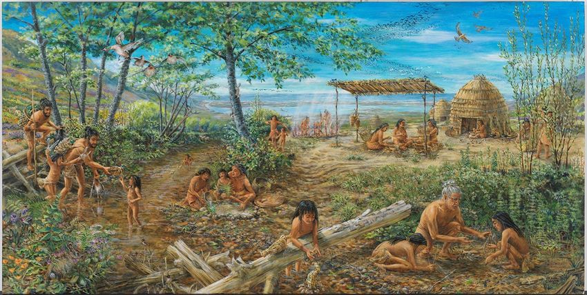
culture occurring prior to the formation of Midpen. The major historical periods include:
• Pre-Spanish/European Contact Period (Up to 1768): The first documented
exploration of the area by Europeans is in 1769 by Gaspar De Portola, which is
assumed to be the first contact between local indigenous persons and Europeans
(Portola 1770).
• Contact through The Mission Era (1769- ~1833): Father Junipero Sera was
documented as traveling with General Portola on his expedition to the region.
• Post Mission “Ranchero Era” (~1821-1844): Mexico gained independence from
Spain in 1821. Following this independence there was an effort to remove control
of the Missions from the Franciscans and distribute land to local indigenous
families who lived on those lands. “Although each [indigenous] family was to
receive a small allotment from the former mission lands, the few who tried to make
Wildland Fire Resiliency Program ● March 2020
7-4You can also read