THE STATE OF BERMUDA'S WATERS: A Snapshot of Bermuda's Exclusive Economic Zone (EEZ) From the Coastline to 200 Nautical Miles (nm) - Bernews
←
→
Page content transcription
If your browser does not render page correctly, please read the page content below

THE STATE OF
BERMUDA’S WATERS:
A Snapshot of Bermuda’s Exclusive
Economic Zone (EEZ) From the
Coastline to 200 Nautical Miles (nm)

             February 01, 2022
CONTENTS
List of Figures and Tables                                                     iii
Acknowledgements                                                               iv
Introduction				                                                                1
                                                                                2
                                                                                2
                                                                                3
                                                                                4
                                                                                6
                                                                                6

The state of the EEZ’s marine environments, species, and underwater cultural
resources                                                                       8
                                                                                9
                                                                               11
                                                                               11
                                                                               12
                                                                               12
                                                                               12
                                                                               13
                                                                               13
Current uses of the marine environment in the EEZ                              15
                                                                               16
                                                                               18
                                                                               20
                                                                               21
                                                                               22
                                                                               22
Threats to marine natural resources and cultural heritage in the EEZ           23
                                                                               24
                                                                               27
                                                                               27
                                                                               28
                                                                               32
                                                                               32

                        i    |   The State of Bermuda’s Waters, 2022
The importance of marine management and spatial planning              33
                                                                      34
                                                                      35
                                                                      35
Ministry’s decision for operationalizing marine spatial planning      38
In conclusion: Bermuda’s approach to marine spatial planning          40
Summary                                                               42
List of Acronyms                                                      44
Appendices                                                            45

                       ii   |   The State of Bermuda’s Waters, 2022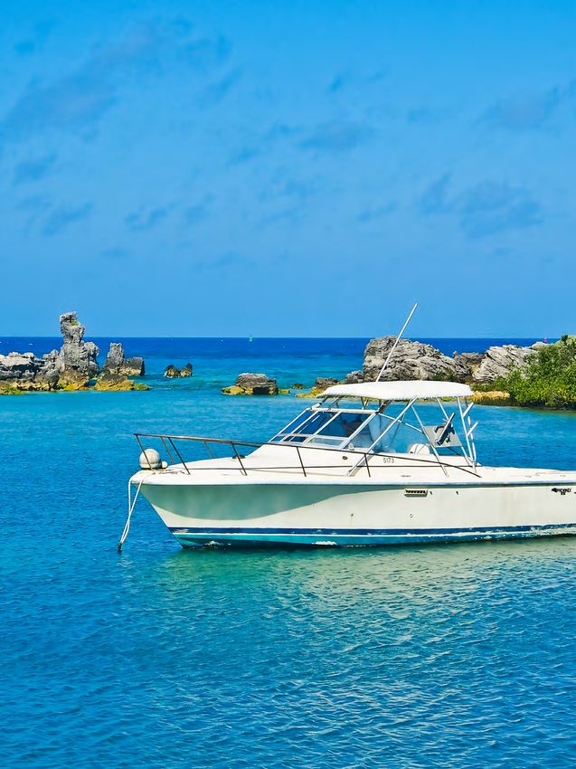
LIST OF FIGURES AND TABLES
Figure 1:    Map of Bermuda’s Exclusive Economic Zone (EEZ)                                                    2
Figure 2:    BREAM survey sites in 2016. The 20 m fore reef sites were not sampled                            10
Figure 3:    Percent loss of seagrass at long-term study sites in the BMMAP program                           10
Figure 4:    Mangrove retreat in Hungry Bay                                                                   11
Figure 5:    Seamounts in the Bermuda EEZ                                                                     12
Figure 6:    Open Bermuda Wrecks                                                                              14
Figure 7:    Closed Bermuda Wrecks                                                                            14
Figure 8:    Heat map based on the records of these 164 wrecks in the Register of Wrecks
             that have not been classified                                                                    14
Figure 9:    Commercial catch of different types of fish in Bermuda’s EEZ from 1975 through 2020              17
Figure 10:   Total visitor arrivals in Bermuda 1980-2020                                                      18
Figure 11:   Average estimated tourist spending per person in Bermuda                                         18
Figure 12:   Estimated revenue spending from air and cruise visitiors in Bermuda                              18
Figure 13:   Changes in temperature, salinity and surface dissolved oxygen at the BATS site (1988–present)
             with earlier data (1983–1988) from Hydrostation ‘S’                                              24
Figure 14:   Map of Bermuda under a projected sea level rise of 0.59 m (top) and 2 m (bottom), respectively   25
Figure 15:   Wastewater Generated in Bermuda: Outfall and Groundwater Sources to Seawater                     29
Figure 16:   Sewage – No Discharge Zones: Water Resources (Prevention of Pollution by Sewage from Boats)
             Regulations 2018 Instruction Card for Boat Users                                                 29
Figure 17:   Environmental sensitivity map of Bermuda, used to help prioritize oil spill responses by
             protecting mangrove areas, key channels, and water ways Instruction Card for Boat Users          30
Figure 18:   Airport Waste Management facility in Castle Harbour, a “seafill” for bulk wastes and
             incinerator concrete–stabilized ash waste		                                                      31
Figure 19:   Significant losses in the bay adjacent to the causeway at Blue Hole Hill Park due to
             2003’s Hurricane Fabian                                                                          31
Figure 20:   Operational zones of marine management in the EEZ                                                34

Table 1:     Coral Reef Survey and Studies                                                                    9
Table 2:     Bermuda Media Coverage Examples                                                                  20
Table 3:     Electricity consumption by type of consumer, 2015-2019                                           22

                                 iii    |    The State of Bermuda’s Waters, 2022
Aerial View of North Rock Reef
            Photo Credit // © J-P Rouja

Acknowledgments
This report was produced by the Government of Bermuda and looks at the physical status, economic context, and
social influences on Bermuda’s Exclusive Economic Zone (EEZ). Many contributors added their knowledge, expertise,
and perspectives to its creation.
This is a public document and its contents will be used to inform Bermuda’s decision makers on appropriate
management decisions for Bermuda’s EEZ.

Contributors
Substantial drafting and editorial contributions were made by Alexander Abbott, Dr. Nick Bates, Sarah Brooks, Chris
Bulley, Jennie Dean, Vanessa Dick, Lauren Gode, Ali Hochberg, Dr. Sarah Manuel, Julie Marshall, Aran McKittrick,
Bruce Myers, Captain Jeffrey Patterson, Victoria Pereira, Amos Peters, Dr. Andrew Pettit, Dr. Joanna Pitt, Canon Purdy,
Philippe Rouja, David Simmons, Scott Simmons, Dr. Geoff Smith, Dr. Struan Robbie Smith, and Dr. Tammy Warren.
Katherine Gustafson, freelance writer and editor, collated and edited the report.
The authors express their gratitude to the Government of Bermuda, and to the many government officials and
personnel who provided their time, insights, and expertise to the authors by way of interviews and review of drafts.
Funding for this report was generously provided by the Waitt Institute. The contents of this report, including any errors
or omissions, are solely the responsibility of the authors. The authors invite corrections and additions. This document
is an educational resource, and nothing contained herein is intended to serve as legal advice.

About Bermuda Ocean Prosperity Program
The Bermuda Ocean Prosperity Programme (BOPP) is an inclusive initiative to support sustainable growth of ocean
economies while maintaining the health of the ocean from now into the future. Led by the Government of Bermuda,
in collaboration with the Bermuda Institute of Ocean Sciences (BIOS) and the Waitt Institute, BOPP aims to foster the
sustainable, profitable, and enjoyable use of ocean resources for present and future generations.

                    iv   |   Acknowledgments          |   The State of Bermuda’s Waters, 2022
INTRODUCTION
This report looks at the physical status, economic context, and social influences on Bermuda’s Exclusive Economic Zone
(EEZ). This report does not provide a comprehensive breakdown of all aspects of the EEZ, but instead establishes a
baseline for further research and development into how to sustainably manage Bermuda’s marine space and resources.
It builds upon the Government of Bermuda’s 2005 State of the Environment report.
Specifically, the report outlines the status, uses, threats, and governance of the EEZ’s marine environment and
underwater cultural resources. This information can help identify priorities for the island’s future development and use
of environmental resources and practices.
In 2010, the Government of Bermuda articulated a vision for Bermuda’s marine environment in the report A Strategy
for the Sustainable Use of Bermuda’s Living Resources. It included a commitment to integrated planning for Bermuda’s
marine waters. This new report aims to provide context for current and future comprehensive marine planning
processes, a topic discussed further in the report’s final section. Marine spatial planning is a public participatory
process that uses the best available information about the natural environment and human activities to direct how to
plan for future use and conservation of ocean space.
How this report is organized: The document is arranged in sections that follow the same sequence as the topics
in this introduction. As such, this introduction serves as a summary, and the sections that follow will provide more
context and detail on the topics summarized here.
The report was completed through the combined effort of several Bermudian industry experts along with support from
the Bermuda Ocean Prosperity Programme (BOPP).

                                                                                 Aerial View of Pink Beach

                       1    |   Introduction      |   The State of Bermuda’s Waters, 2022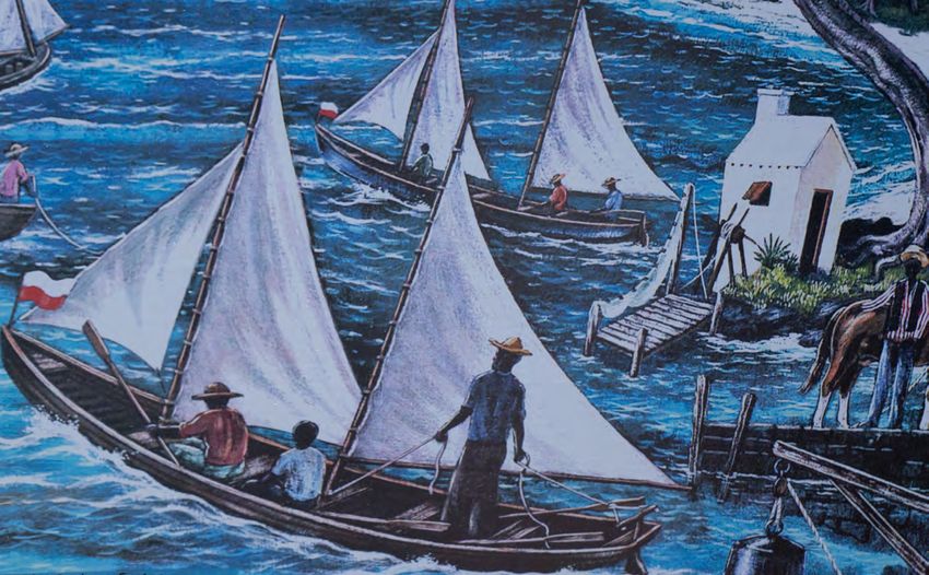
What Is Bermuda’s EEZ?                                        resources, primarily shipwrecks, are world-renowned
                                                              and attract tourists that are a mainstay of Bermuda’s
Established in 1996, Bermuda’s Exclusive Economic Zone        economy. Yet, despite their importance, most of these
(EEZ) stretches 200 nautical miles (nm) from its coast.       resources are facing threats of various kinds, including
Bermuda has special rights over its EEZ, including the        sea level rise, coastal development, climate change, and
rights to:                                                    overfishing. The following is an overview of the status of
                                                              Bermuda’s main ecosystems and cultural treasures.
   1. explore, exploit, conserve, and manage natural
      resources of the water, seabed, and subsoil;            Coral reefs: Bermuda’s coral reefs provide critically
   2. explore and exploit the zone for energy                 important ecosystem services, including acting as a
      production; and                                         natural storm wave buffer that protects Bermuda’s
   3. exercise jurisdiction regarding installations,          shorelines, beaches, and maritime infrastructure. Reefs
      marine scientific research, and the protection of       support diverse fisheries, as well as SCUBA diving and
      the marine environment.                                 snorkeling businesses that use the historic wrecks.
                                                              Bermuda’s coral reefs are in good shape, though they
Although the island is only 54 square kilometers (km2),       face a number of challenges, particularly overfishing,
Bermuda’s EEZ is a total of 464,389 km2, just over the size   climate change, and sea level rise.
of California. The EEZ encompasses the Bermuda Rise, a
vast raised portion of the Atlantic seafloor that is home     Seagrass: Seagrass beds are critical habitats in
to seven seamounts, including the Bermuda Seamount,           Bermuda’s extensive North Lagoon and protected
the shallow top of which is known as the Bermuda              inshore waters, providing essential ecosystem services.
Platform. The Bermuda islands are the emergent portion        Numerous animals move between seagrass beds and
of the Bermuda Seamount, the only portion of the              coral reefs, including many of the fish that serve as food
seven seamounts that rise above sea level. The islands’       for the islands’ human inhabitants. Evidence suggests
coastal environments, coral reefs, and surrounding ocean      that many seagrass beds throughout Bermuda have
are biologically rich, contain priceless marine cultural      collapsed in the past 20 years. Restoration and protection
heritage, provide food and economic opportunities             measures are currently being developed.
for Bermudians, and support diverse local and touristic       Mangroves: Bermuda’s mangroves develop in the
recreational activities.                                      intertidal zone of protected bays and provide similar
                                                              ecosystem services to seagrass beds, as well as serve as a
The State of the EEZ’s Marine                                 natural storm buffer that protect shorelines and maritime
                                                              infrastructure. Mangroves have been devastated by
Environments, Species, and                                    centuries of coastal development and simultaneously
Cultural Resources                                            impacted by hurricanes and sea level rise. The magnitude
                                                              of mangrove loss and their diverse ecosystem services
Bermuda’s natural habitats provide critically important       cannot be overstated.
ecosystem services, from serving as storm buffers, to
supporting fisheries, to hosting spawning grounds for         Inshore waters: Bermuda’s inshore waters include
diverse sea creatures. Bermuda’s underwater cultural          protected bays, sounds, smaller islands, and islets. These
                                                              sheltered areas support rich plankton communities,
FIGURE 1: Map of Bermuda’s Exclusive Economic Zone (EEZ)      which benefit filter-feeders (e.g., clams and oysters)
                                                              and baitfishes. Water quality is improving due to new
                                                              regulations. However, the decline of inshore seagrass
                                                              beds and coastal mangroves has eliminated important
                                                              habitats for many species.
                                                              Offshore banks: Challenger, Plantagenet (Argus), and
                                                              Bowditch are local offshore banks that are important
                                                              locations for several species of pelagic fishes, baitfishes,
                                                              top predators, and marine mammals. The deep slopes
                                                              of the banks and the Bermuda Platform support distinct
                                                              coral, sponge, and fish communities. Extensive fishing
                                                              occurs on the banks and along the perimeter of the
                                                              Bermuda Seamount.
                                                              Open ocean: Open ocean comprises the largest part
                                                              of Bermuda’s EEZ. The broader Sargasso Sea is essential
                                                              to sustain pelagic fishes since it serves as a spawning
                                                              ground and developmental habitat for juvenile fishes
                                                              and sea turtles. In addition, pelagic Sargassum mats
                                                              are critical habitat for many species. Local seabirds and
                                                              diverse migratory seabirds forage in surface waters. The
                                                              warming and acidification of the ocean and persistent

                        2    |   Introduction      |   The State of Bermuda’s Waters, 2022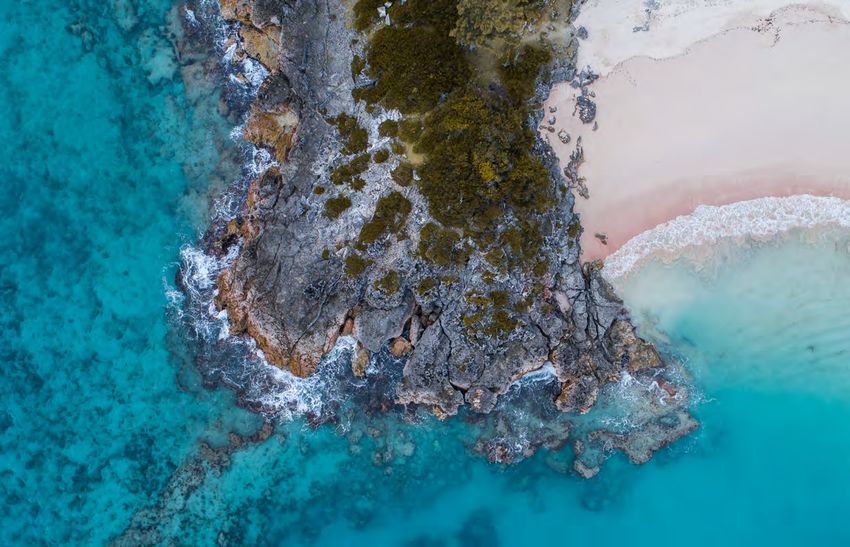
plastic pollution are threats to numerous fishes, turtles,   Fisheries: Fishing, whether for subsistence, at a
seabirds, and marine mammals.                                commercial scale, or for leisure, is the longest continuous
                                                             human activity affecting Bermuda’s marine environment,
Protected       and endemic species: Bermuda’s               and it has both economic and socio-cultural significance.
protected marine species are either those that provide
                                                             Although the commercial fishery employs fewer people
structural integrity for ecosystems and habitats (such as
                                                             (~300) and contributes far less to GDP (~0.25%) than
coral and mangroves) or those that have been damaged
                                                             other maritime sectors such as tourism, it makes an
by over-exploitation or habitat loss. Identification of
                                                             important contribution to food security, supplying ~33%
these species is important to reverse their decline by
                                                             of marine fish, and ~15% of all fish and shellfish consumed
promoting protection and restoration. However, there is
                                                             locally. Fishing in Bermuda has a correspondingly long
insufficient information to mount effective conservation
                                                             history of management and regulation, with a recurrent
work for most of these species.
                                                             theme of regulating the use of fish pots/traps until they
Underwater cultural heritage: Shipwrecks and                 were banned in 1990. Since then, approximately half of
maritime history are Bermuda’s origin story. There are       commercial fisheries landings have been comprised of
currently 215 historic shipwrecks in the official Register   pelagic species such as tuna and wahoo, while reef fishes
of Wrecks. Of these, 38 have been classified as Open         such as snapper and groupers make up the remainder.
and 13 have been classified as Closed. Wrecks listed as      The central fisheries legislation remains the Fisheries Act
Open under the Historic Wrecks Act (HWA) comprise            1972, which makes provisions for an advisory Marine
the major portion of Bermuda’s most extensive no-            Resource Board (MRB) and a Commercial Fisheries
fishing protected area network. The Register of Wrecks       Council (CFC).
also contains 164 wrecks that have not been classified       Recreational fishing is extremely popular in Bermuda.
as either Open or Closed, and information on these is        Sport fishing tournaments are a big economic contributor.
not shared with the public. Wrecks are well-regulated,       It is estimated that 30% of all households in Bermuda
but face a number of threats, from the effects of climate    have at least one member of the family who fishes
change to illegal treasure-hunting to destruction due to     recreationally. Recreational fishing is largely unregulated
storm events.                                                and is likely to have significant catch volume. There are

Current Uses of the                           Marine
                                                             no estimates of total recreational catch on an annual
                                                             basis. The difficulty of monitoring recreational fishing
Environment in the EEZ                                       combined with the lack of oversight of commercial
                                                             sales creates challenges for enforcement and stock
Bermuda’s EEZ is put to a wide array of uses, all of which   assessments.
are managed and regulated to varying extents and in a
variety of ways.
                                                                        Aerial View of the Montana
                                                                          and the Constellation
                                                                          Photo Credit // © Philippe Rouja

                       3    |   Introduction      |   The State of Bermuda’s Waters, 2022
Tourism: The tourism industry represents a significant on the continued maintenance and security of this
portion of the island’s economy and employment environment to maintain its economic stability. Currently,
opportunities. The industry accounted for approximately Bermuda’s Ministry of Home Affairs is looking to diversify
5.3% of Bermuda’s GDP in 2018 and is responsible for the island’s energy production through the establishment
approximately 3,800 jobs (10.2% of employment). The of a Regulatory Sandbox, a legislative framework aimed
2019-2025 Bermuda National Tourism Plan, authored by towards companies interested in testing innovative and
the Bermuda Tourism Authority, contains robust analysis large-scale renewable technologies. The first company
and makes several strong recommendations, including to utilize the Regulatory Sandbox is Seabased, who will,
identifying the “must-win” U.S. segments: experience with the help of the Government and the people of
enthusiasts and adventure seekers. While COVID-19 Bermuda, implement a wave energy pilot program in an
decimated the tourist economy throughout 2020, there approved area of Bermuda’s waters.
is a hopeful outlook for tourism industry recovery in the
near future, with a focus on sports and social group
Transportation in the marine environment:
Managed by the Department of Marine and Ports
travel in the short-term, and corporate business travel
Services, the SeaExpress Ferry Service is part of
resuming.
Bermuda’s public transportation system and, as such, it
Cruise travel has been a particularly prominent segment plays an important role in the community, both for locals
of Bermuda’s tourism sector. Prior to COVID-19, cruise and visitors alike.
travel outpaced overall tourism, with passenger counts
rising by 6.6% (vs. 4.5% for all travel spending) in 2018. Shipping: The Mandate of the Bermuda Shipping and
The cruise industry is among the hardest hit of the travel Maritime Authority (BSMA) is to administer the statutory
sectors due to COVID-19. Many travelers are unsure if functions related to the international registration, survey,
cruise travel can be conducted safely and, consequently, certification, and enforcement of Bermuda Laws on ships
the cruise industry is unlikely to see significant growth for flying the Bermuda flag. The BSMA also has oversight
the next few years. of Bermuda’s Marine Pollution Response readiness to
ensure an effective response following an accident or
Cultural exploration and SCUBA diving: pollution incident on a ship in the territorial waters or the
Shipwrecks are one of Bermuda’s most distinctive Exclusive Economic Zone of Bermuda.
identifying maritime features and one of the island’s
most popular paid visitor attractions. This underwater
cultural heritage also has inherent scientific, historical, Threats to Marine Natural
and archaeological significance. Recreational diving is Resources and Cultural Heritage
in the EEZ
an important economic activity, and shipwrecks are the
cornerstone of the recreational dive industry in Bermuda.
Recreational diving enhances heritage awareness but can Bermuda’s EEZ faces a number of ongoing and growing
also threaten preservation if not appropriately managed. threats, some specific to certain environments and others
Development of the coastline and inshore affecting an array of ecosystems. The following outlines
the main threats to the health of Bermuda’s EEZ.
waters: Since 2016, the Department of Planning has
received an average of 1,000 planning applications Climate change and sea level rise: Bermuda’s
and issued 1,000 building permits each year for various waters have become warmer, saltier, more acidic, and
development proposals. Of these 1,000 applications, less oxygenated due to impacts from the Climate Crisis.
132 involved coastal development, such as docks, In the last ten years, the oceans around Bermuda warmed
floating docks, boat maintenance and storage, boat by nearly 1C. Water temperature that peaks above 29C
houses, seawalls, revetments, and marinas. Other coastal in the summer can result in several consequences for
development proposals included a bridge, subsea coral reefs, including coral bleaching and alteration of the
water and wastewater piping, and works related to corals’ microbial community. Bermuda has also witnessed
America’s Cup. While the current planning framework several fish “die-offs” in the past 20 years, including a
of conservation zones and coastal development policies mass die-off in the summer of 2017 during a spate of
appear to be effective in terms of limiting coastal higher-than-normal surface seawater temperatures.
development to that which is necessary and appropriate, Along with direct impact from warmer waters, sea level
there are practices that could be improved. In addition, rise threatens Bermuda in several ways. For example,
there is little guidance regarding marine development in it inhibits the ability of mangroves to create peat,
places outside coastal areas. disrupting their natural ability to trap leaves and other
organic material among their roots. Ocean acidification
Energy provision and telecommunications in
and deoxygenation also compromises the ability of coral
the marine environment: The space, satellite, to grow in pace with predicted sea level rise. And longer
telecommunications, and energy industries in Bermuda periods of warmer waters increase the risk to Bermuda
are thriving through the continued development of robust from hurricanes. These combined impacts alter the
policy and legislation by the Department of Energy. As delicate balance of biodiversity and ecosystem function,
an island nation, most major industries, including the leaving Bermuda more vulnerable to storm surge, fish
telecommunications and energy industries, rely directly stock collapse, and other consequences of a disrupted
on infrastructure located in the marine environment, such marine system.
as fibre-optic cables. As such, Bermuda is dependent
4 | Introduction | The State of Bermuda’s Waters, 2022
Shoreline development: Development of Bermuda’s                 landfill run-off; contaminants leached from groundwater;
inshore waters with docks, marinas, dredging, land              antifoulant paints; and in sewage from local boats.
reclamation, and dense swinging moorings is decimating          Pollution in Bermuda’s near-shore waters is generally
mangroves and seagrass beds. Mooring systems with               well-understood and has been partly mitigated in many
chains that drag across the seabed are particularly             instances. Recent decades saw a significant increase in
destructive to seagrass. Mangroves often suffer from the        the amount of plastic marine debris in the Sargasso Sea,
construction of commercial properties and infrastructure.       and disposal of metal waste and other inert materials into
Additionally, infrastructure projects in coastal areas such     a marine landfill remains a less-environmentally desirable
as cruise ship dock creation, dredging of channels and          disposal option.
bridge construction, sand extraction, pipeline and cable
laying, and land reclamation have had major impacts on
                                                                Storm events: The impact and reach of extreme
the areas that contain known and potential underwater           storm events have also increased with the rising sea
cultural heritage sites.                                        levels, allowing more water to reach farther onto the reef
                                                                platform and higher up the coasts, causing significant
Overfishing: The consequences of historical overfishing         erosion and destruction of coastal properties, as well
of coral reef fish has been exacerbated by a limited            as loss of local vessels. Several historic shipwrecks in
understanding of the balance between conservation and           Bermuda suffered damage because of the increased
extraction in some cases. Insufficient data on Bermuda’s        frequency and intensity of storm events, winter gales,
fish populations and on the number of Recreational              and hurricanes. Furthermore, a number of moored boats
fishers and their harvest greatly limits an understanding       break loose and run aground annually during storms and
of how much fishing occurs on Bermuda’s reefs and               are abandoned by their owners to become ecological
places the burden of regulation on Commercial fishers.          and safety hazards.
Overgrazing: In recent years, green turtle grazing put          Tourism and treasure-hunting: The tourism industry
unprecedented pressure on seagrass habitat, resulting in        has the potential to cause negative impacts on Bermuda’s
the collapse of local beds and creating a conservation          natural environment and underwater cultural heritage.
dilemma where one protected species, the green turtle,          Cruise ships have issues with waste management despite
is causing the decline of other protected species, the          waste discharge currently being regulated by domestic
seagrasses. In a healthy marine ecosystem, seagrasses           and international pollution prevention laws. At the same
and green turtles co-exist but, in this case, the overfishing   time, even the cleanest cruise ships emit over three
of sharks, a key turtle predator, may have led to an            times as much carbon dioxide per passenger mile as
imbalance in the ecosystem on the Bermuda Platform.             jets. Once cruise ships arrive on the coasts, they need to
                                                                be harbored, and the environmental damage caused by
Invasive species: Various invasive species are
                                                                dredging and anchoring to accommodate massive ships
threatening Bermuda’s ecosystems. Lionfish are pervasive        can be significant. In addition, there are concerns about
across reefs and have been seen congregating on reefs           possible fuel leaks.
up to 60 m deep, though there is evidence they are
currently kept in check by intensive collection by licensed     In regards to tourism at cultural heritage sites, key
cullers. Additionally, cow nose rays recently appeared in       dive sites can become congested with dive boats, and
Bermuda and are growing in number.                              poor anchoring practices can damage shipwrecks.
                                                                Additionally, while it is illegal to remove any historic
Wastewater, pollution, and durable waste:                       artifacts from a historic shipwreck or marine heritage
Pollution in Bermuda’s waters can originate from both           site in Bermuda without authorization, the removal and
overseas and local sources of pollutants, including cruise      damage of historic shipwreck and marine heritage sites
ships, merchant ships, and oil tankers; oil pipelines;          remains a problem.
municipal sewage discharge; stormwater, road, and

           Invasive Lionfish
       Photo Credit // © Shayna Brody

                        5     |   Introduction      |    The State of Bermuda’s Waters, 2022
Governance of Marine Resources existing laws do provide adequate authority for effective
implementation, some areas present opportunities for
and Underwater Cultural Heritage improvement. And because regulatory management is
in the EEZ fragmented, marine enforcement is often focused on
specific sectoral activities, thus reducing their broader
Bermuda is a United Kingdom Overseas Territory with effectiveness.
independent authority to develop laws and policies to
Marine spatial planning (MSP) is an important tool to
manage its own resources, subject to limited United
sustainably optimize Bermuda’s marine environment.
Kingdom oversight and reciprocal responsibilities. In
Globally, nations are developing MSPs as recognition
practice, Bermuda is self-governing with respect to all
spreads that ocean spaces need a planning framework
services, and exercises authority within its Territorial Sea
similar to that which has existed for land resources for
limit of 12 nautical miles, including the resources within
decades.
the water column. One of the few exceptions to this
authority is Bermuda’s seabed, which resides under the While Bermuda’s existing planning structure has many of
sovereignty of the Crown. However, Bermuda’s authority the elements needed to develop a comprehensive MSP,
over fisheries resources extends to the entire Exclusive there is a need for a new overarching policy and legal
Economic Zone. framework that ties these pieces together and fills gaps,
as the most effective and efficient way forward.
The agencies responsible for the protection of Bermuda’s
marine environment and natural resources tend to work In 2010, the Government of Bermuda articulated a
independently, focused on each of their specific areas vision for Bermuda’s marine environment in the report
of interest, cooperating when a common interest is A Strategy for the Sustainable Use of Bermuda’s Living
identified. Other government and non-governmental Resources. This included a commitment to integrated
departments, quangos, and organizations are consulted planning for Bermuda’s marine waters that involved all
and/or advised as necessary. of Government and stakeholders in its development and
implementation. In 2019, to achieve this commitment,
A full list of the central regulatory framework or legislation
the Government of Bermuda partnered with the Waitt
governing the variety of activities that takes place in
Institute and the Bermuda Institute of Ocean Sciences
Bermuda’s marine environment is provided in Appendix
(BIOS), forming the Bermuda Ocean Prosperity
A.
Programme (BOPP). The original commitment expanded
The Importance of Marine Spatial
to include a Blue Prosperity Plan that includes a Marine
Spatial Plan to preserve 90,000 square kilometers (50,000
Planning square miles) of Bermuda’s waters in fully protected, no-
take fisheries replenishment zones, and a Blue Economy
Currently, Bermuda has no comprehensive planning Strategy to sustainably develop, manage, and improve
system operating below the mean high-water mark. Only ocean industries. BOPP officially launched in June, 2019.
developments that are connected to land, such as docks
and marinas, are regulated. Thus, there is no system for The goal of BOPP is to foster the sustainable, profitable,
producing an integrated forward-looking plan for marine and enjoyable use of ocean resources for present and
spaces, and no marine planning strategy to guide such future generations. The program goals of BOPP include:
plans. • Thriving Blue Economy: Assist Bermuda with
The current governance system of local marine the diversification of its national revenue and
management can be described as a patchwork of dozens strengthen the sustainable use of ocean resources
of ocean-relevant laws in which authorities—often for economic growth, improved livelihoods and
independently—make decisions about how to utilize jobs, and continued ecosystem health.
ocean resources. Notably, Bermuda has not enacted • Marine Spatial Planning: Develop and legally
laws to comprehensively govern certain new and adopt an enforceable, comprehensive, EEZ-
emerging activities, including offshore mining, energy wide Marine Spatial Plan designed to sustainably
development (e.g., wind, tidal, wave, current, thermal, manage resources and protect 20% of Bermuda’s
and petroleum facilities), and aquaculture. waters as no-take fisheries replenishment zone.
Various types of marine protected areas (MPAs) have • Sustainable Fisheries: Improve fisheries
been established in the shallow waters of the Bermuda management, where appropriate, and partner
Platform to protect important coral reef areas, prohibit with stakeholders to support Bermuda’s fisheries
fishing at seasonal fish spawning grounds, restrict certain goals through consultations, scientific research,
types of fishing gear, and ease conflict between divers and economic analyses.
and fishermen at particular sites. However, Bermuda Marine spatial planning relies heavily on scientific data
lacks a coherent strategy for the design and objectives and knowledge. This works well for this island nation
of MPAs, or a MPA network, that would inform an overall because Bermuda has been home to a prolific marine
marine use and marine resource conservation plan. science community for many decades, and aspects of
With increases in marine activity and development, there Bermuda’s marine environment have been well-studied.
are corresponding increasing demands on natural marine A marine spatial planning process will help generate a
resources and potential for user conflict. While many central system where this scientific information can be
6 | Introduction | The State of Bermuda’s Waters, 2022stored, shared, and cross-referenced, thereby informing The MSP will provide policymakers a framework for
the basis for marine planning. balancing development with sustainability while
delivering social and economic outcomes in a planned
For this to be successful, more frequent and effective
and predictable way. It will outline guidance for managing
interdepartmental collaboration and consultation is
ocean uses across the entire EEZ and direct marine
needed. Such collaboration and consultation can be
development proposals in a planning process that draws
achieved informally between government technical
on local expertise and utilises an environmental impact
officers or formally as a result of legal requirements.
assessment procedure. Current legislation does not
Increasing the frequency and quality of collaboration
provide for the comprehensive, integrated management
within the government on marine issues may be among
of Bermuda’s marine environment and many Ministries
the most promising first steps Bermuda can take on
and Departments have jurisdiction over some aspect
the path to an MSP. This could include the creation of
of Bermuda’s waters. Therefore, in order to ensure
a Marine Spatial Planning Task Force, Committee, or
environmental health and continued economic growth,
Working Group.
the management of Bermuda’s waters needs to be
Enacting new legislation will help to recognize and conducted in a coordinated manner, hence an MSP. New
incorporate existing processes such as: legislation will complement existing marine legislation,
and provide an overarching framework for the principles,
1. Continued oversight of marine resources,
scope, governance, implementation, and enforcement of
fisheries, and marine heritage by the Department
the MSP. It will also draw from existing terrestrial planning
of Environment and Natural Resources (DENR);
mechanisms and expertise to apply the environmental
2. Continued oversight of the development impact assessment process to development proposals in
process by the Department of Planning; marine waters.
3. Continued oversight by the Department
of Marine and Ports for operations and
management of channels and navigation routes;
and
4. Continued oversight of telecommunications and
energy sectors by the Regulatory Authority. Fisherman Mural by Graham Foster
Photo Credit // © Shayna Brody
7 | Introduction | The State of Bermuda’s Waters, 20221 THE STATE OF THE
EEZ’S MARINE
ENVIRONMENTS,
SPECIES, AND
UNDERWATER CULTURAL
RESOURCES
North Rock Reef // © Shayna BrodySections 1-5 provide more detail on the themes outlined in the introduction. Sections 1 and 2 discuss the state of critical
habitats, species, and historical wreck sites within Bermuda’s marine environment, as well as how they are utilized by
ocean-reliant sectors in Bermuda. Sections 3 and 4 expand on different human and environmental factors that threaten
the natural and cultural resources within the EEZ, and the importance of comprehensive marine management and
spatial planning. Section 5 provides an explanation on the Government of Bermuda’s decision to implement a marine
spatial plan that will address and diminish current risks to Bermuda’s valuable marine environment. Lastly, Section 6
concludes the report and Section 7 provides an inclusive summary of all preceding sections.
1.1 Coral Reefs
Bermuda’s coral reefs provide critical ecosystem services to Bermuda, such as storm wave buffering to protect coastal
environments, and serving as home to diverse commercial species, such as rockfish, snappers, hinds, and lobsters. The
coral reefs also harbor renowned underwater cultural heritage in the form of historic wrecks, which support a variety of
SCUBA diving and snorkeling businesses.
Despite having overall healthy reef ecosystems with high levels of coral cover, the reefs in Bermuda are experiencing
the impacts of historical overfishing, invasive species (particularly lionfish, Pterois spp.), and global climate change.
Table 1 outlines many past studies and surveys performed at various reefs surrounding Bermuda.
TABLE 1: Coral Reef Survey and Studies*
Authors/Contributors Timeframe Location
Bermuda Reef Ecosystem and Analysis 39 sites within the North Lagoon, on the rim reef and
2015-2016
(BREAM) program (Murdoch, 2018) shallow fore-reef (fig. 2)
BREAM program (Murdoch and 92 sites from the shallow reef (5 m) to the deep fore-reef
2009-2011
Murdoch, 2016) (30 m)
BREAM program (Murdoch and
2009 26 buoyed Marine Protected Areas on the rim reef
Murdoch, 2016)
BREAM program (Murdoch and
2004-2006 56 inshore lagoonal patch reefs
Murdoch, 2016)
Marine Environmental Program Multiple locations across Bermuda constituting different
2004-2011
Synthesis Report (Hochberg, 2014) depths, reef zones, and habitats
BBSR Marine Environmental Program Multiple locations across Bermuda constituting different
2004-2005
(MEP) Annual Report depths, reef zones, and habitats
Marine Environmental Program (MEP) Time series studies at 14 sites, from inshore patch reefs to
2006-2007
Annual Report (Jones et al.) offshore northern and south shore rim reefs
DENR Benthic Habitat Mapping, 533 sites across the Bermuda Plltform from the coast
Monitoring and Assessment 2006-2014 to a depth of 10 m outside the rim reef, encompassing
Programme (Manuel et al. 2013)1 different depths, reef zones and habitats
Marine Environmental Program Multiple locations across Bermuda constituting different
2013-2019
Reports (Hochberg et al.) depths, reef zones, and habitats
Benthic Community Mapping 1200 sites across the Bermuda platform, encompassing
Program: Compiled Reefscape Survey 2012-2014 all reef zones and most habitats for depths in the range
Data (Hochberg et al., 2015) 0-30 m
Benthic Community Mapping
Complete coverage of the Bermuda Platform (except
Program: Benthic Cover GIS Layers 2017
harbors) for depths in the range 0-30 m
(Hochberg et al.)
1 Manuel, S.A., Coates, K. A., Kenworthy, W.J. and Fourqurean, W.J., Tropical species at the northern limit of their range:
Composition and distributio:=n in Bermuda’s benthic habitats in relation to depth and light availability, Marine Environmental
Research (2013), http://dx.doi.org/10.1016/j.marenvres.2013.05.003
9 | 1: The State of the EEZ | The State of Bermuda’s Waters, 2022FIGURE 2: BREAM survey sites in 2016. The 20 m fore reef sites were not sampled (Murdoch, 2018)
FIGURE 3: Percent loss of seagrass at long-term study sites in the BMMAP program (Fourqurean et al., 2019)
10 | 1: The State of the EEZ | The State of Bermuda’s Waters, 20221.2 Seagrass pressure on the seagrass habitat (Fourqurean et al.; 2010;
van Tussenbroek et al., 2014; Fourqurean et al., 2019).
Seagrass beds around Bermuda are often comprised of
one species, but it is not uncommon to have a mix of two 1.3 Mangroves
or more species. In recent studies, four open water species
of seagrass were reported on the Bermuda Platform: Bermuda’s mangroves, comprised of Black Mangroves
Syringodium filiforme, Thalassia testudinum, Halophila (Avicennia germinans) and Red Mangroves (Rhizophora
decipiens, and Halodule sp. All four are protected under mangle), are situated in the intertidal zone of protected
the Protected Species Act 2003 (Protected Species bays, where they provide ecosystem services that include
Order 2012). protection from storm surges, nursery grounds for many
species of juvenile fishes, and feeding grounds and
Seagrass beds provide key ecosystem services, including habitat for a variety of organisms (e.g., fishes, crabs,
habitat for endangered and endemic species; feeding birds, and snails). Another important ecosystem service
grounds for many reef fishes and nursery habitat for provided by mangroves is serving as a carbon sink, similar
juvenile reef fishes and lobsters; stabilization of soft to seagrass. Carbon sinks, or carbon sequestration, is the
sediments; regulation of water quality; protection for process by which large amounts of atmospheric carbon
adjacent reef ecosystems from the impacts of ocean dioxide is trapped and stored in plans and the ground.
acidification; and serving as important carbon sinks. Both are protected under the Protected Species Act
2003 (Protected Species Order 2012).
The last two decades have seen the collapse of seagrass
beds across the Bermuda platform, an alarming Unfortunately, mangroves have been devastated by
development considering their importance to the centuries of coastal development and compromised
ecosystem (Murdoch et al., 2007; Fourqurean et al., by steady sea level rise. The pace of sea level rise has
2019). Over a period of ten years from 2007-2017, a outstripped the ability of mangroves to recover from
study of 17 seagrass beds in offshore and nearshore sites storm losses, because mangrove seedlings cannot
found that all displayed evidence of decline (fig 3). Three establish in the deeper water. The magnitude of
beds disappeared entirely, while others were greatly mangrove loss is enormous, as illustrated in Hungry Bay
reduced in extent and functionality. in fig. 4. Sea level rise resulted in multiple die backs of the
seaward edge of the mangrove forest in Hungry Bay over
In contrast to what is happening in many places around
the last few hundred years. Currently, the seaward margin
the world, Bermuda’s seagrass beds are not disappearing
is below sea level due to the combination of sea level rise
due to declining water quality. Instead, the main drivers of
and beach erosion, making it difficult for new growth to
these changes are destruction during the development of
occur. Yet little action has been taken to try to restore this
Bermuda’s inshore waters and most recently overgrazing
habitat or establish new mangroves communities.
by green sea turtles, which is putting unprecedented
FIGURE 4: Mangrove retreat in Hungry Bay
11 | 1: The State of the EEZ | The State of Bermuda’s Waters, 20221.4 Inshore Waters
Bermuda’s inshore waters include sheltered bays and
sounds that support higher densities of plankton
than offshore waters. This, in turn, supports baitfishes
such as anchovies, sardines (‘chovies), and herrings
(pilchards), which provide food for jacks, halfbeaks, and
tarpon. Inshore fish communities are diverse in places
but are dominated by grunts, with some parrotfishes,
damselfishes, butterflyfishes, mojarras, juvenile snappers,
and barracudas (Smith, in prep.; Zuill and Smith, 2019;
Tavakolian, 2018; Blee, 2017). Juvenile spotted eagle
rays are commonly seen in the Foot of the Lane (a
bay near Hamilton, close to the Bermuda Underwater
Exploration Institute) among the mangroves.
Water quality in Bermuda’s inshore bays and sounds has
improved since the 1970s and is generally good. New
boat sewage pump-out regulations should sustain this
trend. However, inshore waters face other challenges,
including the decline of seagrass beds and coastal
mangroves, and the over-exploitation of various shellfish
fisheries (e.g., calico clam, scallop, and conch) resulting FIGURE 5: Seamounts in the Bermuda EEZ
in their placement on the Protected Species list.
1.6 Open Ocean
1.5 Offshore Banks and Bermuda lies within the Sargasso Sea, and open ocean
Seamounts habitats make up 95% of Bermuda’s EEZ. The Sargasso
Sea plays an important role in the life stages of many
Challenger and Plantagenet (Argus) Banks are local important fisheries species, such as mahi mahi, bluefin
offshore banks that are relatively shallow (50-60 m) and tuna, and blue marlin. Pelagic Sargassum mats host
are important locations for several species, including many species of fishes, including the endemic Sargassum
pelagic fishes (e.g., marlins, wahoo, jacks); bait species fish, and a very diverse community of crabs, shrimps,
(e.g., robins, small jacks, rainbow runners); top predators barnacles, gastropods, polychaete worms, and hydroids
(e.g., tiger sharks and Galapagos sharks, tunas, and blue (Laffoley et al., 2012). In addition, the floating mats of
marlin); and marine mammals, including the humpback golden-brown algae serve as critical habitat for seabirds,
whale, bottlenose dolphin, and Cuvier’s beaked whale. spawning habitat for eels and flying fishes, and nursery
The Bowditch Seamount is deeper (~1000 m) but only grounds for all species of sea turtles.
~10 nm to the northeast of Bermuda and occasionally
targeted by fishers. Local seabirds (cahow, longtail) and diverse migratory
seabirds (shearwaters, storm petrels) forage for squids
The deep slopes of the Bermuda Platform and the banks and fishes in these surface waters. A number of other
(50 m to 4500 m) support distinct coral, sponge, and fish notable species have been researched and observed
communities. The upper 300 m was intensively studied in Bermuda’s open ocean waters including whales,
by the NEKTON project in 2016 (Stephanoudis et al., dolphins, and a variety of pelagic fishes. The warming
2019a,b). The survey found a decline in fish biomass and and acidification of the ocean and persistent plastic
species richness with depth, the latter peaking at 30 m. pollution are threats to many fishes, seabirds, and marine
Below that depth, there was a decline in herbivorous mammals.
fishes believed to be associated with the lack of reef-
building corals. The study highlighted distinct vertical Decades of research performed by local and visiting
zonation patterns for several species of fish that live in the scientists and students working at the Bermuda Institute
shallow (Sargassum Swimming Crab
Photo Credit // © Shayna Brody
The Sargasso Sea Commission is working to secure clypeatus, the queen conch, Strombus gigas, now
cooperative agreements to protect the Sargasso Sea renamed Aliger gigas, lined and long snout seahorses,
in areas beyond national jurisdiction in recognition Hippocampus erectus and H. reidi, resident green and
of its biological significance, ecological importance, hawksbill turtles, Chelonia mydas and Eretmochelys
and fisheries resources. Threats to the Sargasso Sea imbricate, the common tern, Sterna hirundo, and the
include impacts of fishing, pollution, impact of shipping, Bermuda petrel, Pterodroma cahow.
and impacts to the seafloor and seabed. Ten Atlantic
Recent studies conducted as part of the NEKTON
nations and British Overseas Territories have signed the
project revealed several new deep water black coral
Hamilton Declaration to advocate for the protection of
species (Wagner and Schuler, 2017). The lack of data for
the Sargasso Sea.
rare species on the shallow patch reefs, the rim reef, the
fore reef, and deep mesophotic reefs makes an accurate
1.7 Protected and Endemic assessment of these coral reef populations challenging.
Species Bermuda has limited diversity of known marine endemic
species (Sterrer, 2003). Endemic species include the
Bermuda has a number of pieces of legislation that Verrill’s hermit crab (Murdoch and Murdoch, 2016),
protect threatened marine species and habitats, and some endemic marine fishes (such as the Bermuda
including the Fisheries Act 1972, Fisheries (Protected bream, yellowfin chromis, and the Bermuda anchovy).
Species) Order 1978, the Protected Species Act 2003,
the and the Protected Species Order 2012, respectively.
A few species are protected under more than one Act.
1.8 Underwater Cultural Heritage
Shipwrecks remain one of Bermuda’s most distinctive
Bermuda’s protected marine species fall into two broad
identifying features and a primary international emblem
categories: species that provide structural integrity
of the island. The management and protection of
for ecosystems and habitats, such as all corals and
Bermuda’s underwater cultural heritage is not only
mangroves, and species that have suffered losses as a
important because of its inherent scientific, historical,
result of over-exploitation (e.g., queen conchs, scallops,
and archaeological significance, providing a vital
Nassau grouper, cahow) or habitat loss (e.g., seahorses,
contribution to the understanding of Bermuda’s past, but
giant land crab, land hermit crab, common tern).
also because it provides direct educational, recreational,
The primary aim in listing protected species is to reverse and economic value. As a result, Bermuda’s maritime
the decline of their populations by preventing their heritage is both locally important and internationally
harvest and promoting habitat restoration. But there is relevant.
a general lack of up-to-date census information on the
Renewed public awareness, local stewardship, and
status of the majority of protected species. Recovery
international interest in Bermuda’s shipwrecks and marine
plans have been developed for the giant land crab,
environment have added significant value to the nation’s
Cardisoma guanhumi, the land hermit crab, Coenobita
13 | 1: The State of the EEZ | The State of Bermuda’s Waters, 2022economy. Taken alone, the value of Bermuda’s reefs is on the Bermuda platform. They are the backbone of the
estimated at over $36.5 million annually (Sarkis et al., island’s recreational diving and tourism industry, and the
2013). Other maritime assets, such as lighthouses, retain main ones featured in the intense television attention
additional commercial value that is added to Bermuda’s that Bermuda’s shipwrecks have received over the past
economic infrastructure. decade.
Private wrecks: There are 164 wrecks in the Register
1.8.1 Register of Wrecks of Wrecks that have not been classified (fig. 8), and
There are currently 215 historic shipwrecks in the information on these is not shared with the public.
official Register of Wrecks. These are divided into two Many of these historic shipwrecks have been reported
categories: publicly known wrecks and private wrecks. in confidence by private individuals and institutions or
are the subject of ongoing archaeological assessments.
Publicly known wrecks: Of the public wrecks listed Additionally, a subset of these wrecks pose a danger to
in the Register, 38 wrecks have been classified as Open recreational divers because they are in busy shipping
and 13 have been classified as Closed (figs. 6 and 7). channels, are beyond recreational diving depth limits,
Wrecks listed as Open make up the major portion of have dangerous physical attributes, or contain remains
Bermuda’s most extensive no-fishing protected area of dangerous cargo.
network. These are the only year-round “no take” zones
FIGURE 6: Open Bermuda Wrecks FIGURE 7: Closed Bermuda Wrecks
FIGURE 8: Heat map based on the records of these 164 wrecks in the Register of Wrecks that have not been classified
14 | 1: The State of the EEZ | The State of Bermuda’s Waters, 20222 CURRENT USES
OF THE MARINE
ENVIRONMENT IN THE
EEZ
St George’s Parish // © Yingna Cai2.1 Fisheries unregulated. It is illegal for recreational fishers to
sell their catch, but it is nearly impossible for fisheries
Fishing, whether for subsistence, at a commercial scale, wardens to monitor for violations due to the dispersed
or for leisure, is the longest continuous human activity nature of fishing and fish sales generally, and the lack
affecting Bermuda’s marine environment, and it has both of oversight over commercial sales specifically. Similarly,
economic and socio-cultural significance. Although the recreational fishers are not required to be licensed, so it
commercial fishery employs fewer people (~300) and is a challenge to estimate their numbers. However, it is
contributes far less to GDP (~0.25%) than other maritime estimated that 30% of all households in Bermuda have at
sectors such as tourism (Dept of Statistics, 2019), it makes least one member of the family who fishes recreationally.
an important contribution to food security, supplying This means that resident recreational fishers could total
~33% of marine fish, and ~15% of all fish and shellfish 16,000, far outnumbering the registered commercial
consumed locally (Skip, 2020). It has been estimated that fishers.
approximately 25% of the population fishes recreationally
Fishing in Bermuda has a correspondingly long history
at some level (Sarkis et al., 2010; Pitt and Trott, 2013),
of management and regulation (Smith-Vaniz et al.,
and those that do often refer to it as “a way of life” or
1999; Ministry of the Environment, 2000; Ministry of the
cite it as an activity that they enjoy with friends or family
Environment, 2005). Legislation aiming to manage fishing
(Pitt and Trott, 2013).
and its impact on the marine environment has existed in
The resources targeted by commercial fishing have some form since the early 1600s, but has generally been
changed over time. Intensive trap fishing, particularly more reactive than proactive. For a complete list of the
during the 1980s, led to declines in the abundance of regulations that govern the management of fishing in
some species, particularly the larger groupers (rockfish), Bermuda please refer to Appendix B.
and some of these populations still have not shown any
signs of recovery. In recent years, changes in technology 2.1.1 Species and Locations
have made offshore fishing more practical, with modern
vessels being able to more easily access deeper water. Bermuda’s living marine resources are categorized based
Currently, Bermuda imports over two thirds of its seafood on their broad biological characteristics, where they
and imported fish, especially wahoo, is cheaper than occur, or how they are caught. Demersal species include
local fish, which often undermines the value of catch various types of fishes, lobsters, and other invertebrates
from local fishers. This is particularly the case when the that are associated with the coral reefs and other seabed
same species that are caught locally are sourced from habitats of the Bermuda Platform and the outlying banks.
overseas. Pelagic species are found in deeper water and offshore,
and often migrate throughout the north Atlantic Ocean.
In addition to commercial fishing, there is a substantial
recreational fishery in Bermuda that, excluding Fishing occurs across the spectrum of environments in
recreational lobster and spearfishers, is largely Bermuda, from coastal waters to the deep ocean.
Spiny Lobster
Photo Credit // © Shayna Brody
16 | 2: Current Uses of the EEZ | The State of Bermuda’s Waters, 2022Inshore bays and baitfish resources: The recent Distant seamounts: There is not much information on
Bermuda Baitfish Project found that the three small the marine resources associated with the more distant
baitfish species known collectively as ‘fry’ are generally seamounts in Bermuda’s EEZ, but these areas are known
abundant and widely distributed. Redear herring to aggregate pelagic fishes, as well as provide a habitat
(pilchard) are also relatively common, but populations for deep bottom-dwelling species. Importantly, many
of the other two larger baitfish species—the round such deep-dwelling species are known to be slow-
sardinella (‘chovy) and threadfin herring—appear to have growing/late-maturing as a result of the effects of very
declined. Baitfish are caught with cast nets and some cold temperatures and low food supply, so they are
commercial fishermen also target them with seine nets. extremely vulnerable to overexploitation.
Coral reefs: Coral reef fishes were traditionally the 2.1.2 Patterns of Exploitation
mainstay of local fishing, with groupers and snappers
the preferred species. Spiny lobsters and Guinea chick The resources targeted by commercial fishing have
lobsters, the only shellfish caught commercially, also changed over time (fig. 9). Heavy fishing, particularly
inhabitat coral reef and hard bottom habitats. These during the 1980s, led to declines in the abundance of
species were captured primarily with traps until fish some species, particularly the larger types of groupers,
pots were banned in 1990. Although specially designed and some of these populations have still not shown
traps are now used for spiny lobsters and Guinea chicks, any signs of recovery. Following the ban on trap
finfish—with a few exceptions that include bait, jacks, fishing in 1990, many in the industry transitioned to
and mullet—may only be caught with hook and line. targeting pelagic species such as tuna and wahoo,
and these species now make up approximately half of
Outlying banks: Diverse marine life is distributed the commercial landings. In recent years, changes in
along the 130 km-long perimeter, or “edge,”of the technology have made offshore fishing more practical,
Bermuda seamount. Coupled with the banks, this area with modern vessels being able to more easily access
where the shallows meet the deep presents the perfect deeper water and target a wider variety of pelagic
place to target pelagic fishes such as tunas and wahoo. species. These migratory pelagic species are managed
The tops and sides of the banks are also fished, targeting internationally by the International Commission for
deep water snappers, jacks, and some deep-dwelling the Conservation of Atlantic Tunas. This helps ensure
grouper species. rigorous management, but places a heavy burden of
reporting on local managers. Further, the quantities that
Deep ocean: The deep ocean waters that make up
may be caught by local fishers are limited by quotas in
~95% of Bermuda’s EEZ are home to a variety of pelagic
some cases.
fish species, including wahoo, tunas, swordfish, and
marlin. Such species make up approximately half of the
landed catch and provide sport fishing opportunities for
locals and visitors alike.
FIGURE 9: Commercial catch of different types of fish in Bermuda’s EEZ from 1975 through 2020
17 | 2: Current Uses of the EEZ | The State of Bermuda’s Waters, 2022You can also read