Giriyaka Hilltop Buddhist Monastic Complex (Rajgir): Understanding Antiquarian Remains and Physical Spaces - Ancient ...
←
→
Page content transcription
If your browser does not render page correctly, please read the page content below
Giriyaka Hilltop Buddhist
Monastic Complex (Rajgir):
Understanding Antiquarian
Remains and Physical
Spaces                                                                                        RESEARCH PAPER

ANAND SINGH

ABSTRACT                                                                                      CORRESPONDING AUTHOR:
                                                                                              Anand Singh
The paper deals with the study of the hilltop Buddhist complex known as Giriyaka at           Nalanda University, IN
Rājgir, Nālandā district of Bihar, India. This site was first noticed by the archaeologists   anandsinghbuddha@gmail.
of the colonial period. A M Broadley, Francis Buchanan, Malcom Kittoe, Alexander              com
Cunningham, etc., surveyed and explored the site to identify Buddhist monastic
artefacts and remains. The archaeological landscape of Giriyaka offers multi phases
linear development of Buddhism since the NBPW period. Cunningham articulates
                                                                                              TO CITE THIS ARTICLE:
it as Indasāla-guhā where the Buddha preached the Sakkapaňňa Sutta but it was                 Singh, A. 2021. Giriyaka Hilltop
vehemently opposed by Broadley and others. The archaeological remains include well-           Buddhist Monastic Complex
preserved stūpas, water reservoir, monasteries, and seals. The close examination of           (Rajgir): Understanding
remains at Giriyaka provides new facets into antiquity, development, and continuity           Antiquarian Remains and
                                                                                              Physical Spaces. Ancient Asia,
of Buddhism from the age of the Buddha to the early medieval period. An enigmatic
                                                                                              12: 13, pp. 1–19. DOI: https://
structure located on a steep hill protected by parapet corresponds to a glimpse of a          doi.org/10.5334/aa.251
well-developed sacred space of stūpas and vihāras. The caves in the surrounding hills
show interesting but intricate information. The structural remains also indicate that
the Giriyaka was the first fully evolved hilltop monastery in the Magadha region.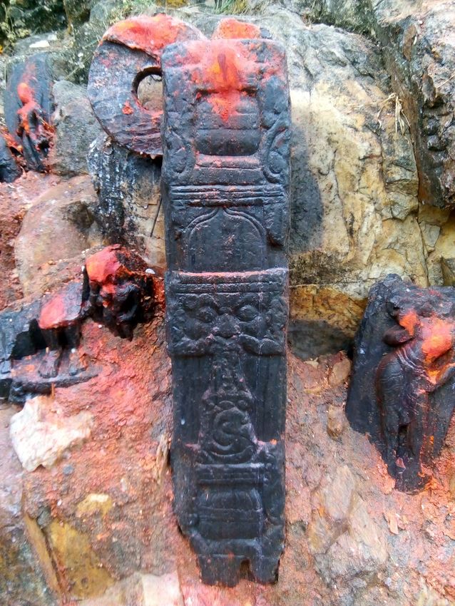
INTRODUCTION                                                                                                        Singh
                                                                                                                    Ancient Asia
                                                                                                                                                   2

                                                                                                                    DOI: 10.5334/aa.251
The hilltop monastic settlement at Giriyaka is situated on an extension of the Rājagriha hills.
Rājagriha was destined to be the earliest capital of Magadha as well as epicentre of multiple
religions, especially śramanic. The political as well as religious glory of the city is visible in the
physical remains of historical structures, archaeological artefacts, solitary caves, and lofty
hills. The geographical propensities of the region like hills, forests, caves, hot springs, water
resources, and vast agrarian lands were the catalyst to the kings and mendicants alike to
cherish their dreams. The ancient city was surrounded by five major hills-Ratnagirī, Vipulagirī,
Sonagirī, Udaigirī, and Vaibhārgirī and the city was protected by a fortification wall (Bimbisāra
or Cyclopean wall) which is 40 to 45 km in length and approximately 17.5 feet thick. (Figure 1)
The wall had sixteen rectangular bastions meant for defence. At one side the river Bānagaṅga
is situated along with Jethian forest and Veṅuvana and at other Giriyaka hill with river Paṅchāna
at its foot (Marshall 2002: 87–89).1 The name Paṅchāna is told because of her five streams
meet together in the south of Rājagṛiha. The river has been identified as Sappinī of Pāli literature
(Law 2016: 38).2 The name indicates the serpentine movement of the courses of the river. It
meanders through the Rājagriha and Nālandā and finally merges in the Gaṅgā. The Rājagriha
hills are composed of quartzite rock and extended in two parallel ranges originating from Oriar
Khurd-Bhindas villages in the neighbourhood of Gayā which further moves to the north-east up
to 58 kilometers to Rājagriha. The eastern termination of the southern range is comparatively
flattened, but the northern hills keep their height, and meandered through two lofty peaks
drooping towards the river Paṅchāna is mainly identified as Giriyaka. The lower hill of this range
in the east has a brick stūpa locally known as Jarāsaṅdha-kī-Baithak (abode of King Jarāsaṅdha)
and the higher peak has an quadrilateral walkway enclosed with remains of stūpa/vihāras
facilitated with a steep flight of steps leading through a pillared room (Cunningham 2000, I:
16). In the local tradition, the eastern hill is acknowledged as Mamubhagṅā or Phulwariā Pāhar
and the western ridge is known as Hawelia Pahār (Broadley 1872: 272). These names seem to
be mythologically related with Jarāsaṅdha as Phulwari in local dialects is known as garden and
the site is identified as Jarāsaṅdha’s garden.

Haweli means mansion or palatial house showing that the remains of monastery and stūpa were
later accepted as the palace of Jarāsaṅdha. Mamu-bhagnā is also associated with maternal
uncle-nephew dyad and had some mythological link of Jarāsaṅdha to King Kaṁsa of Mathurā.

                                                                                                                    Figure 1 Important Hills and
                                                                                                                    Rivers in Rājgir.

1    Two rectangular blocks have been identified on both sides of the pathway at Giriyaka hill may be identified
as smaller bastions to augment the defense from hill side.

2    On bank of river Sappini, the Paribbajakārama was situated where wanderers of all faith especially Jainism
resided. Once the Buddha visited from the Gijjhakūṭa hill at Rājagriha to the bank of this river to interact with
some wanderers, Aṅguttara Nikāya, I.185, II.29.
Buchanan linked this place to Girivraja, the old name of Rājagriha, and says that in passing time      Singh                       3
                                                                                                       Ancient Asia
it got vulgarised to be known as Giriak/Giriyaka. On basis of Faxian’s account of an isolated          DOI: 10.5334/aa.251
hillock, Cunningham accepts its name as Giriyaka. Beglar seeks the mythological connection
of this hill and says that the hill was named on queen Girikā, wife of King Vasu who once ruled
this region (Patil 1963: 148–149). The archaeological remains of NBPW phase puňca-marked
coins, moulded terracotta figurines, and the existence of ring wells suggest the beginning of
state formation in Rājgriha since the 6th century BCE (Barba 2004). Ghosh has explored the
archaeological artefacts scattered in the valley and found evidence of Northern Black Polished
Ware (N.B.P. W.), fragments of coarse undefined pottery, and two post-cremation burials. The
pottery in Rājgir is likely to go to the earlier period. The horizon with the coarse ware and the
post-cremation burials may be linked to the local prehistoric culture (Chakrabarti 1976: 265;
Agrawal, and Kusumgar 1974: 136). Giriyaka was well associated with this socio-economic
formation.

From the village side, a pathway was created connecting the habitation with the monastic
structures lying on the two hills (Figure 2).

                                                                                                       Figure 2 Stone pathway to
                                                                                                       monastic complex at hill.

Buchanan informs that a connecting road was built with stone blocks taken from the hill. It
is approximately twelve feet wide and meandering through the hill to reach the top (Jackson
1925: 112). Technically, the construction of the path way is very crude showing its antiquity
and hoary past. The closer examination of the pathway suggests that at one nodal point, it
break opens trespassing the Bimbisāra wall to create the passage for the road to reach the
monastic settlement on the top of the hill. The same stones were used as in the fortification
wall. It suggests that this path up to the monastic site was built in the same period when the
fortification wall was built. The presence of small rectangular bastion-like structures in this area
gives the possibility that monks who resided at the hills were permitted to move for their alms
round from this path with the permission of the existing authority. The remains of the Bimbisāra
wall and bastion like small structures in this area suggests that it was protected by state.

CAVES
The natural vegetation, deep forest, isolated hills, and rocky caves around Rājagriha have
always been a fascination for the monks and nuns. Some of these places were the abodes of
prominent monks and some important Vinayas were composed and sermons were delivered
here (Cullavagga IV.4.4). Even the Buddha had high praise for the city of Rājagriha and
Gijjhakuta hills (Dīgha Nikāya II: 116). Mahākassapa resided in Pippali-guhā. Once the Buddha
also visited this place to meet him when he fell sick. This cave was also used by the later monks
for meditation (Udāna I: 4; Saṁyutta Nikāya V: 79). On basis of its proximity to the Asura palace,
B C Law identified it at Vaibhāra hill to the west of the hot springs (Law 2016: 252). The caves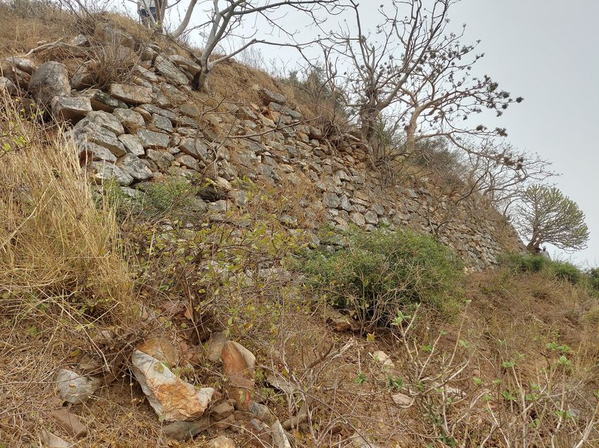
at Gijjakūta, Asura, Giddhdwāra, etc were few of them which became dwellings of numerous Singh 4
Ancient Asia
ascetics. Description of the two caves, one at Giriyaka hill which I call ‘Devadatta-guhā’ and DOI: 10.5334/aa.251
other popularly known as Indrasāla-guhā will be a valuable addition to examine antiquity of
Buddhism in Rājagriha.
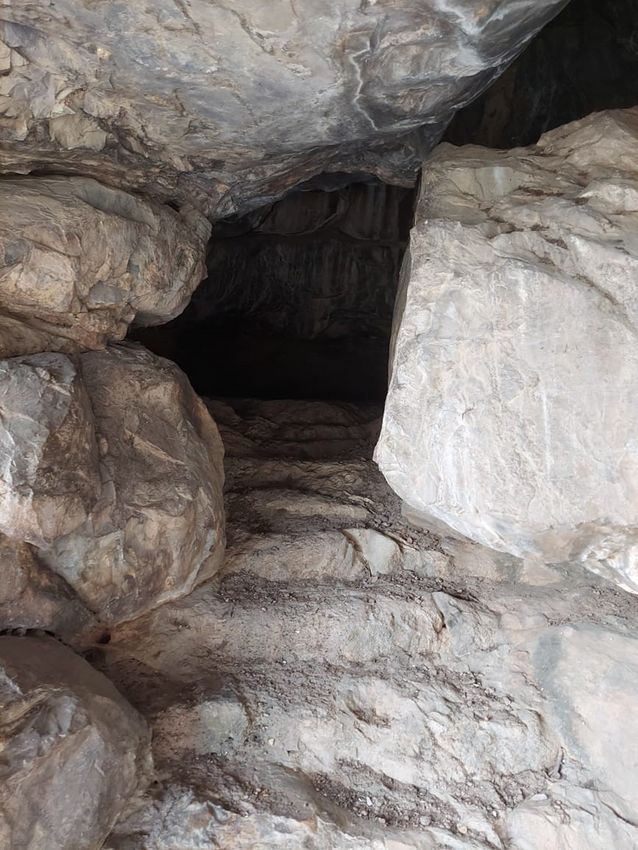
IDENTIFICATION OF DEVADATTA-GUHĀ
When one proceeds to Giriyaka hill from Rajgir by Nawada-Hiswa road, reaching the nodal
point that turns towards the hill just before the river Paṅchāna, after moving about 200 feet
on the right side on the hill, a cave exists still hidden from the keen eyes of the archaeologists/
explorers (Figure 3).
Figure 3 Devadatta-guhā.
This cave, therefore, is not described earlier by any colonial archaeologist. The cave is one of the
best caves of the region and can be rated only after the Sattapanni, Barabara, and Nāgarjunī
clusters of caves. The physical verification of the cave suggests that it is not a natural cave but
man-made. The chiselled marks are still showing on the wall of the cave. It has a wide hall
with one small cavern at the right side, meant for the meditation by the monk who occupied
it. Outside the cave, a small cavern is also excavated. The cave is undoubtedly Buddhist as
the Dharmachakra with six lotus petals is engraved at the entrance of the cave (Figure 4). The
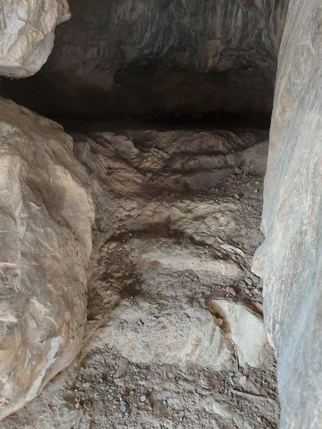
most unique feature is the stairs (steps) i.e. ten in number to get access to the main hall of the
cave which is like a parallelogram measuring sixteen feet long and ten feet wide (Figure 5 & 6).
Some imprints of vermilion, candaṇa, and akṣata have been visible on the outer wall of the cave
(Figure 7).
Later on, this cave might have been be used by some tantrika ascetics. The cave had chiselled
marks but does not exhibit polish which shows its pre-Maurya origin. This whole monastic
establishment was on periphery of Rājagriha and in all respect, was excavated by Ajātśatru
Singh                        5
Ancient Asia
DOI: 10.5334/aa.251

Figure 4 Dharmachakra
symbol at entrance.

Figure 5 Hall in the cave.
Singh                          6
Ancient Asia
DOI: 10.5334/aa.251

Figure 6 Stairs to reach the
cave.

Figure 7 Vermilion marks on
wall.
for his spiritual mentor Devadatta. I would not hesitate to call it ‘Devadatta-guhā’. This              Singh                 7
                                                                                                        Ancient Asia
extraordinary structure required extensive labour and huge financial resources which only               DOI: 10.5334/aa.251
the state could bear. The structural arrangement suggests Ajātśatru replicate the model of
Gijjhakuta cave where the Buddha resided in one cave, Ᾱnanda always stayed as an attendant
in an adjoining cave. The same structure is developed in Devadatta-guhā. Just outside the cave,
a small cavern was intentionally developed for the attendant monk. The Pāli literature mentions
that Devadatta replicate this idea from the Buddha (Dhammapada Aṭṭhakathā, I: 122). Faxian
mentions the stone cell of Devadatta and flat rock near it outside Rājagriha (Beal 2005: 118).
Xuanzang also saw a cave known as the Devadatta samādhi that was placed outside Rājagaha
and besides it, there was a stūpa. He also informs about the flat rock of black colour where
an ascetic performed suicidal practices and oozed blood, the red stain of the blood is visible
(Watters 1973, II: 155). Adjacent to the cave, moving upward the rocks are black in colour and
a large natural platform is still present with the comparatively smooth surface may be the
apparent rock seen by the Chinese travellers but they were confused with red vermillion marks
as blood stains. The red stains may be a mark of vermilion spotted on the surface of the rocks
that were used by tantric practitioners of later period. Some of the marks are still visible on the
walls of the cave. The monks seen by them could be the followers of Devadatta who used to
practice dhutāṅga (extreme self-mortification) meditation.

Beglar on Cunningham’s description of Xuanzang tries to identify a cave on Vipulagirī as
Devadatta-guhā (Beglar 1878: 185). Though, Cunningham does not give any real identification
or description of the cave. Ghosh identifies a cave on the northside of Vipulagirī near Makhdum
kund and hot springs as place for Devadatta. He says that a piece of stone with crimson marks
is believed to be blood stain seen by Xuanzang and it could be the platform where the the
monks practiced meditation. This cave with flight of steps was later on used by Makhdum Shah
Sharfuddin for meditation (Ghosh 1987: 40). But it can be refuted on many grounds. Xuanzang
mentions that Devadatta-guhā was situated outside Rājagriha (Watters 1973, II: 155–56).
Vipulagirī was always the seat of the Jains. Tirthānkara Mahāvīra spent many vassavāsa here
and Muni Suvrat spent his entire life on this hill. They both were contemporary of the Buddha.
It is a little possibility that Buddhists would encroach the caves and forest zones wandered by
the Jains. The cave mentioned by Ghosh is near to cluster of caves occupied by Mahākassapa
and his followers. Devadatta would not live near the sacred space dominated by his opponents.
The cave that I have described is still in outskirt of modern Rājgir, lying on the border of district
Nawada of Bihar can be acknowledged as Devadatta-guhā.

PARVATI-GUHĀ AS INDRASĀLA-GUHĀ: SOME ARGUMENTS
Cunningham identifies Giriyaka hill as Indrasāla-guhā where the Buddha preached Sakka. He
proposes that both Faxian and Xuanzang inform that the cave is situated on the southern side
of the hill, which could be identified as Gidhadvar. It is 3.5 km to the southwest of the Giriyaka
and one and a half km from Jarasandha’s stūpa. Cunningham says that ‘Hill of Isolated Peak’
corresponds to Giri+eka, single hill (Cunningham 1871: 472–73). Faxian mentions that from
Pataliputra to south-eastern direction after travelling nine yojanas a small rock hill standing by
itself on the top of which is a stone cell facing the south. On one occasion when the Buddha
was in the middle of the cell, Sakka visited him with his attendant musicians and asked 42
questions to the Buddha, writing each of them simply with his finger on stone. The traces
of writing still exist (Beal 2005: 110–111). Xuanzang says that Indasāla-guhā has two peaks
with flat gorges covered with vegetation. The south side of the West had a cave in which the
Buddha used to reside. Here Indra asked 42 questions to remove his doubts (Watters 1973,
II: 172–73). A. M. Broadly has contradicted Cunningham’s discovery and proposed hill of Bihar
Sharif as Indrasāla-guhā. He on the description of Faxian, says that Cunningham’s identification
of Indrasāla-guhā is hypothetical and based on inaccurate data. Both hills are entirely different
(Broadley 1872: 262–65). Broadley says that Giriyaka was not a solitary hill and here the rocky
ranges of the Rajgir hill get terminated. Secondly, from the solitary hill, Faxian proceeded south-
west one yojna to Nālā but it is only exactly ten kilometres north-west of Giryaka. For this region,
the hill of the solitary rock could not be Giryaka but the hill of Bihar Sharif (Broadley 1872:
284–286). Based on Viradeva’s inscription of 9th century CE, he identifies Indrasāla-guhā near
Ghosarwan, thirteen kilometres to the great Nālandā Mahāvihāra, eleven kilometres southeast
of the isolated rock of Bihar, and ten miles north-east to the ruins of Rājagriha. The inscription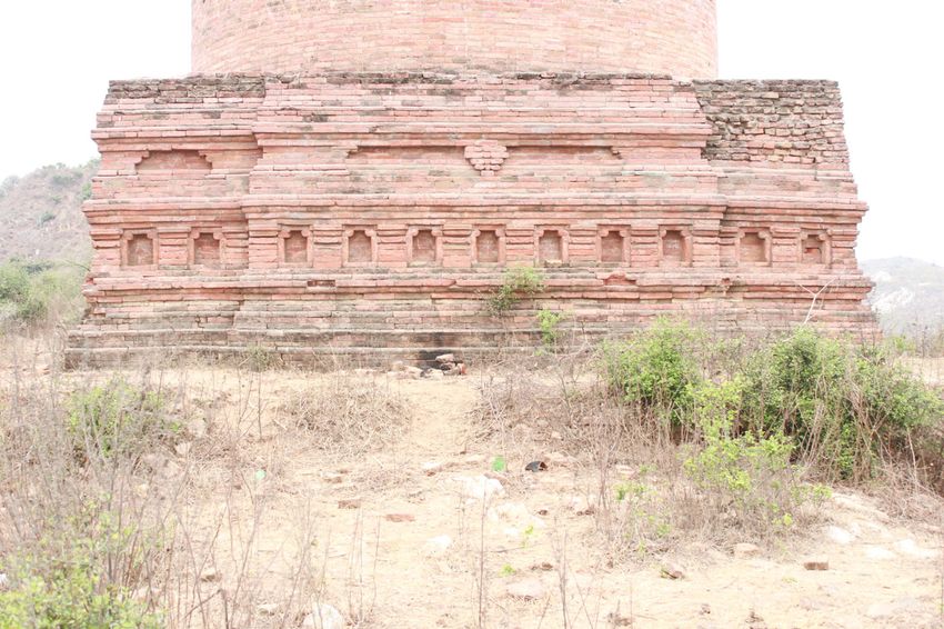
found from Ghosarwan informs that Viradeva in devotion of the saṁgha, erected for the good                           Singh                        8
                                                                                                                     Ancient Asia
of the world two crest-jewels in the shape of the caityas on the crown of Indrasāla (Broadley                        DOI: 10.5334/aa.251
1872: 266–73). However, Cunningham did not accept Broadley’s argument and countered that
Faxian description of direction and distance is not accurate and on basis of Xuanzang accounts
of Pataliputra, Nalanda and Indrasāla-guhā the exact location is Giriyaka.

The Pāli literature mentions that Indasāla-guhā is in Vediyaka mountain which is a natural cavern
in the rock. It is narrow, dark, and uneven. The cave is surrounded by a wall fitted with doors and
windows and decorated with scrolls and floral designs. The blessed once resided here (Dīgha
Nikāya II: 268–69).3 Pārvati can be the most suitable place for this cave as it has two distinct hills,
one is flatter and presently occupied with a Muslim grave and the second is comparatively high
with monastic remains. At the cliff of this second hill lies a natural cave but some modification as
chiselled marks are apparent. The cave is more approachable to live and meditate. It is not steep
like the Gidhadwar and the Buddha visited this region frequently. Buddhaghoṣa informs that it
was a natural cave situated between two hills but the hill where the cave waw existing known as
Vediyaka or Vediya hill because it was surrounded from all sides with blue rocks (Sumaṅgalavilāsinī
III: 697). Buddhist literature inform that the Buddha preached the Sakkapaṅṅa Sutta near a
brāhmin village Aṁasaṅda. This brāhmin village can be identified with village Apsadh which is
still dominated by the bhumihars and brāhmins. A M. Broadley has raised two important points
in his archaeological discoveries in the Bihar region. On basis of Viradeva’s inscription found from
Ghosrawan, which mentions that the king erected two crest jewels in the shape of caityas on
the summit of Indrasāla, he identifies Ghosrawan as the place where the Buddha preached
the Sakkapaňňa Sutta. Secondly, he identifies Ᾱṁasaṅda as Ghosrawan which was inhabited by
people of ‘Babhan’ (brāhmin) caste till 1857. They raised a banner of revolt against the British but
were subdued brutally by them. Their whole village was destroyed, many people were killed and
their properties were burnt down (Broadley 1872: 263–266, 273). Ghosarwan is not a hill and it
may be a possibility that Viradeva raised crystal jewels at Parvatī. Hirananda Sastri on basis of
the stone inscription of the reign of Yaśovarmadeva identifies Ghosarwan with Yaśovarma Vihāra
(Sastri 1999: 78–79). It reaffirms that Indasāla-guhā was at Parvatī.

STŪPAS AND VIHĀRAS AT GIRIYAKA: ANTIQUITY AND
STRUCTURE
Buddhist settlements discovered at Giriyaka hill in the colonial period have brought to the
limelight many early stūpas along with monasteries. On the western peak which is very steep,
a whole monastic settlement has been identified. The majority of parts of this structure are
under the heap of broken bricks and other earthen materials Broadley measures it twenty feet
high and one hundred and seven feet wide with visible remains of two or three stairs (Figure 8).
This place is acquainted with a ledge and was well protected by a strong parapet of stone
blocks (Figure 9).

                                                                                                                     Figure 8 stūpas as well as
                                                                                                                     vihāra at western end.

3    Vediyaka hill was situated to the east of Rājagriha and at north side of the hill was Indasāla-guhā, Saṁyutta
Nikāya, I, 206, 449.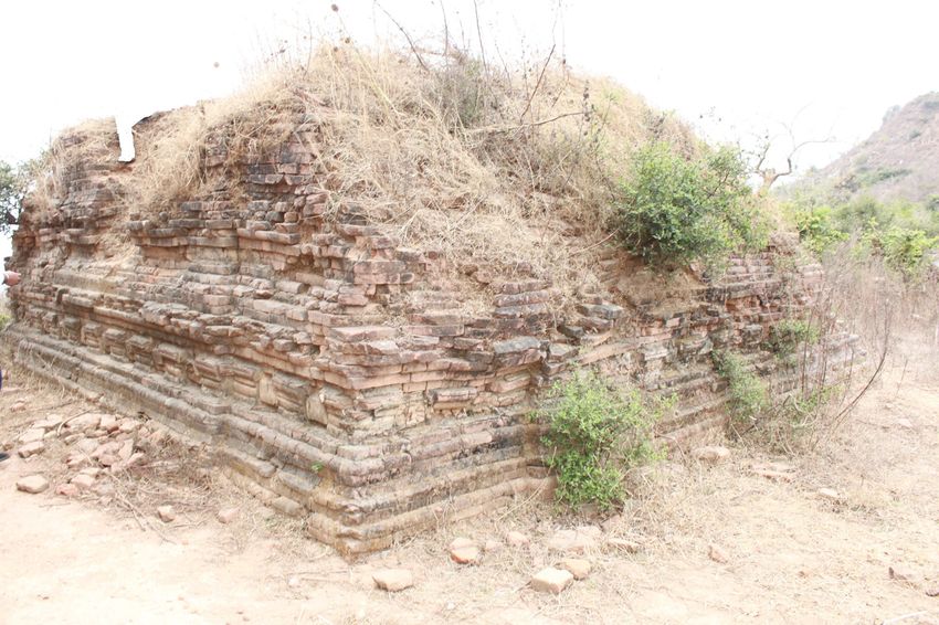
Singh                       9
                                                                                                      Ancient Asia
                                                                                                      DOI: 10.5334/aa.251

                                                                                                      Figure 9 Huge parapet wall to
                                                                                                      protect the stūpas.

The site also has remains of a stūpa on a 45 square feet quadrangular base and adjoining the
stūpa, the remains of monastic complex and cells raised on stone pillars are quite noticeable
(Broadley 1872: 209–215, 263). Buchanan also informs the remains of two or three steps and
the top of this steep structure is a hollow space with a copious ledge around it. It could be
an open courtyard well protected by a stone wall. The terrace surrounds the whole structure
from all sides. He also informs the existence of a tapering mass of bricks i.e., stūpa with the
observable square platform (Jackson 1925: 112–113). The site gives the impression that two
stūpas were built one small with a square base and the other still under the heap that may be
stūpa in the middle surrounded by a terrace from all sides. It could be an elongated structure
formed of a succession of steps with niches meant for decoration, alternating with pillars, and
in the middle lies a stūpa. Such types of stūpas were prevalent right from the Magadha region
to Odisha, Andhra Pradesh, and Gandhāra. The material remains of stūpas and vihāras, masonry
work in stone, size of bricks of this area suggest that the first structure was raised in the pre-
Maurya period and continued up to the early medieval age.

A huge protective wall of chiselled stone blocks was raised from the bottom of the hill from the
western side to balance and protect the stūpas and adjoining vihāra on the hill. This monastic
establishment was connected by a causeway to a water reservoir in which the same stone
masonry was used. The same category and size of chiselled stone blocks were used in the
Bimbisāra fortification wall which leaves no doubt that the earliest structure on the hill and
the parapet to protect it was built by King Ajātśatru as he was a builder of new Rājagriha and
this site falls in this area. About a little distance from the foundation of the parapet, a natural
pond is existing showing that water of it could be used by the monks residing upside the hill.
This monastic complex was well connected with other Buddhist settlements of Ghora-Katora
and other centers of Vaibhār hill. Broadley reported the remains of the monastery on the steep
hill covered by broken bricks and stones near the causeway. He says that the foundation made
of bricks (18 inches x 9 inches x 2 inches) was intact. The brick was joined by clay mortar. The
ruins of pillars supported the roof are scattered in the area (Broadley 1872: 263; Jackson 1025:
111–113). The remains belong to the Gupta period however the first monastery was built along
with the stūpas and parapet wall in the pre-Maurya period (Figure 10). The pillars are square at
the base and octagonal in the upper part showing the Gupta characteristics (Figure 11). The
chiselling marks on the surface suggest some kind of ornamentation on the pillars. One of the
pillars found in the existing temple is well ornamented with numerous stūpas.

Such a glorious structure could be compared to the stūpa built on the bank of river Bāṅgangā,
and excavation of the Sattapanni caves by Ajātśatru. It keeps us wondering that to whom this
stūpa complex was dedicated. My observation zeroing in for Devadatta. It is also possible that
after the death of Devadatta this place was occupied by Ᾱnanda and his followers. Chinese
travellers mention that Ajātśatru made relic stūpas in Rājagriha for Devadatta and Ᾱnanda. It
can be a suitable place for Devadatta as he emphasised to live in the forest (āraññaka); not to
the neighbourhood of a settlement; to get alms by begging (piṇḍapātika); to dwell at the foot
Singh                          10
Ancient Asia
DOI: 10.5334/aa.251

Figure 10 Remains of pillars
and bricks.

Figure 11 Pillar with stūpa
symbols.
of a tree (rukkhamūlika) etc., (Vinaya Pitaka, III: 171). The Dadhi-Vāhana Jātaka and Pañca-                    Singh                 11
                                                                                                                Ancient Asia
Paṇḍita Jātaka narrate an instance that Ajātasattu built a monastery for Devadatta. The king                    DOI: 10.5334/aa.251
used to send five hundred pots of sumptuous dishes for him and his wandering community.
Even this luxurious food was also shared by the followers of the Buddha (Jātaka 186; 508).
Thus, it appears that Devadatta continued to have the support of Ajātśatru. Though Devadatta
was considered as a man of demonic habits in early Pāli literature but his dissidence was
indeed a kind of his adherence to certain austerities, which the conventional community of the
bhikkhus was not keen to follow (Sarao 2014: 31–48). The Sarvāstivāda-Vinaya informs that for
twelve years after his admission into the saṁgha, Devadatta conducted himself with faultless
deeds and judgements. He got perfection in the Vinaya and the Dhamma and strictly followed
truthful and disciplined life (Mukherjee 1966: 120). In the Saddharmapuṇḍrīka Sūtra, Devadatta
is depicted in his previous life as a forest renunciant who helped the Buddha Sākyamuni to
attain Buddhahood (Saddharma-Puṇḍrīka XI: 46). Giriyaka was an ideal place which had all
requisites demanded by him. In a similar fashion story of Ᾱnanda has been mentioned in the
Atthakathās. When Ᾱnanda desired to take mahāparinibbāna and proceeded towards Vaiśalī.
On hearing this, Ajātśatru and Vajji saṁgha both requested Ᾱnanda to take mahāparinibbāna
in their territory. To avoid any kind of conflict between the two Buddhist kingdoms, Ᾱnanda
performed a miracle on the bank of river Rohinī and his body was amalgamated in the flame.
His relics were divided into two parts and Ajātśatru made a huge stūpa at Rājagriha over his
share (Dhammapada Aṭṭhakathā, II: 99ff). Giriyaka could be ideal place for it.

Buddhist literature suggests that Ᾱnanda had great respect for Devadatta and Mahākassapa.
When the Buddha visited Kapilvastu, Devadatta along with Ᾱnanda, Bhagu, Kimbila, Bhaddiya,
Anuruddha, and Upali were converted into saṁgha. Devadatta was the first to achieve
arhathood (Vinaya Pitaka II: 182). The association and respect among them never faded and
despite Devadatta’s ire against the Buddha, he was never abandoned by their cousins. The
proceeding of the First Buddhist Council suggests that despite Ᾱnanda’s prominence, he was
not taken kindly by Mahākassapa and their followers. Several trivial charges were levelled
against him to demean his image. Though he pleaded his innocence and achieved arhathood
to be a compiler of the Sutta Pitaka. Even, he was not treated enlightened by the other senior
arhats. Malalasekera points out that despite his great acumen and erudition, Mahākassapa felt
jealous of other prominent monks like Ᾱnanda and others. It may be the reason that he did not
welcome him in the first Council. Mahākassapa did not have positive vibes for the bhikkhunis
as evident from his spat with bhikkhunis Thullatissa and Thullananada (Malalasekera 2007, II:
480–81).4 Both the nuns had a great veneration for Devadatta and Ᾱnanda but hatred against
Mahākassapa. Once Mahākassapa with Ᾱnanda visited to preach bhikkhuni saṁgha, Thullatissa
became annoyed by his attitude and mocked Mahākassapa ‘as the needle pedlar try to sell a
needle to the needle maker (Saṁyutta Nikāya, II: 215ff.). Thullananada was an erudite nun
with vast expertise in Dhamma. She was an ardent follower of Ᾱnanda and also had respect for
Devadatta. Once Mahākassapa called Ᾱnanda ‘a boy’, then Thullananda scolded Kassapa. She
became so infuriated that she left the saṁgha (Vinaya Pitaka IV: 66, 182, 211–15, 233, 239–40,
248–50, 335). Though Ᾱnanda became the successor of Mahākassapa frequent interactions and
sharing of common abode were probably avoided by the followers of both groups. The southern
vicinity of Rājagriha i.e. Ekanāla and Dakkhinagirī was dominated by Purāṅa and his followers
who even challenged the proceedings of the First council. The Dharmaguptaka and Mahīsāsaka
Vinayas have referred this incident and Purāṅa of Dakkhinagiri has been mentioned as the
person who introduced seven rules in the Vinaya of Mahīsāsaka (Datta 1998: 122). It seems
Purāṅa ushered in great tradition of the Porāṅṅikas and his followers later founded Mahaiśāsaka
sect. The followers of Sarvāstivadins seek their lineage from Ᾱnanda and his disciple Sambhuta
Sanvasi founded its center to Mathurā and Majjhantika led it Kashmir and Gandhara (Datta 1998:
128–129). At Vaibhār hill Mahākassapa and his followers had widespread influence. Gijjhakūta,
Pippali, Asura, and Sattapanni groups of caves belonged to Mahākassapa and his followers. It
was a traditional bastion of the bhikkhus who later developed the Kaśyapiya sect. The vicinity of
Rājagriha from Giriyaka, to Ᾱṁasaṅda (Apsadha) village, was much frequented by the Buddha

4     The Vinaya Pitaka informs that Ᾱnanda had utmost regard for Mahākassapa and he always avoided to
call Mahākassapa by his name, Vinaya Pitaka, II, 287ff; The other instance says that when Ᾱnanda at the first
Council informs Mahākassapa that the Buddha instructed him to do away with the minor rules of the saṁgha but
Kassapa was opposed any such steps as it would create lethargy among the community of the monks, Vinaya
Pitaka, I.92ff.
and Ᾱnanda. It might be a possibility that Ᾱnanda and his followers had a main stay on this Singh 12
Ancient Asia
hilltop monastery. The textual tradition indicates that just after the mahāparinibbāna of the DOI: 10.5334/aa.251
Buddha, the doctrinal difference among the prominent Theras developed and their followers
subsequently accentuated to their Master’s view that gave rise to three important sects from
Rājagriha-Mahaiśāśaka by Purāṅa and his followers from Dakhinagirī, Kaśyapiya-Mahākassapa
and his followers from Gijjhakūta-Pippali-Asura-Sattapanni Caves, Sarvāstivadin by Ᾱnanda
and his followers from Giriyaka-Aṁasaṅda region. Despite differences, personality clashes, and
diverse interpretations of some rules, the saṁgha remained united and it took hundred years
to come out openly to oppose some of doctrinal interpretations and practices. But soon after
it, the eminent elders put their best effort to unify the saṁgha as visible from the Kathāvaṭṭhu
and the schism edicts of Aśoka.
Some of the early stūpas constructed were mainly of stone, earthen, and then brick stūpas.
The remains of stone/earthen stūpas are visible on both sides of the pathway in significant
places. Marshall noted existence of many brick, clay, and earthen stūpas in Rājagriha and its
surroundings. Many of them had antiquity since the Maurya or earlier period (Marshall 2002:
96–97). Cunningham reports stone foundations of small brick stūpas on nodal points of Giriyaka
pathway measuring from 5 to 6 feet in height with circumference of 12 feet (Cunningham
2000, I: 16–17). I have noticed many stone and earthen stūpas with foundation of stone on
both side of pathway (Figure 12). Many have them have same circumference i.e. 12 feet as
measured by Cunningham but one stone stūpa is very unique having diameter of 18 feet, larger
than other such kind of stūpas (Figure 13). It is situated on the right side of the pathway and just
opposite it on the other side of the road a square platform was raised. This stūpa has special
Figure 12 Pre-Maurya stone
stūpa.
Figure 13 Maurya stūpa with
stone base.significance as the platform may be meant for some ritual purpose. It was a kind of memorial Singh 13
Ancient Asia
or śārīrika stūpa. The material remains indicate its pre-Maurya origin. Some of the other mud/ DOI: 10.5334/aa.251
stone stūpas may belong to the Maurya period and some of them were getting renovated in
the age of the Kuṣānas. The monastic structure can be traceable when one starts climbing from
the village side and after covering around 500 meters when reaching on a first flat surface on
the right side of the hill.
The monastery though very small is lying near the earthen stūpas. The foundation wall and
remains of the wall are still visible. It may have a late origin between the Gupta to later Gupta
periods.
On the hill at least two structural remains of the stūpas are visible. The site is known for one
main stūpa that has been recently renovated by the Archaeological Survey of India. Broadley
informs the existence of stūpas near the tank:
‘it brings us to a semi-circular platform about thirty feet in radius, on which is another
conical building quite ruined. East from thence and adjacent is an area forty-five feet
square, the center of which is occupied by a low square pedestal twenty-five feet
square divided into the sides by compartments like the paneling on wainscot, and
terminating in a neat cornice. On this pedestal, rises a solid column of brick sixty-
eight feet in circumference. About thirty feet up, this column has been surrounded
by various moldings, not ungrateful, which have occupied about fifteen feet, beyond
what remains of the column, perhaps ten feet, is quite plain. A deep cavity has been
made into a column probably in search of treasure, and this shows that the building
is solid. It has been constructed by bricks cemented by clay, and the outside has been
smoothed with a chisel and non-plastered. Part of the original smooth surface remains
entire, especially on the east side. The weather on the west side has produced many
injuries.’ (Broadley 1872: 261)
Adjacent to the water reservoir, two stūpas one still intact and the other only has a foundation is
existing. Both of the stūpas are seemed to be intentionally built together with narrow passages.
The mound of the second stūpa is lower than the cylindrical stūpa and the foundation of the
structure suggests that it was square with a projection of center in each face. It has been
identified as a shrine but a stūpa with a square base and hemispherical dome (Figure 14). The
upper part is damaged as it was excavated by Cunningham but the shape of the stūpa indicates
that its dome was 6–7 feet high. Such kinds of stūpas with enlarged Medhi and less projected
dome have been found in different parts of Magadha, Bengal, Odisha, and South India. This
stūpa does not have exposed niches like the adjacent one but projections in all directions with
subdued niches and floral designs in form of lotus petals have been found (Figure 15). The dome
is broken but heap of bricks and square platform indicate that the stūpa was less in size.
The larger stūpa discussed by Broadley i.e., Jarāsaṅdha-ki Baithak is a brick structure and
cylindrical (Figure 16). It was placed on a square brick platform 14 feet high. The cylindrical
Figure 14 Smaller stūpa at
Jarāsaṅdha-ki Baithak.Singh 14
Ancient Asia
DOI: 10.5334/aa.251
Figure 15 Lotus petal design
on medhi.
Figure 16 Jarāsaṅdha-ki
Baithak (stūpa).
shape stūpa is 23 feet in circumference and 21 feet high. Cunningham reports that the upper
part of the stūpa was decorated with a hemispherical dome which is now broken except one
segment 6 feet. This part of harmikā may also be decorated with chattra. So, the total height
of the whole stūpa architecture could be around 55 feet. He sank a shaft from top up to 41 feet
probably to discover relics but got nothing out of it (Cunningham 2000, I: 17). The structure of
the stūpa may be of the Gupta age and it might be constructed between the 5th–6th century CE.
The first three brackets from the base of the stūpa represent adhishthāna. The square platform
rising from adhisthāna symbolizes jagatī upon which stūpa has been raised. The jagatī has
many brackets, the lower one has eleven niches each on all sides (Figure 17).
Eleven niches at each wall of the platform indicate some spiritual significance. Because the whole
complex is dominated by the stūpa cult, the eleven must represent the triple gem (triśarana-
Buddha, Dhamma, Samgha) and atthāṅgika-magga i.e. sammā-ditthi, sammā-saṁkappa,
sammā-vāchā, sammā.-kammanta, sammā-ājīva, sammā-vyāyāma, sammā-sati, sammā-
samādhi. Though eight aniconic symbols (Lotus, mandala, golden fish, dhvaja, Dhammachakra,
treasure vase, chatra, and śankha) related to the Mahāyāna along with trikāya doctrine may
also be associated but has less possibility because remains of decorative motifs represent only
floral designs especially lotus petals showing insignificant evidence of Mahāyāna. The structure
was also adorned with beautiful moldings and the remains of lime plaster show that it was
well treated with plaster. The cylindrical part is like śikhara or deul representing the Buddha
and his prominence. The dome may be capped with āmalaka or chattra but its remains are notSingh 15
Ancient Asia
DOI: 10.5334/aa.251
Figure 17 Niches on medhi of
Jarāsaṅdha-ki Baithak.
available. Adjacent to these remains, a small monastic settlement is visible. The brick structure
of the monastery suggests that it had very late origin probably in the early medieval period.
Both the stūpas are well protected by an enclosure wall of brick. It was approximately 75 cm
thick and bricks were joined by mud mortar. The pradkshinapatha was made by rammed bricks
and was developed in such a way that pilgrims can circumundulate either one stūpa or both
stūpas together (Sharma, Manjul, and Tewary 2015: 449–456, 454). Two stūpas of the same
period with narrow passage suggest that these two stūpas are dedicated to two same persons
for whom earlier stūpas were dedicated. I can infer that main cylindrical stūpa was for Ᾱnanda
and the smaller one for Devadatta. The difference between the two is that the former group
may be relic stūpas but these are votive.
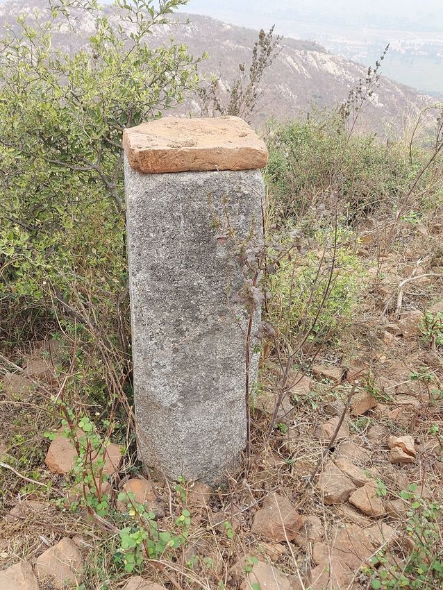
Cunningham says that the Jarāsaṅdha stūpa is that one made in the devotion of the goose.
It can be further corroborated by a broken figurine carved on a pedestal and an impression
of goose on lac seals found from the stūpa remains (Cunningham 2000, I: 18–19). On basis of
Xuanzang’s account, Cunningham identifies it as Haṁsasaṁghārama and says that earlier it
was associated with Theravāda which allowed meat-eating on condition of tikotopariśuddha.
He says that one of the seals bears figure of a goose on its top and a broken figure with a large
goose carved on a pedestal have also been found (Cunningham 2000, I: 17–18). Once the
resident monks could not find alms for many days, When saw a hoard of geese flying over the
monastery, the monks desired to get some of the swans to satisfy their hunger. The leader of
the Haṁsas listened and realised their problem. He intentionally fell from the sky and died in
front of them to satisfy their hunger. The monks realised their fault and buried the Haṁsa with
due homage. After that these monks left the Theravāda and became a follower of Mahāyāna to
follow the complete nonviolence. In memory of the Haṁsa, they built a monastery known as
Haṁsasaṁghārama (Beal 2000: 119–120). The physiology of the site suggests that it cannot be
Haṁsasaāghārama. Giriyaka hill since its inception to decline seems to a dominated by the stūpa
cult. There is a rare presentation of images, mandalas, or structures showing the dominance
of Mahāyāna at this place. The water reservoir cannot be accepted as a tank or sarvovara used
for the domestication of Haṁsa. All Buddhist monastic establishments on the hilltop across
the Indian sub-continent had the provision of a water reservoir for everyday purposes. The
monastic site of Apsadh (Aṁasaṅda) can be the most identifiable place for Haṁsasaṁghārama.
The archaeological artefacts at Apsadh show strong presence of Mahayana-Vajrayana along
with Vaishnavism in the Gupta and post-Gupta periods. The village is existing about 5 km to
the southeast of Pārvatī and had an abundance of Buddhist and Brahmanical sculptures and
monastic remains (Chaudhuri 1936: 307). The Haṁsasaṁghārama can be well identified with
it. Apsadh tālāb is still the most suitable place for swans. The Apshad inscription of Adityasena
informs that this pond was excavated by queen Koṅadevi for the welfare of people of this
area along with living creatures like alligator, fish, and birds (Fleet 1888, III: 205–208). The
talab which is still existing seems to be a natural pond re-excavated by the queen who was a
worshipper of Lord Viṣnu. Earlier it was a Buddhist site as obvious from material remains but
later on Vaiṣnavism also prospered here with the patronage of the Gupta kings.WATER RESERVOIR Singh
Ancient Asia
16
DOI: 10.5334/aa.251
At the receding end of the higher slope within 50 feet of the main stūpa, an oblong water
reservoir has been found. This tank was excavated from two sides from the natural rock of the
hill and on the other two sides plucked up with stone blocks (Figure 18). It is about 100 square
feet (Patil 1963: 152).
Figure 18 Fortification wall for
water reservoir.
Buchanan observed that this tank was surrounded all along its length by an 18 feet wide paved
causeway connecting it to the stūpa complex at the hill. It was five hundred feet long and forty
feet wide. Opposite the tank, a narrow ridge is found extending east and west and rises high
on both sides from the tank but more towards the west. At the west end of this causeway is
a steep slope of brick, twenty feet high and 157 feet wide (Jackson 1925: 111–112). There is
second tank at short distance to the north formed by the excavation of the rock for construction
purposes. Both tanks were dried when Cunningham saw them (Cunningham 2000, I: 16–17).
One natural pond was at the bottom of the hill where the parapet had the foundation. The
reservoir had no ritual purpose as suggested by some scholars. The basic purpose of this tank
was to harvest rainwater for the routine work of the monastery. Making reservoirs for rain
harvesting was important feature of the Buddhist monastic settlement. This structure was
one of the earliest experiments in the land of Magadha. This technique was experimented
in a broader way in the monasteries situated on main land of the Magadha and Ahara-Paine
system of irrigation (based on rain harvesting) was developed. For monasteries on the hills, it
was difficult to get water, so all such monastic establishments had provision of making cisterns
and reservoirs. The masonry and use of stone blocks suggest that its excavation was pre-
Mauryan and definite beneficence by state patronage. The reservoir gives an empirical basis for
re-assessing the development of monastic settlements and the role of the state. The reservoir
offers interesting indications that how kings played an active role to set up monasteries, and
building stūpas. Water management played a major role in this monastic settlement to survive
for a longer period.
SEALS
Cunningham discovered eighty-four oval seals of lac of different sizes. He describes that the
seals are different in size but usually 3 inches long and two inches wide with the impression
of the large stūpa with four smaller stūpas on each side with the inscription of Buddhist
creed Ye Dhamma hetu prabhava in medieval Nagarī character. The seals were all oval, but
of different sizes, generally about 3 inches long and 2 inches broad, All, however, bore the
same impression of a large stūpa (Lawson 1982: 514). The plaque/sealing (Anon 2020) looks
good and an impression is visible (Figure 19). This is a ritual object for offering as a model of
piety by lay or monastics. These sealings may be put inside small mud stūpa as a mode ofcommemoration. The seal suggests a stūpa cult associated with this site. The eight great stūpas Singh 17
Ancient Asia
on the surrounding may have representatives of eight great places i.e. either atthamahāṭṭhani DOI: 10.5334/aa.251
(Luṁbinī, Bodhgayā, Sārnāth, Kuśinagara, Vaiśālī, Rājagriha, Srāvastī, and Saṅkasya) or eight
places where relic stūpas (Ajātśatru of Magadha; Licchavis of Vaiśalī; the S̄akyas of Kapilavastu;
Bulis of Allakappa; the Koliyas of Rāmagāma; the brāhmins of Vethadvīpa; to the Mallas of Pāvā;
and the Mallas of Kuśinagar) were made just after the mahāparinibbāna of the Buddha.
Figure 19 Monastic seal made
from lac (Courtesy-Anon).
This seal belonged to a larger number of similar sealing which was used to be put inside small
mud stūpas as a mode of commemoration. A beaded border gives stūpa a special status. The
central stūpa would be with these eight great places, but specific reference to the find-spot. The
stūpa shown in the center can be the Giriyak stūpa’s visual representation, which is held high
and with more emphasis by its enlarged portrayal. It appears floral decorations were hanging
from the upper part of this stūpa. The central stūpa is shown with elaborate architectural
details in its Medhi, anda, and harmikā. A small projected feature is shown in the front part
of the central stūpa. The multiple layers of the chatra and yasti are intricately depicted. These
features indicate that the central feature was being regarded as a caitya incorporating a ritual
veneration space and not a mere stūpa. These seals could be dated to the Gupta-post-Gupta
period and not earlier. The pinnacles of the central stūpa resemble like śikhara which had seven
stūpa like visible figure that may represent seven relic stūpas made of the Kṣatriya princes of
the seven early stūpas except for stūpa of Rāmagāma dug out by the emperor Aśoka to make
84000 stūpas.
OBSERVATIONS
Giriyaka Buddhist complex can be said as the first fully developed hilltop monastery of Magadha.
Since the age of the Buddha, hill regions in Magadha were occupied by the ascetics of different
religious traditions. At Rājagriha hills, Mahāvīra and his followers spent many vassavāsas. Some
of the prominent monks of Buddhism either frequently visited hills for meditation or made their
abode in natural caves that existed there. Even the Buddha and other bhikkhus visited frequently
at Gijjhakūta for meditation and discourses. John Marshall has reported that at Gijjhakūta,
remain of brick structures of monasteries, and stūpas of the Maurya age are found (Marshall
2002: 92–93). Similar brick structures showing remains of the monastery have been noticed at
Nāgārjunī hills which were earlier carved out and donated by king Daśratha to the Ᾱjīvika monks.These caves were later appropriated by the Buddhists who raised brick monasteries in front of Singh 18
Ancient Asia
caves. At Giriyaka monastic activities began during the age of the Buddha and continued up DOI: 10.5334/aa.251
to the early medieval age. The existing artefacts, brick remains, stūpas, pillars, and monastic
remains leave no doubt that it was the first fully developed hilltop monastery of Magadha.
Giriyaka hill monastic complex is dominantly embedded with the stūpa cult. The remains show
an absence of images and dominance of stūpas. Numerous stūpas, symbol of stūpas on pillars
and seals show that the site belongs to the Sthahviras.
The cave on the side of a hill is meant for a prominent Buddhist monk. The topography of the
region, contexts given in travelogues and literature indicate that the cave belongs to Devadatta.
The cave at Pārvatī hill can be the real Indasāla-guhā as it is very near to Apsadha (Ᾱṁasaṅda)
village. The other cave i.e. Gidhadwara cannot be Indrasāla-guhā because it is too steep and not
easily accessible. This cave may be for the dhutāṅga practices, not for the Buddha.
The inferences drawn in the paper are engrossing in nature and promise a lasting influences
in Buddhist archaeology in times to come. The observations would open up new avenues of
explorations which would enthral the future scholars luring them to venture further in the
sacred space of the Giriyaka hilltop monastery and its surroundings.
ACKNOWLEDGEMENTS
The author is thankful to the Archaeological Survey of India and Dr Shankar Sharma, Asstt
Archaeologist, Nalanda for facilitating support at site. I also acknowledge help of Dr Vishwajit
Kumar, Nava Nalanda Mahavihara to translate Pali sources and Dr Bhaskar Sinha, IIFM, Bhopal
for map. My two research students Sourajit Ghosh and Azad Hind Gulshan Nanda assisted me
in the fieldwork.
COMPETING INTERESTS
The author has no competing interests to declare.
AUTHOR AFFILIATIONS
Anand Singh orcid.org/0000-0003-3607-4303
Nalanda University, IN
REFERENCES
Agrawal, DP and Kusumgar, S. 1974. Prehistoric Chronology and Radiocarbon Dating in India. Delhi:
Munshiram Monoharlal.
Anon. 2020. Giriyak, Bihār. Oval plaque with a large stūpa, flanked by eight smaller stūpas, with part of the
Pratītyasamutpāda Gāthā at the edge. Zenodo. DOI: http://doi.org/10.5281/zenodo.3754638
Barba, F. 2004. Fortification in the Ganga Plain in the First Millennium BE. East and West, 54: 223–50.
Beal, S. 2000. The Life of Hiuen-Tsiang by the Shaman Hwui Li. Delhi: Low Price Publication, Reprint.
Beal, S. 2005. Travels of Fah-Hian and Sug-yun From China to India (400 AD and 518 AD). Delhi: Low Price
Publication, Reprint.
Beglar, JDFM. 1878. Report of a Tour through the Bengal Provinces. Calcutta: Office of the Superintendent
of Government Printing.
Broadley, AM. 1872. The Buddhistic Remains of Bihar. Journal of Asiatic Society of Bengal, III(1): 209–306.
Chakrabarti, DK. 1976. Rajagriha: An Early Historic Site in East India. World Archaeology, 7: 261–268. DOI:
https://doi.org/10.1080/00438243.1976.9979639
Chaudhuri, PC. 1936. The Cult of Tārā and an Image of Pārvati. Journal of Bihar and Orissa Research
Society, XXII(4): 293–307.
Cunningham, A. 1871. The Ancient Geography of India. London: Trubner and Company.
Cunningham, A. 2000. Four Reports Made During the Year 1862-63-64-65. Delhi: ASI, Reprint.
Datta, N. 1998. Buddhist Sects in India. Delhi: Motilal Banarasidas.
Dhammapada Aṭṭhakathā. 1973. ed. Upasaka, CS. Nalanda: Nav Nalanda Vihara.
Dīgha Nikāya. 2012, tr. Walshe, M, The Long Discourses of the Buddha. Boston: Wisdom Publication.
Fleet, JF. 1888. Corpus Inscriptionum Indicarum, Inscriptions of the Early Guptas. vol. III. Calcutta:
Government of India, Central Publishing House.
Ghosh, A. 1987. Rajgir. Delhi: ASI.Jackson, VH. 1925. Journal of Francis Buchanan Kept During The Survey of the Districts of Patna and Gaya Singh 19
Ancient Asia
in 1811–12. Patna: Superintendent Government Printing.
DOI: 10.5334/aa.251
Law, BC. 2016. Geography of Early Buddhism. Delhi: Munshiram Manoharlal, reprint.
Lawson, SD. 1982. A Catalogue of Indian Buddhist Clay Sealings in British Museums. Unpublished Doctoral
Thesis, Hertford College, University of Oxford, U.K. Note by Lawson on these Sealings from Giriyak.
Malalasekera, GP. 2007. Dictionary of Pali Proper Names. Delhi: Motilal Banarasidas.
Marshall, J. 2002. Rājagriha and its Remains. Annual Report of ASI. 1905–06. Delhi: Archaeological Survey
of India, Reprint.
Mukherjee, B. 1966. Die Uber-lieferung von Devadatta, dem Widersacher des Buddha in den kanonischen
Schriften (Munche-ner Studien zur Sprachwissenschaft. Beih. J: Munich, Kitzinger.
Patil, DR. 1963. The Antiquarian Remains of Bihar. Patna: K.P. Jayaswal Research Institute.
Saddharma-Puṇḍrīka or the Lotus of the True Law, Sacred Books of the East. 1984. tr. Kern H. no. 32,
Oxford: Clarendon Press.
Saṁyutta Nikāya. 1996. tr. Woodword, FL, The Book of the Kindred Sayings or Grouped Sutta. Oxford: The
Pali Text Society (first published in 1927), Reprint.
Sarao, KTS. 2014. Dissent and Protest in Early Indian Buddhism with Special Reference to Devadatta. In:
Ramaswamy, V (ed.), Devotion and Dissent in Indian History. Delhi: Foundation Books, pp. 31–48. DOI:
https://doi.org/10.1017/9789384463090.006
Sharma, S, Manjul, SK and Tewary, SK. 2015. Rediscovering of the Buddhist Remains at Giriyak Hill of
Rajgir. In Kumar, V and Rawat, B, (eds.) Mani-Sushma Archaeology and Heritage. Delhi: B R Publishing,
pp. 449–456.
Sumaṅgalavilāsinī: Buddhaghosa’s Commentary on the Dīgha Nikāya. 1886-1932. ed. Davids, TWR,
Carpentier, JE and Stede, W. 3 vols. London: Pali Text Society.
The Jataka; or, Stories of the Buddha’s former births. 1892. tr. Cowell, Edward B. Cambridge: The University
Press.
Vinaya Texts. 1996. ed. Davids, TWR and Oldenberg, H. 3 vols. New Delhi: Low Price Publication, Reprint.
Watters, T. 1973. tr. On Yuan Chwang’s Travels in India, vol. 2, London, 1904–05, 2nd Indian edition. Delhi:
Munshiram Manoharlal (reprint).
TO CITE THIS ARTICLE:
Singh, A. 2021. Giriyaka Hilltop
Buddhist Monastic Complex
(Rajgir): Understanding
Antiquarian Remains and
Physical Spaces. Ancient Asia,
12: 13, pp. 1–19. DOI: https://
doi.org/10.5334/aa.251
Published: 15 July 2021
COPYRIGHT:
© 2021 The Author(s). This is an
open-access article distributed
under the terms of the Creative
Commons Attribution 4.0
International License (CC-BY
4.0), which permits unrestricted
use, distribution, and
reproduction in any medium,
provided the original author
and source are credited. See
http://creativecommons.org/
licenses/by/4.0/.
Ancient Asia is a peer-reviewed
open access journal published
by Ubiquity Press.You can also read