Emergency Management October 2021 - State Emergency Service
←
→
Page content transcription
If your browser does not render page correctly, please read the page content below
Emergency Management
                                                                                                      October 2021

VICTORIA'S EARTHQUAKE
On   22    September     2021,   a   5.9    magnitude   earthquake    hit   Victoria’s

northeast.    The   epicentre     was      located   north   of   Rawson    and   was

recorded at a depth of approximately 10kms. The quake was followed by

two smaller aftershocks. It was the largest recorded earthquake to hit

south east Australia.

The initial earthquake caused damage 130kms away in Melbourne and shaking was felt in Sydney, Canberra,

Adelaide and Launceston. Insurance companies reported receiving hundreds of claims, including the collapse

of a building wall. 35,000 homes lost power and one minor injury was reported.

Two weeks later, on Saturday October 9, a magnitude 4.8 earthquake was felt near Pinnaroo in SA, followed

by 3 smaller aftershocks. Geoscience Ausralia have stated that due to distance the two earthquakes are not

linked.

South     Australia's   most   serious     earthquake   was   the   1954    Darlington   earthquake   which   caused   around

$578million (in 2017 dollars) damage. Many of Adelaide's buidlings suffered serious damage and partial

collapse. This was Australia's most damaging earthquake until the Newcastle, NSW earthquake in 1989.

The Newcastle earthquake killed 13 people and injured 160 . It caused an estimated $4billion in damage,

impacting 50,000 buildings, over an area extending 9000 square kilometres.

For further information, visit Geoscience Australia’s website.

ZONE EMERGENCY MANAGEMENT SYMPOSIUM
                                                The Zone Symposium brings together those who work in emergency

                                                management,       including   Zone   Emergency    Management      Committee

                                                (ZEMC) members and emergency services.

                                                The theme for this year’s symposium is “Living the new normal”. It

                                                focusses on the offerings 2020 and 2021 have delivered. There is a

                                                great line up of speakers ranging from managing multiple hazards in
Date: Friday, 10 December 2021
Time: 10.00 am to 04:00pm                       a COVID environment here in SA and interstate, psychological impact

Venue: Morphettville Racecourse,                of ongoing uncertainty and climate change.

79 Morphett Road, Morphettville, SA
                                                Registrations open soon.
PLANNING FOR EARTHQUAKES
We may never be able to predict when or where the next
earthquake will happen or how big it will be. But we can
estimate the likelihood of future events and this can assist
us to be better prepared to cope with them.
Geoscience Australia develops the National Seismic
Hazard Assessment (NSHA) for Australia. The NSHA defines
the level of earthquake ground shaking across Australia
that has a likelihood of being exceeded in a given time
period. Knowing how the ground-shaking hazard varies
across regions allows higher hazard areas to be identified.
Mitigations strategies can then be developed so
communities can be more resilient to earthquake events.
Prior to 1989, when the Newcastle earthquake occurred, earthquake was not accounted for in the Building
Code. Many buildings built prior to this may be vulnerable to even small amounts of ground shaking.
Further information can be found on the Geoscience Australia website.
DELOITTE SPECIAL REPORT: UPDATE TO THE
ECONOMIC COSTS OF NATURAL DISATSERS
A deeper understanding of the costs of
natural disaster in Australia informs better
decision making around investments in
resilience, mitigation and post-disaster
recovery. This report updates the previous
estimates of the costs with new data and
extends the analysis to consider how climate
change will affect future costs.
The full report can be found on Deloitte's
website.
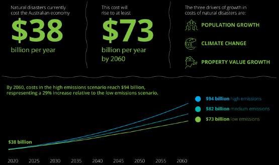
$30 bn
Total costs of natural
disasters under a low
emission scenario over
the next 40 years.
Page 2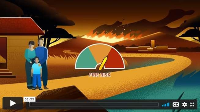
FLOODMON SYSTEM IMPROVING FLOOD
FORECASTING AND WARNINGS
Did you know that the responsibility for providing flood forecasting and warning for flash flood catchments

lies   with    the     South    Australian     State   Emergency           Service     (SASES),      as    the   Control       Agency      Flood    and

Department           for   Environment    and       Water    (DEW),       as   the   Flood    Hazard      Leader,      in   partnership     with   local

governments?

In 2015, SASES and DEW introduced FloodMon, a web-based flood

intelligence system that provides near real-time rainfall, water level

and forecast rainfall data to provide timely flood warnings in flash

flood catchments.

Operational Systems Officer Aaron Blasch explained that prior to

the introduction of FloodMon there was no single point of truth for

rainfall and water level data in South Australia.

‘FloodMon now allows us to view all relevant data in one place and

identify the areas most likely to be impacted by flash flooding. With

this   level    of   details   we   are   then      able    to   better    warn      people    in
                                                                                                           A temporary flood level validation device
advance of the impact’ Aaron said.
                                                                                                           on Pedler Creek, Commercial Rd.

‘However, the flash flood forecasting component of FloodMon has not yet been customised for SA, so we are

running a pilot program using the Pedler Creek catchment. ‘The performance of the system will be assessed

by comparing the forecasted flood levels against the water levels observed at the monitoring stations.

Aaron    said        once    FloodMon’s     flash    flood       warning       capability    has    been   validated         for   the   Pedler    Creek

catchment, we intend to roll this out to other high-risk flash flood catchments in SA.

                           AFTER THE DISASTER PODCAST
ABC Radio has a newly released podcast, After the Disaster, focussed on what to expect and how to

manage         after   a    disaster.   Host   Dr   Kate    Brady    is   a     disaster    recovery   nerd      and    an    enthusiastic    science

communicator. She is the National Recovery Adviser for the Australian Red Cross and is a Research Fellow

with Melbourne University.

Guests include those who have experienced

disasters       as     well    as   those      who     have

researched the best way forward.

Access episodes on the ABC Radio website.

                                                                                                                                                     Page 3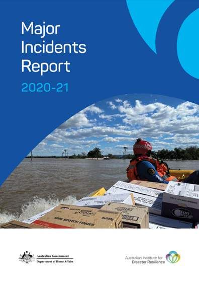
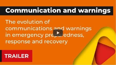
EVOLUTION OF COMMUNICATIONS AND
WARNINGS
Communication            and     warnings      are    now     seen     as   a

priority in any emergency, but this hasn’t always been

the case.

With   historical       roots    in   military-style    command         and

control,      emergency           management           has     undergone

massive changes in the last few decades, in response

to changing hazards, changing communities and a

growing appetite for information.

Bushfire   and         Natural    Hazards     CRC      research      has    shaped   warnings,   public   information       campaigns     and

recovery to help emergency services protect communities from floods, bushfires, heatwaves and other

natural hazards, and to help communities bounce back after a disaster.

A new documentary series highlights some of that research. It follows communications and engagement

practitioners       from     different      sectors    as    they   meet    the   researchers    and   learn   how   they   can   apply   this

knowledge to their own work.

More information and the videos can be found at the Bushfire & Natural Hazards CRC website.

           MAJOR INCIDENTS REPORT 2020-2021
Australian Institute for Disaster Resilience (AIDR) has

released      a    report    providing        an   overview     of     major

incidents that have involved the fire and emergency

services sector in the past financial year.

The report highlights significant incidents that have

been     of       impact     or       consequence        for    fire    and

emergency          services,      as    identified     by    the     sector;

providing background information about the incident

and the corresponding response.

Recent     reports        include       key    observations          (where

identified)       to    identify      and   analyse     recurring       and

emerging          insights       across     hazards,        sectors     and

jurisdictions.

For a copy of the report, or to view previous reports, visit

AIDR's website.

                                                                                                                                          Page 4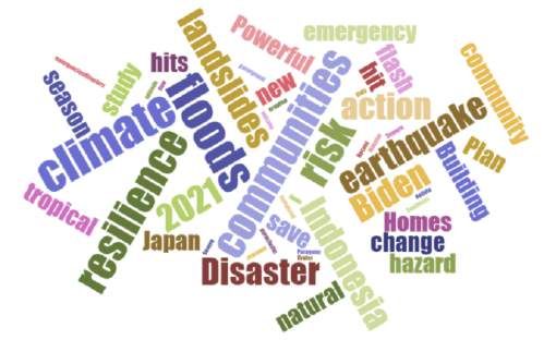
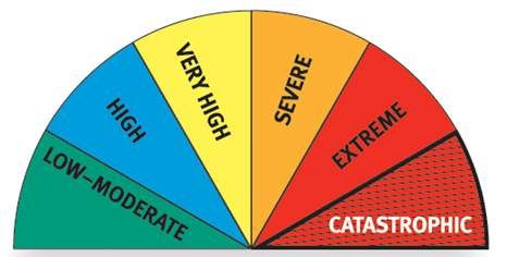
AUSTRALIAN FIRE DANGER RATING
SYSTEM TRIAL
The Australian Fire Danger Rating System (AFDRS)

program is building a modern and consistent fire

danger    rating      system.     By      redesigning     the

forecasting   of   fire   danger,    it   aims   to   improve

public safety and reduce the impacts of bushfires

by improving the way that fire danger is calculated

and communicated.

With the new system set to commence in 2022, jurisdictions are undertaking operational trials throughout

their 2021-22 fire danger seasons. Operational trials are testing the science and functionality behind the

AFDRS, allowing for further development and refining ahead of its implementation.

The components of the AFDRS that are being trialled include:

    Fuel state editor:       a    centrally   hosted,   interactive   and    common   tool   that    allows   fire   and   land

    management agencies to capture field information and update maps relating to the fuel component

    of fire danger.

    Fire danger viewer:          a centrally hosted, interactive and common visualisation tool for states and

    territories to view and interrogate fire hazard information; it includes the fire danger ratings in map

    and table format, weather data, fuel data, etc.

    Bureau of Meteorology standard products:                    this will be standard across Australia and will be

    available via the BoM website.

More information is available on the National Council for Fire & Emergency Services (AFAC) website.

HAZARD REDUCTION BURNING
                                                                      Hazard reduction burning has an important role

                                                                      to play in fire management across Australia.

                                                                      Used    alongside      other     fire    management

                                                                      approaches, it can reduce the intensity, hazard,

                                                                      and impact of a bushfire, and the potential for

                                                                      loss of life and property.

                                                                      Australia’s national science agency CSIRO and

                                                                      AFAC have developed an animation to explain

                                                                      what hazard reduction burning is and its role in

managing fire. The animation highlights fuel management as a key factor to mitigate risk, and the

challenges and opportunities of hazard reduction burning.

Futher information can be found at CSIRO's website.

                                                                                                                             Page 5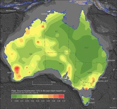
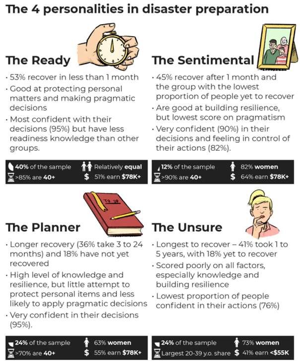
UNDERSTANDING PREPAREDNESS AND RECOVERY
Emergency recovery goes beyond survival. It is a

complex       process      with    potentially      long-lasting

impacts on people’s lives. Within research, policy

and practice, there is a widespread assumption

that   preparing       for   a    disaster    has     a    positive

impact on recovery. However, there is a limited

amount      of   research       proving    this   link    between

preparedness actions and recovery.

Research, commissioned by the Australian Red

Cross,   and      recently       released,     examined          the

experiences of 165 people who lived through a

disaster such as fire and flood between 2008

and    2019      and     identified   a    number         of   steps

people      wished       they’d    taken     to   prepare         for

disaster,   such    as    protecting       sentimental         items,

planning      where       the     family     should       meet     if

separated and better managing stress.
                                                                                               Infographic by The Conversation - 2 Sept 2021

Through this research, four types of persona emerged in terms of preparing for a disasters. Hopefully

identifying      these    groups    means     that       preparedness   messaging   can   in   future   be   customised,      based     on

people’s characteristics.

For a copy of the report, visit Redcross' website.

                                      DISASTER RESILIENCE
To stay up to date between editions of EM News, sign up for Neil Dufty’s This Week in Disaster Resilience for

a range of articles related to disaster resilience throughout Australia and the world.

                                                                                                                                        Page 6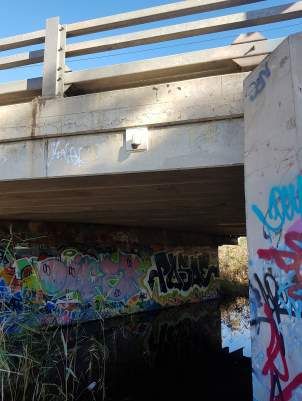
You can also read