WILDFIRE UPDATE - Squamish-Lillooet Regional District
←
→
Page content transcription
If your browser does not render page correctly, please read the page content below
August 6, 2021
WILDFIRE UPDATE
LYTTON CREEK (K71086)
The Lytton Creek wildfire is 51,589 hectares in size and is classified as Out of Control.
RESOURCES:
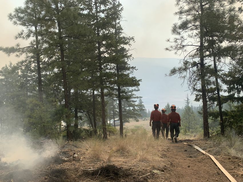
Personnel: 95; heavy equipment: 36; helicopters: 7; Incident Management Team; Structure Protection personnel.
UPDATE:
EAST:
Crews successfully completed planned ignitions over the past two nights (Aug.
4 and Aug. 5) along the southeast flank of the fire to strengthen fire guards
south of the community of Shackan. Early this morning (Aug. 6), crews were
mopping up hot spots in the area. Planned ignitions will continue tonight if
conditions allow. Opportunities for aerial ignitions will continue to be as-
sessed in the coming days. Heavy equipment is continuing to establish fire
guard southwards. Once established, crews will follow up machine guard with
hose lay for mop up operations.
Heavy equipment has completed construction of the fire guard on a portion of
the southeast flank, near the community of Shackan. A control line has been
established north of Agate and heavy equipment is working to construct an
additional contingency guard north of Nuaitch Creek. This guard will be con-
nected to existing roads and creeks that serve as natural fuel breaks.
Structure protection equipment has been deployed in the community of
Shackan and the Nooaitch community has been assessed. Due to reduced fire
activity, structure protection equipment is being demobilized from Spence’s
Bridge and Cook’s Ferry Indian Band. Crews are monitoring for hotspots in the
Nicola Valley area and will action them if required.
WEST:
Fire activity from the Bontanie Mountain area is highly visible from the Fraser Lytton Creek wildfire (K71086) Aug 6 Public Map.
River Valley communities and travel corridors (such as Highway 12) in the west Click here for full size map: https://bit.ly/3fHpCiK
and in the Botanie Valley to the east.
Crews and heavy equipment are working to widen existing road systems in the area of the Laluwissin Creek FSR to establish de-
fendable control lines on the northwest flank of the fire. Downslope fire progression continued towards these control lines
along the Fraser River and the Botanie Valley over the past few days and this behaviour is expected to continue today, Aug 6.
Crews are continuing mop up operations on the east side of the Botanie Valley, near Sleetis Creek. Mop up in this area is ex-
pected to be complete today, Aug. 6. Crews are also mopping up hot spots identified by a thermal scan along the Highway 8
corridor and in the area surrounding the communities of Nicomen and Gladwin.
EVACUATION ORDERS AND ALERTS:
The Village of Lytton has an Evacuation Order in effect for all properties in the Village of Lytton. Effective at noon, August 3,
the Thompson-Nicola Regional District has downgraded the Evacuation Order to an Evacuation Alert for Electoral Area “I” (Blue
Sky Country).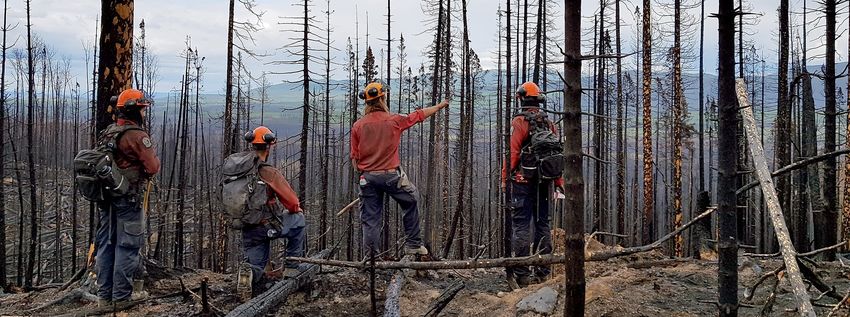
August 6, 2021

              WILDFIRE UPDATE
MCKAY CREEK (K71030)
The McKay Creek wildfire is 31,747 hectares in size and is classified as Out of Control.

RESOURCES:
8 firefighters, 2 helicopters, 9 pieces of heavy equipment, an Incident Management Team and Structure Protec-
tion personnel.
UPDATE:
A significant increase in fire activity Aug. 5 on the southwest corner re-
sulted in small spot fires on the east side of the Fraser River in grass-
land/rangeland to the south of Pavillion. Crews and helicopters sup-
pressed the spot fires that evening and a crew remained on site over-
night to continue fire suppression and monitoring. The spots are extin-
guished as of Aug 6. Fire activity is highly visible from surrounding com-
munities and travel corridors, including Highway 99.
Drive with caution. Hot vehicles can start fires! Only stop your vehicle
in safe locations away from dried, combustible vegetation. Do not con-
tribute to the wildfire hazard!
Crews are engaged in mop up operations in the Lee Creek area around
residences impacted by yesterday's increased fire activity in the south.
Fire growth continues into the Applespring Creek drainage and is ex-
pected to reach the Lillooet-Pioneer Road today or tomorrow. Fire is
active on north flank toward Watson Bar Road. The fire has crossed
West Pavillion Road in some locations to the north.
A Structure Protection Specialist and Crews are in Applespring Creek
area Aug. 6. Heavy equipment is constructing a fire guard on the north
flank of the fire, connecting West Pavilion Road to Watson Bar Road.         Mckay Creek wildfire (K71030) Aug 6 Public Map. Click
                                                                             here for full size map: https://bit.ly/3jt4FcB
EVACUATION ORDERS AND ALERTS:
On Aug 5, the Squamish-Lillooet Regional District and Xwisten (Bridge River Indian Band) issued an Evacuation Order for the area
of L28101 Lillooet-Pioneer Road.

On Aug 4, the Squamish-Lillooet Regional District issued an Evacuation Order for the Electoral Area B – West Pavilion Area. An
Evacuation Alert for selected areas of Electoral Area A and Electoral Area B remains in effect. An Evacuation Order for the Pavil-
ion has been downgraded to an Evacuation Alert. July 24, the Thompson-Nicola Regional District partially downgraded the Evac-
uation Order to an Evacuation Alert in Electoral Area "E" (Bonaparte Plateau). An Evacuation Order remains in place for some of
this area.
August 6, 2021

                   WILDFIRE UPDATE
GEORGE ROAD (K70804)
The George Road wildfire is 1,390 hectares and is classified as Out of
Control.
UPDATE:
On Aug 5, heavy helicopters bucketed on the George Road wildfire to suppress
fire activity to the east of Highway 1 and Skuppah 4A. This increase in fire activity
on the southeast corner was primarily along a ridgetop and helicopters worked to
keep the fire contained along the ridge. Similar fire activity is expected today and
helicopters will continue bucketing as priorities within the Complex allow. The
southwest corner of the George Road Wildfire is in the proximity of
the Skuppah IR #1; fire activity on this corner has been low over the past several
days and this area has seen minimal growth. Previously, fire progres-
sion was mainly to the north. There are no fire suppression resources assigned
solely to this fire and resources will continue to be prioritized throughout the
province based on availability and prioritization of incidents.
EVACUATION ORDERS AND ALERTS:
An Evacuation Alert issued by the Skuppah Indian Band remains in effect for this        George Road wildfire (K70804) Aug 3 Public
wildfire for Skuppah IR #1, 2A, 4, and 4A.                                              Map. Click here for full size map: https://
                                                                                        bit.ly/3lDBZQG

MOWHOKAM CREEK (V11669)
The Mowhokam Creek wildfire is 3,013 hectares in size and is classified
as Out of Control.
UPDATES:
The Mowhokam Creek wildfire is being managed by the Incident Manage-
ment Team in command of the Lytton Complex. This fire is currently classi-
fied as a modified response fire and is continually being monitored. An
aerial assessment of the fire is planned for today. In hot and dry condi-
tions, visible smoke and flame can been observed from Highway 1 and sur-
rounding communities. Fire growth has been observed primarily to the
east with little movement to the west towards Highway 1.

                                                                                        Mowhokam Creek wildfire (V11669) Aug 6 Pub-
                                                                                        lic Map.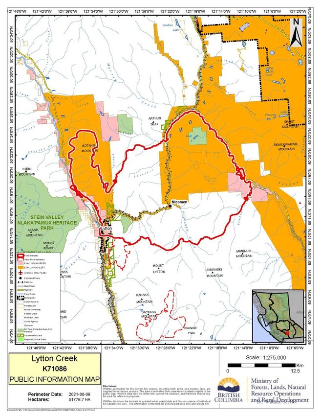
August 6, 2021

               WILDFIRE UPDATE
              EVACUATION EMERGENCY OPERATION CONTACTS

All evacuation alerts and orders are implemented by regional districts. Check with your local regional district
 for updates and alerts. If you border two regional districts, remember to check for updates and sign up for
                                               alerts for both.

                                      TNRD Emergency Operations Centre
                                  Phone: (250) 377-7188 or Toll Free: 1-866-377-7188
                                                 emergency@tnrd.ca
                          Register to get alerts on your mobile device through Voyent Alert!
                                          At: https://register.voyent-alert.com

                                          Fraser Valley Regional District
                                                Phone:(604) 702-5000
                                               Toll Free: 1-800-528-0061
                            Register to get alerts on your mobile device through Alertable
                                                 at www.fvrd.ca/alerts

                                   Squamish-Lillooet Regional District
                             Phone: (604) 894-6371 or Toll Free: 1-866-298-7753
                                              info@slrd.bc.ca

                                              Lytton First Nation EOC
                                                Phone: (604) 860 2352
Aug 6, 2021

               WILDFIRE UPDATE
                                                  Lytton Complex
                                           (K71086, K71030 & V11669)

RESOURCES FOR BUSINESSES AFFECTED BY WILDFIRES:
The BC Economic Development Association (BCEDA) has launched a special webpage dedicated to Wildfires
2021— https://www.bceda.ca/wildfires.php — which contains a live document where information will be added
for business and communities, plus manuals and toolkits dedicated to disaster preparation.
As the Province and others start to roll out support programs, BCEDA will update the live document so that busi-
nesses can easily find this information.
Have the BC Wildfires impacted your Business? Is so, a short survey has been created . The responses will help dis-
tinguish businesses’ and communities’ short and long-term needs. The BCEDA has pledged to do everything it can
to help.
The BCEDA collects this information to share in an aggregate format with provincial, Indigenous, Local and Region-
al Governments. No confidential information will be shared unless a follow-up call is requested by the business. All
information is stored in Canada by Softlanding.

Here is the URL for the survey:
https://www.executivepulse.ca/bcwildfire2021

MORE BCEDA RESOURCES:
Resources for Wildfire Impacted Individuals & Businesses 2021 (Live Document) - A document of resources that is
constantly being updated as new information and resources are released. Check back in on this document regular-
ly for up-to-date information regarding the wildfires.
Top 10 Steps to Prepare Your Business for Evacuation - A document that can be made available to businesses in
your community to aid in, and encourage, preparation for an evacuation scenario. It highlights the 10 steps neces-
sary to prepare a business for an evacuation.
Province of BC: Disaster Financial Assistance—Following a disaster, the provincial government may declare the
event eligible for Disaster Financial Assistance (DFA). Once declared, the DFA program may compensate individu-
als for essential uninsurable losses and/or reimburse local governments for damaged infrastructure.
Local Economic Recovery & Restart Toolkit - This toolkit provides a collection of resources developed to assist lo-
cal councils, organizations and individuals involved in community economic recovery following an emergency such
as the COVID-19 pandemic, wildfires and floods

    Spot a wildfire, smoke or illegal fire activity? Call 1 800 663-5555 or *5555 on your cellphone.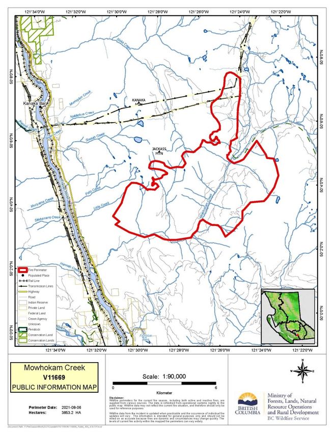
Aug 6 2021

                 WILDFIRE UPDATE
                                            ROLES AND RESPONSIBILITIES
      BC Wildfire Service              Emergency           Local municipalities and         First Nations
                                     Management BC            regional districts
-    BCWS’s jurisdiction co-      - EMBC coordinates       - Local Municipalities       - On IR lands, Evacu-
    vers all BC Parks, Crown        communication            and Regional Districts       ation Orders and
    and private lands, but          across all agencies      speak directly about         Alerts are imple-
    does not include the            and stakeholders to      Strategic Evacuation         mented by a Band
    boundaries of local gov-        support communi-         Orders and Alerts in         Council Resolution
    ernments that have forest       ties.                    their respective juris-      or other.
    fire prevention bylaws and                               dictions.
                                  - EMBC provides ad-                                   - A designated person
    are serviced by a fire de-      vice to evacuees and   -    Local Municipalities      (s) from the respec-
    partment.                       support to communi-        and Regional Districts     tive First Nations
-    BCWS speaks directly           ties regarding Emer-       do not speak about         community will
    about wildfires (i.e. fire      gency Operations           the status of a wild-      speak to Evacuation
    status, operations, etc.)       Centres and Emer-          fire unless the fire       Orders and Alerts on
    and is responsible for dis-     gency Support Ser-         occurs within their        IR lands.
    seminating wildfire up-         vices.                     jurisdiction. For ex-
    dates to local govern-                                     ample, if a wildfire
    ments, stakeholders, First                                 starts within the
    Nations and the public.                                    boundaries of a local
                                                               government, BCWS
-    BCWS does not announce
                                                               will often assist the
    Strategic Evacuation Or-
                                                               local fire department
    ders or Alerts.
                                                               with suppression
-    BCWS does announce                                        efforts. If the fire
    Tactical Evacuations.                                      spreads into Crown
-    In the event of an immi-                                  land to become a
    nent threat to public safe-                                wildfire, BCWS will
    ty, BCWS can authorize an                                  often assume control.
    immediate Tactical Evacu-
    ation of the affected area.

      Spot a wildfire, smoke or illegal fire activity? Call 1 800 663-5555 or *5555 on your cellphone.
You can also read